
‘We should be excited that Allonby is the first inshore HPMA in England! It’s something to celebrate.’ Indeed it is!
It was a small get-together – only five of us had come along – to discuss how much we knew about the new Highly Protected Marine Area (HPMA) in Allonby Bay: the meeting had been organised by Charlotte Boddy, as part of her dissertation for the University of Bath, and she was impressively well-organised and patient in gathering our views. Our discussion about DEFRA’s prior consultations and open meetings, and dissemination of information about the HPMA proposal, had been pretty negative, so it was good to be reminded by this local resident that the HPMA would be a Good Thing.
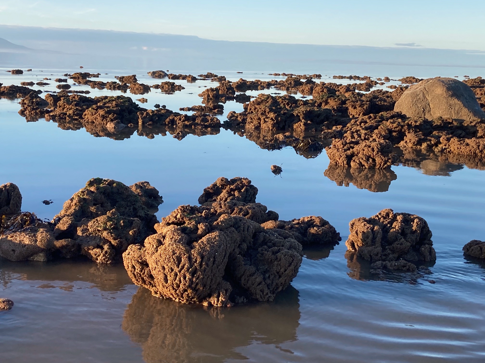
But first, let’s go back a step, to the MCZ. A large part of Allonby Bay has been a Marine Conservation Zone (MCZ) since 2016, designated as such to protect the large areas of honeycomb-worm reef (Sabellaria alveolata) and blue mussels (Mytilus edulis).
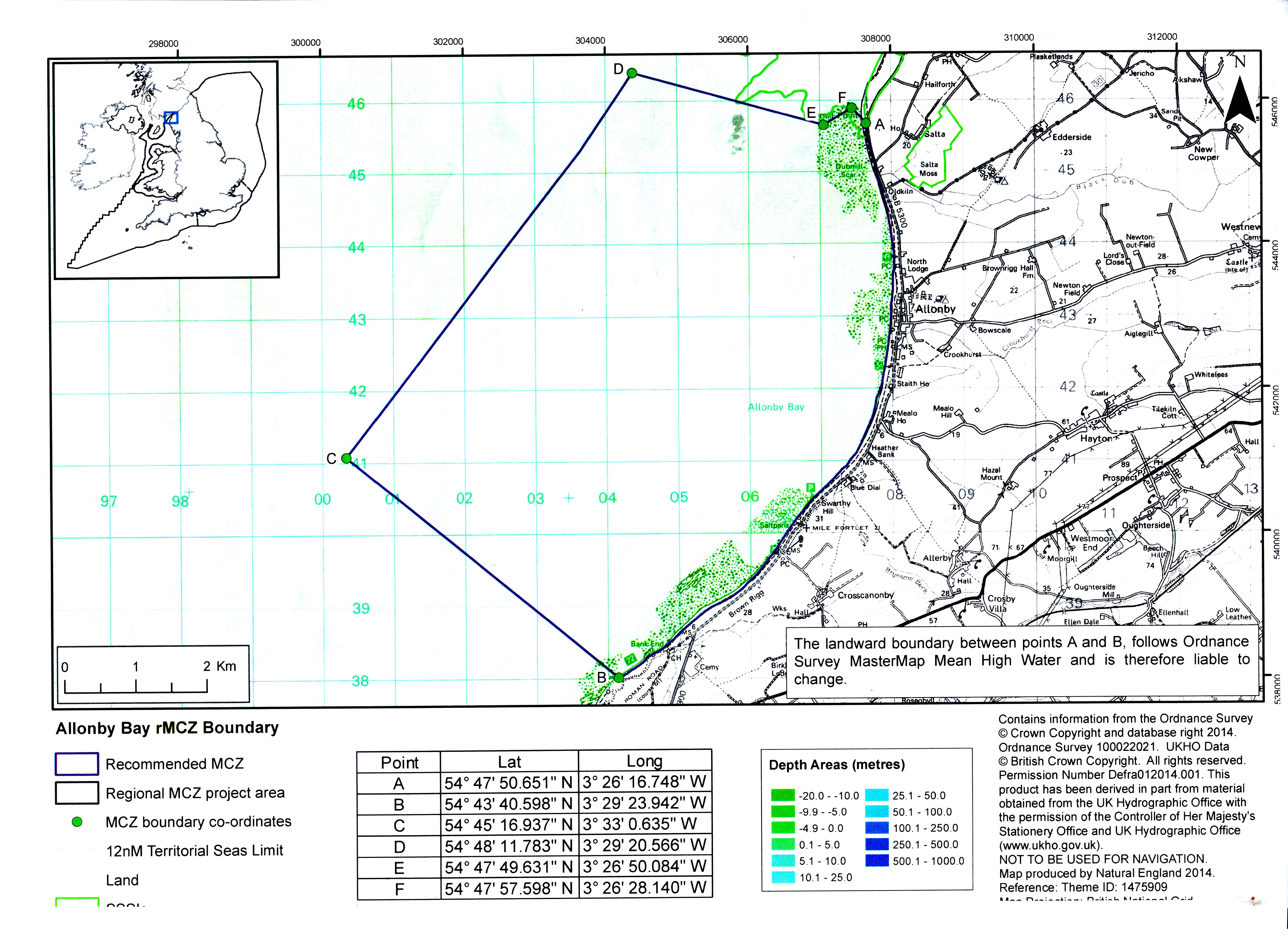
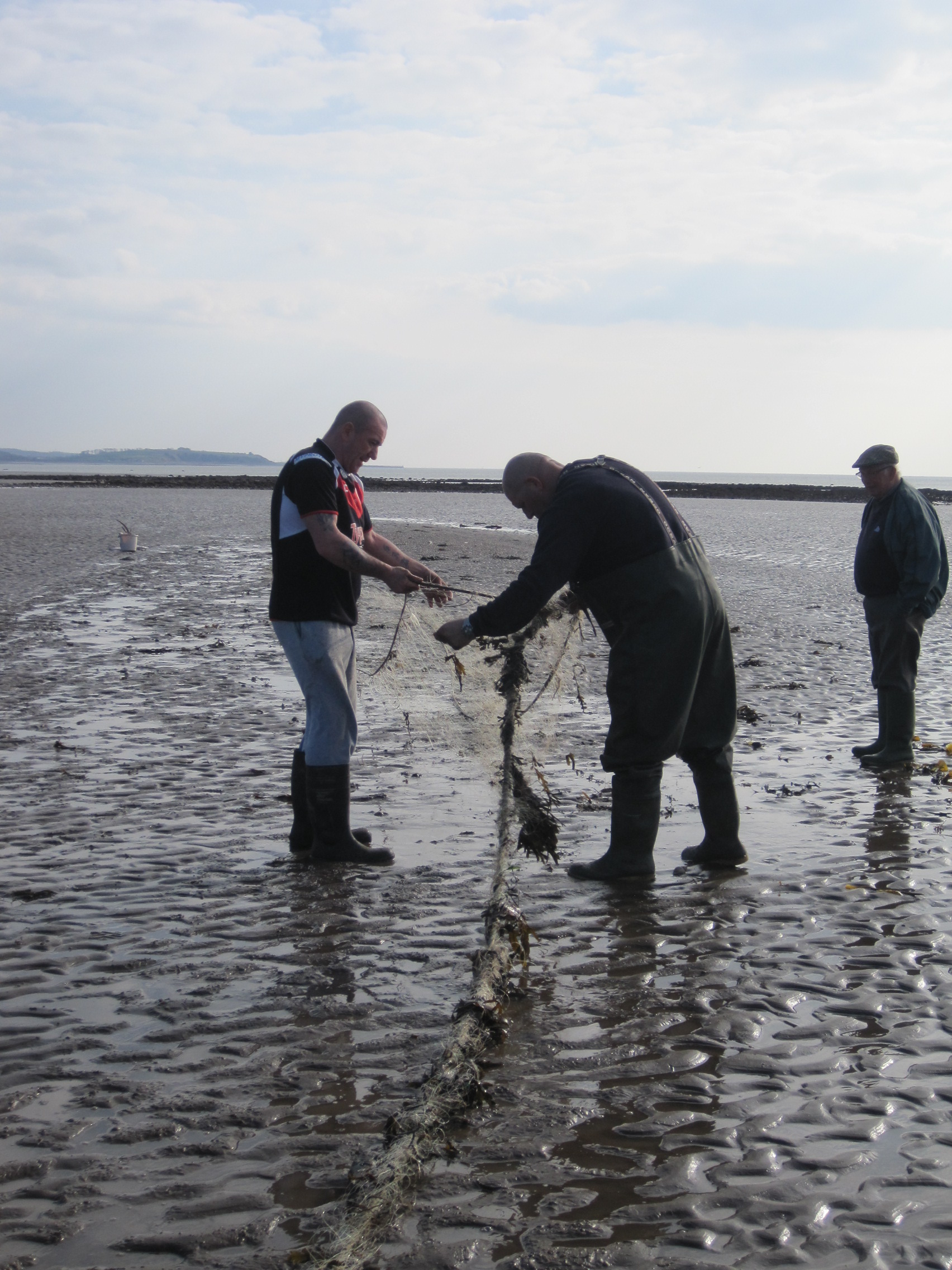
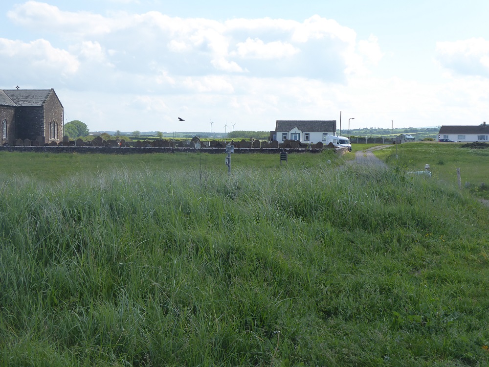
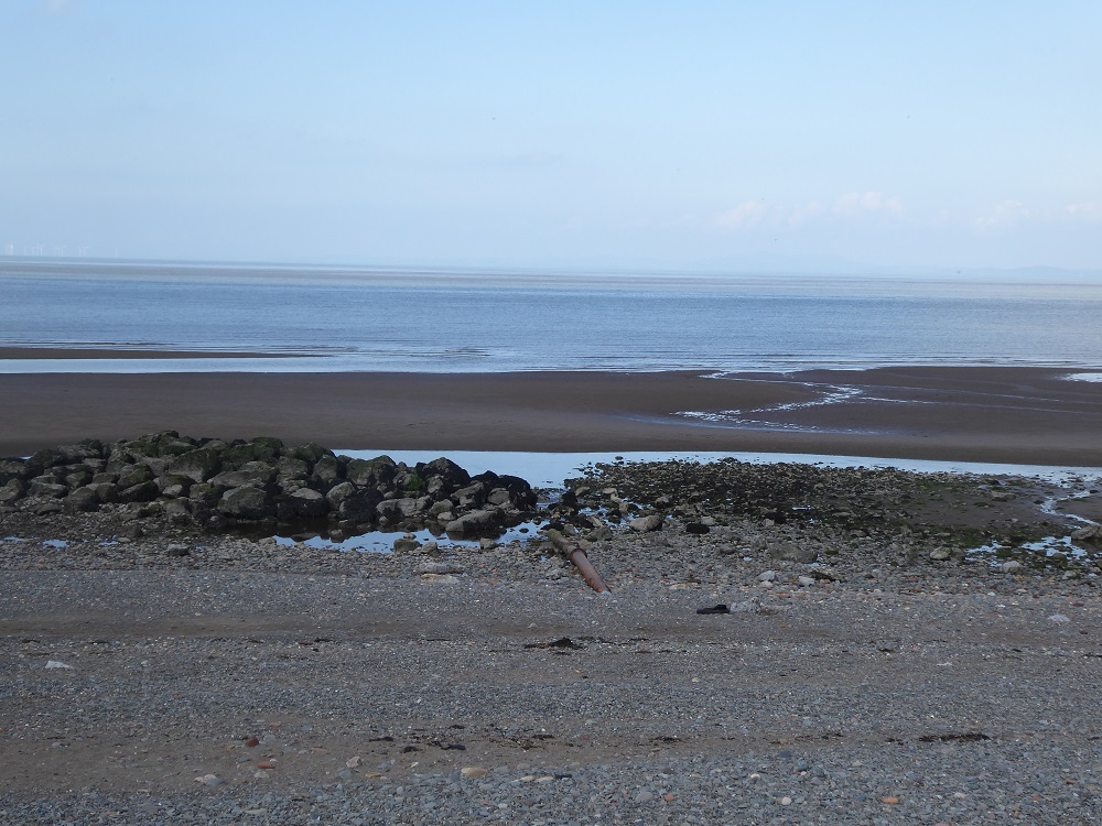
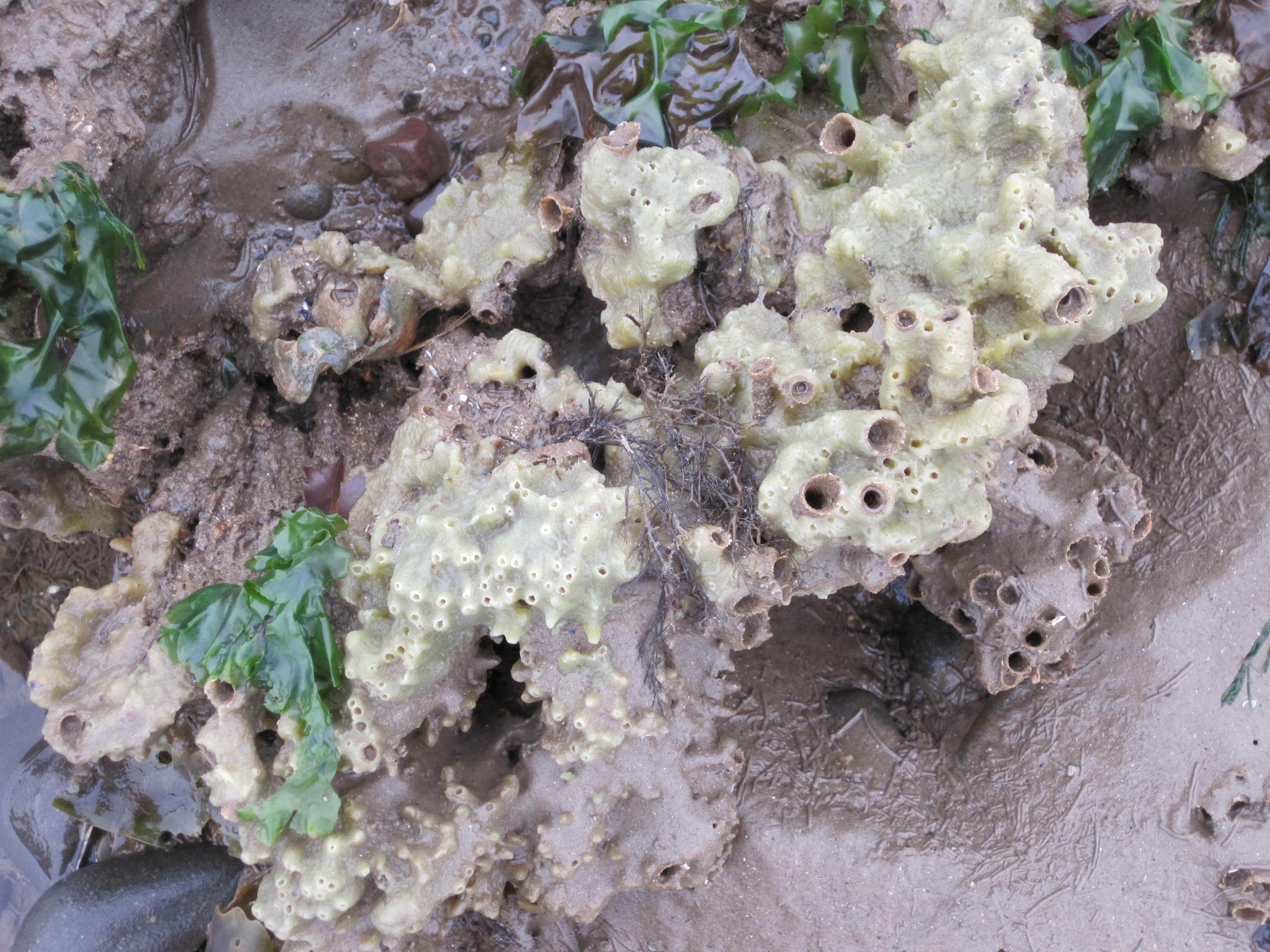
The box-shaped MCZ stretches about 9 km along the mean high-water mark on the shore, from Dubmill Point to just North of Maryport, and reaches out about 6 km into the waters of the Firth. At low Spring tides you can walk far down the shore from Dubmill, through the patches of rocky scaurs – pebbles and small boulders deposited by melting glaciers – to the sculptural brown shapes, many draped with green sheets of the sea-lettuce, Ulva, of the Sabellaria reefs. People who know about these reefs, such as local prawn-netters, often call them ‘sand-coral’, although they are not in fact corals, but worms, each of which constructs a delicate and intricate tube of sandgrains in which to live.
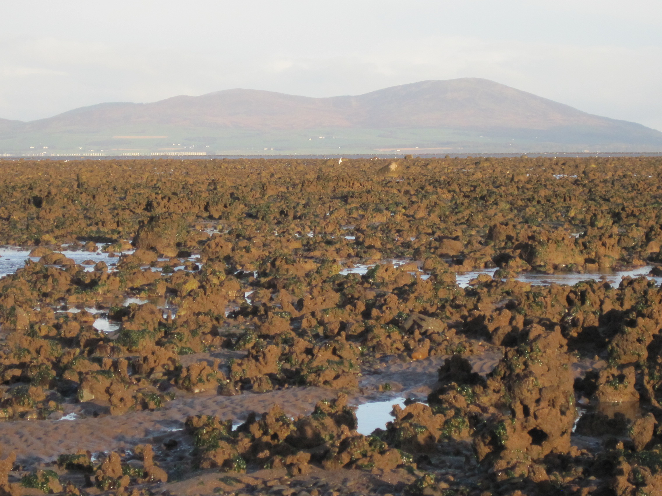
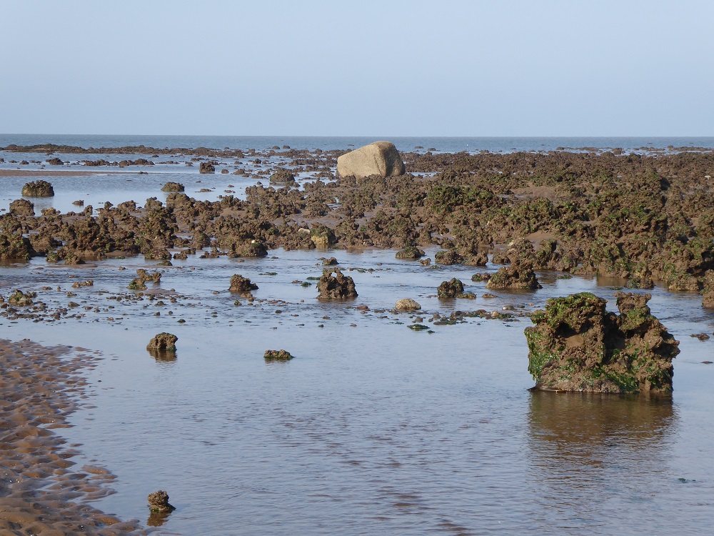
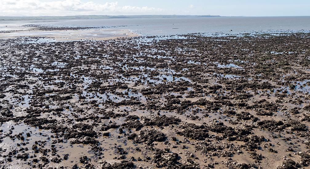
The reefs are like high-rise blocks, multiple accretions of tubes joined side-to-side and reaching skywards. There are other reefs and pavements of Sabellaria along the west Cumberland coast, but the Allonby Bay reefs are the biggest and best in England, and form a protected environment for an exciting variety of other marine animals and algae (seaweeds) . But so few people know that the honeycomb worms and sponges and burrowing anemones are there; the animals are underwater at low Neap tides, and it’s an unnervingly long distance to the bottom of the shore during low Spring tides (for a discussion of the highs and lows of the tides, see here ).
So, if you stood in one of the carparks, could you point to the edges of the MCZ? Who even knows the MCZ is there, and what it is? Who even cares? There are no information boards in the carpark, no handy little leaflets in cafes, shops or the pub. Although I have guided low-tide shorewalks for years to show people the marine life – and the enthusiastic and astonished reactions of walkers make those early starts and often windy weather very worthwhile – let me here play Devil’s Advocate: perhaps it doesn’t even matter that no-one knows about the MCZ because the biologically-important parts of the Allonby Bay MCZ are usually too far away to harm.
Designation of a site as an MCZ means that certain listed features must be ‘maintained in favourable condition’. For Allonby Bay, that list includes ‘intertidal rock’, ‘intertidal coarse sediment’, ‘intertidal biogenic reefs’ (ie Sabellaria reefs), ‘peat and clay exposures’ (the 8000-year-old submerged forest), various other physical features, and the blue mussels. In other words, no driving a JCB onto the shore to scoop up shingle; no jumping up and down on the sandy tubes of the reefs!
The designation document lists the usual ‘alphabet soup’ of authorities responsible for managing and regulating the MCZ, which include the (North-West) Inshore Fisheries & Conservation Authority (NWIFCA), the Environment Agency (EA), Natural England (NE) and the Marine Management Organisation (MMO). The IFCAs manage inshore fisheries from 0-6 nautical miles (nm) (MMO manage the 6-12nm offshore fisheries), so NWIFCA makes the bye-laws that regulate (and currently, prohibit) the mussel- and cockle-fisheries, for example, and the timing and placing of fixed nets on the shore.
Apart from very occasional important activities like re-routing of Allonby Beck away from the dune-edge and across the shore, and surveying the mussel beds, it’s probably safe to say that management of the Allonby MCZ hasn’t been busy, obvious or onerous.
Now let’s take a step up: to a pilot Highly Protected Marine Area, the Allonby Bay Inshore HPMA.
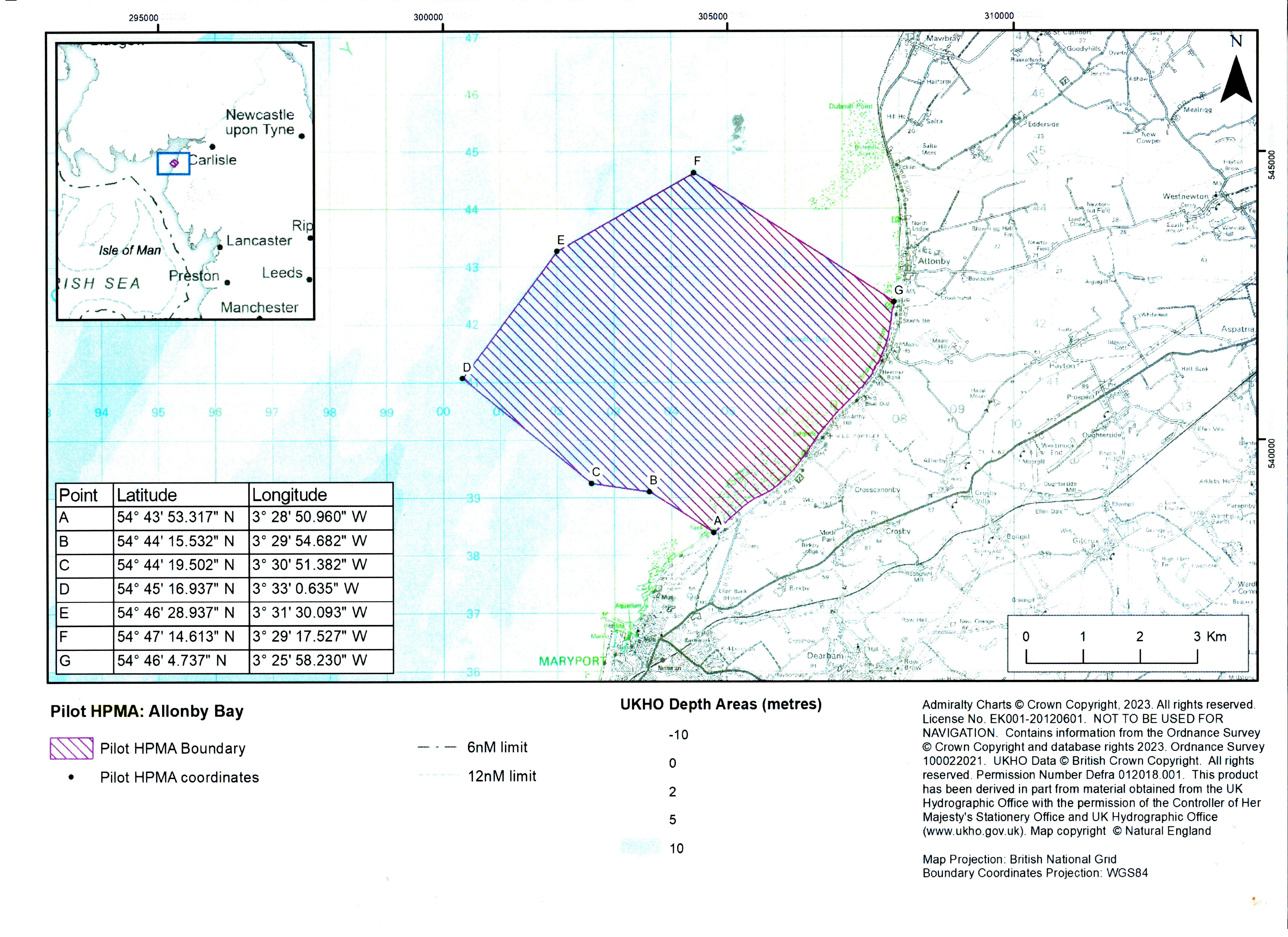
Only three pilot HPMAs were designated by DEFRA in early 2023 after public consultations, two of them offshore in deeper water: Allonby Bay is the only inshore HPMA, its inner edges actually accessible from the shore and delimited by the line of the Mean High Water tidemark (you can download the information from the Government website).
Interested groups (‘stake-holders’) including trawler-owners, lobstermen, shore fishermen, yacht-owners, and representatives of the ports of Silloth and Maryport, and of organisations like NWIFCA and MMO, had been invited to submit comments and answer online questionnaires, and to attend meetings; the DEFRA summary is here . Other people, interested individuals, were alerted to the consultation by organisations like Solway Firth Partnership, Solway Coast AONB (now Solway Coast National Landscape) and Cumbria Wildlife Trust.
The proposed area of the HPMA was modified after the consultation, “to allow for an area of recreational angling, including access for disabled anglers, and for other activities to continue due to its importance to the community and takes account of the needs of Maryport Harbour and the Port of Silloth while still delivering important biodiversity benefits.” For example, Tim Riley, harbourmaster and ships’ pilot at the Port of Silloth told me that “Our route into Silloth skirts just inside the top of the HPMA and as we are surface only, there are no issues with transiting….We can still run ships up and down to Silloth. However the sinker for one of our Buoys was in the area originally designated and we asked for the area to be amended slightly so that we could carry out maintenance on the buoys…”
The result of the consultation was that the Allonby Bay pilot inshore HPMA was formally designated as such in July 2023.
This is DEFRA’s rationale for the designation: to “allow the protection and recovery of marine ecosystems by prohibiting extractive, destructive and depositional uses and allowing only nondamaging levels of other activities to the extent permitted by international law.” (See also more detailed notes at the end of this blogpost).
So, this is the important part for you – how will you know where the pilot HPMA begins and ends?
It will be seen from my overlay, that the modification means that the HPMA does not completely overlap with the MCZ; it is considerably smaller. Astonishingly, the large area of the mature and developing honeycomb worm reefs at the north end of the Bay are left outside. Yet this is reef and lagoons that are rich in animals and macroalgae (seaweeds), and (over)used as a hunting ground for peeler crabs which are then sold as bait in the North-East – these, the reef and lagoons, are the main, living, feature that led to the HPMA designation.
But disregard that bizarre omission for the moment….
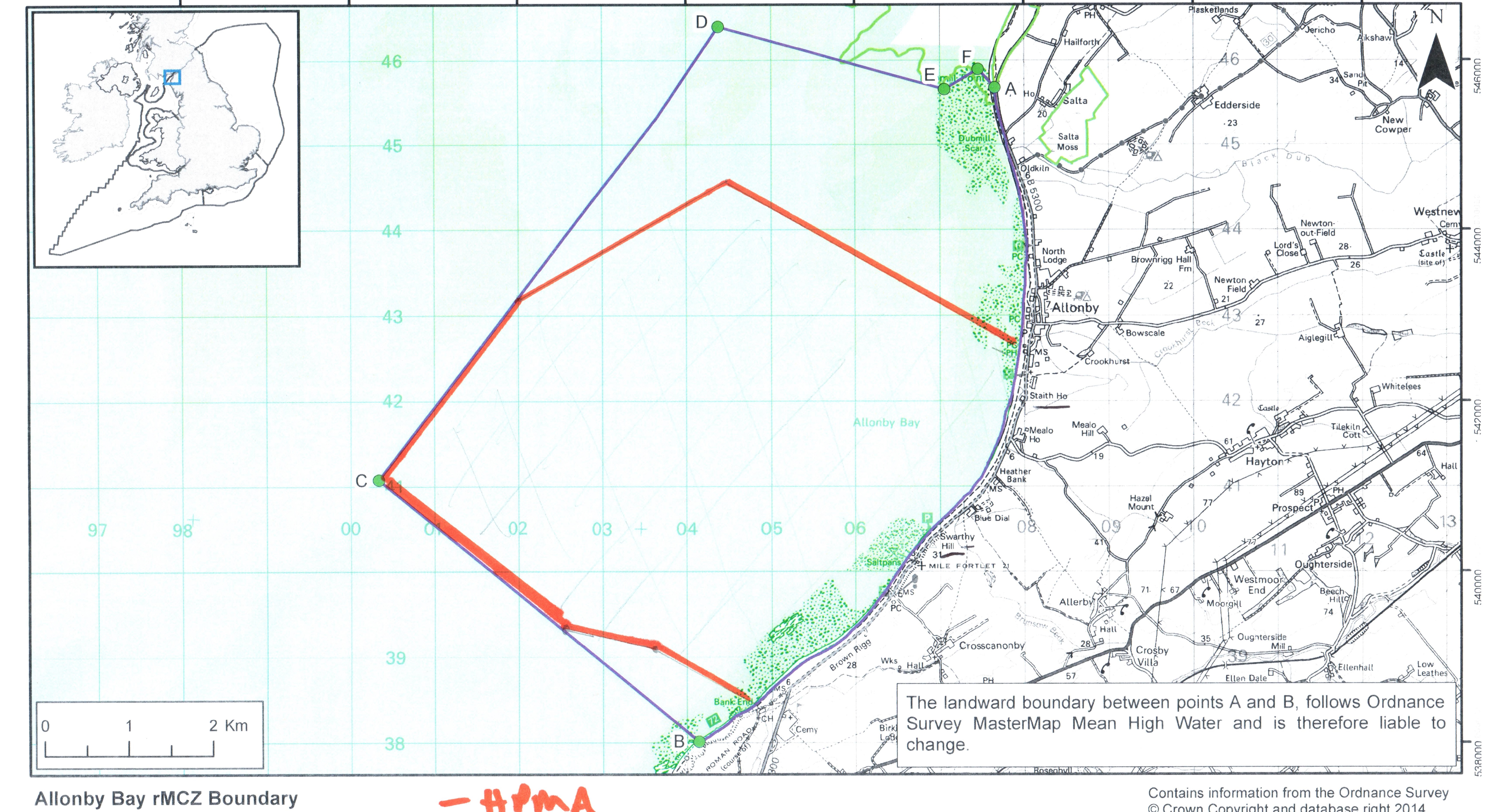
The HPMA’s northern boundary now reaches out North-West into the Firth, from the Mean High Water tideline just North of the Staithes carpark to an invisible point in the sea. On the left of the boundary – towards Maryport – will be the HMPA, which also includes the MCZ. On the right of the boundary, heading North in front of the village and to just beyond Dubmill Point, will be the MCZ which does not have the added protection of the HPMA. Different conservation measures and future bye-laws will apply depending which side of that boundary you stand.
On a good low tide you should be able to work out where this northern boundary lies: it’s very roughly along the line of the pipe that points out to sea. But what about when you are zipping over the waves in your kite-surfer? Tom Barnfield of the MMO told me in an email in early May: “With regard to knowing where the byelaw boundary is, it would be the responsibility of the individual to familiarise themselves with the boundaries using the maps and coordinates provided in the byelaw if it is confirmed. We hope to provide further updates on this process soon.”

Thereafter, in the unlikely event that you see men with a buckets wandering amongst the pebbly scaurs in the HPMA, squatting down to guddle under boulders to collect peeler crabs for bait – phone NWIFCA, down in Whitehaven. “The IFCA (in collaboration with MMO) will still be responsible for compliance and enforcement of the HPMA fisheries management measures in Allonby Bay HPMA” (Tom Barnfield). Since it might take a long time before anyone can respond, just upend the buckets over their heads, and run … (But it’s much more likely that the crab-collectors will be hunting amongst the much richer habitat to the North, in the MCZ.)
What you can and cannot do relating to fishing and non-fishing activities is still to be finalised.
First, prohibition of fishing within the HPMA.
With the legal designation in place, what has followed next has been a period of consultation about fisheries, overseen by MMO – by MMO not NWIFCA, because it had been agreed that it would be sensible for MMO to oversee the fisheries planning for all 3 new HPMAs, both inshore and offshore, rather than splitting it between different IFCAs. The public consultation process is now closed but has led to a draft byelaw about fishing and fisheries within the designated HPMA. The report on the results of the consultation and the new byelaw are due ‘early in 2024’.
This draft byelaw, with regard to Allonby Bay, states among other things, that:
3. A person must not remove any fish or sea fisheries resources from within a specified area.
4. A person must not use any fishing gear in a specified area.
5. A person must not carry fishing gear on a vessel which is present in a specified area unless that gear is inboard, lashed and stowed.
6. Failure to comply with paragraphs 3, 4 or 5 constitutes an offence contrary to section 139 of the Act.”
‘Fish’ also includes shellfish and crabs; ‘fisheries resources’ includes bait such as lugworms, and presumably peeler (newly-moulted) crabs. ‘Fishing gear’ includes prawn and shrimp nets, rod and line, shore nets. For Allonby Bay, there will be an additional 100-metre exclusion zone around the (outer?) edges.

We await the final outcome of this fisheries consultation. Tom Barnfield, Principal Marine Conservation Manager for the MMO and based in Plymouth, speaking at the ECSA meeting in Carlisle on May 21st, said the decision document would be published ‘in the next few weeks’. The final document will then go to DEFRA and to the Secretary of State, and eventually be approved as a legal byelaw. But – the General Election has been announced and all decisions by governmental organisations are on hold and in ‘purdah’. So, ‘watch this space’ – but much later in the year.
So, that relates to the (draft) byelaw for fish-related matters…
Second: what will non-fishing beach-goers be able to do on the shore and water within the HPMA?
Worries have been expressed that ‘We won’t be able to walk our dogs on the shore.’ ‘What about windsurfing?’ and so on.
To understand future decisions, you need to know about Marine Non-Licensable Activities (mNLAs): ‘Marine non-licensable activities are those which do not require a marine licence. These include shore based activities such as bait collection and beach recreation as well as water based activities such as sailing and motor boating.’ Details are on the Government website here. At the ECSA meeting in Carlisle in May, Jemma Aitken of MMO explained that mNLAs included anchoring, sailing, powerboating, walking, dogwalking, general beach recreation and bait collection (although bait collection will be included in the fisheries byelaw).
At first sight, this will horrify Allonby regulars and visitors! But note that the first three activities rarely, if ever, occur within the HPMA in any case. MMO are currently ‘scoping’ the extent of activity by non-motorised watercraft – eg kitesurfers, kayakers – and the effect of launching and recovery on the shore and shallows (and again, note that only a small area of shore near Staithes at Allonby’s southern-most carpark, is used for launching – an area that is mainly sandy, and has no honeycomb worm reef).
After an initial assessment of current activities, ‘stakeholders’ will be asked to ‘engage in a consultation’ in early July this year, in other words to dicuss the suggestions and put forward their own views. The opinions of everyone who lives nearby or visits the shore are very important, and I asked MMO to publicise the meetings and consultations widely – this time using obvious routes like Solway Buzz, the Allonby newsletter, Facebook groups, flyers in the shops, and so on. This consultation was due in July but, as with the results of the consultation on the fisheries draft byelaw (see above) the General Election has interfered with the timetable.
It’s very important to get this right, for both the marine wildlife and for humans – don’t forget that Allonby Bay is a pilot inshore HPMA, the first of its kind and leading the way. Unlike offshore HPMAs where only fishing-boats need to take note and comply, Allonby has a land boundary where people and dogs wander daily.
How will we know if this highly-protected area is having a beneficial effect on the marine life?
I love hearing what local people observe about the shore, hearing their stories – so many have lived here all their lives, and so many wander along the shore on a daily basis: changes in numbers and species of fish (no more herring, many more thornback rays); very few of the largest ragworms; a good year for prawns … During the twenty-odd years I’ve been doing low-tide guided walks I too observe yearly changes – perhaps the Sabellaria reef has spread, or been battered by storms; some years breadcrumb sponge is extremely common on the reefs, some years not; some years the spatfall of mussel larvae is copious, other years less so…
We observe and we see, and we have our stories and anecdotes; and mostly, we care. But we don’t count numbers, we’re not scientific in our comparisons (and I write here as a former research scientist).
The HPMA is a ‘pilot’, so basically it will act as an experiment. The government policy paper states (my italics): “The designation of Allonby Bay as a HPMA would allow us to understand the added benefits the protection of a HPMA can provide in these scenarios. Furthermore, with limited disturbance identified, this area is considered to represent a more natural ecosystem providing an important opportunity to safeguard biodiversity and to help us further understand the ecological impact of the removal of any remaining pressures.”
So, for the organisations seeking to understand impacts and benefits, ‘baseline surveys’ need to be carried out to monitor not only the marine organisms but also the social and economic impacts of having a protected area on the doorstep. Economically, this could also be highly relevant to the placing and construction of turbines for tidal power in the Solway.
Conor Hinchcliffe of Natural England explained at May’s ECSA meeting that different types of biological and sea-bottom surveys have already started: cores of sand taken from the shore to measure the amount of, for example, carbon that is stored; subtidal mapping, using sidescan sonar to get a 3D picture of the seabed; a survey of bottom-dwelling and benthic fish species; drop-down videos to see what’s happening beneath the surface of the sea, and grabs to collect sediment from the seabed and look at its composition. Water quality will be monitored (this will cause some wry smiles given recent bad publicity about sewage releases); there will be aerial mapping of the honeycomb worm reefs (some below Crosscanonby saltpans – but the largest areas are outwith the HPMA and in the northern part of the MCZ) , assessment of shellfish caught during potting; counts of waders and other seabirds – and so on.
On the basis of these data an Evaluation Framework will be developed, which will ‘inform future work towards management measures’. You’ll recognise the language…
Meanwhile, the Solway will do what it always does – it will control its own environment, from tide to tide, storm to storm, season to season, defying management and measurement. That’s why we both respect and love the Firth.
“Lessons learnt”
Well, this ongoing process should be providing a good learning process for the future!
It seems to have been a prime example of DAD – an acronym for the “Decide-Announce-Defend management approach … based on the analysis of an issue by a group of experts, whose decisions will be made through a well-defined hierarchy, even if not everyone agrees with them.”
An interesting analysis was carried out by Charlotte Boddy for her dissertation at Bath University (see notes). I went along to one of her well-conducted sessions in Allonby village hall. Comments recorded made clear that local people had felt left out. “Compounding the sense of local exclusion during consultation was a perception among participants that experts and wider stakeholders dominated the consultation, while local people remained unheard. This was underlined by the fact that the majority of contributors to the digital consultation for Allonby were from outside the region.” This is borne out in DEFRA’s summary of the consultations: “At Allonby Bay, 5% were local to the area and 95% were non-local”.
Additionally, according to Boddy, “… policymakers also failed to capitalise on excellent community co-management opportunities. Existing active community environmental co-management, combined with local support for marine protections create an ideal foundation for effective HPMA co-management if policymakers effectively engage the community. Implementation of the HPMA occurred top-down, lacked effective community engagement, and resulted in limited local buy-in.”
Consequently – as I have discovered during my chats with locals who come on my low-tide shore-walks – misinformation and rumours abound. Once the byelaws are in place, considerable explaining and information-sharing will need to be done to get everyone onside for what is, indeed, a very exciting and important development for the Bay. Leaflets in cafés and pubs, information boards in the carparks, village hall meetings (with cake, of course!), shore-walks, short articles in local newsletters, information on Facebook groups – there are so many ways of letting locals and visitors know how important the HPMA is. And that Allonby Bay’s inshore HPMA is unique and indeed a ‘world-leader’! That is certainly to be celebrated.
Notes:
Charlotte Boddy (2023). Reconciling environmental policy and community prosperity: Community perspectives on the introduction and potential impacts of a Highly Protected Marine Area in Allonby Bay (Dissertation for the Dept of Social and Policy Sciences, Bath University)
HPMA designation. Extracts from the DEFRA document: “Allonby Bay consists of a mix of habitats, characteristic of an environment that is subject to dramatic currents and tides. The seabed here consists of a range of rocky habitats and sediment dominated habitats. The nutrient-rich sediments, dense mussel beds and intertidal rocky habitats in this area attract large densities of shore birds including species such as curlew and oystercatcher. The biodiverse subtidal habitats provide a food source for fish species, such as flat fish, and nursery areas for other species. In turn, these fish species attract diving, foraging seabirds including guillemots, gannets and razorbills.
One of the best examples of honeycomb worm reefs in the UK is found here. Honeycomb worms create a complex sediment network of tubes attached to rock, providing vital habitat for a range of species including crabs and molluscs.
The rich sediments and intertidal rock habitats attract important migratory, non-breeding bird species with large groups of around 16 different species congregating along the shoreline. Allonby Bay provides suitable spawning grounds for sole, thornback ray and bass, and a nursery area for cod, herring, plaice, sole and thornback ray.”
