The art and science of seeing seaweeds

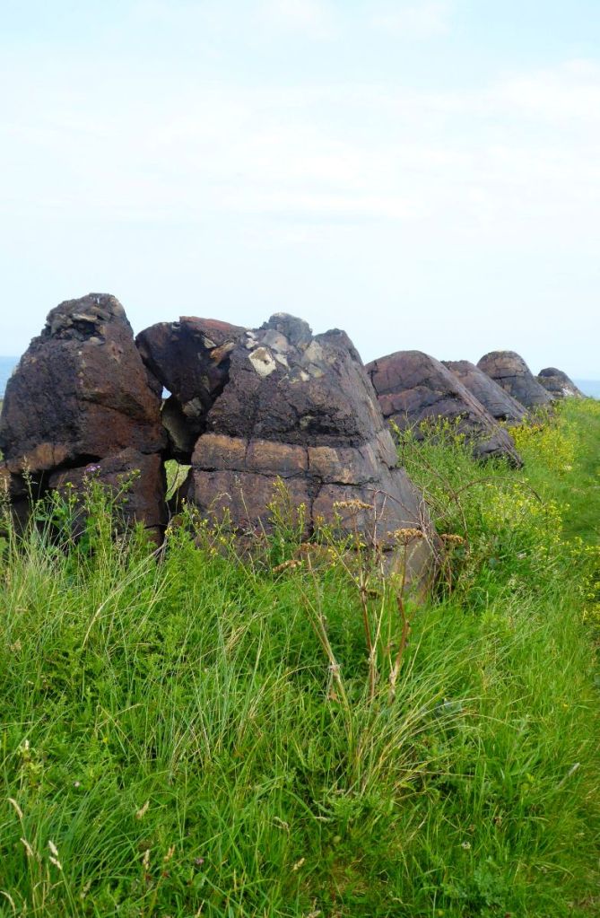
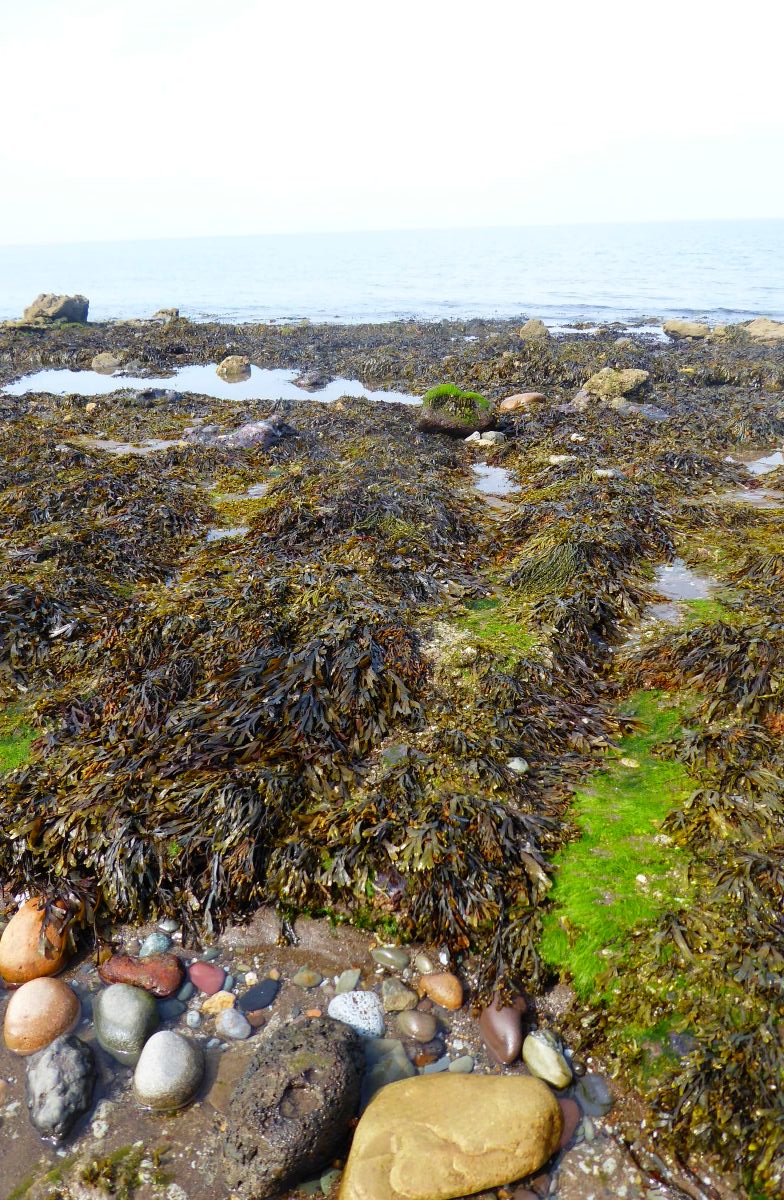
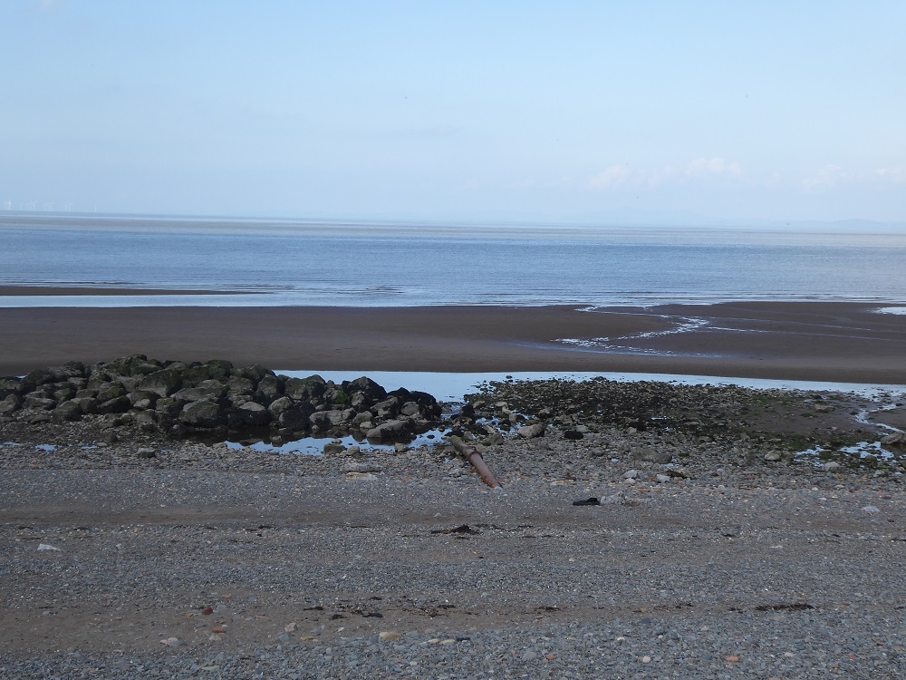
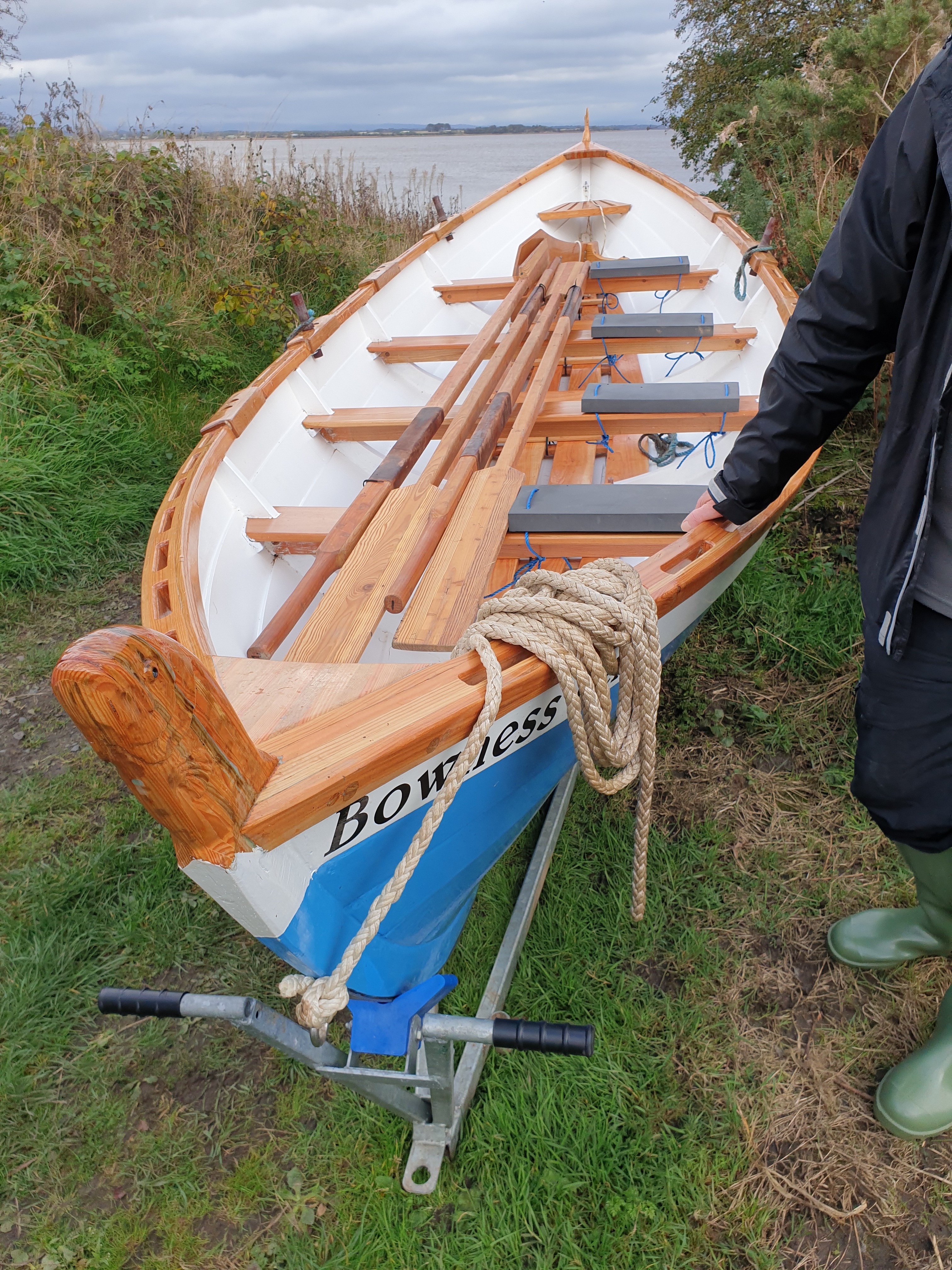
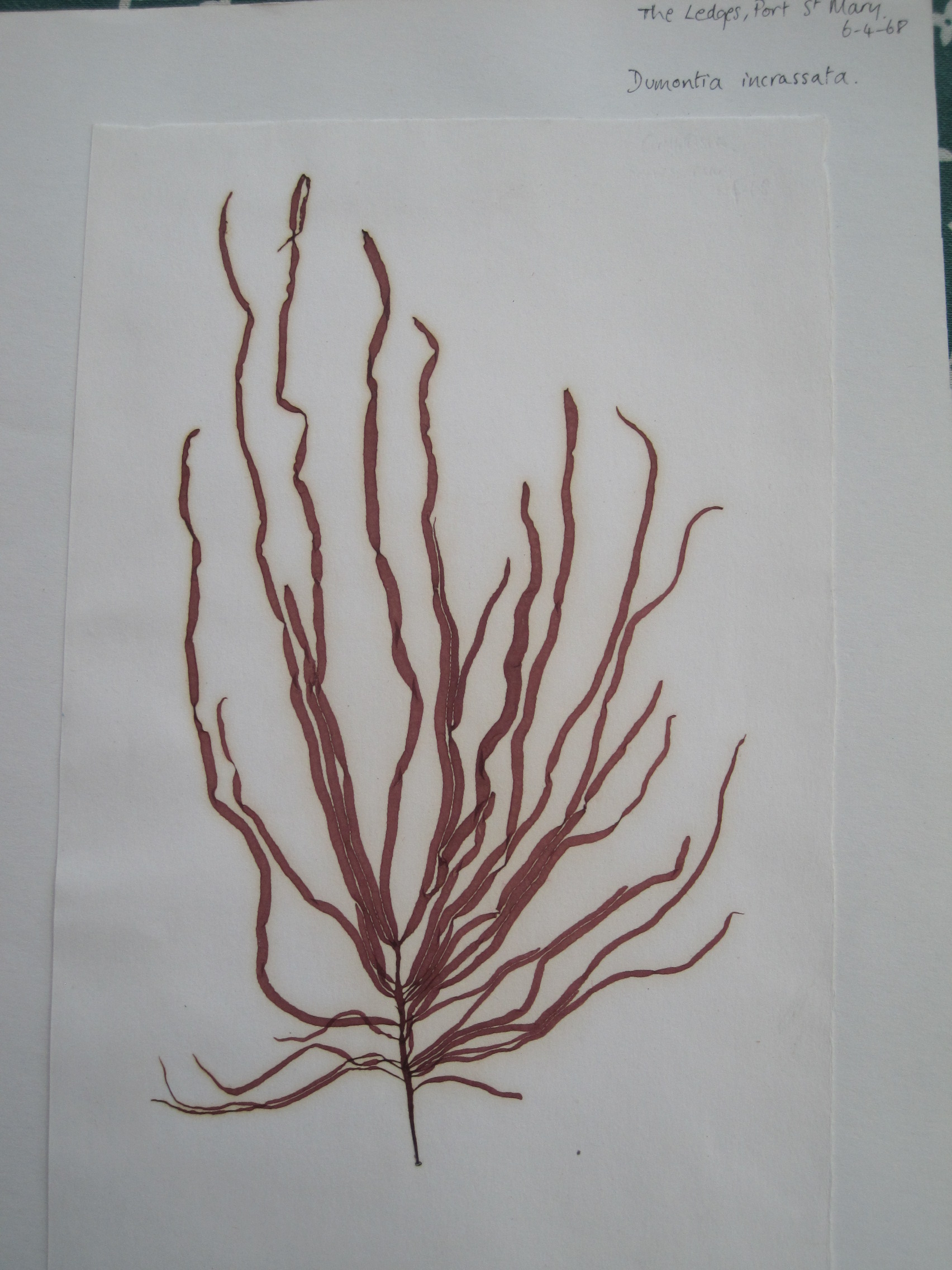
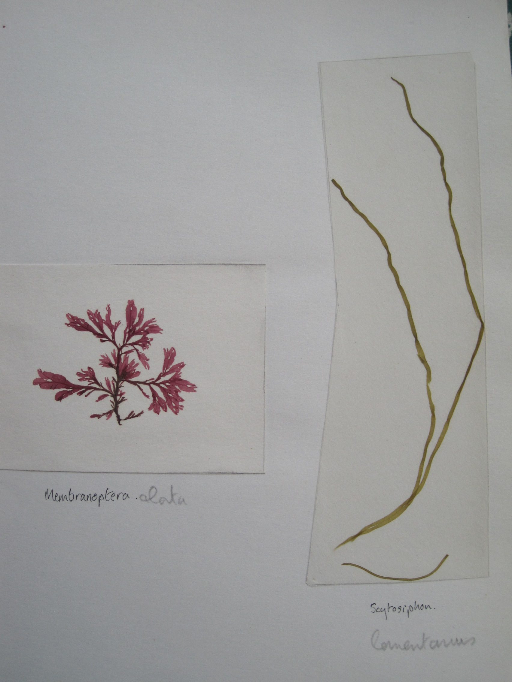
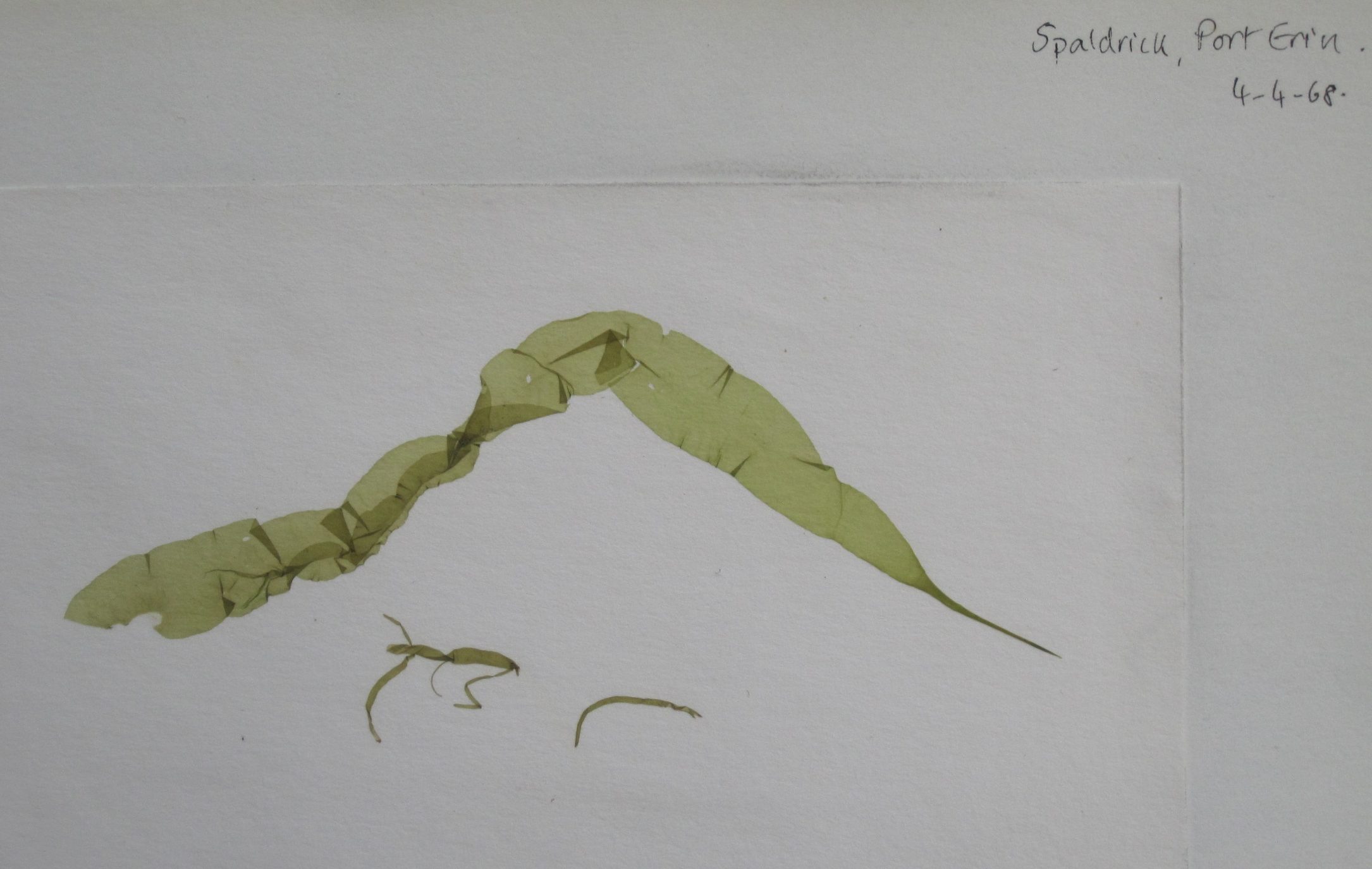
When I was an undergraduate I collected these green and red seaweeds – algae – on a field trip to Liverpool’s former Marine Laboratory at Port Erin, Isle of Man. We were shown how to float the more delicate species onto white card; large sticky molecules of polysaccharides like alginate and carrageenan would be released from the cells, swell as they hydrated, and bind the fronds onto the card as the specimen dried. After all these years the algae have kept their colour and shape. The larger, thicker algae like the brown Fucus species common on rocky shores, were pressed and dried between sheets of newspaper.

'Sentiment and seaweed' 1865, W.McConnell

Collecting seaweed and displaying it in albums was one of the ‘sea-shore pleasures’ that entertained the Victorian middle classes. Ladies were not expected to be scientific in their collecting but, rather, to arrange their seaweeds in an aesthetically pleasing and artistic manner; the making and displaying of scrapbooks was a parlour pursuit, art rather than science.

(Collecting marine animals – especially sea-anemones or actinia – and keeping them in marine aquaria was another craze, inspired by Philip Henry Gosse’s Actinologia Britannica (1860): so much so that he was to bewail, “They have swept the shore clean as with a besom!”. Gosse’s accurate coloured engravings of actiniae were used by the Blaschkas as a basis for their exquisite glass models: art and science combined – the boundaries were dissolving. You can read more about Gosse and the Blaschkas here, and in my novel Seaside Pleasures.) 

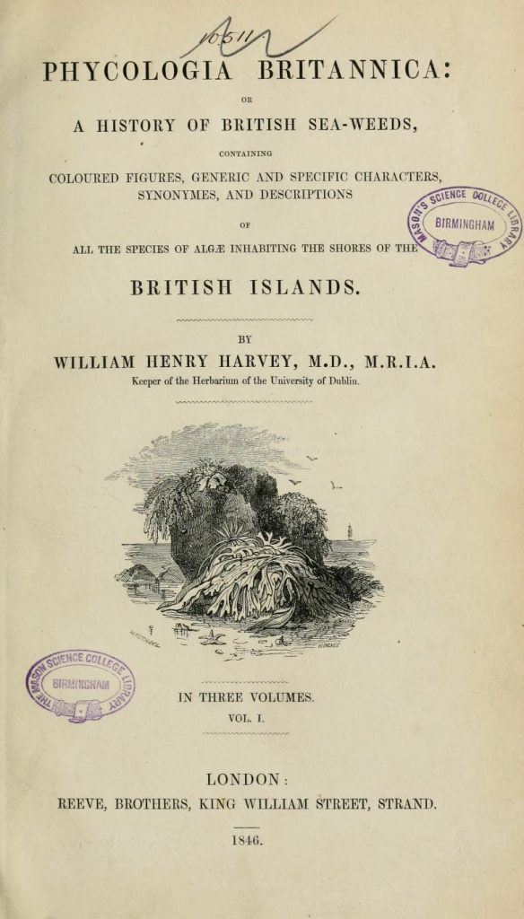
Amelia Griffiths (1768-1858), the widow of a clergyman, had become singularly knowledgeable about seaweeds. From her home-base in Torquay she collected along the Cornish, Dorset and Devon coasts. According to Philip Strange’s fascinating blog-post, “she helped male seaweed enthusiasts in producing scholarly studies on the larger and smaller seaweeds, generously giving her knowledge and donating samples.” Amongst the men was the Irish botanist William Henry Harvey (1811-1866) who went on – with Mrs Griffiths’ acknowledged help – to produce his handbook of British Marine Algae,  followed later by the 3-volume Phycologia Britannica, illustrated with coloured plates, and published in 1846.

Philip Strange notes that Mrs Griffiths was often helped by her maid Mary Wyatt (1789-1871) – who later ran a shop in Torquay selling shells and other seashore memorabilia to visitors. Wyatt was encouraged by Harvey “to sell books of pressed and named seaweeds to help identification. Supervised by Amelia, she produced the first two volumes of Algae Danmonienses (Seaweeds of Devon) by 1833. Each volume contained 50 species …” The Algae Danmonienses: or dried specimens of Marine Plants, principally collected in Devonshire by Mary Wyatt; carefully named according to Dr. Hooker’s British Flora eventually ran to five volumes, supplemented with some seaweeds from Cornwall.

As an aside here, Philip Henry Gosse must surely have come across the elderly Mrs Griffiths (she lived to the age of 90) during his early sojourns on the Dorset and Devon coasts, during his own expeditions to collect and identify marine animals for his marine aquaria.

This was a time when science, in terms of enquiry, knowledge and new techniques, was advancing quickly. Scientists (‘natural philosophers’) knew of each other and, if they had been appointed members of prestigious establishment institutions such as the Royal Societies of Edinburgh or of London, they were sure to meet and talk and correspond. Ideas and information spread quickly through letters – Gosse could post a letter from London in the morning to the Rev Charles Kingsley, his collaborator in dredging marine animals in Weymouth Bay, and Kingsley might well receive it later that day – and face-to-face meetings.

While William Henry Harvey was working on the accurate representation of British seaweeds through coloured engravings, lengthy papers with postcripts and addenda were being published by the Royal Society on other methods of capturing images, on paper or metal plates that had been made sensitive to light.

William Henry Fox Talbot (1800-1877) was developing a method of recording images as negatives on high-quality paper sensitised with a solution of silver iodide, a technique which became known as the ‘Talbotype’ or calotype process. Light pouring through the oriel window at his home, Lacock Abbey in Wiltshire, famously imprinted an image of the window on the paper (a postcard of the image can be bought in the Abbey’s shop.)

Fox Talbot's oriel window at Lacock Abbey
Fox Talbot’s oriel window at Lacock Abbey

At the same time, the astronomer and chemist John Herschel (1792–1871), who – like many natural philosophers of the time – had wide and eclectic interests, had been testing the effect of the spectrum of light in changing the colours of plant extracts. He presented his findings to the Royal Society in a lengthy paper “On the Action of the Rays of the Solar Spectrum on Vegetable Colours and on Some New Photographic Processes,” on June 16 1842, with a post-script added in August.

From Herschel's paper, 1842
From Herschel’s paper, 1842

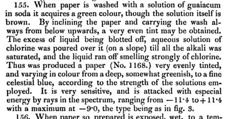
He tested the effect of light on extracts of a wide variety of plants such as elder, poppy, iris, French marigold and solution of gum from the guaiacum tree (formerly used in the treatment of gout), and began to home in on the underlying chemistry and the best methods of producing – and fixing – the colour change of the pigments on exposure to sunlight. Herschel moves on apparently seamlessly to experimenting with the effect of chlorine gas and solutions of salts of chlorine, iron, and ammonium, and speculates on the chemical processes involved, including oxidation. Mr Smee’s ‘ferroses quicyanurate of potassium’ meets with great approval, as it produces the admired Prussian Blue on exposure to light. And, as detailed in the lengthy postscript to his 1842 paper, Herschel develops the method for making what he now calls cyanotypes.

'Cyanotype': from Herschel's 1842 paper
‘Cyanotype’: from Herschel’s 1842 paper

Paper, sensitised with a mixture of iron salts, ferric ammonium citrate and potassium ferrocyanate, produces a background of ‘beautiful and pure celestial blue’ – Prussian Blue – around the object that was being recorded. Three washings in ‘spring water’ are required to process the image. And he was pleased with ‘the highly superb weather we have lately enjoyed’, which provided an abundance of the necessary sunlight.

In 1799 a daughter, Anna, was born to John and Hester Children. Hester died soon after giving birth and it seems that Anna later “received an unusually scientific education for a woman of her time”. Her father was Keeper of the Department of Zoology at the British Museum from 1837-40, and was also a chemist and an entomologist. He too was a Fellow of the Royal Society and served as its Secretary from 1830-37. Naturally, he knew Fox Talbot and John Herschel; indeed, they were friends who, along with other scientists such as Humphrey Davy, visited his home – with its well-equipped laboratory – in Kent.

Anna Atkins, 1861 (Wikipedia)

In 1825 Anna married John Pelly Atkins, a London merchant, and they moved to Halstead Place, the Atkins’ family home in Sevenoaks, Kent. Atkins too was acquainted with Fox Talbot, and so, through her husband’s and her father’s friends, Anna learnt about calotypes and cyanotypes, the new techniques of photography.

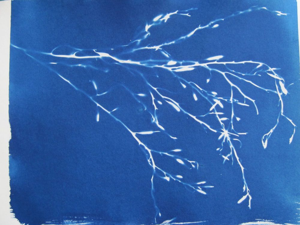
At the same time as William Harvey was being helped by Amelia Griffiths down on the Devonshire coast, Anna Atkins too began recording the variety of British seaweeds, by using Herschel’s photographic technique of  ‘blueprinting’ or cyanotyping: she placed pressed algae under glass on paper that had been sensitised with the mixture of soluble iron salts, and exposed them to the sun. After washing in water, the background colour deepened to a uniform ‘celestial blue’, leaving the detailed outline of the algae in grey; washing, then drying, fixed the colour and the image. Since the object was placed directly onto the paper, these were strictly cyanograms.

Anna Atkins' Photographs of British Algae
Anna Atkins’ Photographs of British Algae

Between 1841 and 1853, Anna produced the several parts of her Photographs of British Algae: Cyanotype Impressions, each of which contained around 400 images. It must have been a prolonged and labour-intensive work, for which she must surely have had help from the family’s servants, and perhaps also from friends: the collecting, pressing, identifying; the mixing of chemicals in the dark, the coating of paper, arranging of the specimens, waiting for suitable sunlight, and testing exposure times; the fetching of fresh water for washing; and the drying of exposed prints. It is not known how many copies she made but fewer than 20 still survive, all slightly different, and those at the British Library and the New York Public Library have been digitised and made available online. Inside the NYPL’s copy is the hand-written inscription, ‘Sir John F W Herschel, Bart. With Mrs Atkins’ compliments’. It is even possible to download a Kindle version (in shades of grey) from Amazon.

Much of her work after 1853, such as the beautiful  Cyanotypes of British and Foreign Ferns, was made in collaboration with her lifelong friend, Anne Dixon (1799-1864), a second cousin of the writer Jane Austen.

 The technique of cyanotyping

It’s possible to find many articles about the technique online, but an inspirational yet straight-forward guide to the technique and to various projects is the lovely book by Kim Tillyer, Beginner’s Guide to Cyanotypes (Search Press).

Basically, just two iron-containing chemicals are required: potassium ferricyanide and ferric ammonium citrate. You make them up separately, then mix them and – in dim light – paint the mixture onto or material paper using a soft, broad paintbrush (without a metal ferrule). The paper must be left to dry in the dark; then the object (‘anything that casts a shadow’, as Kim says) or photographic negative is placed on the sensitised paper, preferably under glass to flatten and hold it in place. It’s then exposed to sunlight (or failing that scarce resource, an ultraviolet light) to ‘cure’.

The pale green-yellow of the sensitised paper or material darkens towards blue in the sun, but is unchanged where it is hidden beneath the object. In bright sunlight the image develops within a few minutes but on a duller day it takes longer – and during a longer exposure the sun moves, so the outline of the object becomes fuzzy.

After washing in cold water until any greenish-yellow colour washes out (the startling Prussian Blue colour develops most strongly during washing), the print is hung up to dry.

Kim Tillyer also illustrates other tricks, such as using hydrogen peroxide to enhance the blue, sodium carbonate to bleach it, or soaking the print in tea to give a sepia tint, and more.

The chemistry:

In the first step of the reaction, ferric (Fe III) ions from the soluble ferric ammonium citrate are reduced in a photochemical reaction, by UV in the sunlight, to ferrous (Fe II). In the second stage, these ferrous ions then react in a complex way with the ferric ions in the potassium ferricyanate.

The result is an insoluble, dark blue compound – ferric ferricyanate – or Prussian Blue.

3Fe2+  + 2Fe(CN)63-   →  Fe3 (Fe(CN)6)2

After exposure, the colour is brought out further by oxidation during washing in tap water (dilute hydrogen peroxide can also be added).

Results

My first attempt: garden plants

My first attempt several years ago, using leaves and seeds from the garden, worked astonishingly well, and I was thrilled with the colour. But it was either ‘beginner’s luck’, or else the marine algae really are more difficult. Anna Atkins’ detailed and accurate cyanograms are especially impressive because the outlines have such sharp edges and the background colour is uniformly blue.

I am experimenting with different papers and with coated material such as white cotton, with different ways of coating them, with different ways of arranging the algae, and with different washing-times. Careful arrangement of each specimen on the paper with forceps before lowering the glass is tricky – but important.

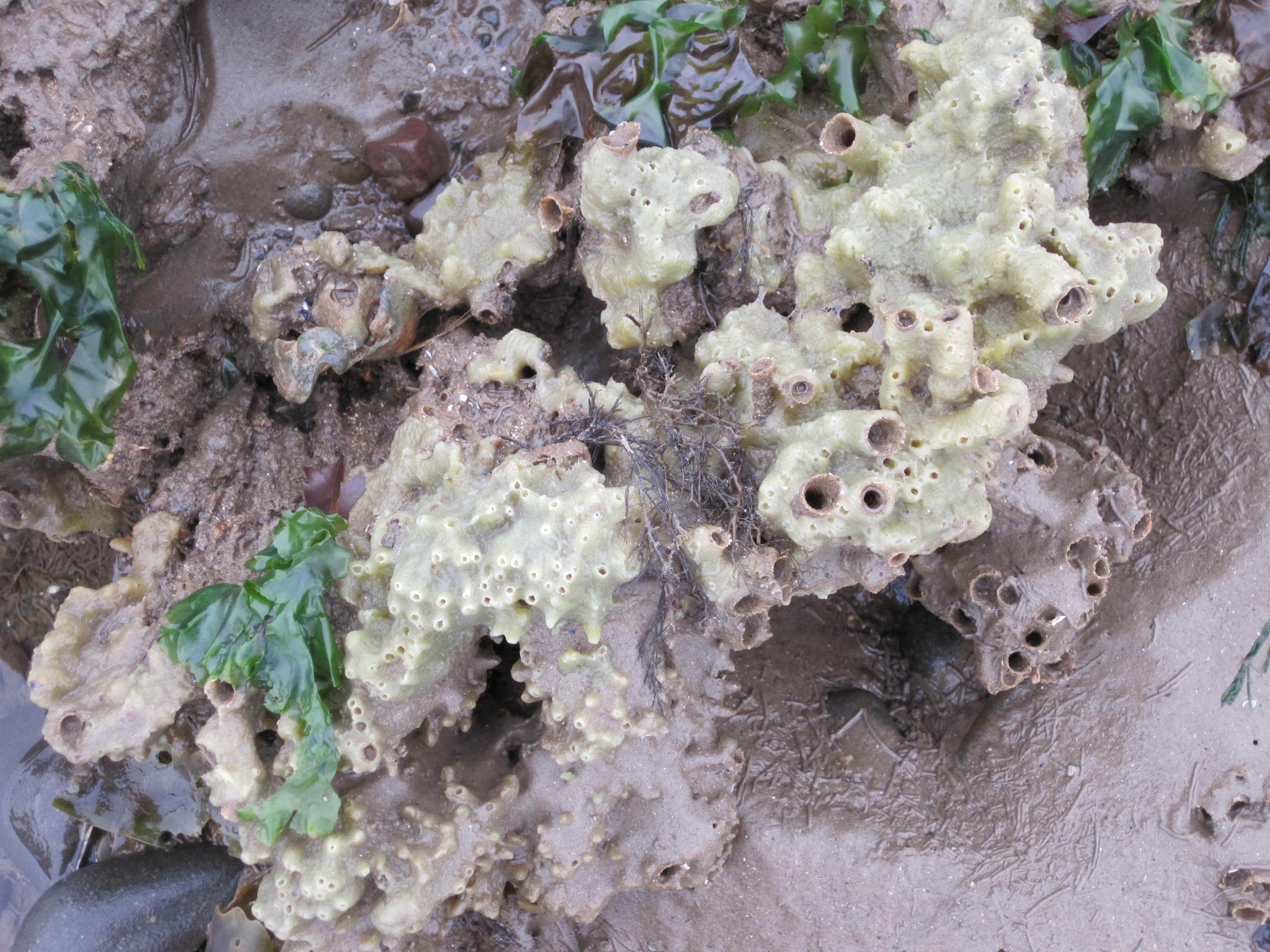
I’ve learnt that thick seaweeds, even after pressing, may throw shadows that blur the edges. With very delicate algae, or colonial animals like hydroids, the finer details often appear during washing. Some specimens will always be too thick to use, so other techniques (work-in-progress) have to be devised!

Art meets science: different points of view

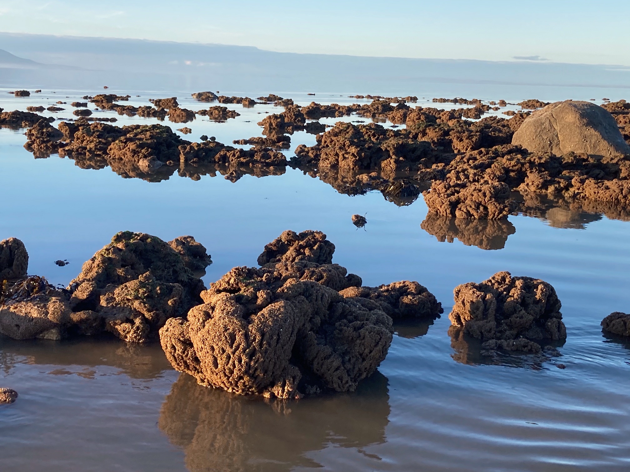
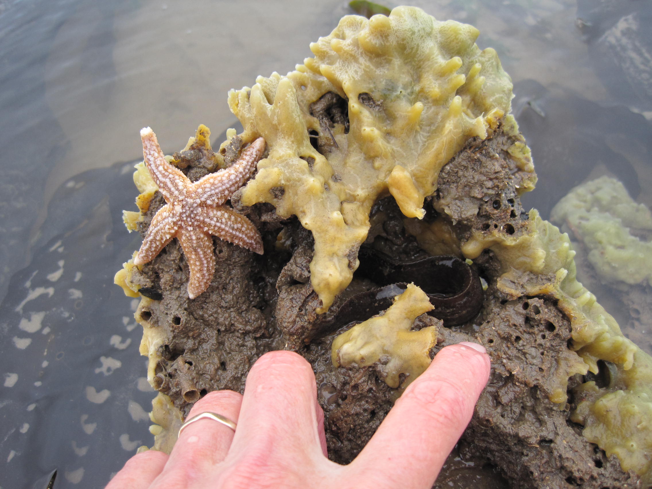
Anna Atkins’ cyanotypes of marine algae and British ferns are a mixture of artistry and science, which she intended to be used as an aid to identification. Although I’ve formerly helped run marine courses where we identified marine algae and animals, this no longer seems quite so important to me because I’m enjoying exploring this new multifaceted approach: cyanograms, photographs of fresh specimens, pressed and dried specimens, and algae that have been floated onto card and dried. Animal material – skeletons, empty egg-cases, crab shells and more – are important too.

Hydrozoan colony and a 'mermaid's purse'
Skeleton of a Hydrozoan colony, and an empty ‘mermaid’s purse’

Here, then, is the possibility to play with different ways of recording shape and colour.

And there is also the possibility to gain different perspectives, and to hint at different points of view.

Posted in art and science, seaweeds | Tagged , , , , , , | Comments Off on The art and science of seeing seaweeds

The ‘lava flows’ of Harrington

As I write this, the twelfth eruption in four years of lava and magma is occurring on the Reykjanes peninsula in the South-West corner of Iceland. Webcams, aerial videos from drones, and photographs capture the flows and colours and forms of the fresh and cooling lava. There are lumps of shiny black obsidian and the thin glassy spikes of Pele’s Hair, and the smooth swirling waves of pahoehoe. Aerial views of the insides of earlier, now dormant, cones show walls that are coloured purple, ochre, red and black, impregnated with burnt minerals.

A few years ago I wrote about ‘the volcanoes of Workington’ – the platforms of slag on the shore and the multi-coloured faces of the cliffs, the very visible remnants of West Cumberland’s industrial heritage: slag that was scooped off the top of the iron-smelting furnaces and dumped, still white-hot and molten, into trucks or ‘ladles’. Pulled by a small locomotive along rails above the shore, each chain of ladles was tilted, one by one, and the slag poured from the cliff down to the shore. There are links to photos from that time in the ‘volcanoes’ blog, but you can get a very good idea of the tipping process from this video taken at a smelter in America (the ladles are here referred to as ‘pots’; my thanks to my geologist husband John Lackie for finding this link).

The shore to the North of Harrington marina is even more dramatic than that shore near Workington, almost extravagantly so. If you leave the sailing club’s carpark and head North, almost immediately you reach a line of tall, reddish-brown pyramids, their tops truncated and smooth. They are the solidified contents of the ladles or tubs, up-ended onto the shore. They vary individually, with different patterns of colours and textures; some have a pattern of rough squares on their faces, imprints of the ladles’ linings. There are occasional small yellow patches where lichen, Caloplaca, has found a foothold and started to grow.

Keep walking along the rough grassy-edged path and then clamber down onto the shore. Between you and the edge of the tide is a greyish platform, flecked with green and blue and brown pebbles. Near the top of the shore it’s bare and rough, but from about mid-shore the algae, green and brown, are starting to colonise it, and provide shelter for sturdy marine creatures like barnacles and winkles.

At your back, at the top of the shore, is a cliff. And when you turn the corner there is an astonishing sight. A tall and undulating cliff stretches North for hundreds of metres, as vertical as the famous White Cliffs, but hollowed and sculpted by the waves and the vagaries of tipping – for this magnificent cliff is made entirely of slag, interspersed with the reddish-brown of ore and the impurities of the smelting process. In a couple of places, rusty iron bars protrude, perhaps broken bits of the rails on which the train pulled the ladles.

It seems impossible that such a huge element of the landscape has been manufactured, a dump of materials, brought up from below the ground, and burnt.

How many thousands of ladles were dragged along this stretch of the coast to deposit glowing-hot, molten waste? It is such a strange place, so improbable and unexpected, that it’s hard to leave. But the tide is in charge and we need to retreat to the path at the top of the shore.

Back near the carpark, we find shiny black lumps that glisten like obsidian, and heavy, rusty pebbles of once-molten ore. There’s another ‘volcano’, too, the base of a gaudy red and purple mound of slag.

'Volcano'
‘Volcano’

Data sheet and geotrail:

Cumbria GeoConservation exists to highlight the county’s amazing wealth of geological sites, and for many of the accessible ones GeoCon members have written illustrated datasheets and Trails. There is now one for the Harrington shore – to find it click on the ‘Geological Sites Map’ in the menu on the CGC website: https://www.cbdc.org.uk/cumbria_geoconservation/cumbrialgs-publicmap/ Find the ‘green dot’ for Workington, and click on it – and a pdf with photos and instructions will download. Well worth a look – and check out some of the other trails too!

Posted in coal, coastal heritage, geology, haematite, industrial heritage, slag-banks | Comments Off on The ‘lava flows’ of Harrington

Snippet 16: A beautiful ‘flower’ on the Allonby shore

Tubularia: its delicate tentacles wafting in the current, its stalks swaying gently, its body glowing crimson-red despite the sediment-laden tide. It’s not a plant, it’s not a sea-weed: it’s an animal which is related to sea-anemones and jellyfish, and a member of the group (Phylum) of invertebrate animals called Cnidaria.

Tubularia polyps joined at the feet

And this year, there are dozens of them in the area of the honeycomb reefs of the Marine Conservation Zone (MCZ) below Dubmill Point.

My group of shore-walkers are laughing at my whoops of delight – it’s only the second time I have found the ‘Oaten Pipes Hydroid’, or Tubularia indivisa to give it its proper name. The first time was of a single small ‘colony’ several years ago – but for some reason this is a year when they have decided to make the MCZ  their home. It’s good that there are several because they are ‘dioecious’, in other words each colony is single sex and not hermaphrodite – it takes two colonies to produce babies.

Tubularia ‘colony’, Dubmill Point

Tubularia’s lifecycle is fascinating, a cross between that of a sea-anemone (a polyp, a sedentary creature) and a jellyfish (a medusa, male or female, which wafts around the sea, free to roam). A sea-anemone may release eggs or sperm, and these fuse to form a fertilised egg which develops into a minute free-swimming larva  – this settles down on a firm surface and grows into the adult polyp that you will recognise, with a colourful column containing its gut, and tentacles around its mouth.

Eggs or sperm of free-swimming jellyfish are also released into the water. The larvae that result from fertilisation also settle down – but then each grows into a small column that starts to split horizontally, ‘transverse fission’. It looks just like a stack of plates, and each plate develops into a tiny jellyfish. These eventually split off one by one from the top of the column (which has the poetic name scyphistoma, sky-fist-omah) and swim away.

Tubularia does things differently. A larva settles down and starts growing a long stalk at the top of which it grows two rings of delicate tentacles. If another larva settles next to it, their ‘feet’ grow together and they form a group, a ‘colony’ (unlike a coral colony where the settled polyps bud off other identical polyps asexually). Then, at some stage tissue buds grow out from near the mouth at the top of the stalk, and each swells and develops into a sac-like extension; this is actually a highly-modified medusa which stays attached to the polyp. Let’s give the sac its proper name, the gonophore, because I do love the ‘naming of parts’! Like a free-living medusa the gonophore produces either eggs or sperm – so each colony is of a single sex. Sperm wafted on the currents enter the female gonophores on other colonies and fertilise the eggs, and in time the larvae swim out of their ‘container’ and settle down.

Some of the Tubularia we found on that exciting morning on the lower shore had red grape-like clusters amongst the tentacles, and these were the gonophores. The animals reproduce in Spring and nudibranch sea-slugs reputedly like to browse their juicy-looking red tentacles and gonophore, so we were there at just the right time.

I too have been browsing, on research papers about the evolution of colonies within the Hydrozoa (the sub-group of Cnidaria to which Tubularia for example belongs). I’ve had to look up a few words: ‘Coenosarc’ – a living body held in common by many organisms … by which they are in connection with each other’ particularly delights me. There is also ‘philopatric’, relevant to larvae which ‘tend to return to or remain near a particular site or area’. Loving their homeland: just like Cumbria’s Herdwick sheep who are hefted to their home fells.

Posted in Allonby, conservation, Marine Conservation Zone, Sabellaria, honeycomb worm, Snippets | Tagged | Comments Off on Snippet 16: A beautiful ‘flower’ on the Allonby shore

The Highly Protected Marine Area of Allonby Bay: the story so far…

‘We should be excited that Allonby is the first inshore HPMA in England! It’s something to celebrate.’ Indeed it is!

It was a small get-together – only five of us had come along – to discuss how much we knew about the new Highly Protected Marine Area (HPMA) in Allonby Bay: the meeting had been organised by Charlotte Boddy, as part of her dissertation for the University of Bath, and she was impressively well-organised and patient in gathering our views. Our discussion about DEFRA’s prior consultations and open meetings, and dissemination of information about the HPMA proposal, had been pretty negative, so it was good to be reminded by this local resident that the HPMA would be a Good Thing.

But first, let’s go back a step, to the MCZ. A large part of Allonby Bay has been a Marine Conservation Zone (MCZ) since 2016, designated as such to protect the large areas of honeycomb-worm reef (Sabellaria alveolata) and blue mussels (Mytilus edulis).

The box-shaped MCZ stretches about 9 km along the mean high-water mark on the shore, from Dubmill Point to just North of Maryport, and reaches out about 6 km into the waters of the Firth. At low Spring tides you can walk far down the shore from Dubmill, through the patches of rocky scaurs – pebbles and small boulders deposited by melting glaciers – to the sculptural brown shapes, many draped with green sheets of the sea-lettuce, Ulva, of the Sabellaria reefs. People who know about these reefs, such as local prawn-netters, often call them ‘sand-coral’, although they are not in fact corals, but worms, each of which constructs a delicate and intricate tube of sandgrains in which to live.

The reefs are like high-rise blocks, multiple accretions of tubes joined side-to-side and reaching skywards. There are other reefs and pavements of Sabellaria along the west Cumberland coast, but the Allonby Bay reefs are the biggest and best in England, and form a protected environment for an exciting variety of other marine animals and algae (seaweeds) . But so few people know that the honeycomb worms and sponges and burrowing anemones are there; the animals are underwater at low Neap tides, and it’s an unnervingly long distance to the bottom of the shore during low Spring tides (for a discussion of the highs and lows of the tides, see here ).

So, if you stood in one of the carparks, could you point to the edges of the MCZ? Who even knows the MCZ is there, and what it is? Who even cares? There are no information boards in the carpark, no handy little leaflets in cafes, shops or the pub. Although I have guided low-tide shorewalks for years to show people the marine life – and the enthusiastic and astonished reactions of walkers make those early starts and often windy weather very worthwhile – let me here play Devil’s Advocate: perhaps it doesn’t even matter that no-one knows about the MCZ because the biologically-important parts of the Allonby Bay MCZ are usually too far away to harm.

Map of the MCZ

Designation of a site as an MCZ means that certain listed features must be ‘maintained in favourable condition’. For Allonby Bay, that list includes ‘intertidal rock’, ‘intertidal coarse sediment’, ‘intertidal biogenic reefs’ (ie Sabellaria reefs), ‘peat and clay exposures’ (the 8000-year-old submerged forest), various other physical features, and the blue mussels. In other words, no driving a JCB onto the shore to scoop up shingle; no jumping up and down on the sandy tubes of the reefs!

The designation document lists the usual ‘alphabet soup’ of authorities responsible for managing and regulating the MCZ, which include the (North-West) Inshore Fisheries & Conservation Authority (NWIFCA), the Environment Agency (EA), Natural England (NE) and the Marine Management Organisation (MMO). The IFCAs manage inshore fisheries from 0-6 nautical miles (nm) (MMO manage the 6-12nm offshore fisheries), so NWIFCA makes the bye-laws that regulate (and currently, prohibit) the mussel- and cockle-fisheries, for example, and the timing and placing of fixed nets on the shore.

Retrieving fish from a fixed net in 2015 (before the MCZ was designated)

Apart from very occasional important activities like re-routing of Allonby Beck away from the dune-edge and across the shore, and surveying the mussel beds, it’s probably safe to say that management of the Allonby MCZ hasn’t been busy, obvious or onerous.

Now let’s take a step up: to a pilot Highly Protected Marine Area, the Allonby Bay Inshore HPMA.

Only three pilot HPMAs were designated by DEFRA in early 2023 after public consultations, two of them offshore in deeper water: Allonby Bay is the only inshore HPMA, its inner edges actually accessible from the shore and delimited by the line of the Mean High Water tidemark (you can download the information from the Government website).

Which tideline is MHW mark?

Interested groups (‘stake-holders’) including trawler-owners, lobstermen, shore fishermen, yacht-owners, and representatives of the ports of Silloth and Maryport, and of organisations like NWIFCA and MMO, had been invited to submit comments and answer online questionnaires, and to attend meetings; the DEFRA summary is here . Other people, interested individuals, were alerted to the consultation by organisations like Solway Firth Partnership, Solway Coast AONB (now Solway Coast National Landscape) and Cumbria Wildlife Trust.

The proposed area of the HPMA was modified after the consultation, “to allow for an area of recreational angling, including access for disabled anglers, and for other activities to continue due to its importance to the community and takes account of the needs of Maryport Harbour and the Port of Silloth while still delivering important biodiversity benefits.” For example, Tim Riley, harbourmaster and ships’ pilot at the Port of Silloth told me that “Our route into Silloth skirts just inside the top of the HPMA and as we are surface only, there are no issues with transiting….We can still run ships up and down to Silloth. However the sinker for one of our Buoys was in the area originally designated and we asked for the area to be amended slightly so that we could carry out maintenance on the buoys…”

The result of the consultation was that the Allonby Bay pilot inshore HPMA was formally designated as such in July 2023.

Map of the HPMA

This is DEFRA’s rationale for the designation: to “allow the protection and recovery of marine ecosystems by prohibiting extractive, destructive and depositional uses and allowing only nondamaging levels of other activities to the extent permitted by international law.” (See also more detailed notes at the end of this blogpost).

So, this is the important part for you – how will you know where the pilot HPMA begins and ends?

It will be seen from my overlay, that the modification means that the HPMA does not completely overlap with the MCZ; it is considerably smaller. Astonishingly, the large area of the mature and developing honeycomb worm reefs at the north end of the Bay are left outside. Yet this is reef and lagoons that are rich in animals and macroalgae (seaweeds), and (over)used as a hunting ground for peeler crabs which are then sold as bait in the North-East – these, the reef and lagoons, are the main, living, feature that led to the HPMA designation.

But disregard that bizarre omission for the moment….

HPMA boundaries (in red) overlaid on MCZ boundaries (purple)

The HPMA’s northern boundary now reaches out North-West into the Firth, from the Mean High Water tideline just North of the Staithes carpark to an invisible point in the sea. On the left of the boundary – towards Maryport – will be the HMPA, which also includes the MCZ. On the right of the boundary, heading North in front of the village and to just beyond Dubmill Point, will be the MCZ which does not have the added protection of the HPMA. Different conservation measures and future bye-laws will apply depending which side of that boundary you stand.

On a good low tide you should be able to work out where this northern boundary lies: it’s very roughly along the line of the pipe that points out to sea.  But what about when you are zipping over the waves in your kite-surfer?  Tom Barnfield of the MMO told me in an email in early May: “With regard to knowing where the byelaw boundary is, it would be the responsibility of the individual to familiarise themselves with the boundaries using the maps and coordinates provided in the byelaw if it is confirmed. We hope to provide further updates on this process soon.”

Thereafter, in the unlikely event that you see men with a buckets wandering amongst the pebbly scaurs in the HPMA, squatting down to guddle under boulders to collect peeler crabs for bait – phone NWIFCA, down in Whitehaven. “The IFCA (in collaboration with MMO) will still be responsible for compliance and enforcement of the HPMA fisheries management measures in Allonby Bay HPMA” (Tom Barnfield). Since it might take a long time before anyone can respond, just upend the buckets over their heads, and run … (But it’s much more likely that the crab-collectors will be hunting amongst the much richer habitat to the North, in the MCZ.)

What you can and cannot do relating to fishing and non-fishing activities is still to be finalised.

First, prohibition of fishing within the HPMA.

With the legal designation in place, what has followed next has been a period of consultation about fisheries, overseen by MMO – by MMO not NWIFCA, because it had been agreed that it would be sensible for MMO to oversee the fisheries planning for all 3 new HPMAs, both inshore and offshore, rather than splitting it between different IFCAs. The public consultation process is now closed but has led to a draft byelaw about fishing and fisheries within the designated HPMA. The report on the results of the consultation and the new byelaw are due ‘early in 2024’.

This draft byelaw, with regard to Allonby Bay, states among other things, that:

3. A person must not remove any fish or sea fisheries resources from within a specified area.

4. A person must not use any fishing gear in a specified area.

5. A person must not carry fishing gear on a vessel which is present in a specified area unless that gear is inboard, lashed and stowed.

6. Failure to comply with paragraphs 3, 4 or 5 constitutes an offence contrary to section 139 of the Act.”

‘Fish’ also includes shellfish and crabs; ‘fisheries resources’ includes bait such as lugworms, and presumably peeler (newly-moulted) crabs. ‘Fishing gear’ includes prawn and shrimp nets, rod and line, shore nets. For Allonby Bay, there will be an additional 100-metre exclusion zone around the (outer?) edges.

Shore-fishing in the MCZ

We await the final outcome of this fisheries consultation. Tom Barnfield, Principal Marine Conservation Manager for the MMO and based in Plymouth, speaking at the ECSA meeting in Carlisle on May 21st, said the decision document would be published ‘in the next few weeks’. The final document will then go to DEFRA and to the Secretary of State, and eventually be approved as a legal byelaw. But – the General Election has been announced and all decisions by governmental organisations are on hold and in ‘purdah’. So, ‘watch this space’  – but much later in the year.

So, that relates to the (draft) byelaw for fish-related matters…

Second: what will non-fishing beach-goers be able to do on the shore and water within the HPMA?

Worries have been expressed that ‘We won’t be able to walk our dogs on the shore.’ ‘What about windsurfing?’ and so on.

To understand future decisions, you need to know about Marine Non-Licensable Activities (mNLAs): ‘Marine non-licensable activities are those which do not require a marine licence. These include shore based activities such as bait collection and beach recreation as well as water based activities such as sailing and motor boating.’ Details are on the Government website here. At the ECSA meeting in Carlisle in May, Jemma Aitken of MMO explained that mNLAs included anchoring, sailing, powerboating, walking, dogwalking, general beach recreation and bait collection (although bait collection will be included in the fisheries byelaw).

At first sight, this will horrify Allonby regulars and visitors! But note that the first three activities rarely, if ever, occur within the HPMA in any case. MMO are currently ‘scoping’ the extent of activity by non-motorised watercraft – eg kitesurfers, kayakers – and the effect of launching and recovery on the shore and shallows (and again, note that only a small area of shore near Staithes at Allonby’s southern-most carpark, is used for launching – an area that is mainly sandy, and has no honeycomb worm reef).

After an initial assessment of current activities, ‘stakeholders’ will be asked to ‘engage in a consultation’ in early July this year, in other words to dicuss the suggestions and put forward their own views. The opinions of everyone who lives nearby or visits the shore are very important, and I asked MMO to publicise the meetings and consultations widely – this time using obvious routes like Solway Buzz, the Allonby newsletter, Facebook groups, flyers in the shops, and so on. This consultation was due in July but, as with the results of the consultation on the fisheries draft byelaw (see above) the General Election has interfered with the timetable.

It’s very important to get this right, for both the marine wildlife and for humans – don’t forget that Allonby Bay is a pilot inshore HPMA, the first of its kind and leading the way. Unlike offshore HPMAs where only fishing-boats need to take note and comply, Allonby has a land boundary where people and dogs wander daily.

How will we know if this highly-protected area is having a beneficial effect on the marine life?

Breadcrumb sponge and sea-lettuce on Sabellaria reef

I love hearing what local people observe about the shore, hearing their stories – so many have lived here all their lives, and so many wander along the shore on a daily basis: changes in numbers and species of fish (no more herring, many more thornback rays); very few of the largest ragworms; a good year for prawns … During the twenty-odd years I’ve been doing low-tide guided walks I too observe yearly changes – perhaps the Sabellaria reef has spread, or been battered by storms; some years breadcrumb sponge is extremely common on the reefs, some years not; some years the spatfall of mussel larvae is copious, other years less so…

We observe and we see, and we have our stories and anecdotes; and mostly, we care. But we don’t count numbers, we’re not scientific in our comparisons (and I write here as a former research scientist).

The HPMA is a ‘pilot’, so basically it will act as an experiment. The government policy paper states (my italics): “The designation of Allonby Bay as a HPMA would allow us to understand the added benefits the protection of a HPMA can provide in these scenarios. Furthermore, with limited disturbance identified, this area is considered to represent a more natural ecosystem providing an important opportunity to safeguard biodiversity and to help us further understand the ecological impact of the removal of any remaining pressures.”

So, for the organisations seeking to understand impacts and benefits, ‘baseline surveys’ need to be carried out to monitor not only the marine organisms but also the social and economic impacts of having a protected area on the doorstep. Economically, this could also be highly relevant to the placing and construction of turbines for tidal power in the Solway.

Conor Hinchcliffe of Natural England explained at May’s ECSA meeting that different types of biological and sea-bottom surveys have already started: cores of sand taken from the shore to measure the amount of, for example, carbon that is stored; subtidal mapping, using sidescan sonar to get a 3D picture of the seabed; a survey of bottom-dwelling and benthic fish species; drop-down videos to see what’s happening beneath the surface of the sea, and grabs to collect sediment from the seabed and look at its composition. Water quality will be monitored (this will cause some wry smiles given recent bad publicity about sewage releases); there will be aerial mapping of the honeycomb worm reefs (some below Crosscanonby saltpans – but the largest areas are outwith the HPMA and in the northern part of the MCZ) , assessment of shellfish caught during potting; counts of waders and other seabirds – and so on.

Honeycomb worm reef near Crosscanonby in the HPMA (c) Brian Donnelly

On the basis of these data an Evaluation Framework will be developed, which will ‘inform future work towards management measures’. You’ll recognise the language…

Meanwhile, the Solway will do what it always does – it will control its own environment, from tide to tide, storm to storm, season to season, defying management and measurement. That’s why we both respect and love the Firth.

“Lessons learnt”

Well, this ongoing process should be providing a good learning process for the future!

It seems to have been a prime example of DAD – an acronym for the “Decide-Announce-Defend management approach … based on the analysis of an issue by a group of experts, whose decisions will be made through a well-defined hierarchy, even if not everyone agrees with them.”

An interesting analysis was carried out by Charlotte Boddy for her dissertation at Bath University (see notes). I went along to one of her well-conducted sessions in Allonby village hall. Comments recorded made clear that local people had felt left out. “Compounding the sense of local exclusion during consultation was a perception among participants that experts and wider stakeholders dominated the consultation, while local people remained unheard. This was underlined by the fact that the majority of contributors to the digital consultation for Allonby were from outside the region.” This is borne out in DEFRA’s summary of the consultations: “At Allonby Bay, 5% were local to the area and 95% were non-local”.

Additionally, according to Boddy, “… policymakers also failed to capitalise on excellent community co-management opportunities. Existing active community environmental co-management, combined with local support for marine protections create an ideal foundation for effective HPMA co-management if policymakers effectively engage the community. Implementation of the HPMA occurred top-down, lacked effective community engagement, and resulted in limited local buy-in.”

Consequently – as I have discovered during my chats with locals who come on my low-tide shore-walks – misinformation and rumours abound. Once the byelaws are in place, considerable explaining and information-sharing will need to be done to get everyone onside for what is, indeed, a very exciting and important development for the Bay. Leaflets in cafés and pubs, information boards in the carparks, village hall meetings (with cake, of course!), shore-walks, short articles in local newsletters, information on Facebook groups – there are so many ways of letting locals and visitors know how important the HPMA is. And that Allonby Bay’s inshore HPMA is unique and indeed a ‘world-leader’! That is certainly to be celebrated.

Notes:

Charlotte Boddy (2023). Reconciling environmental policy and community prosperity: Community perspectives on the introduction and potential impacts of a Highly Protected Marine Area in Allonby Bay (Dissertation for the Dept of Social and Policy Sciences, Bath University)

HPMA designation. Extracts from the DEFRA document: “Allonby Bay consists of a mix of habitats, characteristic of an environment that is subject to dramatic currents and tides. The seabed here consists of a range of rocky habitats and sediment dominated habitats. The nutrient-rich sediments, dense mussel beds and intertidal rocky habitats in this area attract large densities of shore birds including species such as curlew and oystercatcher. The biodiverse subtidal habitats provide a food source for fish species, such as flat fish, and nursery areas for other species. In turn, these fish species attract diving, foraging seabirds including guillemots, gannets and razorbills.

One of the best examples of honeycomb worm reefs in the UK is found here. Honeycomb worms create a complex sediment network of tubes attached to rock, providing vital habitat for a range of species including crabs and molluscs.

The rich sediments and intertidal rock habitats attract important migratory, non-breeding bird species with large groups of around 16 different species congregating along the shoreline. Allonby Bay provides suitable spawning grounds for sole, thornback ray and bass, and a nursery area for cod, herring, plaice, sole and thornback ray.”

Posted in Allonby, conservation, Marine Conservation Zone, Sabellaria, honeycomb worm | Comments Off on The Highly Protected Marine Area of Allonby Bay: the story so far…

‘Compelling and interacting stories’: the inhabitants of a Solway smallholding

A list of animals … could become tiresome, but it is necessary to grasp the true richness of nature. Think of it as not so much an inventory as a catalogue leading to compelling and interacting stories…”  (Richard Fortey, 2016. The Wood For The Trees. The Long View of Nature from a Small Wood. Collins)

Here is a list of the creatures that have lived in or visited the smallholding in the North-West of Cumbria, where we have lived since 2001.  The house and its curtilage date from 1856. We have about 4.5 acres, with sheep pasture (horse pasture until 2001); Victorian woodland; a beck – arising from at least two springs (‘sources’ on the OS map) at the base of the limestone plateau to the South – which flows through and has been used to create a pond; vegetable and flower gardens; plus lawns (some mown, some not). We have planted native trees to create woodland, scrub and hedges – in 2001 and in 2018; hazels and alder blackthorn in the ‘old wood’ to create an understorey; and wildflower seeds in the open areas of the 2018 wood.

A list, then. To understand the meaning of this list, this catalogue of lives, I work my way down slowly, taking time to allow a picture of each named creature to enter my mind; to hear the subject singing or calling, if that is what it does; to see them en masse, in a shape-shifting murmuration, or flitting through the hawthorns, or dotting the mud at the bottom of the pond.

For theirs are ‘Compelling and interacting stories’ – and I have written their names here so that I will not forget.

Nesting robin

BIRDS

Residents

  • Blue tit
  • Great tit
  • Coal tit
  • Chaffinch
  • Goldfinch
  • Greenfinch
  • Robin
  • Common wren
  • Goldcrested wren
  • Blackbird
  • Songthrush
  • Mistle thrush
  • Starling (and murmurations, sometimes as many as 3000 birds, in the autumn)
  • Dunnock
  • House sparrow
  • Tree sparrow
  • Nuthatch
  • Rook (rookery, of ~ 50 nests)
  • Carrion crow
  • Jackdaw
  • Magpie
  • Great Spotted Woodpecker
  • Pheasant
  • Collared dove
  • Woodpigeon
  • ‘Town’ pigeon
  • Mallard (spring & summer, nesting)
    • Visitors
  • Longtailed tit
  • Bullfinch
  • Pied wagtail
  • Grey wagtail
  • Tree creeper
  • Buzzard
  • Kestrel
  • Sparrowhawk
  • Fieldfare (winter)
  • Redwing (winter)
  • Tawny owl
  • Barn owl
  • Moorhen (see note below)
  • Summer visitors
  • Chiffchaff
  • Blackcap
  • Willow warbler
  • Garden warbler (very occasional)
  • Swallow (but, for the first time since 2001, absent in 2023)
  • Spotted flycatcher (visited and nested 2 years running; not 2023)
  • Infrequent visitors
  • Siskin
  • Yellowhammer
  • Brambling
  • Snipe
  • Heron
  • A pair of peacocks! (for one morning only)
  • Overflying
  • Gulls, various
  • Oystercatcher
  • Curlew
  • House Martin (very few in 2023)
  • Swift (not in 2023)
  • and, especially in the autumn, flocks of over-wintering pinkfooted and barnacle geese

MAMMALS

  • Bank vole
  • Field mouse
  • Hedgehog
  • Mole
  • Rabbit
  • Grey squirrel
  • Red squirrel (rare)
  • Bats – pipistrelle
  • 2 white rabbits (appeared one morning but vanished after about 2 weeks)
  • Crappy, predatory and unwelcome neighbourhood cats

AQUATIC CREATURES

BUTTERFLIES

  • Brimstone
  • Comma
  • Green-veined White
  • Orangetip
  • Painted Lady (occasional)
  • Peacock
  • Red Admiral
  • Speckled Wood
  • Small Tortoiseshell
  • Large and small Whites
  • Wall

MOTHS

  • Mullein Moth caterpillars
  • Puss Moth caterpillar
  • Poplar Hawk caterpillars
  • Angle Shades
  • Antler
  • Barred straw
  • Brimstone
  • Buff Ermine
  • Burnished Brass
  • Dark Arches
  • Dotmoth
  • Early Thorn
  • Ermine
  • Golden Y
  • Heart and Dart
  • July Highflier
  • Large Yellow Underwing
  • Lesser Broad-bordered Yellow Underwing
  • Light Emerald
  • Magpie
  • Map-winged Swift
  • Miller
  • Plain Golden Y
  • Poplar Hawk
  • Scalloped Oak
  • Silverground Carpet
  • Silver Y
  • Snout
  • Spectacle
  • Swallowtail
  • V Pug
  • Wainscot Dusky
  • Yellowtail
  • … and many more which I haven’t attempted to identify
Burnished Brass moth

MISCELLANEOUS INSECTS (mentioning just a few)

  • Sawfly larvae, species undetermined, on Poplar and Solomon’s Seal and gooseberry bush
  • Several species of Bumblebee
  • Great Wood Wasps
  • small grasshoppers (species undetermined)

Note: very few honey bees during the past few years; and at one time we had Leaf-cutter Bees (which enjoyed cutting the tender Amelanchier leaves) and Tree Bees.

As for plants, it is true that ‘if you provide the right conditions, they will come’: cuckoo flowers, orchids, great burnett, and more, suddenly appearing to delight us. And the six-year old trees – particularly the apple trees – in the ‘Three-score years + 10’ 2018 wood are already being colonised by lichens. In time, as I grow better at identifying these complex organisms, I hope to include a list of lichens too – for they’re the epitome of ‘interacting stories’.

Postscript: The moorhens:

A few days after I posted this, I thought I was hallucinating – a moorhen wandered past the kitchen window. About a week later, there was a nest amongst the reeds. Then 4 eggs. But only one moorhen. However, the trailcam gave away their secret – there were, of course, two birds, who met up and changed places in the evening and night. There is now always one on the nest, the other occasionally seen in the boggy patch in the next-door field, or lurking at the edge of the pond. The brooding period is 20-21 days, so we look forward to seeing babies. Meanwhile, the mallard sitting on her nest on the island, just a couple of metres from the moorhens, has hatched 8 chicks after 28 days – and after a day pottering around the pond, has taken them away, who knows where? We wish them luck and a happy life. The diversity and number of invertebrates in the pond has no doubt had a set-back …

Posted in conservation, farming, smallholding | Tagged , , , , , | Comments Off on ‘Compelling and interacting stories’: the inhabitants of a Solway smallholding

‘The Fresh and the Salt. The Story of the Solway’

Today, World Book Day 2024, the paperback edition of my ‘Solway book’ is published. The hardback came out in 2020, during lockdown – which was not the best time to be bringing a book into the world! But despite that, I have received many, many comments – emails, contacts through the F&S website, letters, and invitations to speak about the book – from readers who have enjoyed finding out more about this little-known, little-researched and crooked finger of estuary and sea that divides and unites Scotland and England.

So, I invite you too to find out more, and to enjoy reading and dipping into The Fresh and the Salt: from geological timescales to present-day (and, perhaps, the future); from aerial view to the microscopic; from miners and navvies to ships’-pilots; from the silk-lined burrows of mudshrimps to fossil reptile footprints and the colours of sphagnum mosses. And then come and visit this beautiful and unusual area of NW England and SW Scotland, to enjoy its sweeping shores, saltmarshes, raised bogs and sculpted sandstone.

There are many reviews of the book, and extra material – photos, videos and more – on the related website. And the book can be obtained from any bookshop, or through various online shops.

Posted in Writing | Tagged , | Comments Off on ‘The Fresh and the Salt. The Story of the Solway’

Floating cows and snarling dogs: William Mitchell of Maryport

William Mitchell, self-portrait

There is a self-portrait of William Mitchell (1823–1900) in Maryport’s Maritime Museum [1], painted in 1899. Most of Mitchell’s other portraits are rather lacking in life, but he clearly knew himself better than his other subjects: the lower part of his broad face with its long, strong nose is hidden by a bush of white beard and moustache, his forehead by a soft-brimmed black hat, but he has a powerful and rather accusing stare. He arrived in Maryport, from County Down, when he was seventeen, one of many Irish migrants who were fleeing the famine at that time, and found work in the Engine Works of the Maryport & Carlisle Railway, painting the company’s coat-of-arms – its logo – onto the carriages and locomotives. He also started to paint maritime scenes, but he didn’t leave his job (by then he was Foreman Painter) with the M&CR for another twenty years, by which time his paintings had become popular and he was receiving many commissions.

‘Mitchell of Maryport’ is especially well-known for his maritime paintings – ships being built, ships at sea, sailing ships being pulled by a steam-tug, ships wrecked or in the process of being wrecked with their crew and passengers being saved. Portraits and caricatures, Lake District landscapes, Mitchell painted them too, many as commissions – but the maritime paintings are populated with people and animals, who catch the eye and make one laugh. There are men gesticulating, children with hoops, old men leaning against walls and chatting, young men sitting on the edge of the pier, legs dangling over the water as they fish, oblivious to the racket around them. There are gulls, mere hints of white wings and black heads, squabbling over detritus in the water or resting on floating branches.

The Launch of the Collingwood

However, it is the domestic mammals that I love most. Two dogs with open, snarling mouths are leaping towards a man who has raised a stick against them; a lad pulls at the man’s arm, trying to stop him. On the road above them, a large furry dog sits impassively watching the drama below. But the same two snarling dogs are in another painting, and this time the boy is missing, the man fights off the animals on his own.

In one of several versions of The Launch of the Collingwood [2] (which Mitchell himself copied from W. Brown – who may have been his mentor), two growling mastiffs are restrained from attacking in each other, their masters pulling them back and trapping them between their knees. Elsewhere, a small cheerful dog prances besides its owner. There are donkeys, pulling carts or patiently waiting between the shafts. There are horses, standing with hanging heads.

My favourites, though are the cattle. Why are there cattle standing or lying on the slipways? There was a long history of cattle being driven on foot over the shallow waths [3] across the inner Firth like that near Bowness, or across the River Eden, but here in the harbour, it becomes apparent that they have been passengers on a ship. The story is at first hard to unravel – there seems to be a dead cow floating in the water, its legs pointing stiffly at the sky. But a friend of mine pointed out that the gunwhale (the raised side of the ship that acts as a protective barrier) of the ship Gipsy has been lowered, and there are men standing there looking down. The (live) cow has been pushed off the ship – hence the great splash of water surrounding it – and will surely be guided to the slip, for nearby, there is a small skiff alongside which one of the two crew holds another cow as the boat is punted towards the shore. There are two versions of this painting, The Graving Bank, in Maryport’s Shipping Brow Gallery [4]: in one painting the cow has large horns, in the other it has no horns (its head is hard to make out – is it being towed backwards, held by its tail?) And as you would expect, there are many interested onlookers, standing or sitting on the harbour wall –  you can almost hear their banter and their laughter. The owner is likely the man standing on the slip and waving his arms. The onshore cattle are unconcerned. My friend suggested that the cattle boat might have come from Ireland, and indeed it is labelled as such by maritime historian David Bridgwater in his interesting blog [5] about the ship-builders of Maryport: “The Brig Gypsy [sic] Discharging Cattle from Ireland onto the Graving Bank. With the Barque Airey ready for the broadside launching in the background in 1837.”

So many of Mitchell’s paintings encourage you to look closely, to enjoy the tiny details, and imagine the unfolding story. Not all his stories are amusing though: some are grim, like the demasted ship wallowing in the stormy sea and, potentially much worse, the wreck of the Danmark in the Atlantic. The passengers, who have been rescued by small, open boats from the SS Missouri, are crammed together, wet and cold and frightened. But at least we know everyone was saved. The description (in the former Maritime Museum) notes that ‘every soul was saved. 735 persons, 65 mere children and under 11 years, 22 mere babies under 11 months’. And above the terrified mothers, a basket containing 4 of the ‘mere babies’ is being swung down to the rescue boat.

Mitchell was born two hundred years ago, and his paintings of ship and ship-building at Maryport give us detailed and intimate views of life in the town in the 19th century. Yet the activities of the people and the animals are not so different from what they would be doing today, and we can unpick and enjoy their stories.

His obituary in the West Cumberland News notes that ‘He was very industrious, and according to the records which he kept, had painted over 10,000 pictures.’ He was also industrious in other ways: he had had three wives and (possibly) at least twenty children, and he was contemplating marrying again just before he died.

The blue plaque installed at 85 High Street [6]

Notes:

[1] Maryport Maritime Museum  is currently in temporary accommodation at the bottom of Senhouse Street, but will be moving to a specially-designed site in the re-furbished  Christ Church in Spring 2024.

[2] Launch of the Collingwood – a version was sold at Bonham’s in 2015; the catalogue notes that  “A photograph of the original canvas before it was lined shows an inscription on the reverse that reads as follows: “Launch of the Collingwood” from the/yard. Keswick [sic] Wood Maryport/ This picture copied from the original/ by permission of Wilton Wood Esq./ Painted in 1819 by W. Brown Maryport/and Jenkinson of Liverpool/ W Mitchell Maryport 1884’ ” (Note: the launch date is actually incorrect – it should be 1829)

[3] More on the Solway Waths

[4] The Shipping Brow Gallery opened in November 2023, on the site of the former Maritime Museum, and has a permanent display of several of Mitchell’s paintings (as well as a permanent exhibition of paintings by Percy Kelly, and exhibition space on the ground floor for chosen local artists and the artist-in-residence)

[5] David Bridgwater’s blog about Maryport ship-builders, and more.

[6] It should probably more accurately read ‘ … in his 200th birthday year’!

Posted in art and science, coastal heritage, ports, ships | Tagged , | Comments Off on Floating cows and snarling dogs: William Mitchell of Maryport

A Solway smallholding: update 2023

Six o’clock, and the rooks and jackdaws are wheeling in the darkening sky, shrieking and cawing in a cacophony of sound, their attention focussed on the garden below. The football-rattle clatter of vigilant magpies adds another layer of sound. Like snowflakes, pale feathers drift down for several minutes from the sky. On the lawn, a female sparrowhawk struts amongst the pearly fluff of an exploded collared dove, and darts at the three magpies who are daring to challenge her for her kill. After a few minutes, they give up and fly away; the black corvids continue shouting from above, but then they too drift away in twos and threes, and the hawk is left alone, to tear beakfuls of flesh from her prey. She pulls at the carcase for nearly three-quarters of an hour, and when she has finished only a pale plate of feathers remains to hint at its meal.

Sparrowhawks regularly flash through the garden and over the field, the speed of their flight sometimes so fast as to register sub-liminally; collared doves, of which we have many, provide a good meal. The hawks seem uninterested in sparrows, although blue-tits make an occasional snack. (And now I discover, from the RSPB/DorlingKindersley bird book, that ‘males take tits and finches, females thrushes and pigeons’; a new and fascinating fact!) The local buzzards continue to harass the rook colony when the rooklings hatch, and occasionally a kestrel hovers, wings flickering, high above the ‘new wood’ where the voles reign. I am ambivalent about the voles: yes, we are honoured that they like to live and breed in the wilder areas – but they are less welcome when they destroy the flowers of the snakes-head fritillaries, or burrow in the soil of the greenhouse and polytunnel.

This has been the Year of the Mole, too, with mounds of soft brown soil being thrown up all round the small-holding – even, bizarrely, on the island in the pond. Hedgehogs have returned, snuffling loudly in the dusk and, thankfully, no longer seen in the day: whatever disease struck them down previously must finally have disappeared. The bats, pipistrelles, are numerous and active as before.

But this has been the first year that we have had no swallows nesting at all. Indeed, there have been only a few pairs in the village, and the house-martin numbers have plummeted. The tawny owls ignored the nestboxes (which made perfect homes for jackdaws instead) and seemed to abandon the village and its surrounds altogether – but last night, in late October, we finally heard a pair calling to each other in the distance. The good news is that a heron has often been seen flying ponderously overhead, and surely visits the pond when we’re not looking.

Mallard nesting

Yet again, a female mallard risked nesting among the grasses and reeds on the island in the pond, despite the proximity to the rookery. For four weeks she lay flattened over her eggs, barely visible apart from a vigilantly beady eye, until one day her enormous brood of 11 ducklings hatched and were seen rapidly scurrying after her in the shallow water of the droughty beck. Where did she lead them? Who knows!

Various of the no-mow areas in the garden produced surprises this year: in two of them new orchids appeared, and small grasshoppers had flown in too. The wildflower areas near the pond and in the ‘new wood’ were rich in plantains, oxeye daisies, pink campion and clover, and the previously unimpressive patches of yellow rattle have spread and proliferated, the dry brown seed-pods rattling satisfyingly in the late summer.

The ‘new wood’, the ‘Three-score years + 10’ wood, was planted in February 2018.

Friends helping plant the wood in February 2018

It’s now in its sixth growing season, and continually delights and astonishes us: some of the birches and alders are at least 20 feet high, and the hawthorn thickets and hedge are rich and dense and protective.

Chiffchaffs, blackcaps, willow warblers, four species of tit, chaffinches and greenfinches, tree and house-sparrows, blackbirds and thrushes – all regularly visit; and the butterflies – orange-tips laying eggs on the proliferating cuckoo-flowers in Spring, and the red admirals, tortoiseshells and meadow browns in late Summer – make us thankful, yet again, that we decided to turn this area of pasture into mixed woodland.

Fearsome puss moth caterpillar

No poplar hawk caterpillars on the black poplars this year, even though adults were identified in the moth-trap: the tree was given a reprieve and grew almost unchecked, its leaves munched only by one fat, overly-dramatic, puss moth caterpillar in July. Insect life thrives amongst the longer grasses.

As in previous years recently, very dry conditions have struck in the Spring. In the garden, vegetables have struggled and the potato crop almost failed, producing only little bullets instead of large sweet-fleshed ‘Vivaldi’. As usual, the drought caused the springs and the beck to diminish, and the pond gradually to reduce to mudflats and a thin trickle of water for several weeks. Sadly, but as expected, this was unattractive to dragonflies. Impossible to know if the tadpoles survived to fully metamorphose, although we have subsequently seen medium-sized frogs, and even a couple of toads, amongst the vegetation. But an exciting ‘first’ was the arrival of two giant water-beetles, Dytiscus, who are presumably feasting on the gammarids and flatworms. Eventually, the rains returned, and the pond looks like a pond once more.

Dytiscus (bottom centre) from Furneaux's 'Life in Ponds and Streams' 1911
Dytiscus (bottom centre) from Furneaux’s ‘Life in Ponds and Streams’ 1911

And the rain benefitted the fruit, both soft and hard – it has been an exceptionally good year for apples, and for raspberries and red and black currants (not so good for the strawberries though, which became balls of soggy, grey mildew and, past their best as plants in any case, have been dug up).

Raspberry ‘thicket’ flourishing

As I write this, the hawthorns, wild roses, and guelder rose trees are laden with red jewels of berries and the local children have collected large bags of conkers. The ‘wild’ raspberry thicket continues to produce fruit. Flocks of fieldfares are chack-ing in the hedges, joined by the first of the redwings. The pinkfooted and barnacle geese are flying over in large skeins, wink-wink-ing and yelping to each other, coming here to escape the Arctic winter. Herring gulls cruise inquisitively overhead and, improbably large, swirl and settle on nearby fields where slurry is being sprayed.

Posted in conservation, farming, smallholding | Tagged , , | Comments Off on A Solway smallholding: update 2023

Neaps and Springs: high highs, low highs, and high or low lows.

During the biggest Spring tides of the year, often in September, the height of the water in the Solway Firth might change by almost 10 metres – that’s nearly 33 feet – during the course of one tidal cycle. And there are of course two tidal cycles each day, so twice a day an enormous volume of water, a mixture of salt and fresh (from the many rivers that empty into the Firth from both the Scottish and English sides), rushes in and out, and up and down the shores.

But every tide is different: some of the Spring tides may range from a high of about 8 metres down to a low of about 1 metre; and twice a month, in between the excesses of the Springs, are the mild and unassuming Neaps (for further explanation about tides see the first section of the post on tidal power [1])

The Upper Solway (image from The Fresh and the Salt http://www.thefreshandthesalt.co.uk/book/)

Even more confusing, if you are planning activities on the Cumbrian Solway shore, is the difference in tidal range as you move NE towards the Upper Solway; here the estuary becomes shallower, its bed ever-changing due to the wandering channels of the Rivers Esk and Eden [2]. Here, too, the timings of high and low water are very different from those at, for example, Silloth further to the South-West: the great shallow bowl of Moricambe Bay and the bay between Bowness and Glasson Point take time to fill and empty (see ‘Bores on the Solway’ for more on this [3])

***

Two of my favourite Solway activities are leading low-tide shorewalks at Allonby Bay [4] and rowing in the Bowness Belle, a St Ayles skiff, on the Upper Solway at Port Carlisle. The first, obviously, requires very low Spring tides so that we have plenty of time to explore the honeycomb worm (Sabellaria) reefs [5] at the bottom of the shore. The second requires a good high tide so that we can launch the boat from the slipway or from the edge of the saltmarsh, without having to manhandle the boat trailer down a long stretch of squelchy foreshore.

For the shorewalk on April 23rd we took advantage of the Spring low tide to walk the surprisingly long distance down the shore to the Sabellaria reef, and spent time finding Breadcrumb Sponges, Burrowing Anemones, predatory Dogwhelks, tube-building Mason worms and the like.

Some of the shorewalkers (left; photo credit Shona Broome); Hanging Stone & Sabellaria reef (top right); starfish and breadcrumb sponge on Sabellaria reef (bottom right)

In actual fact, the tide was not quite as low as predicted, as the barometric pressure was low [6].

Oyster lays at low Spring tide, Dubmill

Neverthless, we found plenty to look at and chat about, and on the way back up the shore looked at boulders coated with young mussels, and commented on the lines of wooden posts, near the upper intertidal area, that once supported cages of growing oysters.

Allonby low tides: Spring tides (left – click to see height in metres) diminishing to Neap tides (right)

One week later, April 30th, the tidal charts showed the Neap low tide would be rather feeble (see chart above), so I went back to make a comparison. There would have been no low-tide shorewalk that day! Low tide was now at about 2.2 metres above Chart Datum; the previous week it had been at about 0.9m – what a difference 4 feet makes!

Oyster lays at low Neap tide, Dubmill

Where we had guddled previously in the lagoons, the reefs and the large erratic boulder, Hanging Stone, that marks their edge were now completely invisible beneath the water. The posts of the oyster lays stood with their bases in the sea, so I was confined to the pebbly middle reaches of the intertidal shore. Nobody could have guessed what an amazingly diverse array of animals and their architecture lay beneath the quiet surface; nobody would even think to imagine what a busy-ness of feeding, mating, defaecating, and other behaviours, was happening out of sight.

(We spend some time on the lowtide shorewalks looking for clues about the animals’ behaviour when they were covered by the tide – identifying the trails, like mountain-bike tyre-marks, of ragworm species large and small; finding the green ‘blobs’ of their eggs and the yellow vase-shaped eggcases of dogwhelks; noting the sideways scurry-marks of crabs; and the thin strings of sandy Sabellaria poo that showed they were at the mouths of their protective tubes, and feeding…)

***

The Bowness Belle, a St Ayles skiff

In contrast, the row on the 30th had to be cancelled because launching the skiff at high tide at Port Carlisle would have been impossible, for the height of the full tide was at only about 1.5 metres, way down the shore and leaving the slipway and the edges of the saltmarsh high (if not quite dry).

A week previously on April 23rd the Firth had risen to more than 5 metres and by high water, the Firth was slopping over the marsh – making disembarking, and subsequent cleaning of the boat, much easier!

A high Spring high fills the slipway

Bowness high tides: Spring tides on the left (click for scale showing height in metres, and note the difference compared with Allonby) diminishing to Neap tides on the right

Notes

1.A note on the tidal cycle https://solwayshorewalker.co.uk/2015/10/26/barrages-breakwaters-and-bridges-three-proposals-for-harnessing-tidal-power-in-the-solway-firth/ 

2. The SCAPE/Solway Firth Partnership archaeological surveys of the Scottish Solway shore: download PDF and scroll down for diagram of the channels of the R Esk over the decades https://scapetrust.org/project_category/project-reports/ 

3. Bores on the Solway https://solwayshorewalker.co.uk/2020/10/30/bores-on-the-solway/ ).

4. For dates of shorewalks in 2023  https://thefreshandthesalt.co.uk/shore-walks-events/)

5. A short section about the honeycomb worm, Sabellaria, reefs: https://solwayshorewalker.co.uk/2022/01/24/strange-animals-of-the-solway-shore/

6. Atmospheric pressure: each millibar (now called a hectopascal) of pressure changes the height of the sea-level by 1 centimetre. The standard is set at 1013hPa – lower barometric pressure allows the water to rise higher; higher barometric pressure depresses the rise. If pressure varies between 950 and 1050 hPa the expected variation in sea level due to air pressure is between +63 cm and -37 cm around mean sea level. Wind and weather also affect the tides – strong onshore winds can drive waves further up the shore

Posted in Allonby, Marine Conservation Zone, rowing, Sabellaria, honeycomb worm, Spring & Neap Tides, tidelines | Tagged , , , | Comments Off on Neaps and Springs: high highs, low highs, and high or low lows.

WeBS counts and webbed feet

“You can tell barnie poo from pinks’ poo because the pinks’ is greenish,” Frank bends down and points to the soft cylinders of pinkfoot goose poo that are scattered on the cropped turf. “Barnies’ are brownish. But they all have white at one end” (a white ‘paste’ of uric acid crystals, formed from excess nitrogen excreted from the caecum).

I’ve joined Frank Mawby for his WeBS count – the national Wetland Bird Survey – which he carries out every month, irrespective of the weather, on his ‘patch’ of Border, Calvo and Skinburness saltmarshes at the edge of Moricambe Bay.

When I arrived, three wildfowlers, dressed in camo jackets and caps and waterproof trousers were coming off the marsh, accompanied by their muddy dogs. It was the final day of the wildfowl shooting season [2]: one man had a couple of geese in his bag, but the others carried only their shotguns; they stood around, chatting cheerfully, before climbing into pickups and four-wheel drives. One of them stayed to chat to me while I waited – he knew all about the WeBS counts, he knew Frank (everyone knows Frank!); he was glad, but possibly also rather sad, that for the next six months he wouldn’t be getting up early to be out on the marsh at dawn …

South Solway Wildfowlers permitted here

We watched a kestrel swoop down into the marsh grasses then swerve up again to hover, a flicker of russet, by the gate. It was mid-February and still cold, but larks were singing, and there were trilling calls of redshank; a small murmurration of starlings took off from the field behind us, the flock shape-shifting before they dropped and settled once more.

Frank arrived, unloaded his telescope and tripod from the car, and we set off over the marsh. Frank is several years older than I am, and spry. For many years he was Site Manager of the North Cumbria NNRs for English Nature (now Natural England), and his knowledge and understanding of peatlands, birds and marshes is both practical and encyclopedic. He has been a driving force at Watchtree Nature Reserve since its inception after the foot-and-mouth epidemic of 2001, is President of the Carlisle Natural History Society, and over the years he has helped me with projects, blog-posts and my book [1]. I am rather in awe of Frank! Now, I’m trying not to seem wimp-ish as I look for easier spots to jump across the ditches; Frank meanwhile is carrying a bag, and the tripod on his shoulder (but he does have the assistance of two walking-poles).

Geese are grazers, partial to young sweet grass (and also, to the disgust of local farmers, young winter wheat and barley). Frank shows me the short, brighter spikes of Pulcinellia (Common Saltmarsh Grass) that are starting to push through the thin brown deposit of mud on the surface of the marsh. “It’s just shooting now, it’s a pioneer species. But fescue grass outcompetes it, and needs to be grazed down – I keep telling NE [Natural England] the marsh could hold 500 cattle instead of the 250 permitted.” In places the fescue has formed a dense thatch, which the cattle will ignore, and which smothers any Pulcinellia that would provide food for the geese.

Our first stop to set up the ‘scope is Border Marsh. We’ve squished through mud, jumped creeks, avoided tussocks and reached the short green sward. There is a slight breeze; the tide is already rising but the mudbanks are still exposed each side of the Waver estuary.

Frank provides a constant commentary; he points out a little flock of dunlin lifting off and swirling about. “Can’t quite count the little beggars yet!” They settle again on the mud and potter about, and I do a quick count – but I’m way off the expert’s estimate of 300. “There’s 40-50 grey plover among them too. Dumpy little birds – distinctive in flight by that black area under the wing.” I count again, “in fives, then again in twos – they’re nicely spread out”. Both species are scurrying on the mud. This time my estimate is closer to Frank’s. He writes the numbers in his notebook.

Frank on the marsh by Moricambe Bay

The wildfowler had mentioned ‘pricked’ geese, not a term I had heard during my previous visits to the marsh [2]. I spot a couple of geese on their own, not feeding or resting but wandering around.  Frank says they have probably been pricked –shot at, and hit by a few pieces of steel shot; damaged but not killed. It’s good to know that the use of lead shot has been banned on the estuaries, and over the wetlands for several years (but I was surprised because I thought lead shot had been banned everywhere – apparently not, and it is still causing deaths by poisoning of wild birds and other animals). A lone pink-footed goose flies over us, circling, calling as it flies: “Possibly its mate was killed or pricked, and it’s come back to look for it.” From tomorrow they will be safe, and before long they will fly back to the Arctic to breed.

The creeks are still dry-bottomed, with cracks in the mud; some are decorated with goose footprints. But the tide is now coming in, brown and scummy-edged, flowing fast, and we need to keep an eye on those creeks.

There are shelduck on the far side of the estuary and I look through the ‘scope for a clearer picture. They are handsome ducks, striking in their black and white and brown livery. Thirty barnacle geese come flying over from further inland, calling, ‘yapping’ – unlike the ‘wink, wink, wink’ of the pink-footed geese.

Now there are 300-400 dunlin on a far spit that projects from the Newton Arlosh marsh, a spit which has extended and grassed over in the past 10 years, Frank tells me. He laughs: “The things I thought might be birds over there are just clumps of samphire”.

To the North-West, across the Solway, the top of Criffel is hidden, decapitated by grey, flat-bottomed cloud. A band of lemon-yellow light is sandwiched between grey above the Scottish coast. Oyster catchers are probing, and redshanks are foraging along the edge of the incoming tide. They are all duly counted and noted. A patch of sunlight is moving towards us like a spotlight, lighting the scummy foam; the pale grass shines, and the white-painted houses at Anthorn emerge from the greyness. A lark burst into song above us. A rock pipit – a first for me – flits along the side of a creek. Where it is difficult to see the details of distant birds, Frank says he often relies on “their jizz” – their behaviour, as well as their outline and shape – to make a good guess at the species; he has had plenty of experience, as he’s been doing these WeBS counts on the Solway for 36 years.

The flow of the tide has stemmed, the estuary is in stasis; water slops softly in the creeks, waiting for the Bay to start to empty. We move on, heading West towards Grune Point and the next observation point at the boundary of Calvo and Skinburness marshes. There’s a fast-moving orange shape in the Bay beyond Grune: it’s one of the RNLI ribs, its bow raised as it speeds and turns, crew standing upright in their yellow suits. Sunday is their day for practising rescues.

Grune Point, with the edge of Skinburness Marsh to the left

There are more creeks to jump, a barbed-wire fence to squeeze through, more rushes, more tussocks, and then we reach an extensive area where the gorse has been flailed and cut according to a conservation management-plan – to Frank’s annoyance as it was an important area for stonechats and linnets. We set up the ‘scope again on slightly raised ground, sheltered from the keen wind by the remaining gorse. “There are usually 60-70 curlews in this area,” he says, and at first we seen none, but later 24 are counted. Their trilling always thrills. Unusually, no cormorants are drying their wings on the posts of the WW2 target out in the Bay. Soon, they will return to breed and there will likely be a nest on every one of the posts.

Since the tide has stopped rising, and we’re no longer in danger of being cut off by over-topping creeks, we head down to the post-and-wire fence that edges the water – dropping down two tiers of the marsh [3] to spy on any birds that may have been out of sight on the lower tier. We find ducks, including pintails, and a half-dozen pinkfeet geese are wandering around. “They might have got a bit of shot in the wrong place, I can see some feathers scattered around”. There is the ongoing worry of the highly-transmissible avian ‘flu [6]. “With the amount of shooting in the last few days, it’s difficult to know whether the dead birds are from ‘flu or if they’ve been shot.”

Cormorants on the posts of the WWII target, Moricambe Bay (October 2018)

A small flock of dunlin and grey plover are resting at the edge of the marsh, but it seems likely that they are the same as the ones we saw earlier. We don’t want to count them twice. Over on Grune Point, ‘Spike’ will be doing the WeBS counts for the peninsula. And “there’s a couple who do the count on the other side of Moricambe Bay at Anthorn. But nobody does Newton Arlosh marsh – it’s a very long walk to the edge, and you can get in trouble there on the big tides.”

All around the British coast, once a month and whatever the weather, there are more than 3000 birders, with their telescopes and binoculars, counting the numbers of the wetland birds on their patch. These data are entered on a dedicated section of the BTO website, and the record goes goes back to 1947 (and was digitised in 1969).

According to the WeBS information [4], the term waterbirds ‘includes wildfowl (ducks, geese and swans), waders, rails, divers, grebes, cormorants and herons. Gulls and terns are optionally included.’ The data show ‘populations and trends in abundance and distribution. The network of sites legally protected for their importance to wintering waterbirds depends fundamentally on the WeBS counts.’

Annual summaries and newsletters can be downloaded from the BTO website [5]. For example, the newsletter for Autumn 2022 has an article on the effect of avian flu on the geese that migrate to the Solway during the autumn and winter (even now, in March 2023, dead geese are being washed up – thankfully in small numbers compared with a year ago). A map in the Annual Report for 2019/20 shows that the Solway Estuary has the seventh highest annual number of non-breeding waterbirds in the UK.

We’ve been out on the marshes for a couple of hours, and coffee-time is long overdue. I’m surprised to see how far we have wandered, and the walk back, with repeated detours to find narrower crossing-points of creeks, seems lengthy. Frank admits that he’s not sure how much longer he will carry on doing the surveys – the tripod and kit are heavy, the terrain is rough – and he wants to find someone else to train. We see a Little Egret in the distance, startlingly white against the drab late-winter colours of the marsh, and the kestrel is still hovering and hunting near the gate. Then we’re back at the cars and peeling off layers of waterproofs and fleeces, and finding our thermoses. WeBS count done for another month.

Notes and weblinks

[1] Watchtree Nature Reserve – see https://watchtree.co.uk/  and, for background,  https://solwayshorewalker.co.uk/2016/02/17/from-killing-field-to-wetland-and-woods-watchtree-nature-reserve-cumbria/

A historical perspective of the Solway Mosses, by Francis J. Mawby, Chapter 6 in History and Heritage of the Bogs and Peatlands of Cumbria, ed. Ian Rotherham & Christine Handley (2021), Wildtrack Publishing. Note: free download of PDF of the book here.  

Crossing the Moss project about Bowness Moss and the Solway Junction Railway: Frank’s help in the Restoring the Moss’ section https://crossingthemoss.wordpress.com/2017/04/02/11-restoring-the-moss/

[2] See section on Wildfowling in Chapter 9 of The Fresh and the Salt https://thefreshandthesalt.co.uk/chapter-nine/. I’ve been out twice on the marshes with a wildfowler, talked to others, and also talked to people who ‘oversee’ it on the Scottish and English sides. Note that wildfowling is closely regulated, through the issuing of licences, in England; less so in Scotland. Whatever your own views, it is a subject that is not ‘black or white’ – there are nuances, and my own opinion was better-informed, and altered, after my conversations. The final chapter of The Fresh and the Salt goes into some detail…

[3] https://solwayshorewalker.co.uk/2017/08/29/the-solway-saltmarshes-1/ – for saltmarsh structure

[4] WeBS on the web https://www.bto.org/our-science/projects/wetland-bird-survey .

[5] Link to WeBS reports and newsletters https://www.bto.org/our-science/projects/wetland-bird-survey/publications

[6] Report by BTO and JNCC on highly pathogenic avian flu, 2022  https://www.bto.org/about-bto/press-releases/bird-flu-report-spotlights-impact-disease-uk-wild-birds

Posted in conservation, mudflats, saltmarshes | Tagged , , , , | Comments Off on WeBS counts and webbed feet