There is a self-portrait of William Mitchell (1823–1900) in Maryport’s Maritime Museum [1], painted in 1899. Most of Mitchell’s other portraits are rather lacking in life, but he clearly knew himself better than his other subjects: the lower part of his broad face with its long, strong nose is hidden by a bush of white beard and moustache, his forehead by a soft-brimmed black hat, but he has a powerful and rather accusing stare. He arrived in Maryport, from County Down, when he was seventeen, one of many Irish migrants who were fleeing the famine at that time, and found work in the Engine Works of the Maryport & Carlisle Railway, painting the company’s coat-of-arms – its logo – onto the carriages and locomotives. He also started to paint maritime scenes, but he didn’t leave his job (by then he was Foreman Painter) with the M&CR for another twenty years, by which time his paintings had become popular and he was receiving many commissions.
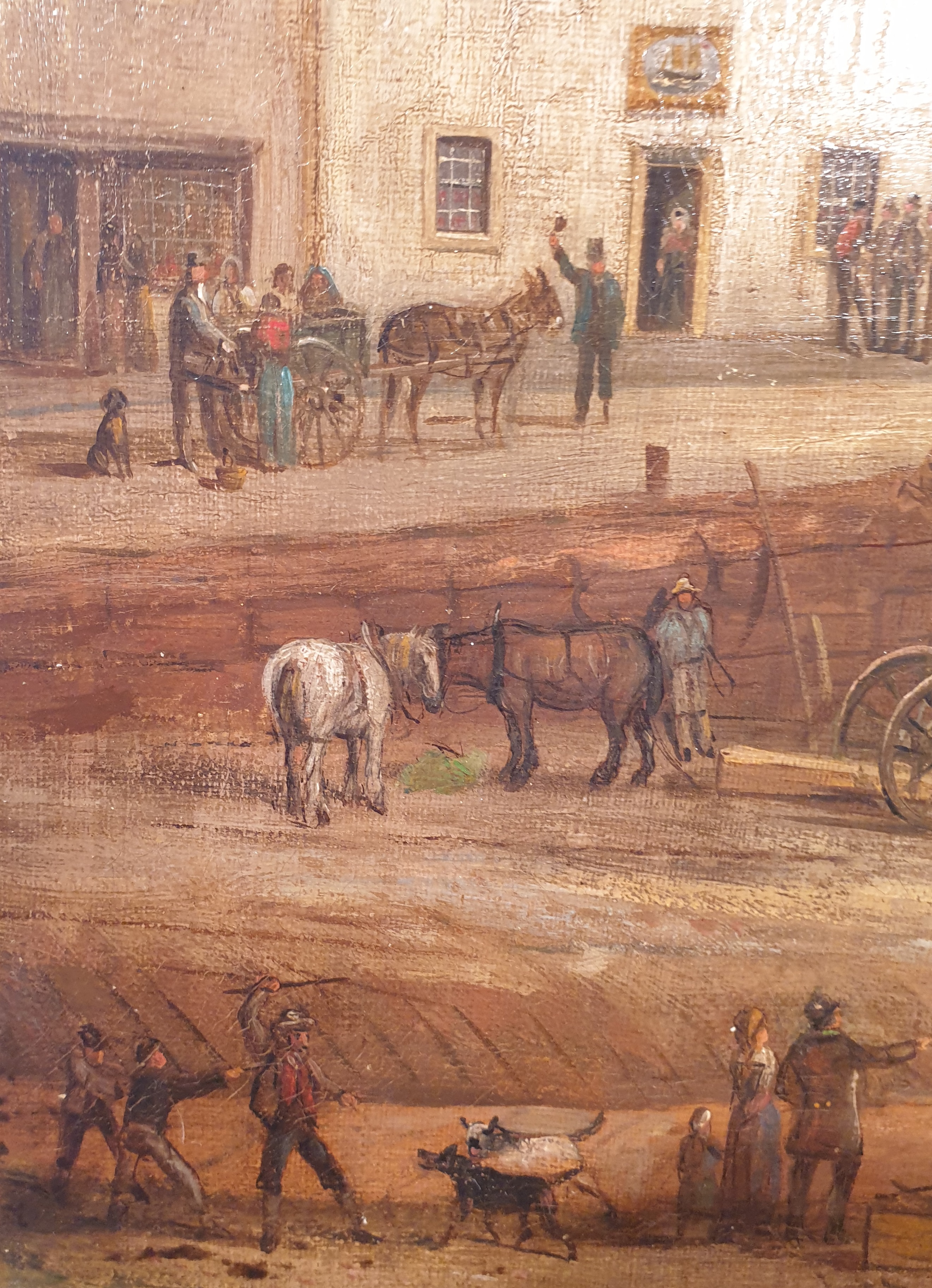
‘Mitchell of Maryport’ is especially well-known for his maritime paintings – ships being built, ships at sea, sailing ships being pulled by a steam-tug, ships wrecked or in the process of being wrecked with their crew and passengers being saved. Portraits and caricatures, Lake District landscapes, Mitchell painted them too, many as commissions – but the maritime paintings are populated with people and animals, who catch the eye and make one laugh. There are men gesticulating, children with hoops, old men leaning against walls and chatting, young men sitting on the edge of the pier, legs dangling over the water as they fish, oblivious to the racket around them. There are gulls, mere hints of white wings and black heads, squabbling over detritus in the water or resting on floating branches.
The Launch of the Collingwood
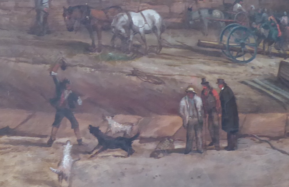
However, it is the domestic mammals that I love most. Two dogs with open, snarling mouths are leaping towards a man who has raised a stick against them; a lad pulls at the man’s arm, trying to stop him. On the road above them, a large furry dog sits impassively watching the drama below. But the same two snarling dogs are in another painting, and this time the boy is missing, the man fights off the animals on his own.
In one of several versions of The Launch of the Collingwood [2] (which Mitchell himself copied from W. Brown – who may have been his mentor), two growling mastiffs are restrained from attacking in each other, their masters pulling them back and trapping them between their knees. Elsewhere, a small cheerful dog prances besides its owner. There are donkeys, pulling carts or patiently waiting between the shafts. There are horses, standing with hanging heads.
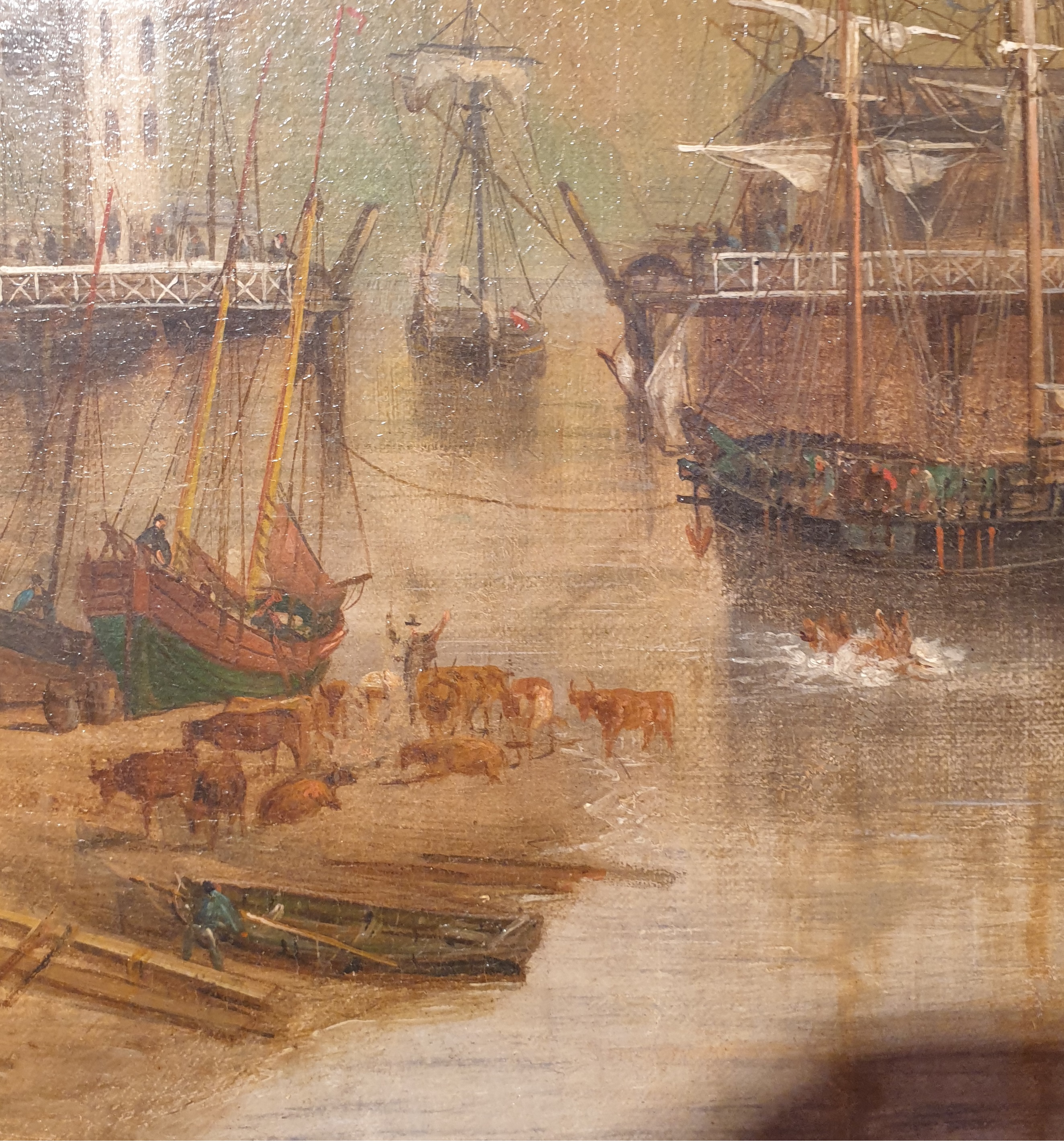
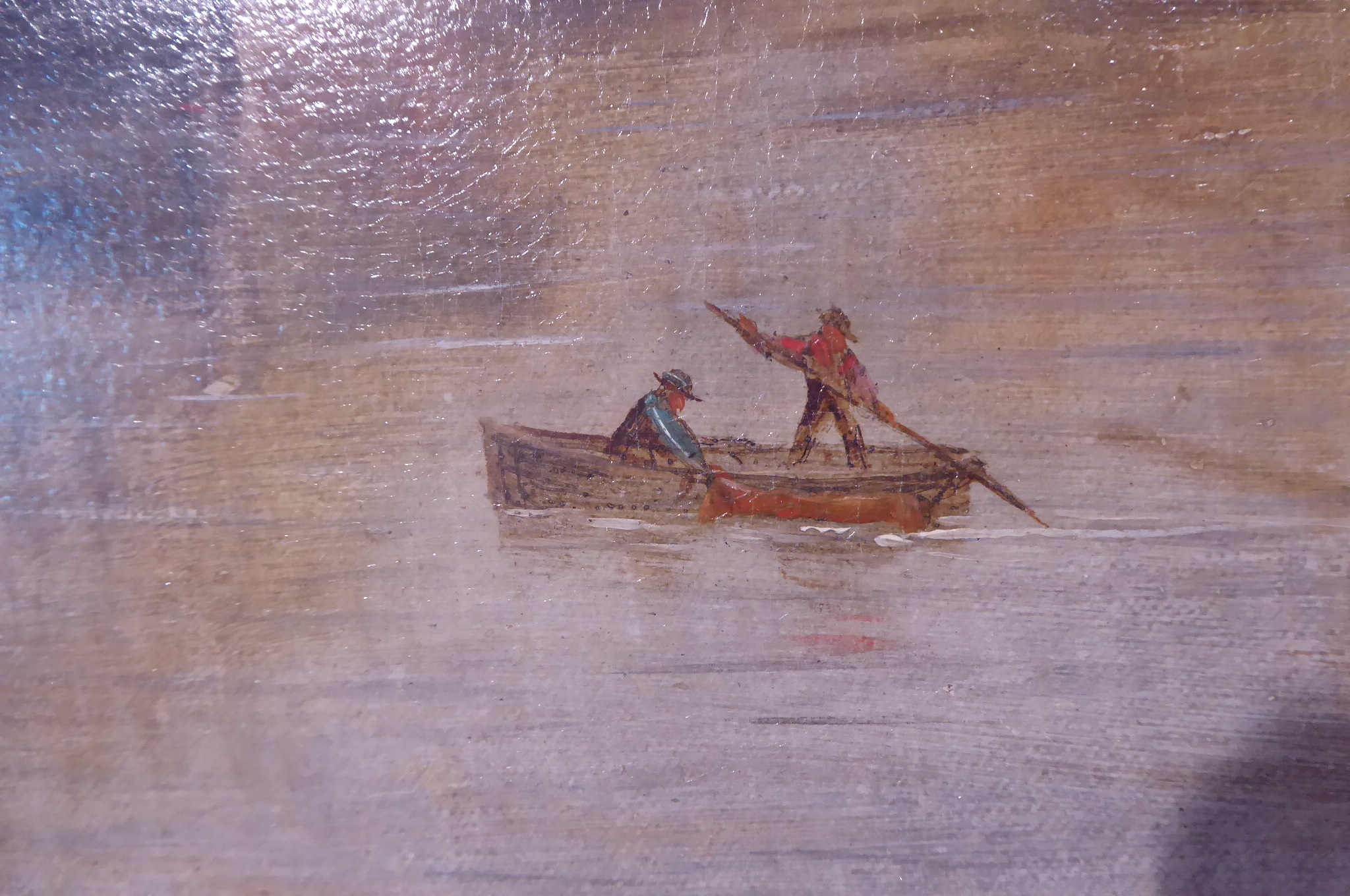
My favourites, though are the cattle. Why are there cattle standing or lying on the slipways? There was a long history of cattle being driven on foot over the shallow waths [3] across the inner Firth like that near Bowness, or across the River Eden, but here in the harbour, it becomes apparent that they have been passengers on a ship. The story is at first hard to unravel – there seems to be a dead cow floating in the water, its legs pointing stiffly at the sky. But a friend of mine pointed out that the gunwhale (the raised side of the ship that acts as a protective barrier) of the ship Gipsy has been lowered, and there are men standing there looking down. The (live) cow has been pushed off the ship – hence the great splash of water surrounding it – and will surely be guided to the slip, for nearby, there is a small skiff alongside which one of the two crew holds another cow as the boat is punted towards the shore. There are two versions of this painting, The Graving Bank, in Maryport’s Shipping Brow Gallery [4]: in one painting the cow has large horns, in the other it has no horns (its head is hard to make out – is it being towed backwards, held by its tail?) And as you would expect, there are many interested onlookers, standing or sitting on the harbour wall – you can almost hear their banter and their laughter. The owner is likely the man standing on the slip and waving his arms. The onshore cattle are unconcerned. My friend suggested that the cattle boat might have come from Ireland, and indeed it is labelled as such by maritime historian David Bridgwater in his interesting blog [5] about the ship-builders of Maryport: “The Brig Gypsy [sic] Discharging Cattle from Ireland onto the Graving Bank. With the Barque Airey ready for the broadside launching in the background in 1837.”
So many of Mitchell’s paintings encourage you to look closely, to enjoy the tiny details, and imagine the unfolding story. Not all his stories are amusing though: some are grim, like the demasted ship wallowing in the stormy sea and, potentially much worse, the wreck of the Danmark in the Atlantic. The passengers, who have been rescued by small, open boats from the SS Missouri, are crammed together, wet and cold and frightened. But at least we know everyone was saved. The description (in the former Maritime Museum) notes that ‘every soul was saved. 735 persons, 65 mere children and under 11 years, 22 mere babies under 11 months’. And above the terrified mothers, a basket containing 4 of the ‘mere babies’ is being swung down to the rescue boat.
Mitchell was born two hundred years ago, and his paintings of ship and ship-building at Maryport give us detailed and intimate views of life in the town in the 19th century. Yet the activities of the people and the animals are not so different from what they would be doing today, and we can unpick and enjoy their stories.
His obituary in the West Cumberland News notes that ‘He was very industrious, and according to the records which he kept, had painted over 10,000 pictures.’ He was also industrious in other ways: he had had three wives and (possibly) at least twenty children, and he was contemplating marrying again just before he died.
The blue plaque installed at 85 High Street [6]
Notes:
[1] Maryport Maritime Museum is currently in temporary accommodation at the bottom of Senhouse Street, but will be moving to a specially-designed site in the re-furbished Christ Church in Spring 2024.
[2] Launch of the Collingwood – a version was sold at Bonham’s in 2015; the catalogue notes that “A photograph of the original canvas before it was lined shows an inscription on the reverse that reads as follows: “Launch of the Collingwood” from the/yard. Keswick [sic] Wood Maryport/ This picture copied from the original/ by permission of Wilton Wood Esq./ Painted in 1819 by W. Brown Maryport/and Jenkinson of Liverpool/ W Mitchell Maryport 1884’ ” (Note: the launch date is actually incorrect – it should be 1829)
[4] The Shipping Brow Gallery opened in November 2023, on the site of the former Maritime Museum, and has a permanent display of several of Mitchell’s paintings (as well as a permanent exhibition of paintings by Percy Kelly, and exhibition space on the ground floor for chosen local artists and the artist-in-residence)
[5] David Bridgwater’s blog about Maryport ship-builders, and more.
[6] It should probably more accurately read ‘ … in his 200th birthday year’!
Six o’clock, and the rooks and jackdaws are wheeling in the darkening sky, shrieking and cawing in a cacophony of sound, their attention focussed on the garden below. The football-rattle clatter of vigilant magpies adds another layer of sound. Like snowflakes, pale feathers drift down for several minutes from the sky. On the lawn, a female sparrowhawk struts amongst the pearly fluff of an exploded collared dove, and darts at the three magpies who are daring to challenge her for her kill. After a few minutes, they give up and fly away; the black corvids continue shouting from above, but then they too drift away in twos and threes, and the hawk is left alone, to tear beakfuls of flesh from her prey. She pulls at the carcase for nearly three-quarters of an hour, and when she has finished only a pale plate of feathers remains to hint at its meal.
Sparrowhawks regularly flash through the garden and over the field, the speed of their flight sometimes so fast as to register sub-liminally; collared doves, of which we have many, provide a good meal. The hawks seem uninterested in sparrows, although blue-tits make an occasional snack. (And now I discover, from the RSPB/DorlingKindersley bird book, that ‘males take tits and finches, females thrushes and pigeons’; a new and fascinating fact!) The local buzzards continue to harass the rook colony when the rooklings hatch, and occasionally a kestrel hovers, wings flickering, high above the ‘new wood’ where the voles reign. I am ambivalent about the voles: yes, we are honoured that they like to live and breed in the wilder areas – but they are less welcome when they destroy the flowers of the snakes-head fritillaries, or burrow in the soil of the greenhouse and polytunnel.
This has been the Year of the Mole, too, with mounds of soft brown soil being thrown up all round the small-holding – even, bizarrely, on the island in the pond. Hedgehogs have returned, snuffling loudly in the dusk and, thankfully, no longer seen in the day: whatever disease struck them down previously must finally have disappeared. The bats, pipistrelles, are numerous and active as before.
But this has been the first year that we have had no swallows nesting at all. Indeed, there have been only a few pairs in the village, and the house-martin numbers have plummeted. The tawny owls ignored the nestboxes (which made perfect homes for jackdaws instead) and seemed to abandon the village and its surrounds altogether – but last night, in late October, we finally heard a pair calling to each other in the distance. The good news is that a heron has often been seen flying ponderously overhead, and surely visits the pond when we’re not looking.
Mallard nesting
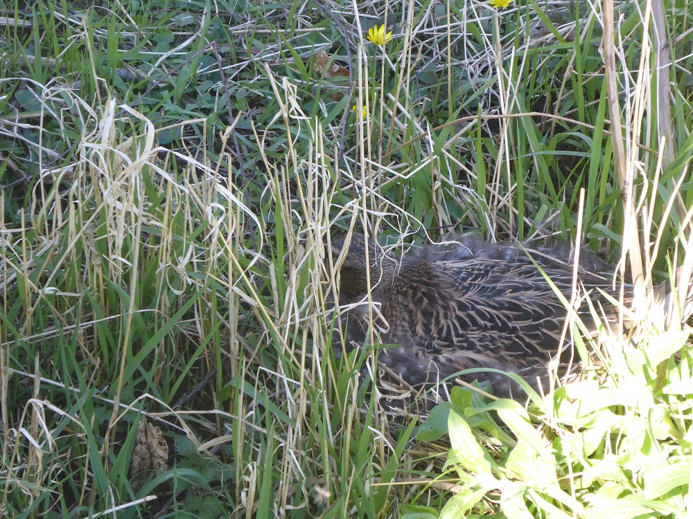
Yet again, a female mallard risked nesting among the grasses and reeds on the island in the pond, despite the proximity to the rookery. For four weeks she lay flattened over her eggs, barely visible apart from a vigilantly beady eye, until one day her enormous brood of 11 ducklings hatched and were seen rapidly scurrying after her in the shallow water of the droughty beck. Where did she lead them? Who knows!
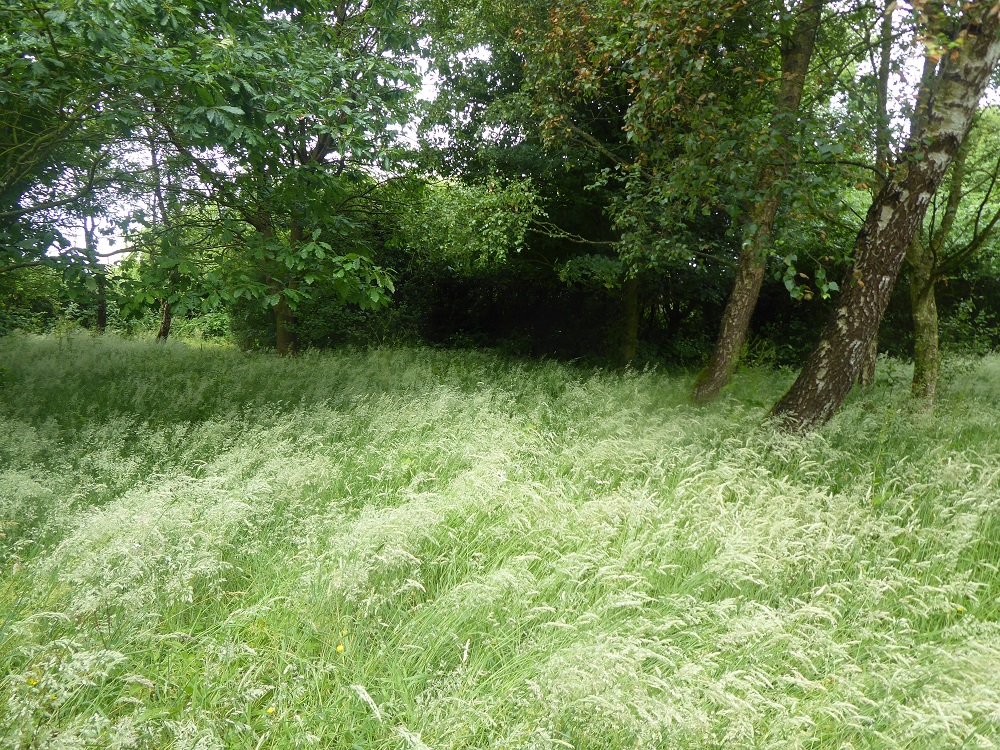
One of the ‘No-mow’ areasAfter mowing and removing the grass
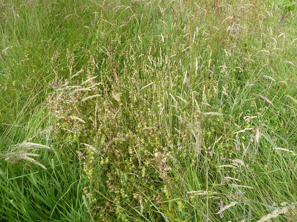
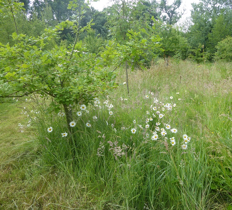
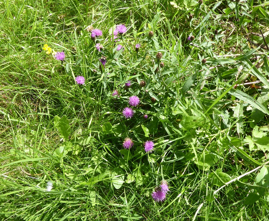
Various of the no-mow areas in the garden produced surprises this year: in two of them new orchids appeared, and small grasshoppers had flown in too. The wildflower areas near the pond and in the ‘new wood’ were rich in plantains, oxeye daisies, pink campion and clover, and the previously unimpressive patches of yellow rattle have spread and proliferated, the dry brown seed-pods rattling satisfyingly in the late summer.
Yellow rattleOxeye daisiesKnapweed
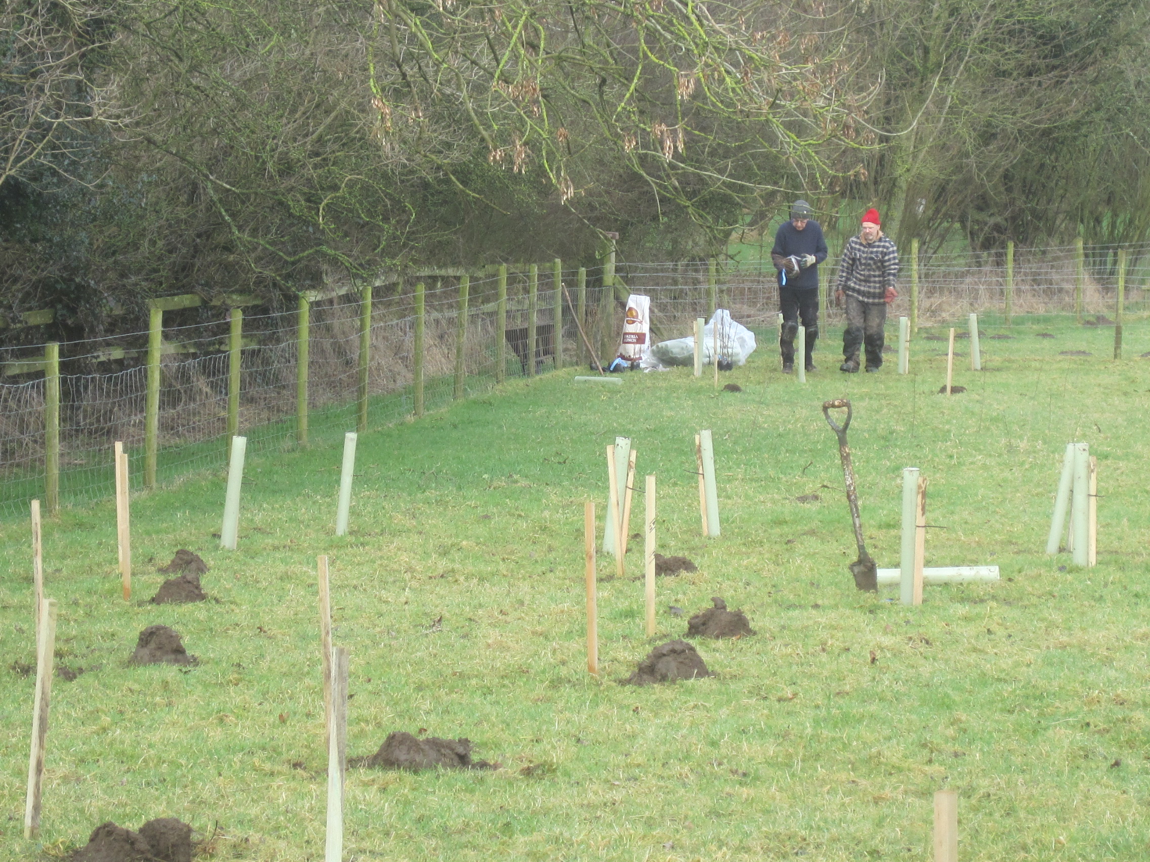
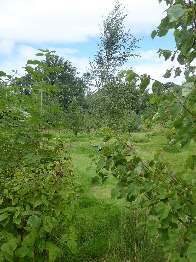
The ‘new wood’, the ‘Three-score years + 10’ wood, was planted in February 2018.
Friends helping plant the wood in February 2018
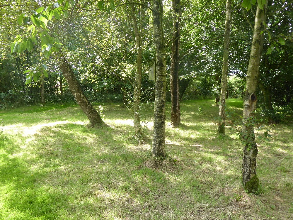
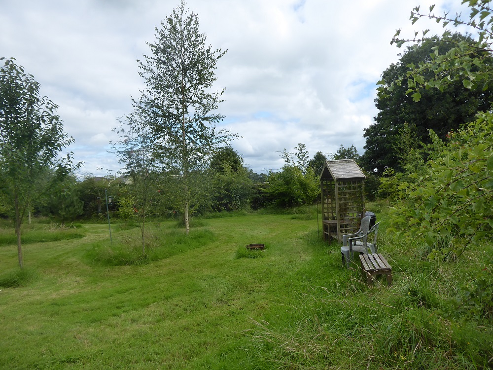
It’s now in its sixth growing season, and continually delights and astonishes us: some of the birches and alders are at least 20 feet high, and the hawthorn thickets and hedge are rich and dense and protective.
Alders and birchesOne of the hawthorn thicketsTall birch near the firepit
Chiffchaffs, blackcaps, willow warblers, four species of tit, chaffinches and greenfinches, tree and house-sparrows, blackbirds and thrushes – all regularly visit; and the butterflies – orange-tips laying eggs on the proliferating cuckoo-flowers in Spring, and the red admirals, tortoiseshells and meadow browns in late Summer – make us thankful, yet again, that we decided to turn this area of pasture into mixed woodland.
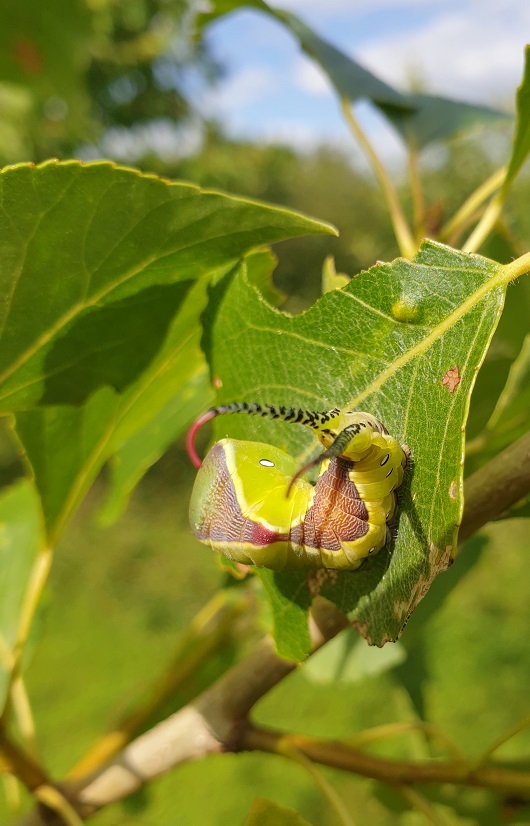
Fearsome puss moth caterpillar
No poplar hawk caterpillars on the black poplars this year, even though adults were identified in the moth-trap: the tree was given a reprieve and grew almost unchecked, its leaves munched only by one fat, overly-dramatic, puss moth caterpillar in July. Insect life thrives amongst the longer grasses.
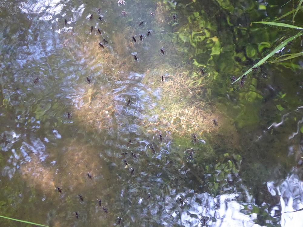
Watercress and other plants growing over the depleted pondPond partly re-filled with waterHappy pondskaters
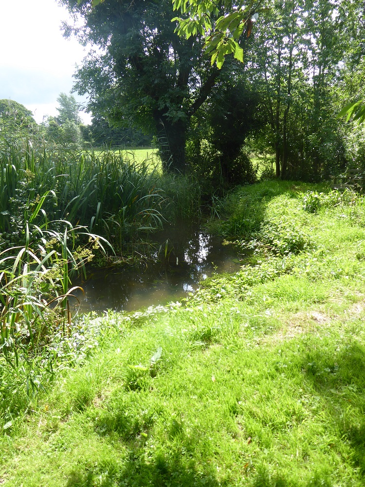
As in previous years recently, very dry conditions have struck in the Spring. In the garden, vegetables have struggled and the potato crop almost failed, producing only little bullets instead of large sweet-fleshed ‘Vivaldi’. As usual, the drought caused the springs and the beck to diminish, and the pond gradually to reduce to mudflats and a thin trickle of water for several weeks. Sadly, but as expected, this was unattractive to dragonflies. Impossible to know if the tadpoles survived to fully metamorphose, although we have subsequently seen medium-sized frogs, and even a couple of toads, amongst the vegetation. But an exciting ‘first’ was the arrival of two giant water-beetles, Dytiscus, who are presumably feasting on the gammarids and flatworms. Eventually, the rains returned, and the pond looks like a pond once more.
Dytiscus (bottom centre) from Furneaux’s ‘Life in Ponds and Streams’ 1911
And the rain benefitted the fruit, both soft and hard – it has been an exceptionally good year for apples, and for raspberries and red and black currants (not so good for the strawberries though, which became balls of soggy, grey mildew and, past their best as plants in any case, have been dug up).
Raspberry ‘thicket’ flourishing
As I write this, the hawthorns, wild roses, and guelder rose trees are laden with red jewels of berries and the local children have collected large bags of conkers. The ‘wild’ raspberry thicket continues to produce fruit. Flocks of fieldfares are chack-ing in the hedges, joined by the first of the redwings. The pinkfooted and barnacle geese are flying over in large skeins, wink-wink-ing and yelping to each other, coming here to escape the Arctic winter. Herring gulls cruise inquisitively overhead and, improbably large, swirl and settle on nearby fields where slurry is being sprayed.
During the biggest Spring tides of the year, often in September, the height of the water in the Solway Firth might change by almost 10 metres – that’s nearly 33 feet – during the course of one tidal cycle. And there are of course two tidal cycles each day, so twice a day an enormous volume of water, a mixture of salt and fresh (from the many rivers that empty into the Firth from both the Scottish and English sides), rushes in and out, and up and down the shores.
But every tide is different: some of the Spring tides may range from a high of about 8 metres down to a low of about 1 metre; and twice a month, in between the excesses of the Springs, are the mild and unassuming Neaps (for further explanation about tides see the first section of the post on tidal power [1])
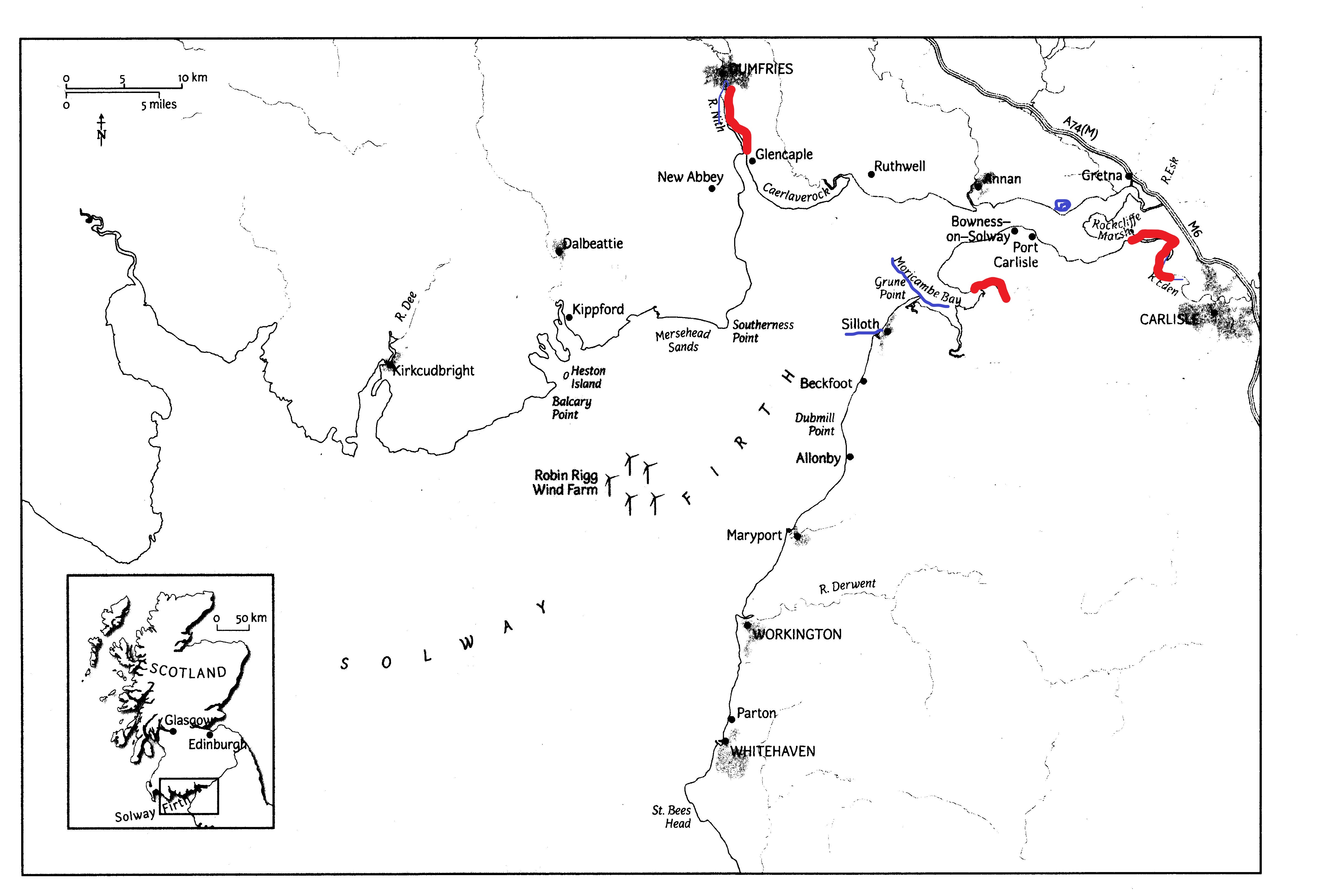
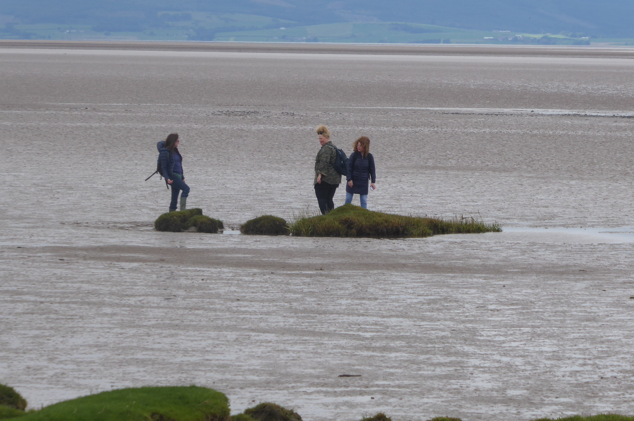
Even more confusing, if you are planning activities on the Cumbrian Solway shore, is the difference in tidal range as you move NE towards the Upper Solway; here the estuary becomes shallower, its bed ever-changing due to the wandering channels of the Rivers Esk and Eden [2]. Here, too, the timings of high and low water are very different from those at, for example, Silloth further to the South-West: the great shallow bowl of Moricambe Bay and the bay between Bowness and Glasson Point take time to fill and empty (see ‘Bores on the Solway’ for more on this [3])
***
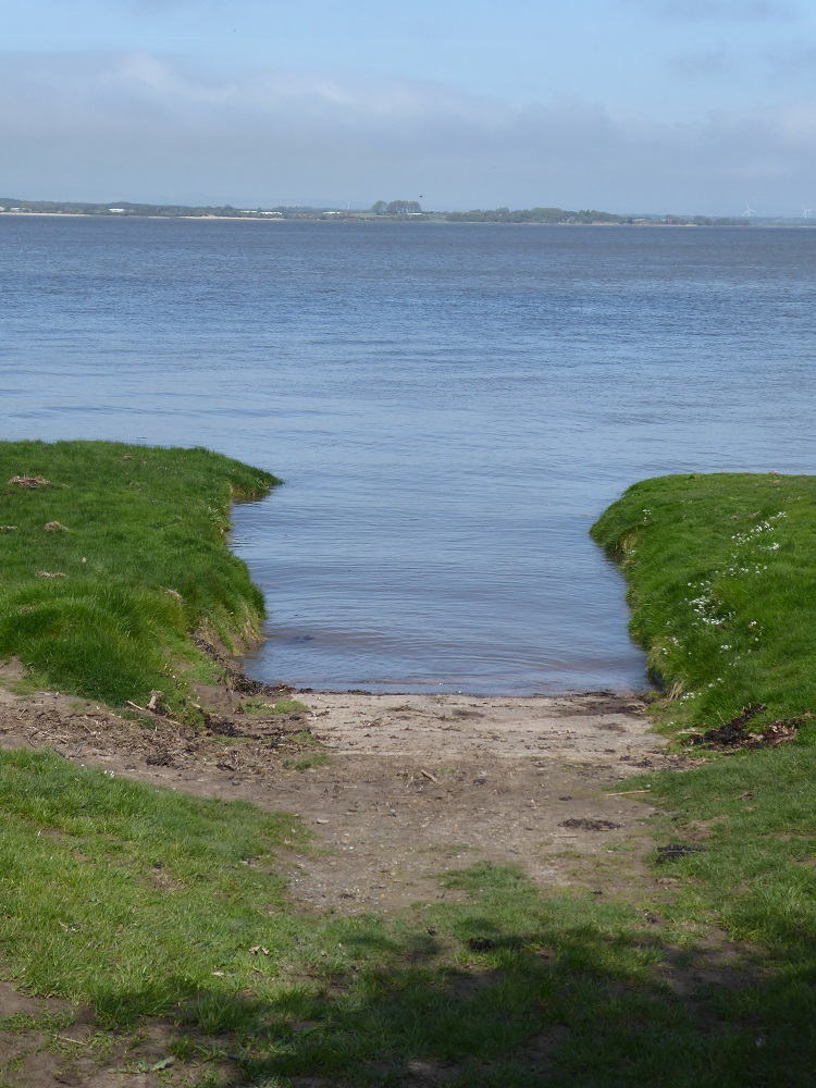
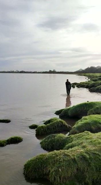
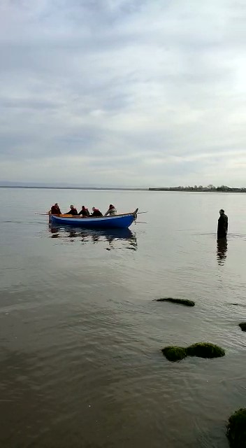
Two of my favourite Solway activities are leading low-tide shorewalks at Allonby Bay [4] and rowing in the Bowness Belle, a St Ayles skiff, on the Upper Solway at Port Carlisle. The first, obviously, requires very low Spring tides so that we have plenty of time to explore the honeycomb worm (Sabellaria) reefs [5] at the bottom of the shore. The second requires a good high tide so that we can launch the boat from the slipway or from the edge of the saltmarsh, without having to manhandle the boat trailer down a long stretch of squelchy foreshore.
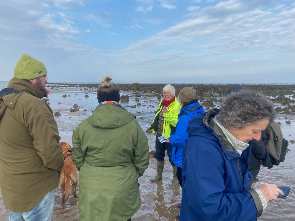
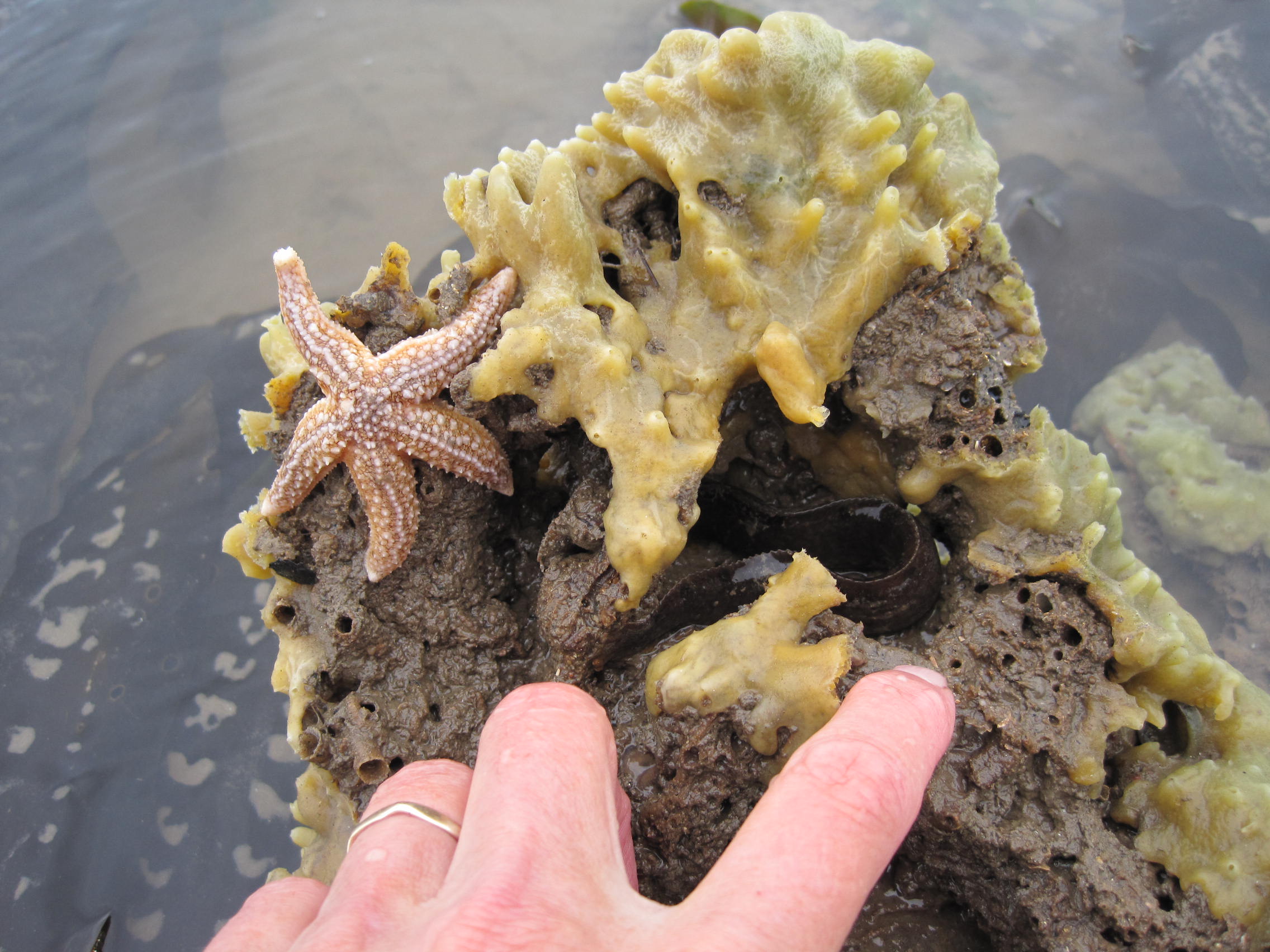
For the shorewalk on April 23rd we took advantage of the Spring low tide to walk the surprisingly long distance down the shore to the Sabellaria reef, and spent time finding Breadcrumb Sponges, Burrowing Anemones, predatory Dogwhelks, tube-building Mason worms and the like.
Some of the shorewalkers (left; photo credit Shona Broome); Hanging Stone & Sabellaria reef (top right); starfish and breadcrumb sponge on Sabellaria reef (bottom right)
In actual fact, the tide was not quite as low as predicted, as the barometric pressure was low [6].
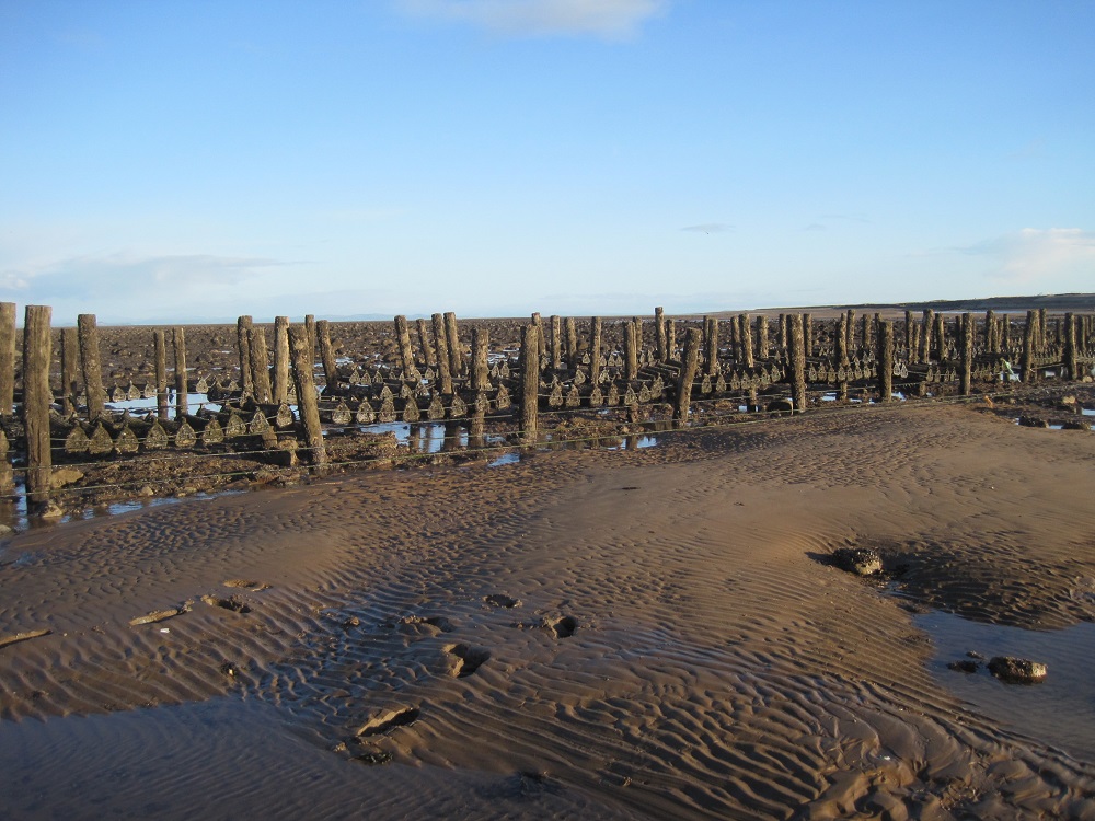
Oyster lays at low Spring tide, Dubmill
Neverthless, we found plenty to look at and chat about, and on the way back up the shore looked at boulders coated with young mussels, and commented on the lines of wooden posts, near the upper intertidal area, that once supported cages of growing oysters.
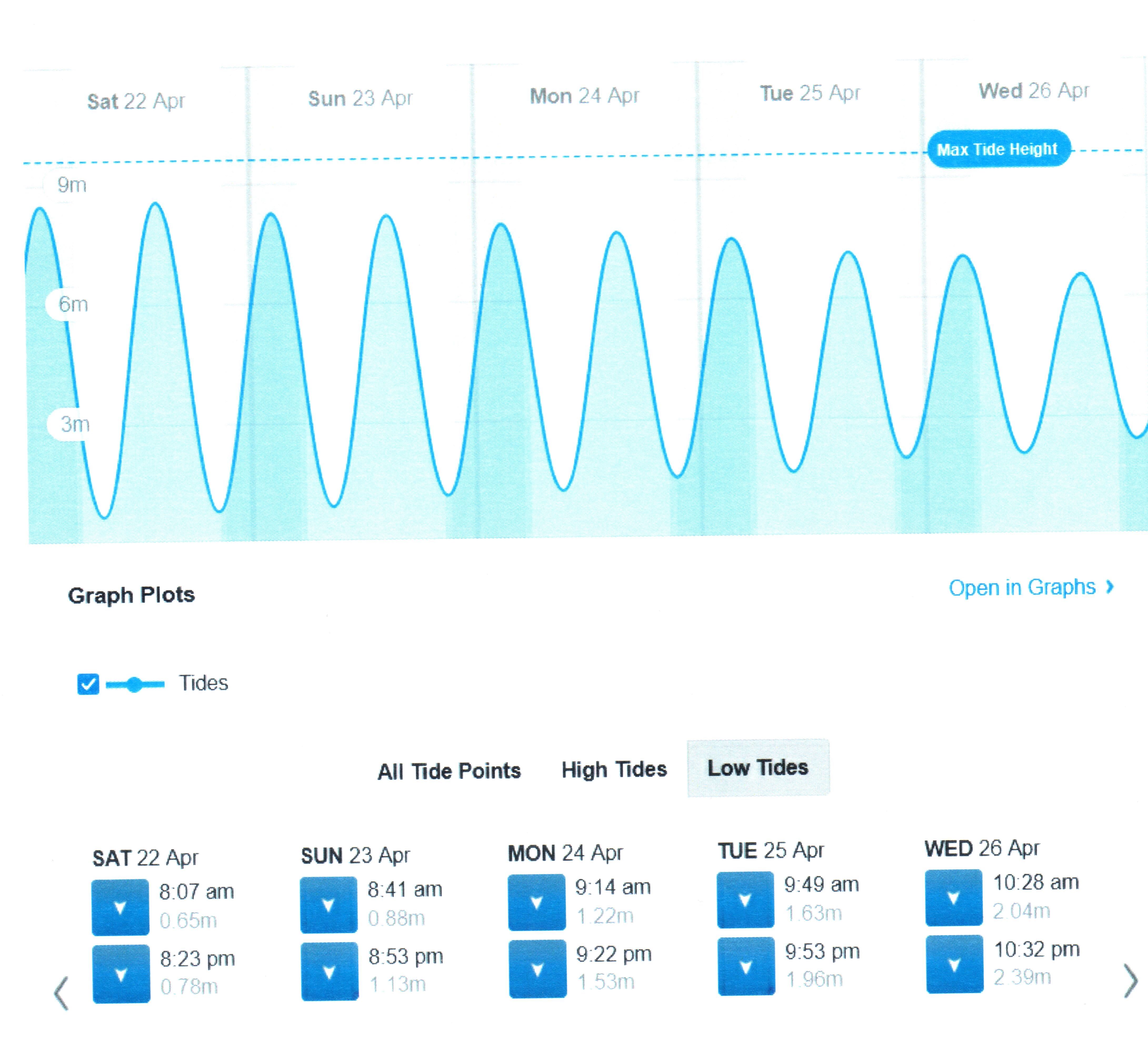
Allonby low tides: Spring tides (left – click to see height in metres) diminishing to Neap tides (right)
One week later, April 30th, the tidal charts showed the Neap low tide would be rather feeble (see chart above), so I went back to make a comparison. There would have been no low-tide shorewalk that day! Low tide was now at about 2.2 metres above Chart Datum; the previous week it had been at about 0.9m – what a difference 4 feet makes!
Oyster lays at low Neap tide, Dubmill
Where we had guddled previously in the lagoons, the reefs and the large erratic boulder, Hanging Stone, that marks their edge were now completely invisible beneath the water. The posts of the oyster lays stood with their bases in the sea, so I was confined to the pebbly middle reaches of the intertidal shore. Nobody could have guessed what an amazingly diverse array of animals and their architecture lay beneath the quiet surface; nobody would even think to imagine what a busy-ness of feeding, mating, defaecating, and other behaviours, was happening out of sight.
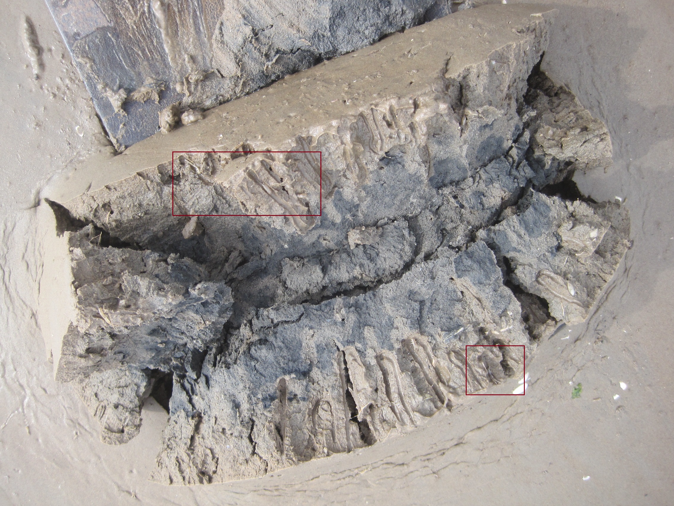
(We spend some time on the lowtide shorewalks looking for clues about the animals’ behaviour when they were covered by the tide – identifying the trails, like mountain-bike tyre-marks, of ragworm species large and small; finding the green ‘blobs’ of their eggs and the yellow vase-shaped eggcases of dogwhelks; noting the sideways scurry-marks of crabs; and the thin strings of sandy Sabellaria poo that showed they were at the mouths of their protective tubes, and feeding…)
***
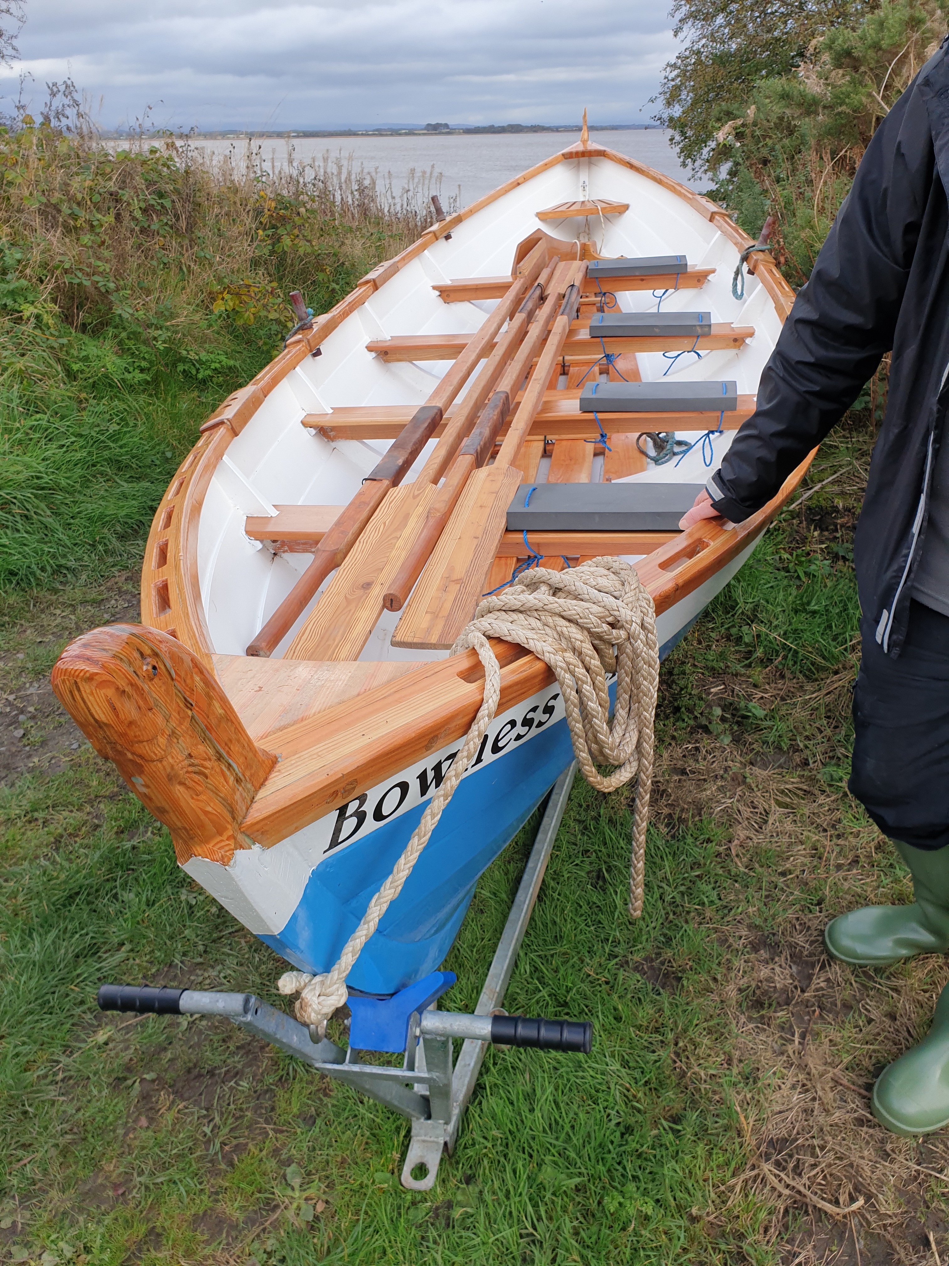
The Bowness Belle, a St Ayles skiff
In contrast, the row on the 30th had to be cancelled because launching the skiff at hightide at Port Carlisle would have been impossible, for the height of the full tide was at only about 1.5 metres, way down the shore and leaving the slipway and the edges of the saltmarsh high (if not quite dry).
A low high: neap tide at Port CarlisleLeft high and dry by the low high tide
A week previously on April 23rd the Firth had risen to more than 5 metres and by high water, the Firth was slopping over the marsh – making disembarking, and subsequent cleaning of the boat, much easier!
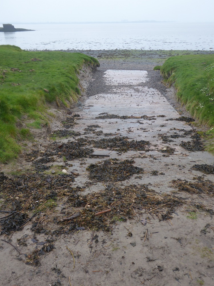
A high Spring high fills the slipway
Bowness high tides: Spring tides on the left (click for scale showing height in metres, and note the difference compared with Allonby) diminishing to Neap tides on the right
Boatman Mark waits for the Belle‘s return (photo credit Jo Williams)The Belle returns at high tide (photo credit Jo Williams)
2. The SCAPE/Solway Firth Partnership archaeological surveys of the Scottish Solway shore: download PDF and scroll down for diagram of the channels of the R Esk over the decades https://scapetrust.org/project_category/project-reports/
6. Atmospheric pressure: each millibar (now called a hectopascal) of pressure changes the height of the sea-level by 1 centimetre. The standard is set at 1013hPa – lower barometric pressure allows the water to rise higher; higher barometric pressure depresses the rise. If pressure varies between 950 and 1050 hPa the expected variation in sea level due to air pressure is between +63 cm and -37 cm around mean sea level. Wind and weather also affect the tides – strong onshore winds can drive waves further up the shore
“You can tell barnie poo from pinks’ poo because the pinks’ is greenish,” Frank bends down and points to the soft cylinders of pinkfoot goose poo that are scattered on the cropped turf. “Barnies’ are brownish. But they all have white at one end” (a white ‘paste’ of uric acid crystals, formed from excess nitrogen excreted from the caecum).
Barnacle geese grazing (at Caerlaverock)Goose poo
I’ve joined Frank Mawby for his WeBS count – the national Wetland Bird Survey – which he carries out every month, irrespective of the weather, on his ‘patch’ of Border, Calvo and Skinburness saltmarshes at the edge of Moricambe Bay.
When I arrived, three wildfowlers, dressed in camo jackets and caps and waterproof trousers were coming off the marsh, accompanied by their muddy dogs. It was the final day of the wildfowl shooting season [2]: one man had a couple of geese in his bag, but the others carried only their shotguns; they stood around, chatting cheerfully, before climbing into pickups and four-wheel drives. One of them stayed to chat to me while I waited – he knew all about the WeBS counts, he knew Frank (everyone knows Frank!); he was glad, but possibly also rather sad, that for the next six months he wouldn’t be getting up early to be out on the marsh at dawn …
South Solway Wildfowlers permitted here
We watched a kestrel swoop down into the marsh grasses then swerve up again to hover, a flicker of russet, by the gate. It was mid-February and still cold, but larks were singing, and there were trilling calls of redshank; a small murmurration of starlings took off from the field behind us, the flock shape-shifting before they dropped and settled once more.
Frank arrived, unloaded his telescope and tripod from the car, and we set off over the marsh. Frank is several years older than I am, and spry. For many years he was Site Manager of the North Cumbria NNRs for English Nature (now Natural England), and his knowledge and understanding of peatlands, birds and marshes is both practical and encyclopedic. He has been a driving force at Watchtree Nature Reserve since its inception after the foot-and-mouth epidemic of 2001, is President of the Carlisle Natural History Society, and over the years he has helped me with projects, blog-posts and my book [1]. I am rather in awe of Frank! Now, I’m trying not to seem wimp-ish as I look for easier spots to jump across the ditches; Frank meanwhile is carrying a bag, and the tripod on his shoulder (but he does have the assistance of two walking-poles).
Geese are grazers, partial to young sweet grass (and also, to the disgust of local farmers, young winter wheat and barley). Frank shows me the short, brighter spikes of Pulcinellia (Common Saltmarsh Grass) that are starting to push through the thin brown deposit of mud on the surface of the marsh. “It’s just shooting now, it’s a pioneer species. But fescue grass outcompetes it, and needs to be grazed down – I keep telling NE [Natural England] the marsh could hold 500 cattle instead of the 250 permitted.” In places the fescue has formed a dense thatch, which the cattle will ignore, and which smothers any Pulcinellia that would provide food for the geese.
Creeks on Calvo MarshCalvo at dawn in 2011The incoming tide
Our first stop to set up the ‘scope is Border Marsh. We’ve squished through mud, jumped creeks, avoided tussocks and reached the short green sward. There is a slight breeze; the tide is already rising but the mudbanks are still exposed each side of the Waver estuary.
Frank provides a constant commentary; he points out a little flock of dunlin lifting off and swirling about. “Can’t quite count the little beggars yet!” They settle again on the mud and potter about, and I do a quick count – but I’m way off the expert’s estimate of 300. “There’s 40-50 grey plover among them too. Dumpy little birds – distinctive in flight by that black area under the wing.” I count again, “in fives, then again in twos – they’re nicely spread out”. Both species are scurrying on the mud. This time my estimate is closer to Frank’s. He writes the numbers in his notebook.
Frank on the marsh by Moricambe Bay
The wildfowler had mentioned ‘pricked’ geese, not a term I had heard during my previous visits to the marsh [2]. I spot a couple of geese on their own, not feeding or resting but wandering around. Frank says they have probably been pricked –shot at, and hit by a few pieces of steel shot; damaged but not killed. It’s good to know that the use of lead shot has been banned on the estuaries, and over the wetlands for several years (but I was surprised because I thought lead shot had been banned everywhere – apparently not, and it is still causing deaths by poisoning of wild birds and other animals). A lone pink-footed goose flies over us, circling, calling as it flies: “Possibly its mate was killed or pricked, and it’s come back to look for it.” From tomorrow they will be safe, and before long they will fly back to the Arctic to breed.
The creeks are still dry-bottomed, with cracks in the mud; some are decorated with goose footprints. But the tide is now coming in, brown and scummy-edged, flowing fast, and we need to keep an eye on those creeks.
There are shelduck on the far side of the estuary and I look through the ‘scope for a clearer picture. They are handsome ducks, striking in their black and white and brown livery. Thirty barnacle geese come flying over from further inland, calling, ‘yapping’ – unlike the ‘wink, wink, wink’ of the pink-footed geese.
Now there are 300-400 dunlin on a far spit that projects from the Newton Arlosh marsh, a spit which has extended and grassed over in the past 10 years, Frank tells me. He laughs: “The things I thought might be birds over there are just clumps of samphire”.
To the North-West, across the Solway, the top of Criffel is hidden, decapitated by grey, flat-bottomed cloud. A band of lemon-yellow light is sandwiched between grey above the Scottish coast. Oyster catchers are probing, and redshanks are foraging along the edge of the incoming tide. They are all duly counted and noted. A patch of sunlight is moving towards us like a spotlight, lighting the scummy foam; the pale grass shines, and the white-painted houses at Anthorn emerge from the greyness. A lark burst into song above us. A rock pipit – a first for me – flits along the side of a creek. Where it is difficult to see the details of distant birds, Frank says he often relies on “their jizz” – their behaviour, as well as their outline and shape – to make a good guess at the species; he has had plenty of experience, as he’s been doing these WeBS counts on the Solway for 36 years.
The flow of the tide has stemmed, the estuary is in stasis; water slops softly in the creeks, waiting for the Bay to start to empty. We move on, heading West towards Grune Point and the next observation point at the boundary of Calvo and Skinburness marshes. There’s a fast-moving orange shape in the Bay beyond Grune: it’s one of the RNLI ribs, its bow raised as it speeds and turns, crew standing upright in their yellow suits. Sunday is their day for practising rescues.
Grune Point, with the edge of Skinburness Marsh to the left
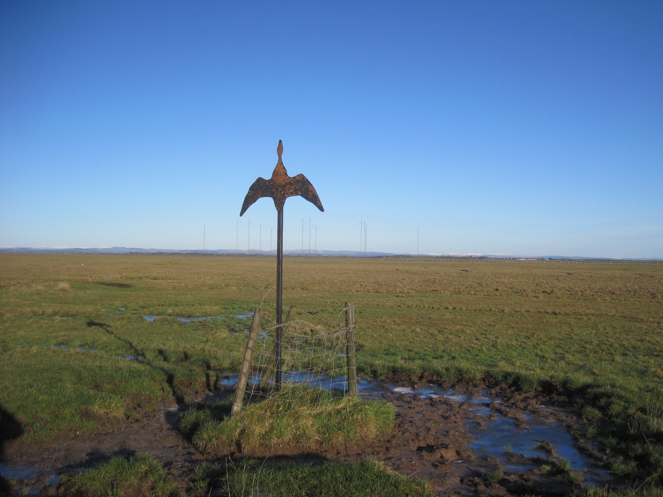
There are more creeks to jump, a barbed-wire fence to squeeze through, more rushes, more tussocks, and then we reach an extensive area where the gorse has been flailed and cut according to a conservation management-plan – to Frank’s annoyance as it was an important area for stonechats and linnets. We set up the ‘scope again on slightly raised ground, sheltered from the keen wind by the remaining gorse. “There are usually 60-70 curlews in this area,” he says, and at first we seen none, but later 24 are counted. Their trilling always thrills. Unusually, no cormorants are drying their wings on the posts of the WW2 target out in the Bay. Soon, they will return to breed and there will likely be a nest on every one of the posts.
Since the tide has stopped rising, and we’re no longer in danger of being cut off by over-topping creeks, we head down to the post-and-wire fence that edges the water – dropping down two tiers of the marsh [3] to spy on any birds that may have been out of sight on the lower tier. We find ducks, including pintails, and a half-dozen pinkfeet geese are wandering around. “They might have got a bit of shot in the wrong place, I can see some feathers scattered around”. There is the ongoing worry of the highly-transmissible avian ‘flu [6]. “With the amount of shooting in the last few days, it’s difficult to know whether the dead birds are from ‘flu or if they’ve been shot.”
Cormorants on the posts of the WWII target, Moricambe Bay (October 2018)
A small flock of dunlin and grey plover are resting at the edge of the marsh, but it seems likely that they are the same as the ones we saw earlier. We don’t want to count them twice. Over on Grune Point, ‘Spike’ will be doing the WeBS counts for the peninsula. And “there’s a couple who do the count on the other side of Moricambe Bay at Anthorn. But nobody does Newton Arlosh marsh – it’s a very long walk to the edge, and you can get in trouble there on the big tides.”
All around the British coast, once a month and whatever the weather, there are more than 3000 birders, with their telescopes and binoculars, counting the numbers of the wetland birds on their patch. These data are entered on a dedicated section of the BTO website, and the record goes goes back to 1947 (and was digitised in 1969).
According to the WeBS information [4], the term waterbirds ‘includes wildfowl (ducks, geese and swans), waders, rails, divers, grebes, cormorants and herons. Gulls and terns are optionally included.’ The data show ‘populations and trends in abundance and distribution. The network of sites legally protected for their importance to wintering waterbirds depends fundamentally on the WeBS counts.’
Annual summaries and newsletters can be downloaded from the BTO website [5]. For example, the newsletter for Autumn 2022 has an article on the effect of avian flu on the geese that migrate to the Solway during the autumn and winter (even now, in March 2023, dead geese are being washed up – thankfully in small numbers compared with a year ago). A map in the Annual Report for 2019/20 shows that the Solway Estuary has the seventh highest annual number of non-breeding waterbirds in the UK.
We’ve been out on the marshes for a couple of hours, and coffee-time is long overdue. I’m surprised to see how far we have wandered, and the walk back, with repeated detours to find narrower crossing-points of creeks, seems lengthy. Frank admits that he’s not sure how much longer he will carry on doing the surveys – the tripod and kit are heavy, the terrain is rough – and he wants to find someone else to train. We see a Little Egret in the distance, startlingly white against the drab late-winter colours of the marsh, and the kestrel is still hovering and hunting near the gate. Then we’re back at the cars and peeling off layers of waterproofs and fleeces, and finding our thermoses. WeBS count done for another month.
A historical perspective of the Solway Mosses, by Francis J. Mawby, Chapter 6 in History and Heritage of the Bogs and Peatlands of Cumbria, ed. Ian Rotherham & Christine Handley (2021), Wildtrack Publishing. Note: free download of PDF of the book here.
[2] See section on Wildfowling in Chapter 9 of The Fresh and the Salthttps://thefreshandthesalt.co.uk/chapter-nine/. I’ve been out twice on the marshes with a wildfowler, talked to others, and also talked to people who ‘oversee’ it on the Scottish and English sides. Note that wildfowling is closely regulated, through the issuing of licences, in England; less so in Scotland. Whatever your own views, it is a subject that is not ‘black or white’ – there are nuances, and my own opinion was better-informed, and altered, after my conversations. The final chapter of The Fresh and the Salt goes into some detail…
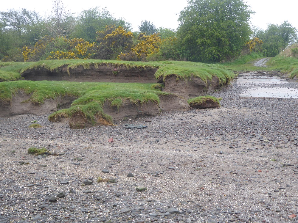
A local Cumberland councillor, who sits on the Board of the cross-border Solway Firth Partnership, often refers to the Cumbrian coast as being the ‘soft side’ of the Firth, in contrast to the rockier Scottish, side. And once you have travelled North-East from Maryport, the softness and malleability of the Cumbrian coastline is very apparent: shingle slides into sand, which slips into mudflats, backed by dunes or saltmarshes.
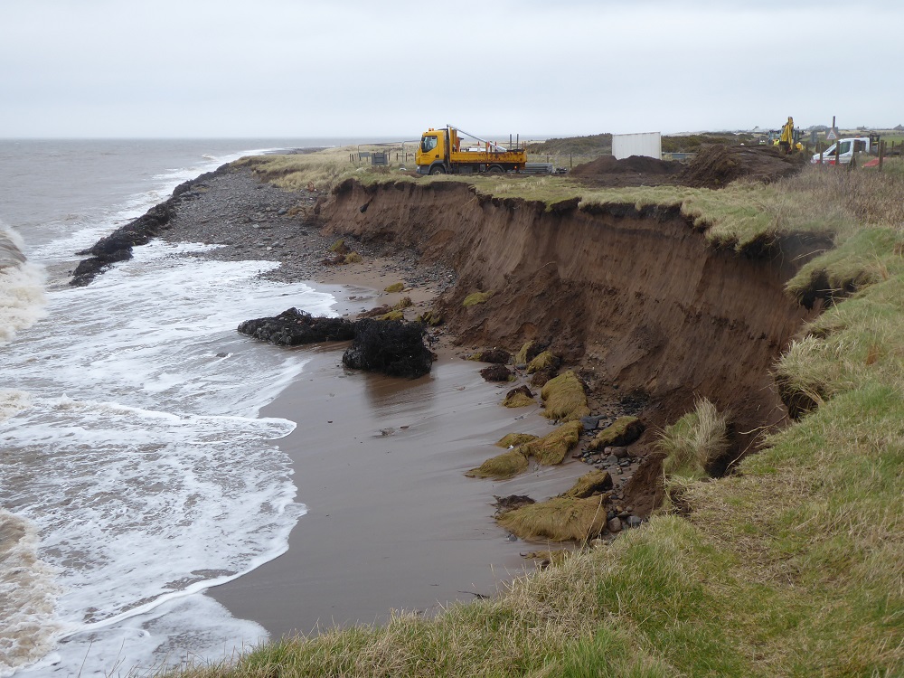
During high spring tides and stormy weather, the brown, sediment-laden waves pound against the margins, shifting the sand, gnawing at the mudflats and pummelling the edges of the saltmarshes. Year by year – and more so now that ‘extreme’ weather events are occurring – the border between land and not-land is shifting. The coast road from Maryport to Silloth is continually being threatened, and is sometimes closed to be cleared of pebbles and seaweed or – in the worst cases – have its seaward side shored up. The loss of the coast road is a major inconvenience; the potential loss of houses and shops a disaster for human lives and livelihoods. So how can they be protected from the force and height of the water?
Mangrove swamps would be effective and a very pleasant and interesting addition to the Solway coast … but meanwhile saltmarshes certainly do their bit to dissipate the force of the waves. Leaving aside these natural (and importantly, carbon-sequestering) coastal defences, the usual answer is ‘hard engineering’, the construction of unnatural defences using concrete or rocks.
Around the British archipelago’s coast, horrifyingly large volumes of cement, requiring massive costs in quarrying, crushing, transport and the use of energy have been poured and moulded into various types of defensive wall to hold back the sea. Some of these constructions are more effective than others, as illustrated in a simple set of experiments in a wave tank by researchers at the Jeremy Benn Pacific Trust (JBA Trust). In the video, which is on YouTube, the researchers set up different shapes of hard engineering at one end of the tank, and then measure the volume of water that has overtopped the defences after 5 waves. For example, for a ‘beach with a sea wall’, the overtopping volume is 50ml; for a wall with a sloped revetment, like the new concrete defences at Dubmill Point, considerably more – 125ml;
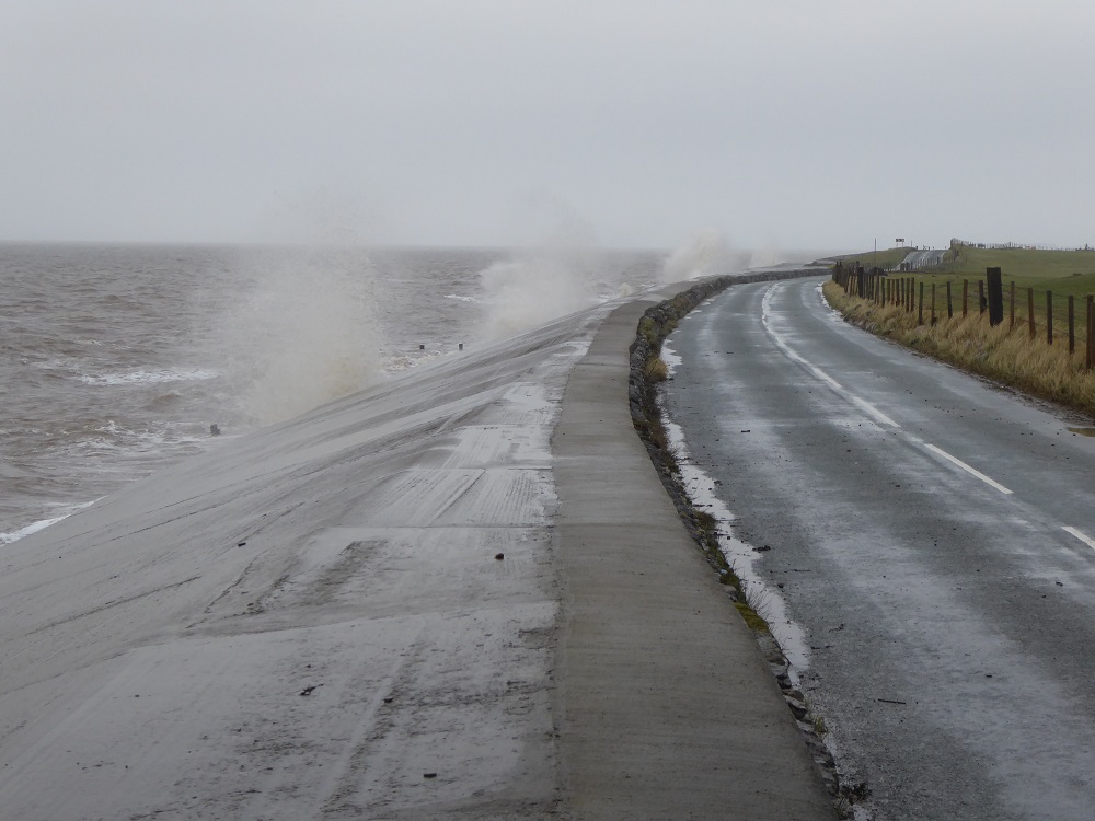
The sloped concrete revetment by Seacroft farm, Dubmill Point, during a stormy high tide
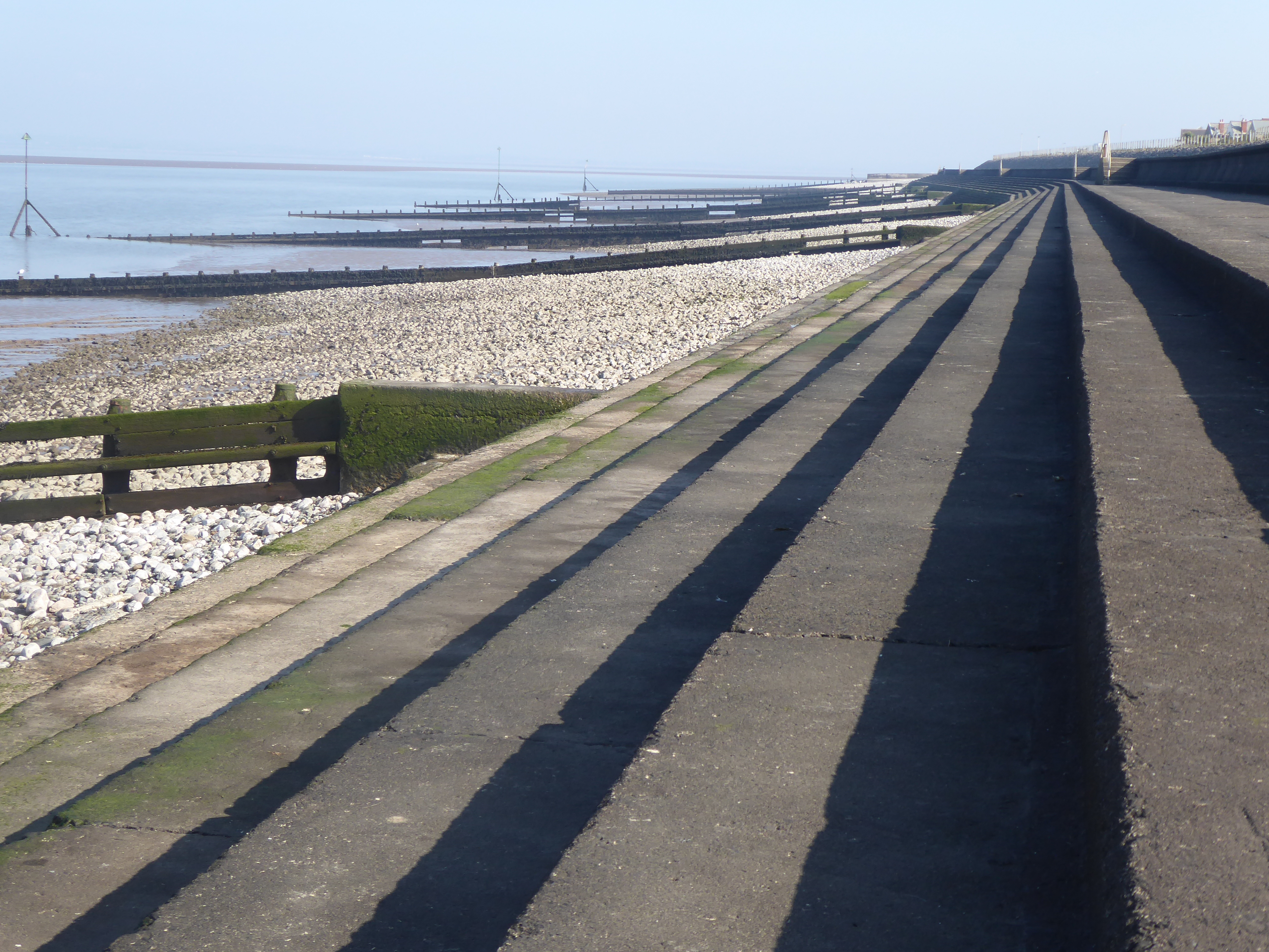
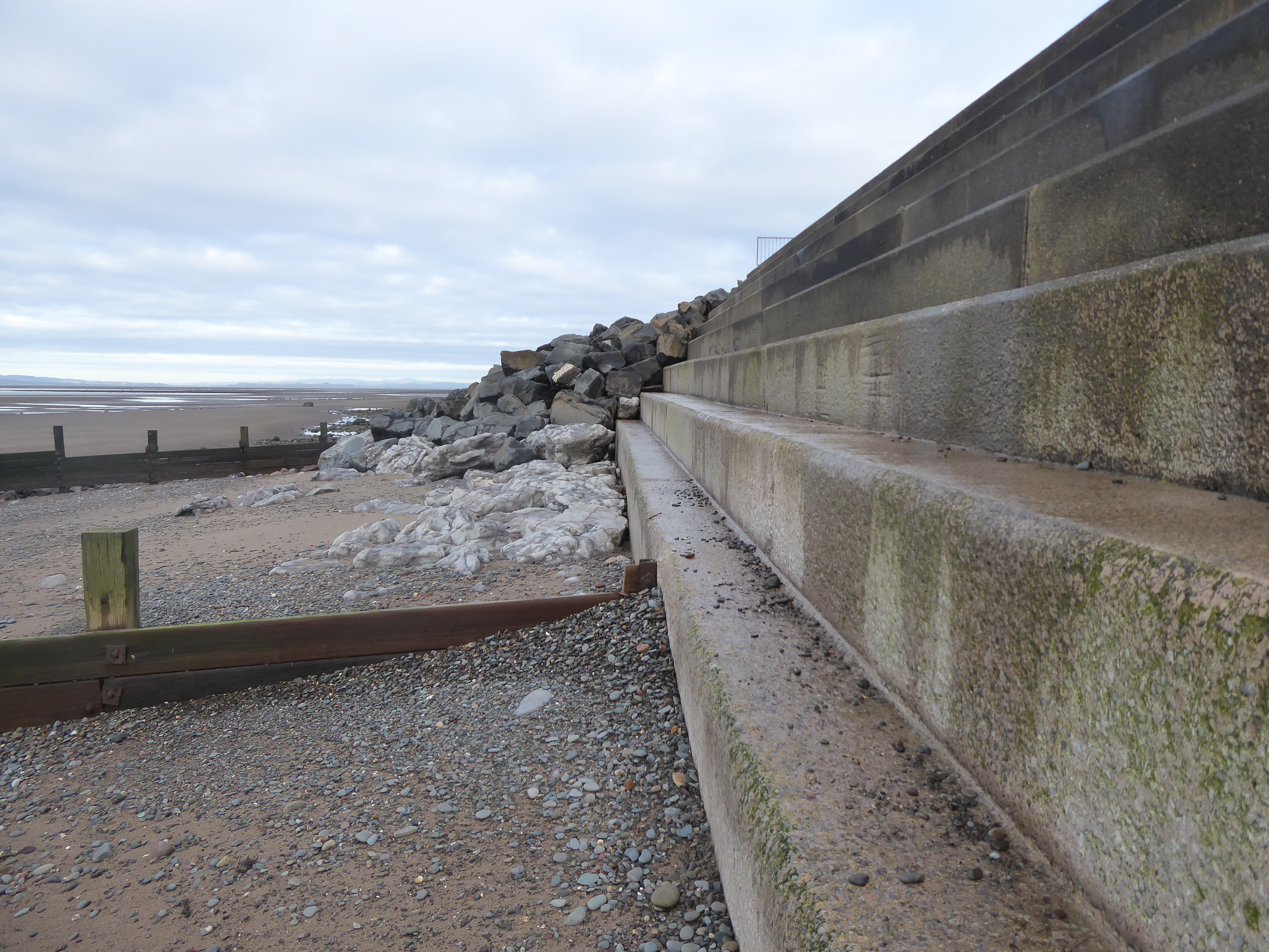
for a wall with a stepped revetment – just like the steps on the long promenade at Silloth (see below) – 100 ml.
The ‘stepped’ promenade at Silloth
But, for a wall with a recurved top – rather similar to that of the concrete promenade at Maryport – no water overtops the defences in the research tank. (I’m not entirely convinced by the reality of this, having got soaked by spray on Maryport prom, during a stormy high tide!)
The (slightly) recurved top of Maryport promenade
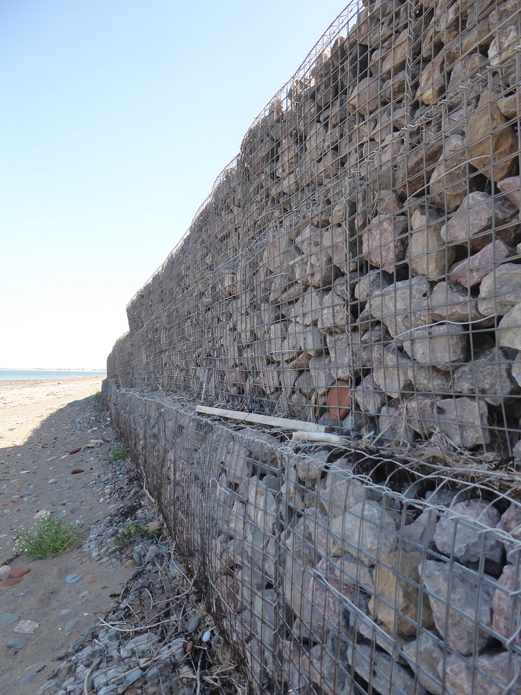
And also at the high end of protection against the tank’s waves are gabions – wire cages of boulders – and rock armour (only 5ml overtopped). This a very nice demonstration of how the rocks reduce the energy and therefore eroding power of the waves, breaking up the flow and forcing it in many different directions simultaneously.
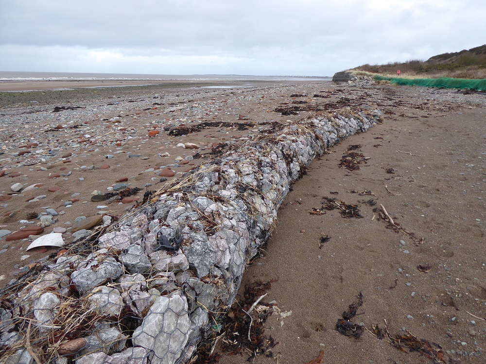
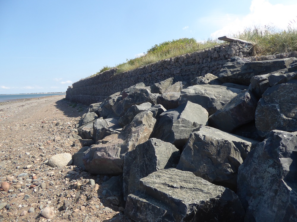
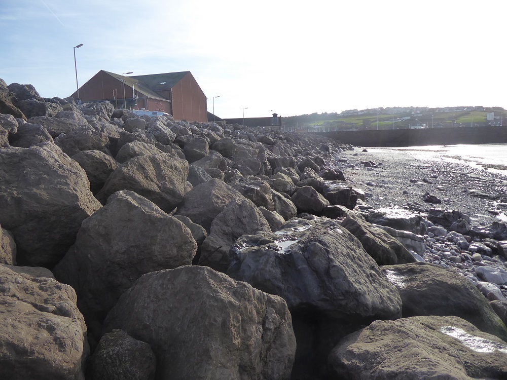
Away from the wave-tank, bunds of gabions and rock armour have been constructed along vulnerable stretches of the Cumbrian Solway coast from Whitehaven to Allonby Bay, to Skinburness and Grune Point.
Intact gabions at Crosscanonby (left); displaced and damaged gabions at Crosscanonby (top) and at Dubmill Point
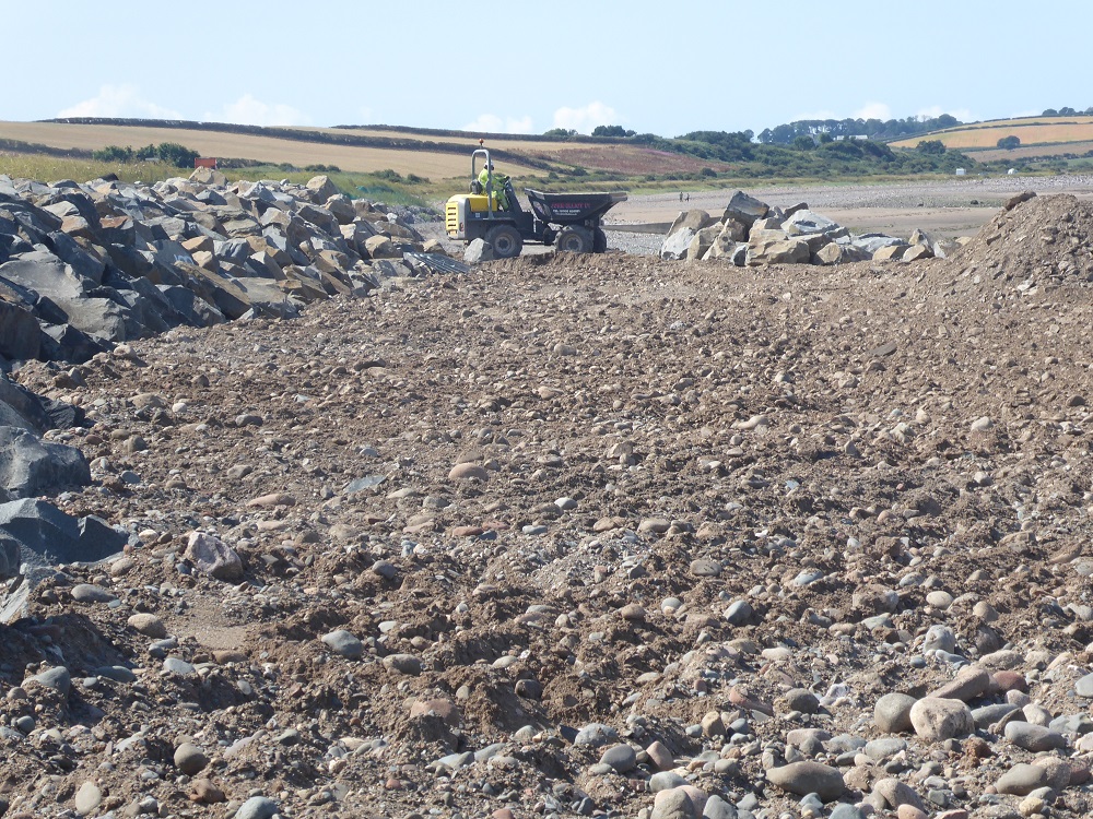
But the wire gabions, containing smaller stones, that protected the historic saltpans and the coast road at Crosscanonby, were severely damaged – ripped apart and their contents scattered – by one of the winter storms; in their place the defences have been repaired during the past year with boulders of a harder rock, an igneous dolerite probably from somewhere along the Whin Sill (my thanks to geologist Ian Francis for the identification).
Dolerite rock armour being put in place at Crosscanonby, 2022
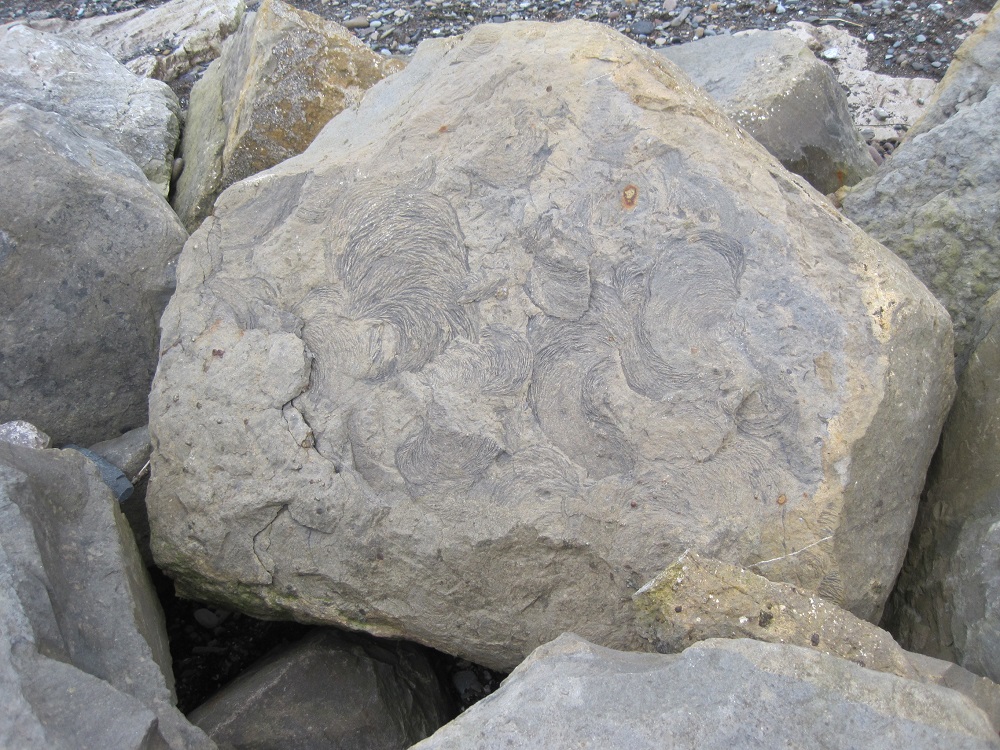
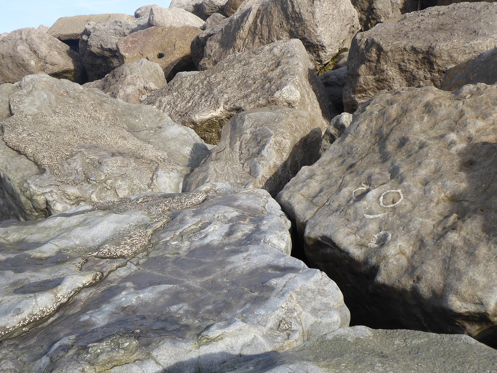
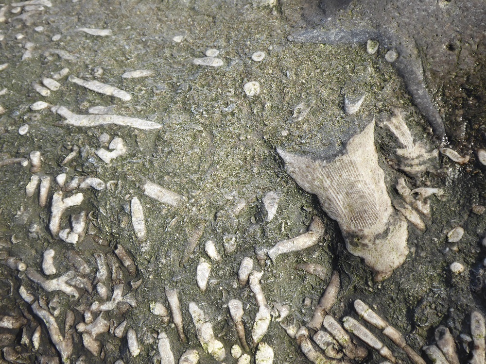
The use of dolerite is a new departure, because nearly all of the other stretches of rock armour are of limestone – and this is where rock armour becomes fun. Fossils! Corals, solitary and colonial; crinoids; brachiopods; and ‘trace fossils’ – they are all there, if you have the patience and courage to clamber amongst the boulders to search.
Trace fossils at Parton
I first became aware of fossils in limestone rock armour some years ago when I stopped at the shore-side carpark at Parton, just North of Whitehaven; these were ‘trace fossils’, traces left by an animal rather than of an animal. Imagine, say, a polychaete worm or a bivalve mollusc that lives in a burrow in the sand. It’s sedentary, staying put in one place, so, rather than roaming around on the surface to look for food (and exposing its own vulnerability as prey), it waits for food to come to it. In the case of the polychaete, the worm extends its crown of tentacles like a net in the water, or sweeps its tentacles over the surface of the sand around the burrow. The burrowing bivalve, on the other hand, has a muscular tube, the siphon (rather like an elephant’s trunk in its mobility and sensitivity) which hoovers up food particles from the sand around its burrow. These feeding movements could leave the sort of arcs of indentation that are seen in the Parton traces. What class of animal left the fossilised traces of its feeding? It’s impossible to tell although geologists, hedging their bets, often refer to the marks as ‘zoophycos’.
Limestone rock armour, North Shore, Whitehaven
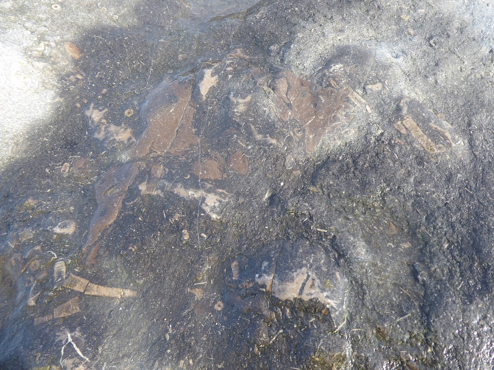
At North Shore beach, Whitehaven, the fossils in the rock armour are even more impressive. As I scrambled over the rough, pale boulders I was asked a couple of times what I was doing by local dog-walkers, who were then surprised and impressed when they saw the (previously unnoticed) fossils of solitary and colonial corals. There were thick bands of colonial corals; there were curving longitudinal sections, and the packed circles of colonies broken transversally. It was easy to imagine the colourful masses of the little filter-feeders extending their tentacles to capture food borne by the incoming tide. Here too were pale curved sections through the dished shells of brachiopods, sometimes solitary, sometimes clumped together by the currents of the warm Carboniferous sea, to lie on the sediment surface.
Whitehaven: crinoids, brachiopods, and solitary and colonial corals
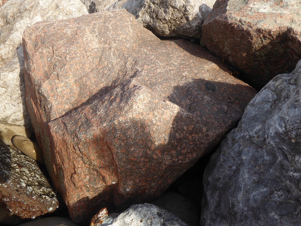
Further along the shore, there is a sudden sharp demarcation where the limestone blocks have been replaced by boulders of pink Shap granite, studded with large shining crystals; perhaps there was a BOGOF on a few truckloads of the stone.
Shap pink granite armour
But there is more limestone rock armour a little further North-East, dumped in an attempt to protect the Maryport golf course at Netherhall from being eaten by the sea: more fossil corals, brachiopods, and sections of ‘sea lilies’, crinoid echinoderms. Here, too, are piles of bricks and broken concrete, tossed aside contemptuously by the waves.
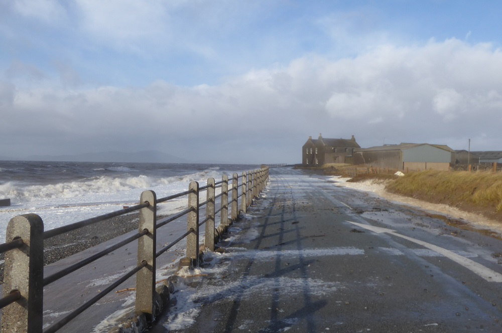
Dubmill Point; the shuttered farmhouse, and debris thrown across the road
Further up the coast again, to Dubmill Point at the north end of Allonby Bay, to huge sloping revetments of concrete, which have been repaired and extended yet again; despite this, the stormy waves throw large pebbles and sand onto the coast road, and hurl spray high over the farmhouse on the Point. You pass the ‘Road Closed’ signs at your own peril.
North of Dubmill: a mixture of groynes, concrete ‘steps’, and 2 types of rock armour
The concrete gives way to rock armour again, in which fossils are scarce. On a sunny day a few summers ago, I noticed a figure in a skin-coloured bathing suit (perhaps) sunbathing against the radiating warmth of the stones.
And so to Skinburness and the finger-like promontory of Grune Point that protects the western edge of the shallow expanse of Moricambe Bay. Here the rock armour is a tumbled line of large limestone boulders, some with a thin red crust and speckled with rusting iron-rich nodules.
Grune Point; limestone rock armour; half-buried groyne; and limestone pebbles on the beach
The shore here is dazzlingly white in the sunshine, and glimmers even on a dark and cloudy day, for it is covered in pebbles of limestone that have been churned and cleaned by the waves. The pebbles are round and smooth, and too numerous to have been broken off and eroded from the large boulders; they are likely the ‘quarried cobble’ referred to in the Cumbria Coastal Strategy for Silloth to Skinburness (see note below).
Grune: a thin iron-bearing crust; pebbles on the shore containing corals
As with all this rock armour, I try to discover where the limestone was quarried, and when it was brought to the coast; indeed, how the rocks and pebbles were placed in situ – for there are often no roads, and clearly barges were not used. It has been – so far – almost impossible to discover these simple facts [but see important note below], despite asking the County Highways Department and highways representatives on Borough Councils. But Grune Point is part of the Solway Coast AONB and, as I expected, the former Manager, Dr Brian Irving, knew the answer: the rock came from the large limestone quarries at Rowrah, and was deposited in the late 1990s… But that is all I learnt. Yet to know its geographical origins within the county would be to know more about the geological history of the stone, and to be able to guess at the reasons for the inclusions of iron ore and different species of animals.
Whatever their origins, the piles of limestone boulders at the top of Cumbria’s ‘soft’ shores look incongruous; but perhaps it helps to think of them as a man-made complement to the ring of limestone that surrounds the rocks of the Lakeland Fells.
Notes:
This blogpost is part of my former ‘limestone lockdown’ project. For an Introduction to the project, and a guide to the list of related posts, see Limestone in the Lake District: an Introduction – and the ‘categories’ list in the right-hand bar.
A very useful summary of sea-level change projections and ways of mitigating damage, and much more (including useful links), is to be found in Chapter 4 of the updated Solway Review, produced by the Solway Firth Partnership.
Chapter 1 of the Solway Review, on Coastal Change, includes links to pdfs of the Cumbria Coastal Strategies, Technical Appraisals: this might sound dull, but the documents are very interesting, looking at the type of coast, the attempts to mitigate damage, and with discussions about possible future work. The PDFs for Maryport to Dubmill, and Silloth to Grnue, are especially worth downloading.
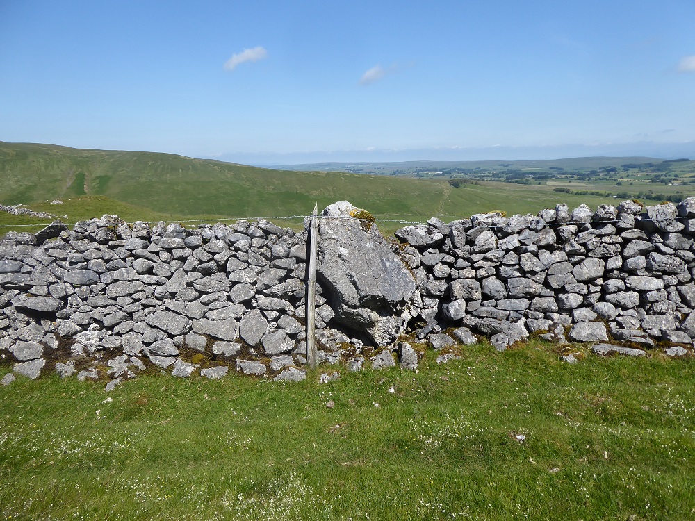
Dry stone wallers need to be pragmatists, building around or over problem areas, or incorporating boulders too big to move.
A ‘jumping wall’, Orton in the Westmorland Dales
At Bents, near Newbiggin-on-Lune on the edge of the Westmorland Dales, red sandstone and pale limestone are strikingly juxtaposed. Huge rounded knolls and whalebacks of faded red-brown sandstone, mottled with white lichen, push up out of the moorland and pasture. And running alongside them, over them, around them, leaving narrow paths beside them, occasionally incorporating a boulder’s bulk in the boundary, is the purposeful line of a limestone wall; a barrier between the grazed green farmland and the moor. The wall is tall and well-fettled, built of shallow, sharp-edged plates of limestone; it is a double wall, with large flat through-stones, and coping-stones that are tightly-packed and tilted. High and solid, it is a daunting challenge even for adventurous sheep.
BentsBentsBents: unused limestone
At the eastern end, near Bents farm, names have been carved in the sandstone boulders. Many are weathered and, part-obscured by lichen, are difficult to read; the beautifully-engraved J Smith (or is it Smillie?) Bolland dates back to 1888; other names are even older.
Nearby, layered shelves of limestone – the origin of the stones for the wall – peep out of the eroded side of a hill. Here it’s easy to see the dramatic mix of the two types of rock, the Ashfell Sandstone Formation, which is part of the Great Scar Limestone Group. According to the information on the Cumbria GeoConservation website, “ The Ashfell Sandstone Formation is interpreted as the deposits of a river-delta system that spread into the shallow carbonate seas that covered this area during the early Carboniferous. Thick sandstone layers, like the one at Bents, may represent sands deposited in large river channels or as offshore sand bars. The reddish colour is due to the presence of iron oxide and suggests deposition near an arid shoreline.”
Limestone outcrop above the sandstoneUsing the sandstone for the wall
Where the limestone wall jumps to the top of a Bents boulder, the waller has incorporated chunky sandstone blocks to give the free end extra stability and majesty: limestone and sandstone intermingling their organic and inorganic origins.
Not far away, next to Natural England’s Great Asby Reserve , we are looking for something marked on the OS map as ‘Thunderstone’. On our left, a rubbly, part-tumbled limestone wall, and the clatter and growl of an approaching, as-yet hidden, quad bike. The noise stops, there is some muttering and swearing, and a man, round-faced and with thick brown hair, dressed in a mud-smeared jacket, appears by a gap in the wall. Although surprised to see us, he grins and asks, ‘All right, then?’, and we chat about the weather, and how the yows will always break down the walls. ‘Look at this!’ He gestures at the fallen stones, which he has come to fix. ‘See, it’s just bloody rubble round here – no good for walling.’ It’s true, on this stretch the limestone is fragmented and irregular, and the wall is only a single layer thick and barely four feet high: a determined tup could send it flying. We ask about the thunderstone and are told, ‘it’s just along there, you’ll see it on the corner’. And so it is, a smoothed, rounded boulder with the wall built around and on top of it. It’s a little underwhelming in terms of size, but its provenance is greater – an ‘erratic’, a boulder that was once caught up in the ice of a moving glacier; a boulder that was seized from another area, a different type of rock – Shap granite – carried away and dropped where it didn’t belong; and now incorporated in a dry stone limestone wall. [2]
‘Thunderstone’ in a wall near Great Asby Scar
Although it might seem odd that the farmer’s wall was ‘bloody rubble’ compared with the grandeur of the nearby and more recent wall around the Great Asby Scar Reserve, this reflects the properties of the local rock – wallers use the rock that is ‘to hand’. The pavements on the Scar are themselves very varied in structure and appearance, depending on how the limey skeletons were deposited and subsequently eroded. This new wall around the Reserve’s perimeter is nearly two metres high, built of blocky stones, with two layers of projecting throughs, and sturdy, slanting coping stones. It is a text-book example of ‘how to build a dry stone wall’.
‘Dry Stone Walling, a practical handbook’ [1] makes surprisingly gripping reading! I read it at breakfast and over lunch, enjoying the technical terms and their local variations, showing diagrams to my husband (who has done a fair bit of walling himself).
‘Dry stone walls are semi-flexible structures,’ Brooks and Adcock explain, ‘with the stones settling over time. The basic principles involved in building a dry stone wall are aimed at reducing the potential for movement during this settlement.’
The wall that encloses the Great Asby Reserve Great Asby Reserve wall: a ‘textbook’ example of walling
So there are the footings, which support two faces of stone courses; these are held together with throughs that straddle the wall, connecting one face with the other, ‘tying the two faces together in a single unit’ and stopping them bulging outwards. The interior of the wall is filled with rocks – without the filling (also known as packing or hearting), the face stones would settle inwards and the wall would collapse into the centre. Finally, a row of coping or topping stones caps the wall, weighing down and bonding the faces below, and protecting them and the filling ‘from the weather, animals and people’. The angle of each vertical face to the horizontal is the ‘batter’, for which a frame or template is sometimes built. There are many variations in style or height or shape, depending on the local stone and what is required of the wall – sheep (especially Herdwicks) are more agile than cattle and need a higher barrier.
Waller Arthur Robinson talks with humour about long stones and flat-sided stones, and the ‘golden rule’ of wall-building, placing the stones “one over two, and two over one” in a delightful ‘Countrystride‘ podcast with Mark Richardson [3].
Meandering wall near Great AsbyMeanders near Potts Gill, Little Asby
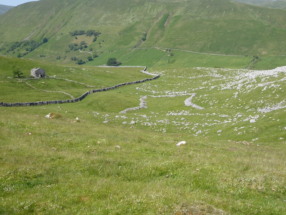
The Great Asby walls are tall and ‘tight’ – they march across the moor with straight lines and sharp corners, but walls nearer to the road are freer and more curvaceous, as they drop down into the shallow valley. Walls wiggle to avoid obstacles, such as sinkholes or springs or patches of bog. In areas where there is a shortage of stone and the wall is only one stone thick, wiggles might also be constructed to give the wall strength, against the lateral pressure of the wind. (Such sinuously-wiggling walls, usually built of brick rather than of stone, are known as ‘crinkle-crankle’ walls.)
Last summer, while walking past Opinan, near Laide on the NW coast of Scotland, we stopped to chat to a woman who was clearing vegetation off a single-thickness drystane wall right by her house. The stones there were sea-worn boulders, balanced apparently precariously on each other, and she said that she had been told that because the wall looked unsteady, with gaps revealing the view on the further side, sheep would not climb it. (Our conversation led, of course, to Herdwicks – for it turned out that the woman, who had lived there for 30 years, originally came from Cumbria.) In their book, Brooks and Adcock also refer to this style of wall: ‘Single dyking is surprisingly stable, but looks so unsteady that all stock, including the notoriously adventurous black-faced sheep, are supposed to be deterred from climbing it’.
A single-thickness granite wall at Kippford
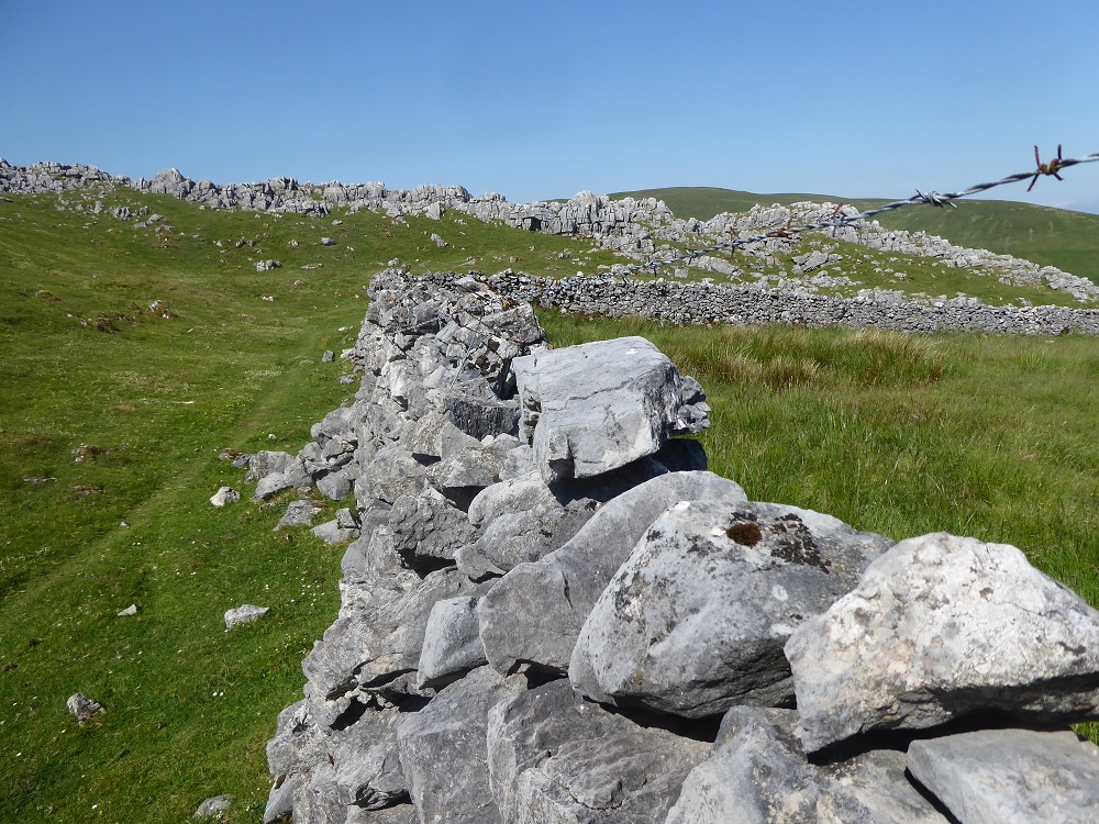
Limestone is rarely used in single-thickness walls – it’s more usual to use tougher stone like granite (as at Kippford on the Scottish side of the Solway) – but on the fellside amongst The Clouds near Ravenstonedale, there are scrappy limestone walls, some single, some built from stones cleared from the fields around the now-derelict Harry’s House. Many of the walls not ageing well, and are strung about with posts and wire.
Harry’s House and enclosure built of cleared stoneSingle-thickness wallA strong waller worked here
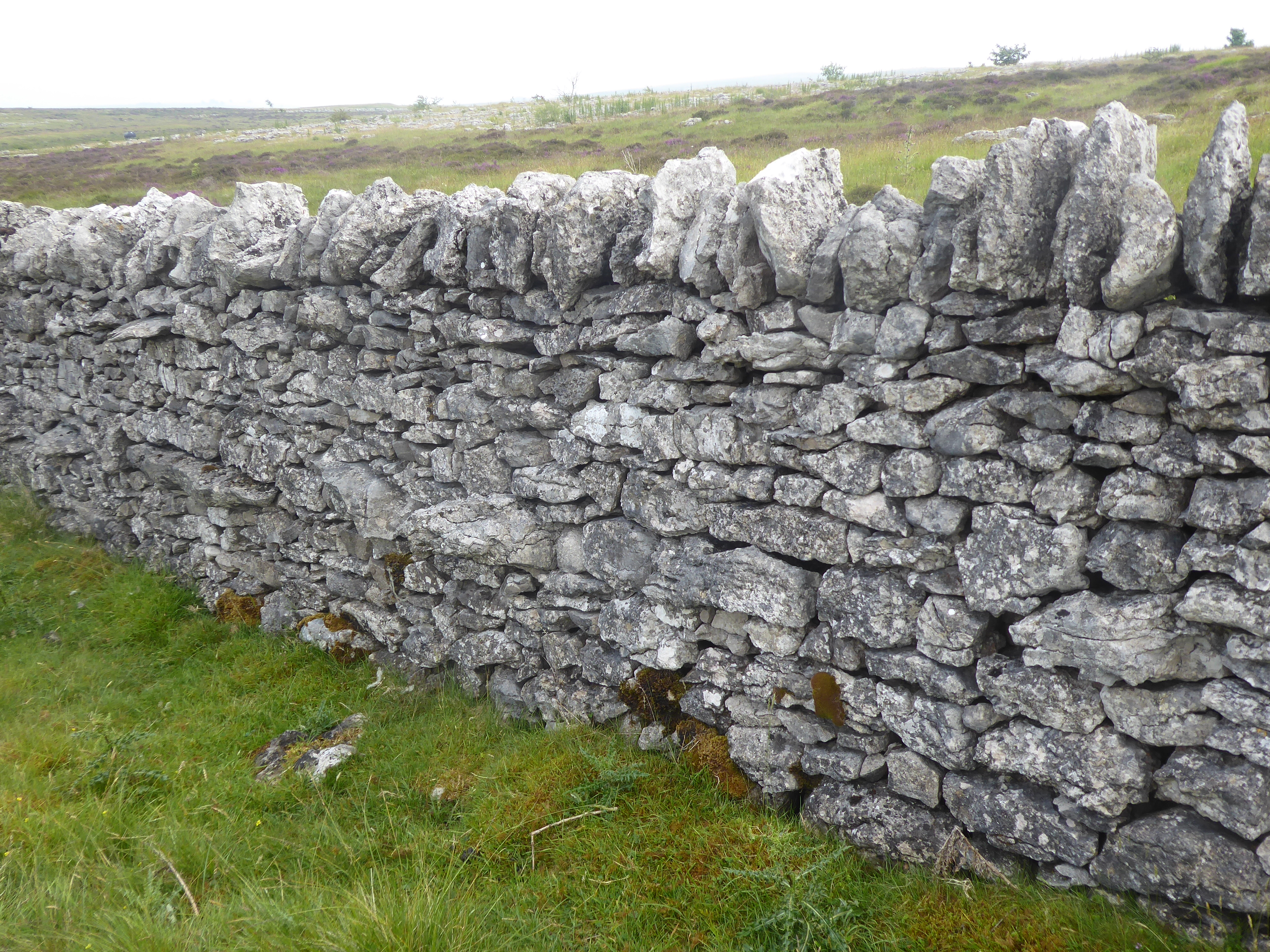
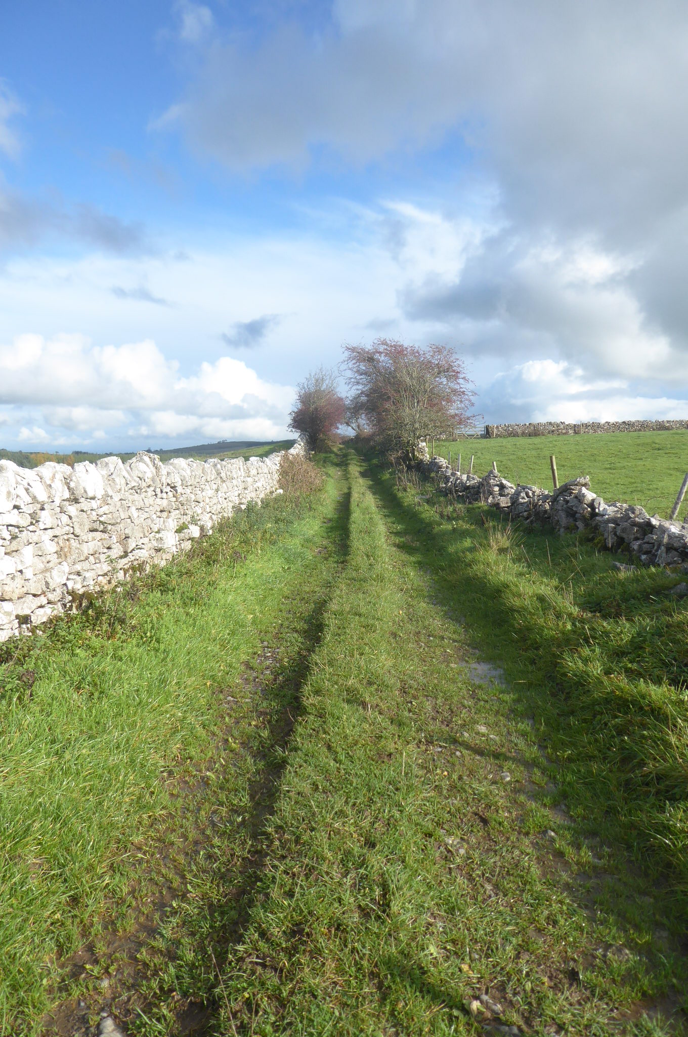
I’ve written elsewhere about the grikes and clints of my local limestone pavement at Clints Crags, but it is the dry stone walls along the northern approach that I love most. They urge me to examine them, carefully; there is a strong sense of human stories, and of the wallers’ understanding of the stone and the land around them. The walls each side of the narrow, grassy, occasionally boggy, track differ markedly from each other, indicative of different wallers for different landowners.
The track to Clints
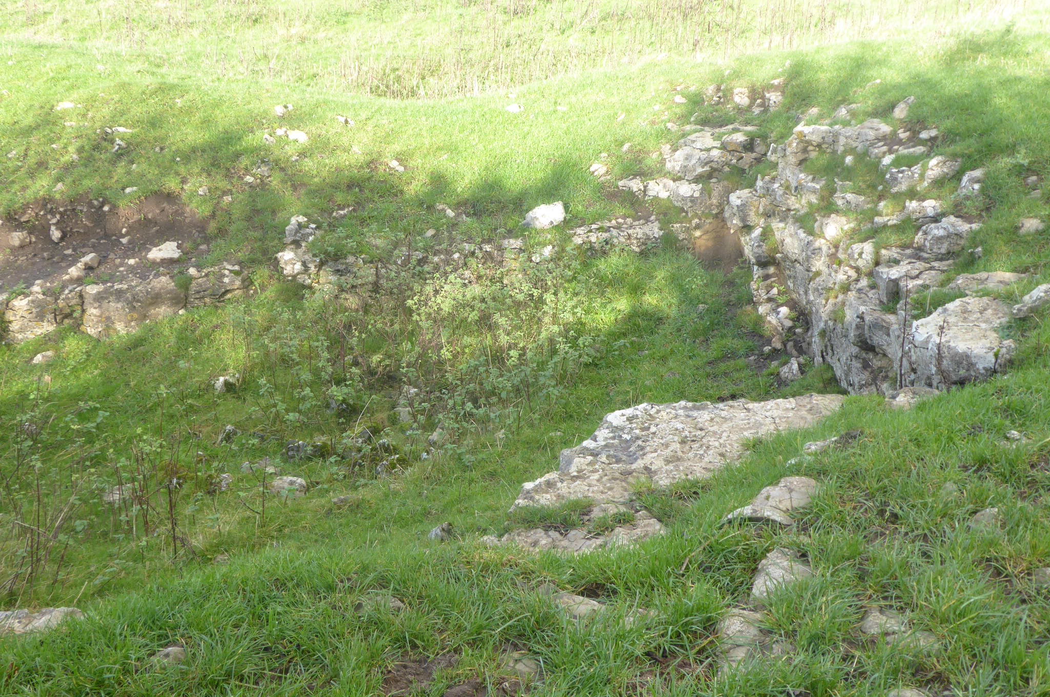
On one side a stretch of wall is intact, constructed of chunky blocks and with large coping stones. There is an unusual pit, looking man-made rather than a natural sink-hole, in the field beyond. The fraying blue twine that fastens the nearby metal gate to its sandstone stoop has been chewed by the sheep to make a tangled knot, so I climb over, and poke around in the shallow, rectangular depression in the field. It has clearly been a small quarry, hacked out by the wallers as a source of stone: water-worn vertical joints and horizontal layers have presented the limestone in handy blocks, ready for prising out and manoeuvring to the wall.
On the way to ClintsThe ‘quarry’ in the fieldThe quarry
Further along the track, and abruptly, the copings vanish and the courses of stones on the face are loose and ill-fitting. In places the wall is scarcely double, more of a hybrid with a double base and single upper part; many of the stones are thin and flaky. Not all are limestone – there are broken pieces of terracotta floor tiles, still with cement adhering; there are occasional small round ‘erratics’ of grey granite; and other stones coated with a red crust, which I can’t identify.
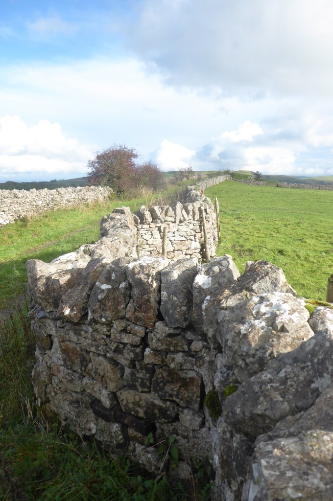
The wall on the left had been a low jumble of stone, but now it gains height and becomes tight and topped. It wiggles sharply – and when I climb up to look, I see that the waller has had to divert around a sinkhole. Further on, the wall rises and falls, taking its footing on a small hummocky outcrop.
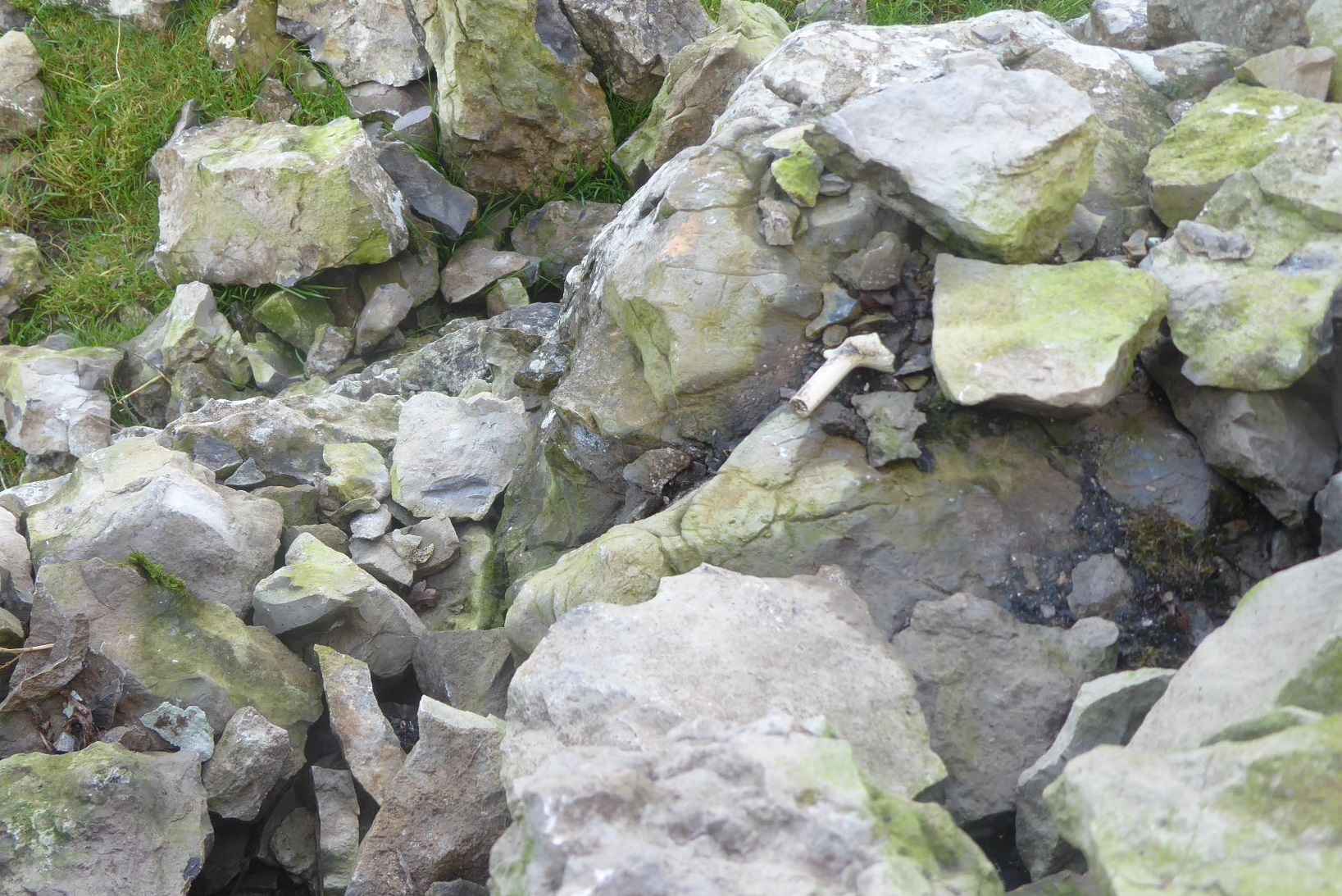
The neat wall on my right now degenerates into little more than a hopeful boundary. Sheep and the weather and old age have taken their toll on its integrity. In the field beyond, a Border Leicester tup, long-legged and Roman-nosed, stares at me imperiously from where he is standing possessively by two Swaledale ewes. I wish him ‘good morning’ and stare back, and then the light glints on something smooth and out-of-place in the interior of the tumbled wall: not a bone, but the stem and part of the bowl of a clay pipe.
A possessive tupThe waller’s clay pipe
Note:
This blogpost is part of my former ‘limestone lockdown’ project. For an Introduction to the project, and a guide to the list of related posts, see Limestone in the Lake District: an Introduction – and the ‘categories’ list in the right-hand bar.
[1] ‘Dry Stone Walling, a practical handbook’. Alan Brooks & Sean Adcock, illustrations by Elizabeth Agate & Linda Francis. 2nd ed 1999. Publ The Conservation Volunteers. https://www.conservationhandbooks.com/dry-stone-walling/
[2] For more about thunderstones (the erratics, not the fossilised sea-urchins which are also given that name) watch the interesting talk by Sylvia Woodhead about the Westmorland Dales (from 29’25”)
The RSPB’s Campfield Reserve near Bowness on the Upper Solway is a perfect place for a writing workshop, especially if you want to ‘experience’, think about, and write about saltmarshes; they form a land- and sea-scape that most people probably do not consider as particularly interesting or important. Saltmarshes are, according to poet Norman Nicholson, ‘neither land proper, nor sea proper’.
My third ‘saltmarsh writing workshop’ was held at Campfield in mid-September, timed to coincide with a low spring tide so that we would have plenty of time to explore the marsh and mudflats without having to worry about the incoming sea.
As always, my reason for running the workshop is to encourage writers to see saltmarshes in a new way, and hopefully begin to understand why they are so special – and to find a way of conveying this to other people, in their writing and conversation. The key to this is, to use Attenborough’s important statement: ‘No-one will protect what they don’t care about; and no-one will care aboutwhat they have never experienced’. Saltmarshes need our protection.
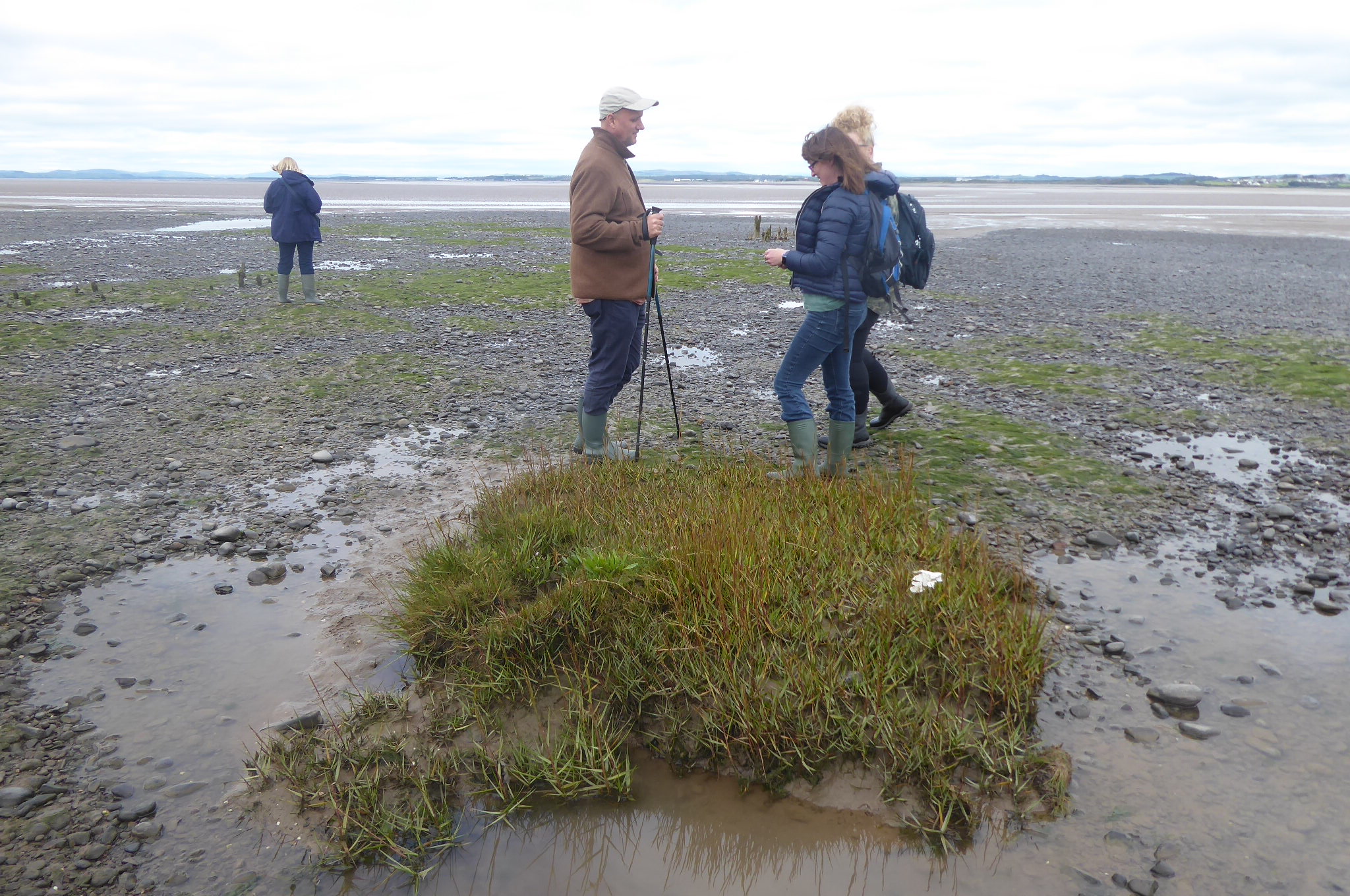
It was a day of changing patterns of light, a shifting beam that picked out fields in Scotland, pale ochre bands of sand that floored the estuary, the far-distant glimmer of the Firth, the partly-demolished towers of Chapelcross. We spent time outside – and returned mid-afternoon to watch the now high tide reaching up through the creeks into the marsh – and time inside, in the Wetlands Centre’s meeting room. It was a day of laughter, and the exchange of ideas and viewpoints (nine people offering nine completely different ways of viewing the saltmarsh and mudflats), some intense work – plus a rescued jellyfish, and a water-filled welly. I introduced everyone to some new words, too – and was asked if I could make a list so that the anyone who wanted could refer back to them, and perhaps use them in their writing.
I also agreed to post some images as aides memoires, and some links to articles that were mentioned. So, here we are, some words and pictures…
The marsh:
Some words that we used: accretion, erosion; stratification and history, ‘stories’; ‘topping tides’ and ‘mucky tides’; tiers, and pioneers; ‘merse bergs’; creeks and dubs.
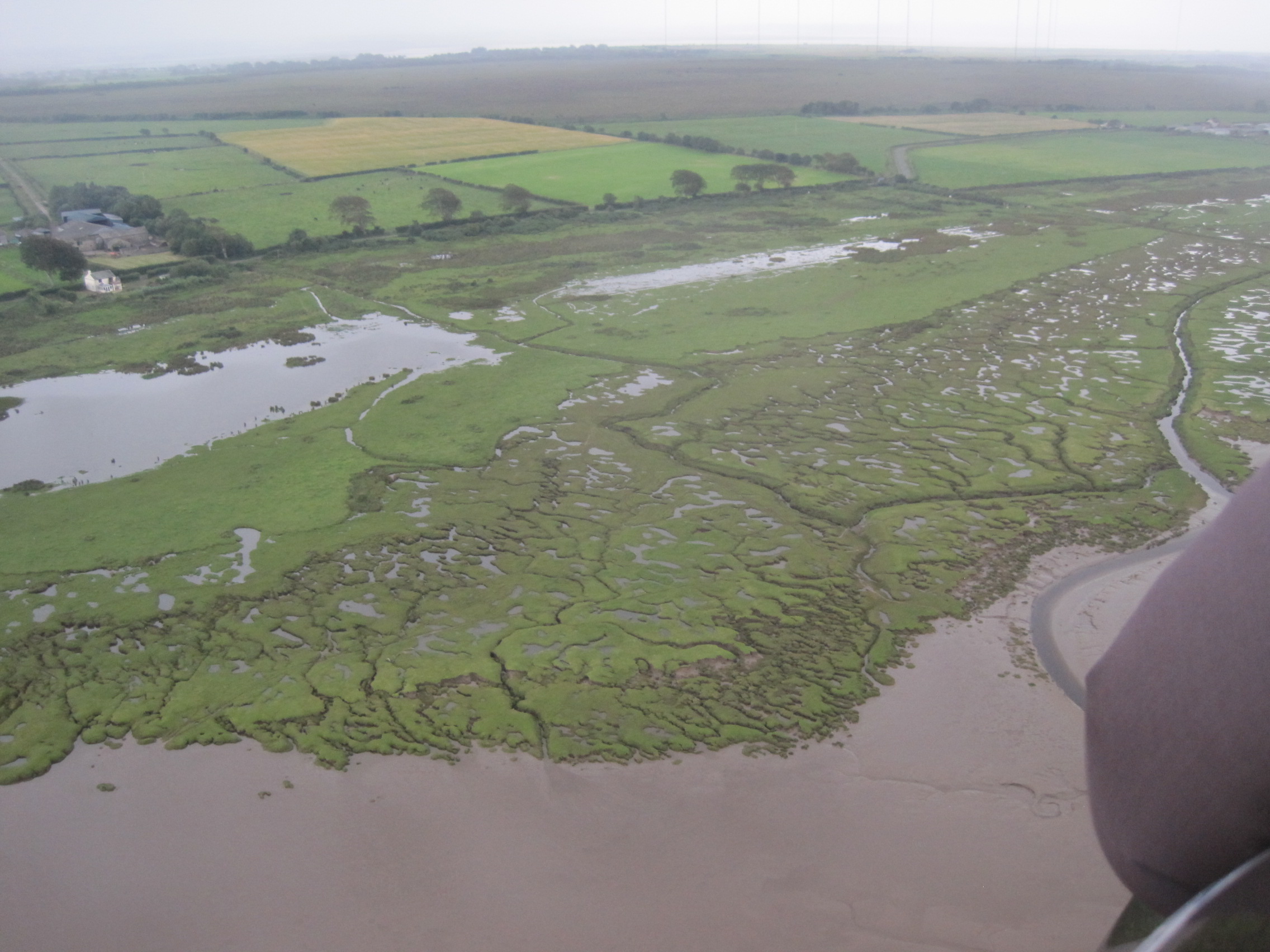
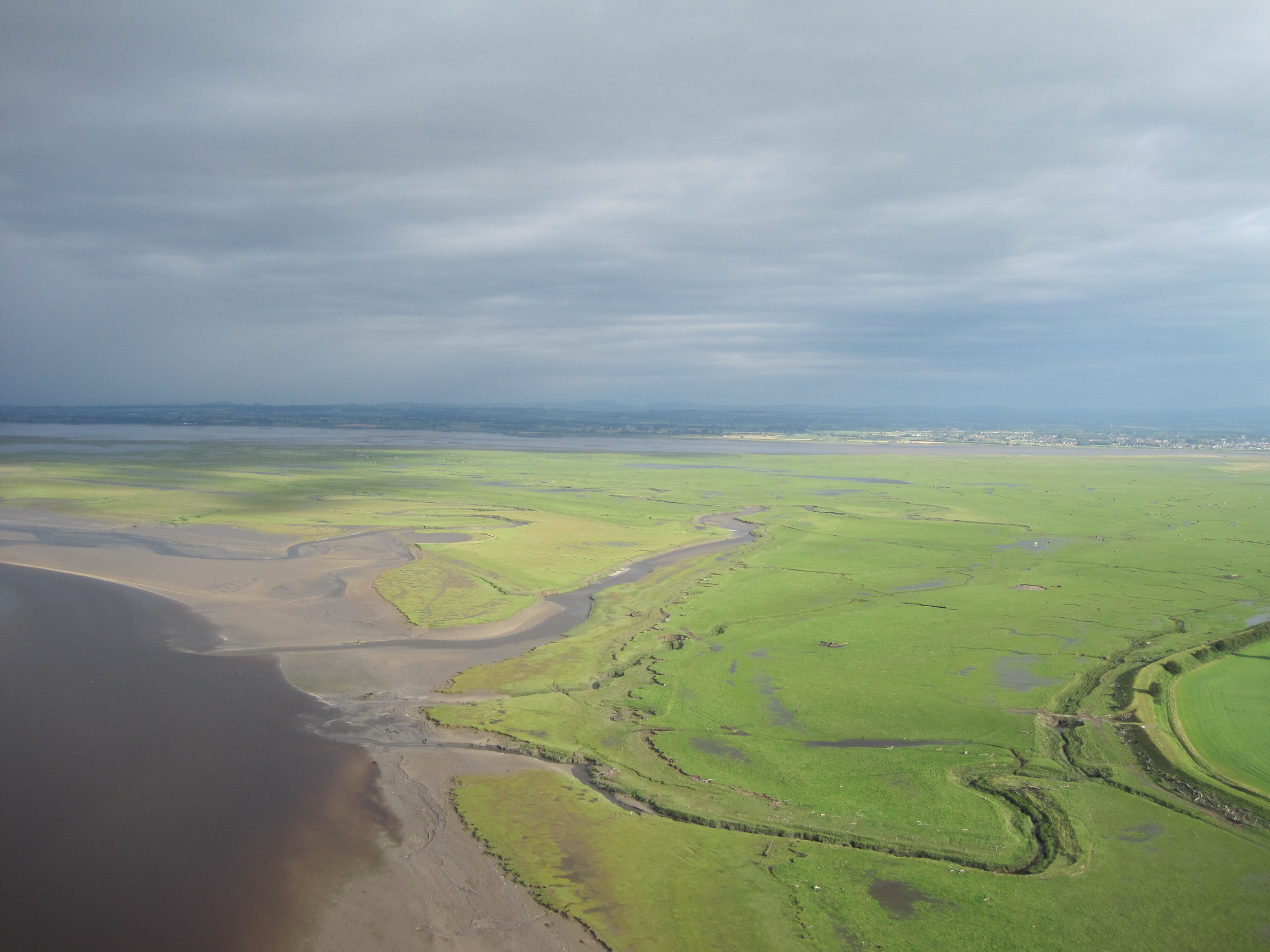
The fractal edge, intercut with creeks; and the expanding marsh at Rockcliffe between the Rivers Eden & the Esk. For more on my gyroplane flight, see this post.
View from a gyroplane: Campfield marshView from a gyroplane: Rockcliffe marsh
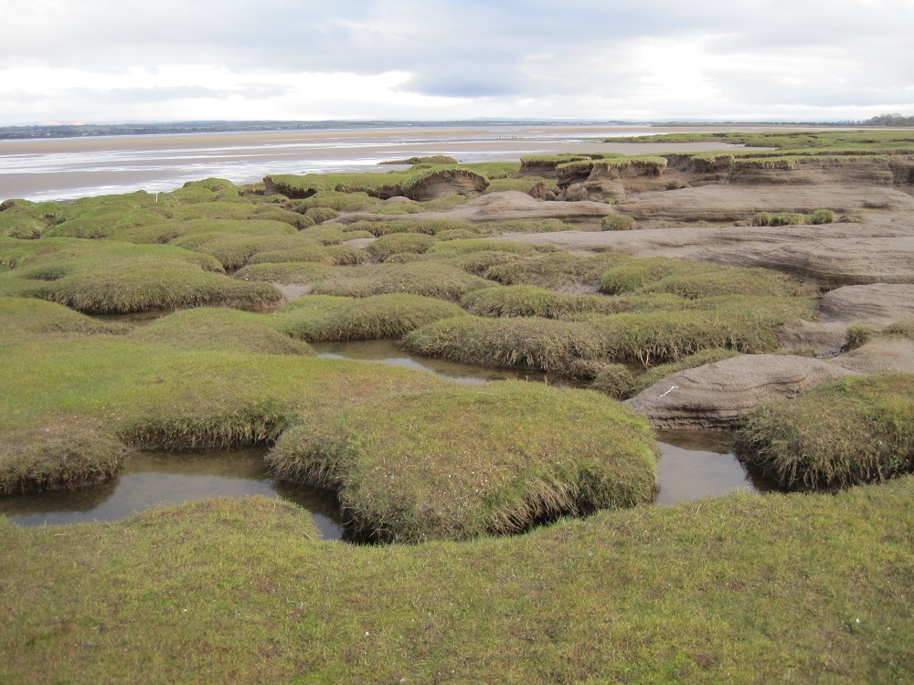
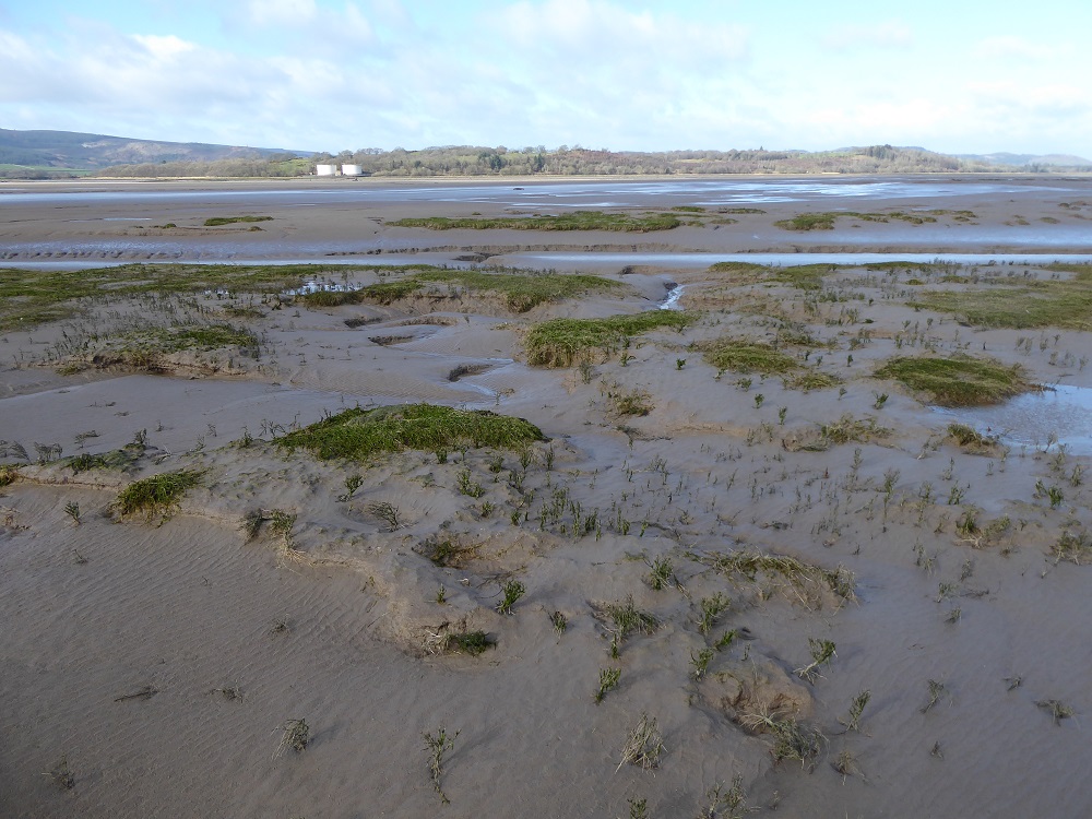
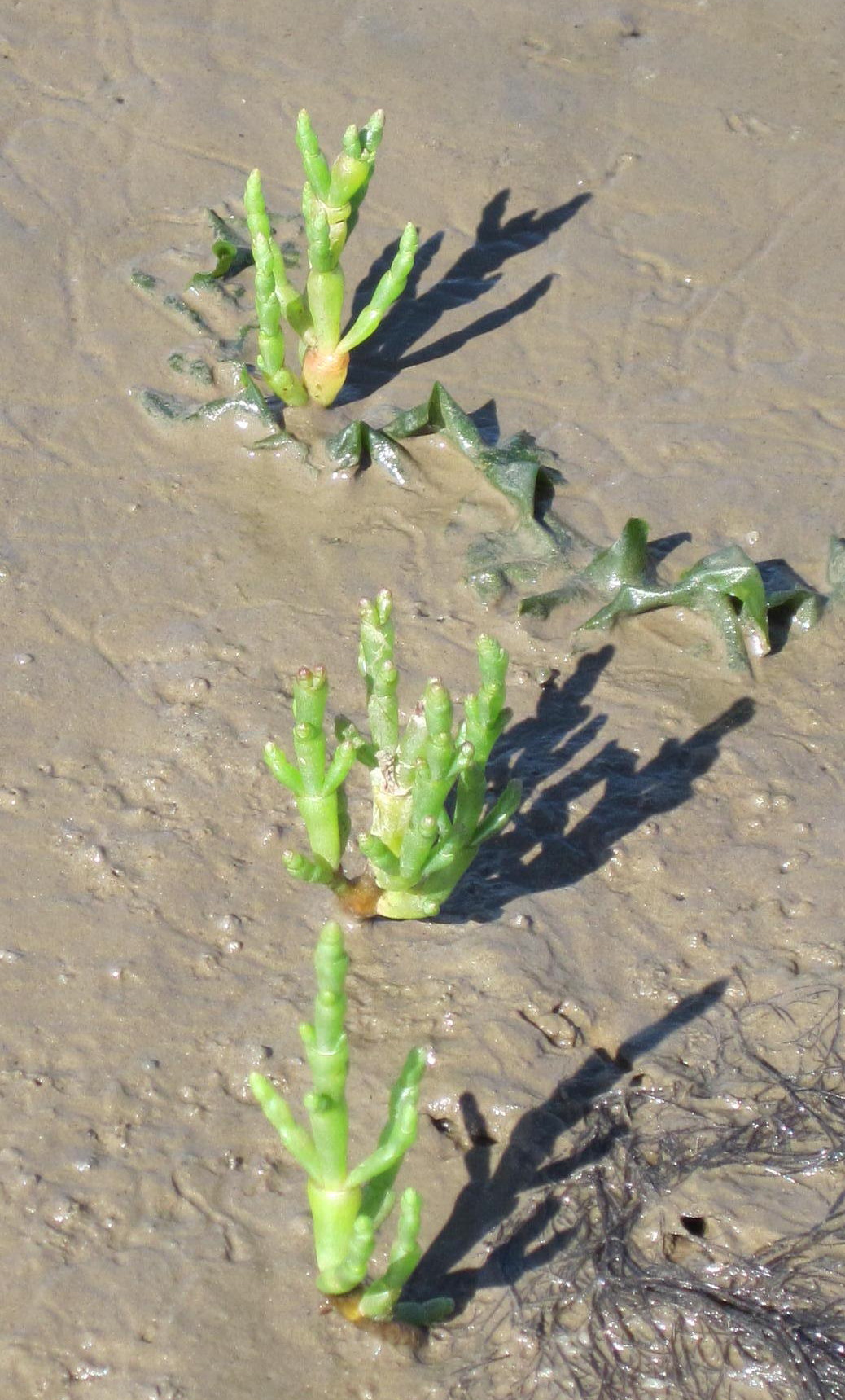
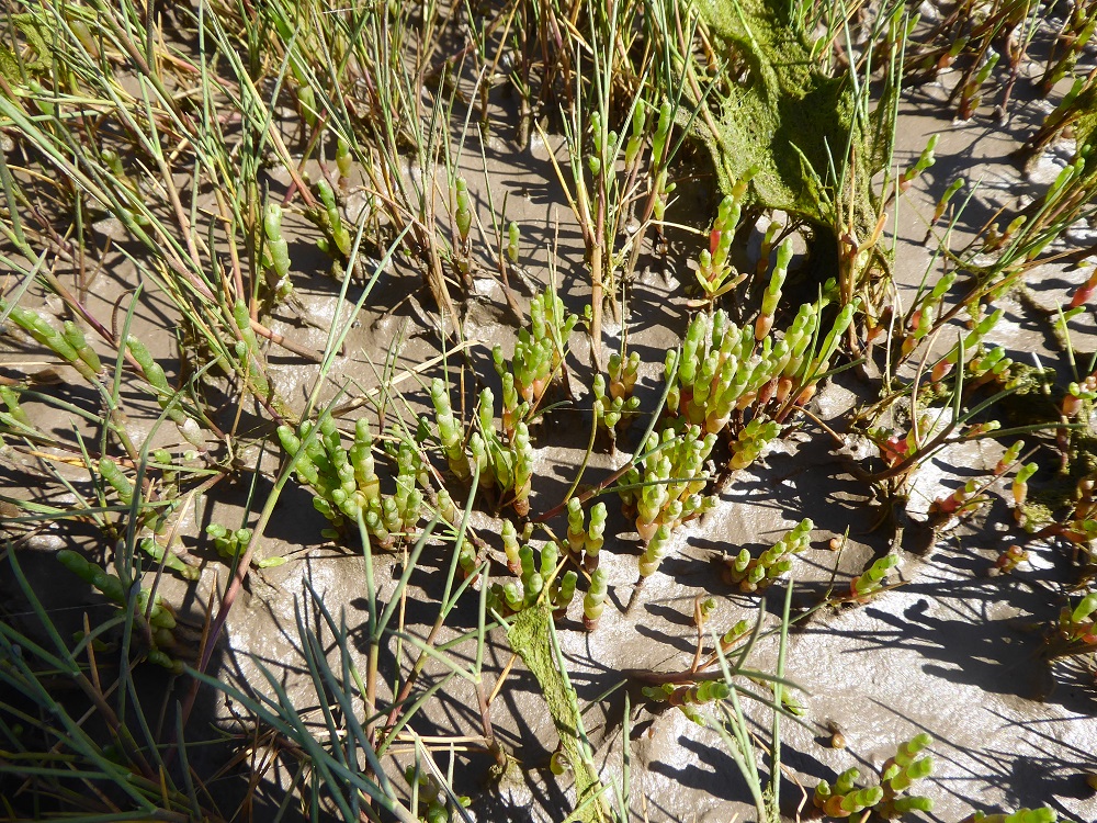
A ‘classic’ saltmarsh has three tiers, formed as it grows outwards (accretes) and upwards, gathering and trapping and compacting sediment. The new edge, next to the estuary, is stabilised by the growth of pioneer plants like samphire, Salicornia, and the ‘invasive non-native’ grass, Spartina (it originally came from America) which trap sediment between their roots and in the ‘stationary layer’ of water at their base.
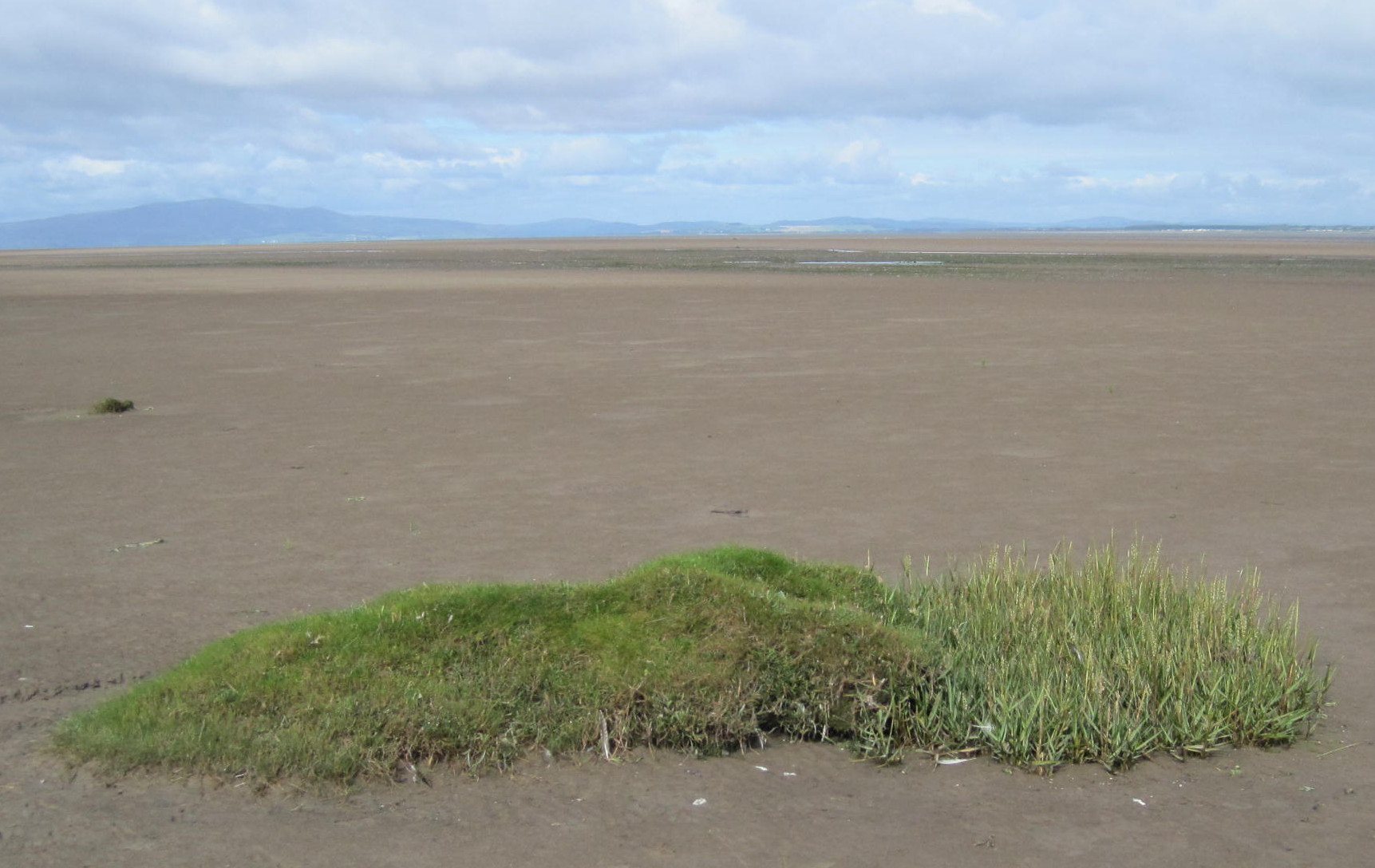
Creeks & dubs at CampfieldKirkconnell, by the R Nith – a tiered marshThe lower edge, new marsh forming (R Nith)Samphire, Salicornia: marching outwardsSamphire trapping sediment; a pioneer plantAnother pioneer: the grass Spartina (at the right-hand end)Spartina and friends
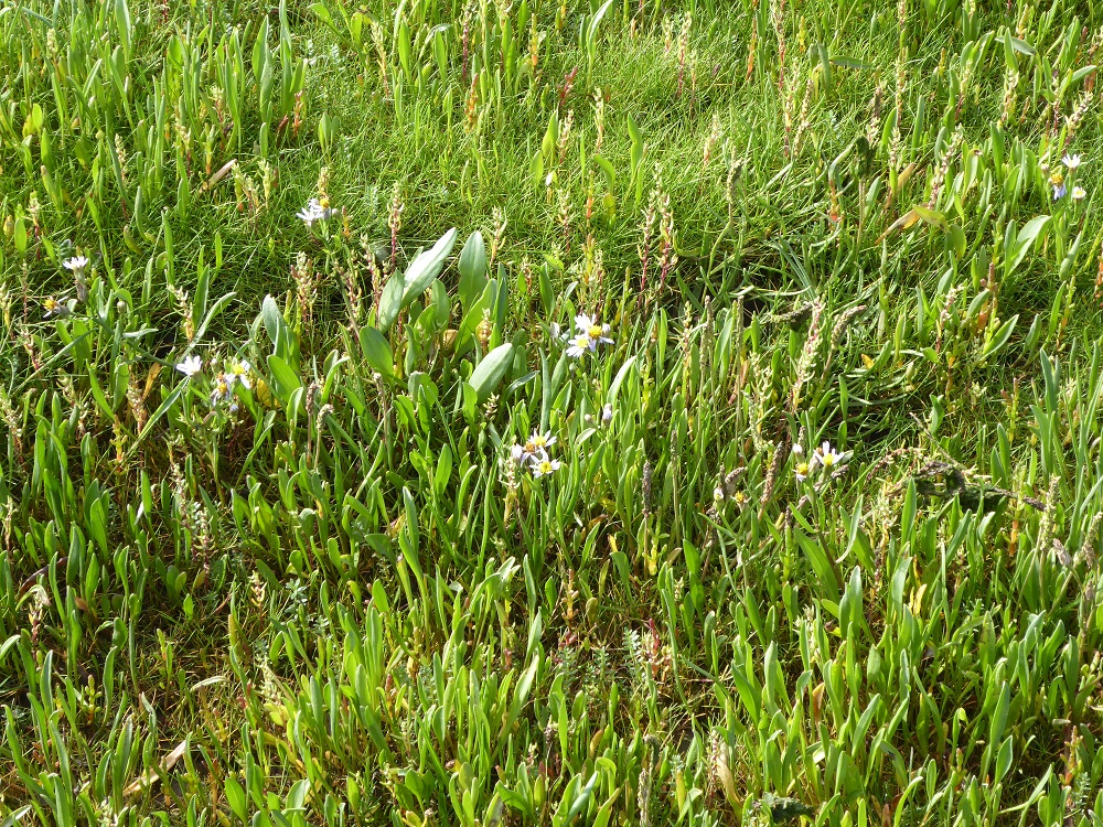
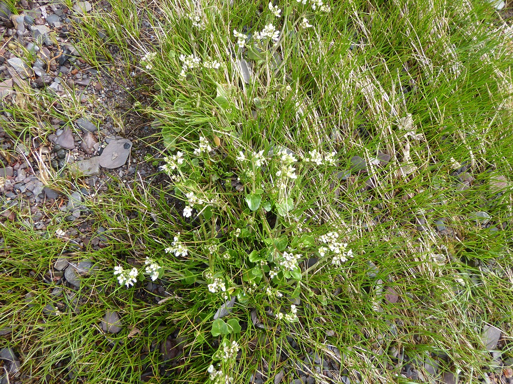
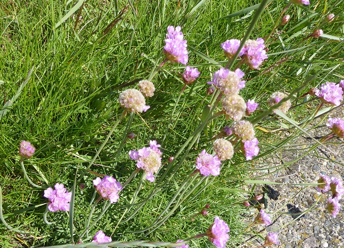
The different tiers have characteristically different vegetation, the less salt-tolerant species at the top (like gorse, rushes); many of the flowering plants (salt-tolerant ie halophiles) are in the middle layer, flowering at different times of year (only a few asters were in flower when we were there).
Purple astersScurvy grass in flowerThrift or sea-pink
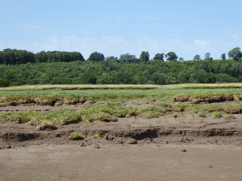
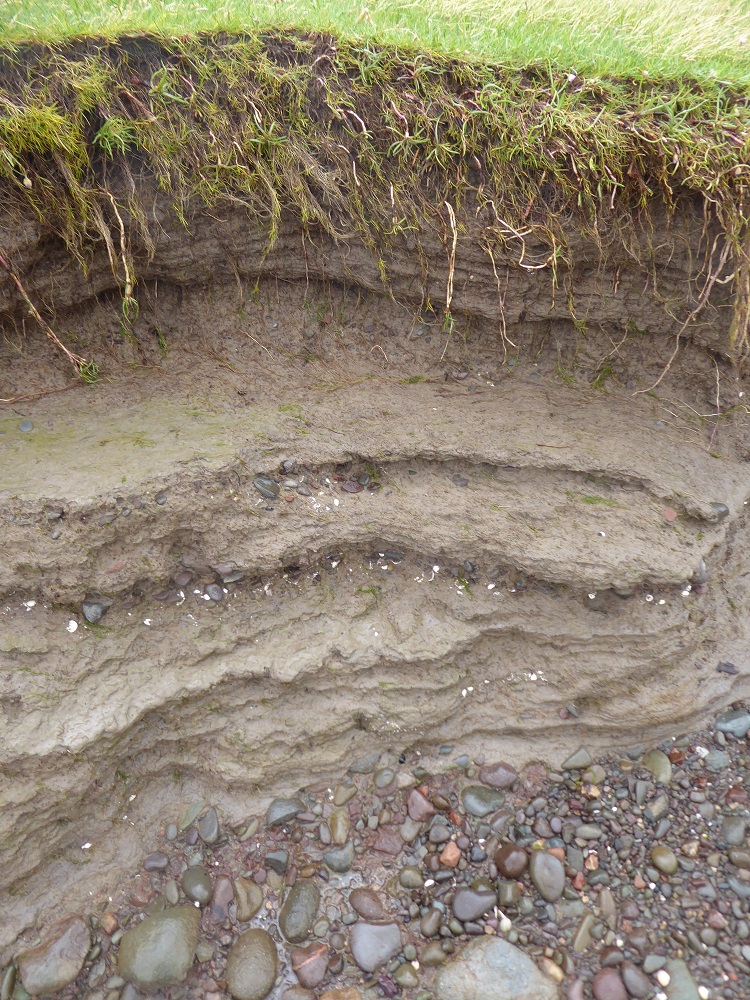
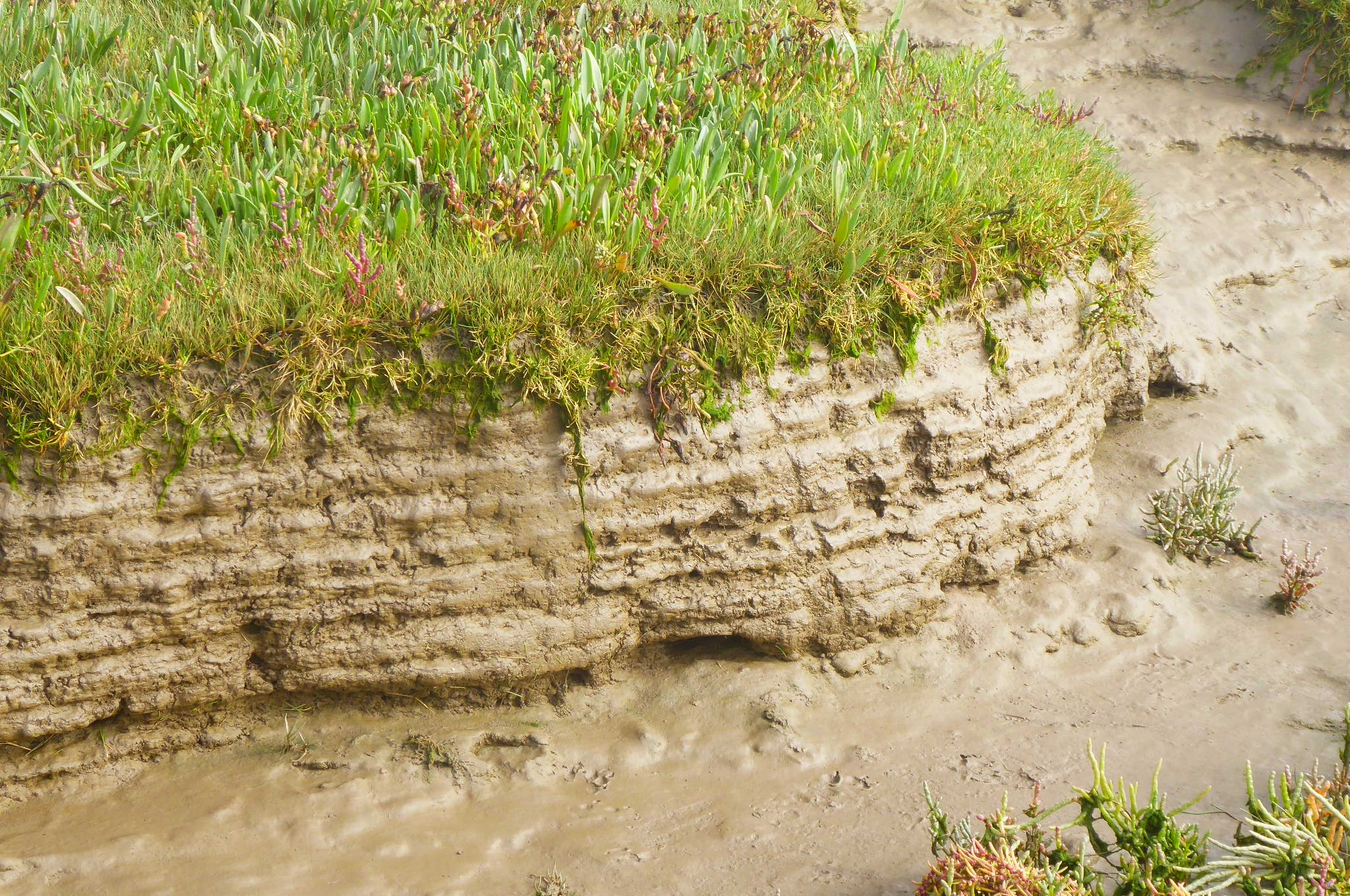
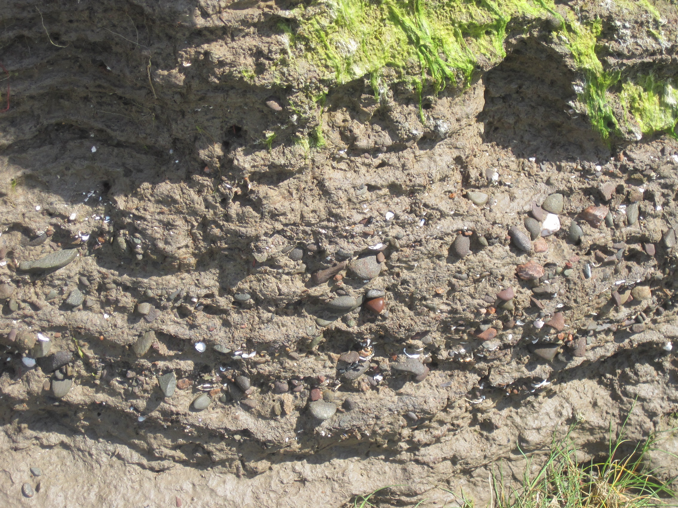
Sediment is deposited over the years, decades, even centuries: each layer tells a story – of weather, climate, sea-level, human activity.
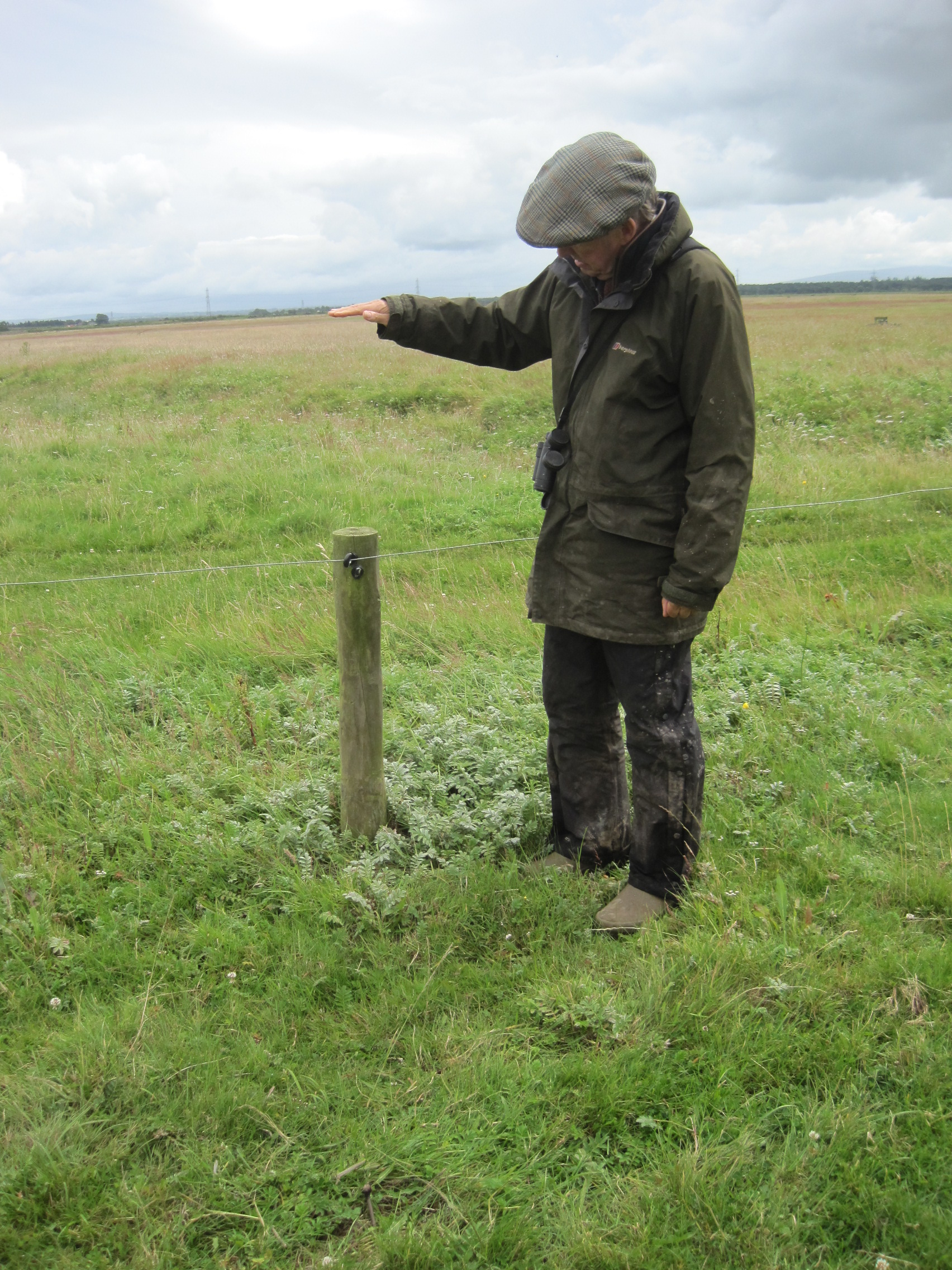
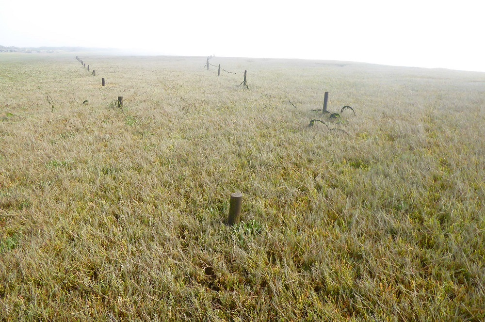
The tops were once this high above the surface: Rockliffe marshBuried fences at Grune PointTree-trunks and baulks of timber, carried up to the top of Rockcliffe marsh during winter storms
But the crenellated edges of the marsh – the creek-mouths and the dubs (‘pools’ or hollows) – dissipate the energy of the waves. Saltmarshes are an important intermediary between the water and the land.
Stormy high tide, CampfieldCampfield
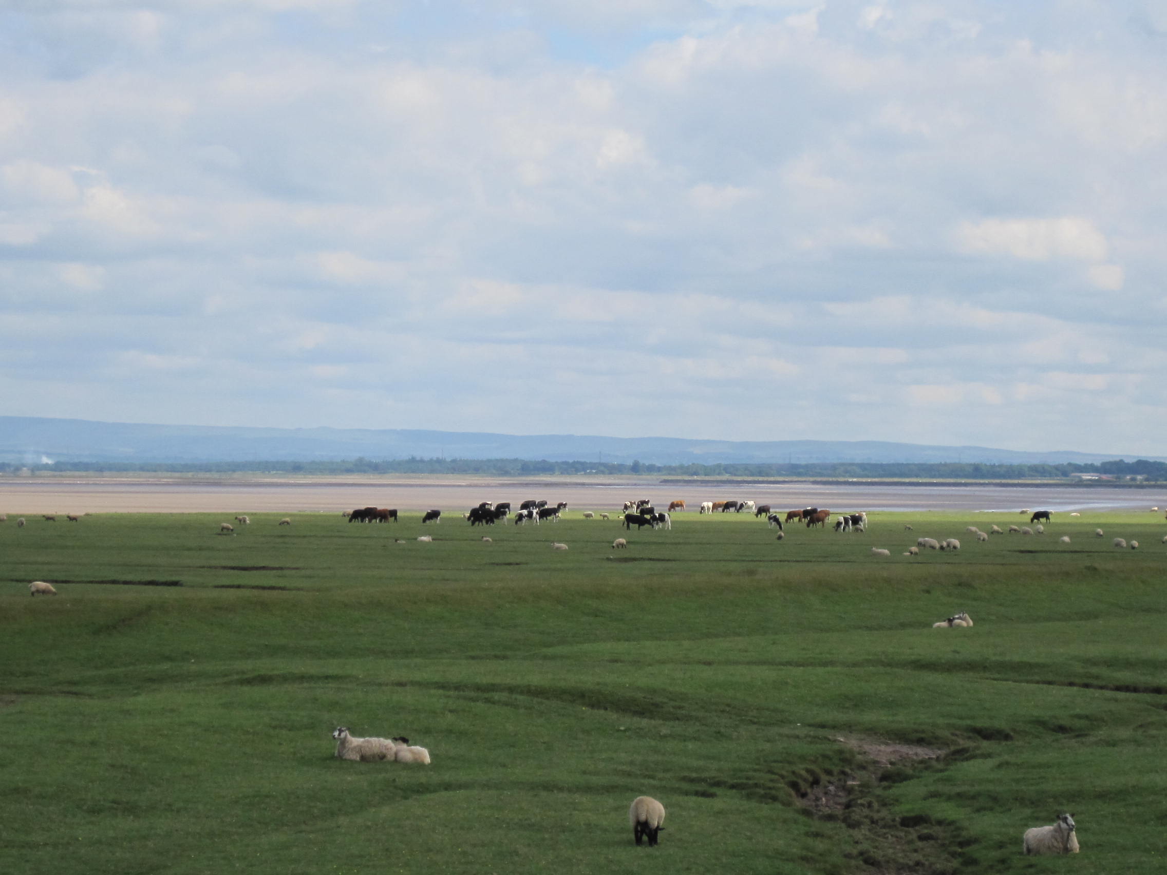
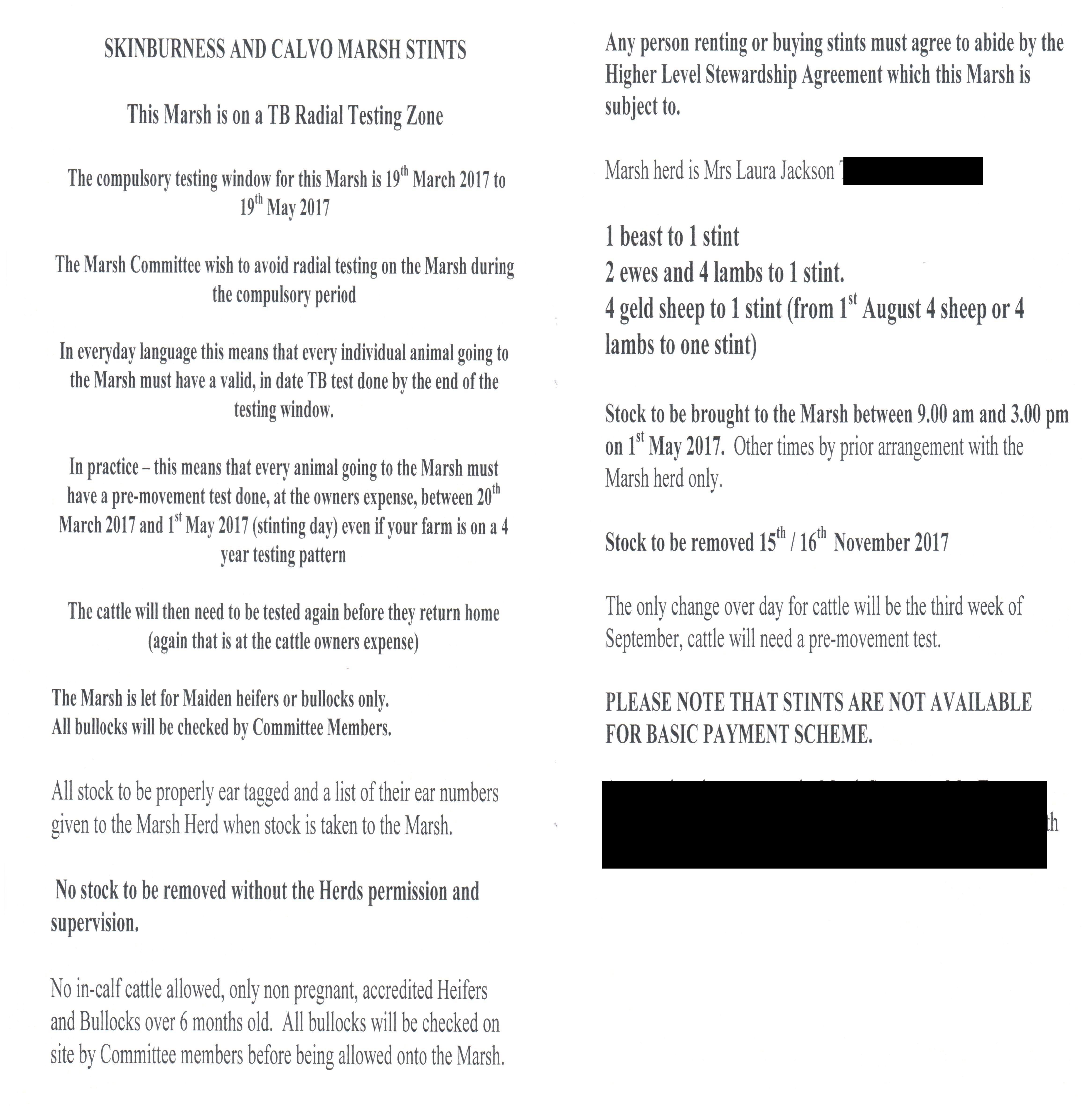
Human activity on the saltmarshes includes farming – the grazing of livestock during the summer months. On the Cumbrian coast, marshes are divided into stints, the grazing of which is auctioned each year.
Sheep and cows grazing a stintStints: grazed from May-September/October (depending on the marsh, and on the tides). Part of a Hope’s Auctioneers catalogue
Wildfowling is permitted on Calvo & Border Marshes and Rockcliffe on the English side, between September-February; permits are necessary and the numbers and species of birds regarded as targets are strictly regulated. The rules are different on the Scottish side, although tightly regulated at Caerlaverock, for instance. See the final chapter of The Fresh and the Salt for a discussion of this (nuanced) topic.
Border & Calvo Marsh: Wildfowling permitted here
The mud:
Microphytobenthos (MPB): the bacteria in the top layer of the mud and the marsh, which migrate up and down depending on the amount of light and the state of the tide. Photosynthesis – using, thus ‘storing’, carbon dioxide – the top layer of bacteria and the middle layer of cyanobacteria need light and oxygen; sulphide-using bacteria in the black, anoxic layer, do not, and do not photosynthesise.
Mudshrimps (Corophium), mudsnails, ragworms, and lugworms – live in or on the mud.
Mudsnails, Hydrobia
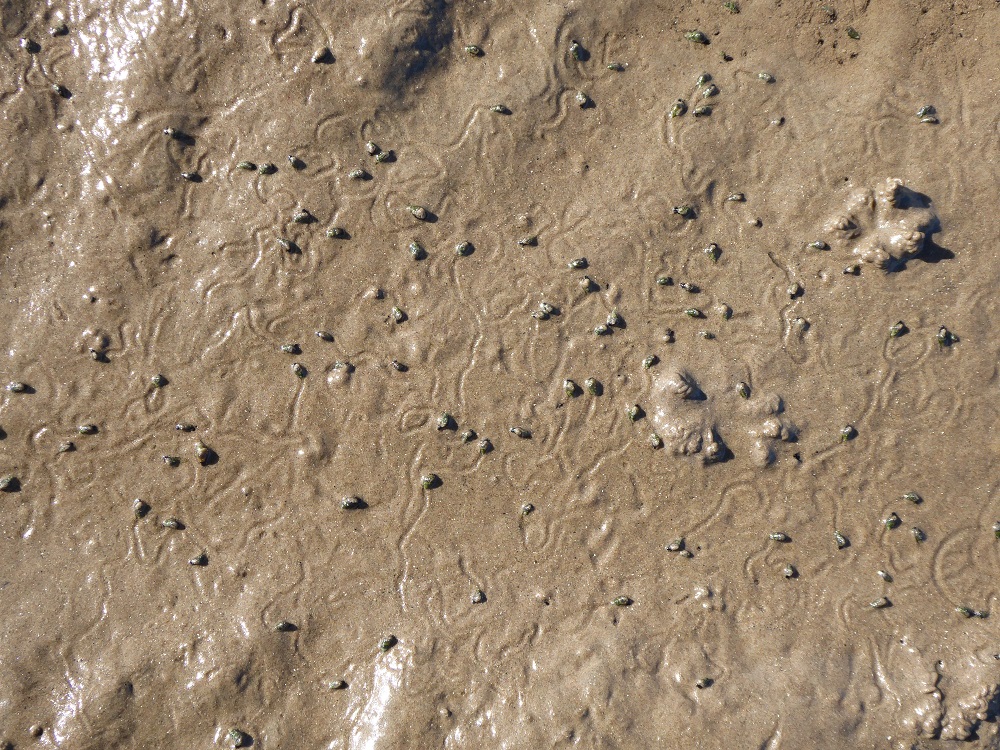
The density of mudshrimp burrowsA mudshrimp’s trailU-shaped mudshrimp burrows on a spadeMudshrimps, Corophium, with their long first pair of antennae
Corophium limbs and how the animal feeds – the ‘naming of parts’ blogpost – with a link to Jenny Bell’s song. The blogpost also refers to bioturbation and bioengineering – and silk-lined burrows!
Tides and tidal bores:
We touched on this briefly: bores on the R Nith, the R Wampool, and up near Burgh marsh, for example There are images and weblinks in this blogpost, and videos of the bore on the R Wampool here (scroll down to the bottom of the page).
Tidal charts are here – choose your piece of the coast.
Miscellaneous:
For the former Solway viaduct, damage to and repair of Bowness Common (peatbog, part of RSPB Campfield), and the Solway Junction railway, see Crossing the Moss.
Writing:
Norman Nicholson. Collected Poems. ed Neil Curry, (1994) Faber & Faber
Discussions and insights into ‘new nature writing’: just a few references here (there are more recent articles too, but mostly ‘re-inventing the wheel’ – the topic has been around for a while and it’s easy to get bogged-down).
This is now a topic of major importance: bacteria and plannts sequester carbon dioxide, taking it out of the atmosphere, during photosynthesis, and as they die and are buried, so that carbon is stored. Damage to saltmarshes (like damage to peatbogs) releases the stored carbon again, as carbon dioxide. Many efforts are being made to map the extent of marshes around the coast, and to protect and restore them where possible.
Hopefully, after our writing workshop and discussion, you’ll now understand a bit more about the drama and dynamics and uniqueness of the saltmarshes, and will stand up for them when they are under threat.
And spread the word in your conversations and writing; pass on your experience. Remember, ‘No-one will protect what they don’t care about; and no-one will care aboutwhat they have never experienced’.
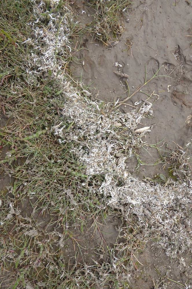
Snowdrifts! Small semicircles and rippling lines of white on the grass of the saltmarsh: the cast exoskeletons of thousands of mudshrimps. My friend and former colleague Professor Geoff Moore (himself an expert on amphipod crustaceans including Corophium) once told me how, on the Isle of Cumbrae, he had seen drifts of cast skeletons “lying along the tideline like snowflakes”. I had been envious – but now, here on the marsh at Grune Point, I had at last seen the same phenomenon.
‘Snowflakes’: cast cuticles of CorophiumCast cuticles: antennae clearly visible
***
As the tide ebbs the level of the salty sediment-laden water at Moricambe Bay is dropping, turning increasingly brackish as water from the saltmarsh creeks and the rivers Wampool and Waver dominates. The edges of Calvo Marsh stand proud above mudflats that are glistening sweeps of ochre, sienna-brown and grey; the smooth glossiness of their upper slopes shades down into roughness, speckled with stones and weed at low-tide level.
That smoothness, as seen from the comparative safety of the saltmarsh, is an illusion, for if I step – squelch, glissade – out onto the glutinous surface and look down, the surface is pockmarked with tiny holes and the wriggling trails of wandering creatures. Other larger animals have been here before me, too: there are bird footprints – the precise three-toed prints of waders, the webbed prints of gulls and aggressively sharp footsteps of oystercatchers; rough-edged holes where beaks have probed; and a line of paw-prints of an otter who has looped to and fro between the water and the short, silty grass of the saltmarsh.
These are signs that animals have been busy on the surface while the tide is out, but the minute holes hint at other animals that are here for much longer periods, burrowed down below. For to live on this apparently featureless and changeable shore means there is nowhere to hide – except within the mud.
The density of burrows (photo of the mudflats of the R Nith)
To find the mud-dwellers I search for where the density of holes is greatest, and then use the spade. The divot is heavy and sticky; at the top are sections through U-shaped burrows opening to the surface. Each is the home of a tiny pale brown mud-shrimp: mud-shrimp – a uninspiring name for a small animal that is so beautifully adapted to where it lives – the crustacean, Corophium volutator.
Mud on the spade: rectangles mark burrows with mudshrimps
The elegance of limbs
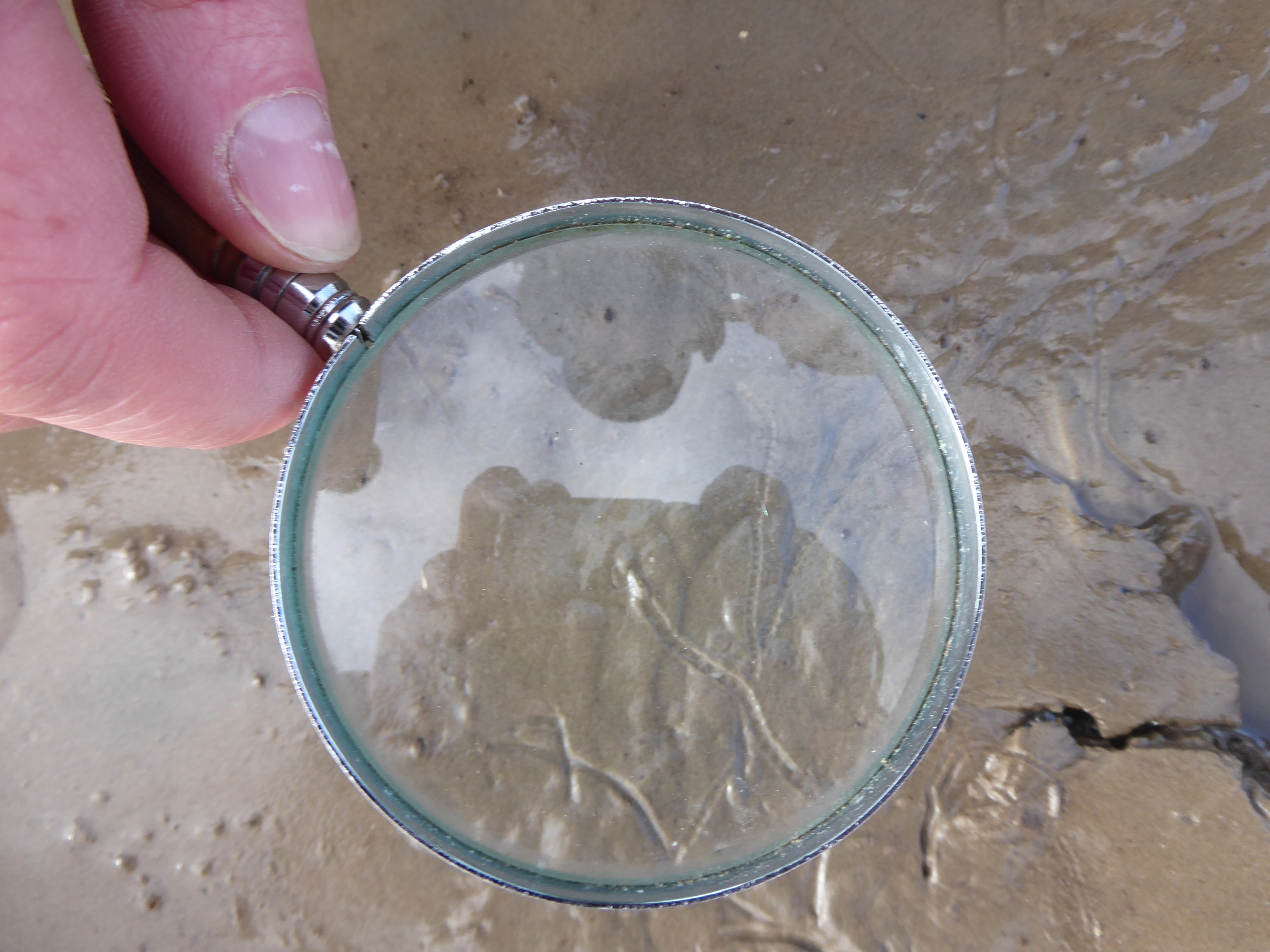
I carefully extract some of the mudshrimps from the divot on the spade, and place them in water in a white enamel pie-dish. Unlike shrimps in rock-pools or the Silloth brown shrimps cooked and ‘potted’ in butter, Corophium belongs to a group of related animals, the amphipods, that are dorso-ventrally flattened – from top to bottom – rather than laterally, from side-to-side. Also unlike shrimps and lobsters, Corophium doesn’t have a carapace – its head and the middle segments of its body aren’t covered by a single curved piece of armour but all the segments are visible from above. With a hand-lens it’s easy to see how different parts of a mudshrimp’s body are perfectly adapted for different functions. There are flexible joints between the segments so that – lacking a carapace – the animal can straighten or flex its body. Each segment has a pair of jointed limbs, and groups of adjacent limbs are modified in size and shape to carry out different functions.
A pie-dish of Corophium
At the head its appendages are adapted to ‘read’ the surroundings, and to find and deal with food. The pair of long, flexible antennae that are so characteristic of Corophium have a sensory function, but a second pair are also used as rakes to pull food towards the mouth. Behind the antennae and on the underside of the body, are small ‘feeding limbs’ with different sizes and shapes – the maxillae, maxillipeds and gnathopods (‘jaw feet’) – all specialised for separate roles in the capture, handling and ingestion of food. Inside the mouth (unseen by my lens), a pair of hard mandibles act as macerating-machines. Some of those feeding limbs have a second function, too – they have small thin-walled flaps of gills at their base to take up dissolved oxygen from the water.
Under the middle section of the body are the legs, the pereiopods (‘transporting feet’), by which Corophium crawls on the surface of the mud, and further back, tucked beneath the abdomen, are small, feather-like limbs, the pleopods (‘swim feet’). The pleopods beat like paddles when the Corophium swims, or they can beat more slowly to send a current of oxygenated water over the gills. I am happy to be re-visiting old friends – it was watching how these pleopods beat perfectly in unison that so captured my imagination so long ago.
At the back end of the body, a broad flat telson and a couple of leaf-like uropods form the tail fan, a small version of a lobster tail: if the abdomen is suddenly flexed forward, the fan acts as a paddle that drives a current of water forward – and the animal backwards: a useful method of escape from a predator.
This then, is what a live Corophium looks like under a magnifying glass.
Just as taxonomists look for relationships between animals and, god-like, name the formerly unknown, so anatomists look for relationships and name the parts. Every part of the body has a name. Every segment of the jointed legs has a name. Even though I’m not an anatomist I love the music of the names, to be chanted like skipping-songs. Watching the crawling Corophium, I struggle to recall the knowledge I had as a student, so long ago. With the edge of an empty mussel shell I try to draw the outline of a jointed leg on the mud’s surface – the physical act of drawing helps retrieve the words: coxa, basis, ischium, merus, carpus, propodus and the pointy-fingered dactyl. I love the words for themselves, and their Greek or Latin derivations. (Later, singer and composer Jen Bell composes a song about these names, for Pentabus’s stage production, ‘On One Side Lies the Sea’ [1].)
We don’t need to know the names of the parts, but by knowing them and their provenance we can trace the beautiful economy of evolution – reuse this bit slightly differently, take a little bit of this and a little bit of that, try out the effect of this gene in controlling that later sequence and if it brings advantage, keep it.
Synchronicity
In retrospect I realise that Corophium set me on the road to becoming a research scientist. When I was an undergraduate in London, the field-trip for our marine biology course took us to Swansea and the Gower for ten days, where we were offered a range of short projects to help us learn about research: the constructing of hypotheses, the practicalities of ‘materials and methods’, the gathering and interpreting of data. This brought, too, the realisation that the lives and activities of intertidal animals worked to a different schedule than our own, their lives governed by the shifting clock of the diurnal tides: depending on your project, evenings might be spent in the lab, not in the pub. I chose to investigate how Corophium responded to the falling oxygen levels in its burrow – did it become quiescent and sit out the low-tide period, or did it pump the water in its burrow more rapidly over its gills?
So how do you watch an animal that lives in a burrow? You fill a narrow glass chamber with muddy sand from a Corophium colony, and hope the animal will construct its burrow next to the glass … You fill the chamber with seawater of different oxygen concentrations, you hope you can see the delicate pleopods and count their rate of beating … A short project, naïvely simple through ignorance, yet a mixture of logic, planning – and hope. As the lecturer in charge drove me back to the lab one evening, he asked, ‘Do you really enjoy doing this?’ Yes, I really did! (What were the results and conclusions of this research? I can’t remember. All I remember is the delicate, synchronised beating of the pleopods, and the animal’s elegant, questing antennae.)
I didn’t go on to research the physiology of marine animals but, years later, when I moved to Glasgow University, one of the other lecturers in the department was Peter Meadows, whose early research, in the 1960s, had been on the burrowing and feeding behaviour of Corophium [2]. Mudflats might look fairly uniform to us, but Corophium swim about and use their antennae to test the nuances in the size of sediment. Peter Meadows had written that the animal is ‘apparently quite deliberate’ in choosing where it burrows: some patches of mud are perfect, others are rejected like Baby Bear’s porridge. The sediment must be not too fine or the burrow might collapse, and not too coarse. Most important, the particles must be coated with organic matter – a slimy biofilm of bacteria, microalgae, and other organic material: a larder as well as a building block. Having found the right conditions, the shrimp burrows into the mud using its antennae and pereiopods, and stabilises the compacted particles of the walls with a sticky secretion
Dimensions and planes
Our own lives are carried out on the surface of our world; few humans penetrate above or below that single plane. But an animal that burrows in the intertidal zone, has an extra freedom – to pass through that plane in either direction, from solid to liquid, liquid to air, depending on the tide; to live, crawl, swim, mate, feed, in three dimensions.
There is, too, the extra dimension of time. For an intertidal animal, time is synonymous with tide. There must be periods of waiting, when the animal keeps a low profile, hiding from predators, ‘house-keeping’, digesting, defaecating – and anticipating the return of the water that brings fresh oxygen and food (and sometimes, sex and procreation).
This coming and going of the sea, and the behaviour and activity of these marine creatures – and of all the animals that depend upon them – are influenced by the moon and sun, on a daily and seasonal schedule. A couple of months before I found the ‘snowflakes’, the phase of the moon would have sent the signal that it is the time for mating. When an adult female mudshrimp is receptive to a male, she releases ‘come hither!’ pheromones into the water, and a male comes swimming or crawling to her burrow. If they approve of each other, the male releases sperm which are swept into the female’s special brood-pouch – her marsupium – where the now fertilised eggs develop into embryos (Corophium, unlike other crustaceans such as barnacles and crabs, say, doesn’t have a planktonic larval stage). About two weeks later they hatch as miniature adults, ready to make their own way out, onto and into the local neighbourhood. As mudshrimps grow, they must moult their old exoskeletons and expand the underlying new one; the ‘empty’ cuticles line the tideline, pale ghosts of their former occupants.
The ‘juddering trail’ of a mudshrimp
Food-chains and engineers
I step off the saltmarsh and slide out onto the mud. The surface of the mud is squiggled with trails, and I squat down to watch mudshrimps as they part-crawl, part-swim in the shallow film of water that remains on the surface. The upper reaches of the Solway Firth have multiple conservation designations [4], reflecting the enormous importance of the mudflats in providing food for local and visiting waders such as dunlin, knot and redshank. Corophium and the snail Hydrobia are special favourites, and the birds scurry hither and thither, following the falling tide, rapidly probing the mud.
But to think of the Corophium colonies merely as unwitting suppliers of thousands of tasty snacks for visiting birds is too simple: we have to turn the idea on its head – the invertebrate animals and single-celled organisms, the algae and bacteria are the core of the life of the mudflat, and without them the ‘mudflats’ would be a sterile shifting slurry of mud and sand, washed this way and that at the whim of storms and tides.
The shrimps themselves feed in several ways: by using their mandibles to scrape and gnaw the biofilm that coats the sediment particles; by raking around the burrow-mouth with their large second antennae; and by using bristles on their gnathopods to filter and sort organic particles like diatoms from the water that the pleopods circulate through their burrows. Look again at the contrasting colours of the mud on the spade. The deeper mud is black and anaerobic, containing little oxygen, but around the mudshrimps’ burrows it is pale and yellowish-brown, oxygenated by the animals’ activity. We can think of Corophium as the engineers of the mudflats, through their feeding on biofilms, their burrowing and ‘bioturbation’ of the sediments – they are so much more than food for wading birds.
Bioturbation: oxygenated mud around the burrows, black anoxic mud below
A foreign shore?
Corophium are almost unknown, rarely seen – for why would anybody bother to venture out onto a sticky muddy shore? Indeed, mudflats and saltmarshes are probably as foreign as another country in most people’s imaginations, and as David Attenborough has said, “No-one will protect what they don’t care about; and no-one will care about what they have never experienced”.
A repetitive and well-worn argument about ‘nature-writing’ is that we ‘need new words’, simpler concepts to talk and write about the places that we share with other living things. Richard Mabey, writing about barn owls, found he was constructing “extravagant phrases” and “was rather pleased with my poetic metaphors….” Then, delightfully, he saw that he should think of the owls as his neighbours. “For much of my working life I have been trying to find way of talking about other organisms that neither reduces them to mechanical objects nor turns them into sentimentalised versions of ourselves. Neighbours are fellow creatures, but independent souls. You share their territory (their parish) and often their fortunes, but you can care about them in full knowledge they may not even recognise you.”[3] We may not share the mudshrimps’ territory but we can visit them, physically or in our minds, and perhaps this will help us to care about them – and their neighbourhood.
***
I notice that the mud in front of me is prickled with coruscating light. The mudshrimps are reaching out and waving! All across the mud, they are waving their antennae – they are not scraping up food, but seem to be signalling or sensing the air. Each is rapidly extending and then withdrawing one of its long antennae, and the incident sunlight is catching and high-lighting the movement. It is a ‘Lopez moment’: suddenly, “You know that the land knows you are there” [5].
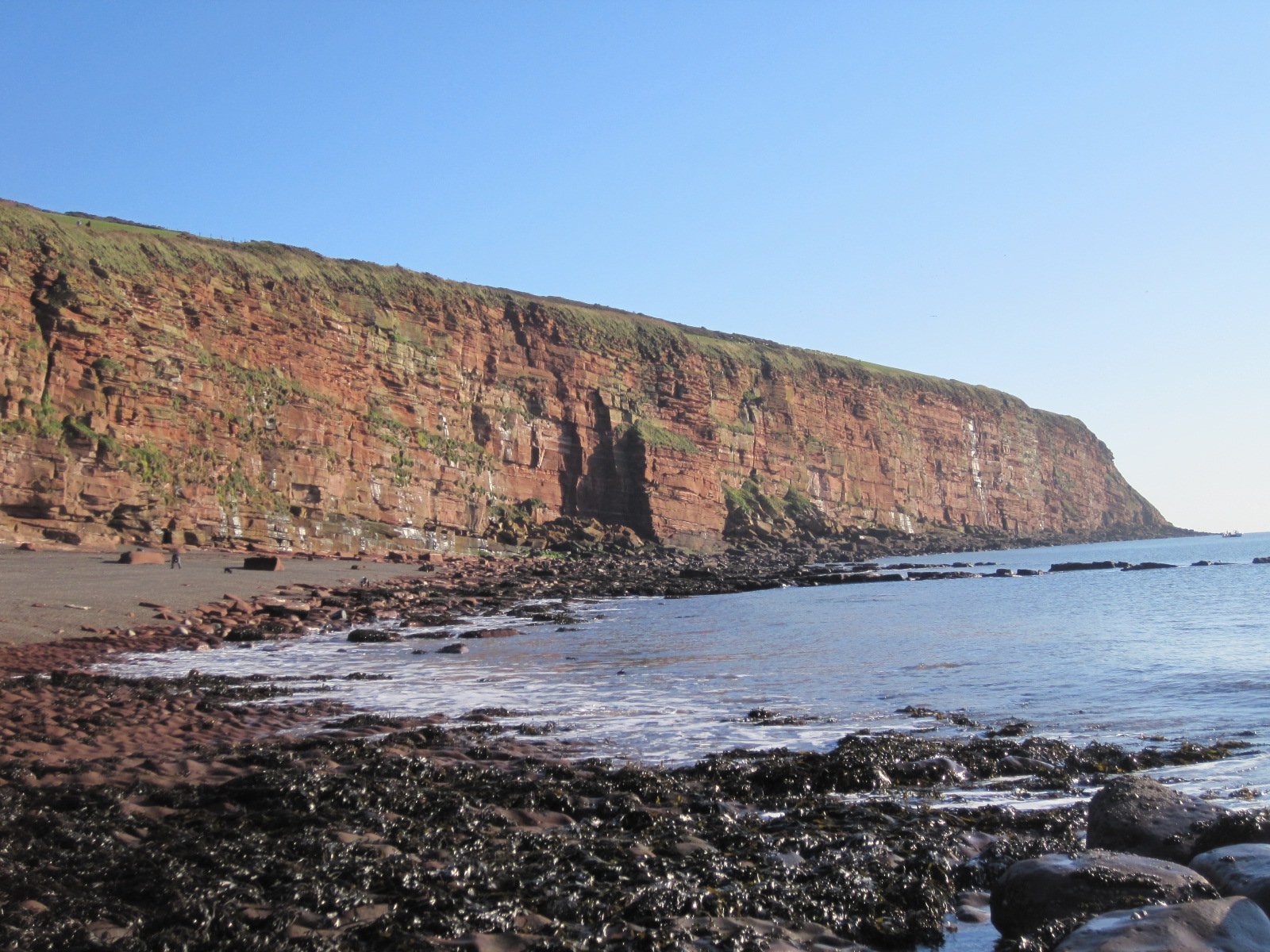
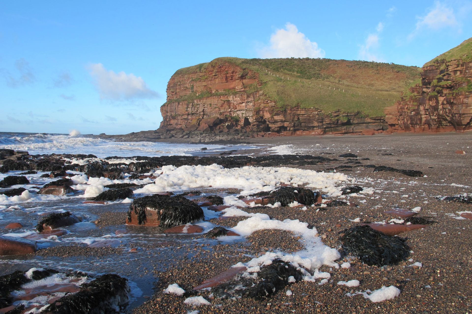
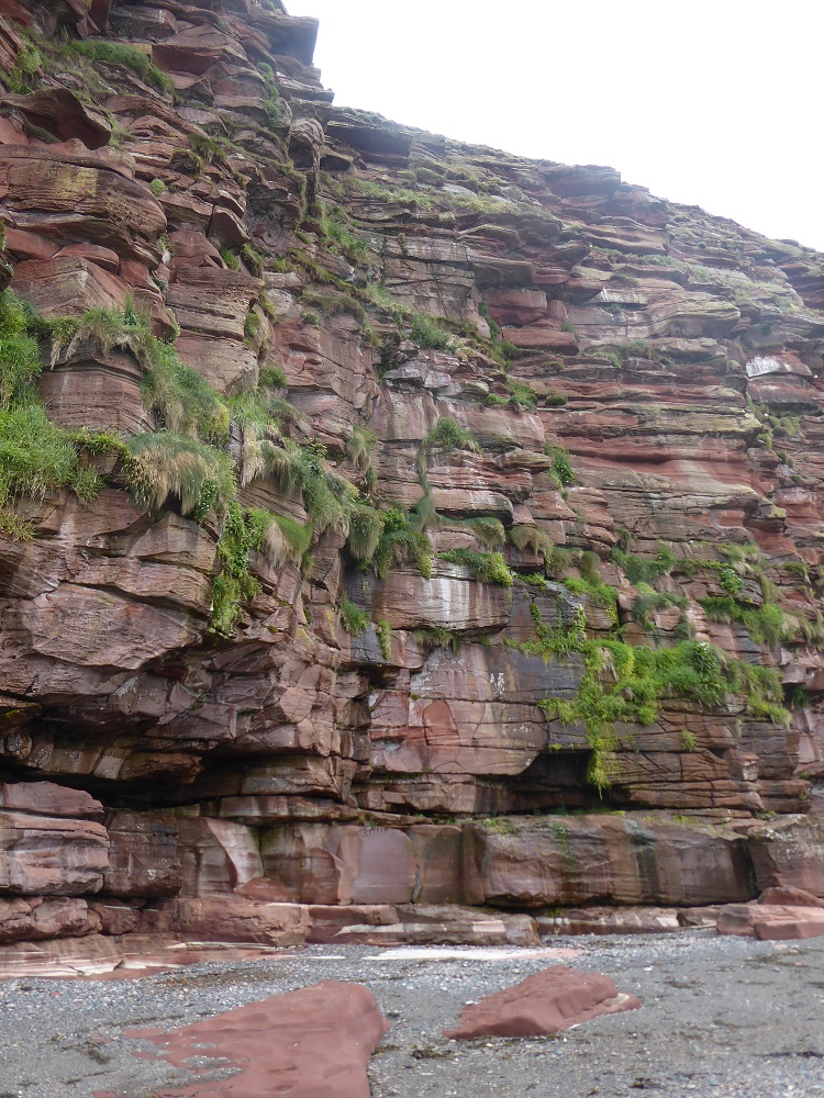
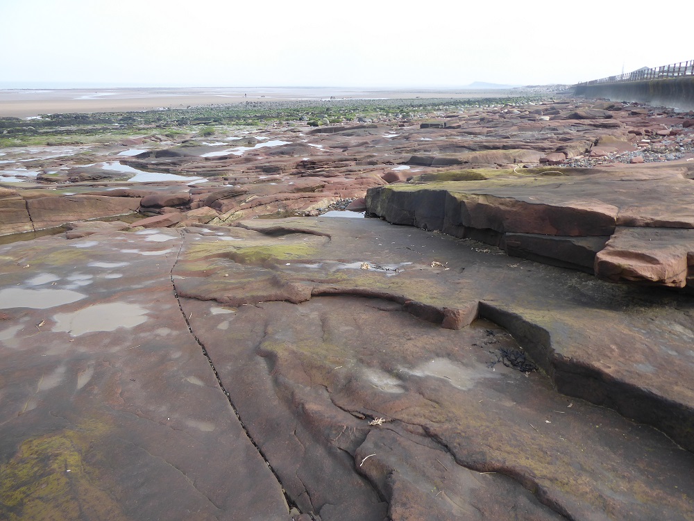
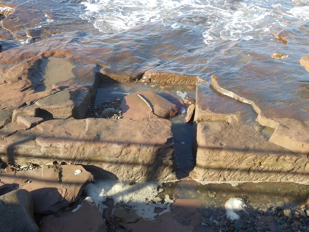
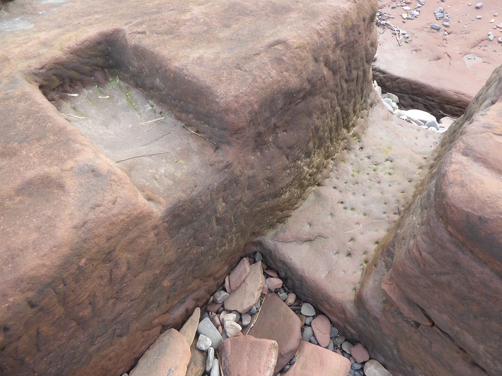
Whatever the weather or state of the tide, Fleswick Bay never disappoints. Sheltered within the two arms of the St Bees headlands, it is an anomaly on the Cumbrian Solway coast – tall cliffs, caves, rocky platforms pitted with deep Corallina-encrusted pools, and a shore of multi-coloured pebbles as smooth as ball-bearings.
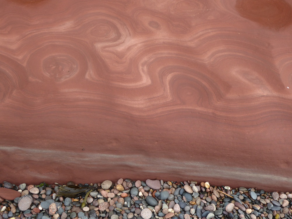
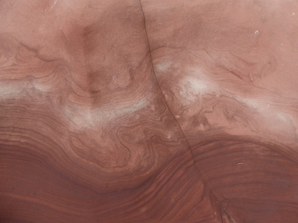
The cliffs and platforms are a breath-taking mixture of art and of the visualisation of scientific processes, as well as the desires of humans to leave their mark. Even as you lean into a wind that whips clumps of foam from the incoming waves, it’s a bay that requires close study and contemplation.
I’ve written about the New Red Sandstone of Fleswick elsewhere [1]: about the 200 million year-old deposits of sand and sediment, lifted and dumped and swirled by ancient rivers and flash-floods, compressed, lithified and eroded; about the coal-miners who worked the nearby undersea pits and who swam with basking-sharks; about the names carved into the cliffs, and especially the story of ‘Judy McKay’; about the sculptors who love to work with the stone; about the small reefs of the tubes of the honeycomb worm Sabellaria …
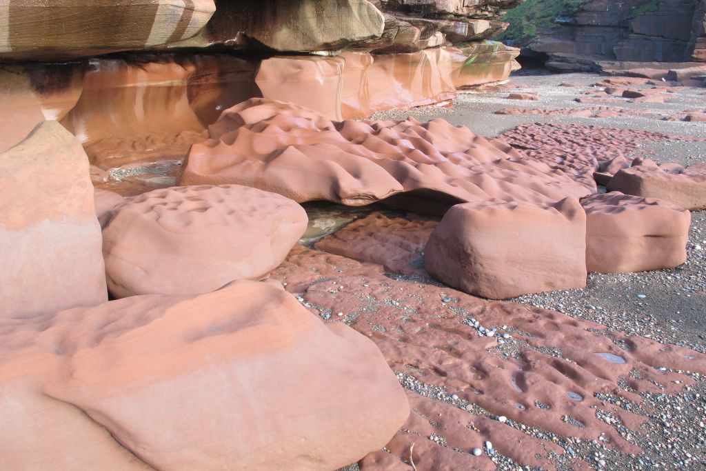
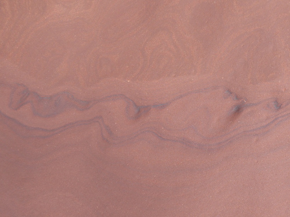
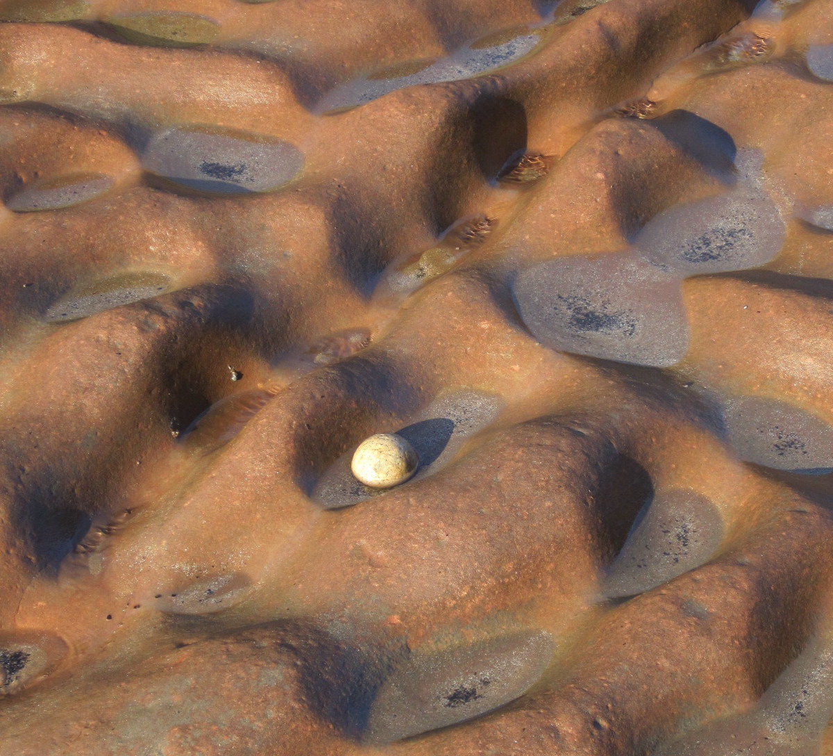
But here, instead, the pictures and the patterns speak for themselves.
Cliff and wave-sculpted pavement (photo by Peter Stanier)Sculpted rock (photo by Peter Stanier)HollowsLithified ripplesLines of reduction (where ferric iron is reduced to ferrous)
And the pebbles, so varied, so round and smooth: jasper, agates, quartz, granites and cornelian. A geographer friend, pointing out the scarcity of jetsam and sea-borne rubbish on the Bay’s tidelines, suggested that longshore drift had passed it by, and that the pebbles had stayed in situ, being rolled to and fro, to and fro, with every tide – perhaps for decades, perhaps for centuries, who knows?
There are, too, patterns made by human hands: pickmarks and names, of all which will tell their own stories; most of the stories now long-forgotten.
And nesting guillemots, cormorants and fulmars make their own patterns on the pitted shelves, their guano fertilising the ‘hanging gardens’.
Along the top of the shore between Maryport and its golf club is a high and wide promenade, constructed in the 1930s from an astonishing volume of concrete. At weekends it’s a perfect walkway for families with pushchairs, small hairy dogs, and toddlers on bikes. There are occasional slipways and steps, coated with slithery green seaweed, that allow you to reach the shore 3-4 metres below, but few people attempt the treacherous descent because so much of the shore is rocky and offers little opportunity for play. In fact a large area of the northern stretch is a fine example of a wave-cut platform [1] of New Red Sandstone; there are naturally straight-edged blocks, and channels, and the indentations of lithified ripples dating from when the rock was still in the form of sandbanks and river channels. Loose blocks are strewn on top of the platform, shunted here and there by the storms.
The sandstone platforms of Maryport foreshore, looking North
Earlier this year a geologist friend, Ian Francis (one of the authors of a recent excellent book on Lake District geology [2]), wondering if I knew what the structure was, emailed a photo of a rectangular basin that had been cut into the rock at the top of the shore, close to the base of the promenade. Of course, ‘an expedition’ was required!
‘Basin 1’, with thanks to Ian Francis for the photo that stimulated this blogpost
The tide was high but on the ebb, and complex local currents were swirling the incoming waves and sending spray shooting into the air and over the edge of the prom. We walked, and sat, and waited until the top of the rock platform was uncovered – and there below us was Ian’s rock basin (let’s call it No.1 for convenience), the sea still sloshing in and out through a narrow channel. Nearby was what could be another basin, less exactly hewn with one side partly missing; and the remnants, further off, of possibly a third. Basin No.1 was about 1.5 metres at its longest side and perhaps a half-metre deep, and partly filled with shingle and a loose slab of sandstone. As Ian had written, the basin leads “via a square-cut gutter to another wider half-basin cut parallel to the sea wall. Only the seaward edge of this larger area is extant. There are cuttings in the basin edge just behind the gutter which look like the supporting beds for some sort of cross-beam.”
Basin 1Basin 2Basin 3
The basins looked to me like storage containers for shellfish – for sacks of crabs or winkles, perhaps. I put my own photos on Twitter and someone local tweeted a comment that they were to do with salt manufacture, probably the Netherhall or ‘Bank End’ saltpans owned by the Senhouses and functioning from 1650-1735. (When I was on the prom, trying to photograph the basins on a later visit, an elderly man stopped to ask if I was “looking at the saltpans”.) But the basins seem too small, even for storing seawater and are certainly not ‘pans’ where brine was concentrated – see the post about the Crosscanonby saltpans elsewhere on this blog).
Another regular Twitter contributor, Paul Montgomery, [@stonefishweirs] kindly emailed me a couple of pdfs about saltworks. One of these articles, on salt production in post-medieval Ireland, is an archaeological investigation of the basins cut into the rocky shore, and related remains, in the Ballycastle region, on the north coast of Northern Ireland [3]. But these Irish basins are considerably larger than the Maryport ones – for example, one is about 6 x 4 metres and about 2 metres deep – so were able to contain a large volume of seawater, which could be transferred to the metal pans onshore and evaporated by burning coal from the local mines.
I also sent photos to my archaeologist friend, Mark Graham of Grampus Heritage, who has done a considerable amount of work researching saltworks on the Cumbrian Solway coast. He suggested I got in touch with Andrew Fielding, one of the Directors of EcoSal-UK, an organisation engaged in ‘Preserving the history and heritage of traditional salt making’ [4]. I had watched Andrew’s webinar, Salt on the Solway (organised as part of the Coastal Conversations series by the Solway Firth Partnership and Solway Coast AONB [5]) back in autumn 2020. In that webinar Andrew too mentioned the Senhouses’ Netherhall Saltworks at Bank End, Maryport – the stone ‘basins’ had been identified as being part of the Netherhall works and had been the subject of a training day in survey methods run by CITiZAN (the Coastal and Intertidal Zone Archaeological Network) in July 2016 [6].
Andy Sherman, CITiZAN’s Discovery Programme Officer based in Liverpool, replied to my email, explaining that they had indeed had a session recording and measuring the rock basins, which were ‘noted by the local Historic Environment Record as being part of a saltworks’. The report included the measurements of the ‘No. 1’ basin, and some photographic observations. Andy suggested that ‘the majority of structures associated with this site were damaged or destroyed by the construction of the promenade’.
After I got in touch with Andrew Fielding, he wrote me several very interesting and helpful emails. I learnt, for example, of a Dr William Brownrigg (1712-1800) of Whitehaven, who had written a book on The Art of Making Common Salt, and who had been born at High Close Hall, Plumbland (possible the existing High Close Farm), near to where I live! Andrew says “Bank End is an intriguing site that no one yet has properly interpreted. … I think that it is likely that the remains in the rock at Bank End are only the bottom portion of features associated with the salt works and that there may also be remains still existing inland of the promenade. Some have suggested that Bank End Farm may also have been part of the salt works.”
The promenade is a mighty structure, nearly a mile long, about 5 metres wide and in places 3-4 metres high above the shore, and was apparently built during the war; even imagining the process of its construction takes some effort! Jane Laskey, Manager of the Senhouse Roman Museum, had been looking at documentation about the supposed Bank End saltworks, and she too thinks that important structures were buried when the prom was built.
With regard to the rock basins themselves, comparison of photos taken by Ian Francis, CITiZAN, and my own photos taken on two different occasions, shows the difficulty of finding and interpreting the basins and the channels on the shore. Pebbles and sand shift and fill in the hollows, revealing structures to different extents at different times.
Basin1, low tideBasin1, channel and troughsBasin1 pickmarks
‘No. 1’ is the nearest and clearest basin to examine. Its sides are pocked, hatched and cross-hatched with pick-marks; there are the two short troughs on the side that has the square-cut entrance gully, into which a gate or sluice might have been slotted, trapping seawater within the basin. The entrance gully opens into a channel cut parallel with the prom wall; on my second visit this had become much more obvious as it was now clear of pebbles, and its face, too, was pitted with the marks of the axes that had chipped away the sandstone.
Basin2 and possible channelBasin2Basin3 pickmarks
A few metres away is ‘No.2’ basin, slightly larger and with one wall apparently missing. Its opening empties into what looks like a channel that heads directly down towards the seaward end of the rocky platform – but it’s hard to be sure whether this is man-made or a natural gully in the stone. A little further away are traces of perhaps a third basin. As Andrew Fielding said, the site needs “another look”.
But are the basins really associated with salt-making? As a zoologist and ‘shore-guddler’ I still hope that the basins were used as temporary storage tanks for shellfish. Such things do exist. One evening, an email arrived from Mark Graham, who was camping over on the Northumberland coast: he sent a photo of an information panel from the top of the shore at Creswell where, he said, “I have just been reading about ‘Bratt Holes’, sometimes written ‘brat holes’. I believe that these are the best parallel I’ve seen for the rock cut basins near Maryport and were used to store crabs, lobsters, shellfish….” ‘Bratt’ is apparently a local word for turbot.
‘Bratt holes’. My thanks to Mark Graham of Grampus for this interesting photo
***
Postscript: there is a shallow basin (a few centimetres deep) cut into the rock at the top of the shore at Parton. Now, what could that one be for?
Ian Francis, Stuart Holmes & Bruce Yardley (2022). Lake District: Landscape and Geology. Crowood Press
Wes Forsyth, Rosemary McConkey & Colin Breen (2018) Persistence and risk: salt production in post-medieval Ireland, World Archaeology, 50:4, pp 603-619. To link to this article use https://doi.org/10.1080/00438243.2018.1487878