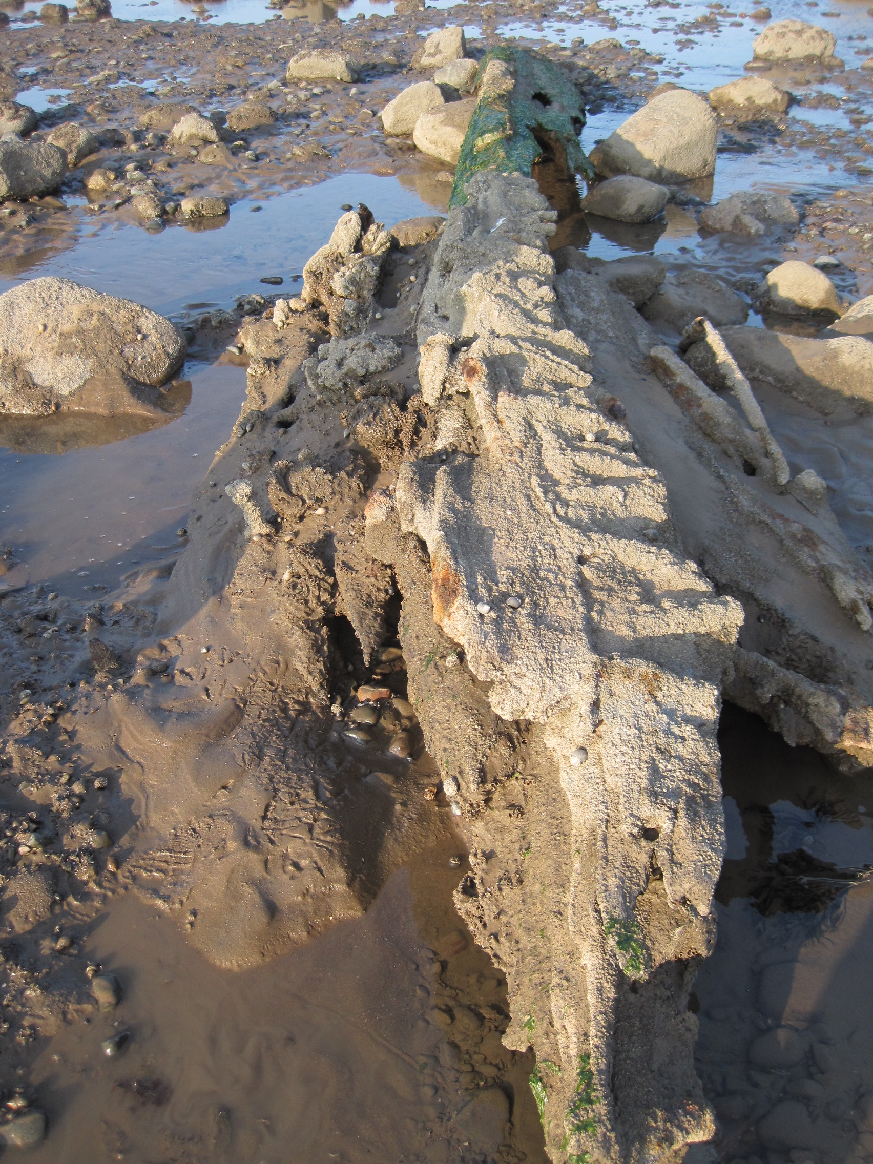
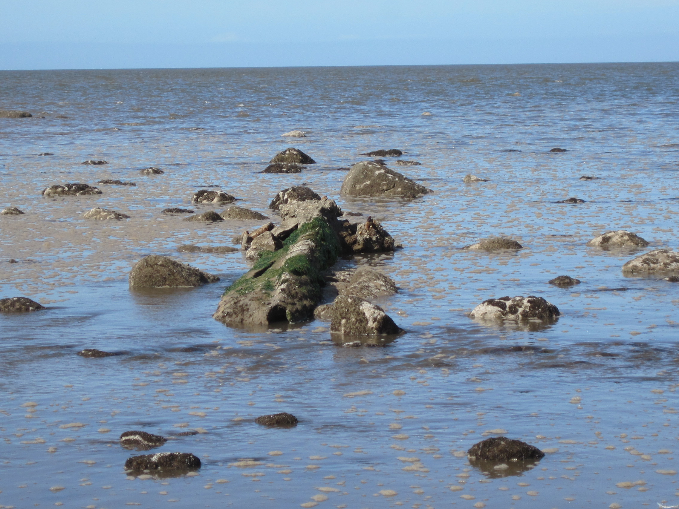
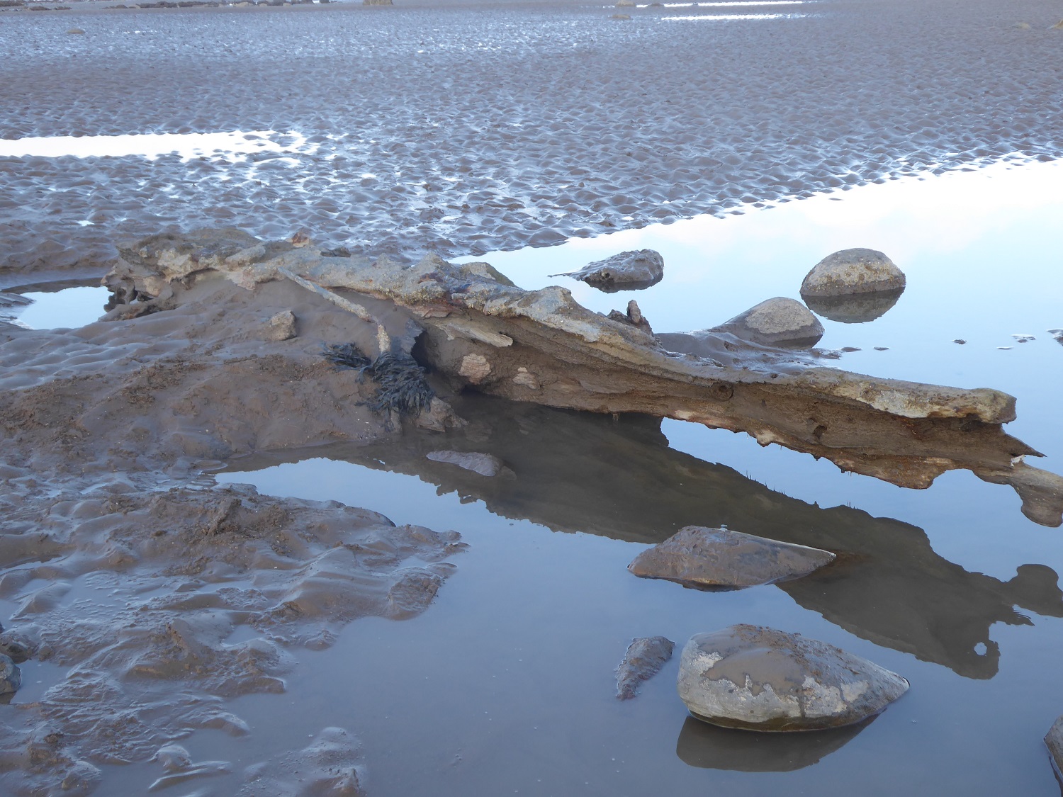
Back in 2015 near Dubmill Point on Allonby Bay I finally found what I’d been searching for: the ‘ship’s keel’ for which Ship’s-Keel Scaur is named.
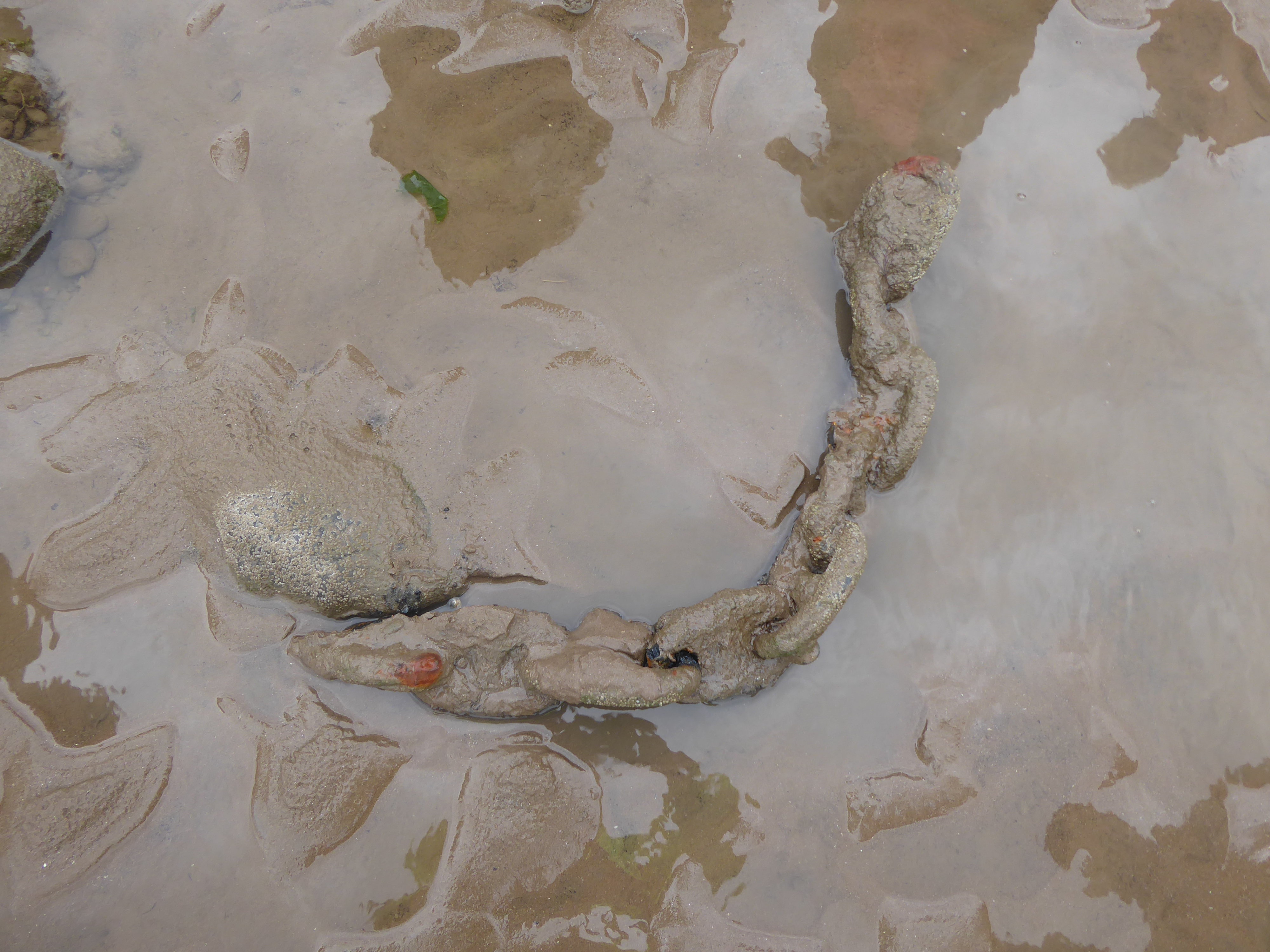
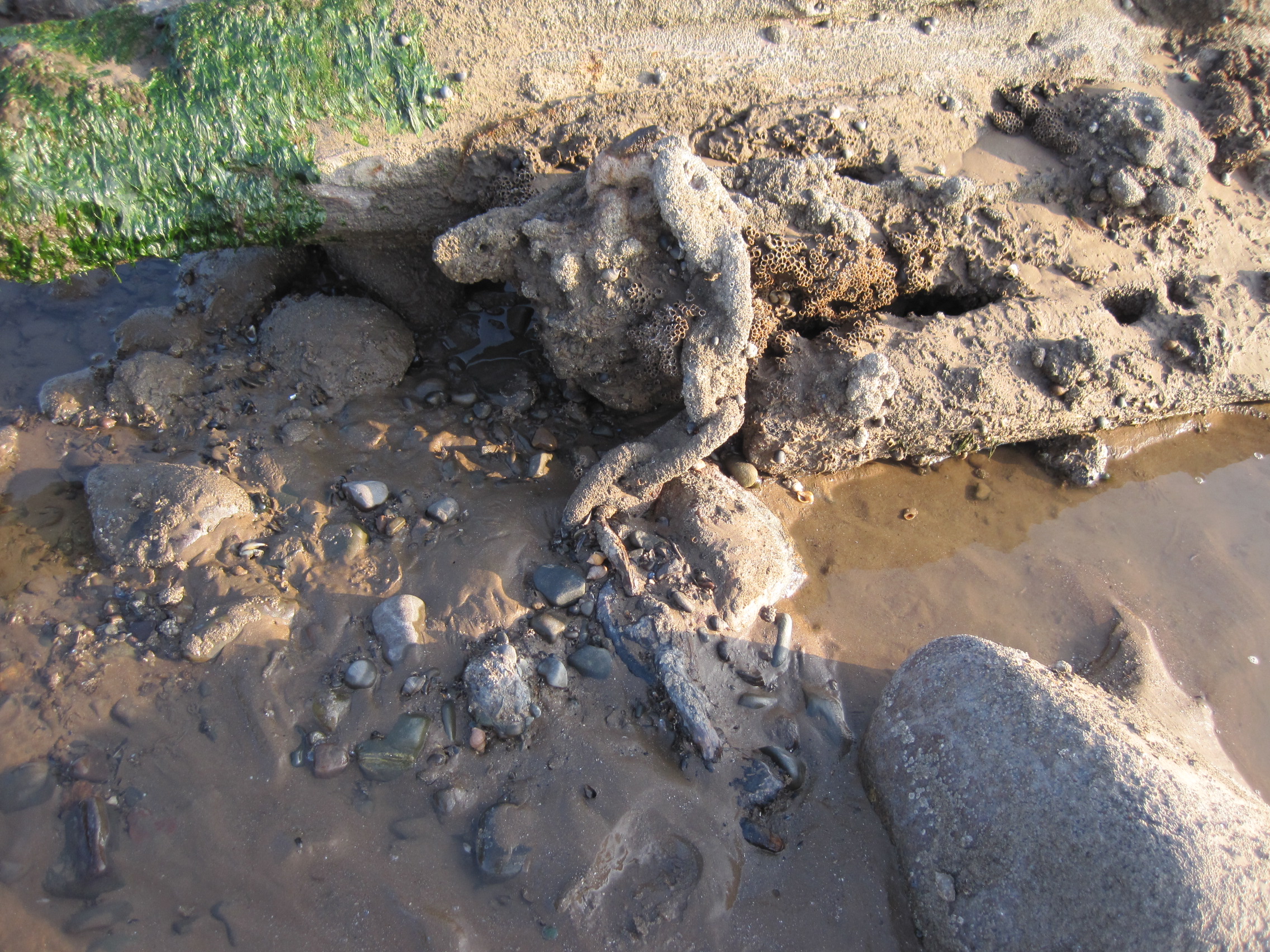
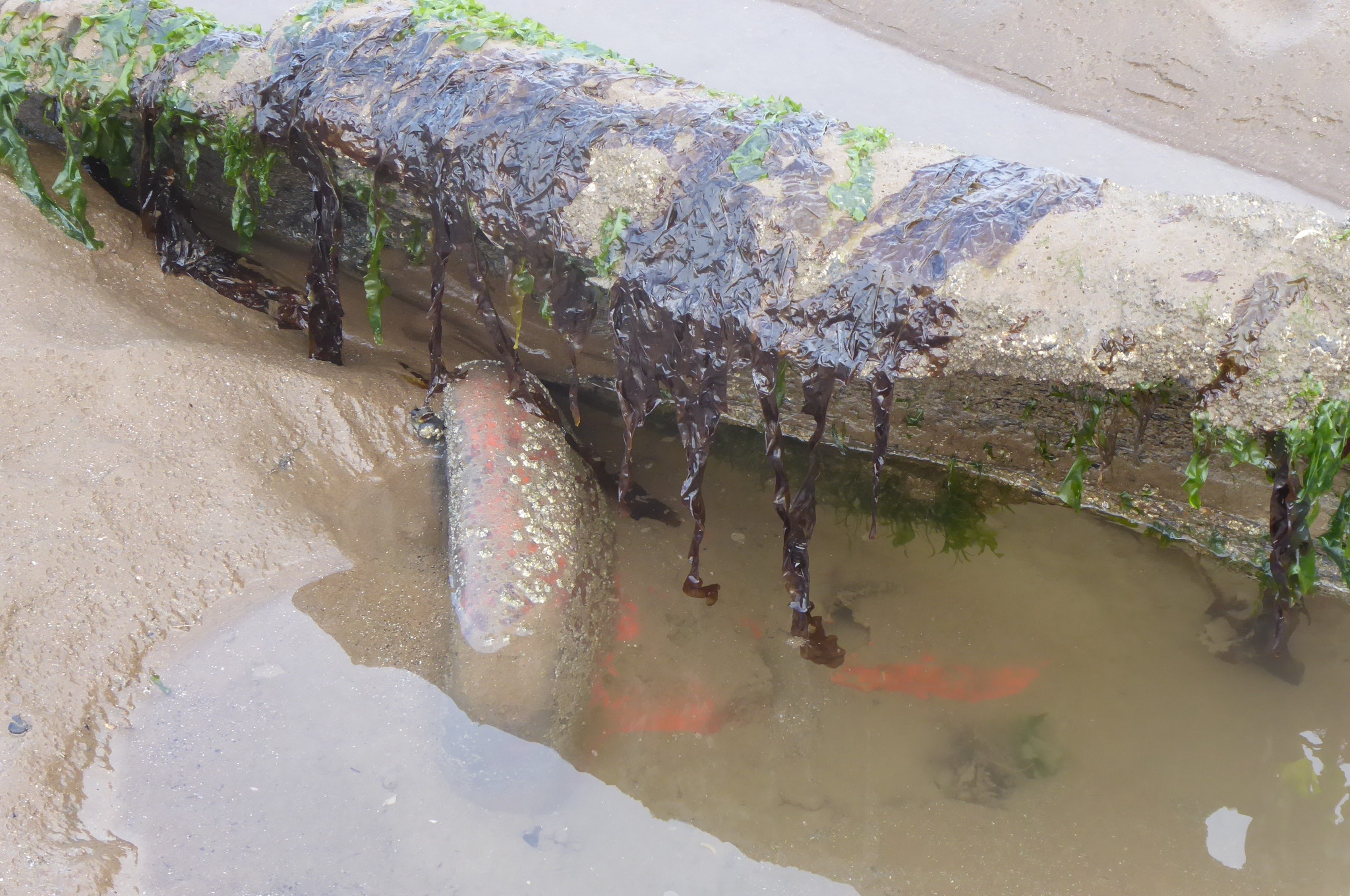
Its timbers were as hard as iron, the keel (if that is what it was – its profile had been much transformed, holed and distorted and overgrown) was home to a variety of marine species, a microcosm of the animals and algae on the shore. Sandy tubes of the honeycomb worm, Sabellaria; mats of barnacles; a few limpets; grazing winkles; predatory dog-whelks, which had laid mats of their orange vase-shaped eggs under overhanging timber; beadlet anemones, Actinia; green Ulva algae. Footprints in the sand showed that wading birds had been sheltering in its shadow.
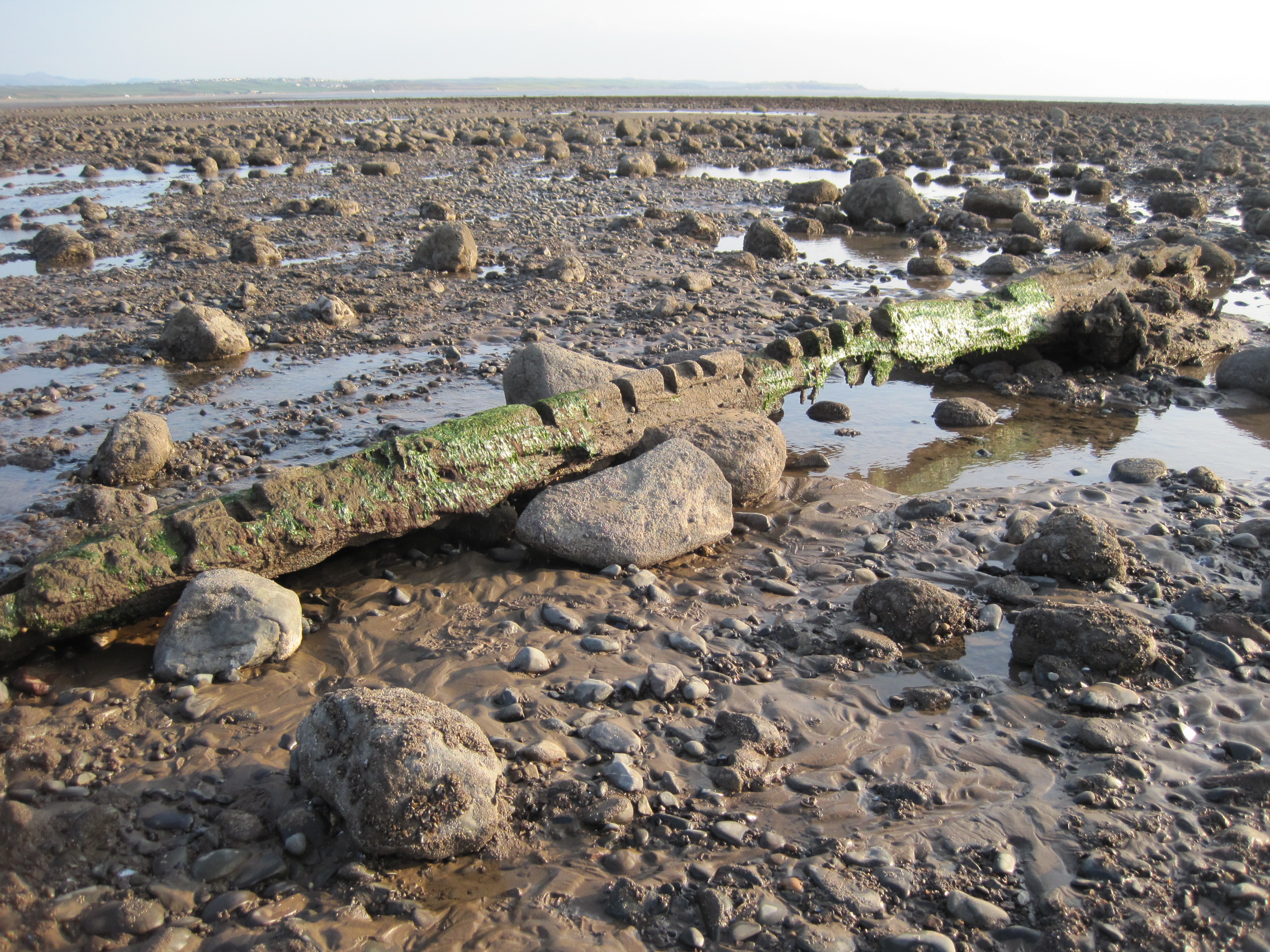
Although 6 or 7 metres long, the keel blended into its surroundings on the scaur, providing yet another stable surface against the shifting sands; its encrusted chain bled oxidised iron.
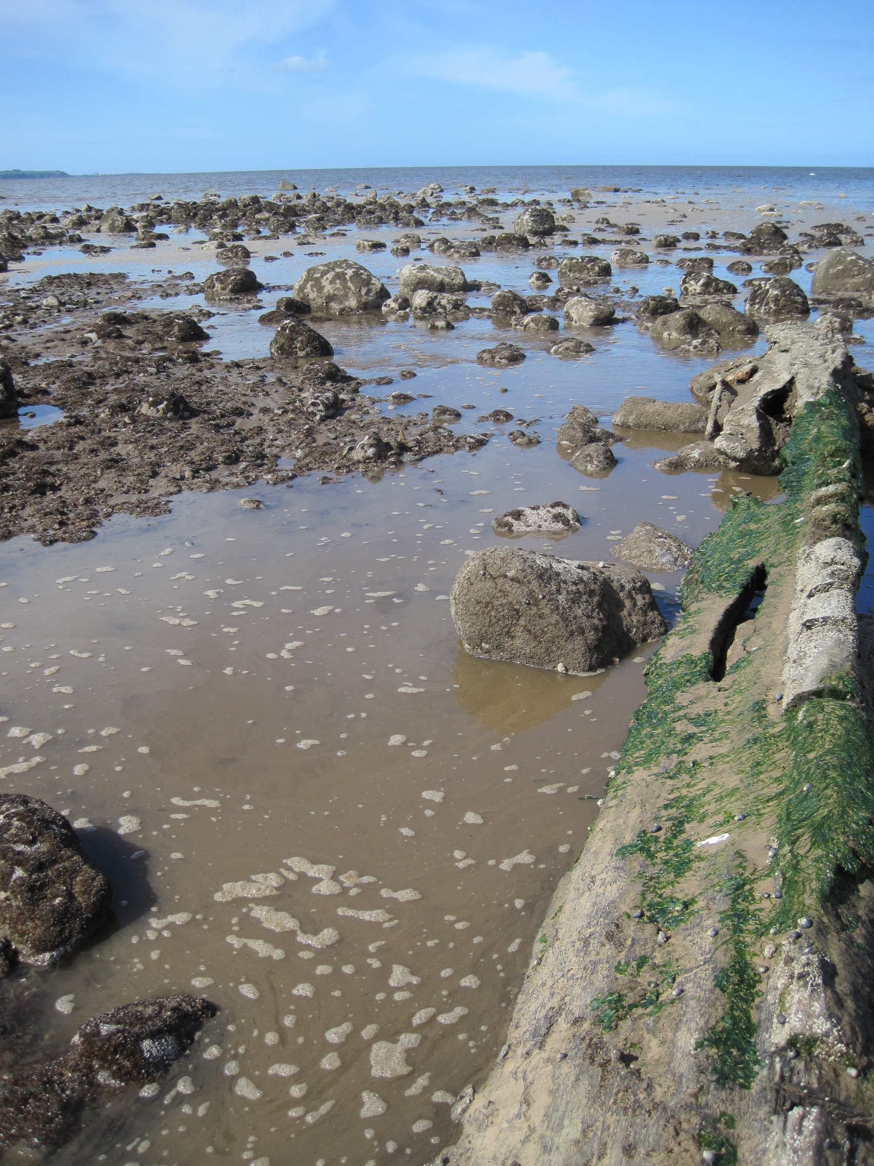

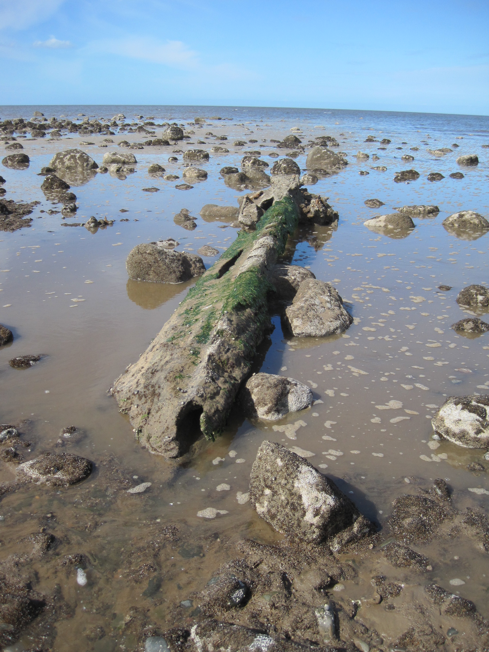
I went back later in 2015, on a ‘big tide’in June, to examine it more closely, and soon had to retreat as the water rose quickly and quietly around it. In less than 15 minutes the keel was invisible beneath the sea.

Allonby Bay is infamous as a place where ships wrecked on the Solway’s sandbanks – and their contents – have come ashore; it was also the site of a business in ship-breaking in the late 19th and early 20th centuries. I have written about this, and suggestions for the origin of the ‘ship’s-keel’, elsewhere on this blog, and in more detail in chapter 3 of my book The Fresh and the Salt.
I’ve returned to the wrecked timbers and chain several times over the past years and I wanted to record here a pictorial time-line of their gradual break-up. When the wreck finally vanishes, an unexplained piece of the history of this coast and the Solway Firth goes with it.

Later that year…
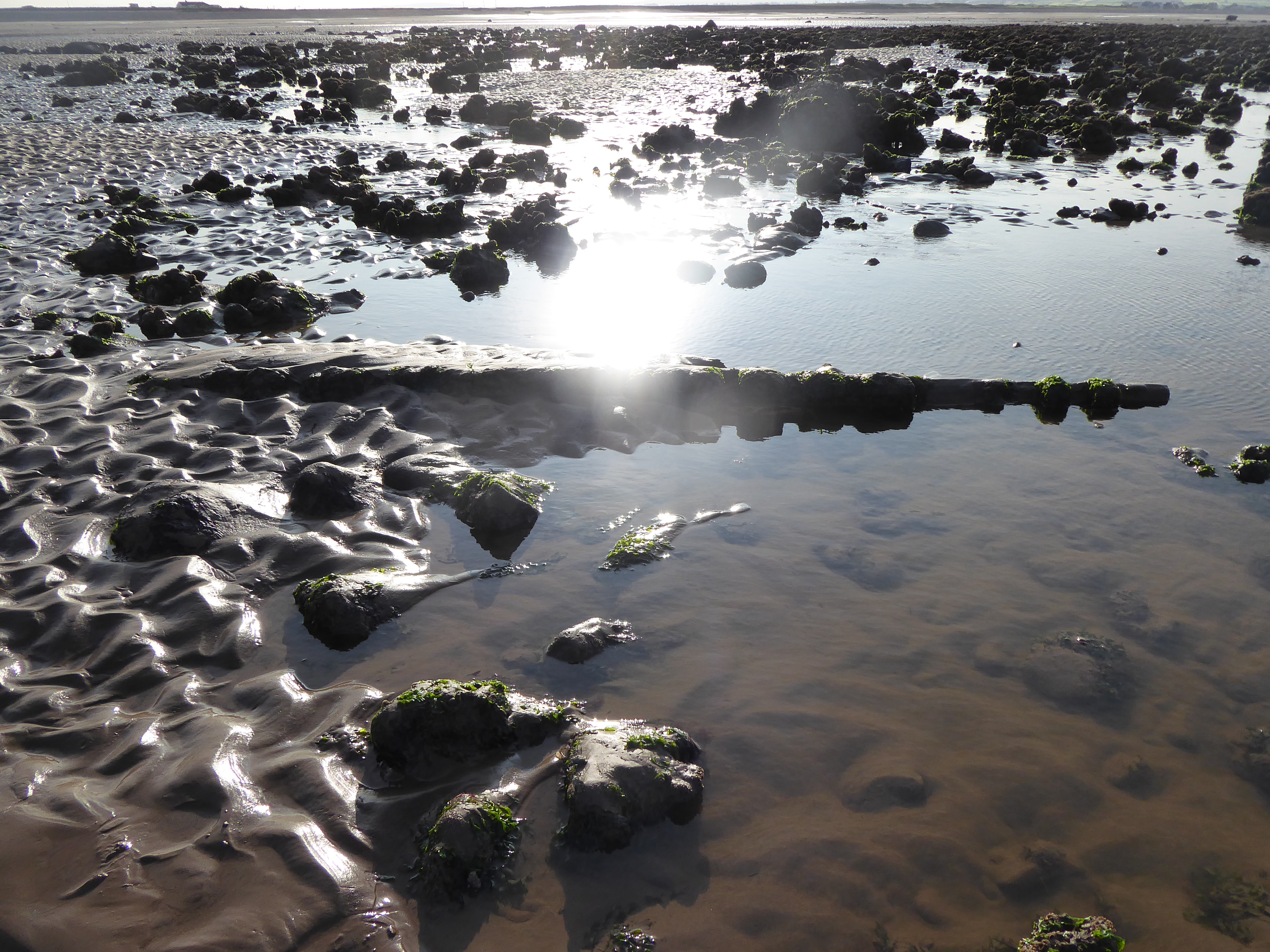
One year later, 2019, and the profile of the shore has dramatically changed as sand has been swept up from further West and deposited over the rocks. Where is the Scaur? Ship’s-Keel Scaur and its glacial origins are barely recognisable. The wreck is almost buried; but the traffic cone has re-appeared.
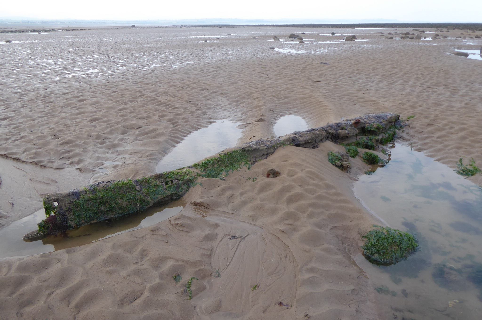
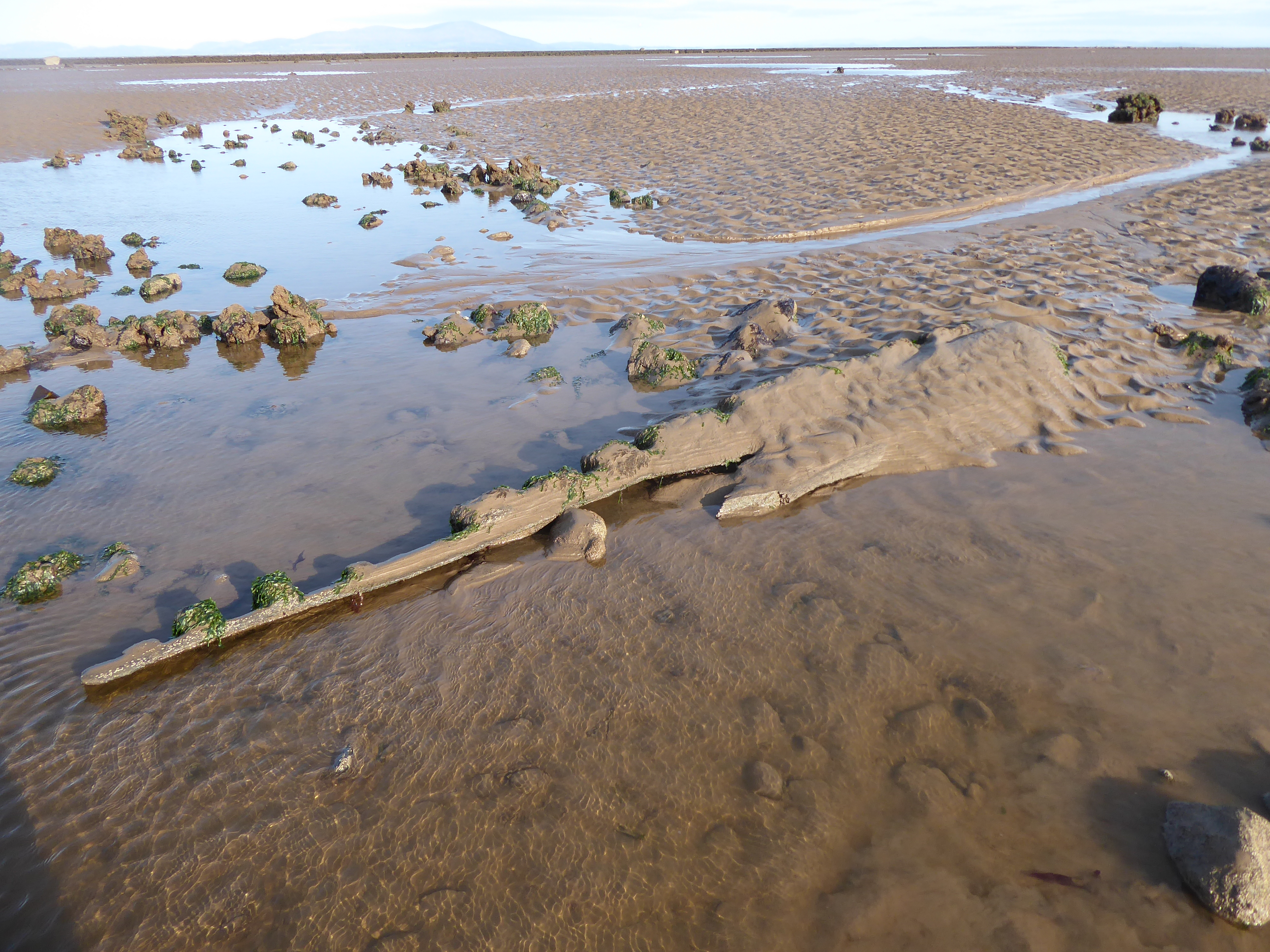
The first year of the pandemic, and we are sometimes locked down. When I re-visit the shore in September 2020, sand has shifted yet again, and some of the Scaur has been re-exposed. But the ‘Ship’s-Keel’ is barely a memory of its former self. There is no sign of the chain; the encrusting and sheltering algae and animals have almost vanished from this now inhospitable former home.
I look for it again in the autumn of 2021, but the shore has changed so much that I can’t find my usual ‘land-marks’, and can’t locate the Scaur or the wreck. I suspect the remains have vanished entirely, and soon no-one will remember the reason for this Scaur’s name.
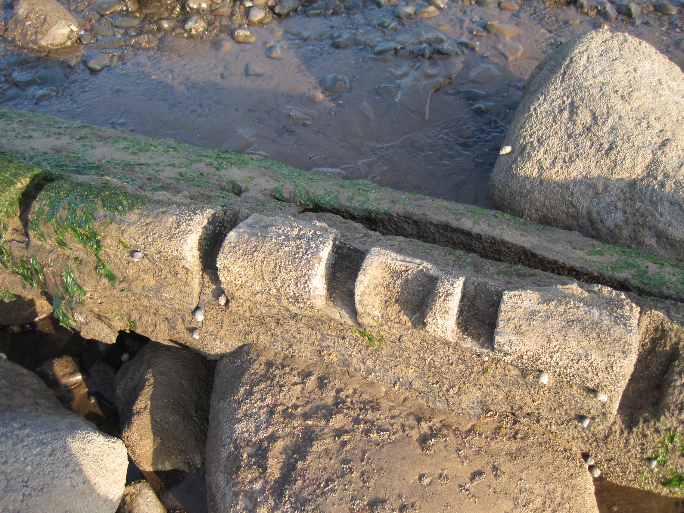
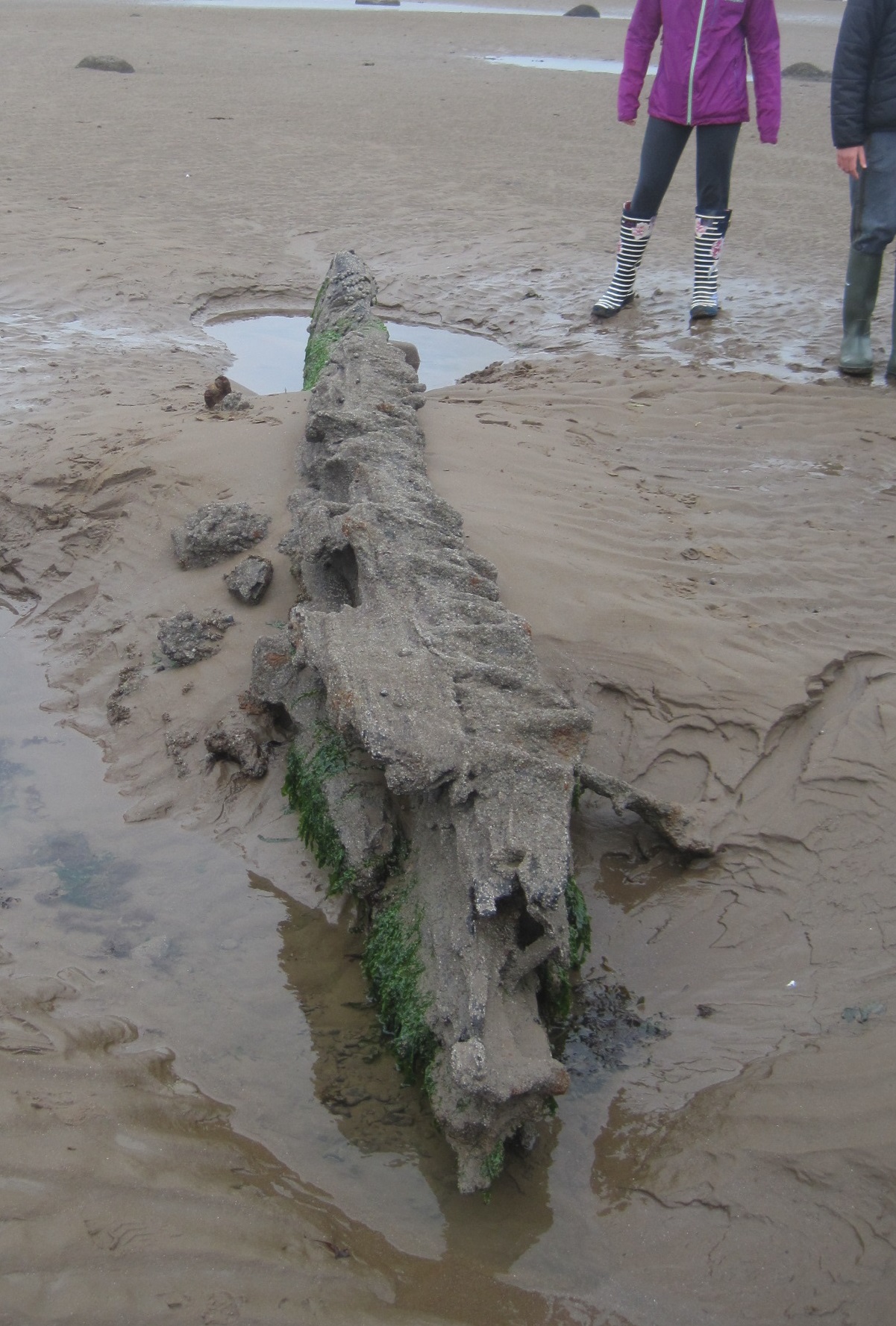
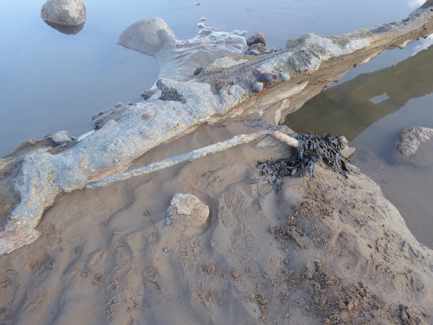
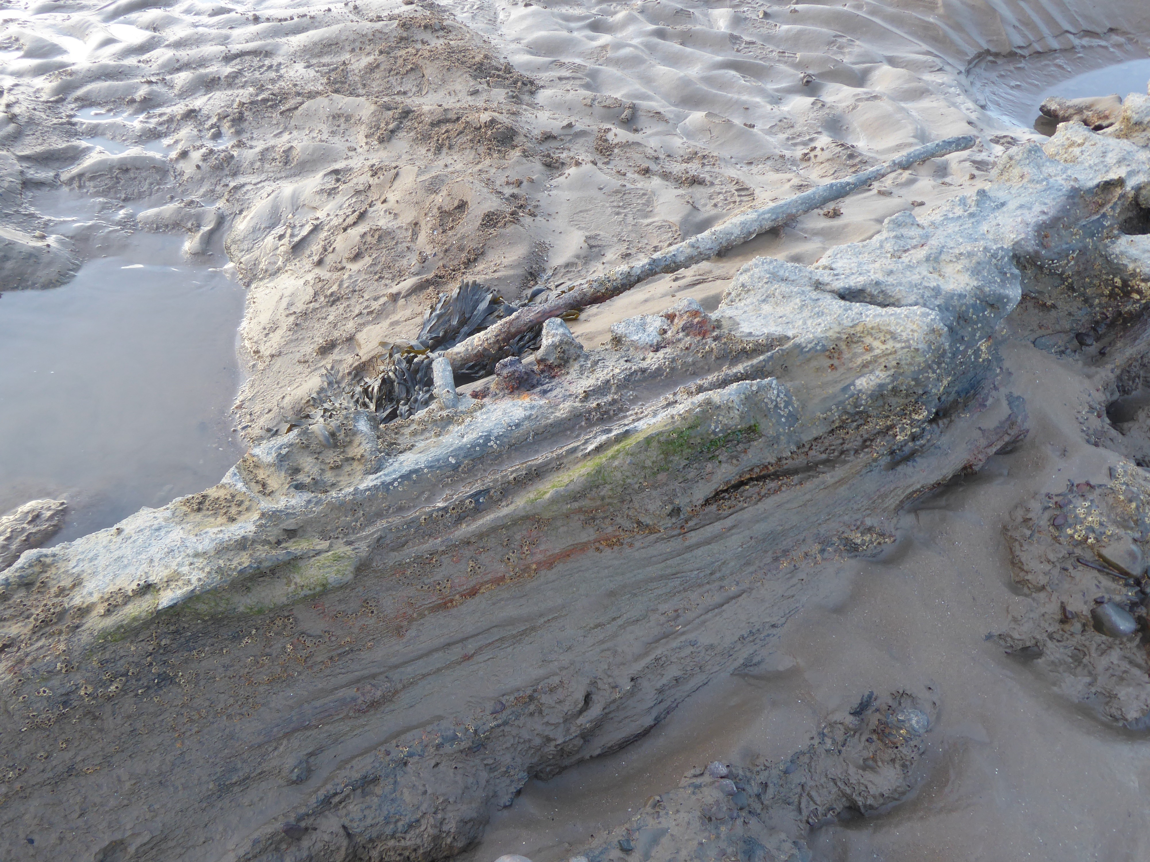
But then, on April 19th 2022, I did my first low-tide guided shorewalk for about 2 years – and although the rocks of the Scaur weren’t obvious, the morning sun was catching the long, low shape of solid mass. And although it was much reduced, there again was the ‘ship’s keel’! It looked very different. It seemed to have been tilted to reveal much more metal-work than before – a long rod, and a metal band along the top surface. A few Sabellaria worms had built a small colony of tubes – but the former rich habitat had been scoured and depleted. Nevertheless, it was good to re-discover ‘an old friend’.

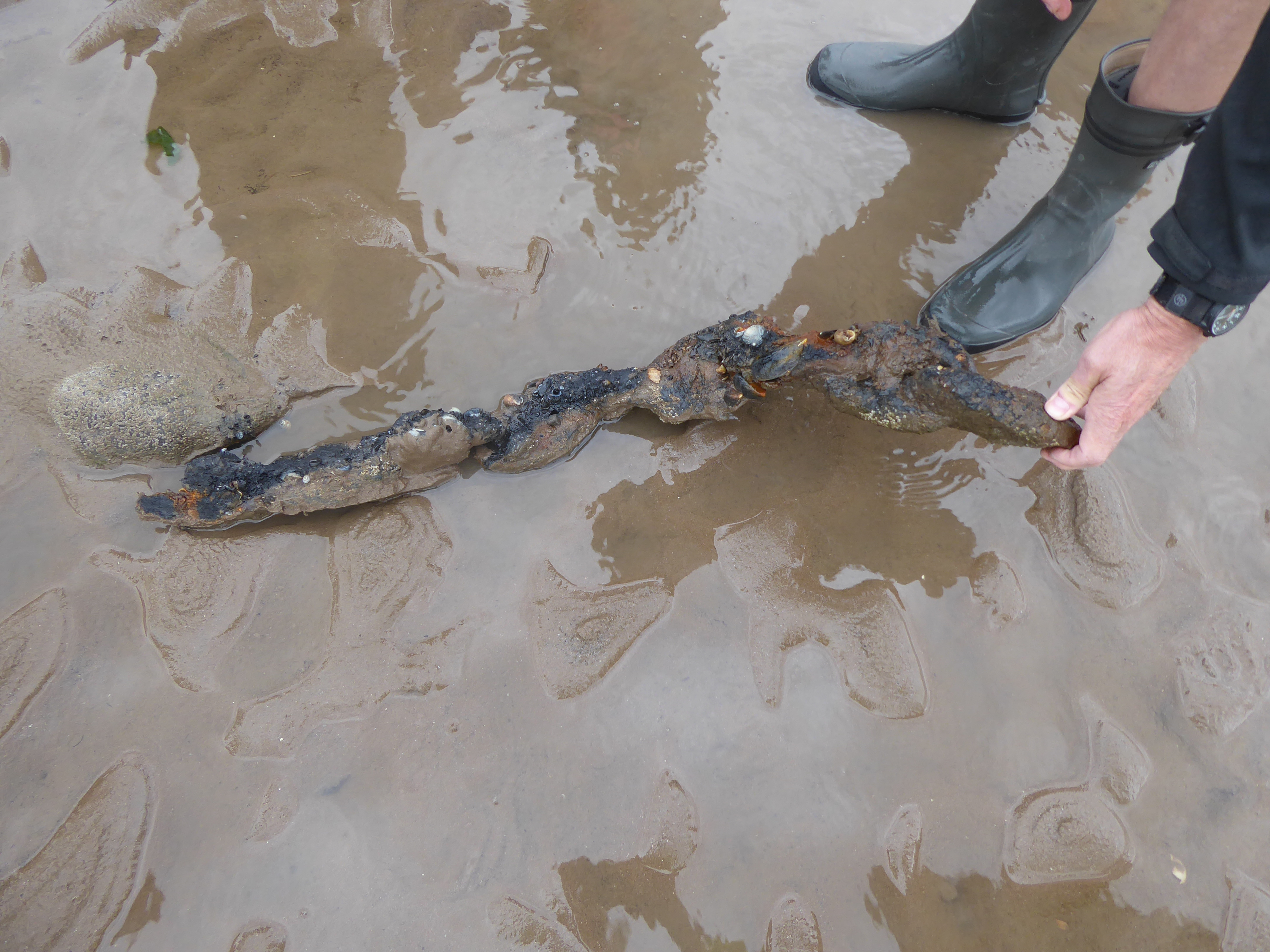
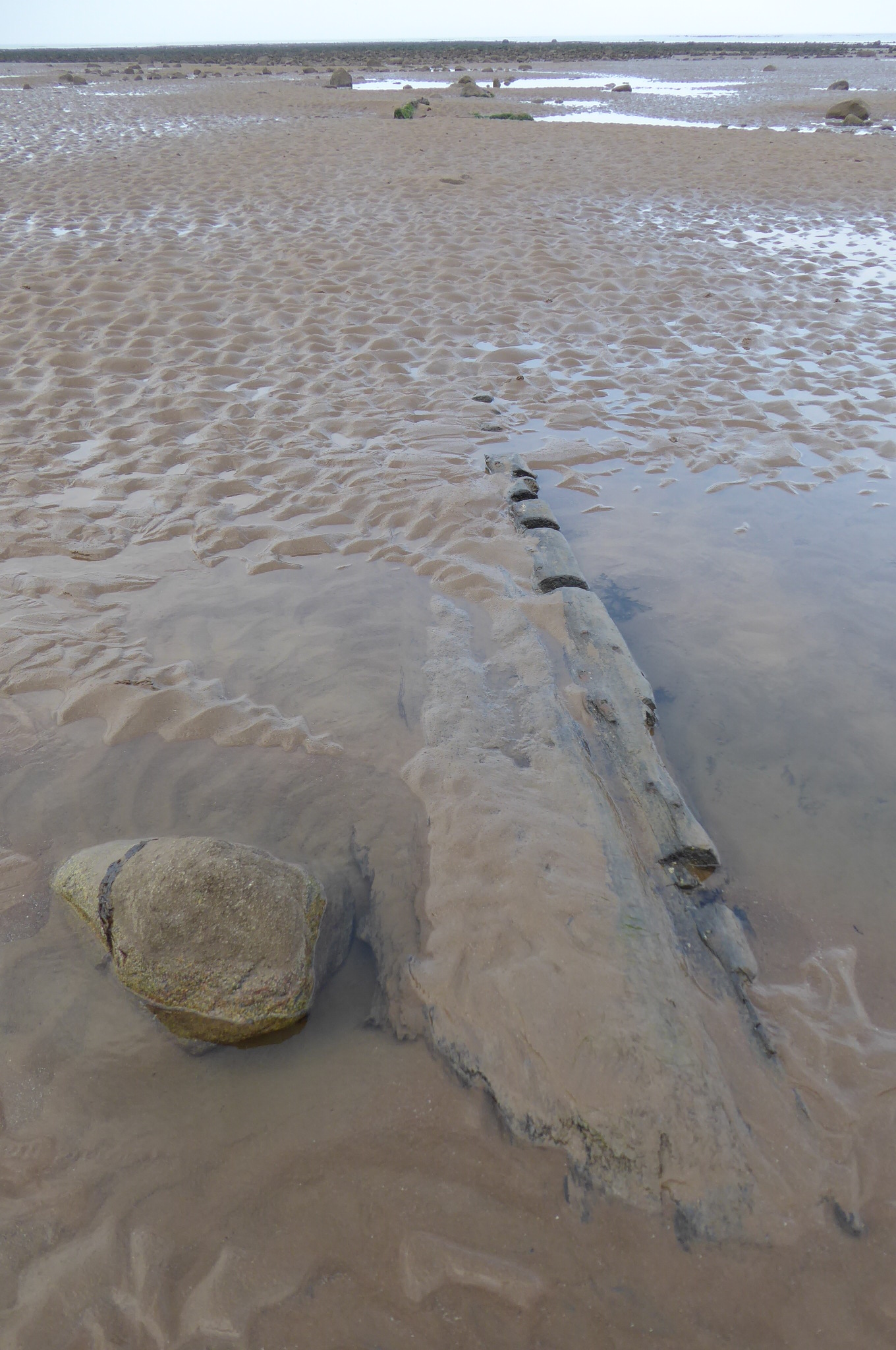
In July 2022, we rediscovered the chain, now separated from the hulk by several metres. And on my most recent guided shorewalk, in August 2022, the chain was still there, part-buried in the sand, but its rusted links – encrusted with long-dead shells – were still free to move when the chain was lifted free. We buried it again, in the hope that it will stay near the timbers it once helped anchor.