
A local Cumberland councillor, who sits on the Board of the cross-border Solway Firth Partnership, often refers to the Cumbrian coast as being the ‘soft side’ of the Firth, in contrast to the rockier Scottish, side. And once you have travelled North-East from Maryport, the softness and malleability of the Cumbrian coastline is very apparent: shingle slides into sand, which slips into mudflats, backed by dunes or saltmarshes.
During high spring tides and stormy weather, the brown, sediment-laden waves pound against the margins, shifting the sand, gnawing at the mudflats and pummelling the edges of the saltmarshes. Year by year – and more so now that ‘extreme’ weather events are occurring – the border between land and not-land is shifting. The coast road from Maryport to Silloth is continually being threatened, and is sometimes closed to be cleared of pebbles and seaweed or – in the worst cases – have its seaward side shored up. The loss of the coast road is a major inconvenience; the potential loss of houses and shops a disaster for human lives and livelihoods. So how can they be protected from the force and height of the water?
Mangrove swamps would be effective and a very pleasant and interesting addition to the Solway coast … but meanwhile saltmarshes certainly do their bit to dissipate the force of the waves. Leaving aside these natural (and importantly, carbon-sequestering) coastal defences, the usual answer is ‘hard engineering’, the construction of unnatural defences using concrete or rocks.
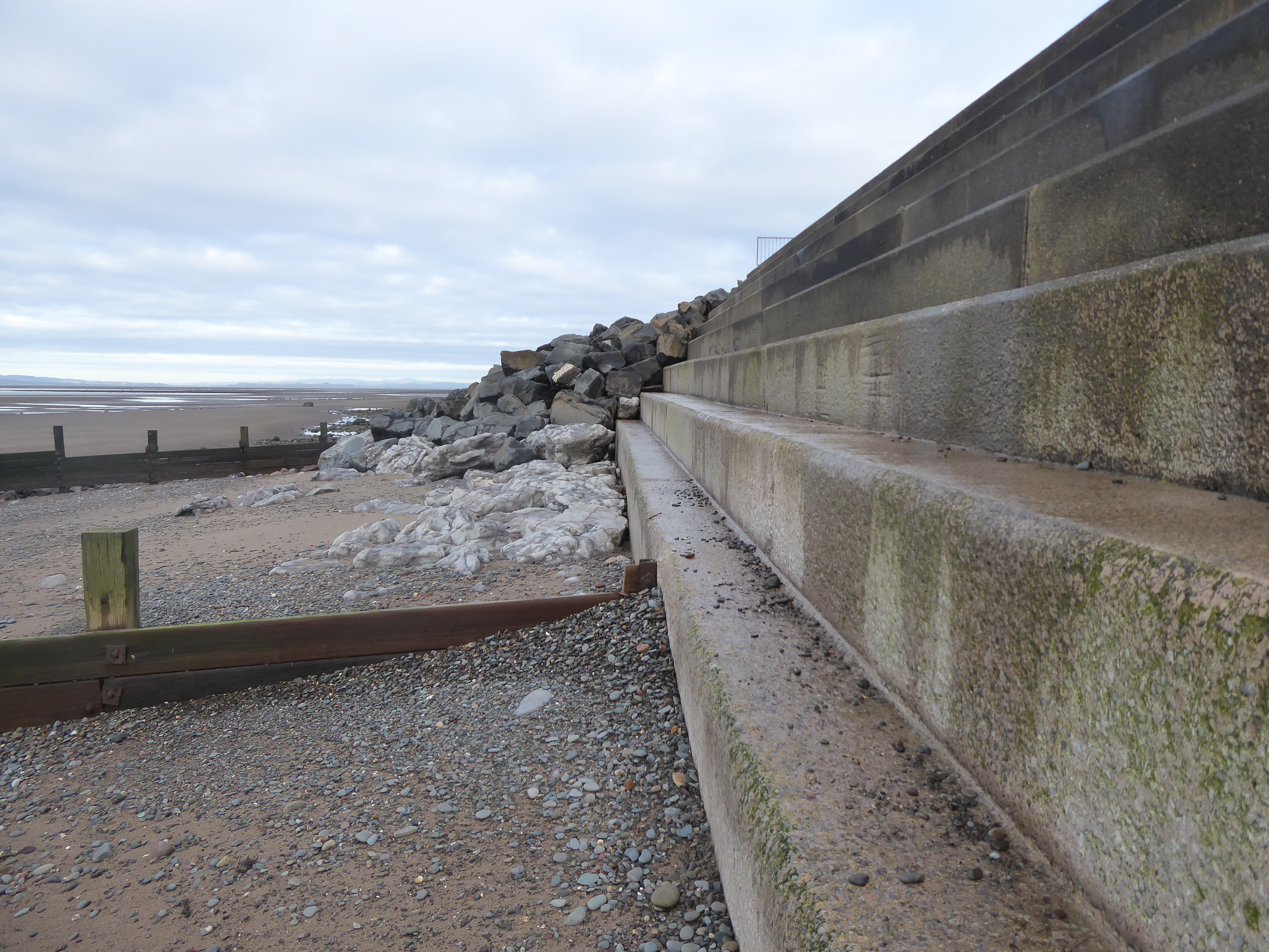
Around the British archipelago’s coast, horrifyingly large volumes of cement, requiring massive costs in quarrying, crushing, transport and the use of energy have been poured and moulded into various types of defensive wall to hold back the sea. Some of these constructions are more effective than others, as illustrated in a simple set of experiments in a wave tank by researchers at the Jeremy Benn Pacific Trust (JBA Trust). In the video, which is on YouTube, the researchers set up different shapes of hard engineering at one end of the tank, and then measure the volume of water that has overtopped the defences after 5 waves. For example, for a ‘beach with a sea wall’, the overtopping volume is 50ml; for a wall with a sloped revetment, like the new concrete defences at Dubmill Point, considerably more – 125ml;
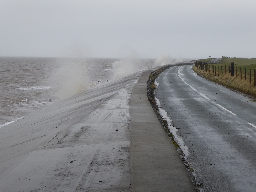
The sloped concrete revetment by Seacroft farm, Dubmill Point, during a stormy high tide
for a wall with a stepped revetment – just like the steps on the long promenade at Silloth (see below) – 100 ml.
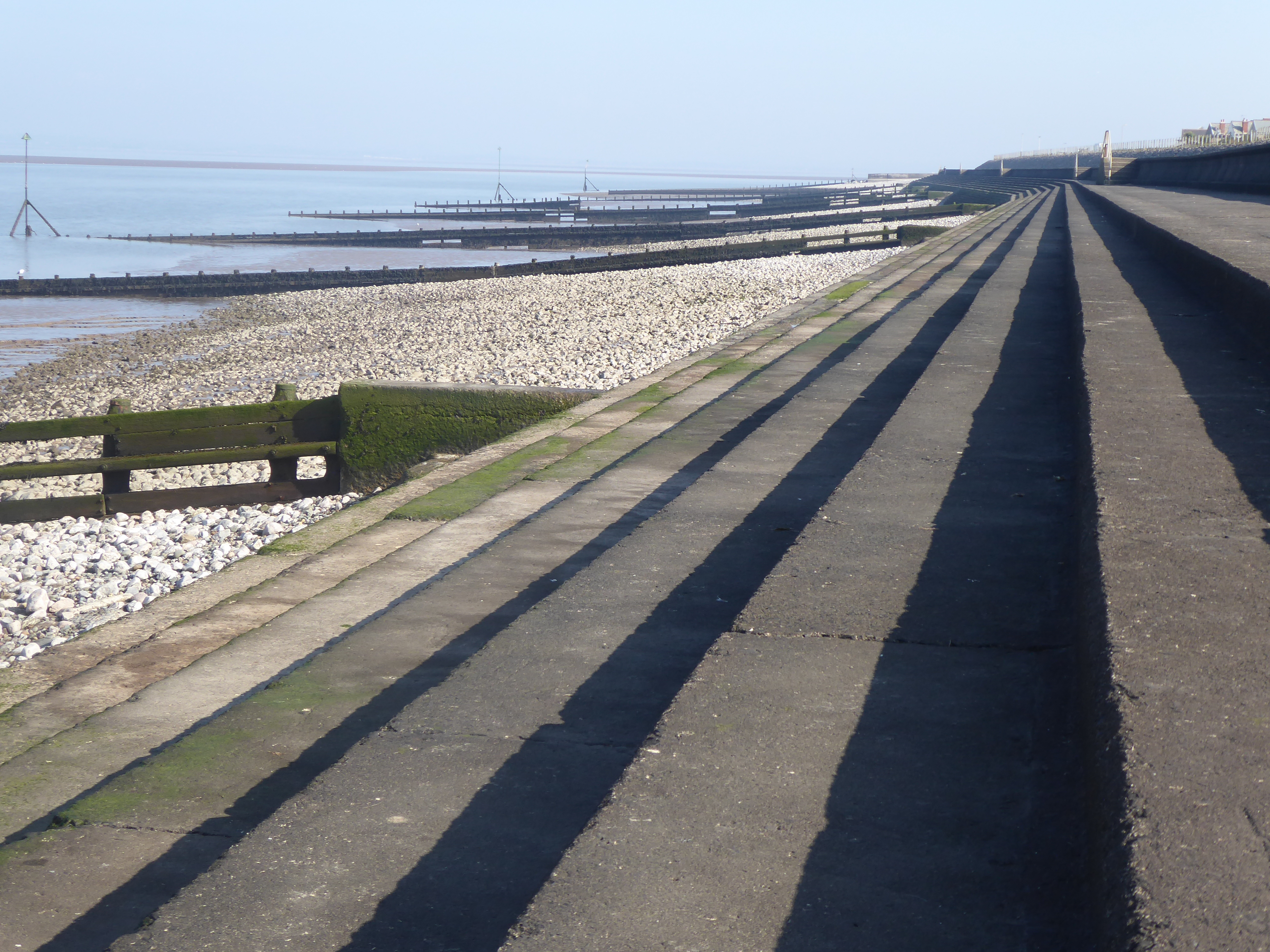
The ‘stepped’ promenade at Silloth
But, for a wall with a recurved top – rather similar to that of the concrete promenade at Maryport – no water overtops the defences in the research tank. (I’m not entirely convinced by the reality of this, having got soaked by spray on Maryport prom, during a stormy high tide!)

The (slightly) recurved top of Maryport promenade
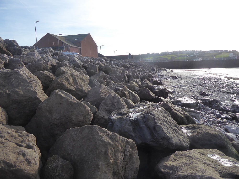
And also at the high end of protection against the tank’s waves are gabions – wire cages of boulders – and rock armour (only 5ml overtopped). This a very nice demonstration of how the rocks reduce the energy and therefore eroding power of the waves, breaking up the flow and forcing it in many different directions simultaneously.
Away from the wave-tank, bunds of gabions and rock armour have been constructed along vulnerable stretches of the Cumbrian Solway coast from Whitehaven to Allonby Bay, to Skinburness and Grune Point.
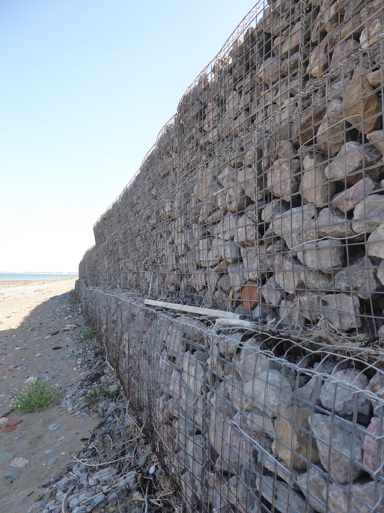
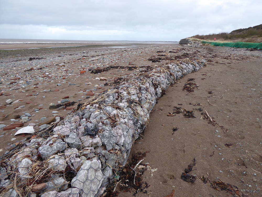
Intact gabions at Crosscanonby (left); displaced and damaged gabions at Crosscanonby (top) and at Dubmill Point
But the wire gabions, containing smaller stones, that protected the historic saltpans and the coast road at Crosscanonby, were severely damaged – ripped apart and their contents scattered – by one of the winter storms; in their place the defences have been repaired during the past year with boulders of a harder rock, an igneous dolerite probably from somewhere along the Whin Sill (my thanks to geologist Ian Francis for the identification).
Dolerite rock armour being put in place at Crosscanonby, 2022
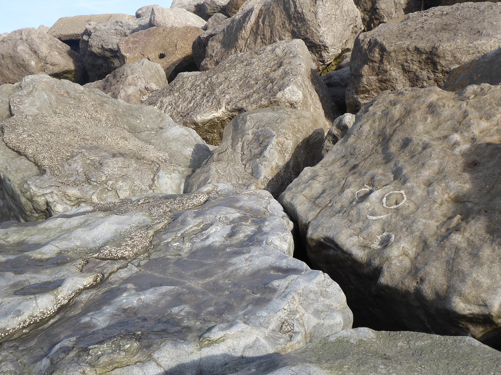
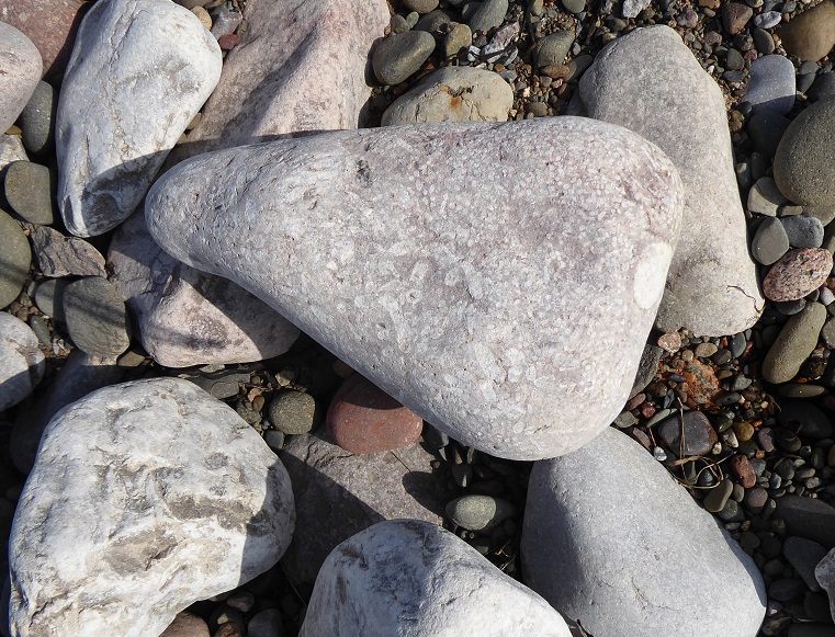
The use of dolerite is a new departure, because nearly all of the other stretches of rock armour are of limestone – and this is where rock armour becomes fun. Fossils! Corals, solitary and colonial; crinoids; brachiopods; and ‘trace fossils’ – they are all there, if you have the patience and courage to clamber amongst the boulders to search.

Trace fossils at Parton
I first became aware of fossils in limestone rock armour some years ago when I stopped at the shore-side carpark at Parton, just North of Whitehaven; these were ‘trace fossils’, traces left by an animal rather than of an animal. Imagine, say, a polychaete worm or a bivalve mollusc that lives in a burrow in the sand. It’s sedentary, staying put in one place, so, rather than roaming around on the surface to look for food (and exposing its own vulnerability as prey), it waits for food to come to it. In the case of the polychaete, the worm extends its crown of tentacles like a net in the water, or sweeps its tentacles over the surface of the sand around the burrow. The burrowing bivalve, on the other hand, has a muscular tube, the siphon (rather like an elephant’s trunk in its mobility and sensitivity) which hoovers up food particles from the sand around its burrow. These feeding movements could leave the sort of arcs of indentation that are seen in the Parton traces. What class of animal left the fossilised traces of its feeding? It’s impossible to tell although geologists, hedging their bets, often refer to the marks as ‘zoophycos’.

Limestone rock armour, North Shore, Whitehaven
At North Shore beach, Whitehaven, the fossils in the rock armour are even more impressive. As I scrambled over the rough, pale boulders I was asked a couple of times what I was doing by local dog-walkers, who were then surprised and impressed when they saw the (previously unnoticed) fossils of solitary and colonial corals. There were thick bands of colonial corals; there were curving longitudinal sections, and the packed circles of colonies broken transversally. It was easy to imagine the colourful masses of the little filter-feeders extending their tentacles to capture food borne by the incoming tide. Here too were pale curved sections through the dished shells of brachiopods, sometimes solitary, sometimes clumped together by the currents of the warm Carboniferous sea, to lie on the sediment surface.
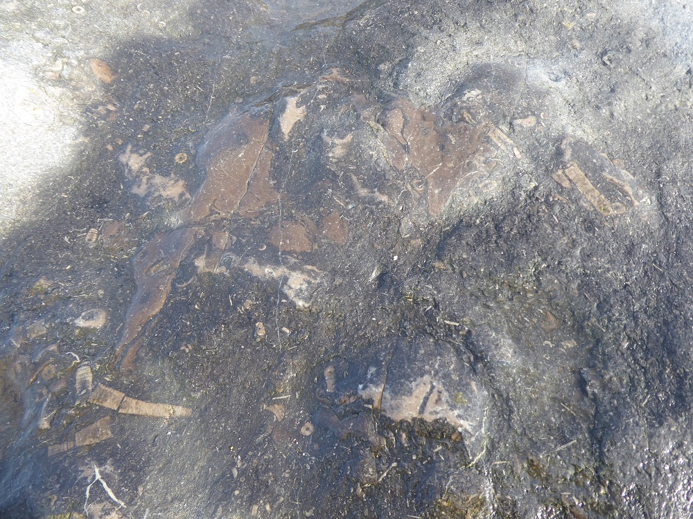
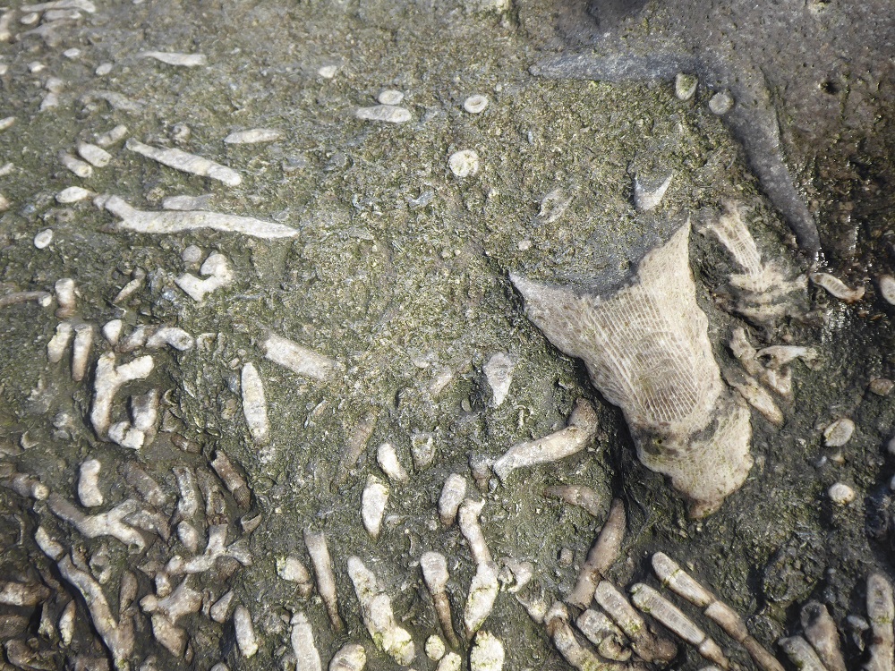

Whitehaven: crinoids, brachiopods, and solitary and colonial corals
Further along the shore, there is a sudden sharp demarcation where the limestone blocks have been replaced by boulders of pink Shap granite, studded with large shining crystals; perhaps there was a BOGOF on a few truckloads of the stone.
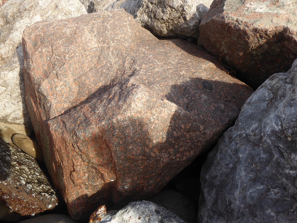

Shap pink granite armour
But there is more limestone rock armour a little further North-East, dumped in an attempt to protect the Maryport golf course at Netherhall from being eaten by the sea: more fossil corals, brachiopods, and sections of ‘sea lilies’, crinoid echinoderms. Here, too, are piles of bricks and broken concrete, tossed aside contemptuously by the waves.

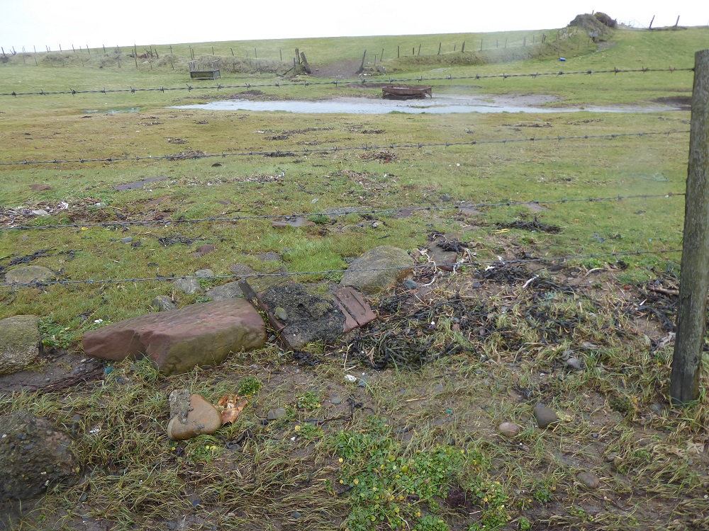
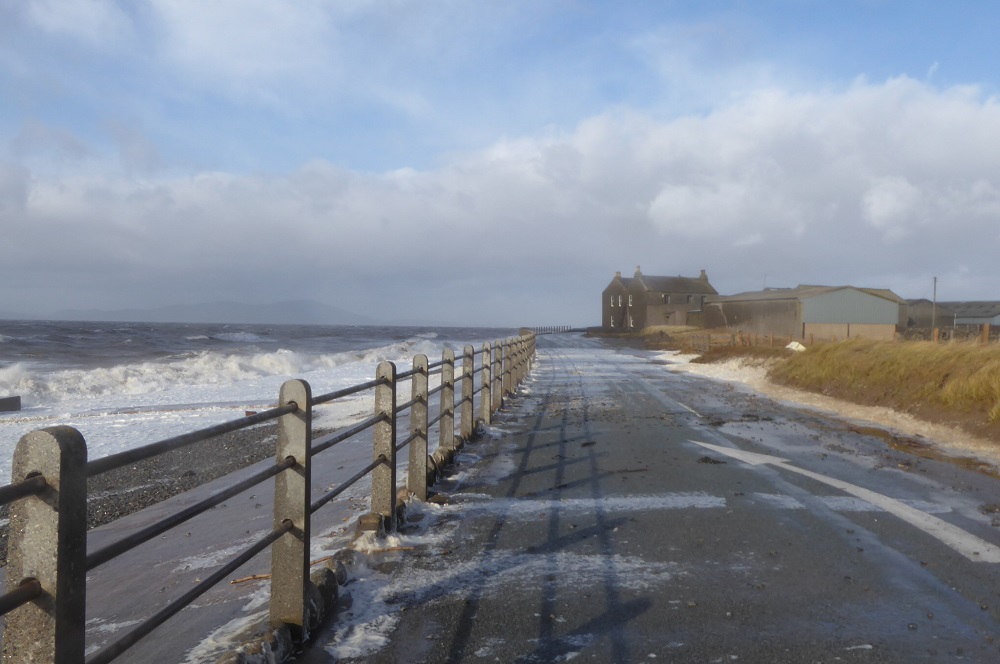
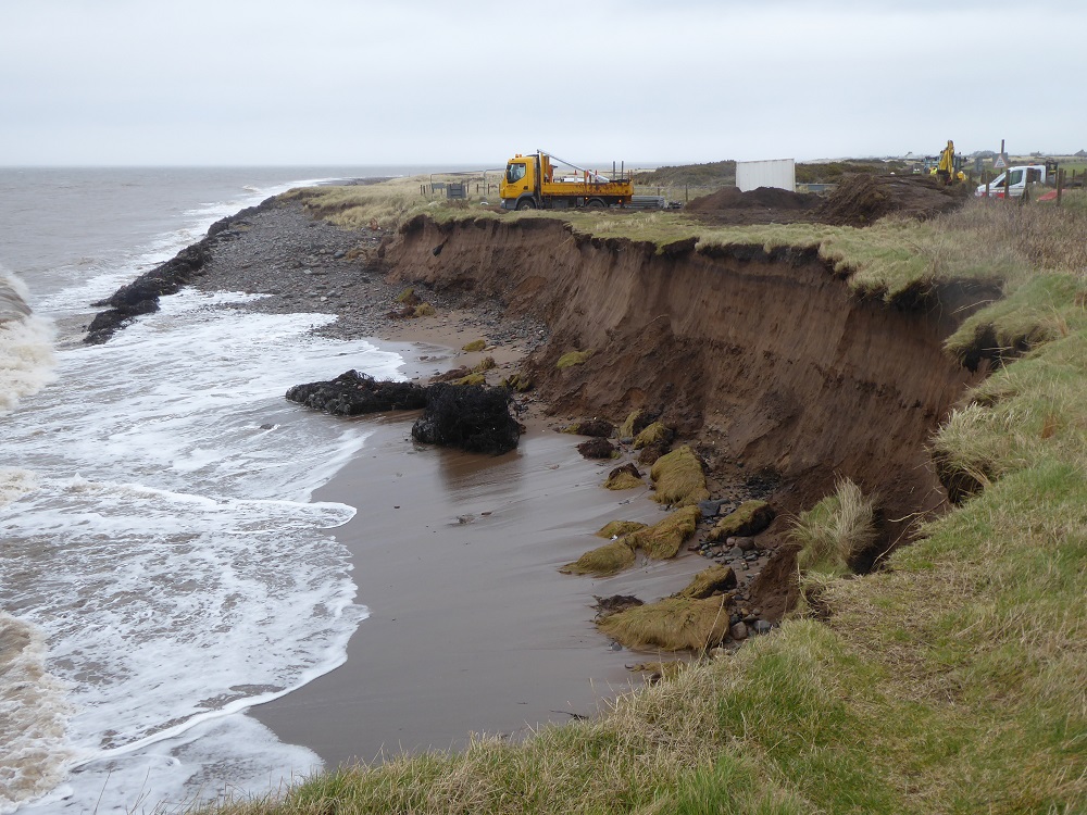
Dubmill Point; the shuttered farmhouse, and debris thrown across the road
Further up the coast again, to Dubmill Point at the north end of Allonby Bay, to huge sloping revetments of concrete, which have been repaired and extended yet again; despite this, the stormy waves throw large pebbles and sand onto the coast road, and hurl spray high over the farmhouse on the Point. You pass the ‘Road Closed’ signs at your own peril.
The concrete gives way to rock armour again, in which fossils are scarce. On a sunny day a few summers ago, I noticed a figure in a skin-coloured bathing suit (perhaps) sunbathing against the radiating warmth of the stones.
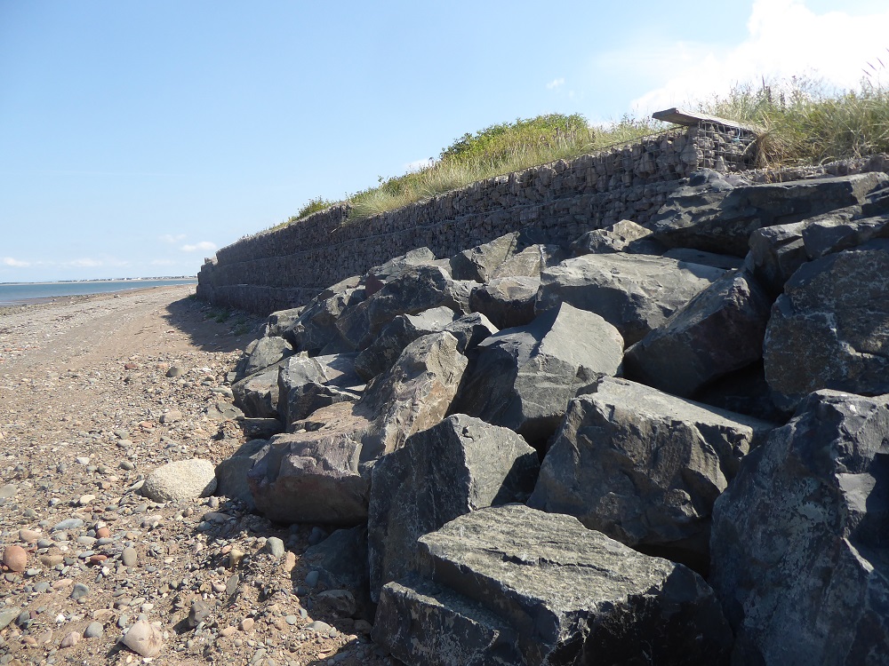
And so to Skinburness and the finger-like promontory of Grune Point that protects the western edge of the shallow expanse of Moricambe Bay. Here the rock armour is a tumbled line of large limestone boulders, some with a thin red crust and speckled with rusting iron-rich nodules.


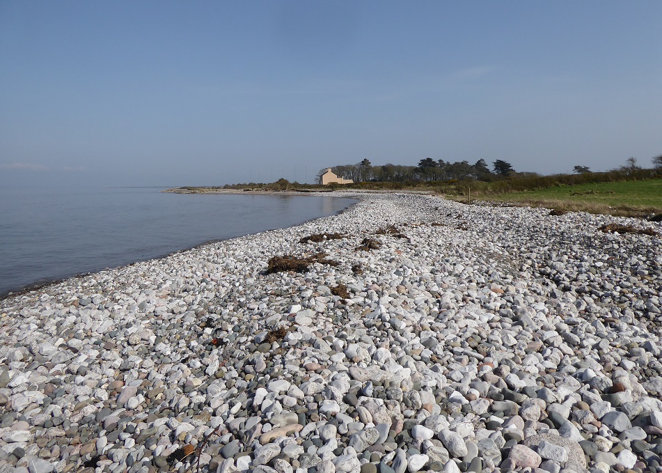
Grune Point; limestone rock armour; half-buried groyne; and limestone pebbles on the beach
The shore here is dazzlingly white in the sunshine, and glimmers even on a dark and cloudy day, for it is covered in pebbles of limestone that have been churned and cleaned by the waves. The pebbles are round and smooth, and too numerous to have been broken off and eroded from the large boulders; they are likely the ‘quarried cobble’ referred to in the Cumbria Coastal Strategy for Silloth to Skinburness (see note below).


Grune: a thin iron-bearing crust; pebbles on the shore containing corals
As with all this rock armour, I try to discover where the limestone was quarried, and when it was brought to the coast; indeed, how the rocks and pebbles were placed in situ – for there are often no roads, and clearly barges were not used. It has been – so far – almost impossible to discover these simple facts [but see important note below], despite asking the County Highways Department and highways representatives on Borough Councils. But Grune Point is part of the Solway Coast AONB and, as I expected, the former Manager, Dr Brian Irving, knew the answer: the rock came from the large limestone quarries at Rowrah, and was deposited in the late 1990s… But that is all I learnt. Yet to know its geographical origins within the county would be to know more about the geological history of the stone, and to be able to guess at the reasons for the inclusions of iron ore and different species of animals.
Whatever their origins, the piles of limestone boulders at the top of Cumbria’s ‘soft’ shores look incongruous; but perhaps it helps to think of them as a man-made complement to the ring of limestone that surrounds the rocks of the Lakeland Fells.
Notes:
This blogpost is part of my former ‘limestone lockdown’ project. For an Introduction to the project, and a guide to the list of related posts, see Limestone in the Lake District: an Introduction – and the ‘categories’ list in the right-hand bar.
A very useful summary of sea-level change projections and ways of mitigating damage, and much more (including useful links), is to be found in Chapter 4 of the updated Solway Review, produced by the Solway Firth Partnership.
Chapter 1 of the Solway Review, on Coastal Change, includes links to pdfs of the Cumbria Coastal Strategies, Technical Appraisals: this might sound dull, but the documents are very interesting, looking at the type of coast, the attempts to mitigate damage, and with discussions about possible future work. The PDFs for Maryport to Dubmill, and Silloth to Grnue, are especially worth downloading.
