
During the biggest Spring tides of the year, often in September, the height of the water in the Solway Firth might change by almost 10 metres – that’s nearly 33 feet – during the course of one tidal cycle. And there are of course two tidal cycles each day, so twice a day an enormous volume of water, a mixture of salt and fresh (from the many rivers that empty into the Firth from both the Scottish and English sides), rushes in and out, and up and down the shores.
But every tide is different: some of the Spring tides may range from a high of about 8 metres down to a low of about 1 metre; and twice a month, in between the excesses of the Springs, are the mild and unassuming Neaps (for further explanation about tides see the first section of the post on tidal power [1])
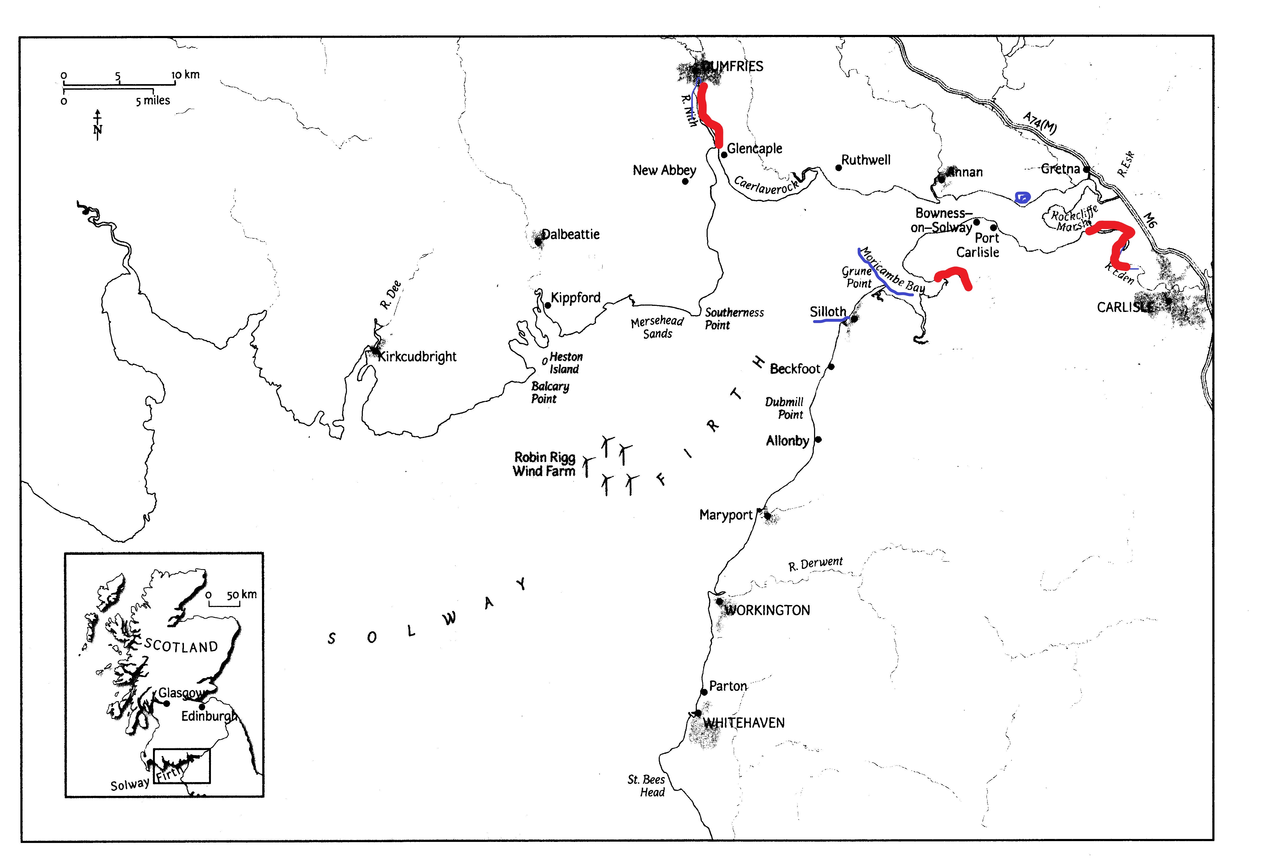
Even more confusing, if you are planning activities on the Cumbrian Solway shore, is the difference in tidal range as you move NE towards the Upper Solway; here the estuary becomes shallower, its bed ever-changing due to the wandering channels of the Rivers Esk and Eden [2]. Here, too, the timings of high and low water are very different from those at, for example, Silloth further to the South-West: the great shallow bowl of Moricambe Bay and the bay between Bowness and Glasson Point take time to fill and empty (see ‘Bores on the Solway’ for more on this [3])
***
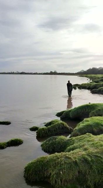
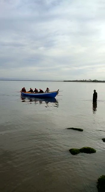
Two of my favourite Solway activities are leading low-tide shorewalks at Allonby Bay [4] and rowing in the Bowness Belle, a St Ayles skiff, on the Upper Solway at Port Carlisle. The first, obviously, requires very low Spring tides so that we have plenty of time to explore the honeycomb worm (Sabellaria) reefs [5] at the bottom of the shore. The second requires a good high tide so that we can launch the boat from the slipway or from the edge of the saltmarsh, without having to manhandle the boat trailer down a long stretch of squelchy foreshore.
For the shorewalk on April 23rd we took advantage of the Spring low tide to walk the surprisingly long distance down the shore to the Sabellaria reef, and spent time finding Breadcrumb Sponges, Burrowing Anemones, predatory Dogwhelks, tube-building Mason worms and the like.
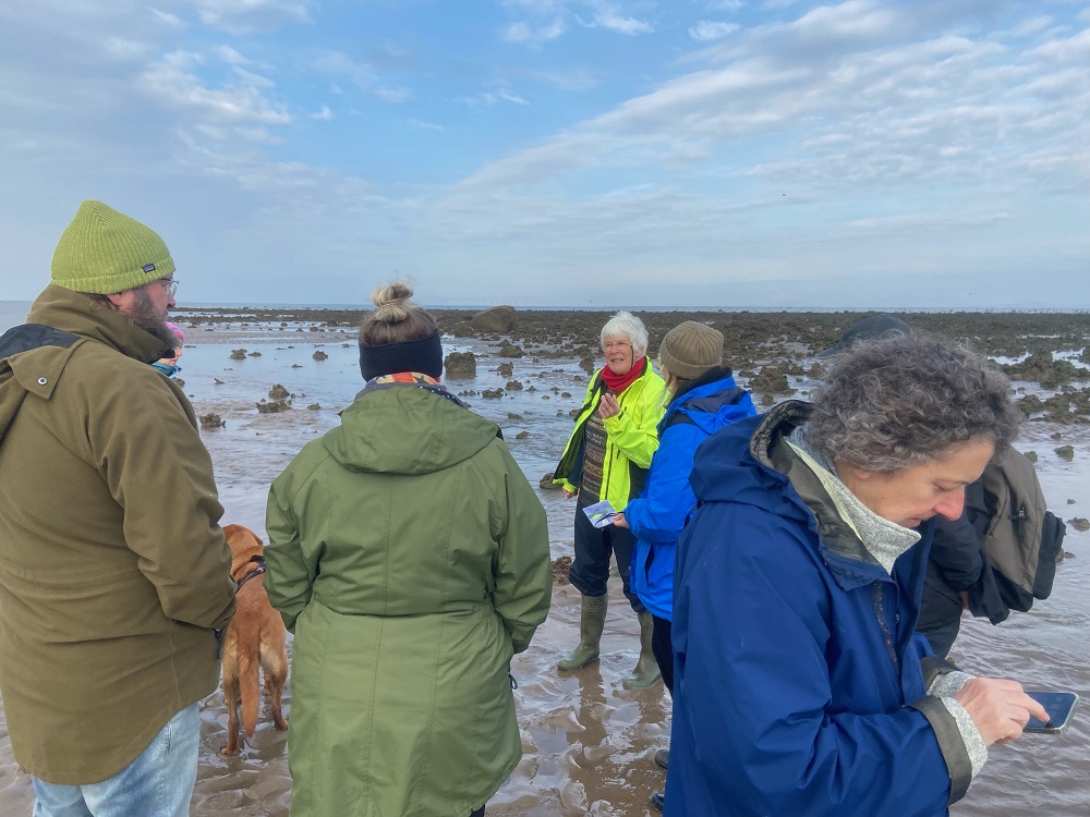

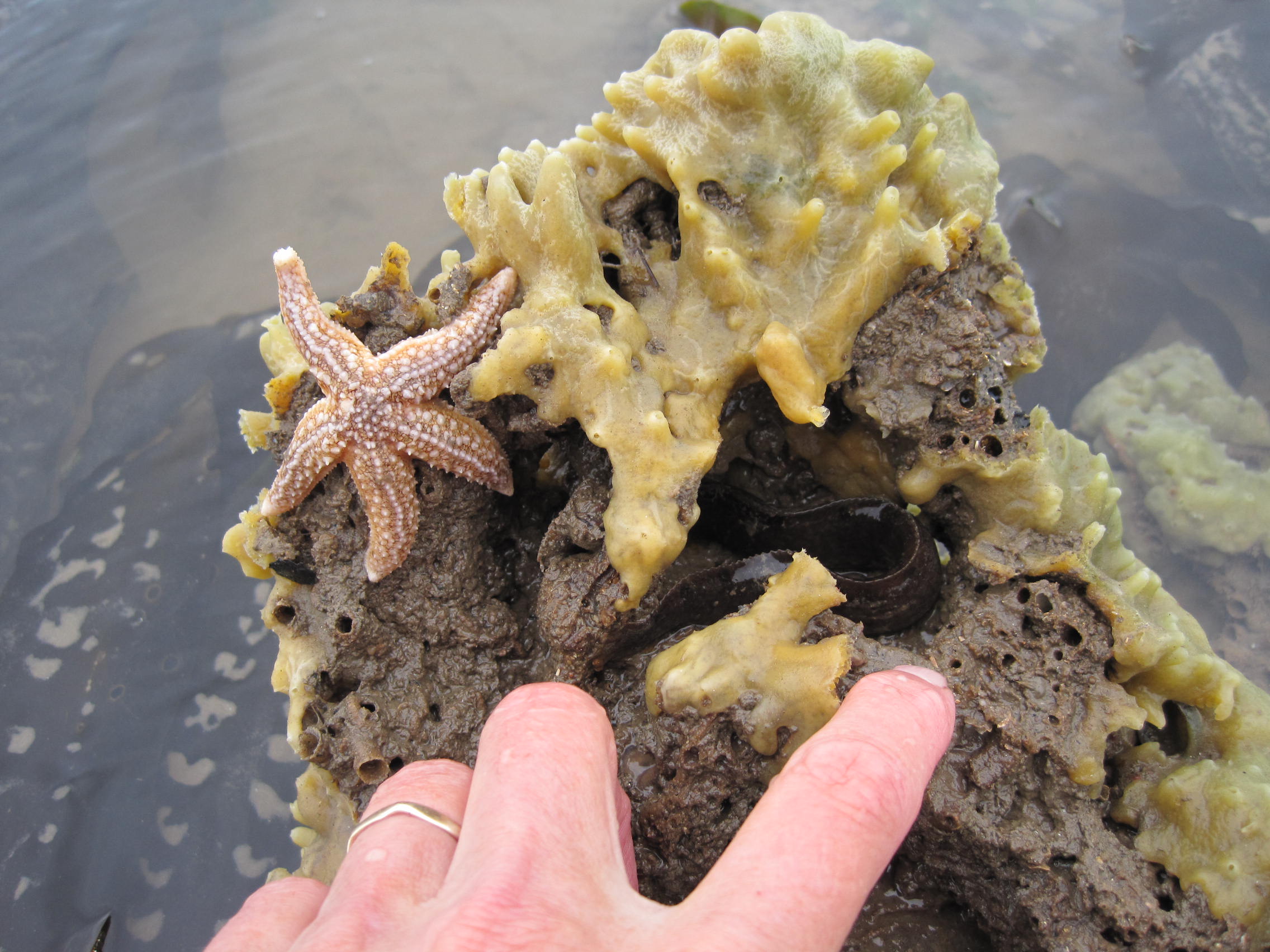
Some of the shorewalkers (left; photo credit Shona Broome); Hanging Stone & Sabellaria reef (top right); starfish and breadcrumb sponge on Sabellaria reef (bottom right)
In actual fact, the tide was not quite as low as predicted, as the barometric pressure was low [6].
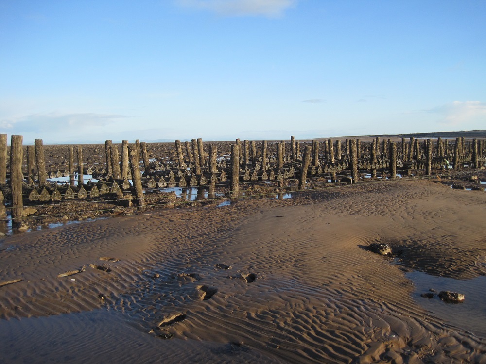
Neverthless, we found plenty to look at and chat about, and on the way back up the shore looked at boulders coated with young mussels, and commented on the lines of wooden posts, near the upper intertidal area, that once supported cages of growing oysters.
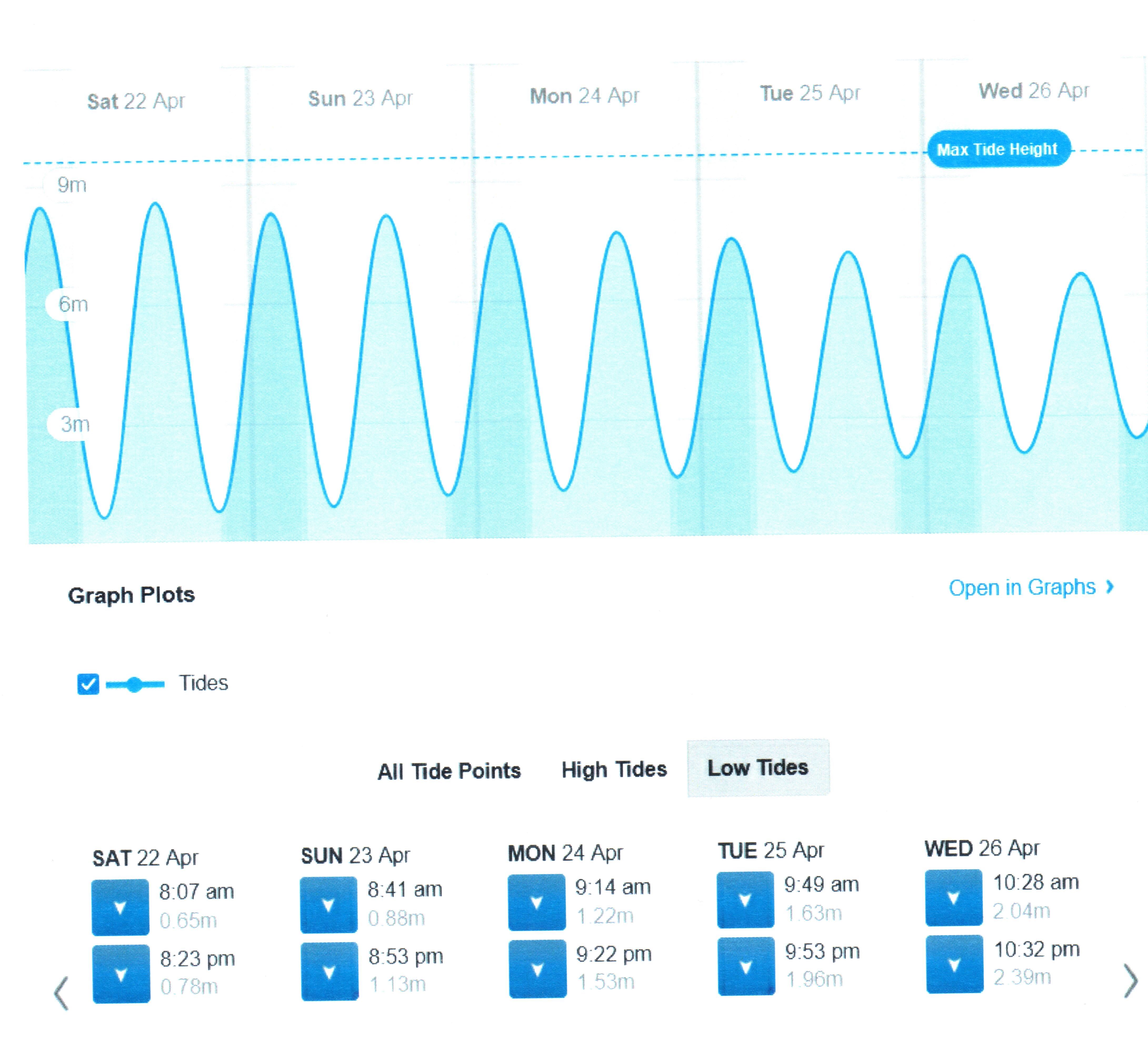
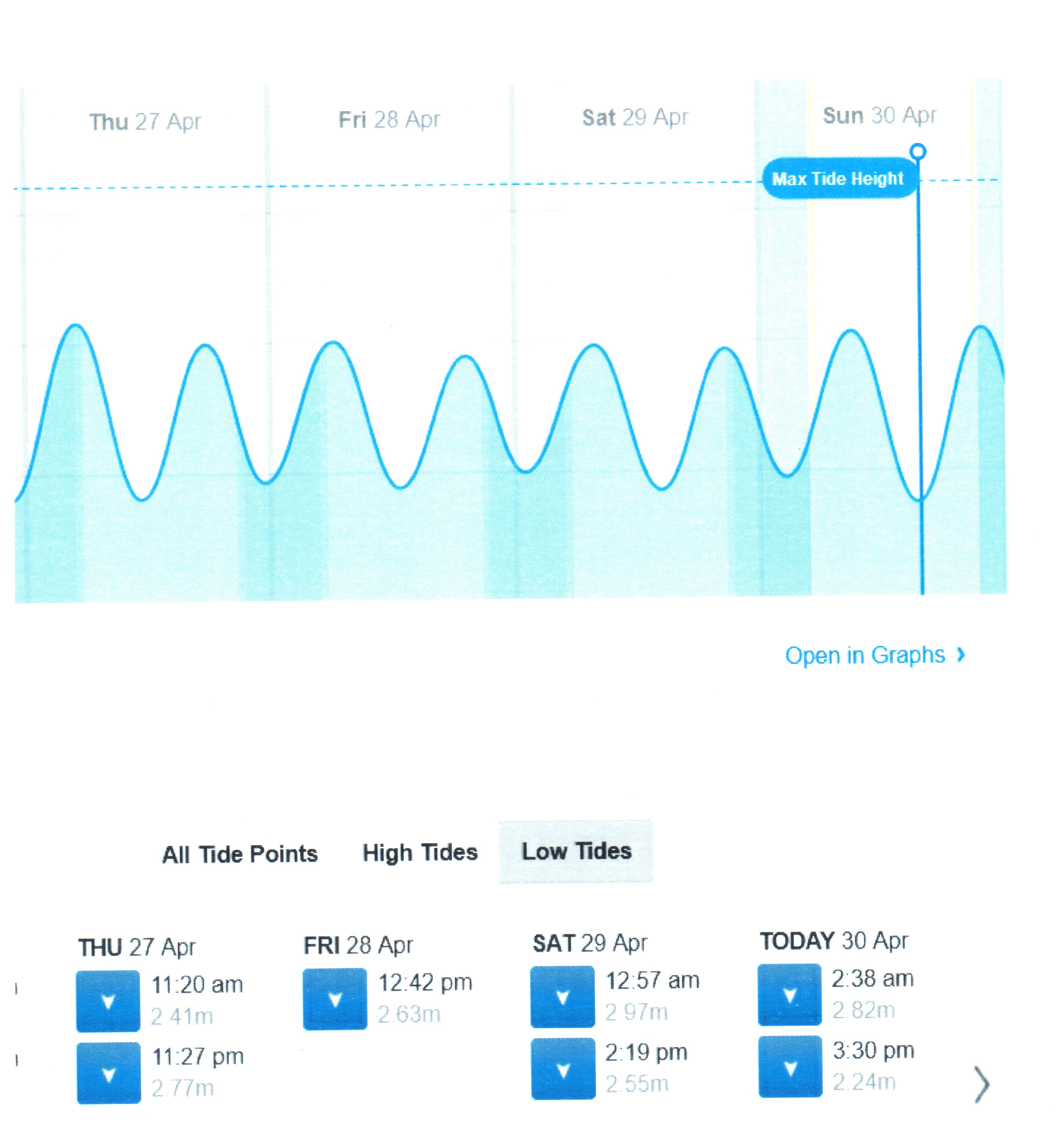
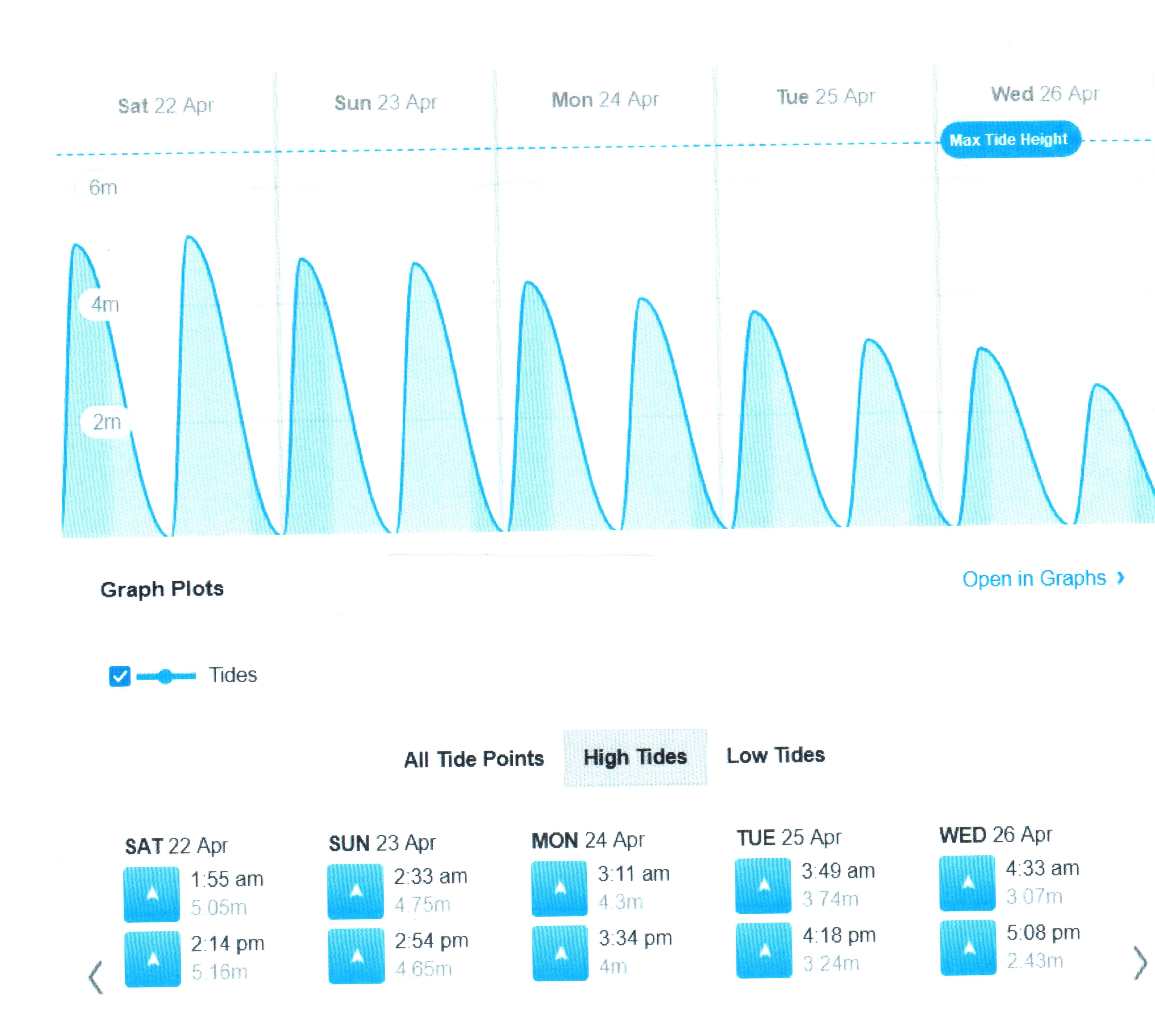
Allonby low tides: Spring tides (left – click to see height in metres) diminishing to Neap tides (right)
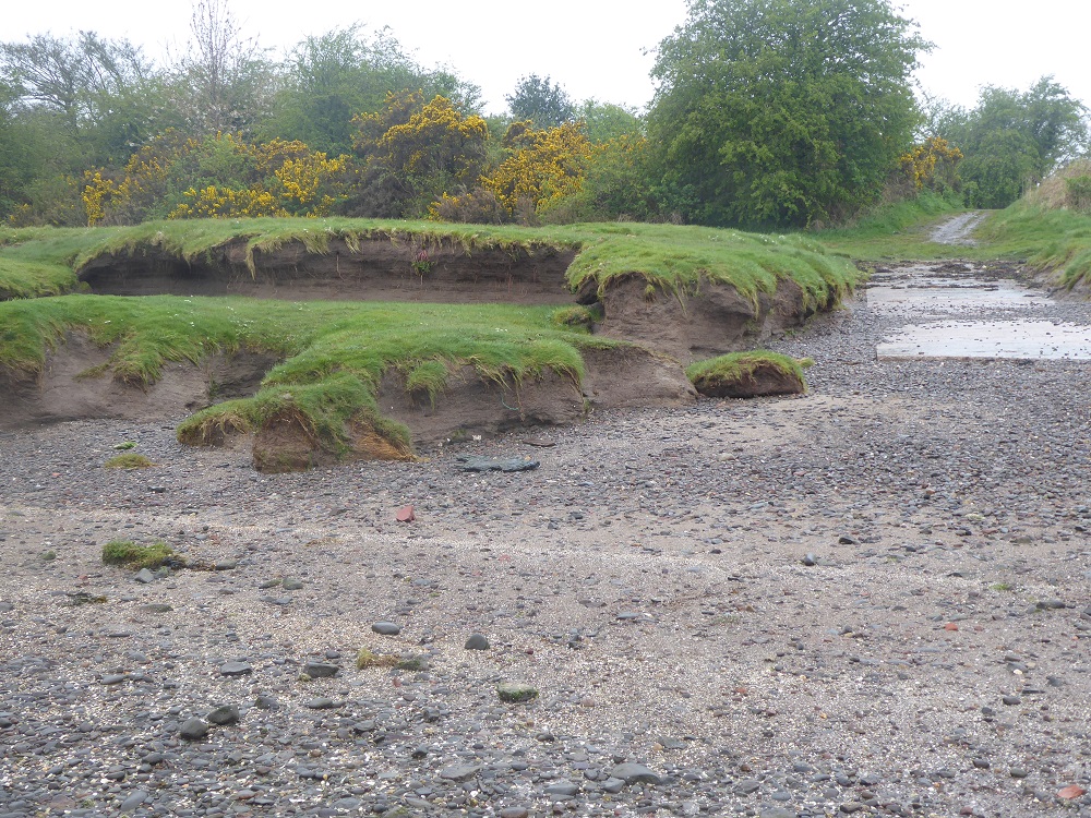
One week later, April 30th, the tidal charts showed the Neap low tide would be rather feeble (see chart above), so I went back to make a comparison. There would have been no low-tide shorewalk that day! Low tide was now at about 2.2 metres above Chart Datum; the previous week it had been at about 0.9m – what a difference 4 feet makes!

Where we had guddled previously in the lagoons, the reefs and the large erratic boulder, Hanging Stone, that marks their edge were now completely invisible beneath the water. The posts of the oyster lays stood with their bases in the sea, so I was confined to the pebbly middle reaches of the intertidal shore. Nobody could have guessed what an amazingly diverse array of animals and their architecture lay beneath the quiet surface; nobody would even think to imagine what a busy-ness of feeding, mating, defaecating, and other behaviours, was happening out of sight.
(We spend some time on the lowtide shorewalks looking for clues about the animals’ behaviour when they were covered by the tide – identifying the trails, like mountain-bike tyre-marks, of ragworm species large and small; finding the green ‘blobs’ of their eggs and the yellow vase-shaped eggcases of dogwhelks; noting the sideways scurry-marks of crabs; and the thin strings of sandy Sabellaria poo that showed they were at the mouths of their protective tubes, and feeding…)
***
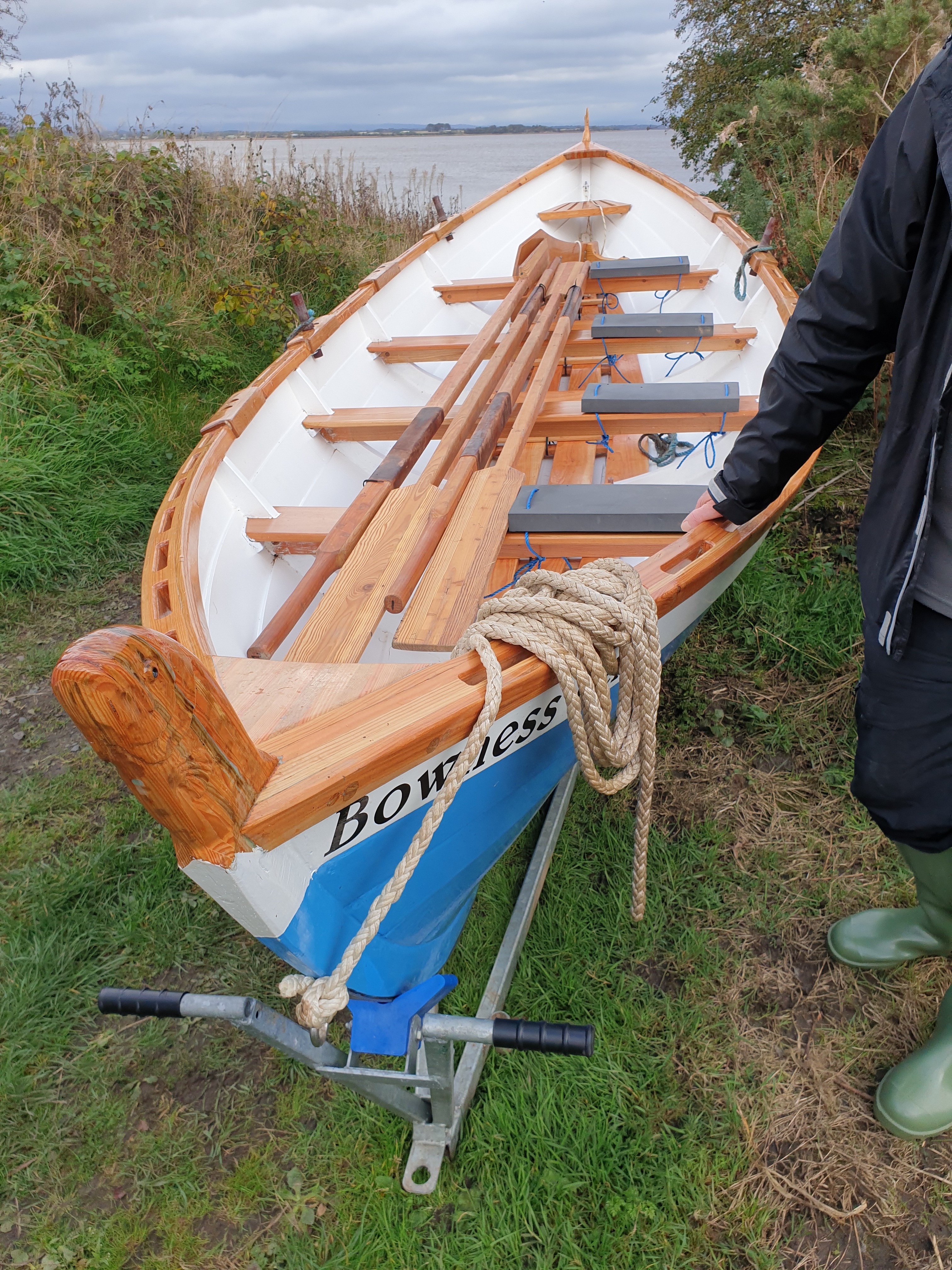
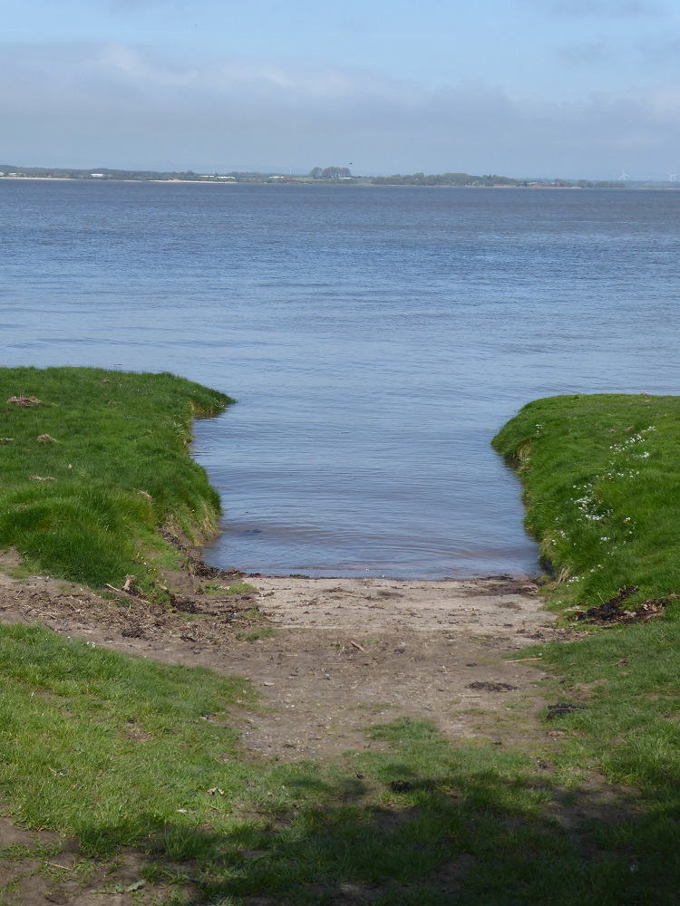
In contrast, the row on the 30th had to be cancelled because launching the skiff at high tide at Port Carlisle would have been impossible, for the height of the full tide was at only about 1.5 metres, way down the shore and leaving the slipway and the edges of the saltmarsh high (if not quite dry).
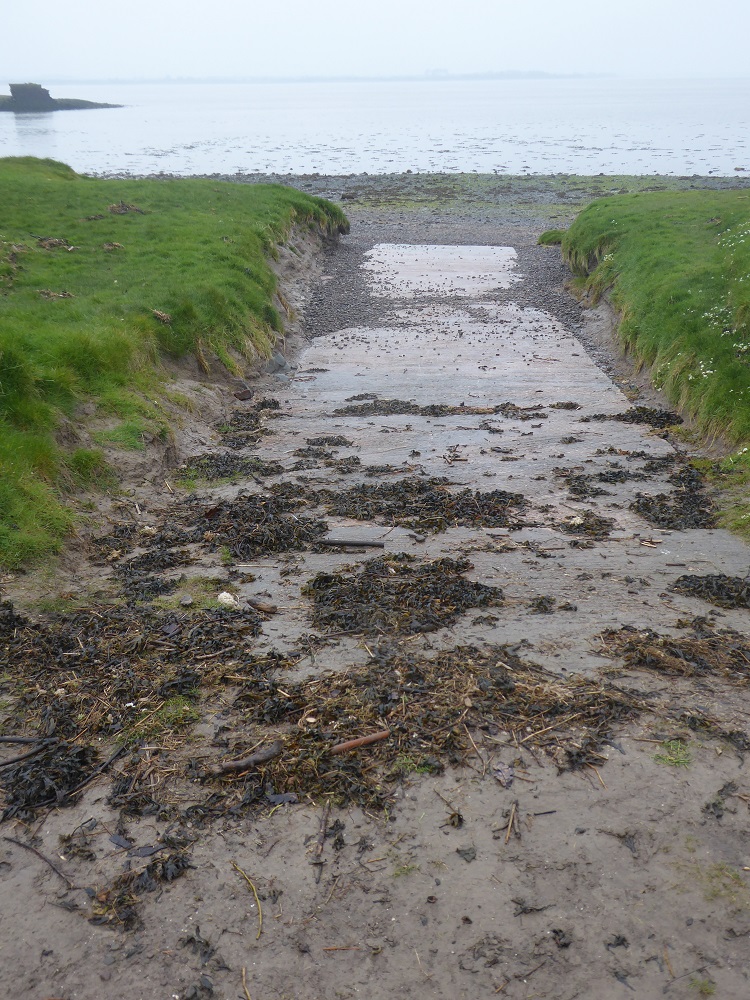
A week previously on April 23rd the Firth had risen to more than 5 metres and by high water, the Firth was slopping over the marsh – making disembarking, and subsequent cleaning of the boat, much easier!
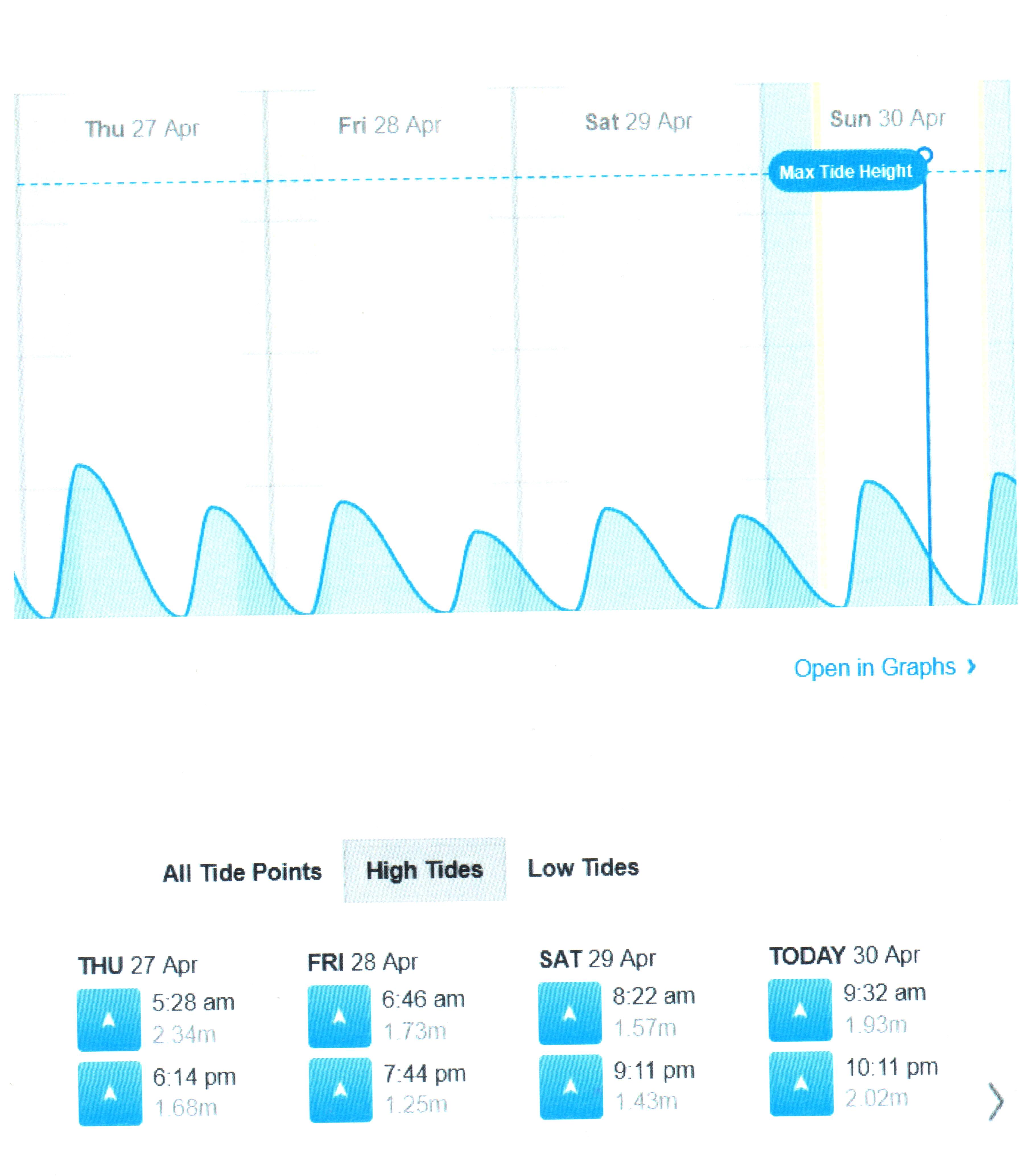
Bowness high tides: Spring tides on the left (click for scale showing height in metres, and note the difference compared with Allonby) diminishing to Neap tides on the right
Notes
1.A note on the tidal cycle https://solwayshorewalker.co.uk/2015/10/26/barrages-breakwaters-and-bridges-three-proposals-for-harnessing-tidal-power-in-the-solway-firth/
2. The SCAPE/Solway Firth Partnership archaeological surveys of the Scottish Solway shore: download PDF and scroll down for diagram of the channels of the R Esk over the decades https://scapetrust.org/project_category/project-reports/
3. Bores on the Solway https://solwayshorewalker.co.uk/2020/10/30/bores-on-the-solway/ ).
4. For dates of shorewalks in 2023 https://thefreshandthesalt.co.uk/shore-walks-events/)
5. A short section about the honeycomb worm, Sabellaria, reefs: https://solwayshorewalker.co.uk/2022/01/24/strange-animals-of-the-solway-shore/
6. Atmospheric pressure: each millibar (now called a hectopascal) of pressure changes the height of the sea-level by 1 centimetre. The standard is set at 1013hPa – lower barometric pressure allows the water to rise higher; higher barometric pressure depresses the rise. If pressure varies between 950 and 1050 hPa the expected variation in sea level due to air pressure is between +63 cm and -37 cm around mean sea level. Wind and weather also affect the tides – strong onshore winds can drive waves further up the shore
