Triops cancriformis adult (photo thanks to Larry Griffin)
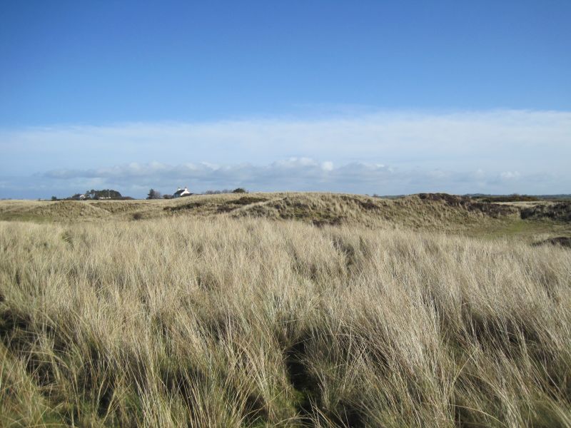
In August, after the long weeks of cloudless blue skies, and heat that shimmered over the cracked mud of the merse, the rain came. The jet stream had looped into another orientation, and the rain fell day after day for a week. Dr Larry Griffin emailed me: “the rain after the heat has brought the eggs out of stasis in at least two pools” and so he was ready to take a small group to have a look.
Larry is the Principal Species Research Officer at the Wildfowl and Wetlands Trust (WWT) Caerlaverock Reserve on the north coast of the Solway Firth, near Dumfries, and Caerlaverock is one of only two places in the UK where the rare and elusive tadpole shrimp, Triops cancriformis, is – occasionally – found. [1]
The modern story of Triops is a story of discovery and loss and re-discovery. But this is an animal that has scarcely changed since the Triassic period – its fossils date back two hundred million years. It is a freshwater Crustacean, belonging to the Order Notostraca, and looks very similar to (but is unrelated to) a small horseshoe crab as it trundles around on the bottom of a pond: its head and thorax are covered by a carapace, like a shield, so that from above its legs and mouthparts are scarcely visible.
Was it always the case that Triops lived, fed and bred in freshwater pools? This is a dangerous life-strategy yet despite, or because of, this danger the animals evolved a means of surviving when the pools dried out. Today, they are found only in ephemeral pools in the New Forest and on the saltmarshes (merse) and wet pastures around Caerlaverock. They can live for two to three months, or until the tide inundates the merse – and when the pools dry out under the hot summer sun, the adults die and disappear. But in the drying sediment their eggs live on, yet ‘switched off’ in a state of diapause.
When the rain comes and the pond re-wets, the eggs are stimulated to hatch – and the larvae feed and grow very quickly, so that adults are ready to lay eggs within as little as two to three weeks from hatching. As Larry says, “They can flash in and out of existence – it’s just luck whether you find them. It needs an inquisitive person … in the right place at the right time, who thinks ‘Oooh, what’s that?’ ”
This explains why the Triops’ story has been so exciting and challenging; for me even more so because this special animal survives just across the Solway from where I live, and I now have a chance to see the creatures alive, rather than – many years ago – pickled in formalin in an undergraduate Invertebrate Zoology class.
It was more than 100 years ago that Triops (then known as Apus) was found on the merse, by F. Balfour-Brown. Forty years later, in 1948, in a paper to Nature, he wrote (or narrated – the style of scientific writing was much more like story-telling than it is now):
“In September 1907 I discovered two shallow grassy pools on the Preston sea merse, near Southwick, Kirkcudbrightshire, in which Apus was present. In one of these it was so abundant that when I raised my eleven-inch ring net out of the water it was half full of specimens, mostly full-grown. I searched many other pools in the same area but without finding it and, returning to the same pools a few days later, I found the edges covered with the shells and very few specimens left in the water. The gulls had discovered this mass of food and had destroyed most of the Apus. I have visited the area many times during the last forty years but not until this month, working the merse near the mouth of the Southwick burn, have I again seen Apus. My son found three specimens in a pool which then yielded us about thirty or more, and several other pools near the first produced small numbers, mostly immature.”
These pools were subsequently lost through erosion of the merse, but Tadpole Shrimps were found again, nearly 20 kms away, in 2004.
Larry grinned as he told me about his own discovery. “I’d been out looking for natterjack tadpoles, it was quite a late season. I thought I might as well have a look in that pool – and there they [the Triops] were, tons of them!”
A Triops in the hand …
Several Triops and other invertebrate animals
He wasn’t immediately sure what he had found, until he took some of the animals back to the lab. “It was a gradual dawning… I was looking in the back of a Collins book, I think it was – there was a drawing, a silhouette. And then I had a memory of someone from the RSPB, who had been talking about trying to introduce them somewhere – and then it was ‘hang on, this is that incredibly rare thing’!”
Collaboration with Dr Ruth Feber [2], from Oxford University’s WILDCru, and Professor Colin Adams of Glasgow University’s Scottish Centre for Ecology and the Natural Environment (SCENE), and their colleagues, led to discussions, then further investigations and research at WWT Caerlaverock.
Colin and colleagues collected sediment from the bottom of 86 ponds at Caerlaverock. It was known that the eggs or cysts needed to be desiccated to enter the quiescent, diapause, state, so samples were dried out and then incubated in fresh water at 20oC. Samples from just two ponds produced living larvae (nauplii). And then, “During the preparation of this [scientific] paper, on 29 July 2010, a population of c. 100+ adults of various sizes up to 3cm were discovered by chance in another ephemeral pond 80m west of the original 2004 site on the Caerlaverock upper salt marshes. This pool was largely created by tractor wheel ruts and cattle movements in an area of gorse (Ulex sp.) and rushes (Juncus effusus).” [3]
As a result of this serendipitous discovery, just three ponds at Caerlaverock were found to be home to Tadpole Shrimps!
Rubbing post & pond where Triops has been found
Cattle on the merse
It’s thought that eggs are spread in several ways – through the guts of animals, on the feet of cattle, deer, or geese, “Anything traipsing around, really,” Larry says. This includes the tyres of tractors and quad bikes, and because the Tadpole Shrimps are hermaphrodite, “It just needs one egg, and after it hatches and survives, you could then get hundreds.”
Sometimes the shrimps themselves have been found, other times it has been the presence of the eggs in washed and filtered sediment samples. Larry reckons there could be stores of eggs of different ages in some of the sites. “I feel a lot better knowing that it’s not just in the one pool!”
Dried mud samples in the lab
He has collected mud from the ponds, as a safety precaution and also as part of his research. There’s a shelf in his office piled with polythene bags that contain mud-samples dating back to 2008. “I wet them every September – so far, they’re still hatching out. This year will be the tenth year [to test them].”
Larry uses tanks of de-chlorinated tap-water, bubbled with air for a day to oxygenate it, then throws in the mud-sample containing eggs. “It’s really low-tech! I feed them on fish food and a bit of sea-weed to provide some iodine. They show good behaviour! They learn that when I come into the office, I’ll feed them. They come up to the surface – and I sprinkle the food on the surface, and they turn over and swim on their backs so they can take it with their little legs.”
The adult shrimps lay their eggs in little scrapes in the mud. From an egg less than 0.5mm diameter, an adult can grow up to 7 cm long when reared in the lab. It reaches maturity by passing through several larval stages, each of which grows then moults its skin, or exuvium, before passing on to the next stage.
How often does Larry find the Triops out on the merse? “Most years. It depends on the weather, but if conditions are right, you can easily see them crawling around. One clue is the exuviae, you find them wind-blown at the end of a pond.”
When Larry emailed me after the rain, it was because he had seen these papery skins at the edges of a pond and found some nauplii. But finding a date for even our small group of privileged people to join him proved impossible – and the pools dried out again. This was not to be the year when I would see living Triops in the wild.
Are they living on the other Solway saltmarshes, at Rockcliffe, say, or at Campfield or Newton Arlosh? After all, these are no distance as the goose flies (and large flocks of geese do fly between these sites).
Barnacle geese at Caerlaverock, February 2016
People have looked, and Bart Donato, of Natural England, who has a great interest in Rockcliffe, says the shrimps have never been found there. But it needs someone to be there at exactly the right time, someone who can recognise what they are seeing.
Now, though, there’s a new molecular diagnostic technique available, to test environmental samples for a range of ‘eDNA’ – fragments of genes that are species-characteristic and which may have been left ‘lying around’ in the environment. Graham Sellers from Hull University has recently developed this ‘DNA bar-coding’ technique for Triops and, working with Larry, has established the existence of the shrimp in six ponds at Caerlaverock. [4]
Location & condition of Triops egg-banks: Fig 4 from the paper by Sellers et al 2017 (see below)
Perhaps this technique can now be used for pools on the other Solway saltmarshes?
It would be exciting, and a relief, to find that the story of the rare and elusive Triops can be expanded to a few more chapters: that this enigmatic survivor will remain an important addition to the other ‘shrimps’ – brown shrimps and mudshrimps – of the Solway.
Meanwhile, I’m hoping for a hot dry summer in 2019, followed by a spell of rain …
Notes:
1.Triops cancriformis is classified as Endangered, listed as a priority BAP species, and specially protected under Schedule 5 of the Wildlife and Countryside Act 1981.
2. Ruth Feber et al. June 2011. Ecology and conservation of the Tadpole Shrimp, Triops cancriformis, in Britain. In British Wildlife, p334
3. Colin Adams et al. 2014. Short range dispersal by a rare, obligate freshwater crustacean Triops cancriformis (Bosc). In Aquatic Conservation: Marine & Freshwater Ecosystems. 24: 48–55
4. Graham Sellers et al. 2017. A new molecular diagnostic tool for surveying and monitoring Triops cancriformis populations. PeerJ 5:e3228; DOI 10.7717/peerj.3228
Why we need to pay attention to the other living species with whom we share this area, and identify and record them. My thanks to Deborah Muscat, Manager of the Cumbria Biodiversity Data Centre based in Carlisle, for writing this guest post.
In mid-April Cumbria Biodiversity Data Centre (CBDC) and the Solway Coast AONB launched the Solway Nature Networks as a small project to encourage people to tell the CBDC what nature they had seen on their walks and travels around the area. So why are we doing this – surely everyone knows what nature there is on the Solway?
First, a bit about me. I have some very early memories: one is looking at wiggly things in a hole filled with water in a tree, another is poking snails to make their eyes go in. Cut to fifty years later and natural history still makes me excited – just as it did when I was four.
Having lived here for many years I have explored both the Solway coast and the plain. I know that we live with wildlife that my friends in the South can only dream about; Hares, Natterjack toads, Curlew, Grey Partridge, Corn Marigold, Mudwort (more about these later) etc. But, because we have so much wildlife it becomes commonplace, and that is when it starts to become overlooked.
This was brought home to me when I started to work in Tullie House Museum for the CBDC, a small organisation that few people have ever heard of, but one that has a unique insight into 150 years’ of Cumbria’s natural history.
A wildlife (or biological) record consists of: what was seen, where it was seen, when it was seen and by whom. Currently, CBDC has over 2.2 million individual records from the whole of Cumbria, and they include flowers, ferns, trees, seaweed, snails, worms, butterflies, beetles, flies, fish, to name but a few. But digging deeper into the data, it was clear that apart from information about birds and toads, CBDC receives only a few records from the Solway area each year.
Why does this matter? All decisions about land use, management and development must consider biodiversity and this is where biological records are vital. Increasingly makers look at dots on maps to discover the presence or absence of a species. However, an absence of a dot does not mean that something isn’t there! But if decisions are made this way then we need to make sure that we record our wildlife so as to put the dots on the map.
This leads me on to another issue. Observations of common species like the brown rat are not noted down; sightings of rare species like red squirrels are always recorded. This skews our view of what is really out there. Take the rat as an example. According to the National Biodiversity Network Atlas, an online source of information used by Government about the distribution of species in the UK, there are two records of Brown Rat on the Solway Plain. Experience tells me this is not true! The Atlas also shows a similar number of House Mouse records. Once a common sighting, few ecologists have seen a House Mouse recently and it could be becoming extinct without us even noticing. Thus we need to start recording the common species as well as the rare and interesting ones.
It was this last fact that started to make me feel guilty – I hadn’t sent a record to CBDC for years. So, inspired by our new Solway Nature Network project I too have started to take a note-book and camera with me on my local walks.
I know a bit about wildlife but I am far from being an expert. Like a lot of people I rely on photographs, books, other people and the internet to find out what I am looking at. But even with my basic knowledge I am finding out what a remarkable place the Solway is.
Anyone travelling by Dub Mill at this time of the year will see a field yellow with flowers. These are corn marigolds (Chrysanthemum segetum), a species which was probably introduced to the UK in Neolithic times with grain from the Mediterranean. Once an abundant sight in the cornfields of Britain is becoming rare.
Corn marigolds (photo: Debs Muscat)
Similarly, the nationally scarce Mudwort (Limosella gallica) thrives in the Summer on the dry muddy edges of Edderside pond. Found on only 6 sites in Cumbria this small unassuming plant is disappearing as UK ponds are not allowed to dry up, or are lost altogether.
Many people are aware that the traditional Bluebell (Hyacynthoides non-scripta) is also in decline as it hybridises with the larger Spanish Bluebell grown in many gardens. Here on the Solway Plain most of the ones we see are the native variety. This fact inspired one of the new Solway Nature Network volunteers to go out and map the Solway’s bluebells, especially those on the banks at Crosscanonby.
The more volunteers we have the more eyes there are to spot rare and unusual wildlife. One such plant is the endangered small-flowered catchfly (Silene galica). I spotted this in New Cowper several years ago. It had previously been seen in Silloth in 1877. The catchfly has now almost disappeared from Northern Europe, and I have not seen it since in New Cowper as the field was reseeded with more vigorous clover and rye grass. However, the catchfly could still be lurking in sandy soil around the edge of a field close by.
Having rediscovered the four-year-old in me I am always looking under stones, logs and leaves for “bugs”. It is surprising what has turned up. On a dog walk at very low tide near Mawbray I picked up some sandstone. Underneath I spied something that looked like a woodlouse. It turned out to be a waterlouse (Sphaeroma serratum). As it was only 0.5cm long I am not surprised that it is not something anyone had recorded before. Because I am not a waterlouse expert I needed help from someone who is.
Fortunately, CBDC is part of a network of wildlife recorders and museums and we can usually track down someone who will confirm what has been found.
Indeed, a little brown thing, about 1 cm tall that I discovered on a leaf in Flimby Woods took a year to identify. I found out from a gentleman in Scotland that it was a chocolate tube slime mould. A Google search followed and to my astonishment I learned that a slime mould consists of several different types of single-celled organisms that exist as slime on decaying plant matter. When the food starts to run out or conditions are not right these single-celled organisms begin to move and join together to create the reproductive structures that I had found. I then read that there are scientists currently studying the slime mould “decision making” algorithm which is described as “a tendency to exploit environments in proportion to their reward based on previous experience”. Apparently this is similar to the algorithm used by Amazon when it finds items that you might like to buy based on previous searches!
Stemonitis, the chocolate tube slime mould (photo: Debs Muscat)
More recently a shiny black beetle caught my eye. Looking closely at the indentations on the wing cases and the shape of its “feet” I decided it could be the rare Chrysolina oricalcia, one of the leaf beetles. This time I sent my pictures to John, a reknown beetle expert in Whitehaven. He agreed with my identification and followed it up with “this beetle has not been seen in Cumbria since 1835.”
The beetle Chrysolina oricalcia (photo: Debs Muscat)
The more I look the more I am inspired to look again, and the more I learn – just as when I was four. We really do live in a place that is home to some amazing plants and animals. Our area is special and we should be proud that we haven’t lost as much of our wildlife as other parts of the UK. However, we still need to know more about what is here to keep it that way.
So why don’t you rediscover your inquisitive inner child and join the Solway Nature Network volunteers to find out about the wildlife on our doorstep?
To join in or find out more contact CBDC on 01228 618717 or visit their website.
At first light on a Sunday morning in late September, Norman Holton sat on the edge of Campfield Marsh near Bowness on the Solway. On the Scottish side the starlings were, as usual, gathering in great wheeling clouds, and as usual there were several sparrowhawks flying above them, attempting to pick off a few for breakfast. This time, though, the starling-cloud spiralled round and round, and the mass of birds coalesced and flew across the Solway. Norman estimated that there were two million birds: “They were flying low, about 10 feet above the water, coming straight towards me. I couldn’t see the ends of it, from Cardurnock to beyond Herdhill Point, the flock was so wide. It must have taken 10 minutes to pass over – it lifted slightly to pass over the marsh, flying right over my head. The noise! And the wind of their wings, the draught! I was absolutely plastered in crap. But it was fantastic – the hairs on the back of my neck are standing up just telling you about it!”
Creeks at the edge of Campfield Marshfurther up the Solway (photo: Ann Lingard)
Norman Holton [*] was Senior Sites Manager of the RSPB’s Cumbria Coast Reserves until 2016, and not one to exaggerate about bird numbers. The Campfield Reserve, based at North Plain Farm, and situated between Anthorn and Bowness-on-Solway, has 2 miles of coastline and about 50 hectares of saltmarsh, as well as about 500 hectares of arable land and raised bog, and it is host to thousands, sometimes tens of thousands, of wildfowl and wading birds. But on the day I first met Norman, back in 2004, the tide was well out and the bird-flocks had dispersed to feed across the miles of glistening sand. Our wellies made perfect prints in the overlying layer of mud as we, too, left the saltmarsh and walked out into the estuary.
There was food all around us: small shore crabs scuttling; patches of tiny black flecks that were snails, Hydrobia; the surfaces of shallow pools suddenly churned by the skittering of minute fish and gammarid shrimps; sandy coils ejected by lugworms; minute holes made by burrowing shrimp-like Corophium; and the empty shells of cockles and pink tellins that, when alive, had burrowed in the sand near the low-tide mark.
Even though the Scottish coast was only three miles away across the Firth and houses and cars startlingly clear, the space and emptiness – and silence – were almost overwhelming. Sheep and cows were grazing the marsh in the distance, the sun was a pale disc above the haze, and for a while, until the tide turned and the birds returned, there was peace; a privilege.
Grazing stock at Campfield Marsh (photo: Ann Lingard)
If you stand on the bridge at Boustead Hill, between Drumburgh Moss and Burgh by Sands, and look North-East, the salt-marshes of Burgh and Rockcliffe are pale green and deceptively smooth. Cattle are grazing or dozing, and beyond them lies a gleaming sliver of water in the channels of the Esk and Eden; there’s little movement except the speeding rectangles that are lorries on the distant motorway near Gretna – it’s all very domesticated and safe. But common sense as well as the notices warning of quicksands and dangerous currents will tell you that it’s probably not a good idea to wander on the sands here at the head of the estuary, that the sea will come charging in when the tide turns. Of course you could hurry to the safety of that smooth green saltmarsh … Norman spoke about a day on Rockcliffe Marsh when the tide came in fast, quickly rising to cover the grass; grabbing his tripod and telescope he hurried back towards his car, trying to watch for hazards in the turbid water – and fell into a deep creek. “It was February, freezing cold,” he said, “it took me ages to get to the car and I had no dry clothes.” “So what did you do?” “Put the heater on high, stripped off and drove home in my underpants.”
However, on a warm August day at Campfield he led me across the saltmarsh, stepping over deep potholes, jumping across creeks, and following the cattle-trails that divert around the meanders and oxbows of the water-courses; it is certainly not a smooth, safe surface.
Accretion and erosion after the winter 2015 storms (photo: Ann Lingard 2016)
The topography of marsh is always changing, a balance between water and plants. Norman pointed to a metre-high tower, capped with grass but with steep bare sides: some of the towers and hummocks collapse, while elsewhere the sediment builds up, the amount changing every day with every tide.
Despite the mutability of the lower reaches, if you look carefully at the marsh and its surrounds you can see that there is a logic to the structure. The single-track road is built on a raised beach, and the marsh steps down from it in three tiers. At the top there is gorse and tough creeping couch-grass, thistles, clumps of pink-flowered rest-harrow, and low purple asters; damp hollows are filled with rush, Juncus, and sedge. Walk towards the sea and you step down a small “cliff” of sand onto the next tier, where the salt-tolerant grass, Pulcinellia maritima, is like shiny wire, and there are low broad-leaved plants like silverleaf. The vegetated cushions, speckled with pink thrift, taper down towards the sand and there, at the edge and marching outwards towards the sea are the “pioneer species”.
Solitary, upright, their limbs pointing defiantly upwards, they appear intrepid and surreal. I had a distinct impression that they would advance a few centimetres, triffid-like, the instant I looked away. Some had gathered a little sand around themselves to form an embryo island, some of the islands had accumulated a tuft or two of grass; each island would consolidate and grow and the marsh would spread outwards. The plants are samphire or glass-wort, Salicornia, pale-green and fleshy. Norman said he used to fry them in butter and eat them when he was an impoverished RSPB worker on The Wash, and he picked off a piece for me to try. It was juicy and salty and delicious. I was an instant convert.
Samphire & Pulcinellia grass
Samphire: brave pioneers
On the seaward side of a small green island is a mat of a surprisingly spiky plant, Spartina anglica. Spartina, too, is a pioneer and in more than one sense, for the genus is an import from America.
Spartina on the right-hand side
“It’s an absolute pain,” Norman told me. “Once it gets a foothold it spreads and spreads.” The seeds come in on the rising tide, and get deposited as the tide goes out; they germinate and grow and trap silt, raising the level of the marsh.
Later we found perfect unblemished mushrooms, but the most exciting though inedible find was a crumbly, grey deposit, thumb-sized, that glitters with fish-scales when I picked it up. Otter droppings! I’ve been told (by an otter-spotter) that otter spraint smells of violets unlike that of mink which stinks – and it certainly smelled sweetish, although “violets” didn’t instantly come to mind.
Down the coast, the sea nibbles away at the dunes, sea-walls and shores. The northerly longshore drift and storms that stir up the shallow Solway ensure that at high Spring tides or when the wind is driving the water up the Firth, the waves deposit their load of silt on the saltmarshes. A so-called “mucky tide” may deposit a few centimetres of sandy silt, and thus the potholes gradually get filled in and vegetated, the meanders get cut off – and the grass becomes salty and unpalatable, ungrazed until the next rain.
It’s astonishing to realise that the Solway marshes have been grazed for over 1000 years. Grazing has made them the globally – not just locally – important places that they are, the place where “the world population of barnacle geese”, as many as 30,000 birds, overwinters, for example, and because of this the marshes have a string of initials after their names: SSSI, SAC, NNR … all those somewhat distancing though extremely important conservation acronyms.
“Summer Shower – Grazing cattle on Campfield Marsh.” John Rogers
(My grateful thanks to John for permission to use this image)
In 2001, during the Foot & Mouth crisis when the grazing stock was “cleared”, the Solway’s salt-marshes changed dramatically. Brian Irving, Manager of the Solway Coast AONB which includes the Skinburness marsh near Silloth, told me: “It was the first time in my lifetime that I saw the marshes really flower, you know. The first time in their history of grazing – an increased level of genetic diversity going on because the plants were allowed to flower and set seed, rather than propagate by roots and suckers. Stunning, the quality and texture of the marshes. A once-in-a-lifetime sight – and it was there for all the wrong reasons,” and he enthused about the overall orange hue, the buttery-yellow, the coppery tones of the fescue, and the pink drifts of thrift.
Thrift at Campfield. (With thanks to Judith Rogers)
Most of the marshes are predominantly common land whose area is divided into “stints”; a Marsh Committee allots each grazier a certain number of stints, each of which may carry a set number of cattle or sheep. The animals roam free, the stints are not limited by fences – except around the RSPB Reserve, where a neighbour’s Texels, probably muttering about their right to roam and humming “the other man’s grass is always greener” were that day chomping at the turf. However, they casually, without quite appearing to capitulate, wandered back towards their home stints when they saw us. Campfield is grazed by up to 100 beef cattle between May and October; in theory the stocking density is 0.6 units per hectare, the optimum to get the sward “into condition” for feeding and nesting birds and to minimise trampling of lapwing and redshank nests.
Norman told me that his system for managing the grassland was simple: “When I came here 12 years ago my complete knowledge of farming came from ‘The Archers’. But with the help of the local graziers we’ve learnt to balance the birds’ needs with the cattle’s needs. Basically, when the grass is up to my ankles it’s about right, below that I need to take a few stock off. Managing the grass looks very scientific, but in the end, it’s how far it comes up your wellies!”
Cows at Campfield
Sheep on a flooded saltmarsh, Grune Point, Moricambe Bay (AONB, SSSI, SAC, SPA, Ramsar)
Redshanks prefer tufts of grass to nest against; lapwings like to nest in open areas; roosting waders prefer short grass so they can watch for predators when the tide pushes them off the mudflats. The diversity and number of birds that come to the Solway coast is astonishing, and sightings are well-logged on many websites and blogs – for as well as the expected waders like dunlin, knot, red- and green-shank, godwits, curlews, oystercatchers, and the species that prefer the fields and wooded fringes like the plovers, tree-sparrows, linnets and so on, there are sightings of cranes, spoonbills, egrets, red kites, short-eared owls and ospreys. While Norman and I searched the edges of the small pools on the upper tier of the marsh for natterjack toadlets, a green sandpiper swooped down to the water, and a ruff had been seen the day before.
Then there are the geese. Their arrival is an event of local importance, something to anticipate. “Are the geese back yet?”: everyone is listening for their honking and calling; looking upwards, away from the flickering masses of knot and dunlin skimming over the sands and the black-and-white binary flashes of the oystercatcher flocks, hoping to see geese circling to land instead of passing over in a V.
In mid-September, the first of the Pink-footed geese start flying in from Iceland; most carry on to The Wash and Martinmere from Iceland, but a couple of thousand remain on the Solway. Those who went further South start moving North again in the New Year, and from mid-January to mid-March you can see them in vast numbers on the salt-marshes and fields. Barnacle geese from Svalbard arrive on the Solway in early October, and they stay, right through to the end of April and early May.
Barnacle geese on a field next to Campfield Marsh
It is during that period, from mid-September to April, that the grasslands and the carefully-managed sward on the saltmarsh are especially important as they provide grazing for the geese that are escaping the Arctic temperatures of the far North.
But you don’t have to be a “birder” to fall under the spell of the salt-marshes – even here, where the Firth is narrowing down, constrained by its banks at the top of the estuary, it seems to be the sense of spaciousness and wildness that exerts the strongest emotions.
“It’s the wilderness … to come back to the Solway and sit on the saltmarsh at dawn … Everything has got its place. The birds start to fly off the sands, the golden plover first, then curlew, godwit. Every dawn is different because of the tide – the different height, different wind, it’s very variable. It’s rare for there to be the same conditions from one day to the next. I love the dynamism of the tides and the wildness of the marsh. On the seaward edge there are no street-lights, you can’t hear any traffic. Even after all this time it still makes the hairs stand up on the back of my neck,” Brian Irving told me.
John and Judith Rogers’ house overlooks the Solway, and the salt-marsh’s character is part of their lives: it can be “transformed in moments by a storm sweeping in from the Irish sea: the wind picking up – hail showers sweeping across, pushing the tide relentlessly into the creeks and channels and overflowing, even on to the roads… But all this can change again within the hour. The tide goes out, the clouds disappear … sunlight sweeping across the mud flats; highlighting swathes of golden gorse; catching the sudden glint of gulls and flocks of waders wheeling back and forth …”.
And Brian Hodgson, a wildfowler, told me, “I just like being out here and being part of it, the early morning, the solitude of it.”
In memory of Norman Holton.
“If I was a cow, I’d be happy on the marsh! It’s just the best place to be”
(Photo: Ann Lingard, 2004)
***
[*] Norman Holton died in the autumn of 2016; a great ‘Solway man’, he continues to be very much missed by his many friends and colleagues.
***
The first version of this article was published in Cumbria Life in 2004; I have since updated it with extra information and photos.
RSPB Campfield Reserve, tel: 016973 51330, is a reserve that is open to all. The Solway Wetlands Centre is also there, with an information area and a comfortable room in which to sit and drink coffee!
There is an excellent blog by John and Judith Rogers on what is to be seen at the Campfield Reserve.
Pupils from Kirkbride Primary School look at ‘Household Objects’ (photo: Naomi Hewitt)
‘I’ve enjoyed every single bit of it – every interview, every person has been a sheer gem,’ Jean Graham told us at the celebration that marked the end of the oral history project, Remembering the Solway. ‘And how marvellous it is that all these people are gathered here enjoying a few hours of reminiscing – and it isn’t a funeral!’
Naomi, currently Assistant Manager of the Solway Coast AONB and former Manager of the SWLP, has overseen the project since its inception about three years ago; Remembering the Solway has been one of the 29 schemes in the Solway Wetland Landscape Partnership’s four-year HLF-funded project.
‘We wanted to capture the memories of people who have lived and worked on the Solway Plain,’ Naomi Hewitt said. ‘The idea came from Sarah Hodgson of Drumburgh Farm – she waylaid me with the idea, and she persisted, she didn’t give up! Jean Graham was another great advocate for the idea.’
The unusual land- and sea-scape of this small corner of England that is tucked in next to the Solway Firth and the border with Scotland was sure to have imprinted unusual stories in the minds of those people who have lived here, in some cases for as long as 90 years.
So, more than three years ago, there was a meeting in the Methodist Chapel at Port Carlisle to make plans and, Naomi said, “We knew we had the foundations of a good project.”
They brought in Susan Child from Creative Horizons, an expert in oral and community history, and she trained the nine volunteers in how to gather oral history, how to do the recordings – and, importantly, in the ethics of carrying out recordings.
As Sarah Hodgson said at one of the planning meetings at the Chapel, “Interviewees need security, they need to know we’re not going to be rummaging through their belongings. Many of them are in their eighties or nineties and we tiptoe round until we get the opportunity to record them, we can’t just plough in.”
There is so much information, so many memories, to gather and preserve. Naomi explained, at the celebration, “We knew we were time-limited, so we decided to concentrate on on the central and North areas of the Solway Plain, from Kirkbride up to Burgh and down to Cardurnock. And being able to use the chapel was great – it’s such a great community and historical asset.”
Port Carlisle chapel
A drop-in and update session in the chapel
I went to a couple of the planning and update meetings in the little white-washed room at the chapel, and ideas were flowing fast as to which topics needed still to be covered, who could be contacted and, hopefully, interviewed. There was a buzz of laughter and chatter over the coffee and biscuits. “The group had a huge amount of energy,” Naomi said.
Which of the many topics should they choose? Farming, peat-cutters, ferrymen, the WRENs who came in the War, the Anthorn Camp, the Shooting Range at Burgh, turf-cutting for (it was said) Wembley, the people who were in service, the Home Guard …?
The list was finally narrowed down to farming; the railways; peat-cutting; fishing; growing up; and the Solway itself.
The group held frequent Open Days throughout the two years so that everyone interested could come and meet their friends and hear how the project was developing. I went along on a mid-June afternoon in 2016. There were about twenty people crammed into the tiny room, as well as the recording volunteers. Cake and cups of tea were being handed out, and around the room were boards and tables with photos, scrap books, letters and several transcripts of recorded interviews; people were poring over them, exclaiming, pointing out friends or acquaintances in the photos, this sometimes leading on to suggestions for further interviewees. Susan Child was sitting in the corner feeding letters and photos into a scanner. After a while she put on her head-phones and we all settled down to hear one of the recordings, then Jean Graham, a local writer and poet as well as one of the volunteer interviewers, read three poems based on her interviews and her own experiences.
In the last year the pace has increased: there was the film to be made, the transcripts to write, the recordings to tidy up, the booklet to publish.
Naomi Hewitt (2nd left), and Susan Child (2nd right) with some of the peole who took part
Before the lunch
Jean Graham reads her poem ‘Black & White’ about hound-trailing
And finally, on July 14th 2017, the end of the project was celebrated with a lunch at the White Heather Hotel, Kirkbride. More than 150 people came, and the room – and the lengthy queue for the buffet lunch – was echoing with conversations and laughter. As Jean told me, “Some of these people probably haven’t seen each other in years – they’re not always able to get about, they’ve been isolated on their farms …”
Tables around the room were piled with memorabilia such as farm implements, peat-cutting tools, kitchen equipment and school-books.
The celebration also included a showing of the film, made by Tony Wilkinson of Red Onion Video, and the ‘launch’ of the free booklet that includes extracts from some of the interviews.
In all, there have been 46 recorded interviews, involving 53 people (some of whom were unable to do a final recording through ill-health). Each person who had been recorded received a CD of their own interview to hand down to their families, and the written transcripts will be given to the Cumbria Archives at Carlisle.
‘It was an agonising task to choose clips for the film and for the book,’ Naomi said. ‘They’re very much tasters of the wider archive. And we know the archive will be preserved for generations, though the book and CD will have a shorter life.’
There were hints that future funding may be secured to continue the project: after all, there are still several important topics that have not been recorded, like hound-trailing, ferries, ‘HMS Nuthatch’ and so much more!
We all have stories to tell, some may be dull and repetitious but others are important in reminding us of how our attitudes have changed, and how we have changed the world around us. Many of us will be wishing, far too late, that we had encouraged our own parents to record their memories in some way. Even though aural recording technologies change, the oral stories can still be captured using the simple technology of pen and paper.
Susan Child talks about the delivery of the Remembering the Solway project, at the Solway Heritage Conference, Burgh-by-Sands 2017
‘Remembering the Solway’: the film, starring David Hume (peat-cutting on the Moss), Margaret Sharples (railways on the peat-moss), Geoff Hodgson (bird-nesting), Daphne Hogg (swimming at Port Carlisle), Allen Hodgson (farming and milking), Jean Graham (playing on the peat-moss)
A hare in a fix (Carlisle Journal, February 4th 1881)
The polar bear on the ice-floe is the iconic image of climate change and the warming of our seas. Here on the Solway Firth nearly 140 years ago, the climate had changed in the other direction – towards a bitter winter. If ‘social media’ had existed, this hare would have been the iconic image for that time.
***
The hare, although presented on a plate, is not still.
Legs scrabbling, eyes bulging,
she tests her sea-legs.
The ice-floe zig-zags across the watery border
between the lands,
buffeted by waves, spinning,
so that the hare no longer knows
which is Scotland or England
(if she ever did).
She is immersed in noise, the sound
of wind and rushing water;
ice groans and rasps
and iron squeals against iron.
Men’s arms point like guns,
and she flattens, black ear-tips
pressed into her soft back fur.
The floe thuds against dark pillars,
tilts, swings free.
The hare, shivering, splays her legs, and
pounds her feet against the unforgiving ice.
Then, body too cold to melt a hollow,
she squats, past fear.
But when the fast-ebbing tide wedges
the floe against a sandbank,
the hare opens her eyes.
Her back legs unfold and gently catapult her ashore
onto a cold, moist island lacking green.
Leaving the ghosts of foot-prints,
she scoops out a shallow form.
Safe.
Until the tide turns.
***
or:
A gull screeches in low, head tilting,
hoping for a meal in the huddle of fur.
The hare opens her eyes and watches its flight.
“Bugger this for a shit start to the year,”
she mutters.
And stretches.
“I’ll go where he’s going, thanks.”
Scrabbling aboard the beached floe,
she kicks off.
Her back legs unfold and catapult her afloat
as the slack tide turns
and pushes the ice-raft back upstream.
Gliding ashore on the Scottish side,
she slides off onto glistening mud,
leaving deep indented footprints.
“Och aye the noo,” she tries,
in her Cumberland accent,
and she staggers stickily upwards
towards the green edgeland.
***
The explanation of why there were ice-floes on the Solway Firth and why the hare heard the noise of iron squealing against iron, is in Chapter 10 of Crossing the Moss – the intriguing Victorian and present-day story of the raised mire or ‘Moss’ of Bowness Common and the Solway Junction railway.
This was a project in which photographer James Smith and I collaborated, with support from the Solway Wetlands Landscape Partnership (to whom, needless to say, we are very grateful!).
The mental image of the hare on the ice-floe was too good to waste (and why she found herself there, in deep winter, raises many questions with regard to extreme cold, hibernation, food and foraging).
If, like me, you have had enough of sad and disturbing news, choose the alternative ending …
“The first thing people do is stroke the walls – it’s tactile, there’s something about it that makes people want to touch it.” Alex Gibbons
March 2017 (before the floor was made)
On April 28th 2017 the first clay dabbins building to be constructed on the Solway Plain for more than a century was officially opened.
It has been an interesting story, driven along by the boundless enthusiasm of Peter Messenger, Chris Spencer and earth-buildings specialist, Alex Gibbons.
***
Last July, Clayfest 2016 – a week-long celebration of traditional building techniques, organised by Earth Buildings UK and Ireland (EBUKI), Solway Wetlands Landscape Partnership, and the RSPB – was taking place at the RSPB’s Campfield Reserve. Tents and campervans formed a small encampment behind one of the barns for, despite Clayfest being held at Bowness, on a corner of the Upper Solway coast, people had come from as far away as the USA and the Netherlands to take part.
There were talks, and tours, and workshops on the ‘rammed earth’ technique of building, and on techniques for making and using earth plasters. Chris Spencer, Manager of the Solway Wetlands Landscape Partnership, was running the clay dabbins workshop, using the traditional method of layering straw and wet clay to build a bird hide overlooking the pond.
I had dropped in briefly half-way through the festival, on the hottest day of the year. It was lunchtime and everyone was sitting in the shade, chatting and eating healthy-looking mixtures of vegetables and fruits but Chris immediately broke off from his more substantial lunch to give a quick tour.
Mudpies in the earth plaster workshopEarth plaster workshopForm for the rammed earth archThe start of the clay dabbin bird-hide
In one of the barns a mound of reddish local clay was ready to be mixed into plaster; more clay was down by the developing bird-hide. “Three hundred tonnes,” Chris said. “It was dug up from near one of the ponds just along the track.”
In the ‘rammed earth’ area, plywood was being cut and screwed together to make the large arch-shaped ‘form’, into which clay would be pounded.
Further along, what looked like sandcastles were lined up in front of a straw-bale wall; books and a whiteboard suggested theory rather than practice had been occupying the time. “They do a lot of talking,” Chris explained with a grin.
Down by the pond, Chris’ group had not only been talking but had been working hard. The hide was progressing fast, the first layers of dabbins already in place on top of a low drystone wall of red sandstone blocks.
May 2016High-tech kit
Next to it, the early stages of the Clay Dabbins House – which would eventually be an exhibition area to explain the Solway’s clay dabbin heritage – were baking gently in the sun, the layers of straw and stamped wet clay now hardened and firm, the walls awaiting a roof and inner and outer lime-plaster coatings.
In one of the Reserve’s other barns, an intriguing array of jars and earth materials were being laid out for a Clayfest demonstration, but more eye-catching was the future roof of the clay dabbins building. Here were baulks of oak which had been cut and chiselled into traditional curves; holes drilled, offset, ready to receive the wooden pegs that will hold the pieces together – a functional structure, yet sculptural and majestic.
Oak Truss timbers in the barnMilled roof timberpegs in the off-centre holesHoles awaiting pegs
What and where are the clay dabbins buildings?
Before we tell the story of Campfield’s little clay dabbins house, let’s look at clay dabbins buildings in general, a type of vernacular architecture found previously on both sides of the Upper Solway, but now mainly – and in decreasing numbers – on the Cumbrian side.
In a landscape formed on glacial till, gravel and mud, with very little ‘country rock’, how do you build a dwelling? You use the materials to hand – the earth and clay, and straw, and whatever trees you can fell for timbers. You need some stone too for a plinth, the foundation of the walls, lest rising-damp gradually liquefy the clay construction; perhaps the ruins of Holme Cultram Abbey or the Roman wall can provide a source, otherwise cobbles or field-stones must do. And if your friends and neighbours will help you tread and mix the clay with straw, then the walls will rise quite quickly.
‘It is conceivable that it could be done in a day, using lots of people from the village, say. People with the fitness of the 18th century, rather than someone like me who stops for an egg sandwich!’ Alex Gibbons.
The advantage of the dabbins method is that it is quick. Peter Messenger is a local expert on the Solway’s dabbins buildings, and has written a delightful and well-illustrated article with practical instructions about their repair.
A “serviceable mixture [of earth for the walls] could contain 30% (by weight) of stone/gravel (from 5mm to 40mm); 30% of coarse and fine sand; 15% silt and 25% clay. There are examples on the Solway Plain where the proportion of silt and clay in total can be as high as 80% and these walls are as hard and compact as others which have 50% of stone and gravel. So there are no hard and fast rules.”
Sandstone plinth, layers of clay dabbin and straw
By adding straw, the whole becomes, essentially, a ‘composite material’ – the straw lends strength and prevents cracking. The amount of water added to the mix is critical (neither too much nor too little, cf Goldilocks).
“The ratio of straw to mud is when it looks about right! You get in as much straw as possible, it adds tensile strength.Sand helps with the plasticity, so it’s not too claggy.” Chris Spencer
Then the well-trodden mix is lifted onto the wetted plinth, and spread and trodden again.
Peter Messenger writes that
“The layer should protrude a little beyond the line of the plinth (c. 50mm) and once a depth of c.100mm has been reached a thin layer of loose straw is spread over the surface of the lift. This will appear to be about 50mm deep but once the next layer has been laid on top of the straw its depth will reduce to about 15mm or less.”
These interleaved layers of straw act to suck out the moisture from the mixture, and because all the layers are thin the wall can be built to its full height without having to allow intermittent periods for drying-out.
During construction, lintels for doors and windows are put in place, and traditionally the supports for the roof were wooden ‘crucks’, tied together by wooden cross-trees, often with purlins running the length of the roof.
Cruck fraem in a barn at Burgh-by-SandsCruck-framed barn at Burgh-by-Sands
Various materials – including turf and heather – were used for thatch, and the walls were rendered inside and out with lime-render, to prevent rain penetrating the dabbins and causing it to slump.
Dabbins house at Burgh-by-SandsPart of a ‘long-house’
A few years ago, I joined one of Peter Messenger’s walking tours around Burgh-by-Sands, where several dabbins buildings (variously decaying or restored) and cruck barns remain. He showed us a typical ‘long-house’, the living end of which was separated from the byre by a cross-passage; on another house, the cement-rendering had come away to show the layered dabbins underneath. A handsome cruck barn behind a farmhouse had been recently patched with new dabbins.
An early 1900s survey found about 1500 dabbins buildings around the Solway Plain, but by the time Nina Jennings carried out her own survey nearly twenty years ago there were only about 300 remaining. Her 2003 book, Clay Dabbins: Vernacular Buildings of the Solway Plain is the classic reference book, containing entertaining stories of some of the home-owners – and Jennings herself was an extraordinary woman, who started a degree in electronic engineering, was a member of the anti-war Committee of 100, active in CND, and a keen walker and skier; she died in 2015.
Peter Messenger’s own surveys have found many dabbin buildings in a sorry state of disrepair, with damaged rendering and unstable walls. The problems are caused by water ingress – “Waterlogged clay turns to mud, which slumps and collapses.”
He was instrumental in persuading Alex Gibbons, a William Morris Craft Fellow specialising in earth buildings, to move to Cumbria and become practised in restoring dabbins buildings. (An update on Alex’s work is in my ‘Quicklime’ post, as part of the ‘Limestone’ series.)
They, and Chris Spencer of the Solway Wetlands Landscape Partnership (SWLP), realised that to help people – owners surveyors, builders – understand how to protect and repair this special type of building on the Solway Plain, a practical demonstration would be not only useful but an entertaining (and muddy) project that could gather local volunteers – of all ages – to its heart.
And so, on April 25th 2016, the dabbin building was started, with financial and other support from a large number of organisations: it was part of a four-year grant to the SWLP from the Heritage Lottery Fund, and has been constructed on the RSPB’s Reserve at Campfield near Bowness-on-Solway.
It’s been a wildly popular project. Hundreds of volunteers have helped, including a group of land-agents and RSPB wardens, fit retirees and conservation volunteers of all ages. “A group of building inspectors came out to do several training days – before that they had no idea about dabbins buildings,” Alex said. Chris worked especially with groups of school-children: more than 150 students came from seven local schools. “Local kids came from villages where there were clay dabbins buildings. They used their hands – hand-balling the mixture – and then forks. It was a great opportunity for them and we loved having them around. It helped that it was fantastic weather!”
The plinth of Penrith sandstone was laid, marking the base of the 4 metre by 5.5 metre building. “There’s no damp-proof course,” Alex explains. “The stones have gaps between them. As long as you use breathable materials, any water should evaporate. It’s all about being able to get the water away again.”
Mixing the clay and sand and straw is heavy work. “We used a tractor to do a batch-mix. It lifted the clay really, really high then dropped it, a big splodge,” Chris laughed. “We built it in four-inch lifts, then put a layer of straw on top. Then you immediately build the next layer on top of the straw, which binds it all together. As we got higher we put up staging, so we could raise the floor level and then just tipped the material onto it. This stuff is incredibly, incredibly heavy – so we used a tractor bucket to lift it.” The sides of each layer are sliced off flat where they slump over the layer below.
Constructing the building with the help of volunteers inevitably took longer, because it depended on availability of volunteers, of Chris and Alex – and, of course, on dry weather. As Alex said, “If I’d been building it with a team of guys that I’d trained, I reckon we could do the clay walls in three weeks – obviously with the help of a tractor, too. It is conceivable that it could be done in a day, using lots of people from the village, say. People with the fitness of the 18th century, rather than someone like me who stops for an egg sandwich!”
By May 2016 the dabbins layers beneath the window were in place; by July the wooden window-frame had been incorporated and the timbers for the roof had been prepared (see photos above).
July 2016Inside: July 2016August 2016
Some of the oak – for the wall plates, the ridge beam, rafters and so on – was sourced locally, from wind-felled trees at Setmurthy.
“We went for truss construction in the end, not cruck,” Chris explained. “Mick Read, the joiner, is a genius with oak!”
Mick, who lives across the border in Canonbie, told me that he started as an engineering apprentice, then went into carpentry making furniture, and his interest in wood led him to tree surgery, “specialising in portable chain-saw milling. It’s small-scale equipment, quite light to transport – but time-consuming and slow. Basically, I have the option of going into a woodland, selecting a tree, and then milling the wood that has a bend in it.” In other words, producing timber that has two flat sides and two curved sides.
He found the oak for the truss – the tie beam, king post, truss members and wind braces – “at the back of the Canonbie sawmill. There was a ‘firewood pile’ of oak trees. The owner said ‘Take anything you like’. He let me chainsaw it and take it away, and gave it to the dabbin for free! I milled it at my house, framed it, then dismantled and labelled it, and brought it here.”
Mick also made the wedge-shaped pegs, and drilled the off-set holes in the beams. ‘You hit the pegs in, and the wood shrinks and tightens up the pegs. It’s quite an old way of construction.’
Mick Read enjoying chainsaw workLifting the blocks into placeThe final timbers are lifted…… and lowered into place
In August, he supervised the lifting and fixing of the truss roof timbers. As project photographer Fiona Smith and I watched, Chris and volunteers had little trouble steering the timbers into place. Chris was full of admiration: the tractor-driver “just dropped it onto the tenon on the kingpost and it fit so well we just had to give it a knock with a hammer.”
We hastily found a sprig of hawthorn and Fiona climbed up to nail it in place for the ‘topping-out’ ceremony.
Fiona ‘topping out’
Wilson Irving got a small bursary from SWLP to take part in the EBUKI 2016 festival, and has worked on the dabbins house throughout. “I came on training days, and to the workshops on making dabbin and heather thatching. I was involved more or less from the beginning. I didn’t do the drystone wall at the bottom,, but I helped with the dabbin, put on the wooden wall plates – they rest on the dabbin and spread the load of the roof. And two of us helped Alex build the gables. I enjoyed it all – but seeing the truss go up was the best bit.”
That was Chris’ favourite moment too. “It was all good! But lifting the roof timbers on was very good, it felt like it was marking a sense of completion, the mud work was over.”
rafters in placeHeather thatch finished
Over the next couple of months, the rafters were nailed in place and the thatcher William Tegetmeir from Scarborough, “a real craftsperson” according to Chris, laid the heather thatch. The door and window were completed and the building was water-tight – but not yet weather-proof.
The rendering of the inside and outside walls
Render tests
was done by Alex early this year. “The outside was done by harling – using a scoop-shaped trowel and throwing it on. I used a limewash of pure lime putty mixed with pure clay putty – the clay is screened down and water added.” In contrast, the inside walls are smooth, with flat plaster that reflects the light.”
Then there was the floor. “The base layer [of the floor] is about four inches thick, it’s rubbish, screed – everything that didn’t go through the screen. The top layer’s screened-down mud mixed with the sand and tamped down.”
Tamping down the floor
John helped with the tamping, and we went to help again on the day the ox-blood was to be added.
As we arrived, two dumpy bags of Dalston sand were being delivered to the dabbins’ door. “You’d think we could go and get some sand from the Solway just up the road,” Alex said, “but it’s all too muddy.This sand’s slightly rough, it holds together well.” He squeezed some to show us, and it kept its shape.
And the ox-blood?
‘What am I supposed to do with this?’‘Thick or thin mixture?
“I heard about blood from various people – it’s one of those folklore things.”
We were using dried and powdered blood. We tried mixing the powder with water to various consistencies, and there was much hilarity and discussion about the best way to apply it to the surface of the floor.
Alex speed-painting the thin mixtureAnd trowelling on the thick …
“I’m calling it experimental archaeology,” Alex said. “It sounds better than saying I don’t know what I’m doing! When I’ve looked at old floors, they’re always really black.”
In the end, Alex painted on the mixture. Apparently it was very smelly and ‘furry’ a week later! But on the day of the official opening, April 28th 2017, it was clean and firm, although it was generally agreed it would probably need a linseed coating to ‘fix’ it.
***
Three pupils from Kirkbride Primary performed the official ribbon-holding and cutting, and the building – now fitted with solar-powered LED lights and very helpful interpretation boards – was open, a year after it had been started.
Chris and Kirkbride students ‘open’ the houseExplanation panels‘Job done!’:Wilson, Alex and Mick celebrate
As Chris Spencer said in his opening speech, “Many hundreds of people have helped – with the drystone walling, the clay-building, the thatching – it’s been quite an amazing year centred around the building.”
The dabbins house “shows how the Solway vernacular buildings were made. It’s also important to show that they are under threat around the Solway Plain. We hope from this to help people understand how to care for them and mend them.”
And then, of course, there was Elizabeth’s cake…
House complete with dogAlex cuts the cakeDemonstration of what happens when clay walls slump
Bowness Moss, looking towards the Solway; Rogersceugh Farm on its drumlin in the foreground (Copyright James Smith, with thanks.)
Bowness Moss or Common is one of the South Solway Mosses National Nature Reserves, NNR. The near-pristine centre of this raised mire is a Site of Special Scientific Interest, SSSI; it’s also a Special Area of Conservation, SAC. Acronyms are alienating but the reality of their being is important: I’ve tried to explain why elsewhere.
I could write a paean of praise to Bowness Common by searching for metaphors and complicated synonyms to exercise your mind, “sympathising in some fuzzy way with the totality of nature and the interconnectedness of things”[1].
Or I could write a check list – tick, tick, tick – of everything I have seen.
Here is the list, summoned from my memory not from a note-book, of some of the plants, mosses and animals I have seen amongst the hummocks, ‘lawns’ and bog-pools of the central mire (there are many more but they are currently nameless because I need some expert tuition in identification).
10 species of Sphagnum moss
Bog rosemary
Bog myrtle
Cranberry
Heather
Cross-leaved heath
Bog asphodel
2 species of cotton grass
2 species of sundew
Butterwort
Assorted sedges and grasses
Rushes
Frogs and spawn
Lizards
Adder
Roe deer
Fox scat & otter spraint
9 species of dragonfly and damselfly
Caterpillars and pupal cases of oak eggar moths
Grasshoppers
Midges
Curlew
Snipe
Reed buntings
Peregrine
Larks
Pipits
According to Fortey [1], “A list of animals and fungi could become tiresome, but it is necessary to grasp the true richness of nature. Think of it as not so much an inventory as a catalogue leading to compelling and interacting stories…”
Now enjoy trying to imagine how those ‘compelling and interacting stories‘ might play. This requires some effort and certainly some patience, but perhaps it will imprint in your mind the importance of the Moss – of any Moss or peatland. Perhaps, by creating the stories in your mind, instead of being handed the words on the page, you will start to understand the characters and the sense of place; perhaps you will enjoy a sense of ownership.
So, imagine those stories in three dimensions: burrow into the ancient peat, bask in the sun on a boardwalk, hide amongst Sphagnum floating in a pool, flit above the heather, rise up into the air.
And then throw in the fourth dimension, of time: imagine what is happening around you on your ‘virtual Moss’, minute by minute (as a damselfly flits), day by day, week by week, through the seasons … the years of growth past and future.
Imagine the smells, of wetness and hot, dry heather.
And then try to imagine the sounds – what might you hear?
But imagine too, and above all, the silence; a silence that is comfortable with itself.
***
The impact of humans on Bowness Common has been a grimace on the face of its geological history and now we’re working to smooth out the wrinkles. Let’s hope that we can continue to feel, in Paul Kingsnorth’s words, “that the natural world, the non-human realm, is not an obstacle in the way of our progress but a part of our community that we should nurture” [2]. Imagining the interacting stories on the Moss might help.
Bog myrtle
Bog rosemary
Whitebeaked sedge, sundew and cross-leaved heath
Cranberry
Cross-leaved heath
Common sundew
Lizard in the sun
[1] Richard Fortey, 2016. The Wood For The Trees. The Long View of Nature from a Small Wood. Collins
Peat-cutter’s barrow, tools & foot-boards. Scale model made by Mr Malcolm Wilson (see below)
“I just went and asked for a job – I fancied gaan cuttin’ peat. The foreman said, ‘I’ll take you up on the moss’ – and what a walk it was! A big wide open space, peat stacks everywhere. And I thought, I’ll have a bit go at it.” And so Thomas Holden and his cousin went to work on Kirkbride Moss.
The Solway Mosses – Wedholme Flow (which includes Kirkbride Moss), Glasson Moss, Drumburgh and Bowness Common – are unusual in that they are raised mires, not blanket bogs, and as such are very special. They are now of course protected by several important conservation designations but previously they were used as turbary – where individuals and families had their own ‘stints’ to cut peat for fuel – and then commercially for compost and other products.
Google Earth image. South Solway Mosses = Wedholme + Kirkbride MossRed line shows Kirkbride Moss on Wedholme(thanks to Frank Mawby)
The Cumberland Moss Litter Company at Kirkbride was started by a Dutchman, Henry Engelen. This might seem surprising, but peat-cutting and drying on a commercial scale requires well-founded knowledge of cutting and draining the landscape, and the Dutch had been designing and overseeing peat-works in England and Scotland since the late 19th century. Indeed, a Lodewyck Engelen (Henry’s father?) is recorded as among ‘the Dutch’ who came across to work with the Midland Moss Litter company on Whixhall Moss in Shropshire in 1926.
“My mother’s side of the family were Dutch, too,” Engelen’s son (also Henry) told me. “Her father came to Airth in Scotland in about 1920, and they had Blackburn Moss at Fauldhouse near Bathgate.”
It was there, as a young woman, that she met and married Henry Engelen; they moved to Horwich, near Bolton in Lancashire, where Engelen set up the Lancashire Moss Litter Company in 1931; next in his sights were the deep peat Mosses to the South of the Solway and so, Henry Jr told me, “He bought up some of Wedholme Flow, and they had two mills near the hangars on Kirkbride airfield. He used to travel there on a motorcycle, and lodged at Whitrigg.” Once the Cumberland Moss Litter Company was established at Kirkbride Moss, the whole Engelen family moved up to Cumberland.
Patrick McGoldrick, now in his seventies and living in Carlisle, was born in Ireland; his father came over to Scotland in 1927, where the family later joined him. I first met Patrick and his twin sister Bridget at Port Carlisle, where they were taking part in the oral history project, ‘Remembering the Solway’[1], and later I visited them at their home to hear more of his stories about working on the Moss. Patrick, with a shock of white hair and a soft Scottish accent, told me about his father: “Dad worked on at least four mosses in Scotland, the last moss was Blackburn [2], in Fauldhouse about three miles from Bathgate. It was owned by the Dutch, they were all owned by the Dutch. Some got worked out, they were not as deep as Kirkbride [Moss]. At Kirkbride you could dip your big ash pole in as far as you could and still couldn’t feel the bottom.” (Frank Mawby, former Reserves Manager for Natural England in the North-West, told me that coring had shown about 10 metres of peat in some places on Wedholme Flow – and that it must have been even deeper before the mire was damaged by cutting.)
Bridget and Patrick McGoldrick (peat-cutter), and Tommy Atkinson (peat-mill worker), at Port Carlisle 2016
“The boss said to my Dad, ‘My son-in-law, he’s a big man down in England, at a place called Kirkbride in Cumberland – and he’s desperate for skilled men to work.’ I was fourteen-and-a-half at the time – it was just at the start of the school holidays – and me and my Dad landed down in Kirkbride. There were four ex-RAF sheds, me and my Dad got one [to live in].” Patrick’s mother stayed in Blackburn with his seven sisters, and moved down later.
“We got there and Henders [the foreman?] said, ‘There’s a lot of stacking to do, some of it’s just stooled, some just walled’– so we went stacking. I helped Dad. As life went on, after eight weeks, the school-board man came looking for us. ‘Why’s that laddie not at school?’ But by then it was tattie-picking time – we had a week off school for that – so I was able to stay on. Dad went on cutting and I got a job at a farm at Kirkbride. Every time I could I went to the moss with my Dad.”
Stooking and sticking and batting
Stooling/stooking, walling, stacking; stickers, bats and spades: the language for cutting and drying the peats varies from country to country and region to region. The shapes of the tools vary, too, as do the patterns of piling peats to dry.
Tools were personal and precious. “My Dad used to look after his tools, he had a big stone and a file to keep them really sharp. We always carried our tools over our shoulders. Then we went back to Ireland for a week’s holiday and he put them in a ditch that had running water in it, to keep the handles tight. When we came back the tools were missing. He said, ‘Patrick, where did I put my tools? I was sure it was in that ditch but they’re no’ there. Somebody’s pinched them.’ There was this big guy, broad, Big Stan the Pole, and he wasn’t a grafter, his tools weren’t good. Big Stan would have fought anybody. And Dad said, ‘Aye, he’s cutting peat, I’m going to see his tools.’ And there was the stripping spade, the tools, all with my Dad’s initials on them – he’d carved them on the handles. Stan was in the ditch working and my Dad says, ‘That’s a good set of tools you’ve got here. They’re mine.’ ‘No. No, Frank, you bugger off.’ And Dad picked up the spade and put it to Stan’s throat – he got his tools back! Anyway, Stan got some more tools. And then I saw them, sitting on the bank, and my Dad was sharpening his tools for him!”
“Your tools – the blades were never rusty,” Thomas Holden told me. “You stuck them in the peat at the end of the day, and they came out really clean and shiny, it must have been the acid in the peat.” Thomas had got in touch with me when he heard that I was interested in talking to Kirkbride peat-cutters, and had invited me to his home in Aspatria; he had started cutting peat when he was in his thirties, and later had driven the workers’ bus. Even though he is now in his seventies, he still had happy memories of that time, although “it was hard work, but I was younger then. You got worked-in!”
Patrick had explained how to use the various tools. “You put down a line then cut a mark along the line with the sticker [Dutch stikker], it’s flat with a handle, and very very sharp, about 15 inches long.Then you stripped off the heather, with like a turfing
Swan-necked spade: scale drawing (2″=1ft) by Malcolm Wilson
spade.” He still has his father’s spade and went to fetch it from the shed. The shaft is curved (‘swan-necked’), the blade pointed; he showed me how he’d cleaned it and repainted the metal part green, then demonstrated in the sitting room how to push it in at an angle and lift the turf.
The layer of heather and grass stripped off the top was thrown down into the ditch “with the heather up so it widnae die back”, to keep the bottom of the cut drier and to protect the underlying peat.
“The bat was used for cutting the peats, its blade was only 4-5 inches wide—” (he drew a little diagram on my note-pad – it looks a bit like a cricket bat, with its long, narrow blade). Standing in the cut, “You cut in at an angle, then lifted out the peat and heaved it up onto the bank.”
In July 2017, at the ‘launch’ of the oral history project Remembering the Solway, some of the peat-cutting tools were on display:
Peat-cutting tools: bat, sticker & spadeGordon Wanning demonstrates how to use the bat
Mr Wilson’s models
Another person who contacted me about the Kirkbride peat-cutting was Malcolm Wilson; he told me he was 88 years old, and his family had lived in North-West Cumbria – Calvo, Holme Cultram and now Silloth – since the late 1700s. He used to go out on the Moss where the lines of peat-stacks “were like a village, nearly”. Malcolm has been a model-builder for most of his life, building yachts, barques and ships like the Bounty from scratch, making and assembling all the parts himself. Some of his exquisitely detailed models have even been sold at Christies. But in the 1980s, the manager at Fisons – the company were still cutting peat commercially at Kirkbride – asked him to make models of the tools and barrows as gifts for members of staff who were retiring.
Malcolm had visited the Kirkbride workings to measure the tools, and in the course of a few years, he had made six or seven scale models. Now, as the warm Spring sunshine flooded into his front porch, he unrolled the scale drawings that he had made in 1989 and showed me photos of the beautifully detailed finished pieces. Suddenly, movingly, the reality of what Patrick and Thomas had been describing became very clear. And before I left, Mr Wilson gave me his precious drawings and photos, insisting that he was glad that they were going to someone who would appreciate them. I shall treasure them.
Scale model of barrow, tools and foot-boards, by Malcolm Wilson
The area for commercial cutting at Kirkbride was mostly brown peat, and not used for fuel, but individual and families had stints around the edge of the Moss. According to Thomas, “Some of the peat was like butter, but it was more fibrous where we were cutting ‘cos it was used for gardens.There was peat being cut for fires too – that was black peat. It was dark and thick, and it curled up like a banana when it was dry. They used a different tool, like a bat but with a blade on the side so it was L-shaped, it could cut the bottom and the side at once.”
This blade with a flange would have been like the Fenland ‘beckett’, Irish ‘slane’ or Scottish ‘flauchter’ [3], or the tairsgeir of the Outer Hebrides. Artist Anne Campbell, with the help of Finlay Macleod and others living on the Isle of Lewis, has produced a glossary of Gaelic words relating to the moorlands, and especially to the cutting and stacking of peat. The words are collected together in a delightful pamphlet Rathad an Isein [4]: all parts of the tairsgeir have their own name, so important is the cutting of the peats on the island. The book’s title means The Bird’s Road – the narrow gap left on top of the bank between the cut edge and the gàrradh, the stook or stool.
The cuts and drains
The peats, then, were dug out along a line or cut. “The cut was 22 metres long – it was all in metres because of the Dutch,” Patrick said. “The stacking area between the cuts was 10 metres wide – that was the bank, there was room for the stacks and walls and the rails.” These lengths, equivalent to 1 chain and a half-chain, were standard distances for constructing ditches to drain the peat on, for example, Thorne Moor [5] in Yorkshire, and Bowness Common for the Solway Junction Railway.
Patrick’s father “was a grafter. He could cut one-and-a-half lengths in a day.” And Thomas was full of praise for the Irish workers: “Those Irish fellas, they could cut a straight line, it was spot-on … The Irish, they were dab-handed, they used to cut the peats a lot bigger than we could. You couldn’t fault their peats. The tidier they were, the easier they were to stack. They had their own patch of the moss, and they looked after that lump of moss…”
“You got [paid] the most for cutting,” Patrick told me, “’Cos that was the hardest work. First you cut one peat length, then two down, then the two bottom ones. And you’d throw them up onto the bank.” Usually, one man would cut, another would do the stooking, but Thomas and his cousin seem to have worked in tandem.
Peat is wet, about 95% water, 5% solid material; if its integrity is damaged, all that water will escape. Peat-cuttings, then, were wet and slippery places, and ditches had to be dug at the ends of the banks to allow the water to flow away.
Scale drawing of a footboard, by Malcolm Wilson
Thomas Holden told me, “Every so often the ditch would lift ‘cos the peat rises, so you had to cut another depth off the ditch. … It was surprisingly how wet it was. You’ve got boards on your feet, you walk like a duck!” He laughed and stood up to show me, walking bent-kneed, bow-legged, across his sitting-room.
“The deeper you cut the wetter it got. We wore footplanks to stop you sinking. You had a piece of wood with the corners cut off. Then the bottom of a boot nailed on, and you put your wellies in and laced it up – we’d get bits of leather to strap the boot in, see?” Patrick explained.
Piling the peats to dry
All peat is wet, and the best peat, low down, was the wettest. Drying the peats seems to have been a complicated process on Kirkbride Moss, perhaps influenced by the Dutch way of doing things (‘stooling’ is a Dutch word for the first set of peat-piles).
Patrick tried to explain the three stages to me, lifting and stacking imaginary peats in his sitting-room.
First, there was stooling or stooking: heavy work, piling the new-cut peats 4-5 high, with one bridging across the top of each stook, in a way that would allow air to circulate. There would be about 5-8 stooks along the side of the cut. Stooking started sometime after Easter, and the amount they could do would vary. “My Dad could do about five a day. He’d tell me, ‘stand in the ditch, Patrick, it’ll save your back,’ because you’d be having to lift the peats and it was easiest with the first rows.”
Thomas called this stage ‘walling’ rather than stooking. “You’d put two down then another two on top crossways so the air blows through the gaps – up to about five peats high.” I had taken along some wooden blocks and he showed me what he meant.
Thomas Holden stooking the ‘peats’‘peat stooks’
The stooks were left for one or two months to dry, depending on the weather. Then, according to Patrick, the peats were taken from the stooks and built up into small towers eight peats high, with a hole in the middle; more peats were stacked, slanting, against the towers. “You might have 6-8 towers along the bank. The air could get through everything and that’s how they dried.” This was walling. “Walling would be finished the middle of July, it would all be dry by then.”
Finally there was the stacking. “When it all got dry, it was time to stack. We had two barrers, they were long with wooden wheels, the legs were short, mebbe six inches high.”
Part of Malcolm Wilson’s drawing of a barrow
Thomas explained further, “There were planks, we’d lay them each side of the walls and across the ditch at the end. We’d pile the peats on the barrer – they were quite light by then so you’d get on as many as you can – and wheel the peats along the planks and over the ditch. There’d be a space six or seven metres wide up the middle, you’d throw the peats roughly in the middle, then start to put them on the ground … building them up. The air gets reet through the stack. On the top you lay two peats so the water drains off. You get knackered throwing them up.” “The stacks would be all in a row right across the moss.”
“In the middle of your workings you might have 60 rows of walling,” Patrick said. “Dad would go way up the bunker [bank]– he’d run his barrer up and he’d build a tower to start about 12 peats high. Then you’d build the stack up against it, you’d empty your barrer and fling it all into the middle. The peats were then put in singly, up to 10 feet high. You put standards, peat standing up on end, then a whole row right the way round again. The stack would be like that—“ Patrick holds his hands up at an angle—“ to let the rain run off.”
It was all piece-work, Thomas said. “The foreman would come along and he’d make a note of how many peats you’d cut, how much you’d stacked.”
“You can imagine if it was bad weather you wouldn’t be earning much. But [Patrick’s Dad would] work to build up the peats so there was always walling and stacking to do. He’d put his wages on the mantelpiece every Friday night, he never opened his wage-packet. And Henders would come along and say ‘You two men have done as much work as these three other jokers’.”
Rails and locomotives
Narrow-gauge rails, Wedholme Flow, 2016: thanks to Mark Graham of Grampus Heritage
The dry peats then had to be taken to the mill – in waggons or bogies, drawn by a small, narrow-gauge locomotive. This meant that temporary rails had to be laid along the banks beside the stacks.
Patrick had started on the Moss when he should have been at school, but “at 15, they could legally employ me – and at that time you went to work filling the bogies. We could put the rails down even when we were young, we were strong. The only time we’d get to drive the locomotives was when we were putting the rails down!”
“The rails were tied to the sleepers by fish-plates and transported on a flat bogie, in pieces 4-5 yards long, piled 5-8 high on the bogies. Two men could lift them and put them in place. They were laid down all this way and that, it was hard to move the cart. I lost a few bogies in my time! There were sets of points too, to send the bogies to the different stack areas.”
Frank Mawby told me, “It was by all accounts an incredibly wet mire and I recall Pete Wanning [a later foreman] telling me that when they began the drainage of the main dome the bog sunk so rapidly that almost every morning they had to re-do the railway line because it buckled and distorted the tracks.”
Thomas, too, remembered the uneven-ness of the tracks. “The lads’d put their laal railways down, narrow gauge it was. It was all up and down, they’d need to chock up this bit, and let down that bit – there were some queer angles, like. The lines would be across the gutters and along beside the stacks – the lads’d stand on the stacks and throw the peats in the bogies. There’d be some fun with them, like, the bogies coming off the tracks …”
He talked about the locomotives being electric “with loads of batteries stacked on them, just sort of humming along. We used to ride on them sometimes ‘cos it was a long way to walk.”
Patrick’s memories were of diesel locos: “They were big diesel engines – originally from the First World War, 22-inch narrow-gauge. And they got a lot of the locomotives from the mines, the pits.” There was a driver – but Patrick had been able to drive too. “They could be hard to start. They had big crank handles, we used to tie a rope onto the handle and shout ‘pull!’ When it was cold, you got a peat and soaked it in the diesel, then you’d light the peat and put it over the air filter.”
According to a letter shown me by Henry Engelen Jr, Fisons (who took over the Cumberland Moss Litter Company) “arranged for a locomotive which [they had] donated to the Lakeland Mining Museum to be rebuilt for display and named Henry Engelen”. I went to look for it, so I could send him a photo, but although several men, young and old, who lovingly repaired and reconstructed old locos, were there, sadly none had any knowledge of that particular engine. I was, however, shown other engines from the Mosses – but none were intact, all were in various stages of decay, patiently awaiting repair.
Remains of the ‘Lincoln’ diesel locomotive at Threlkeld MuseumRemains of an electric (?) locomotive at Threlkeld
The mill
At the mill, “The first grind, that was granular, very fine, and it was all baled between four pieces of wood and wire, and then compressed. Then there was the tailings, that was rough stuff used for horticulture. Even during the war, the army came and used it for packing bombs – you know, they had nothing else for packing, eh?”
Henry Engelen told me, “The peat was milled for horticultural use, and also used to make firelighters. They sliced the peat, and then the pieces, like fingers, were treated with paraffin and then wrapped in cellophane – that came from the factory at Wigton [where the plastic film for banknotes is now made].”
Cutting peat was hard manual labour, but Thomas thought it would be better than working in the mill: “When the mill-workers come out of the mill they were absolutely brown with all the dust. And it was noisy in there, really humming, you knew when they were milling.’
Out on the Moss
It was unremitting hard work, but what comes over strongly is how much Thomas, and Patrick and his father seem to have enjoyed being out on the moss.
“And see, you’d see all the wildlife. Cuckoos – my Dad would never disturb cuckoos. There were dragonflies, and adders there too … The only thing my Dad would grumble about would be the midges – but he’d have his pipe and he’d puff the smoke. Even in the rain it was good.”
Southern Hawker dragonflyFour-spot dragonfy
(My thanks to Judith Rogers for these photos from her blog about Campfield Reserve)
For Thomas, “Mind you, I enjoyed it, there was a lot of freedom, there was nobody chasing you, like. What I liked about it as well, there was always a lot of birds there [he’s been a keen bird-watcher since about 12 years old]. There were cuckoos in summer, nesting in the meadow pipits’ nests – they nested in the stacks, and there were wagtails nesting there too. And I remember another thing, all the snakes – adders. One fella said he’d chopped more snakes in two than he’d hardly cut peat. The adders’d be curled up on the path, and they slithered away when you came.”
“On the moss, we’d get really dry, we used to run out of drink in the hot weather. We’d gaa across the fields and gaa to the farm and get bottles of lemonade – they made it there. We was absolutely gasping. … You could start at any time of day, some of them took their wives – it doesn’t mattter, as long as you get the peats.”
In contrast, “if it was really cold you could make a fire. If it was gey windy, where you’d stacked the peats you could take peats out and make an alcove, like. The peats would burn away faster than … they were that dry and light.”
Or, if you were near the mill, there were old railway carriages and, as Patrick recalled, “an old bus which was a bothy for the workers. We’d eat our pieces in there – we called it our ‘piece’ [that’s the Glaswegian term] and the men from Aspatria and Wigton, they called it their ‘bait-tin’.”
He remembers his father as a hard-working, kind and honest man: the photo in the sitting-room shows a man with a broad, kindly face. “He was only a small wee man – he had hands like leather. He was a grafter. As soon as he finished with his piece he started again. I always remember him, working away with his pipe in his mouth. He’d put it on top of a peat and forget where it was. Then later he’d be saying ‘You know, Pat, I’ve covered that pipe of mine again.’ In stacking the peats in the Springtime he’d find his pipe again and he’d always say ‘that’s the best smoke I’ve had for a month!’.”
But the men and the methods moved on.
In 1958, when he was nineteen, Patrick left the moss to work as a shunter on the railway.
Thomas left in 1963, having shifted from cutting peat to driving the bus for the peat-workers from Wigton. “It was the winter of ‘62/’63 – it was that hard winter, there was snow on the ground for months, everything was frozen. The covering of short moss, all over, it was solid. We went on the dole, and then I went to work on the chicken farm at Heathfield. I didn’t go back to the Moss after that.”
Henry Engelen Sr, meanwhile, went to Germany “to look at the automated cutting there, and he imported German cutting machines – which could cut, chop, lift and lay, so that the hard labour was done away with.” Engelen eventually sold the Cumberland Moss Litter Company to Fisons. After a management buy-out in 1994 Fisons became Levingtons; then Scotts took over the peat-cutting and milling in 1997, until peat-harvesting ended in about 2000.
The Moss was skimmed and ‘harrowed’, the heather all gone, the peat exposed and drying out. Patrick took his father back a couple of times, but they were upset at the changes, the lack of heather and vegetation, the lack of birds.
Wedholme Flow restoration March 2017Wedholme looking South, March 2017
(My thanks to James Smith for these aerial photos)
Since 2003, Kirkbride Moss and Wedholme Flow have been in the care of Natural England, and work is ongoing to repair and re-wet the damaged peatlands. If the many wetland species of Sphagnum moss can re-colonise, they will capture and store rain-water, the virtuous cycle of wetland restoration can re-start, and the mire will gradually rise up again. This could take several decades, but the first steps have been made.
We appreciate, now, (even though this often means re-learning, and reminding others) how unique and important the Mosses are in terms of their vegetation, their animals – birds, vertebrates ranging from lizards to roe deer, and invertebrates such beetles and dragonflies – and their importance as a carbon-store and record of the past.
The peat-workers, too, appreciated the wildlife and special-ness of the place, but in those days climate change and carbon stores were not part of the vocabulary. ‘Natural capital’ means different things at different times: then, peat was there to be harvested and sold, and peat-bogs provided work.
As for Henry Engelen Sr, after he retired “he liked his music, and his ballroom dancing – he’d often go dancing five times a week!” his son told me.“He bought the old British Legion hall at Silloth because it had a good wooden floor, perfect for dancing, and he took the floor away and used it in St Cuthbert’s Hall at Wigton.”
***
I am grateful to Patrick McGoldrick and his sister Bridget, and to Thomas Holden, for their warm hospitality and willingness to tell me about their experiences; to Susan Childs of the Remembering the Solway project for introducing me to Patrick; to Frank Mawby for helpful discussions about awards, stints and the history of Wedholme Flow; to Mark Graham of Grampus Heritage for the photo of the remnants of the narrow-gauge track at Wedholme; to Henry Engelen for a long phone conversation; and to Malcolm Wilson for his great generosity.
[1] Remembering the Solway, a video based on the Oral History Project with Solway Wetlands Landscape Partnership and the NE Civic Trust; see especially the first two interviews (David Hume, Margaret Sharples) about working and playing ‘on the Moss’.
It was a fine bright morning, there was still a sprinkling of snow on the fells, but Spring was clearly on its way; I’d spent too much time at my desk writing and longed for the changed perspective of the shore, and so arranged to be dropped at Allonby. Solway Coast AONB had asked for volunteers to help with a beach litter-pick at Silloth, so my husband had offered to help. We agreed I’d meet him at Silloth two-and-a-half hours later, which would allow plenty of time even if, as expected, I was distracted by rock-pools, tidelines and stones.
Twentyman’s sweetie shelves
From Twentyman’s store, with its eclectic mix of goods and rainbow stacks of sweets, I walked along the ‘new’ cycle-track on the grassy bank by the shore – a bank that was built by the council to prevent the shore-side houses, some of which were formerly herring-salting sheds, being flooded by high, storm-driven tides – and then cut inland to walk beside the beck. Otters have been seen in the beck, despite its proximity to the houses, and one of my shore-walkers saw a kingfisher.
On the other side of the beck is the Ship Hotel, a blue plaque marking the fact that Charles Dickens and Wilkie Collins stayed there in 1857: it’s all too obvious from his story ‘The Lazy Tour of Two Idle Apprentices’ that Dickens found the village very unappealing [1]. The tall red sandstone reading room, commissioned by the Quaker Thomas Richardson, and just a hundred yards along the road, drew his scorn too.
The Reading Room undergoing restoration 2015
North Lodge
I crossed the fast-flowing muddy waters of the beck by a wooden footbridge, soon passing the long building of North Lodge, Thomas Richardson’s holiday home. The central house is flanked by ‘cottages’ in which single ladies and widows could live rent-free.
A small yappy dog leapt out of a car which had just parked, and bounded towards me, tail wagging, its ears as big as bat’s wings. It was hard to believe that 15 months ago, during Storm Desmond, the waves had been crashing over the bank into the carpark, so that those of us who had come to enjoy the wild mood of the Firth had hastily to move our cars up onto the road. Today, though, the tide was low and ebbing, the edge of the water a distant line.
Each time I come to the shore, I marvel how the beach profile has changed, season by season, year by year; sometimes the sea takes, sometimes it restores, the sand and shingle. Strange concrete structures, parts of now-defunct drainage schemes and perhaps the war, appear and disappear.
I continued walking on the grass above the beach for a while, past wooden benches and a shrine of sodden toys and dead flowers; dried seaweeds, a plastic bottle, and a mermaid’s purse – the egg-case of a ray – were tangled in the marram.
A tractor pulling a cylinder of slurry (a ‘pong-wagon’ in our childhood jargon) passed along the road, leaving a trail of – pong. Two small birds zipped past me and perched on the tall dry grasses – stonechats, with proud strong markings of red and brown.
Rather than paddling through the beck that ran across the shore, I climbed onto the concrete outflow to admire Criffel with its hat of pale cloud, across the water in Dumfries-shire; Scotland was a land of misty blues and greens and browns, fronting the blue sea.
The grey mass of Seacroft Farm, perched on Dubmill Point at the North end of Allonby Bay, was for once looking comfortable as the sun dried its salty walls. In the ‘big tides’, with a storm driving up the Firth, spray is thrown over the roof of the house, pebbles and water cascading against the shuttered windows. The coast road becomes impassable, even dangerous, and the storm-surges are only prevented from taking bites out of the Point by the sloping concrete sea-defences, and the blocks of fossil-laden limestone ‘rock armour’.
Further along the shore, piled gabions have been ripped apart by the waves, their wire cages gaping and tangled, stones spilled out onto the shore.
Seacroft Farm, Dubmill, March 6th 2017
Seacroft Farm in a storm
But here, below Dubmill Point, is the Allonby Bay Marine Conservation Zone, barely one year old [2] The sculptural mounds and reefs built out of delicate sandgrains by the honeycomb worms, Sabellaria [3] were not yet uncovered, and the big blocky granite erratic known as Maston [4], a landmark on the low-tide shore, was only half-visible. Thread-like sandy coils on the surface of the sand around me betrayed the presence of young lugworms in their burrows, and a small flock of ringed plovers, previously masquerading as grey and white pebbles, took off from a few metres away; oyster-catchers peep-ed and trilled down at the tide’s edge
Dubmill groynes
and disused oyster-lays
Reaching out wooden fingers from the concrete wall, groynes attempted to hold back the drift of sand and shingle that would be pushed northwards by the sea. Their lines of posts mirrored the posts of the abandoned oyster-lines that stuck up from the edge of rocky Dubmill scaur; the tops of the current oyster-lines, with their wire cages of growing shellfish, peeped above the water further out.
And then, round the corner, Silloth was just visible to the far North. Underfoot, drifts of fragmented sea-coal contrasted with the broken white shells of Buccinum, the common whelk.Three clear tidelines on the shore, memories of the passage of the moon, had in places sorted the jetsam by size: large tangles of weed at the top; a middle row of shells; and the lowest row with beech leaves, leaf skeletons, feathery hydroids and flat pale fronds of bryozoan hornwrack.
Tidelines: Looking North to Silloth
The middle row
The lowest line
A sea-drift of coal
A grubby Shetland pony with tangled mane stared out from its paddock on the shore side of the row of three houses at Mawbray Banks, and I looked down towards the sea, hoping to see the strange low walls and triangular shapes of what must once have been fish-traps. I have walked these lines of boulders on a low-tide day and have flown above them in a gyroplane [5,6] and can discover no more than anecdote and speculation about their provenance: unlike the boulders in Allonby Bay, their oral history has vanished.
Fish-traps, an aerial view 2016
A grounded view 2014
Then up onto the dunes again, through marram grass that, pale and wintry, still struck at my legs like sharpened knitting-needles. All along this shore, to gain the extra height of two or three metres provides a very different perspective; looking back, southwards towards the Irish Sea, the drumlin at Crosscannonby with its Roman milefortlet juts above the shore, and clouds of steam plume upwards from the Iggesund paper-mills further South at Flimby; the offshore wind-turbines on the Robin Rigg sandbank gleam white against the sea and sky.
Marram-grass on dunes near Bank Mill
Then I had a strange experience: there was a figure way down the shore, near the crooked boulder that I use as one of the markers for my low-tide shorewalks; someone walking slowly, crouching down to look in pools. I had never seen anyone so far down the shore, with that behaviour, before. Through my binoculars, I saw that it was a person with white hair, wearing a jacket the same colour as mine, and accompanied by a black-and-white border collie, similar to our own long-departed Hafren. It was like seeing my doppelgänger, through a timewarp of six or seven years: I mentally wished them well.
The dunes were close-cropped, pock-marked by rabbits. A halo of grey-brown fur marked a fight, but perhaps not a death, for there were no bones. In a shallow valley between the dunes I was surprised to find moss and lichen underfoot; the scrape for the natterjack toads contained water, greenish and still, but as yet no spawn. The nearby concrete arrow was a war-time relic, marking the direction for bombing practice for the young pilots from the Solway’s airfields [7].
Back on the shore, the sand had shifted, large patches of pebbles had been exposed, and shingle had been pushed to the top of the shore and compacted, a raised beach in the making. Another small beck formed rills of light and water as it drained towards the sea, and further along I stood watching a larger braided beck, and puzzled about a regular pulse of water that travelled down it, spreading like a fan. Each time, the noise of the ripples briefly crescendoed, and a large round pebble was tumbled in the rush.
Rills
Water outflows from an empty oyster-shell
Changes had occurred too where the submerged forest [8] has been exposed for several years. Now there were only battered peat banks and large pools of water, with no sign of the stumps and roots. A little further on, ridged banks and sheets of rough red clay like terracotta had been exposed – clay that must have been the source for the loom-stones and fishing-weights that you can occasionally, if you are very lucky, find along the shore [9]. The winter storms had damaged the seaward faces of the sand-dunes too, showing the layers of former beaches and vegetation. The holes of last year’s sand-martin nests were ragged-edged.
Embryonic raised beach 2017
Raised beaches 2016
Past Beckfoot village where there is a Quaker burial ground, and where there was a Roman camp.
White splats, footprints and the occasional feather were clues that gulls had rested here,
Evidence of gulls
preening, on the mid-shore.
I could see my goal in the far, far distance – a sandy point, and just inshore the pale rectangle of the grain silo at the port. It was more than 45 minutes away for sure. I needed to walk faster, to cover some distance, keeping to the firm smooth sand of the mid-shore – no diversions would be allowed to look at tidelines, sand-ripples or pools…
Out in the Firth, I could see the small green shape that was Beckfoot buoy, which with the Solway and Corner buoys marks the ‘English channel’ for shipping up to Silloth [10]; Criffel was now clear of cloud and the hill-top clump of trees to the West of Caerlaverock merse was as sharp as a gelled quiff.
Jared Diamond, talking about the ability to spot birds in the rain-forest canopy, talks of the transient glimpse and the sense that ‘something is awry’ in the familiar and expected pattern of the surroundings. And so it was on the smooth, domed sand of the mid-shore – a merest flicker that took a second to register. A slim twig, barely 18” high, barely seen, bearing tiny unopened leafbuds, and stuck vertically, so firmly, in the sand. How did it get there? I had seen no footprints for half a mile at least. Its long, thin shadow, was precise as a gnomon. I looked at my watch – and laughed: the time was midday, precisely, and the shadow pointed directly North. Directly North, to where the AONB’s volunteers were now just visible, as small black pins, on the distant sandy point.
Midday
Heading North
Now, with only a half-hour left, I strode determinedly North, cutting a chord across the curve of the shore. The pins fattened into columns, grew tall on a wavering mirage. The sun was right behind me, the shore was otherwise empty, and my husband would see me now and wait. The figures were no longer black – one wore orange, another pale blue. At a quarter-past-twelve they bunched together, and shrank in size until they vanished. For a moment I felt completely alone and bereft, unable to believe that nobody had waited.
Lees Scaur lighthouse – the ‘Tommy-legs’
But the sun was warm, the Firth was blue, Scotland was close across the water, and I had some attractive fragments of pottery in my rucksack. The ‘tommy-legs’ lighthouse stood like a spider-crab at the edge of the tide, and the varying sound of my footsteps over the alternating bands of sand and fine shingle was delightful.
Half-an-hour later I finally reached the carpark by the port. The tide was out, leaving the mud of New Dock to be enjoyed by a flock of dozing redshank.
I admired the mountain of beach rubbish the AONB volunteers had collected – and I finally had time to pause for coffee from my thermos, before getting a lift home with my husband!
Rubbish
****
Not long into this walk, I realised how intimately I had come to know this shore – both in the minute sense and from a larger viewpoint – and (less intimately!) some of the people who live and work along it. Below are links to earlier articles on my blog and website about some of the things I saw on this walk: each will also have links to information and articles by other people, all of which will help you to follow up on the ‘stories’should you be interested.
For many years, Captain Chris Puxley was Harbourmaster of the Port of Silloth and a ship’s pilot, bringing ships up the Solway’s unpredictable channels from Workington. He has always been interested in the Port’s history and has written a book about it, The Port of Silloth, and amassed a fine collection of photos, charts and documents. He was also, until December this year, a regular contributor to the Solway Buzz (as ‘Captain Slog’) reporting on shipping movements and events at the port.
I first met Chris back in 2010, when I was writing an article about the port, and we met again when I wanted to find out what it was like to pilot a ship up the Firth to Silloth. Both those articles were published in Cumbria Life, but I have subsequently added to them and they form part of my Solway Shore Stories collection – and you can read much more there about the Port of Silloth and Chris’ role.
‘Lighthouses of the Solway’ was his final column (see page 13) in the Solway Buzz (he has decided to hang up Captain Slog’s peaked cap) I am grateful to him for allowing me to reproduce it here, with photos from his own collection. Silloth is now the only functioning port for cargo ships on the Upper Solway, so it’s good to learn about the ways in which they – and fishing vessels – are alerted to ever-present dangers.
***
The lighthouses of the Upper Solway
East Cote Lighthouse
The East Cote lighthouse was established in 1841, as a navigational aid for shipping proceeding to and from the quays at Annan and Port Carlisle – it initially shone a red light out over the Solway. For many years it was manned by Silloth man, Edward Dalglish, and later it was maintained by the Silloth Port Authority.
Although sited at a fixed position for most of its life, in the 1850s it was reportedly placed on a short trackway so that it could be moved to shine a light down the latest navigable channel, whilst in transit with the Silloth Pierhead lighthouse. The shape of the wooden structure has changed little over the years, receiving a major overhaul in 1997.
It currently shines a fixed green light down the Silloth approach channel.
Lees Scar Lighthouse
Aerial view of Lees Scar lighthouse at low tide (photo: Ann Lingard)
Located on a shallow outcrop of hard clay (scaur or scar) to the south west of Silloth Docks, it was commissioned in 1841 as part of the suite of navigational aids for vessels trading to and from Annan and Port Carlisle.
It was equipped with a fog bell, and various old charts indicate that it shone a white or a red light. It was and still is maintained by the Port of Silloth. For a while it was manned by a keeper called Tommy Geddes, from whence it acquired its local name ‘Tommy Legs’.
In the Carlisle Journal of Friday 7th September 1906, there was an article reporting the drowning of the Silloth lighthouse-keeper Samuel Jardine on the previous Saturday. He had been in the job for some time and usually walked out to the Lees Scaur (sic) lighthouse at Low Water, when it was safe to negotiate a number of depressions across the dunes to reach the scaur and climb the tower. On this occasion, he had been seen proceeding to the lighthouse rather later than was expected. As it got dark, it was noticed at the dock that the light was not shining, so the Silloth tug was sent to investigate. The lighthouse was found to be locked and unattended. Sadly, at 5.30am the following morning the body of the keeper was found face down on the sands by a walker on the beach. The Coroner concluded that the deceased, being late for work and whose watch had stopped at 7.15pm, had been caught by the incoming tide on the Saturday evening on his way to the lighthouse. A verdict of “Accidental drowning” was returned.
On 1st July 1911, the Dockmaster at Silloth came across the Lees Scar lighthouse-keeper in town, at a time when he should have been manning his lighthouse – to make matters worse he was drunk. Suspending him from duty, a deputy was arranged to take his place. When the deputy went to take up his duties at about 8.30pm, he found that the lighthouse was on fire. The blaze had been noticed by others, who had reported seeing a figure running away from the scene. The regular keeper was later arrested and sent for trial at Carlisle Assizes, where he was found guilty of having feloniously set the lighthouse on fire. An emergency light was rigged on the structure until it could be repaired.
The lighthouse continued to be manned until 1938, when the structure was declared unsafe.
Lees Scar lighthouse as it is today
The light was re-established in 1959 as a result of the gradually collapsing pier. The elaborate light housing on the top platform is now long-gone and the legs’ bottoms have been reinforced with concrete. For a while in the 1970s-80s a small glass fibre cabinet on the top platform housed the light batteries, which were re-charged by a wind-powered generator, but this arrangement was replaced around the year 2000 by a solar-powered light, which now flashes green every 5 seconds.
Silloth Pierhead Lighthouse
This attractive timber-built lighthouse, which was established in 1857 at the extreme end of the new Silloth Pier and maintained by Silloth Port Authority, had to be abandoned for safety reasons when the end of the pier began to subside during the early 1900’s.
With the loss of access to the pierhead, a replacement light was erected near the end of the stable section of the pier. As the pier gradually deteriorated, the light marking this structure was also moved, to indicate the pier’s extremity at night.
Pierhead light in the 1930s and the 1960s
Barnkirk Point Lighthouse
Located at Barnkirk Point, at the entrance to the River Annan, this light was built and commissioned in 1841, as one of the navigational aids for the small docks at Annan and Port Carlisle. When the dock at Port Carlisle closed, the lighthouse was managed and maintained by staff at Silloth Docks. It was equipped with a fog bell and had two fixed white lights, one shining down the Firth, whilst the other shone upstream towards Port Carlisle. The lighthouse was decommissioned in the 1960s and was destroyed by fire shortly afterwards.
Southerness Lighthouse
Located on Southerness Point, Dumfriesshire, it is the second oldest lighthouse in Scotland, commissioned in 1748 and completed a year later. The structure was improved in 1805, under the guidance of the famous lighthouse builder Robert Stevenson, but it was not lit until 1881. The structure was owned and maintained by the local lighthouse authority, to act as guidance for shipping using a navigable channel to the River Nith and the small dock at Carsthorn, which served the busy trading town of Dumfries. As trade ceased to that dock, the lighthouse beacon was extinguished and the structure decommissioned in 1931.
Still visible from Silloth, the 17m tall, rectangular white tower is now cared for by the owners of the nearby caravan park.

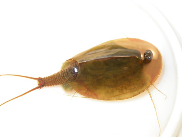


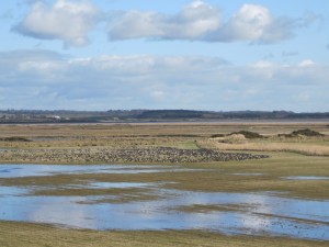

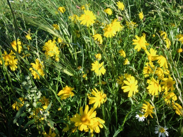
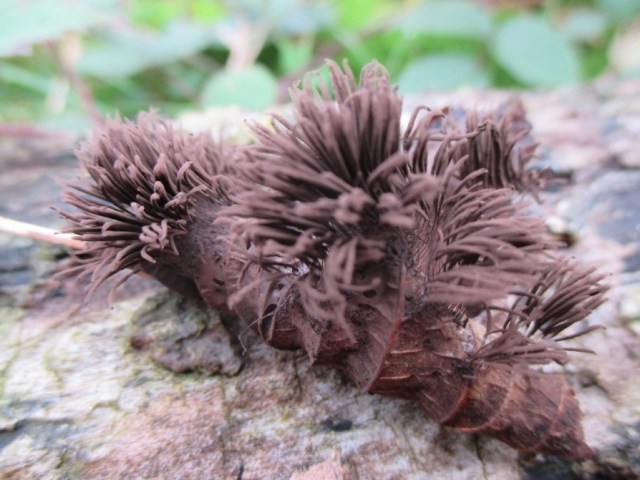
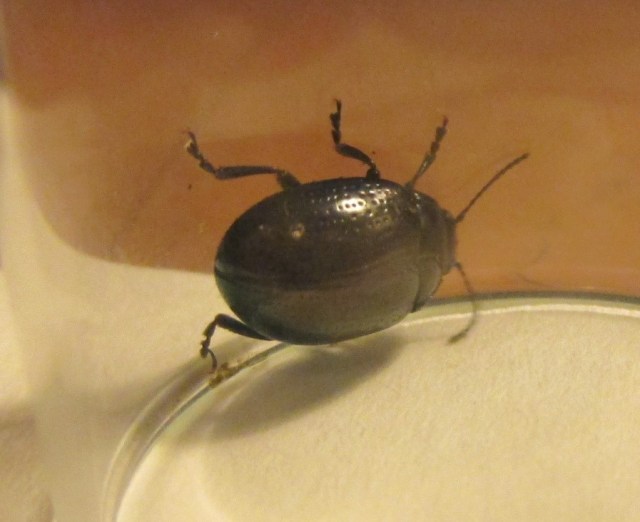


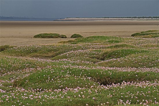

")
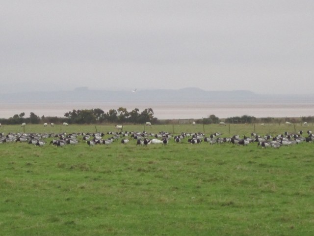
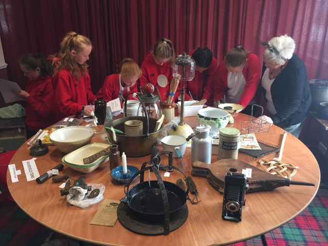


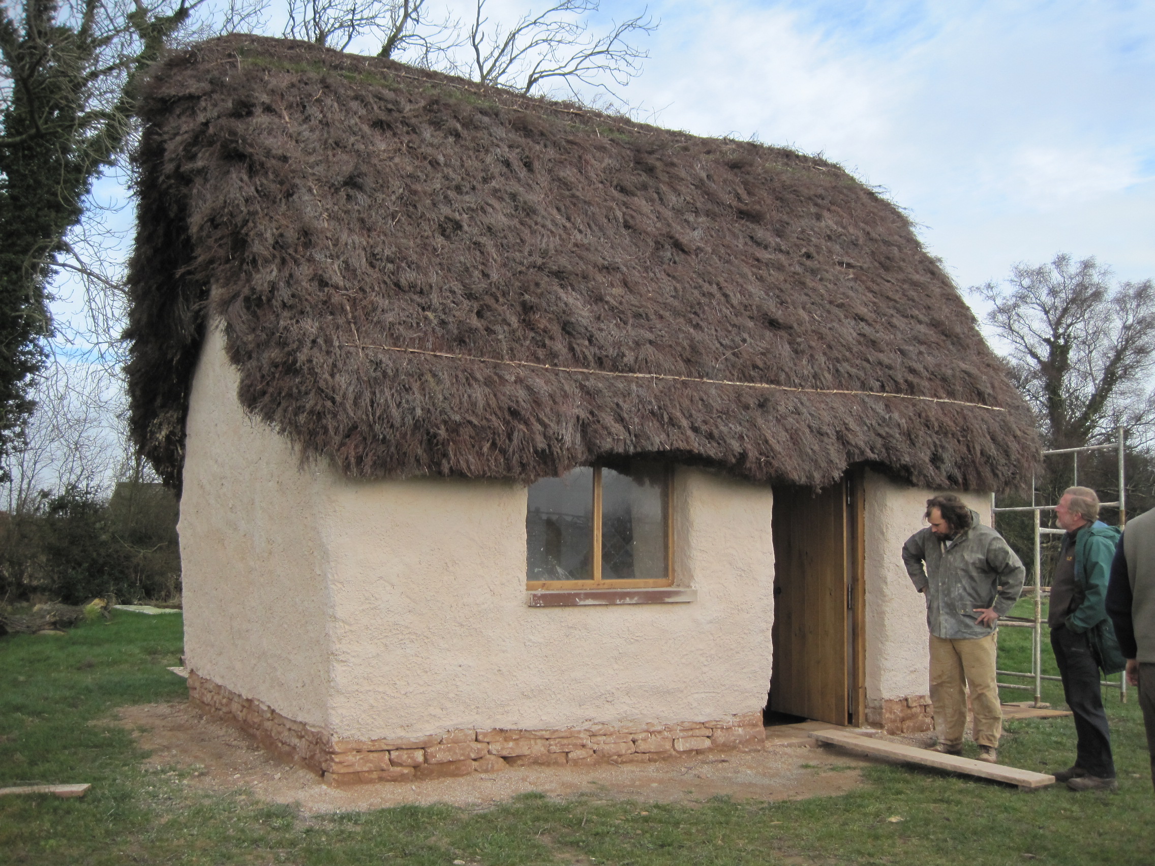


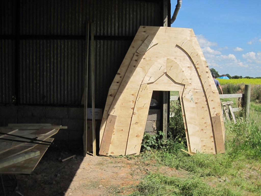
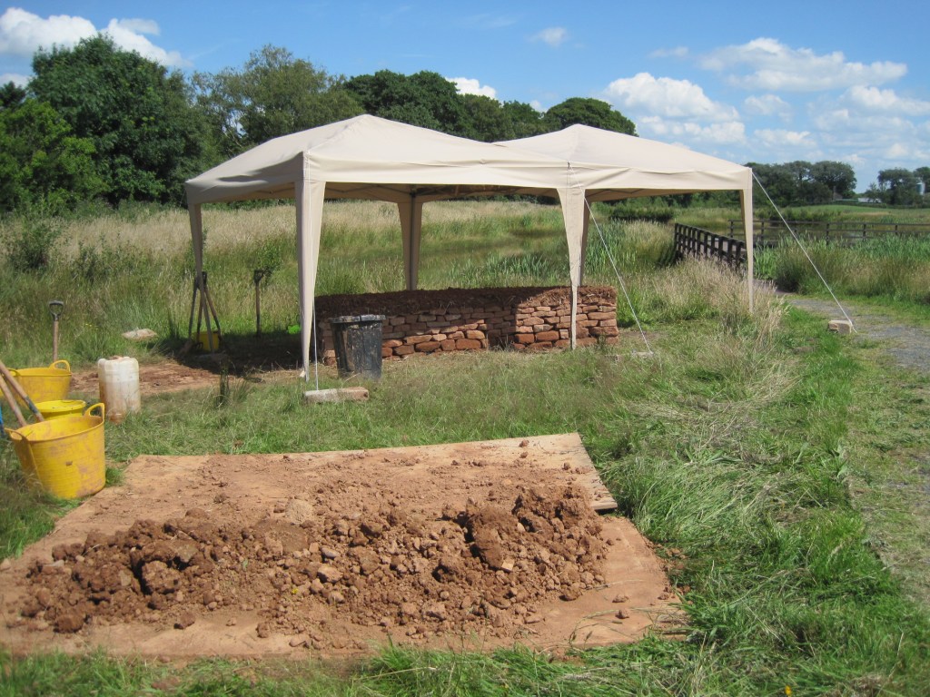
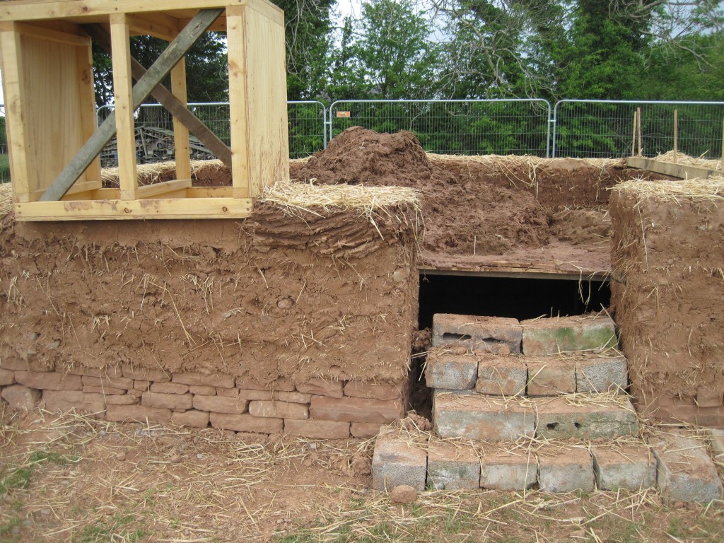
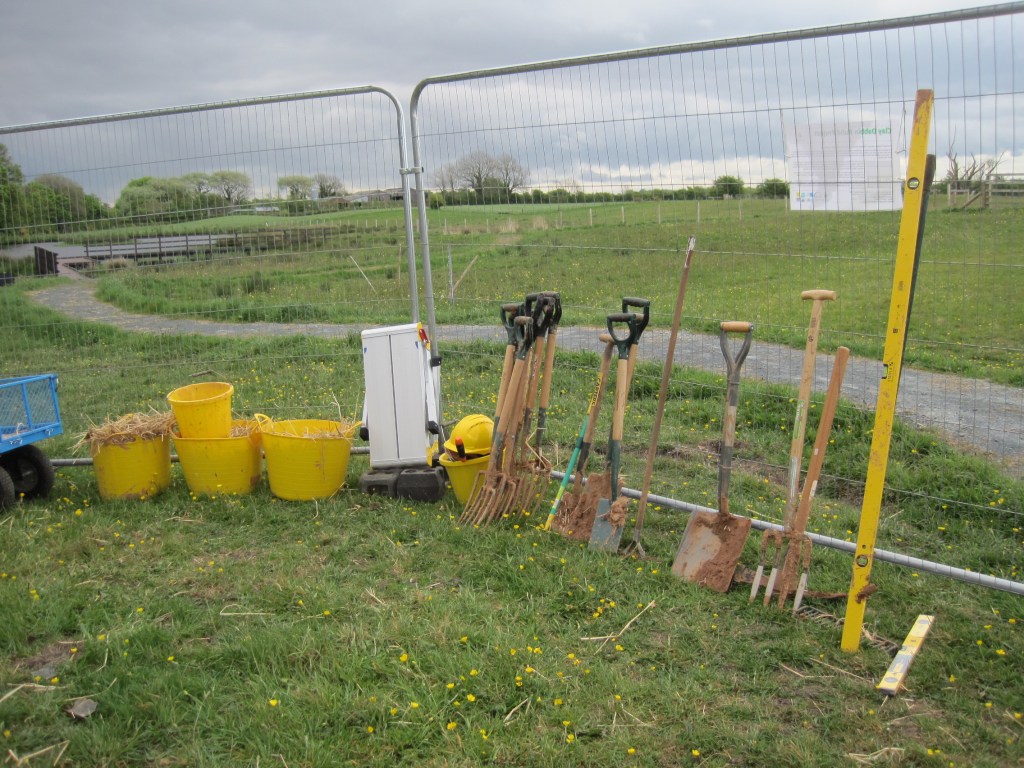


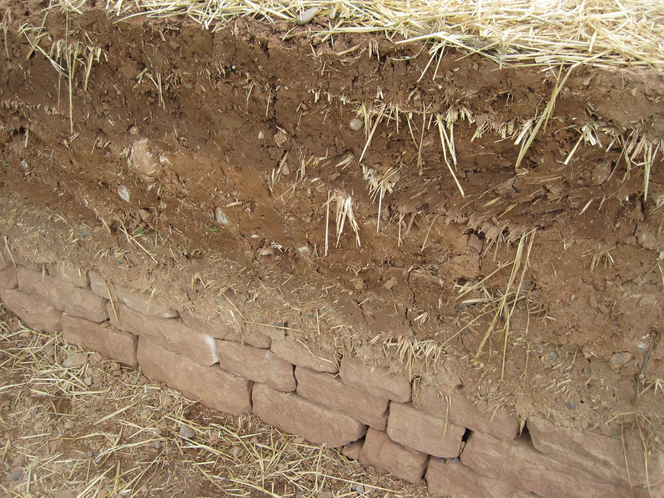
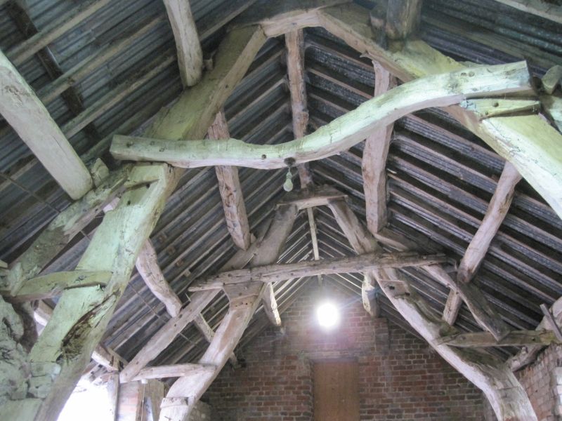
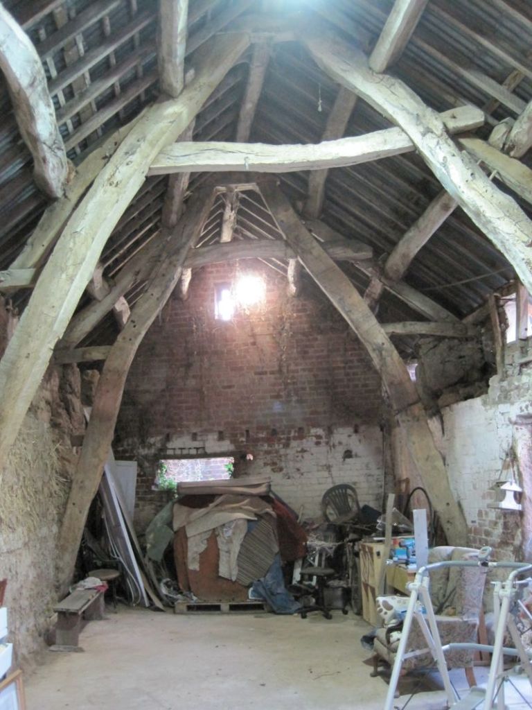

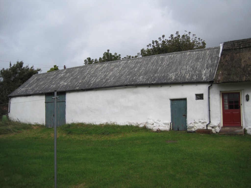
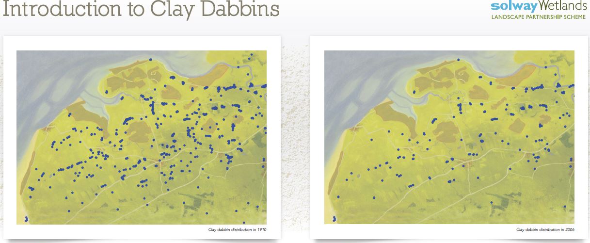
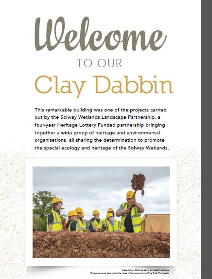


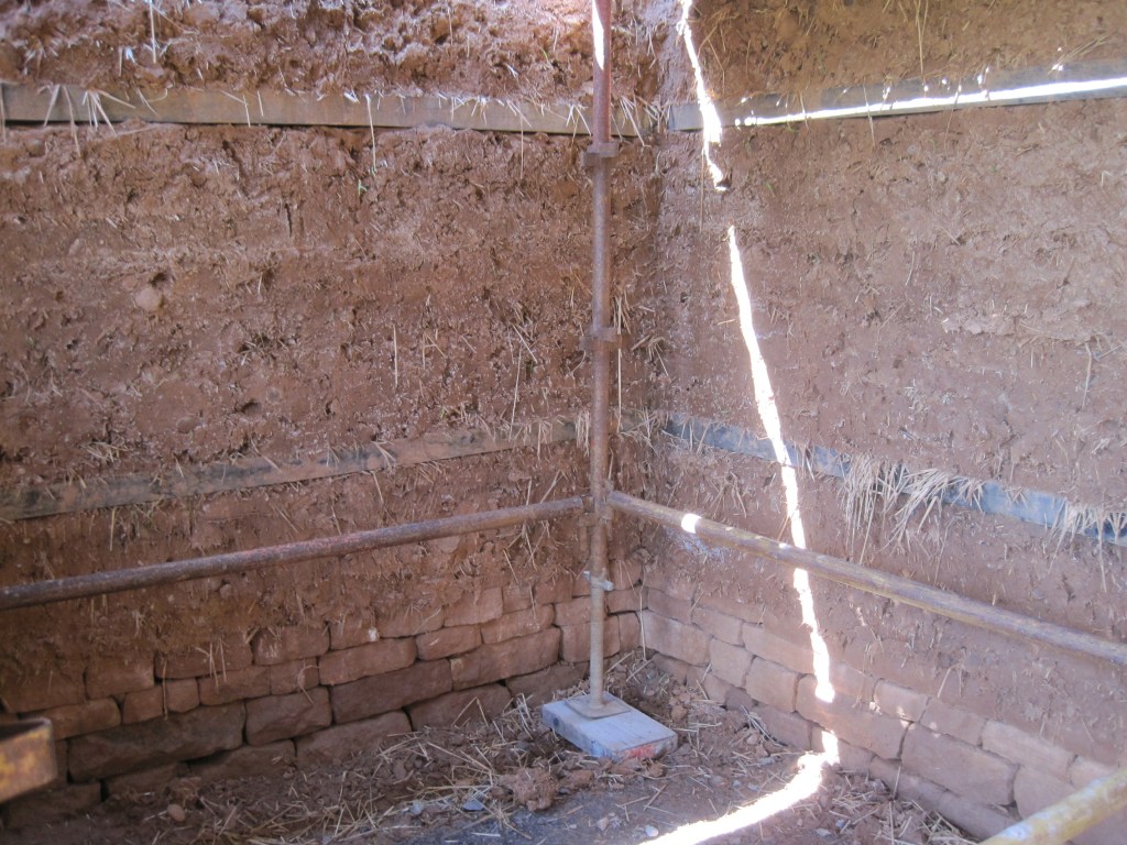

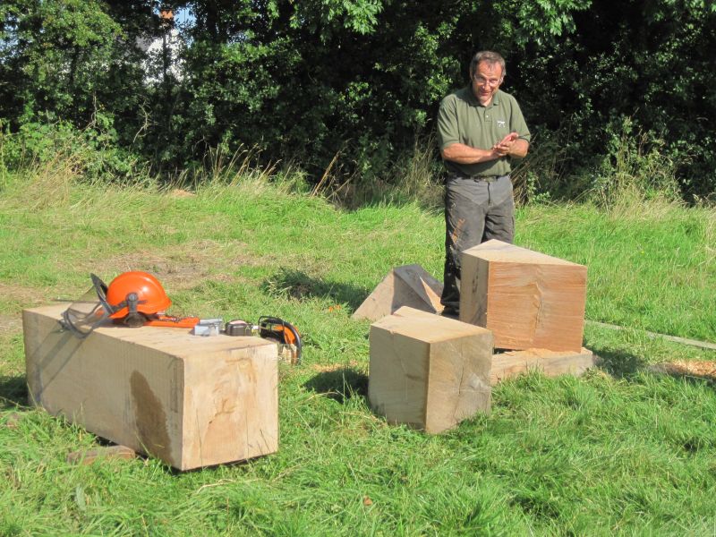
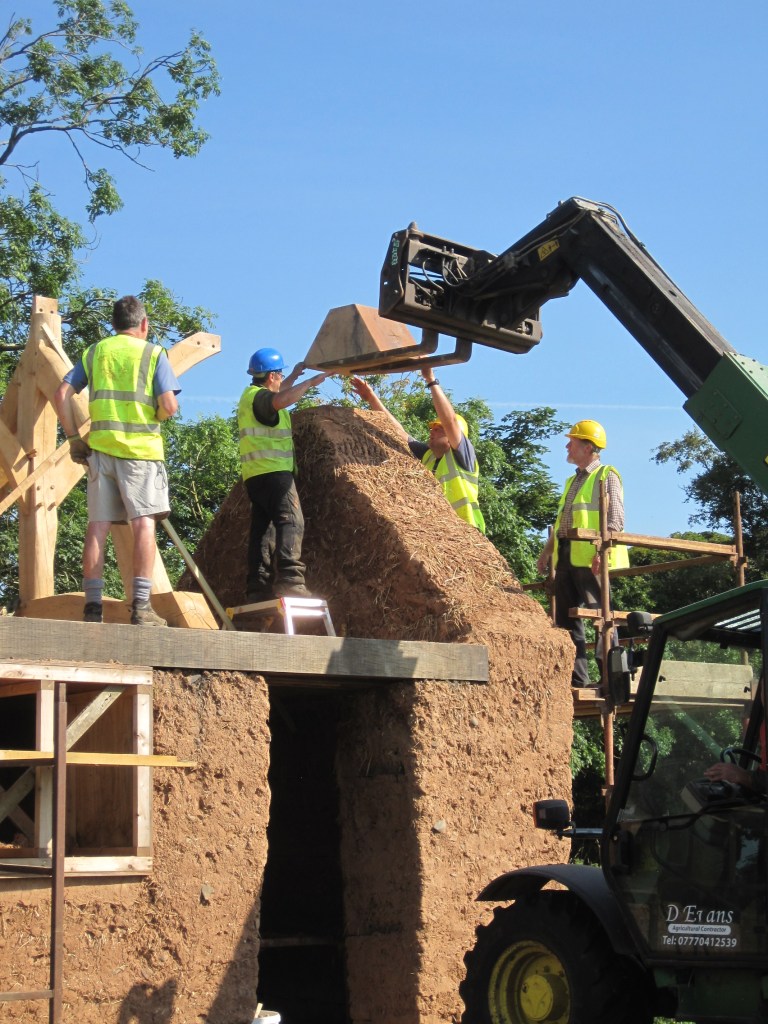
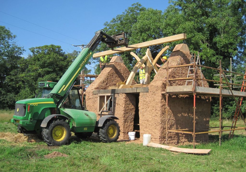

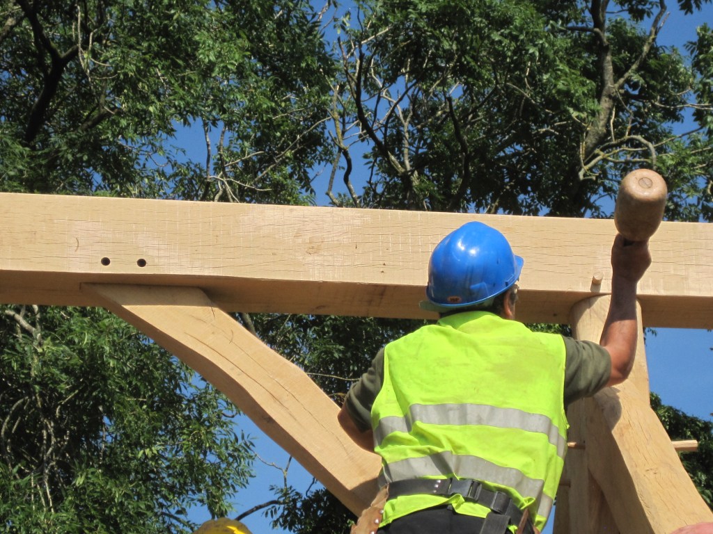

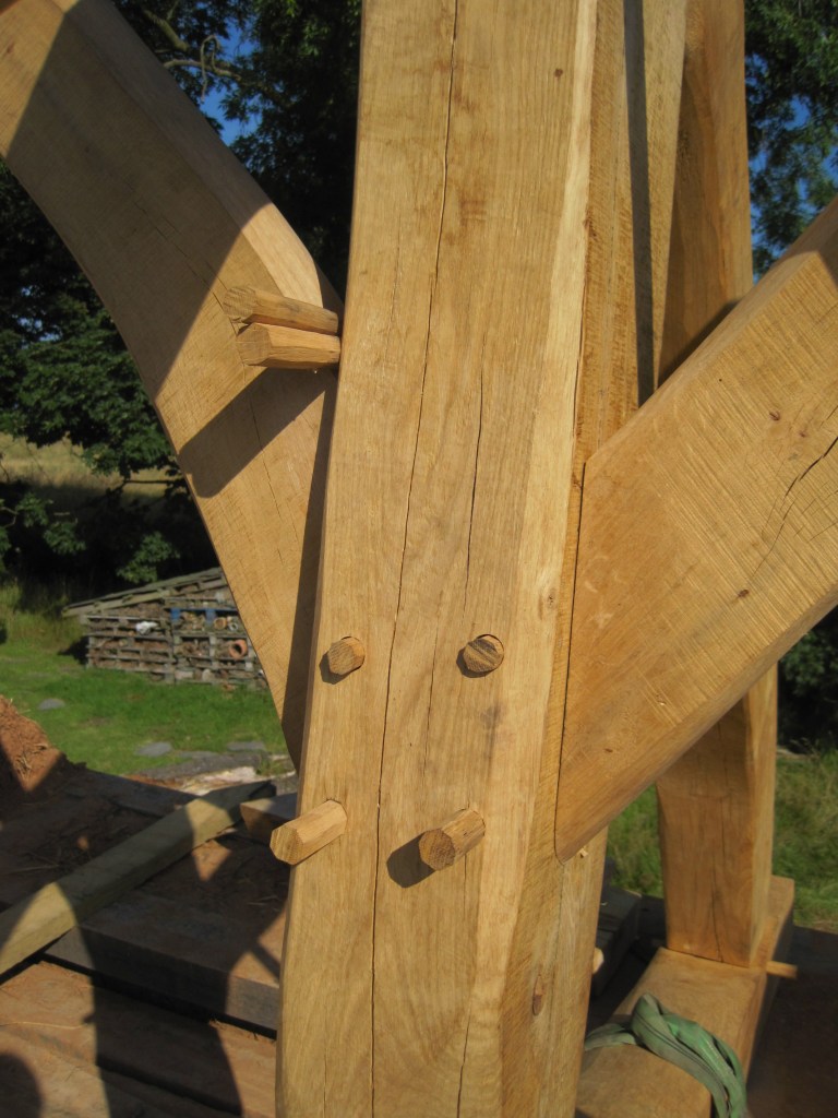
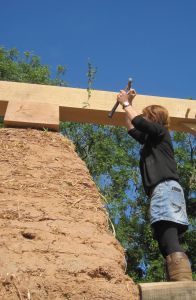
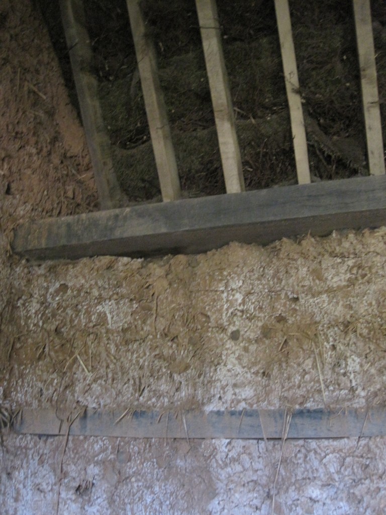
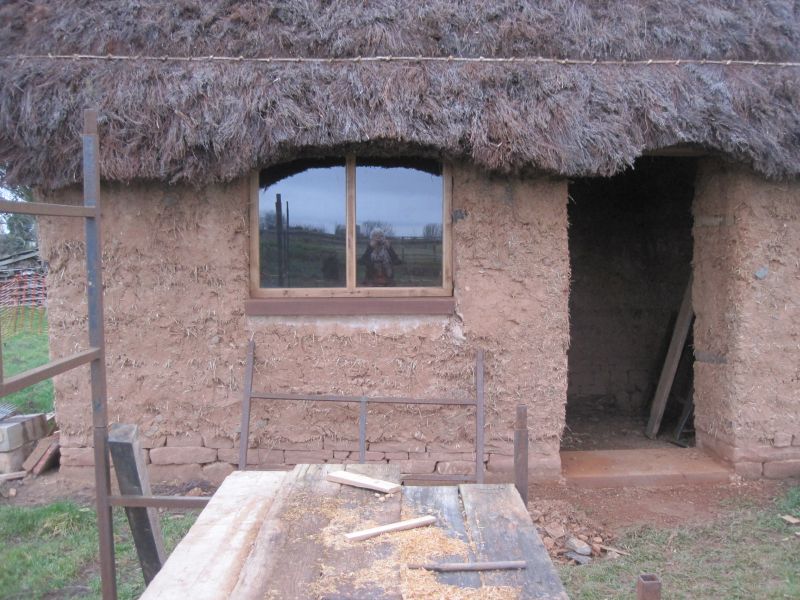
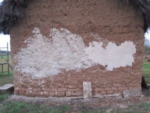
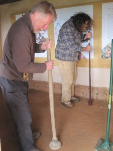

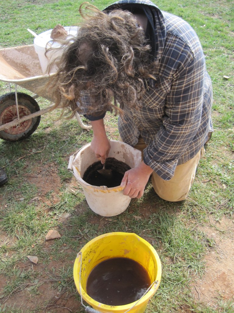
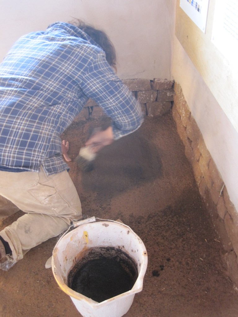

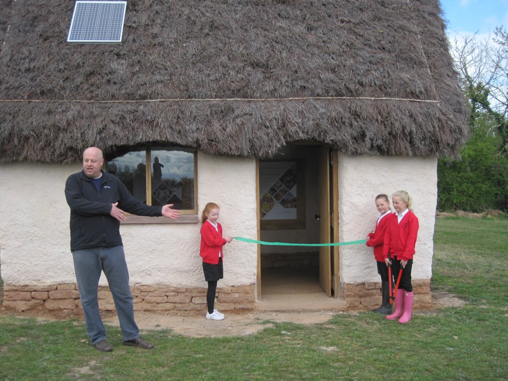


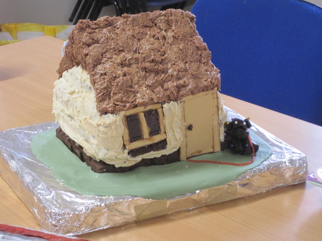

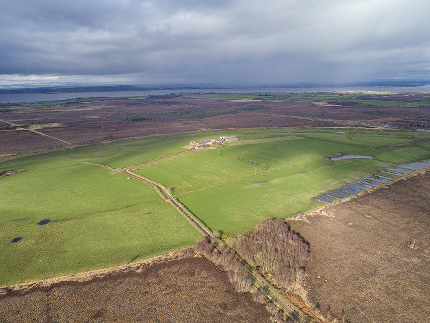


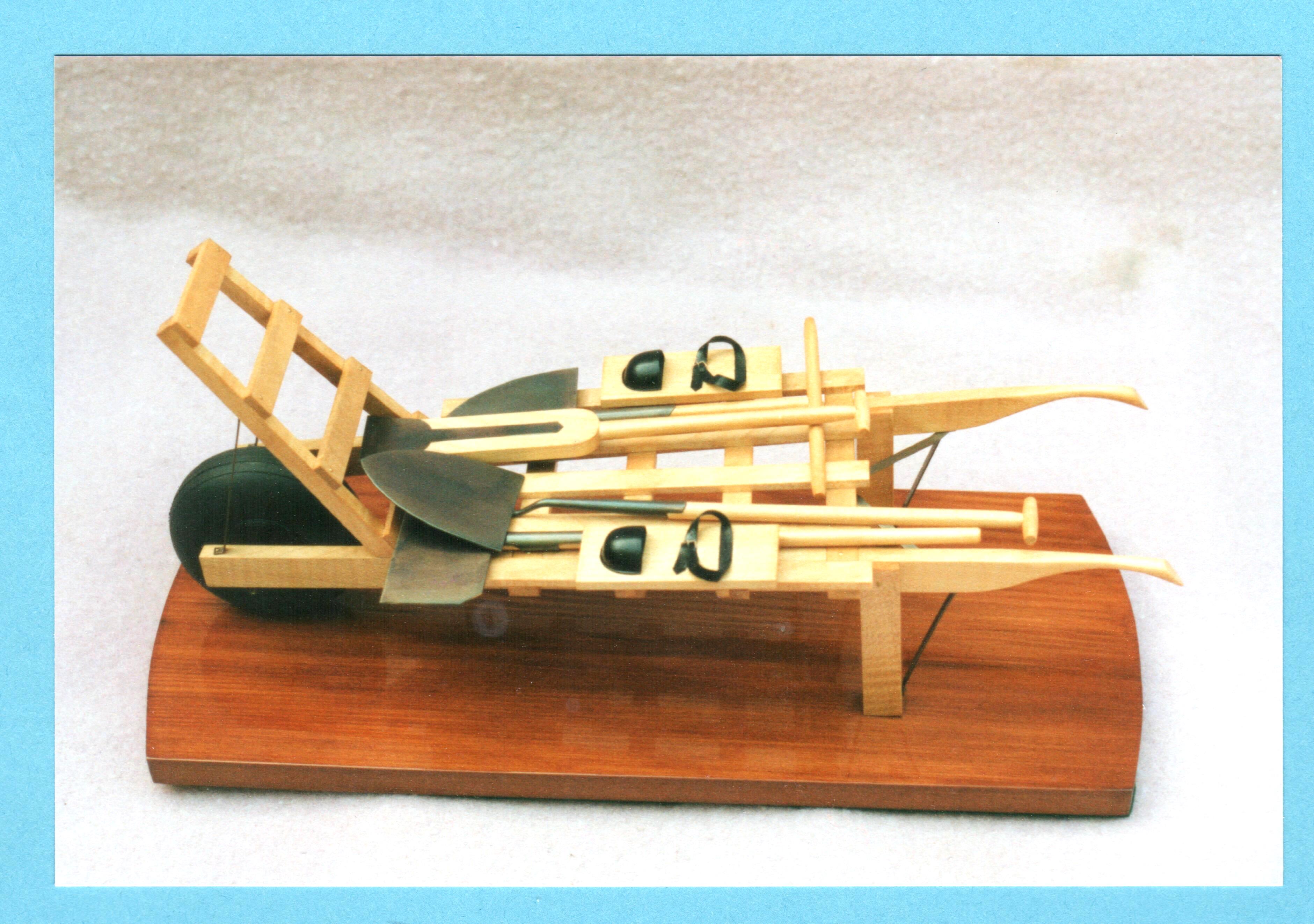
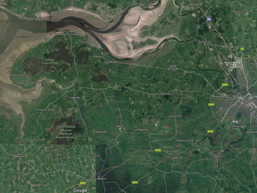

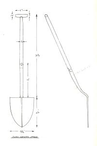
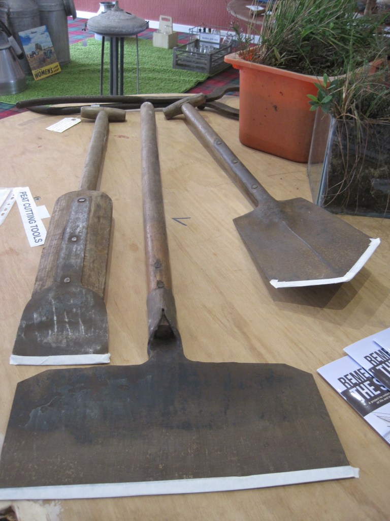

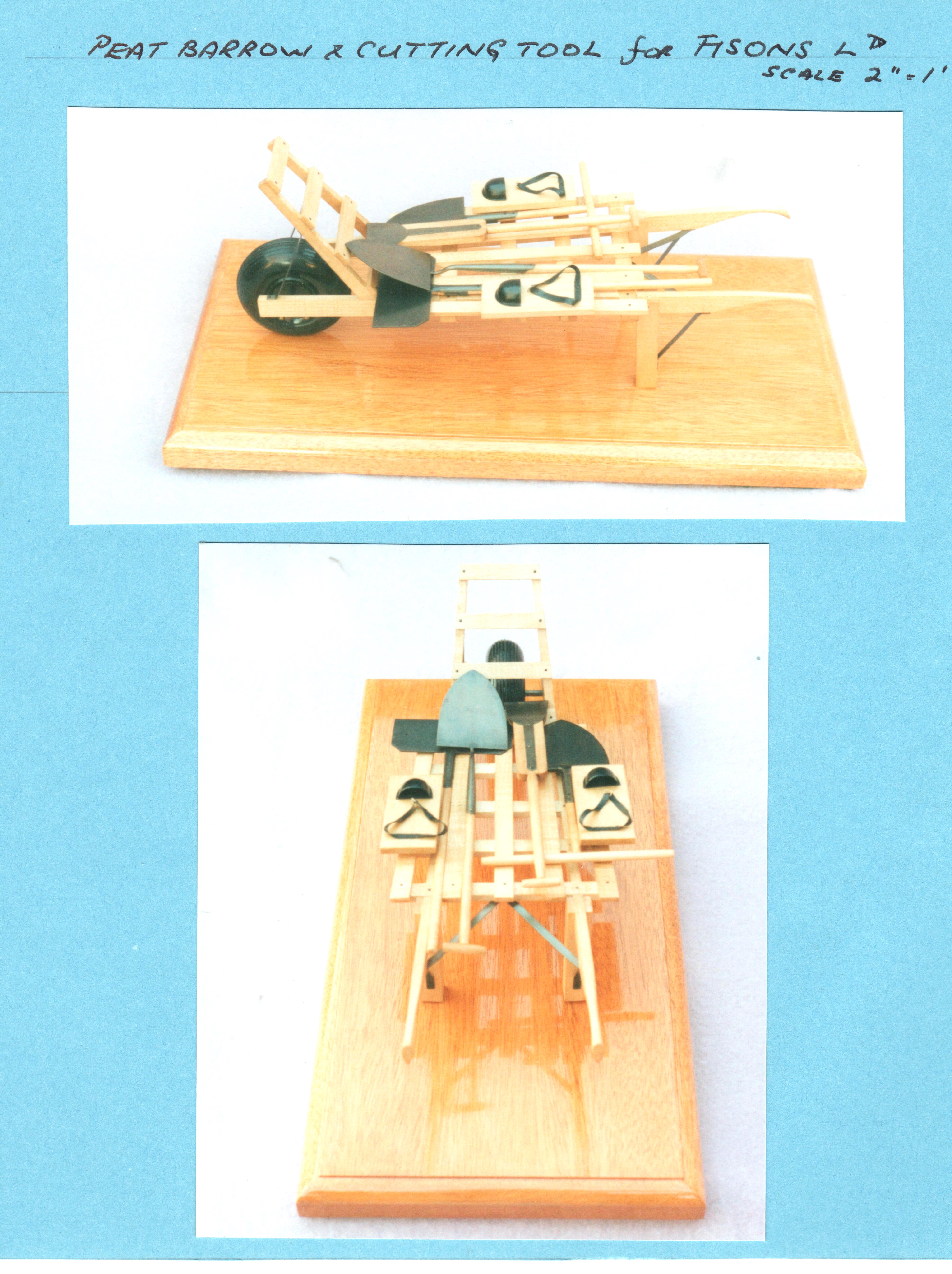
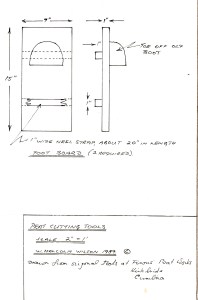
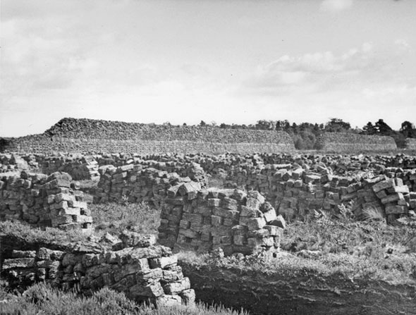
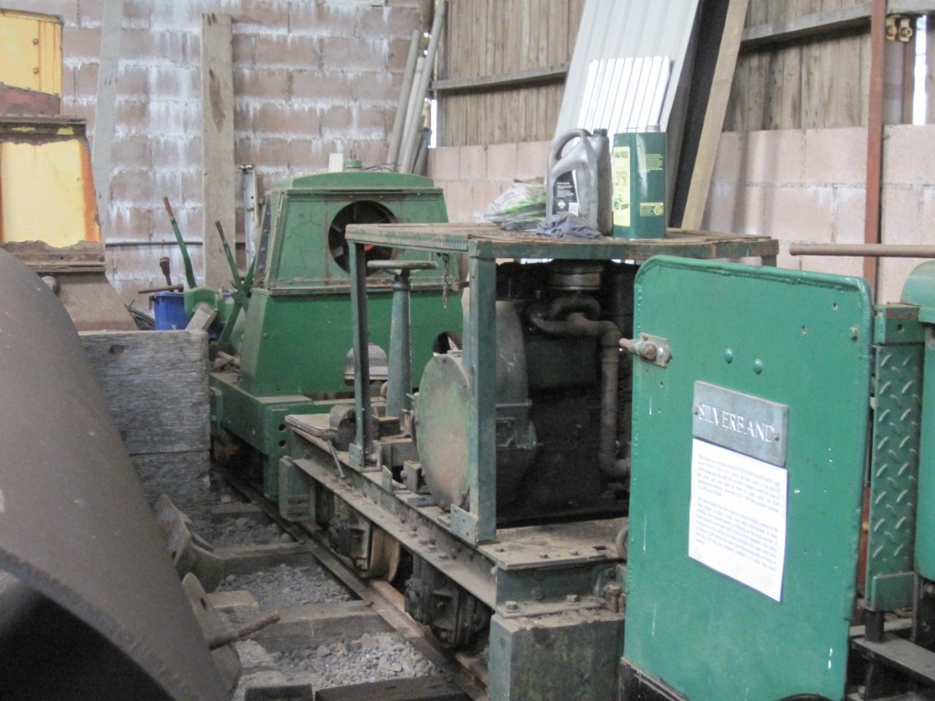
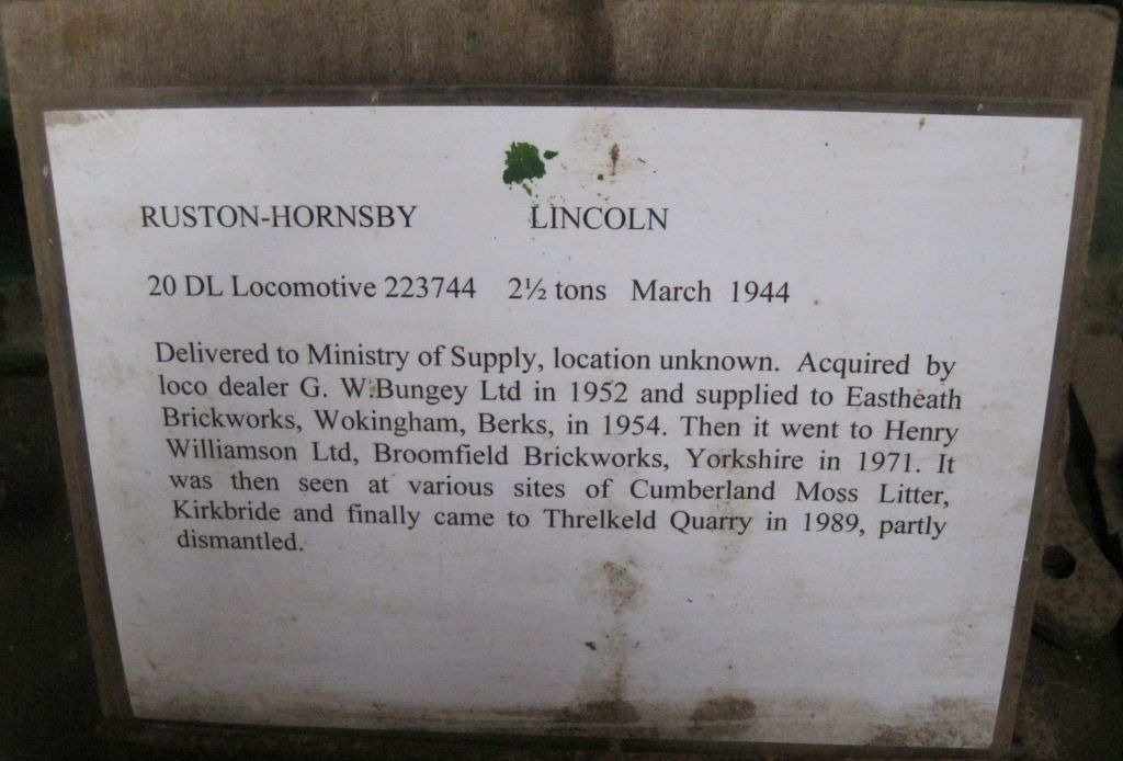
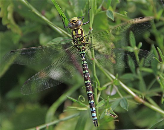
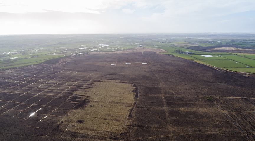


 along the road, leaving a trail of – pong. Two small birds zipped past me and perched on the tall dry grasses – stonechats, with proud strong markings of red and brown.