Haematite in Eskdale

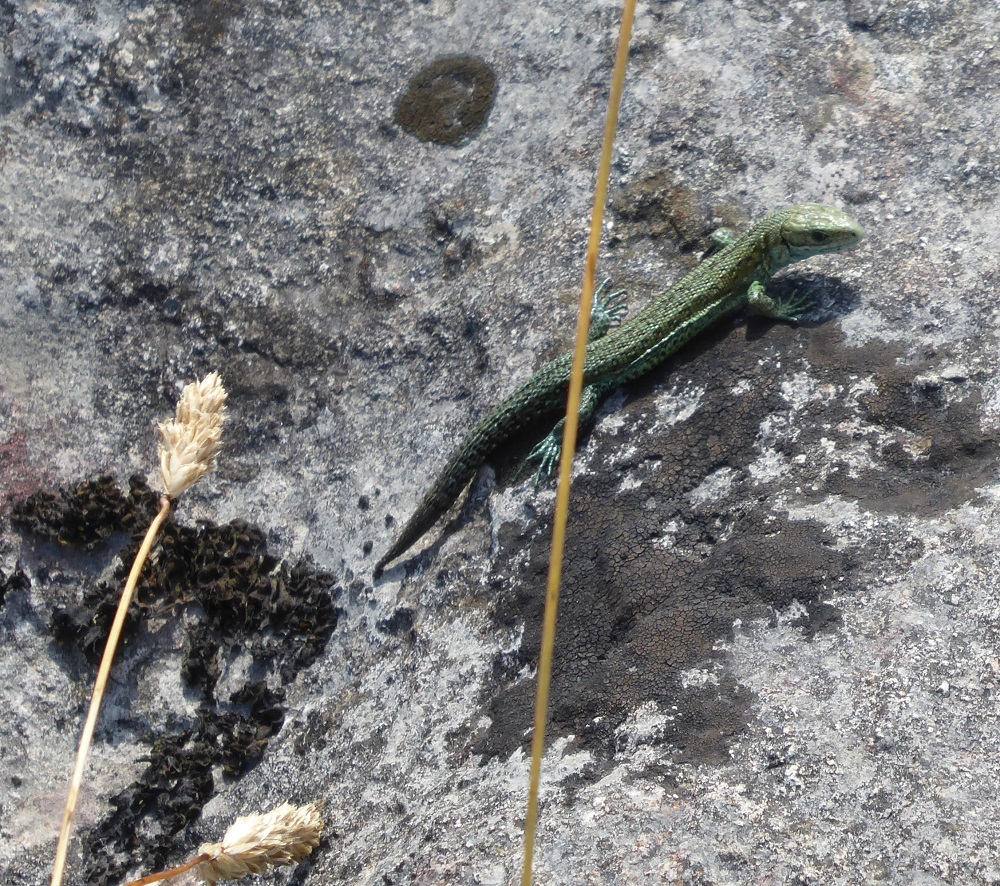
On the first weekend in October the annual ‘Keswick’ Show and Sale of Herdwick sheep is held in Mitchell’s Livestock Mart in Cockermouth. Our tup ‘Bonzo’ had been accepted for official registration in the breed’s Stock Book: his appearance – his grey fleece, and hairy white face, testicles and legs – and therefore presumably his genes, were judged acceptable for sale, and he was being primped for the show. A friend who is a well-known Herdwick breeder came round with a tub of raddle and set to, rubbing the greasy red mixture into the fleece on Bonzo’s back. But up at the mart, surrounded by pens of feisty red-dressed tups who were clashing heads at every opportunity, our tup seemed unimpressed and lay down in his allotted pen, looking bored. When his turn came to show off his masculinity in the ring, his laid-back attitude even prompted some laughter. He did not sell.

Amongst Herdwick breeders, this tradition of dressing the fleece with red raddle is thought to mimic the natural red colour that the sheep would have acquired if they had been grazing on fellsides where the red iron-bearing ore, haematite, was found. These days the pots of raddle are usually bought from Relph’s farm supplies near Penrith. 

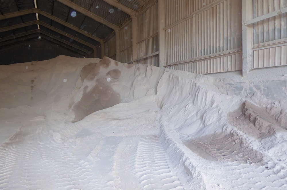
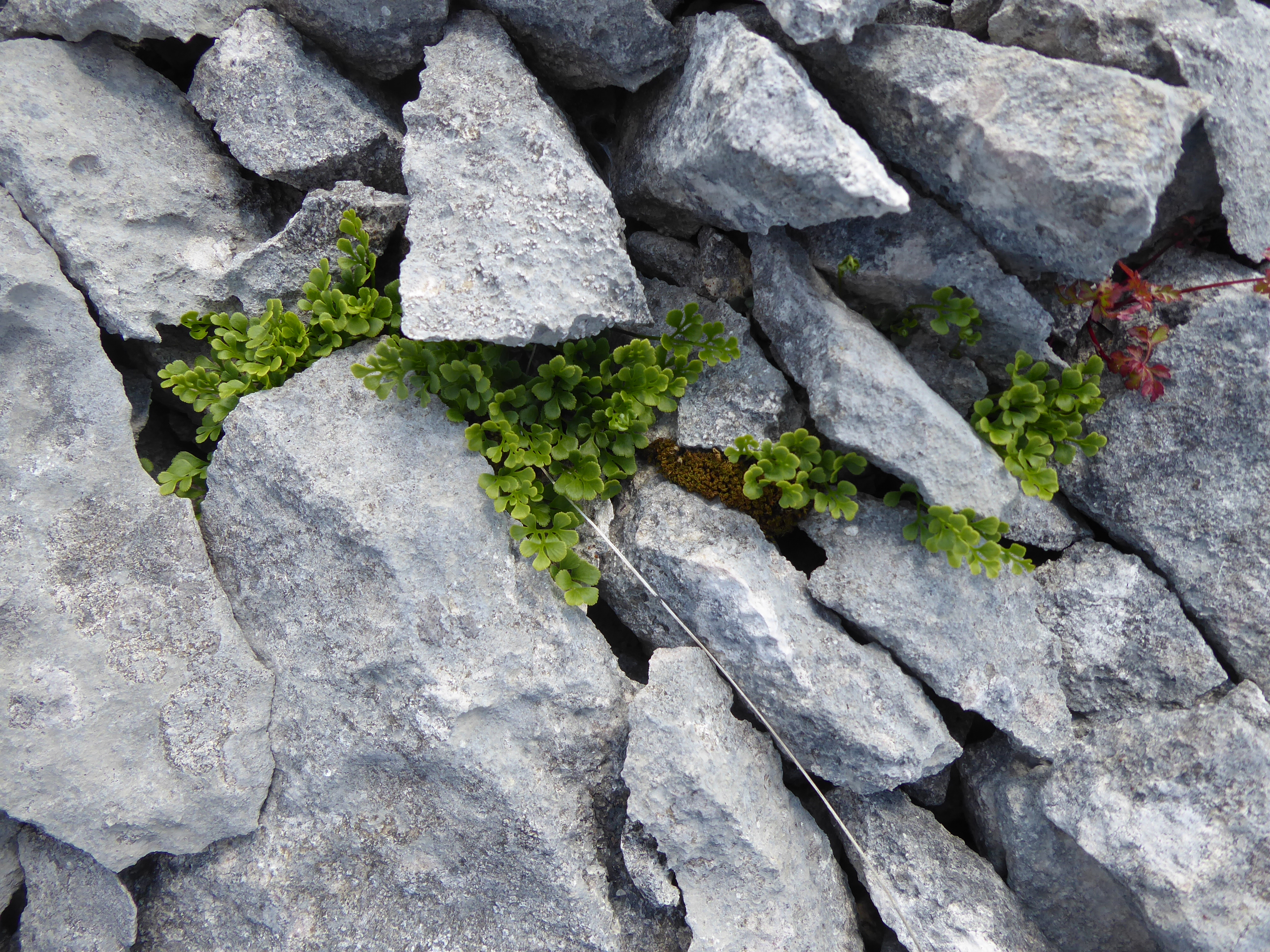
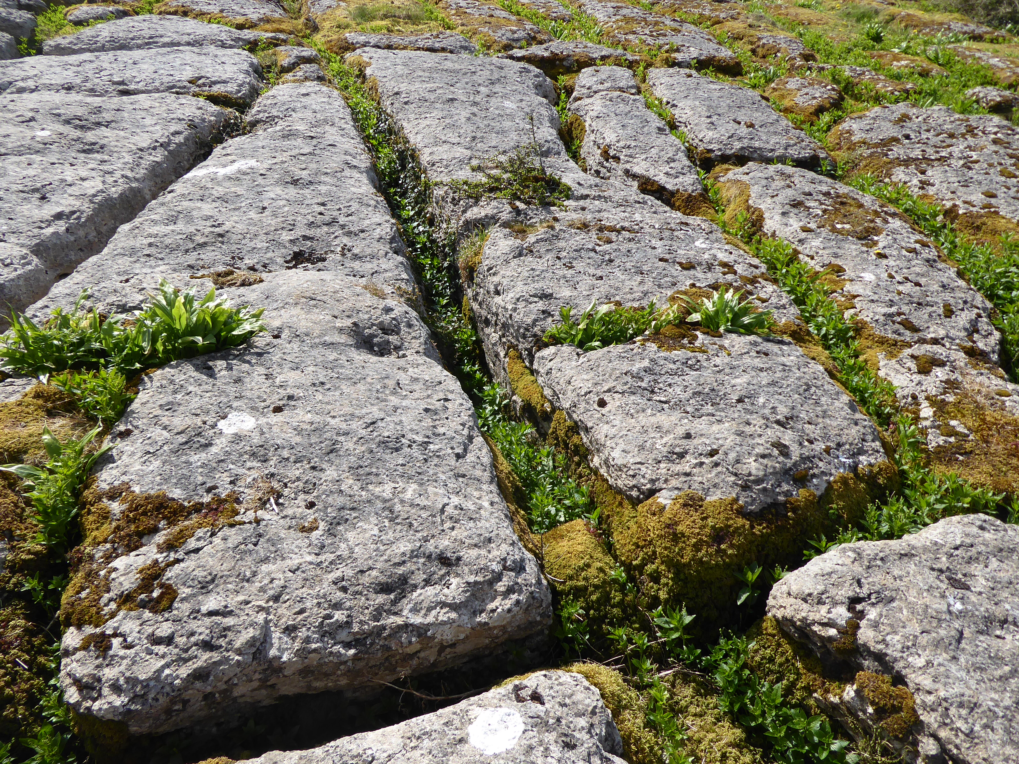
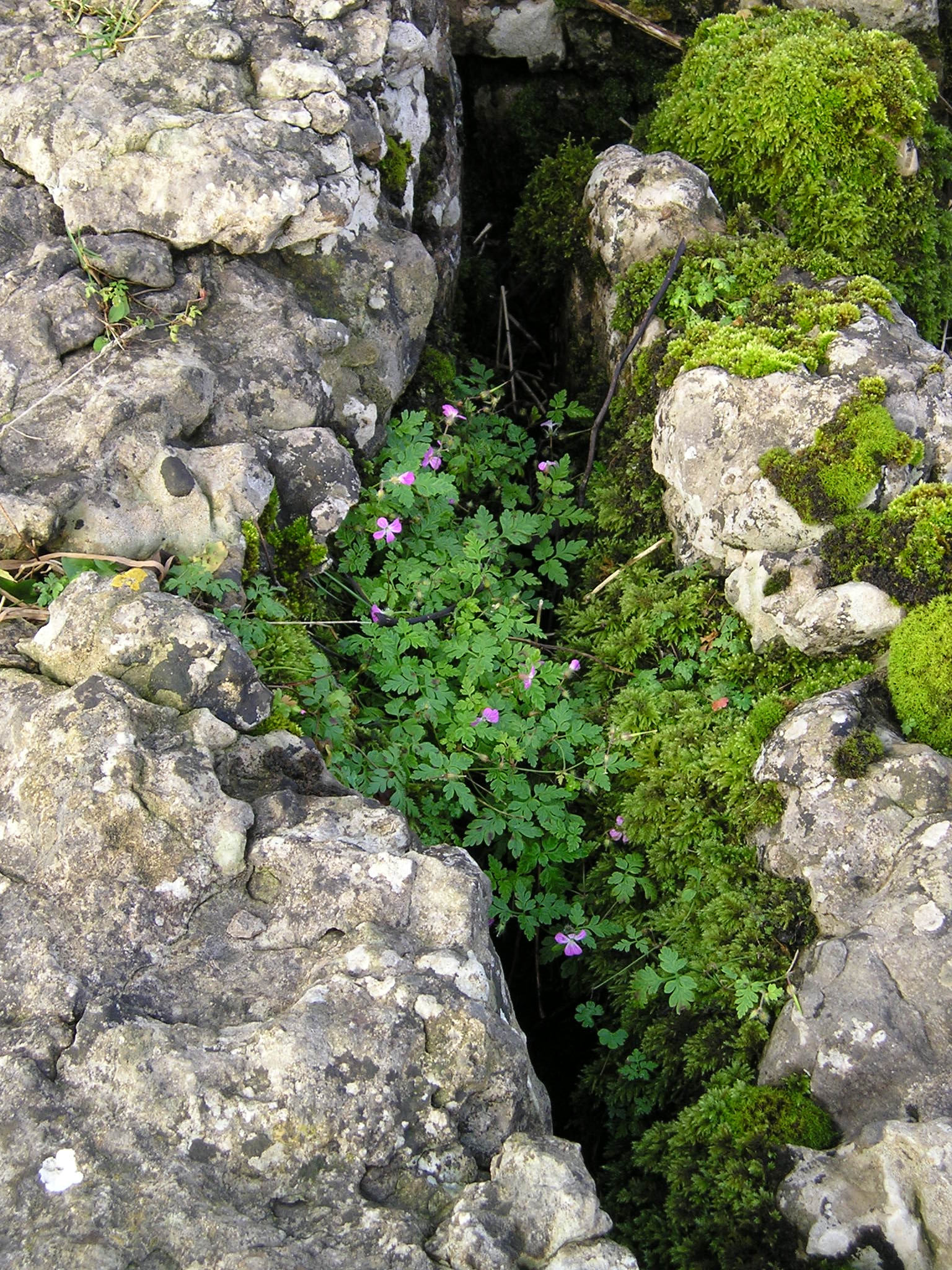
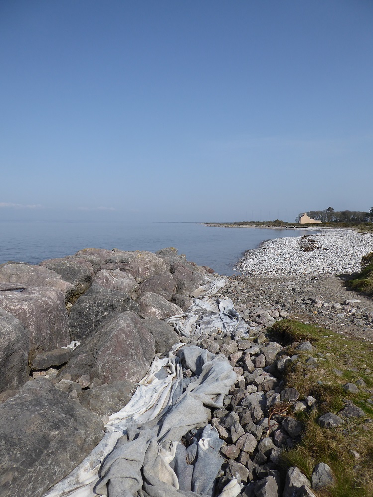
This red haematite is the same pigment that has been used from as long ago as Stone Age cave paintings [7]; it is used to colour lime plaster and mortar, as ‘Venetian Red’ (see blogpost ‘Hot mix’); and has been used at the Florence Arts Centre (which is on the site of the former Florence haematite mine) as a pigment for modern projects on painting and dyeing. It defines the molehills on the soil above the Triassic Sandstone of St Bees, and the mud on the tracks around the limestone areas of Egremont and Millom, and it smears down the Nab Gill fellside over the pink granite of Eskdale.

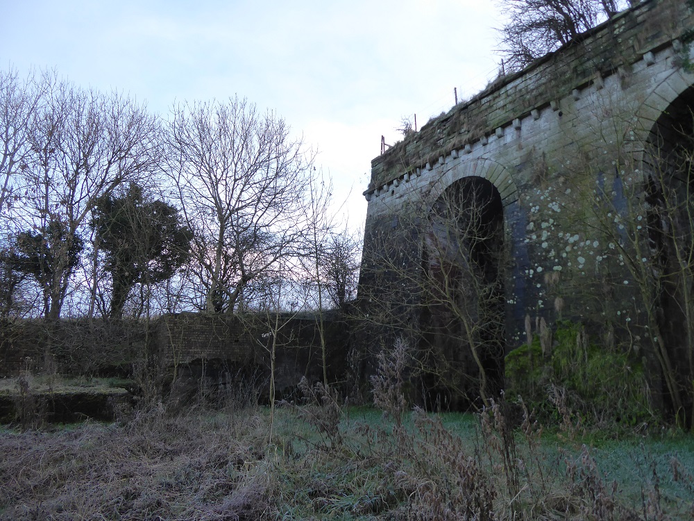
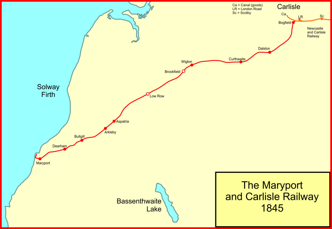
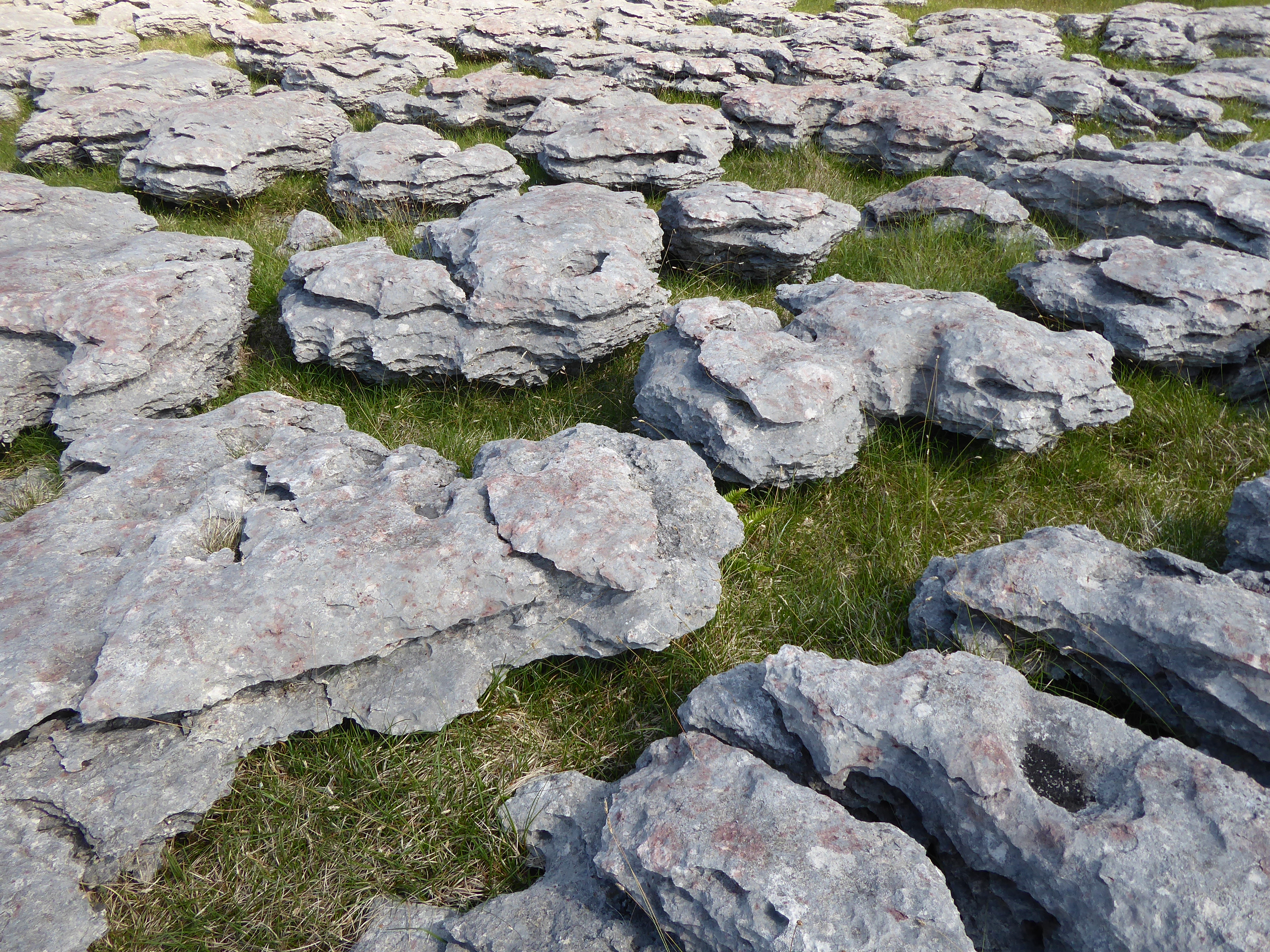
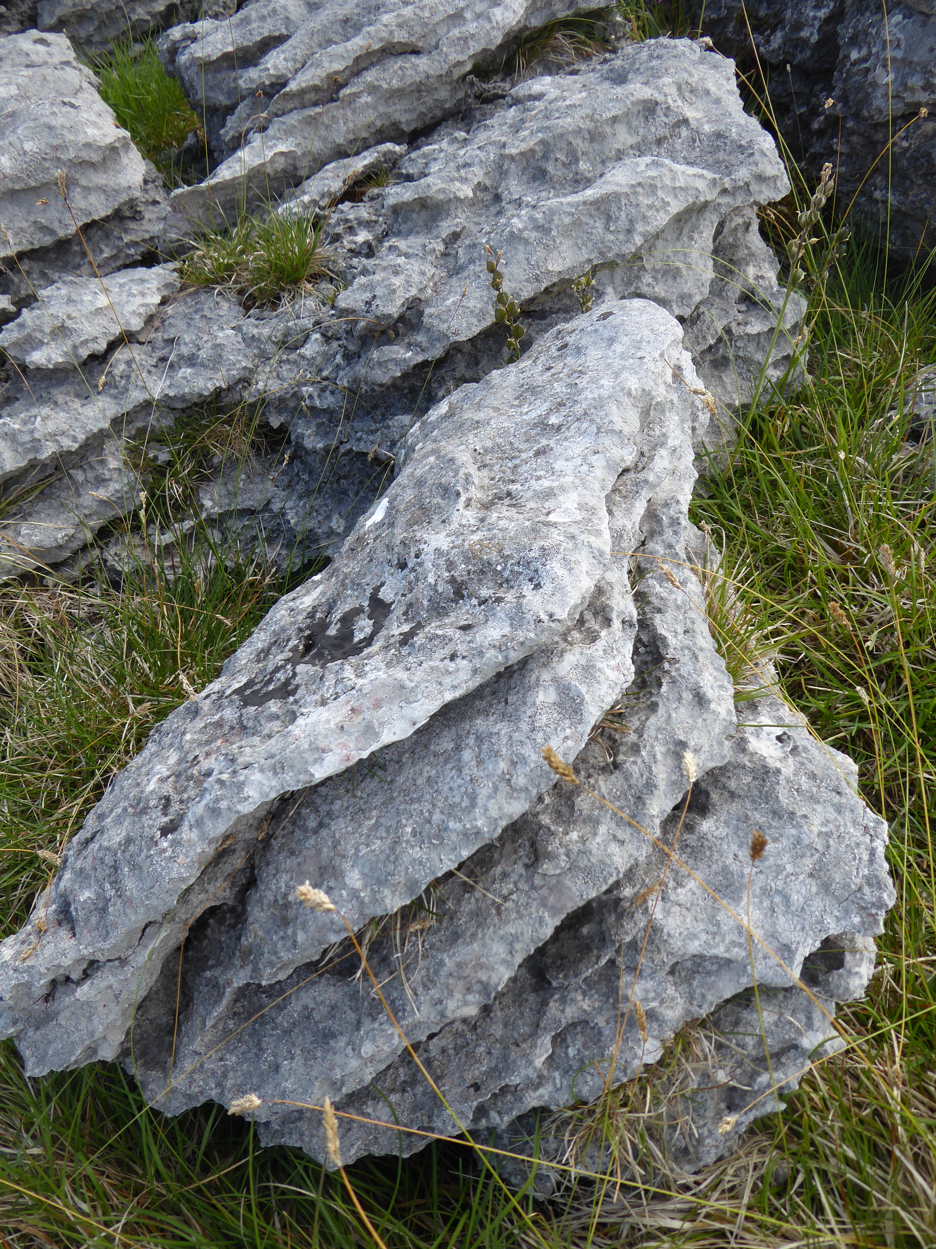
In this form, the particles of haematite are small and powdery, mixed in with the soil; it is the least pure form of the ore and scarcely worth working. But the soluble iron salts also once dribbled and trickled through the joints and faults of the limestones of West and South Cumbria, becoming oxidised and insoluble as they crystallised to form veins and lumpy masses of haematite, in sufficient quantities of good quality ore that it was worth mining and smelting it to form iron. This haematite, plus local limestone, and plentiful coal from the West Cumbrian coalfields combined to form perfect conditions for smelting and steel-making, and thereby making Victorian and early 20th century Cumberland rich, with the extra benefits of stimulating improved infrastructure in the form of new railways (for example, the Solway Junction Railway and its viaduct across the Solway Firth [1] ) and improved ports.

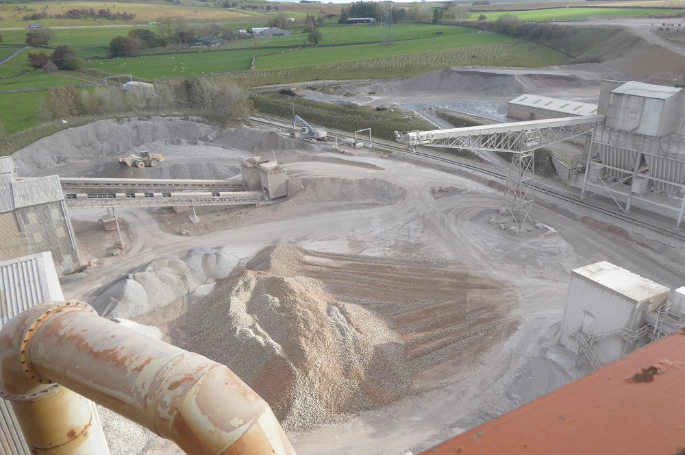
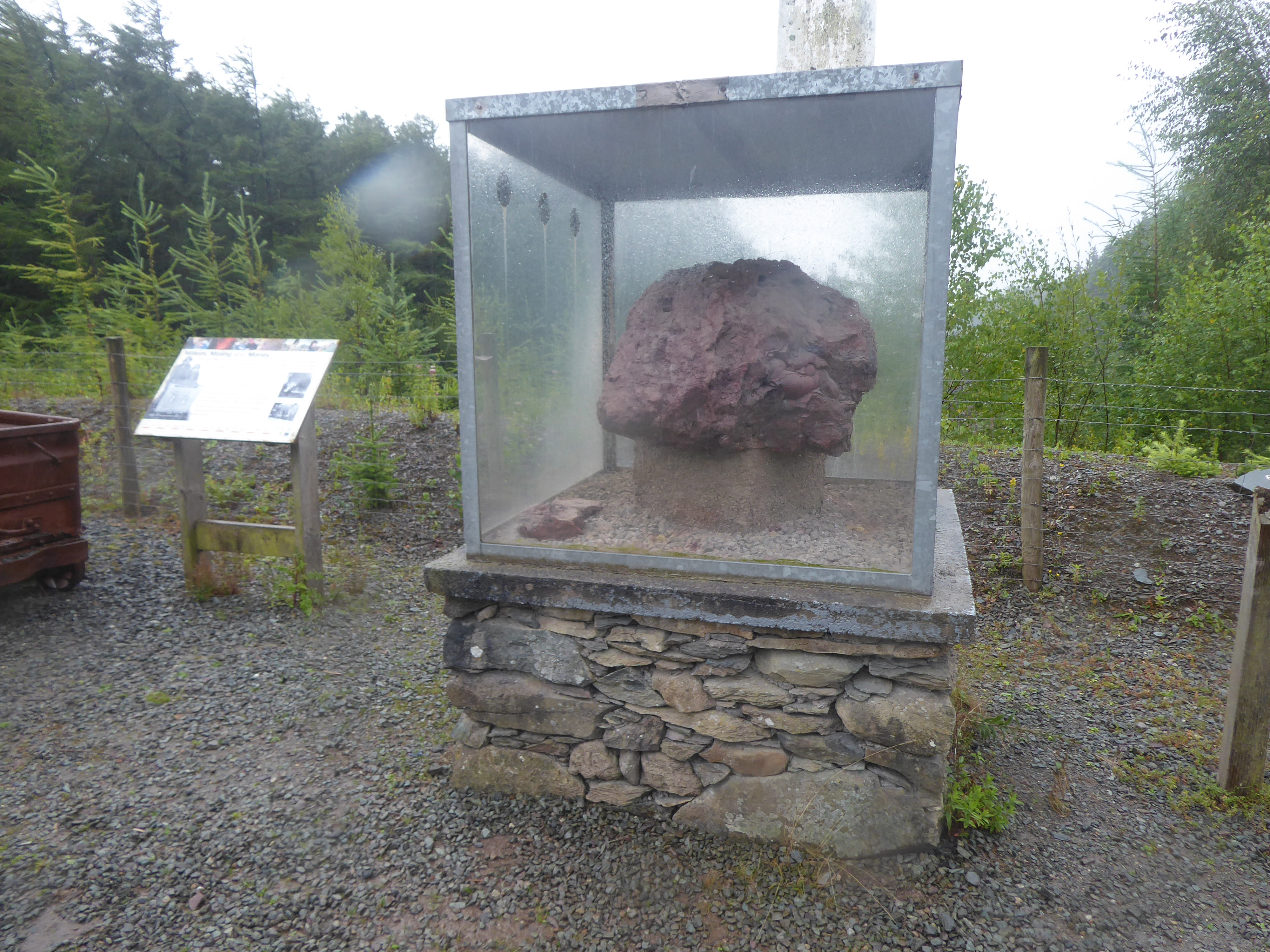
Along a gated track close to a quarry a few miles North of the former haematite mines of Hodbarrow and the ironworks of Millom, is the Millom Rock Park. Quarry companies have very large machines for obtaining and lifting chunks of rock, and here the owners have laid out a demonstration of the kinds of rock that are found in Cumbria, such as granite, Skiddaw slate, and andesite from the Borrowdale Volcanics group. The park – a flattened area otherwise cleared of stone – looks a little tired, the ‘type specimens’ no longer identified except by rotting wooden posts from which the labels have vanished, but at one end there is a perspex box inside which is cemented a hefty, bulbous lump of kidney haematite, brought here from Hodbarrow. The information board, headed ‘Millom, Mining and Money’, is still intact and shows a black-and-white photo of helmeted men smiling for the photographer and pushing a wheeled metal truck that is laden with ore; in colour, red would have predominated.

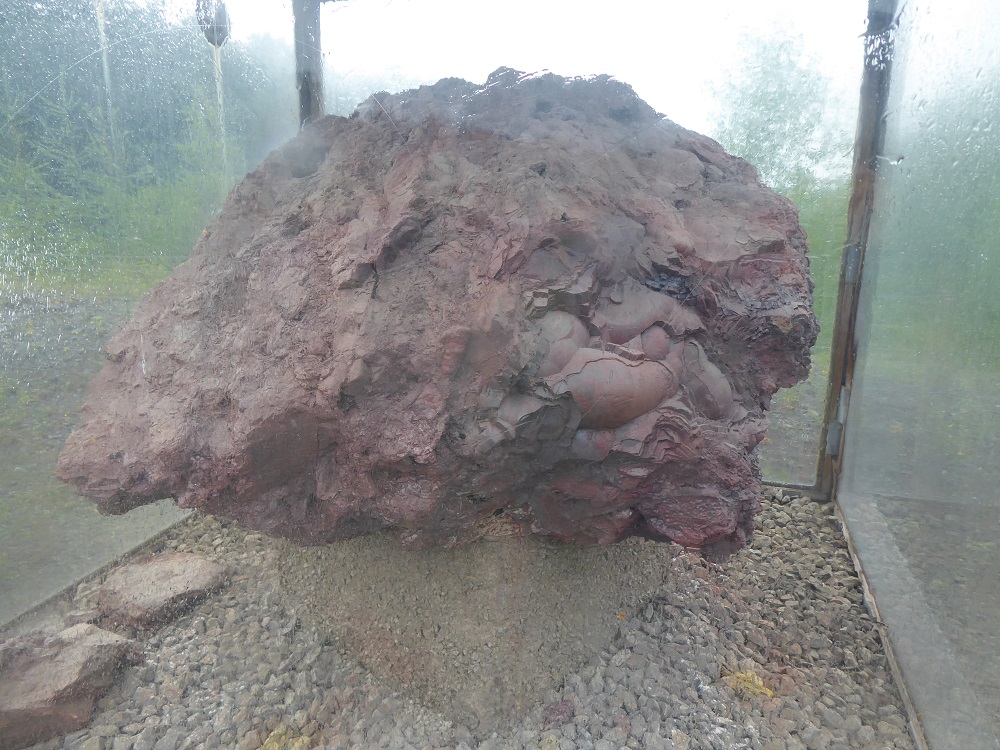
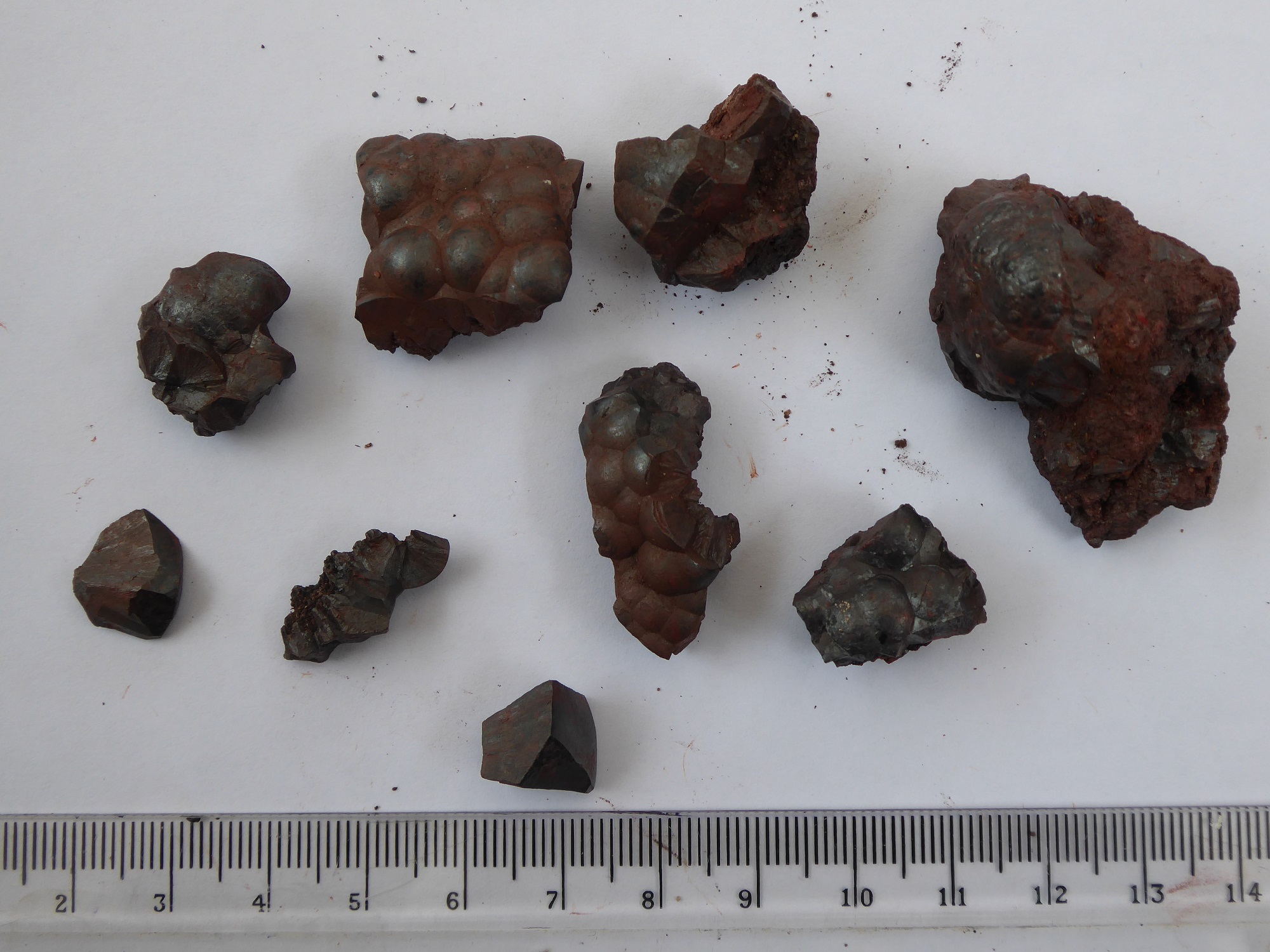
Mervyn Dodd, in his book, The Story of Iron Ore Mining in West Cumbria [2], describes how the different forms of the ore arise: veins are steep and narrow bodies of ore close to faults; flats, as their name suggests, follow the layers of rock; and there are vugs, which are spaces within the rock where irregular shapes like the kidney ore can grow. Some of the kidney shapes can grow to a massive size, like the one from Hodbarrow, and smaller versions were often seen being used as doorstops in the mining areas.

Veins, vugs & flats: haematite formations. From Mervyn Dodd’s book The Story of haematite mining in West Cumbria [2]

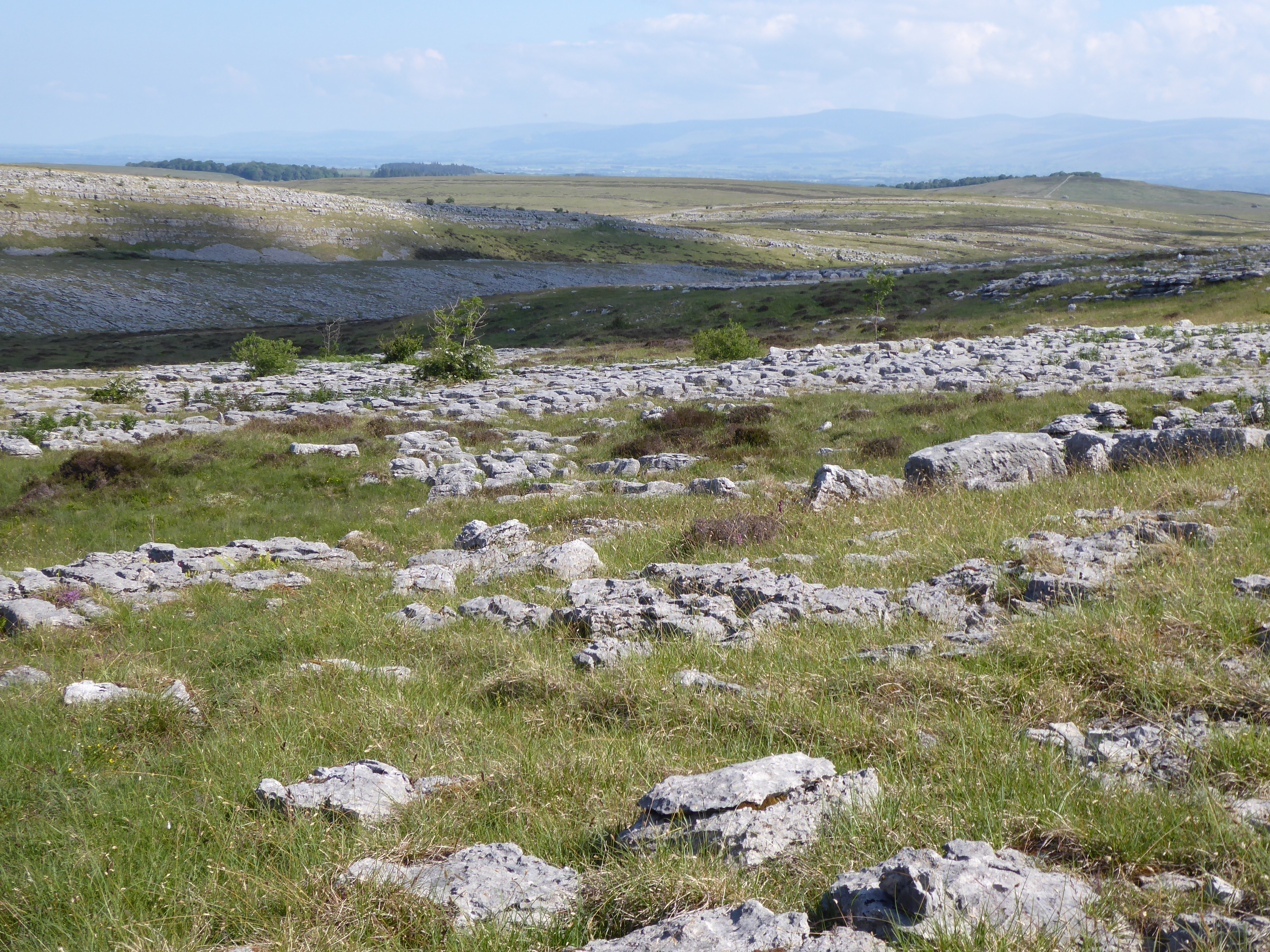
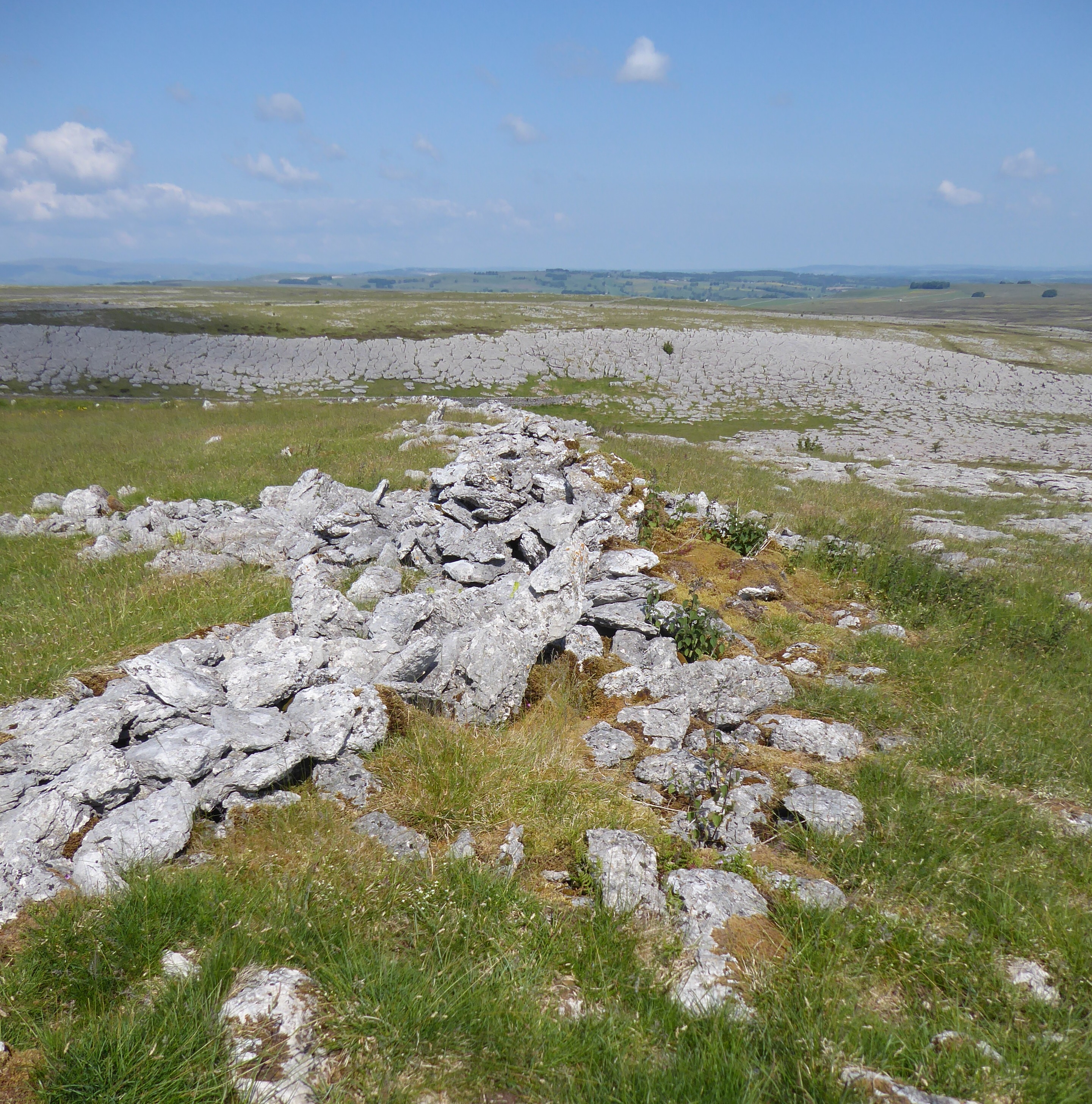
Dodd’s book also has a diagrammatic map that shows the principal areas of the West Cumbrian limestone where haematite was mined, and he includes details of short walks to explore these sites. “Castles in the red ore made/ Are buttressed, tunnelled, turreted” [3] : these mines, in the Cleator Moor and Egremont area and down to the South around Furness, “became the richest mining areas in the world”, according to Albyn Austin [4], but after they ceased being worked, the mines were filled in or cleared, and very little remains to be seen. So my first ‘geological’ outing to a haematite mine was not to a disused mine in the limestone area, but to Nab Gill, one of the mines of Eskdale [4] , in the granite at the edge of the Western Fells.

The haematite areas of West Cumbria: from Mervyn Dodd’s book [2]

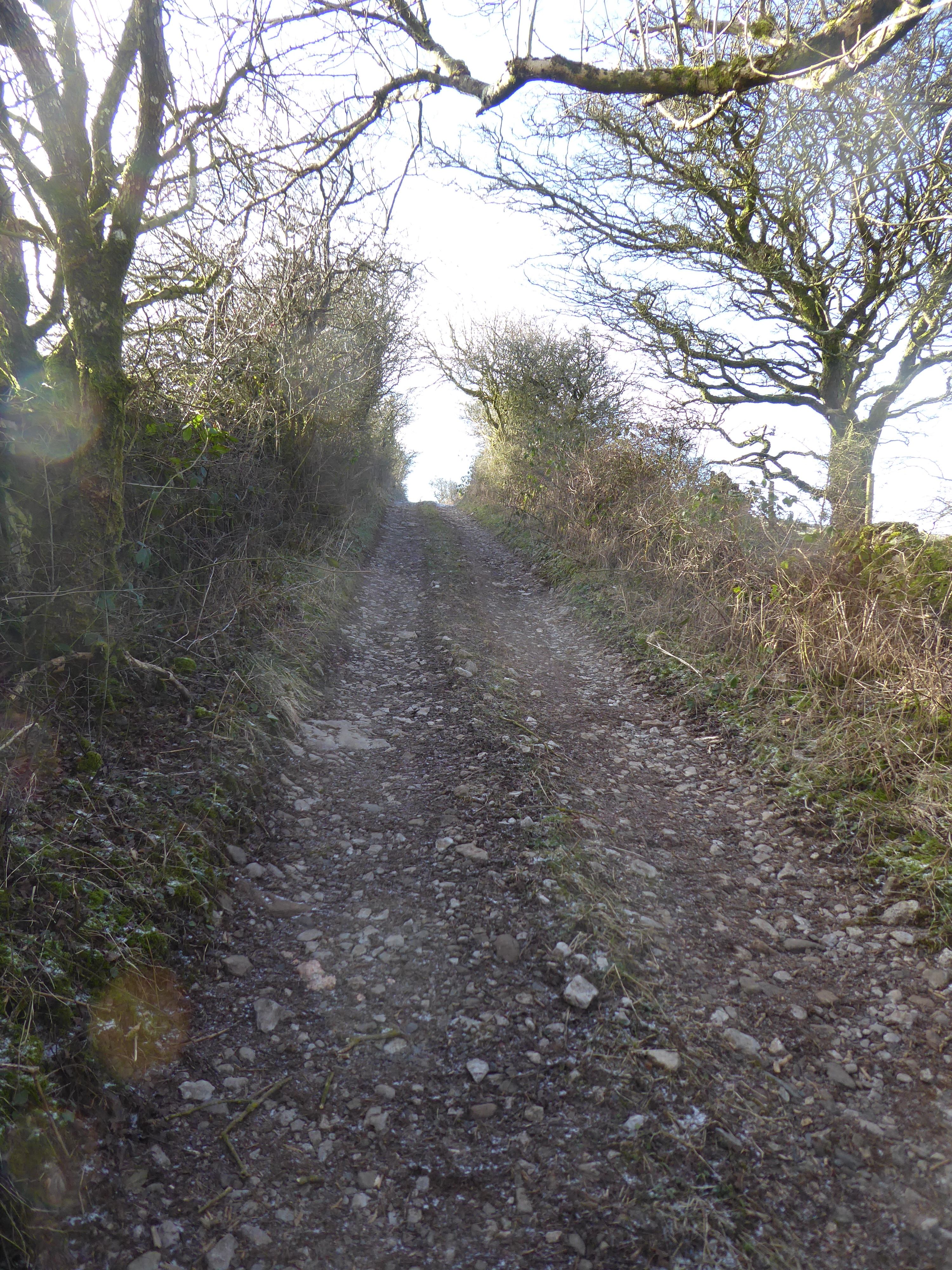
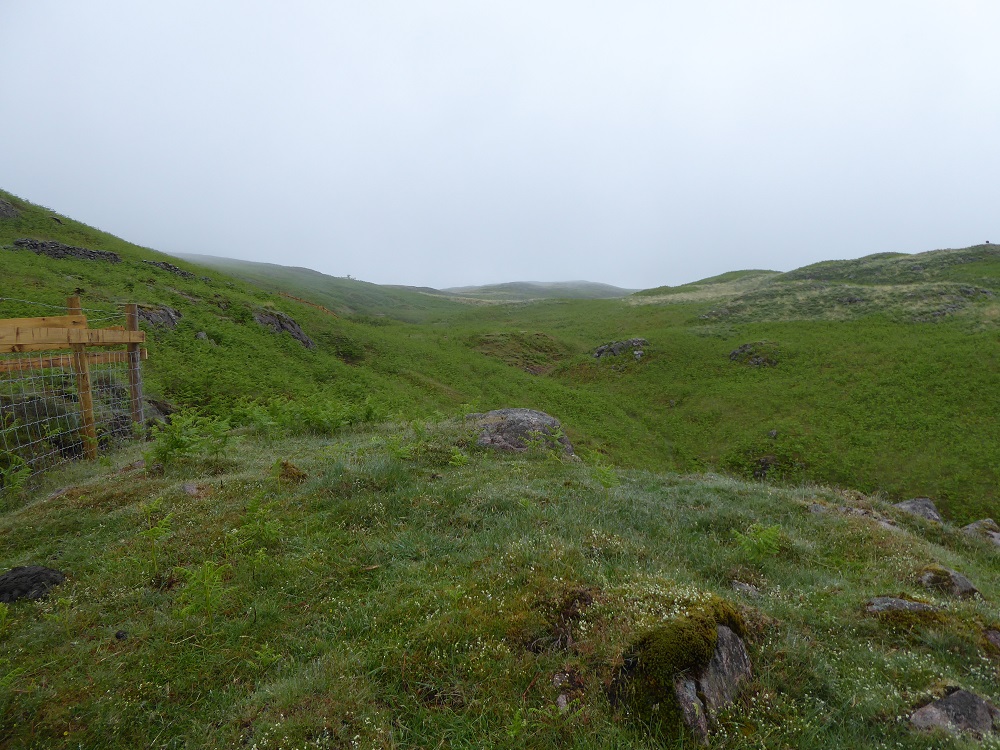
The twisting road along the dale runs next to the Ravenglass-Eskdale railway line, a narrow-gauge line built originally to transport the haematite down to the coast, but now used by the very popular La’al Ratty engine and its coaches to carry visitors to Boot and back. I drive there on a summer day in June 2021 but it is raining at Boot, the clouds down almost to valley level, so that David and I, each of us hooded and bent against the rain, initially have trouble recognising each other. David Kelly is a retired teacher and former President of the Cumberland Geological Society, and he and I had first met more than a decade previously when he showed me the Triassic Sandstone, dolomite and breccia of St Bees’ Head [5]. When I look back at those notes, I see that he strode ahead effortlessly up the cliff path and, as we waded through sodden vegetation the bottoms of his jeans, like mine, were soon dark and soaked with water. Nothing had changed (except that today I wore waterproof trousers) as I scrambled to keep up with him up the steep path and rubble at the side of Nab Gill!

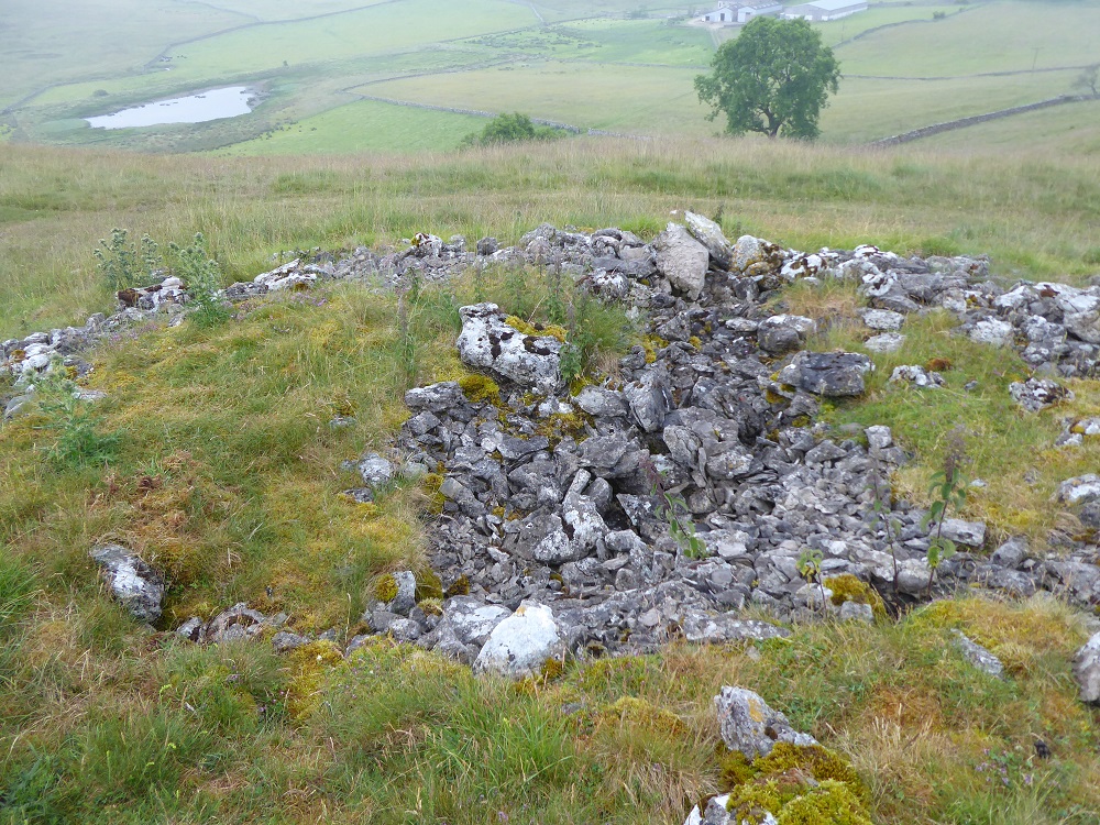
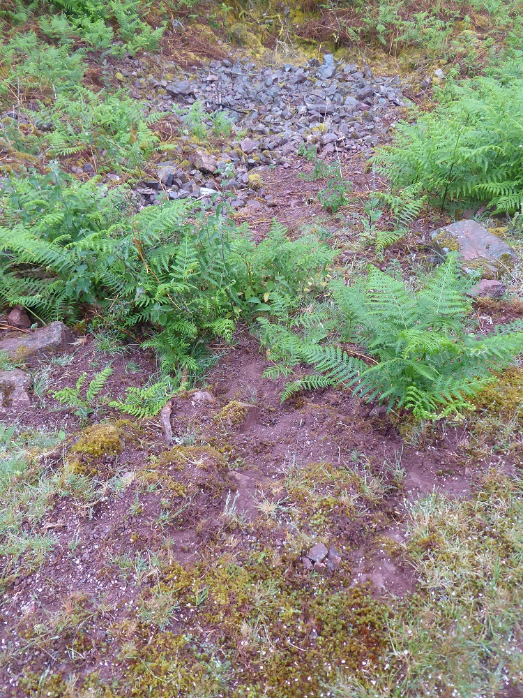
But first we stop to look at the remains of the platform and loading bay, now almost hidden by bracken, gorse and nettles, where formerly the railway trucks were loaded with the ore. The walls of the building that had contained the office still remain, although the roof is long gone; lichens and thick moss have colonised the mortar and blocky stones of pinkish granite typical of the area.

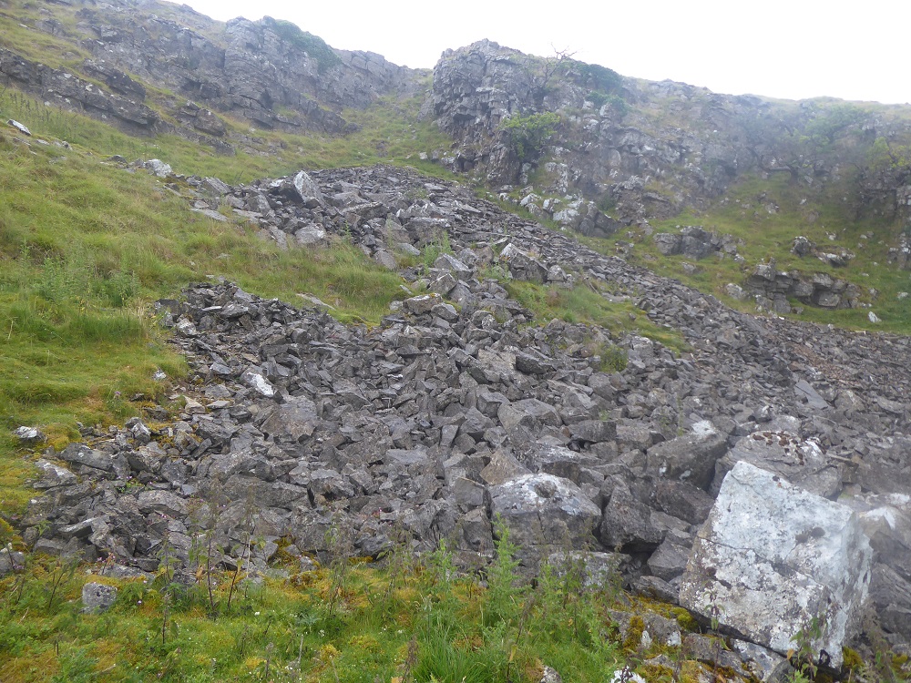
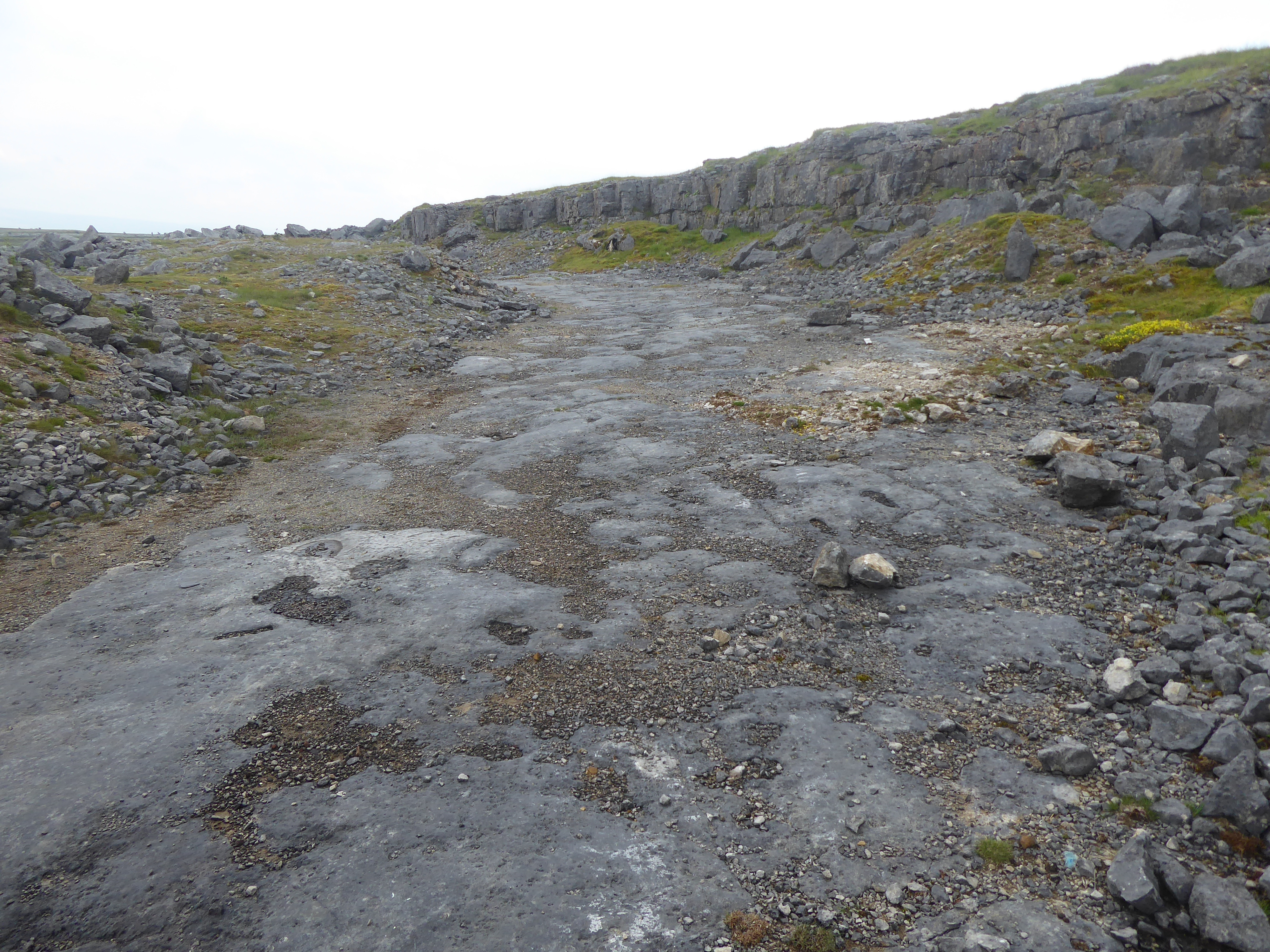
A straight and narrow track stretches up the fellside behind the building, raised on a base of stones – this was the tramway, an inclined plane, down which the ore-laden wagons would have travelled to the station and been pulled up, empty, to the top.

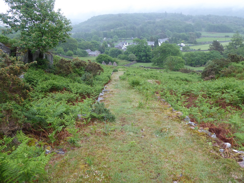
It is long and almost shockingly steep, and the enormous effort required to move and man-handle the stones and soil into place is almost unimaginable. We stand on its grassy surface and as we look down we speculate about the kind of winch and brakes that would have been needed to control the wagons’ descent. 

Climbing up hill beside the tramway

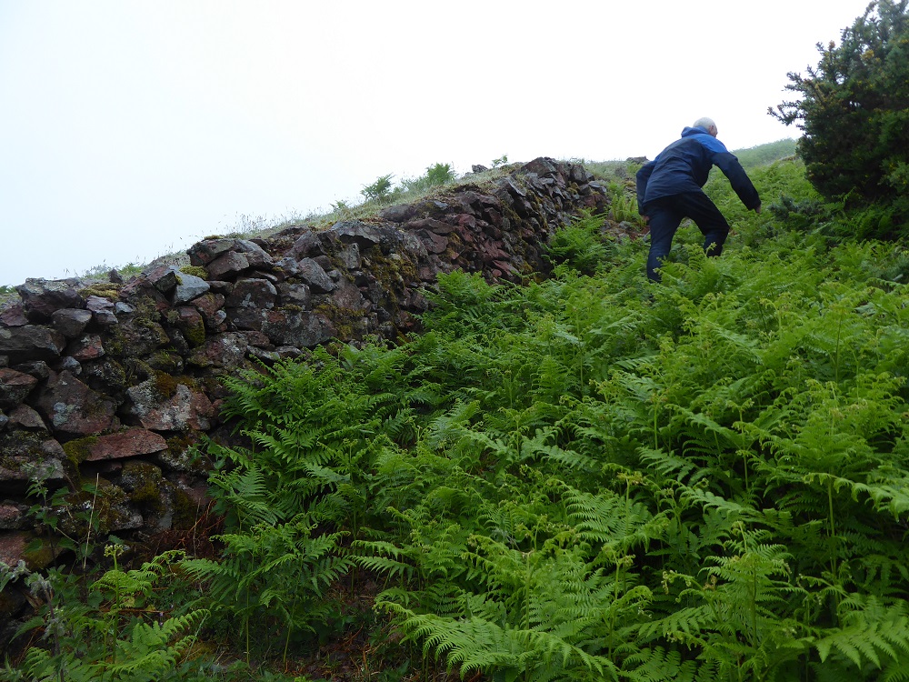
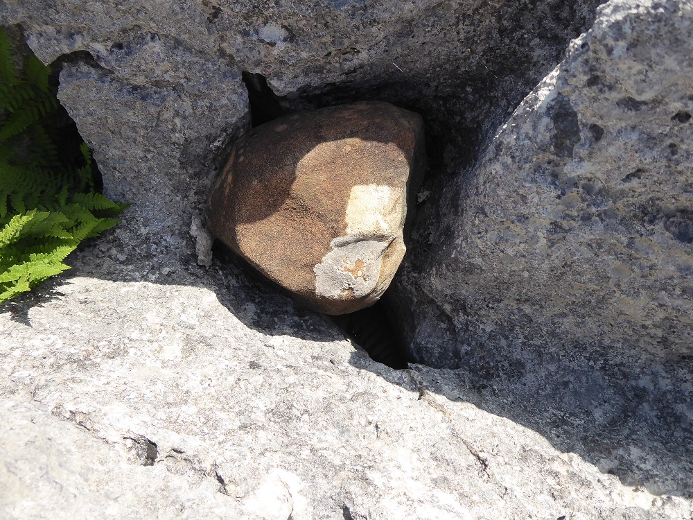
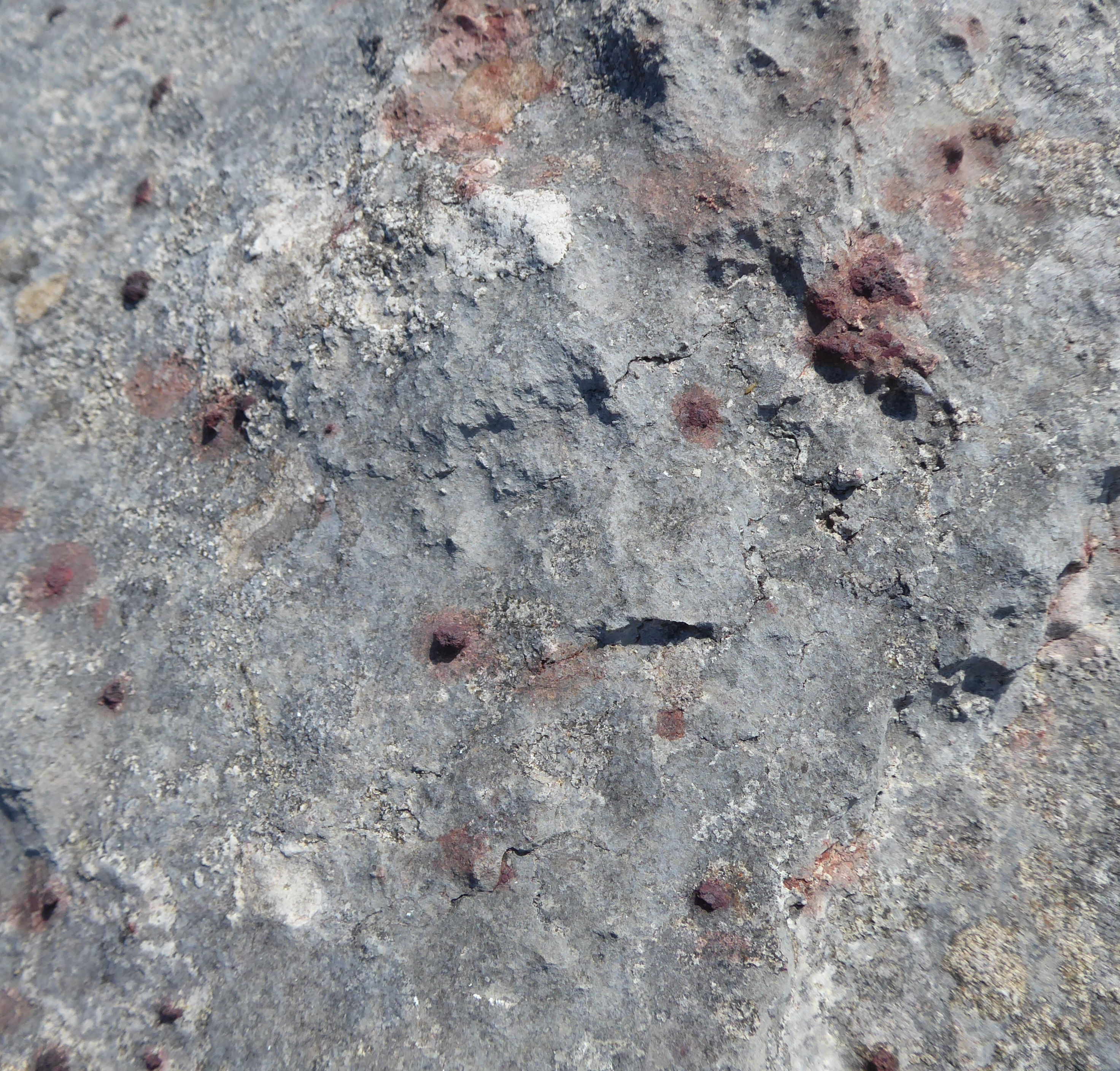
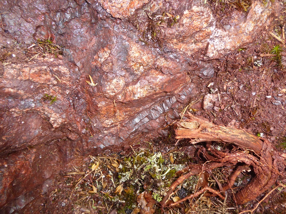
The haematite workings at Nab Gill were in five levels, connected by shafts, and followed a vein of ore that trended North-North-West, presumably along the same fault-line eroded by the gill and along which the iron-rich fluids must once have trickled. The gill, a deep and heavily-vegetated cleft in the hillside, no longer flows with water, probably because it has been considerably altered by the mining operations which started in about 1870 and finally ended in 1917. The slippery path up the cleft has been cleared in places, perhaps by other geologists, and David pauses to show me a small round rock that has been brecciated – it formed by the granite splitting and iron salts infiltrating, so that the fragments of pinkish granite became cemented together with a dark purple glue of haematite. Wherever the soil is exposed, it is red and crumbly.

Although the entries to the levels are still visible, they have collapsed or been filled in, blocked with stony debris, brambles and ferns. Level No. 5 is the lowest, there is little to see at the mouths of No. 4 and No. 3, but by the entrance to Level No.2 David suggests I climb up to look at a boulder.

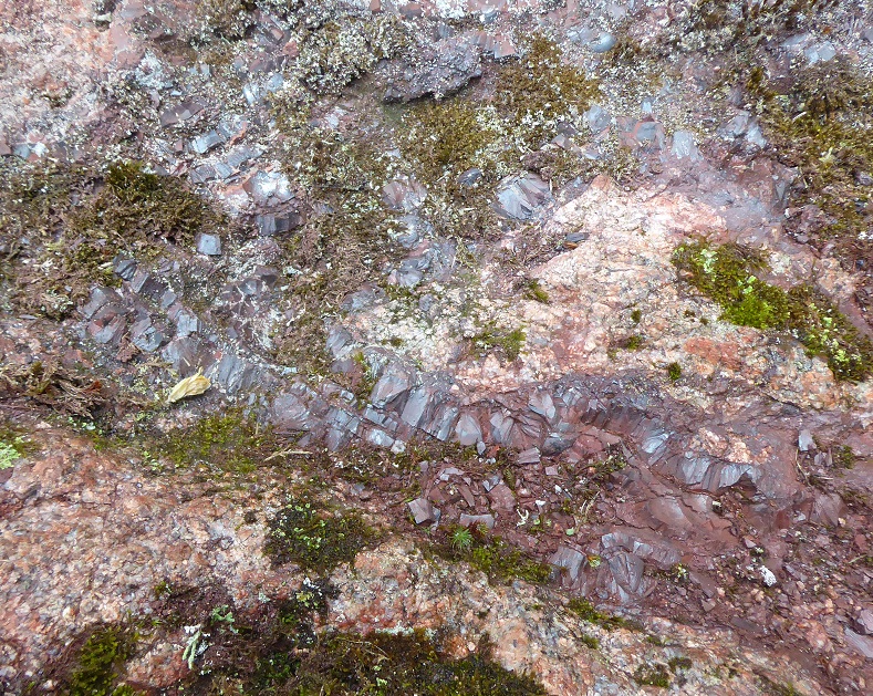
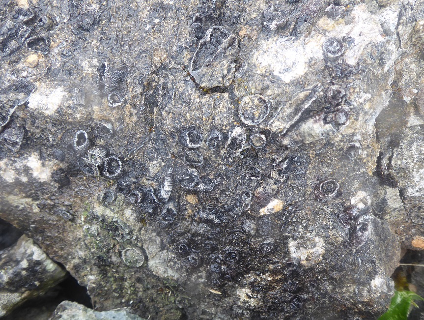
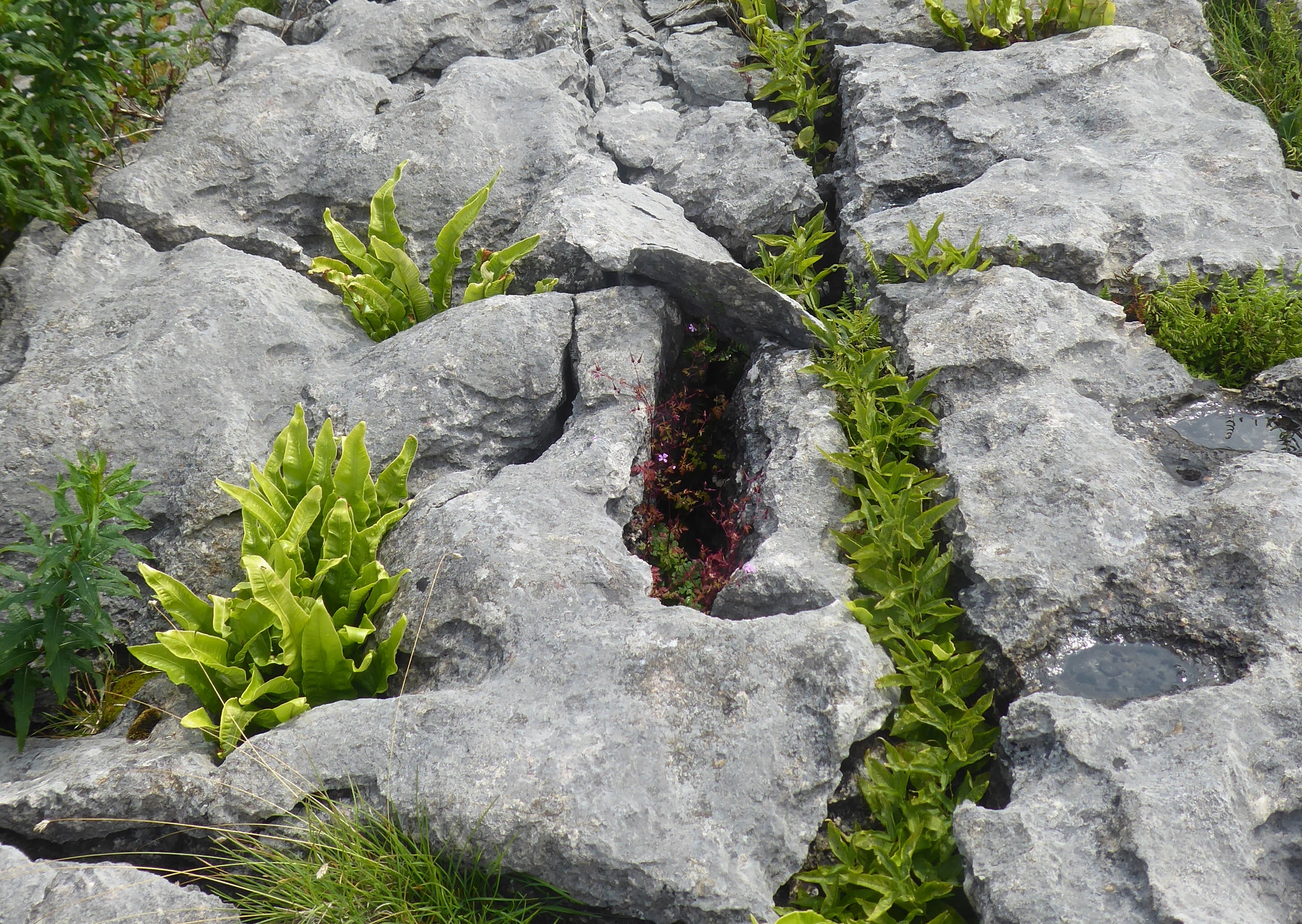
And here is a vein of haematite, in shining blue-ish-purple bands of kidney ore! It is so unexpected, and so beautiful: the crystals’ upper, smooth convex surfaces seem to bubble out of the rock. They are perhaps a centimetre in diameter and, seen from the side, are conical, sharp-pointed at the other end, the facets of their sides glinting in the grey light. Later, on our descent below Level No.1, we hunt on the scree for samples; the pocket of my jacket still holds a small piece of kidney ore, a smooth talisman to rub between finger and thumb as I walk.

My ‘pocket rock’: a crystal of haematite

We reach the top of the gill in the drizzle; the climbing has been warm and steamy work, and the grasses are sodden, beaded with droplets of water. Here, adjacent to Level No. 1, is a deep, narrow cavity, an open stope, now protected by a new post and wire fence. We peer down into its ferny darkness, and David shows where a miner would have stood, legs braced each side of the fault as he hacked out the ore. There are also open-cast mines to the North on the top of the hill but they are overgrown, so we don’t bother to explore further.

The rain eases; the clouds come and go, hanging in the dales and on the tops, dropping and lifting, parting in snatches – the views always changing, the distant fells of Langdale being revealed then hidden again. There was formerly a branch line to mines at the opposite side of the Esk; David points out the route. With the end of the rain comes the end of silence, and suddenly there is birdsong below us – the songs of thrushes and blackbirds, echoing in the valley, and the conversations of rooks amongst the trees.

We slither back down the path, picking our way past the Levels, hunting for treasure among the scree. Red earth spills down from the bottom of the talus, and it’s easy to imagine the raddle colouring a Herdwick’s fleece. Four walkers, hot in their waterproofs, huff up the path towards us, pushing on their walking-poles, surprised at the steepness; they have mistaken their route, but are interested to learn about the mine.

I wonder about the person who first discovered traces of ore here – was he (it was extremely unlikely to have been a woman) looking purposefully, or was it serendipity? Did he mention his discovery to someone else, or was he sufficiently well-informed that he knew what he had found? Why, indeed, search amongst the granite, when most haematite discoveries were in the limestone or even sandstone? I think about working in these conditions, the ‘commute to work’ as we would call it these days: climbing the steep path, carrying heavy tools; the changeable Cumbrian weather; the dark, enclosed spaces inside the mines; the dangers of rock falls, and of the speeding, laden wagons on the tramway …

With occasional views towards the Langdale Pikes

The history of the Eskdale mines makes interesting reading. As with all mining ventures, the fortunes of the owners, and of course the workforce and their families, depend on geology – the size and quality of the veins of ore or coal – and  the market value. Two great variables, one of which was set millions of years previously, and the other of which is man-made and subject to even daily variation. The Eskdale mines, as Austin [4] writes, ‘were hopelessly uneconomic’ and were finally closed in the early 20th century. Nothing remains of the original railways, except the re-built track, from Ravenglass to Boot, for La’al Ratty. As we walk back to our cars, the valley reverberates with the repeated hooting of the little train, and soon dozens of people, single and in families, with buggies, rucksacs and trekking-poles, are walking out of the station and along the road to Boot.

Where does the haematite come from?

Iron itself is very reactive with oxygen and water, being oxidised to form ferrous (Fe2+ or Fe (II)) oxide, or ferric (Fe3+ or Fe(III)) oxides (like ‘rust’); interacting with water to form ferrous hydroxide; or with sulphur to form iron pyrites, otherwise known as ‘fool’s gold’; and so on. The enormous deposits of haematite that lay in the limestone and granite of West Cumbria are made of insoluble ferric oxide.

So what was the source of these enormous quantities of oxidised iron? Iron is one of the most abundant elements on earth, and it’s thought that most of the iron in the oceans has entered as dust from deserts, or via rivers and estuaries, or – in the early oceans – from eruptions of volcanic ridges on the sea-bed.  (While I was writing this, the Fagradalsfjall volcano system in Iceland has been erupting for six months, pouring out vast quantities of lava which, in the case of this volcano, originate from the iron-rich mantle rather than the overlying crust; at that time there was a possibility that the lava from this shield volcano might eventually reach the sea.) In those early seas there was little oxygen, so the iron that leached from the basaltic lava was primarily in the soluble, reactive ferrous state. But with the evolution of bacteria that could use the sun’s energy to photosynthesise, the oxygen levels rose dramatically, and the iron in the ferrous state was oxidised to form insoluble ferric oxyhydroxides, which precipitated – and were available to be further oxidised to form compounds such as haematite.

Treasures from the spoil-heap

The next question is, why is there such a concentration of haematite in West Cumbria? There are various theories (of course – and it’s impossible to set up the experiment to check them out), but one of the ideas relies on the fact that the magnetic North pole has wandered around over the tens of millennia of years, and on the other convenient fact that haematite is weakly magnetic and retains the ‘memory’ of where the magnetic North was when the ore was deposited. Measurements have shown that the deposits of haematite laid down in the eastern margins of the existing Irish Sea – in other words, in West Cumbria – all hold roughly the same memory of these ‘palaeopoles’. Or, as Crowley and collaborators write [6], “Correlation of poles with the European apparent polar wander path indicates that these ore deposits formed during the Middle Triassic”, in other words between 247 and 237 million years ago – after the end of the great Permian extinction, and before flowering plants evolved. In their paper they speculate on the development of ore-forming fluids within the evolving East Irish Sea Basin, “and subsequent migration of fluids to basin margins where iron was precipitated as hematite.” Where the ‘fluids’ came from and how they were oxidised to ferric oxide can only be guessed at, but was probably not due entirely to the metabolic activity of biological organisms.

So, those fluids crept and trickled their way into the permeable sandstone, and through to the limestones that originated from the skeletons of marine organisms in earlier warm seas, and into the joints and faults in the hard pink granite – eventually becoming a valuable commodity as humans discovered the usefulness of iron.

Notes:

This blogpost is part of my ‘limestone lockdown’ project. For an Introduction to the project, and a guide to the list of related posts, see Limestone in the Lake District: an Introduction – and the ‘categories’ list in the right-hand bar.

[1] Crossing the Moss. The Solway Junction Railway and Solway Viaduct

[2] Mervyn Dodd (2010) The Story of Iron Ore Mining in West Cumbria (Cumberland Geological Society; ISBN978-0-9558453-1-4

[3] Norman Nicholson (1944), lines from the poem Egremont, in the collection Five Rivers 1944

[4] Albyn Austin (1990) The Mines of Eskdale, on the Industrial History of Cumbria website

[5] See Chapter 6, ‘Red’, in The Fresh and the Salt, the Story of the Solway (2020) Birlinn Books

[6] Stephen F. Crowley, John D. A. Piper, Turki Bamarouf and Andrew P. Roberts (2013) Palaeomagnetic evidence for the age of the Cumbrian and Manx hematite ore deposits: implications for the origin of hematite mineralization at the margins of the East Irish Sea Basin, UK. Journal of the Geological Society, 171, 49-64

[7] There’s an interesting podcast about ‘Ochre’ – its origins and uses – in the Chemistry World series

Posted in geology, haematite, industrial heritage, LIMESTONE, limestone and haematite, quarries | Tagged , , , , | Comments Off on Haematite in Eskdale

Quicklime: Hot Mix

It’s May 2021, the latest lockdown for Covid has been eased and crossing the Border between Scotland and England is once more permissible, so I drive North to Canonbie where Alex Gibbons has his yard. I’ve known Alex since 2016, when he was designing and overseeing the construction of the demonstration clay dabbin house at RSPB Campfield near Bowness-on-Solway, as part of the Solway Wetlands Landscape project. On one occasion we spent a memorable morning doing ‘experimental archaeology’, as Alex laughingly referred to it; he had read that the use of fresh ox blood was a traditional way of making a glossy, hard-wearing floor, but abbatoir rules meant that obtaining a bucket of blood was not an option. Instead, we mixed dried ox blood with earth and water attempted various ways of spreading and painting it. (A warning: the method was not effective – subsequently the floor became smelly and furry with mould as it absorbed the damp.)

Alex and volunteer helper John Lackie at the Campfield dabbin house 2017

My instructions are to turn up a lane between a farmhouse and a ‘tin shed’. The lane turns out to be a rough farm track with a slalom course of deep potholes; a man and a border collie, busy attending to a quad bike in the yard, both appear surprised when I drive by. Alex, a Fellow of the Society for the Preservation of Ancient Buildings (SPAB) and an expert in constructing and repairing earth and lime buildings, runs his own business, ‘Stick in the Mud Conservation’, and he’s invited me to his yard to watch a ‘hot mix’, the process of making a large batch of lime plaster from quicklime. The yard is based next to a longhouse that he has almost finished renovating. Ambling out in response to my shout, smiling, with unruly curly hair and plaster-spattered work clothes, he explains, with a grin, that this is the best example, with its cruck frame and cobbled floor, of a dabbin house in Scotland – because it’s the only one remaining! (For much more about the dabbin houses of Cumbria and Scotland, see ‘What’s a Clay Dabbin?‘)

On one side of the yard are large white dumpy bags full of quicklime, which looks like dirty-white grit. Alex buys this ‘kibbled’, that is crushed, lime from Tim Wells of Eden Hot Lime Mortar, who obtains it from TataSteel’s vast kilns at Shapfell Quarry next to the M6. Some people buy the quicklime already-mixed with a small amount of water, but Alex prefers to mix it himself: “I have the raw materials – the quicklime, the sand. I just like doing it, really, and I can adapt the mix myself depending on what I’m using it for – even though it costs me in terms of labour.” The grit sand, piled up by the hedge, comes from the Cardew Mires Quarry at Dalston near Carlisle. It’s grey-brown, and has a coarse texture with tiny sharp bits of grit; it needs to be “chunky, to hold its own shape.”. The quarry sometimes also supplies Alex with material for his clay dabbin work.. “I have to check it to make sure it’s right, which I know sounds ridiculous, but it can go wrong! I can get 20 tonnes at a go, which is ace!”

We walk across into one of the open-fronted buildings, squeezing past a blue pickup and low-sided trailer into a large corrugated iron shed. Piles of straw, white plastic containers of water and of sand, bulging plastic sacks, folded tarpaulins and plastic sheets – the plethora of basic materials for earth and lime building – fill the space. There’s a hose-pipe snaking across the floor, and a wire leading to an old red van outside. At the back, in its own territory, is the plaster-encrusted mixer.

Now it’s time to make the hot mix. I’m wearing old clothes, waterproof trousers and now, too, safety goggles. “When the water’s added it fizzes and pops and steams – it’s sensible to keep back,” Alex warns.

The mixer is a roller pan mixer – there are two large rollers or wheels that crush the quicklime, and a paddle which turns and folds the mix. Alex fires up the generator in the back of the red van and the machine starts rumbling as the axis turns horizontally, the wheels turning on vertical axes (‘the wheels help no end’). For the lime plaster he’s making today, the mix requires two buckets of water, one bucket of quicklime and four buckets of sand; the proportions will vary depending on the use. When he adds the water to the dry ingredients, clouds of steam gush and swirl around us. Lumps of the mixture are adhering to the edges of the rollers, and Alex scrapes them off with a spatula which was hooked onto the wall next to the machine. Next he picks up a bundle of goat hair, and pulls out the fibres, sprinkling them into the mix. “Traditionally it was usually horsehair, but that’s not easy to get. The goat-hair is soft, it has barbs” (which help the adhesion between the fibres and the lime). It is imported from China, having previously been treated to kill anthrax, a treatment which has also removed some of the natural grease.

We stand watching the mixer. It’s mesmerising, I say, I can’t look away.  “I always warn everyone,” Alex laughs. “Don’t look into the mixer, you’ll get sucked in!” It is a surreal scene: in a dimly-lit shed and half-hidden by steam, the machine grinds and groans, so that we must shout to be heard, and outside, from a darkening sky where heavy black clouds are louring, rain begins to fall. There is a strange, sharp smell coming from the slaking lime.

Alex opens a shutter at the bottom of the drum and the pale-brown mixture slides out into the waiting, plaster-caked wheelbarrow. He scrapes down the shute, closes the shutter, leaving the machine mixing – then runs the barrow of plaster up into the waiting low-sided trailer and tips it out. The rain is pock-marking the sloppy mess of plaster, so he unhitches the trailer and pushes it further into the shed. The plaster in the trailer is steaming; the slaked lime is hot and very caustic – he shows me scabbed burn marks on his arms, where small gobbets of mixture had landed previously, and grimaces, “It can be very painful.”

For the second of the four batches he adds less water and the reaction is more dramatic releasing greater clouds of steam. “A lot of it is about feel – you add water until it looks and feels right. If things go wrong you can always sort it out!” Does he learn by experience? He laughs: “You learn by cocking it up, like that first lot!” (It was too sloppy – the subsequent batches are much firmer).

And he surprises me when he says, “There’s no part of this job which isn’t really hard work. It’s very physical. It’s like thatching – that always sounds romantic until you end up doing it!”

While mixing the fourth batch, the machine abruptly stops, jammed. Alex yanks at the paddle, then stirs and pokes the mix with a long-handled shovel (which had beens propped nearby, exactly for this purpose). He switches the mixer on and off several times; the generator whines and grumbles. The mixer groans and stutters, recalcitrant, but finally starts moving, gaining speed.

We chat about his work and lockdown. He tells me he is now doing much more teaching, particularly for the Prince’s Foundation on a new dabbin at Dumfries House. He also got married about ten days before our visit; the last time I met him he was living South of the Border near Wigton, but now he lives in Scotland, just North of Canonbie. This trailer-load of lime plaster is to be used to repair the wall of a nearby walled garden.

This is a characteristic of lime plaster, that it can be used indoors or out. And I’m surprised that he will not be working with it until the following day: would it not dry out? He explains, “You can age it, and the older the better. The bits that are not completely slaked get slaked overnight. It’s more workable the next day too.” Even more surprising is that if you cover the plaster in a bucket with a layer of water, it will remain usable for a long time – it doesn’t dry and harden, taking up atmospheric carbon dioxide (see diagram of the Lime Cycle below) until it is spread.

Testing render on the dabbin house back in 2017

The rain has eased, the trailer is half-full of porridge-y plaster, and Alex is ready to head home. Before I leave he tells me to check on the clay dabbin house at Campfield, where he has just finished replacing the lime-render on the gable end which had suffered over the winter.

“And you should go and see Tim,” he says, “A nice man. He likes talking about lime.”

***

The Lime Cycle

Tim Wells lives in the Westmorland Dales, in a handsomely-renovated farmhouse near Great Musgrave. I arrive in the village and, after a couple of phone calls as we each try to ascertain where the other is, I find his low-loader JCB waiting at the end of a concrete drive, and follow him to his yard. His family ran stock on the farm – 700 sheep and 300 cows – until the 2001 Foot-and-Mouth epidemic that saw their animals culled out; like so many farming families, they have had to diversify and seek new occupations. Tim decided to learn about the renovation of old buildings, and eventually set up Eden Hot Lime Mortar to supply materials and expertise. As a business it’s thriving and increasing each year; he tells me later that he receives 50-60 calls a day, fixing meetings and starting conversations – “getting builders on board, and architects, and importantly insurers. It will become massive with the next generation”, as people get a better understanding of how to renovate older buildings.

The yard is large, with several barns and sheds, storage areas, and concrete clamps for sand and grit. Tim comes over to greet me and I get an impression of strength; he has a shock of dark hair, a broad, tanned face, and strong, tanned arms. At first he speaks in short sentences, slightly terse explanations of what we’re seeing, but he becomes more expansive as we both relax. A small black dog, Connie, follows us, roots around in some black polythene, then lies down in the corner of a sandy clamp, and generally keeps an eye on us.

Hopper and mixer

The quicklime Tim obtains from the Shapfell kilns has already been through a crusher, and comes in various sizes; he prefers the 2mm pellets. He sells this as it is (these are the pellets Alex uses) or – he shows me a row of 1-tonne dumpy bags – he mixes it with grit and some water to make partially-slaked lime. The mixture is crumbly, but no longer caustic by this stage, and the buyer then adds a small amount of water to make lime plaster. “It will keep for ten or more years like this,” he tells me. “You can re-mix it and use it.”

Nearby is a very large mixer with rollers and paddle, which can be filled from a hopper; this is a large-scale operation, for not only does he supply materials for builders, but he also runs between 50 and 60 training courses a year. “We get trainees from all over, Orkney, Shetland, London, Hampshire … They come for a day. I hand out pdf sheets of instructions and they get to try different things.” In a shed by the mixer are rectangular wooden frames filled neatly with limestone blocks, ready for mortaring and pointing; slates laid on top of laths form a mock roof for pargeing; there’s a vertical array of laths for lath-and-plaster training. On a table are tubs and packets of pigments with names like Burnt Turkey Umber, Brown Umber and Venetian Red, for colouring the plaster, and cylindrical rolls of the goat hair – he pulls some out of the bundle, teases it apart and snips it with sheep shears to show me the size for sprinkling into a plaster mixture. The hair gives tensile strength and forms a composite material, which is useful for crack-stopping. “But people used to mix the lime with whatever was to hand locally, crushed oyster shells, wood ash, ash from the steel works – nothing was written down, the knowledge was just passed on.”

Modern mortar uses cement, based on a mix of calcium carbonate and other minerals such as silicates; modern plaster is based on gypsum, hydrated calcium sulphate; both materials have the advantages of standardised components, and are quick-setting. But anyone who renovates and repairs old buildings is quick to explain how these modern materials are completely inappropriate in that they do not allow the walls and floors to ‘breathe’ or flex. Water is trapped and walls become damp; cement and mortar are rigid and can transfer cracks to the surrounding walls; modern plaster may seal in the damp. As Tim says, “These modern houses won’t last fifty years!”

The well-designed and informative website for Eden Hot Lime Mortars gives several reasons why hot lime mixes should be used instead: “Walls breathe better and moisture can evaporate. Mortars and renders do not set too hard. Thermal movement can be accommodated without damage…”

There is much more of interest to learn about lime mortars, such as the difference between hydraulic lime, air lime and pozzolans, but I’m beginning to suffer from information overload. I’m saved from embarrassment by Tim’s phone ringing: he has another appointment lined up and his visitor is trying to find the yard. Connie, the little black dog, accompanies me to my car and jumps onto the driving seat when I open the door; I scoop her out, regretfully, and thank her for the dusty pawprints she has left as a reminder.

Note:

This blogpost is part of my former ‘limestone lockdown project. For an Introduction to the project and a guide to the list of related posts, see Limestone in the Lake District: an Introduction – and the ‘categories’ list in the right-hand bar.

Posted in coastal heritage, conservation, LIMESTONE, limestone limekilns, quicklime | Tagged , , , , , | Comments Off on Quicklime: Hot Mix

Limestone: the Tata Shapfell kilns

The Tata Shapfell limekilns

The motorway sweeps down past the smooth rounded ‘sleeping elephants’ of the Howgill fells, down into the valley by Tebay, and then up again onto the moorland heights of Shap. Suddenly, incongruously, you see a tall vertical array of cylinders and truncated cones, pale greyish-green, streaked with rust, with steam drifting from the chimneys. You pass so quickly that there is barely time to register how bizarrely out of place is this industrial machinery amongst the grazing sheep and the moorland of the distant hills.

The imposing structure is a bank of four kilns, for ‘burning’ limestone to produce quicklime, and they are the remaining active processes of the once-busy Shapfells or Hardendale quarry. These metal Maerz kilns couldn’t be more different from the stone-built kilns at Wardhall, not only in their construction but also in the very efficient way they ‘burn’ – calcine – the lime.

Calcining (a quick reminder) is the process of heating limestone, calcium carbonate CaCO3, to change its chemical composition by driving off carbon dioxide CO2, as gas, to leave ‘quicklime’, calcium oxide CaO. This requires temperatures in excess of 800oC which, in ‘old-fashioned’ limekilns, are produced by burning coal in the presence of air. In the Maerz kilns, heat comes from the burning of natural gas which is injected into the upper cylinder.

John Baird, the Operations Manager, is infectiously enthusiastic about the kilns. He has worked on the site for more than 30 years, “in most roles, in the aggregate plant … drove dumpers …” and has overseen great changes, including the closure and now restoration of the quarry area as a nature reserve. About three years ago, a new control and monitoring system was put in place for the kilns themselves –  the SCADA system (Supervisory Control and Data Acquisition) which is a system of networked computers and monitors, where a single operator can see – and control – what is happening in the kilns in real time. We go into an office to watch a short powerpoint presentation about how the kilns work, and John switches into the SCADA system – and I’m impressed how we can watch a live overview with coloured graphs and flows, and then focus in on minutiae such as the changing pressure of the gas from minute to minute, the temperature, the weight of stone in a hopper that’s feeding a particular kiln, and so on. The operator, watching this, can dictate the length of burn, the amount of air, the intensity of the flame, and more. Later we have a look at the control room, where there is indeed just a single operator, sitting at a bank of keyboards in front of an array of monitors.

Some basic details about the Maerz kilns at Shap: Each active kiln uses up to 520 tonnes of limestone per day, and each tonne of stone gives about a half-tonne of lime (quicklime). Stone, about 4.5 tonnes per hopper, is loaded every 11 mins into each of the parallel shafts continuously throughout the day, and lime is continuously taken out of the bottom. The kilns are Parallel Flow Regenerative, PFR, kilns – three of the kilns have two parallel shafts, and No.1 kiln (the first on the left as you head North on the motorway) has 3 shafts.

Maerz PFR kilns: see their website for more details

Burning is carried out at 850-1100oC, and what is so special about the Maerz kilns is that the parallel arrangement of shafts linked by a cross-channel means that the hot exhaust from one cylinder is passed up through the stone in the second, a contra-flow that pre-warms the stone waiting there to be burnt. This ‘counter-current’ is exactly the system by which penguins’ feet are kept warm, and how the kidney is so efficient at removing waste products in the urine – biology got there first! This makes me happy. And John – who laughs a lot and is unendingly friendly and helpful – says, “I think Shapfell is the most efficient lime-maker in the world.”

He has kitted me out with helmet, hi-vis jacket, gloves and eye-protectors, and I assume we are going to wander around at ground level. But now comes a very welcome surprise: “Are you okay with heights?” John asks. We are going to climb up between the kilns, almost to the top.

We pass the hoppers at the base, from which the lime is decanted and taken by conveyor belt to be stored then transferred to waiting railway wagons. The railway is a siding from the nearby West Coast mainline – one of the sleek passenger trains speeds by during our tour – and wagons bring limestone to the kilns and take lime away. From here at ground-level we watch a large yellow lorry tipping out its load of limestone, which is rapidly bull-dozed to the edge of a waiting pile, from which it will be conveyed to a crusher, and eventually loaded into a hopper that will take it to the top of a kiln. There is limestone of a pinkish shade, which comes from Hanson’s quarry just 5 miles to the North; and there is whiter stone which is brought by rail from a Tarmac quarry at Buxton, Derbyshire. At one time the stone would have been dug out here, at Shapfell/Hardendale, but local ‘good’ stone, the best for quicklime and steel-making, has been exhausted, and the land is being restored.

Limestone from different sources

Around us all the hard surfaces are white: the handrails, the outside of the hoppers, the gantries, cranes and platforms – but it is not powdery, the whiteness is hard with a pimpled surface, smooth to touch. It must have built up over the years, but surprisingly, there is no dust.

We cross a metal bridge, beneath a conveyor belt, and onto a platform from which the first flight of steps leads upwards, perforated metal stairs through which the ground below is visible; but there are sturdy handrails each side. The cylindrical wall of this bottom section of the kiln is cool but up on the second platform I can feel warmth radiating from the wall. The weather today is perfect, with little wind, but I can imagine how pleasant that warmth would be when the wind is howling across from the Howgill Fells, funnelling up the valley by Tebay.

There is a complex scenery surrounding us, of pipes, supports, metal stairs, pressure valves, and the smooth bulk of the kilns, with intriguing glimpses of sheds and moving hoppers. Number 2 kiln has been decommissioned, and John says it will not be removed – I can see that the resulting gap would be as ugly to the symmetry as a missing tooth – and Number 3 has just been shut down for the day.

But there is a busy-ness on the ground and lower levels around Number 4, and up on the third platform, now about 100 feet above the ground, there is a smell of hot new paint. This kiln has been completely refurbished over the past two years. “It was a £3.8 million project,” John explains, “and we started heating it again about 5 days ago.” Apparently it takes this time to re-light – the refractory lining eventually becomes hot enough, between 600-700oC, that the gas will ignite itself when the gas-lances are turned on. Here by Number 4 there are pressure gauges and flexible gas pipes, and everything looks clean and new and glossy. Below us, in an enclosure on the ground there is a vast storage tank for natural gas; the works are supplied by their own mainline pipe. The recent hike in gas prices has quadrupled the cost of calcination …

Gas pipes for Number 4 kiln

Climbing another airy flight of steps, we return along the platform to kiln Number 1 to watch a hopper laden with stone being pulled up the rails. Arriving at the top, it tilts; John Baird warns “Cover your ears!”, and the hopper tips its load into the kiln with a rattle and crash of tumbling stone, then creeps back down to be refilled. In 11 minutes another laden hopper will tip its load into a parallel shaft to be pre-warmed by the exhaust gases before being fired.

So what is coming out of the chimneys? I’d been reading about old types of commercial kiln in David Johnson’s book [1] and photos showed the land surrounding white with lime-dust. Johnson notes, “A former public house close to Swinden Quarry, Grassington, and all nearby fields were noted for their covering of white lime dust” from the Spencer steel kilns, built in the early 1900s. Here at the Shapfell works a small amount of dust comes out in the steam, but John assures me that the filtration processes are very efficient. Tata own the land surface around the site and use it for local tenancy grazing, and we look down on the fields at the northern boundary and it is true, there is no trace of whiteness; but whiteness has accreted, slowly, on the metal structures and walkways.

Depending on the weather, the drifts of steam coming from the chimneys may appear white, grey, or even be invisible. A system of Venturi ‘scrubbers’ cleans up some of the emissions, such as sulphur dioxide and particulates. There is water-vapour – steam – from the heating of the washed limestone; there is carbon dioxide from the burning of the methane-rich natural gas, and there is of course also a very large amount of CO2, approximately 40% of the initial weight of stone from the breakdown of CaCO3 to form CaO.

When mixed and heated with metallurgical coal (such as that which would be produced by the projected and controversial West Cumbria coal-mine) and iron ore (haematite), the quicklime collects the impurities, floating on top of the molten iron as slag (see ‘Volcanoes of Workington’). Steel-making itself, by burning coal, also produces CO2. But until new methods for steel-production are devised, at scale, there will continue to be the need for lime and coal as accessories. Carbon-capture would seem to be the only way forward if CO2 emissions are to be reduced.

The Shapfell kilns produce 4,000 tonnes of quicklime per week and nearly all of this goes for making steel – formerly to plants at Teeside and Scunthorpe, but now more than 90% of the output going to Port Talbot: Britain still does have a (much-reduced) steel-making industry. The quicklime produced here at Shapfell is of the high specification required for steel. We look around the lab later, where the quicklime is tested. The lab is small, bench-tops clear, and with surprisingly little equipment, although most of what is there is apparently expensive. A pyrex desiccator, a piece of lab equipment that I probably haven’t seen since research student days, contains a pile of small white ceramic crucibles for heating lime. The quicklime is sampled every four hours throughout the production sequence to check the amount of unburnt material, known as the Loss of Ignition, LoI, percentage: for the steel industry this must be less than 4%, in other words the lime should be at least 96% pure. Reactivity with water is also tested by mixing 600ml water at 20oC with 140 gm lime – the temperature of the reaction should reach between 60-70oC in two minutes. To demonstrate the exothermic reaction between CaO and water, John mixes some powdered quicklime with water straight from the tap, and the beaker is immediately swathed in steam. (For more on the effects of mixing quicklime with water, see the post on the ‘hot lime’ process). Positive results in these lab tests mean the lime produced at Shapfell can be labelled as conforming to the British Standard, a new certification required since we left the EU, the CE (Conformité Européen) certification being no longer deemed relevant by the government.

For steel-making, the calcined lime needs to be crushed to the optimal size of about 60mm. But for use in the renovation and repair of old buildings, as lime mortar and lime plaster, the lumps of quicklime need to be crushed much smaller. It was through Tim Wells, of Eden Hot Lime, that I got an introduction to Angela Wilson, the Commercials Office Manager, who very cheerfully and willingly set up my visit to the kilns – Tim buys in dumpy-bags of 2mm pellets and he then adds water to the quicklime, converting it to slaked lime, calcium hydroxide Ca(OH)2, the basis of lime plaster.

The agri-lime shed

After leaving the kilns, the labs and the control room, we walk back to the offices, past a large open-fronted shed piled with white powder. This is ‘agri-lime’, finely-crushed limestone – not quicklime – for spreading on the fields. Although no longer a lucrative part of the business, production is kept going mainly for the benefit of local farmers.

Limestone: to be used in making steel, in renovating old buildings, and to fertilise the fields – there are several stories here about the uses of the stone that comes from the quarries. Other stories are of the extraction of the stone, and of the restoration of the land.

Both Tata Shapfell (Hardendale) and Hanson’s (Shap Beck) quarries are on land owned by Lowther Estates. (Lowther Estates own land and foreshore, and have mineral rights, to vast swathes of the county – and have already been mentioned in the context of the small quarry near Great Asby.) Hardendale, opened in 1960, was leased from Lowther Estates by the Messrs Colville, who owned the Ravenscraig steelworks on the Clyde. Colvilles became part of the nationalised British Steel, and through a series of buy-outs and reorganisations, became Corus, which eventually was partially taken over by the Indian company Tata. Shap Beck was leased from Lowther by Harrisons Limeworks, and originally sent lime to Colvilles’ Ravenscraig. Harrisons had their own kilns, but these were decommissioned in about 1980, and the quarry – now owned by Hanson’s Aggregates, who have consent from the Lowther Estates until 2042 – now supplies the characteristic pinkish limestone for the Tata kilns.

Wherever there is limestone in Cumbria there are quarries, either small indentations in a hillside outcrop to supply stone for drystone walls or for a small local kiln, or the larger industrial excavations that supply stone for cement or roads, such as the Bredon quarry at Moota, and the currently (and hopefully, forever) disused quarries at Clints Crags, both to the North of Cockermouth. In recent times, when the extraction of stone has become uneconomic or the quality of extractable material has declined, it has been recognised that remediation of the landscape and environment is necessary. Thus, at Moota, the disused sections of the quarry are being re-modelled and improved for plant and animal recolonisation, and an explanatory ‘geology trail’ is being developed.

So too at Hardendale, where landscaping began as early as the 1970s. John Baird explains that they now have a new restoration plan (you can download details and maps here) . From up on the northern platform we had looked down on large rectangular piles of pale material and an improbably milky-turquoise pool of water: this was where the slurry of clay and small limestone particles from washing was allowed to settle and drain. As we watched, a yellow JCB was scooping up buckets of the soft residue and loading it onto an enormous truck; it would then be tipped into the quarry – where it would recombine with atmospheric CO2 and harden, to form new stone (see diagram of ‘The Lime Cycle‘ in ‘Quicklime: Hot Mix‘)

Settling ponds and quarry re-fill

The quarry’s land is also on and bordered by SSSIs and Special Areas of Conservation, so Natural England are involved in design and maintenance of the new reserve, and RSPB volunteers help record the birds. ‘There’s a big newt area too,” John says, “with hibernacula” and, laughing, he goes on to explain the intricacies of newt-protective fencing. “We’re aiming to reduce the footprint of the works on site, we’ll be removing redundant buildings, like the crushing plant. There’ll be strategic planting of trees to screen the works. The former settling pools are full of wildlife.” He’s clearly as enthusiastic about the long-term restoration work as he is about the management of the kilns.

Looping back onto the M6 again to drive North, I saw that there was white exhaust coming from the chimney of the newly-lit Number 4. Now, each time I drive across that moorland limestone country and see that tall, incongruous bank of grey cylinders, I’ll say to myself, with some amazement, “I was up there!”.

Notes:

This blogpost is part of my ‘limestone lockdown’ project. For an Introduction to the project, and a guide to the list of related posts, see Limestone in the Lake District: an Introduction – and the ‘categories’ list in the right-hand bar.

[1] David Johnson (2018) Lime kilns, history and heritage: Amberley Press

Posted in industrial heritage, LIMESTONE, limestone limekilns, quarries, quicklime | Tagged , , , | Comments Off on Limestone: the Tata Shapfell kilns

Limestone: quicklime, tubs and ghostly kilns

At Wardhall kilns

Lime kilns are a feature of limestone country. Many are small, and slotted into hillsides and escarpments like eyes in a skull, their brows an arch of brick or stone. Others are taller more imposing stone-built structures, sometimes with fancy arches. Older, simpler versions like clamp kilns, dug into a slope and formerly turf-covered, may be harder to recognise; the wide variety of designs of kilns of all ages and types is comprehensively discussed by David Johnson [1 – book and video], and David Kitching’s website [2] lists details of many Cumbrian kilns.

But all are used for ‘burning’ – or more accurately calcining – limestone, to give quicklime. Quicklime, slaked lime – words for altered limestone that tell different stories, and bring back remembrance of chemistry lessons. If limestone (calcium carbonate, CaCO3), is heated, carbon dioxide (CO2) is driven off to leave calcium oxide (CaO); this is quicklime or burnt lime, a crystalline, alkaline and caustic substance, that is used for dressing pastures [3], and in the steel-making process [4], and – if water is added to convert it to slaked lime (calcium hydroxide, Ca(OH)2) – for making plaster and mortar [5].

Calcining requires the stone to be heated to between 600 to 1200oC, depending on the type of kiln, and in the earlier types of kiln this was achieved by burning wood or gorse or peat; later, coal or coke was used, and in modern times the fuel is gas. Fuel and stone might be tipped in from the top, separately or sandwiched; the firing might be fairly continuous or intermittent; as Johnson explains, there was often a degree of flexibility. The outcome, however, was the removal of quicklime from the bottom. The surprising result is that if lumps of stone are fed into the kiln, lumps of stone – albeit about 40% lighter since CO2 and any moisture have been driven off – are removed as quicklime, and usually need to be crushed before use.

Continuous use of fields for crops removes nutrients and gradually increases the acidity of the soil, and decreases the fertility. The (alkaline) quicklime from the small field or estate kilns was probably used locally either for spreading on arable fields and pastures to improve the productivity of the land [3], or as a building material, but there are several majestically large commercial kilns whose origins were closely linked with not only the West Cumberland coalfields but also the large deposits of haematite or iron ore in the West of the county. Near where I live and well-hidden from public view are the Wardhall – or Warthole – limekilns.

The track to the kilns runs straight, sloping gently downhill towards the River Ellen. It’s January 2021 and the fields are full of chocolate-brown Herdwick hoggs with white legs and faces, brought down from the fell farms to over-winter on the richer lowland pastures. In the way of Herdwicks, three of the young sheep have escaped and are browsing on the brambles along the track; they stare at us and, knowing they are doing wrong, sheepishly sidle back into their field, remembering exactly where the fence is broken.

The track is firm underfoot and runs for nearly a mile, lined on each side by tall flailed hedges of hawthorn, ash and elder that limit the view. Then suddenly we are out, onto a flat area, glistening with ice and green with moss, that is raised above the river valley like a belvedere. There is an unconvincing rusty-wire fence at the abrupt edge – and a steep vertical drop, a cliff-face of dressed sandstone blocks. Although it’s impossible from here to tell, we’re on top of the kilns and, although they are now covered over, we’re standing on the entrances to the pots into which limestone and fuel – coal – would have been tipped.

We back-track to a strip of damp woodland beside the track, and scramble down a bank, through brambles and the stalks and flat dry heads of cow parsley, frost-rimed; clamber down a low brick wall onto what might have been a platform or loading area, and then onto a plain of straggling grass and shallow moss-filled pools overlying rubble and broken brick. Now we’re at the base of the enormous flat front of the bank of kilns. The entrances to the four pots are like half-bottles, each framed in perfectly-cut and aligned sandstone blocks. The interior walls are dank with green algae and liverworts, and partly-hidden by ivy.

Scrubby, boggy ground and straggling ash trees make reaching the openings difficult – but at the back of each deep arch are small brick-edged rectangular openings, supported by rusting metal. One is still partly closed by horizontal iron doors. These are the draw-arches, from which the quick lime would have been raked out of the fire-pots, probably straight onto waiting railway-wagons. The arches are now blocked, one by horizontal rusty iron doors; another by a solid tumble of grey and black stones. From two others, spectral effusions of white, streaked limestone ooze out – slow waves of calcium carbonate re-petrified – decorated with the jagged teeth of stalactites. Within the massive stone structure, the hidden pots of the kilns still contain limestone – through which water has trickled down, dissolving the calcium salts, the concentrated brine seeping out year after year.

When lime-burning first started here isn’t clear, but Graham Brooks, in his research into Cumbrian limekilns [3,6] states that the Warthole kilns, “were rented out to both the Gilcrux colliery company prior to 1852 when they were advertised to be let by Mr Richardson of Dovenby Hall. (The present kilns probably date to after this time.) The Solway Haematite Iron Company, Maryport worked the quarries and kilns in the 1870s.”

In other words, the 19th century limeworks were associated with companies that dealt with coal and with iron ore, haematite – so the quicklime would have been used in the production of iron. If haematite is heated to high temperatures, molten iron is liberated – and the quicklime bonds with the impurities from the fuel (coal) and the stone to form slag, which floats on top of the molten metal [4,7].

Maryport & Carlisle Railway: By Afterbrunel – Own work, CC BY-SA 4.0, Commons Wikimedia

This was also the age of railway building, especially in Cumberland. Between 1840 and 1845, the railway from the coastal town of Maryport to Carlisle in the North was completed, and the section from Maryport to the coal-mines at Arkleby (very close to Wardhall) was finished in July 1840 [8].

Warthole quarry, 25-inch OS map extract

The 25-inch Ordnance Survey map for 1865 [9] clearly shows the Maryport & Carlisle Railway (M&CR) running alongside the River Ellen, with sidings that connect with a fan of four lines from the Warthole Limeworks (where, curiously, only three – not four – pots are shown). The OS map also shows the track that brought the limestone down from Warthole Quarry, to the South-East of Warthole Guards Farm – this was the sloping inclined plane or tramway, down which rope-linked tubs laden with stone would pass, and down which we had walked between the wintry hedges. Gravity ensured the tubs would reach the flat area at the top of the kilns and, as they rumbled down the rails, their weight would pull a train of empty tubs back up to the top; the double line of rails midway acted as a passing place. Rails fan out to the rock-faces in the quarry, too. The deep quarry is still there, now partly obscured by a tangle of trees and vegetation.

But by the time the OS map was revised in 1891 [10] the M&CR sidings have been removed; Ward Hall Limeworks are marked as Disused, and the tramway is marked as ‘Old Wagonway’; there are no longer rails for tubs in the ‘Disused’ quarry. Iron and steel production was still centred on Workington, but cheaper iron ore was being imported from Spain and the economics of transport were changing rapidly [11]; the M&CR’s Arkleby station was closed, and the Solway Junction Railway that carried haematite across the Solway Firth to Scotland would soon be closed.

Interestingly, the 2007 obituary of Donnie Bewick (12), a former neighbour of ours, notes that “During the war, Donnie drove for Gilcrux hauliers, Johnston Bros, many times leading lime into Scotland from Warthole limeworks, Plumbland.” Curiously, this implies that the kilns might have still been working – ‘lime’ usually refers to quicklime, limestone to the rock itself.

Here, then, is another lost story. There will surely still be local memories, some of which might go back a couple of generations. Further details of the stories must wait.

Notes:

This blogpost is part of my ‘limestone lockdown’ project. For an Introduction to the project, and a guide to the list of related posts, see Limestone in the Lake District: an Introduction – and the ‘categories’ list in the right-hand bar.

1. David Johnson (2018) Lime Kilns. History and Heritage. Amberley.

          2021 ‘Lifting the Lid. Excavation of an early limekiln at Pendragon Castle.’ A video in the Westmorland Dales series of webinars, https://vimeo.com/513514308

2. David Kitching’s website. http://www.brocross.com/industrial%20history/cumbria%20limekilns/cumbria%20limekilns_files/cumbria%20limekilns.htm;

3. Graham Brooks’ website  http://www.solwaypast.co.uk/index.php/structures-in-stone/2-uncategorised/14-cumbrianolway)

4. Ann Lingard (2015) Volcanoes of Workington, blog-post https://solwayshorewalker.co.uk/2015/07/16/the-volcanoes-of-workington/

5. Ann Lingard (2017) What’s a clay dabbin? Blog-post https://solwayshorewalker.co.uk/2017/05/05/whats-a-clay-dabbin/

And ‘Hot mix: lime plaster’ Blog-post – due shortly

6. My thanks to Graham Brooks for his email discussions, and for further information on his website http://www.solwaypast.co.uk/index.php/structures-in-stone/7-limekilns/35-wardhall

7. https://britishlime.org/technical/iron_and_steel.php

8. https://en.wikipedia.org/wiki/Maryport_and_Carlisle_Railway; map by Afterbrunel – Own work, CC BY-SA 4.0, Wikimedia Commons

9. https://maps.nls.uk/view/121142384

10. https://maps.nls.uk/view/101091244

11. Ann Lingard & James Smith (2017) Crossing the Moss, Bowness Common and the Solway Junction Railway https://crossingthemoss.wordpress.com/

12. https://www.whitehavennews.co.uk/news/17166976.donald-donnie-berwick/

Posted in coastal heritage, industrial heritage, LIMESTONE, limestone limekilns | Tagged , | Comments Off on Limestone: quicklime, tubs and ghostly kilns

Skeletons: sea-sorted

Gently, the waves carry and deposit their offerings, seeking suitable places to pile them: fine black grains of coal in the hollows between ripples; grey-white tangles of hornwrack, heaped beside a log, the minute animals dead within their skeletal cells; a small patch of knitted-together mussel-spat, like black beads on the necklace of their byssal threads. Here there is a concentration of broken shells of Common Whelks; here a patch of the white heart-shaped skeletons of the sea-urchin Echinocardium, now devoid of their spines – urchins that must have been nibbled out of their burrows by the probing tide and carried, so very gently, to the intertidal shore. The tideline is a tangle of drying wrack, mermaids’ purses and whelk eggs, but the tiny contours of the shore and the minute changes in the currents of water and wind create special resting-places where the flotsam is sorted and categorised by the waves, and filed for the next few hours.

Not far away, the retreating water laps a jumbled collection of twiggy whiteness.

Skeleton, sleeping

It is a bird, the glistening, clean, skeleton of a bird, laid gently to rest on the sand of the mid-shore. Small and delicate, it is almost intact, skull still attached at the neck; curving ribs; legs slightly bent, one digit still clawed.

From the size of its body and shape of its beak, it could be a ring-plover, a bird common on the Solway shore, seen scurrying along the tide’s edge or the shingle, and flocking together with its peers at high tide. A female, anxious about her nest or young, may feign injury, dragging a wing to lure us or a predator away. Small birds, but always busy, full of character and colour and sound.

Ringed plover feigning hurt (My thanks to Peter Robert 2015)

Yet here it lies, still seeming defiant although it is now only the outline of a bird, a three-dimensional scaffold of thin, hollow bones. Without feathers and lacking muscle, the skull – its beak and eye sockets, the cavity that held the ‘bird brain’ – seems disproportionately large in relation to the supporting body. Its wing bones are missing, but this little bird looks as though it might leap up and run for the dunes, snapping its pointed, black-tipped beak in defiance.

Skeleton, translocated

It is a mystery: so many steps of serendipity have brought it here – the bird’s death on a shore; the careful cleaning of its bones by bacteria, small detritivores and water, which nevertheless left cartilage and connective tissues intact; the uplifting of the skeleton by the tide; its passage through the ebb and flow; to be dropped, so gently, almost unbroken, on the sand. To be filed for a few hours in its own special place, before it is uplifted again and finally broken or transported elsewhere.

Such improbability is breath-taking, and I, too, gently lift it and transport it, intact, to another resting-place.

Posted in Found Objects, tidelines | Tagged , | Comments Off on Skeletons: sea-sorted

Limestone: Death assemblages

The boulders are the fossilised graveyard of hundreds, perhaps thousands, of the shells of brachiopods, that lived then died about 300 million years ago. These tangled remains of former lives are what geologists call a ‘death assemblage’ [1]. A variety of brachiopod species, large and small, are crumpled together within a layer of limestone less than a metre thick. This scene of mass deaths is sandwiched between other layers that are almost devoid of fossils, in a small outcrop in the ‘limestone country’ to the East of Tebay and at the edge of the Westmorland Dales.

Layer with brachiopods above a layer without

Just a few miles away is Little Asby, where eroded plates of ancient limestone decorate the plateau of the fell-top. At the edge of this limestone pavement, the fell-side drops steeply down to the valley of the looping meanders of Potts Beck – listed, delightfully, as a ‘misfit’ river (apparently this is a technical term!) on the CumbriaGeoConservation website (search for Little Asby and Potts Beck). Thistles and grasses are interrupted here and there by shallow but vertical escarpments, and on the top of the hill there are piles of stones and the vegetated hollows of former sink-holes. One, edged with a circle of jumbled rocks, makes us wonder if it was at one time a clamp kiln for ‘burning’ limestone [2].

We work our way down the side of a dank gully, picking our way across slippery soil and screes of flat, sharp-edged stones that plink underfoot, and then into a rockfall of boulders. Mosses flourish, ferns peep out from crevices; another rain shower blows down the valley, slicking the slippery surface. Then my husband points to a rock from which fossil corals appear to be bursting out, fanned like the drones of a miniature bagpipe. We scramble around the gully, examining small rocks and clutching at large boulders to keep our balance in the wind and rain – the limestone is packed with fossils, mainly corals but brachiopods and crinoid stems too. There are corals in side view, their thin cylinders packed side by side, and in cross-section, with skeletal filaments radiating across the core; some are less than a centimetre across, others are huge solitary specimens ten to fifteen centimetres in diameter. As the rocks have split, so the skeletons have been sliced through in longitudinal, transverse and even sagittal section; they are dramatic, rough and grey and, of course, very dead. Picture, instead, the animals alive and feeding, a rich and colourful profusion of life, tentacles swaying in the currents.

This patch of corals and other invertebrates lived and fed and reproduced in a warm shallow sea, that fringed a land-mass that lay South of the Equator. There were brachiopods, twin-shelled animals lying partly submerged in the sediment; crinoid ‘lilies’ (echinoderm animals related to sea-urchins) with stalks supporting a crown of feathery arms; corals (cnidarians, related to sea-anemones) either solitary or grouped together in colonies; and bryozoans, colonies of tiny, tentacled animals each enclosed in its own box-like skeleton. And because these invertebrate animals were fixed in place, their life-style was that of filter-feeders – they were adapted to strain the water either through wide gills that flickered with minute hair-like cilia, or past hydraulic tube-feet with suction-pads, or tentacles with an armoury of sting-cells and sticky mucus. Planktonic plants and animals, and small particles of organic matter were filtered from the water and captured by the blanket of animals that coated the sea-floor.

Carboniferous sea. (C) Dr Elizabeth Pickett [7]

But during millions of years the relative levels of sea and land repeatedly changed and the environment was slowly but drastically altered. It is possible that there were 40-50 cycles of inundation and retreat by the ocean during the 60 million or so years of the Carboniferous period [3]. These numbers, these periods of time, are impossible to imagine, their reality seems meaningless – but by concentrating on the living creatures themselves, the animals and marine algae, it becomes easier to comprehend what was happening. The brachiopods, crinoids, corals and the like were supported by skeletons made of crystals of calcium carbonate, and when they died their bodies settled on the sea-bed and the soft tissues decayed or provided feasts for bacteria and detritivores. Particles of calcium carbonate were mixed with the sediment to form limey mud. Or more acute catastrophes might have occurred – a storm might uproot a colonised area and sweep the creatures into a pile; the edge of a channel might collapse and smother the filter-feeders; mud might be swept down by flash-flooding rivers: protected by sediment, the skeletons of the animals would remain intact, piled together in death.

Such mass killings are much more frequent than you would expect. In 1860, naturalist Philip Henry Gosse wrote: “After the intense and protracted frost of February 1855 the shores of South Devon were strewn with dead and dying Anemones … which rolled helplessly on the beach” [4]. An earthquake in New Zealand’s South Island in 2018 caused pau or ormer shells to be lifted out of the ocean and deposited in piles, and in February 2021 mounds of burrowing bivalve Molluscs, the razorfish Ensis mixed with some large clams, were washed up at Mossyard Bay near Gatehouse of Fleet on the Galloway coast, the razorfish shells still glossy, their pale muscular feet and siphons extended in death: cause of death very likely the low sea temperatures, and especially the freezing of the sands and mud during low Spring tides. In contrast, there were possibly 1 billion mussels, starfish, sea-anemones and other marine invertebrates of the Pacific shores that died during the ‘heat dome’ that hit western Canada in this same year [5] We are able to see these results of local crises, but there will be many more marine events where the animals die sub-tidally and are buried out of view.

Unlike the sad and stinking mounds of dead animals on the shore, the ‘death assemblages’ and other fossil-packed rocks like those near Little Asby are thrilling to discover. By looking at these skeletal remains we can try to imagine those ecosystems and changing environments, both local and large-scale, short-term and long-term, that occurred in those far-distant times.

See also ‘Skeletons: Sea-sorted’

Notes:

This blogpost is part of my ‘limestone lockdown’ project. For an Introduction to the project, and a guide to the list of related posts, see Limestone in the Lake District: an Introduction – and the ‘categories’ list in the right-hand bar.

[1] Dale Chadwick (2019) Death assemblages of marine shells. Earth Sciences Picture of the Day

[2] David Johnson (2018) Lime kilns. History and Heritage. Amberley Press

[3] Peter Wilson (2010) Lake District Mountain Landforms Scotforth Books

[4] P H Gosse (1860) Actinologia Britannica: a history of the British sea-anemones and corals. p214 The Dahlia Wartlet Anemone. London, Van Voorst

[5] California heat dome, July 2021, in The Guardian

[6] See also a very informative video by Sylvia Wooodhead, about the Westmorland Dales limestone pavements

[7] My thanks to Dr Elizabeth Pickett for allowing me to use her painting of the ‘Carboniferous sea’. Elizabeth was a Consultant in the Westmorland Dales geology project, and in addition to her research produced information and diagrams for several information boards at limestone pavements and quarries. See for example, the video [6] at eg 16’40”

Posted in fossils, geology, LIMESTONE, limestone fossils | Tagged , , , | Comments Off on Limestone: Death assemblages

Limestone: ‘pavement’ plants

Great Asby Scar, in the Orton Fells on the east side of Cumbria, is one of the best limestone pavements in Britain. From Victorian times until fairly recently, areas of the pavement were plundered and damaged due to the fashion for garden rockeries: indeed, the garden of my own Victorian house has a pile of artistically-arranged limestone boulders, apparently installed as recently as the 1960s and now home to an assortment of ferns and ‘alpine’ plants. Thankfully, the Scar is now protected by several conservation designations – SSSI, SAC and NNR – and monitored and managed by Natural England.

A natural ‘rock-garden’

One route to Great Asby Scar is to leave the motorway at Tebay just before it sweeps up and through the enticingly smooth hills of the Howgill Fells, and head through Orton and up the Orton Scar – into a landscape that is more manageably uniform to the eye and mind than the lumpy, mismatched skyline of the Lakeland fells to the North-West. The countryside opens out each side of the road; sheep, mainly black-faced, white-spectacled Swaledales, wander amongst heather and rough moorland grasses, cattle-grids rattle under the wheels, and occasional patches of woodlands are incongruously dark.

It is a warm day in mid-June, and I’ve arranged to meet Trevor Lowis who, I’ve been assured, ‘knows all about the plants’. We have not met before, and his email tells me he has a pale blue campervan. As I turn into the small carpark I see an old and slightly battered blue campervan already parked, with curtains drawn. I wander across and call “Hello? Hi, Trevor …” A young woman in her thirties, with rich red hair in dreadlocks, pulls back a flowery curtain and leans out of the sliding door, smiling. “Hi, I’m not Trevor. How are you?” It turns out she is on her way from visiting friends in Aberdeen to Bristol, where she hopes to find work. I explain that I’m waiting for someone who is going to show me the flowers on the Scar. “Haven’t you met him before?” she asks. “Are you going on a first date?” I’m still laughing when the real Trevor, driving a pale-blue and immaculate VW campervan arrives.

Trevor – slight, tanned, with brown hair – has the build of a fell-runner and we set off across the moor towards the Beacon at a good pace, stopping to look at various plants along the way. Since he retired from the low-energy construction industry, he tells me he has had more time to concentrate on botanizing, and is now a recorder for the Botanical Society of Britain and Ireland (the BSBI); he has his own hectads (10km x 10km squares) around the Great Asby Scar to survey, recording his finds on the BSBI distribution map. The resulting online Plant Atlas is an extraordinary, free, resource where you can look up the distribution of each species, with photos, maps, and other information.

From the Beacon we head to the Scar reserve, which is enclosed in tall and perfectly-constructed drystone walls, and spend a couple of hours walking, talking and investigating the topography and the botany of the limestone pavements. It’s a glorious day, and a delight to be in such empty, open country, clambering across pale stone under a blue sky.

There are so many different species of grass, of fern, of flowering plants, all with their different preferences, different times of appearance; a plethora of names – Trevor has recorded more than 200 species in his survey area. We point out plants to each other, and he tells me the name and why the plant is interesting. I ask how he has come to know so much and he says he is self-taught, but is quick to point out that he has had “huge and generous support from several very experienced County recorders.” Recording is “just a matter of patience,” he says, of observation, and of checking the visual details with identification keys and photographs. A quick photo taken using the MapMate app on his phone, and the grid reference is automatically recorded, ready to be transferred to the BSBI database.

And so we look at the delicate shivering heads of quaking grass, Briza media, the languidly drooping glaucous sedge, Carex flacca, and the purple moorgrass, Molinia. The forms of the pavement vary from place to place; sometimes they are shallow plates of smooth-topped clints, well-spaced amongst the varied grasses; in other places there are deep bands of rock, sculpted by karren and kamenitsas (see ‘The language of pavements’), the intersecting grikes deep and narrow. There are areas where the lines of grikes are made visible by rows of the pale green, shining and pointed fronds of Harts-tongue Ferns, Asplenium scolopendrium; scattered stunted hawthorns and birches bristle amongst the flat plates. (This is in marked contrast to pavement outside the reserve’s wall, where the wandering sheep have grazed down any saplings that stick their heads above the parapet.)

Trevor knows about ferns, and soon we have a collection of ‘limestone specialists’, large and small, including the greyish-green Rigid Buckle-Fern, Dryopteris submontana, (‘Very rare, on Carboniferous limestones of N England’, according to the Collins Wildflower Guide), and the ‘dull green’ Limestone Fern, Gymnocarpum robertianum. We find tiny Wall Rue, Asplenium ruta-muraria, with fan-shaped leaves, common, and often found growing from the lime mortar of old buildings; and the related but longer Green Spleenwort. There are others with names like Brittle Bladder Fern, Scaly Male-Fern and Hardshield Fern. It’s like a game, what sort of fern can we find next, hiding within or bursting from the grikes. The scientific names taunt me to remember or guess at the Graeco-Latin meanings: aculeatum – prickly, barbed; scolopendrium, Latin version of the Greek for centipede; ornithopoda – bird + foot; pilosella – from ‘hairy’.

(L to R) Dryopteris filix-mas (Common male-fern), Asplenium scolopendrium (Hart’s Tongue), Dryopteris affinis aggregate (Scaly male-fern), Polystichum aculeatum (Hard shield fern ) and probably Dryopteris submontana ( Northern buckler fern ) or Rigid buckler fern

Pink and deep purple spikes of orchids, Early Purple, Common Spotted and the much less common Northern Marsh Orchid are dotted among the grassy areas between the pavements, and here too is a small patch of furry white balls of flowers, Mountain Everlasting, Antennaria dioica. Something new: Trevor photographs and records it. There are too many names for me to remember or note as we work our way through the maze-like pavement and later we sit on a bank in the car-park and Trevor shows me illustrations and reads out names from the Guide. Plants that are thought to resemble the parts of animals – Cat’s Foot, Birds-foot Sedge (Carex ornithopoda), and bright-yellow Mouse-ear Hawkweed, Pilosella officinarum. There was a patch of Hairy Rockcress (Arabis hirsuta,‘erect unbranched, pubescent’), and mats of white-flowered Limestone Bedstraw. Some were common, others restricted to limestone country. It’s always thrilling to find rare species, whether plant or animal, and tempting to tick boxes, but it has been even more thrilling this morning to see such richness and variety in what, at first glance, might seem like an uninhabited rock-scape; a difficult terrain.

Wall Rue

We had walked up onto a slightly raised area which has been identified as a Romano-British settlement of stone hut circles, Castle Folds. A large-diameter circle of tumbled stones hints at the wall that circumscribed the camp, now all that remains of a barrier that was apparently about three metres high. It is a good vantage point, from where you can look down into the valley and with clear views on all sides. But where is the water? We puzzle where the inhabitants could have obtained water for themselves and their animals.

Remains of the wall at Castle Fold

And so it is with the plants that live within the cracks and deformities of the limestone pavement; the micro-climate in the grikes is humid and protected from excesses of temperature and dehydrating winds, but there are other plants, like ferns and herbs, rooted in tiny crevices or in sparse soil at the edges of hollows and grooves where water infrequently collects. They are indeed specialists, adapted to live in a unique landscape.

Note:

This blogpost is part of my ‘limestone lockdown’ project. For an Introduction to the project, and a guide to the list of related posts, see Limestone in the Lake District: an Introduction – and the ‘categories’ list in the right-hand bar.

Posted in LIMESTONE, limestone pavements | Tagged , , , , | Comments Off on Limestone: ‘pavement’ plants

Limestone: the language of pavements

Clints, grikes, karst, karren and kamenitsas – they are evidence of the power of water in its liquid or frozen state, the power that sculpts limestone to form ‘pavements’.

Smooth surfaces, reflecting light from the sky when wet; slippery underfoot; tabular, raised above the grass, and deeply incised by intersecting lines of grikes, accentuated in the summer by burgeoning lines of ferns and dark whorls of willowherb. Or thin plates, jagged-edged; others intercut horizontally like the ragged-edged pages of an ancient book, edges that are sharp and unforgiving. Grikes that are long and straight, or truncated; shallow with overhanging edges, or deep and narrow, their dark interiors glowing with the red-purple leaves of Herb Robert. Surfaces are scooped and hollowed with channels and pools. There are ridges as smooth as sea-washed whale-bones, and delicate arches and whorls. Every rock invites attention.

To stand on the raised mound of Castle Fold at Great Asby Scar in the Westmorland Dales is to stand on a low island in a sea of ancient, Carboniferous limestone, now bared to the sky by erosion. But this wasn’t deposited as a single layer during that long, long era; it’s now known that there are many different layers, each corresponding to a time when the area – then part of a coastline South of the Equator – was a shallow, warm sea, the sea-bed teeming with invertebrate animals such as brachiopods, corals, sponges, crinoids and bryozoans; most of them sedentary, all of them filter-feeding on the organic matter and plankton brought in on the tides. The relative levels of the sea and land fluctuated throughout those millions of years, and during those periods when the seabed was exposed and became dry, its inhabitants were desiccated too. When the sea returned, so too did marine life, to re-colonise the sea-bed: the to-ing and fro-ing repeated over and over again. Microscopic planktonic animals drifted downwards when they died, their tiny skeletons contributing to the sediment. Creatures died, and their hard parts – the shells and tubes and minute cell-shaped box-y skeletons – accumulated over tens of thousands of years, being compressed and lithified to form thick layers of calcium carbonate. The fossilised skeletons of whole corals and brachiopods are scattered through the rocks at Great Asby. Occasional climatic events would have caused mass deaths, as evidenced by the fossil-filled boulders at nearby Little Asby: a rich graveyard of former brachiopod lives.

‘Carboniferous sea’: (C) Elizabeth Pickett (my grateful thanks to Elizabeth for allowing me to use this image)

The beds of sediment are not intact sheets of material because, in drying, they crack and ‘joints’ open up through which water can percolate. Horizontal gaps between the beds are filled with muddy shales or even volcanic dust. These layers or bedding planes, sometimes a metre or more thick – and therefore tens of thousands of years in the making – are clearly seen in many outcrops and scarp edges but more especially in quarries. As you would expect, their sequence and age, and of course their naming, has been much debated by geologists. In the Westmorland Dales local places like Ashfell, Potts Beck and Breakyneck Scar have given their names to these layers of the Asbian or Great Scar Group.

Layers of limestone, Pickering Quarry, Great Asby

Probably the majority of people would not think, if they ever even wondered about it at all, of geology as being a ‘research’ subject, but the ideas about how the limestone pavements have formed are various, and it’s a continuing subject for investigation: it’s accepted though, that limestone pavements arise in different ways, they are ‘polygenetic’ (of many origins, a good weasel word). It can be hard to comprehend the length of time, those tens of millions of years, during which the hard parts of marine animals accumulated and were eventually transformed into rock. What is slightly easier is to think in thousands of years, and consider the time when glaciation reached its maximum about 22000 years ago. At that time the great limestone beds of the Westmorland Dales would have been (roughly) where they are now on the face of the globe, in a land that was more recognisable as ‘Britain’ (although not yet an island archipelago). They were there, but only gradually becoming visible as glaciers crept over the surface of the land, filing down the surfaces and gouging out corries and valleys. Overlying rock was scraped away to expose the limestones to the rain and sun and freezing temperatures.

Water trickled through the joints and between the beds and, because it was made slightly acidic by dissolved carbon dioxide from the air, it reacted with the calcium carbonate and dissolved it, in the same reaction as dripping vinegar onto a cockle shell. The limestone was re-modelled both where it was exposed, and where it was hidden beneath soil and vegetation. Water scooped out hollows and runnels, and joints were widened into grikes. This became the typical karst landscape, with the names that define the intimate details of the pavement’s anatomy: hollows on the top faces of the clints are kamenitsas, a caressing kind of word; karren are stronger, the runnels and grooves. There are rundkarren, smooth-edged grooves sculpted by water running across a pavement that is covered by soil; the rinnenkarren are ridges; trittkarren are, as their names suggests, grooves that are ‘stepped’ to form different levels; and centripetal runnels seek the centre.

Every limestone pavement is unique in its design, the shapes and thicknesses depending on small differences such as the rock’s chemical composition or its angle of tilt to the horizontal. At Great Asby the patterns are diverse, differing each side of the Castle Folds valley that forms a perfect but shallow U-shaped syncline. In 1995, P Vincent wrote (quoted by Sylvia Woodhead in a very useful webinar about the Westmorland Dales) that at Asby Scar “there is probably more variety in pavement form than anywhere else in the British Isles.”

And so it is that walking around Great Asby Scar becomes an exercise in leaping, striding and tip-toeing; balancing, bending, crouching and touching. The pavements are neighbourhoods that are home to hundreds of plants and insects; blue-green lizards spread themselves on the rock on sunny days; curlew-calls bubble and wheatears flit and chak. And in the winter when the freezing wind and rain blast across the moorland, water seeps and trickles over the stone, and ice prises rock flakes apart, as the pavement changes inexorably and slowly.

Sun-bathing lizard

Note:

This blogpost is part of my ‘limestone lockdown’ project. For an Introduction to the project, and a guide to the list of related posts, see Limestone in the Lake District: an Introduction – and the ‘categories’ list in the right-hand bar.

Posted in LIMESTONE, limestone pavements | Tagged , , , , , , | Comments Off on Limestone: the language of pavements

In limestone country: Clints Crags

The village where I live is at the foot of a limestone plateau on the north-west edge of the Lake District. It is one of a line of low-lying villages where springs arise to feed becks that flow out onto the Solway Plain. When there is a lot of rain, our own beck rises quickly and the water from the tap in the yard – fed from a Victorian cistern that itself is filled by a spring – starts to run white and cloudy with sediment. Walk up the lane onto the hill behind the house and the drystone walls change subtly in colour and shape, from mossy pale-red sandstone to lichen-decorated limestone. In the fields that are grazed by cattle and sheep the limestone outcrops in surprising places and the pasture is pocked with grass-filled sink-holes, dolines.

There are several ways to reach Clints Crags, my local limestone pavement, but the most interesting route in terms of seeing the typical scenery of karst or ‘limestone country’ is up a narrow, walled-in track, where the stones underfoot are smoothed white and slippery by the passage of farmers’ pick-ups and herded sheep. At first the walling looks haphazard, the stones flat but craggy-edged and their surfaces rough and pitted, dappled with mosses and patches of white lichen that teasingly mimic the outlines of fossil brachiopods. Nearer the Crags, rounder, blockier stones have been incorporated and the row of angled stones atop the wall is neater and intact.

It is January, and the frost hangs on in the shade and in the sink-holes. The outlines of the few trees are skeletal – tangled, scrubby hawthorns contrasting with the straight trunks and limbs of ash. The track deteriorates to rushy bog that crackles with sheets of ice which are too thin to support my weight, and I climb over a rusty metal gate to enter the fields that rise gently to a line of stunted trees that are silhouetted on the skyline. The grass is close-cropped and sere, with little substance for the sheep to graze, even though their colourful backsides show they have been tupped and are in lamb. Lines of drystone walls, perforated with tumbled stones, mark boundaries that no longer serve as barriers; the sheep roam at will, unbothered by my presence. I head uphill towards the flat skyline, clambering over stones fallen from a wall that is a couple of metres high. Large cow-pats are crusty and decaying, picked over by crows and invertebrates: the cattle are still indoors.

Upwards, avoiding crumbling rocky outcrops, towards the cluster of trees – and here is the limestone pavement that forms that horizontal skyline. Blocks – clints – are intersected by the channels of the grikes, and form varied patterns: rectangles and squares, in places smooth-surfaced, in others hollowed and channelled. At Clints Crags much of the pavement surface is, surprisingly, coated with mosses and, despite the grazing pressure, hawthorns, ash and elder have grown several metres tall. Fallen timber has been drilled by woodpeckers, and is crumbly with decay. Traces of summer plants remain in the grikes – scarred brown fronds of Hart’s-tongue Fern, scarlet leaves of Herb Robert.

The view to the North across the just-visible ribbon of the Solway Firth is of Scotland, marked by the familiar granite hulk of Criffel. There is snow on far-distant Scottish hills – Merrick in Galloway, and around Beattock where the turbines of the huge Clyde Valley windfarm glitter. To the South is the sheen of Bassenthwaite Lake, enclosed by the multicoloured patchworks of conifer forest, dead bracken, and the grazed hillsides of the fells – Ullock Pike and Skiddaw, places of dark slippery slatey screes, and unfriendly rock underfoot. The Dodds form a distant line and, hidden by the hills of the ‘Coledale Round’, are the fells of the Borrowdale volcanics, beyond which is granite country. These are the rock types that define the Lake District in people’s minds: that there is also limestone often comes as a surprise.

Skiddaw and Bassenthwaite Lake

Yet limestone forms a semicircle from the West near St Bees, through the Caldbeck Fells in the North and down to Shap in the East; patches then reach South past Kendal, Grange and Arnside, and around to Millom. The geological history of the origin, the over-laying and then the re-emergence of the limestone strata is complicated, but is explained clearly and diagramatically in Peter Wilson’s book Lake District mountain landforms [1]. All we need to know here is that the limey muds and skeletons of invertebrate animals were deposited and lithified during the Carboniferous period between 360-300 million years ago; towards the end of that period the limestone was covered by different sediments that became sandstones, shale and coal. Later still, between 300-200 million years ago, the sediment that became the red Permo-Triassic sandstones so characteristic of the St Bees’ and Penrith areas was laid down. What followed then was a period of uplift, and erosion of the overlying sandstones, which revealed the central dome-like core of the older rocks – the Lake District – surrounded by the bands of younger limestone. Another important factor was the action of various periods of glaciation during the Quaternary period, from about 2.5 million years ago, when glaciers buried, then scraped across the surface of the Lake District and its limestone edges, etching the landscape, scouring and scarring the surface, leaving clues to their passing.

Millom poet Norman Nicholson (1914-1987) writes, in his poem The Seven Rocks, [2] how ‘Flinty clints are scraped bone-bare’, to be further eroded and sculpted by acidic rain. The glaciers, too, picked up rocks from other areas during their passage across the land and dropped them here and there, out of geological sequence and often far from their point of origin. These boulders, referred to as ‘erratics’ as though they themselves have wandered across the landscape, can be found on the Solway shore (where the largest have long had their own names, such as Maston and Archie and Pintle, see Chapter 8 in The Fresh and the Salt) and deposited on or at the edges of limestone pavements.

Close to the broken drystone wall that no longer fences Clints Crags, a pinkish boulder has been smoothed by the sheep who have used it as a scratching-stone. Nearby, a small lump of dark rock possibly of the ‘Borrowdale Volcanics’ series is embedded in a grike.

Although there are farms and other habitations in view, the limestone pavement at Clints Crags feels oddly remote and unvisited, and made a good place of escape during the various lockdowns of 2020 and early 2021. I decided I would visit every month to take notes and photos, to record the seasonal changes in the plants and the surrounding countryside (coming soon, in a separate blog-post). Limestone country has its own very special flora which, on the pavements, find shelter, dampness and stability within the channels of the grikes (see the blog-post about the plants of Great Asby). At Clints the pale-green, shiny fronds of Hart’s Tongue Ferns are immediately obvious, even in the winter; and the dissected red-tinted leaves and small pink flowers of Herb Robert can be found year-round.

But it is the moss, coating large areas of these clints, that is unusual. In early May 2020 the pavement was an astonishing sight: beneath the still-leafless trees there was a pattern of khaki rectangles accentuated by a grid of the lush, bright green of Dog’s Mercury. The regularity was unnatural on this landscape scale.Within a fortnight the Dog’s Mercury had been joined by the shiny lanceolate leaves of Wild Garlic (delicious in soup) and the white star-bursts of their flower-heads. Trees came into in leaf, then produced their seeds or berries, before being blasted bare in the autumnal gales. Low scrubby blackthorn bushes within a grike were laden with the blue-black berries of sloes.

In August I failed to take photos because the field that I needed to cross was busy with frisky stirkies, who were watching me, jostling each other with tails raised. I retreated and climbed a gate to attempt to slink by on the far side of a wall, but when I retrieved my rucksack from the ground where I had thrown it I stood up and saw that I was being watched by a mountainous brown bull. He was lying down, he looked benign – but I was on his territory and I knew I could not outrun him, so I said ‘good morning’, and left. In the winter, frost, then snow, made the pavement treacherous underfoot.

Red bull, watching

It requires patient searching to find fossil invertebrate animals at Clints. Scattered brachiopods occasionally form hollows on the clints, their concave shells crackly with hard dry moss in the summer. There are colonies of corals here and there in the walls, and sometimes the sections of crinoid stems. For whatever reason, it seems the former sea-bed was not as rich as that at Little Asby (see ‘Death assemblages’).

Yet the scenery around this small pavement at Clints Crags offers hints about the limestone, and how we have used it. There is the typical karst landscape of rolling hills, low scarps, and sinkholes; there is the pavement itself, with its special flora, and its different layers and shapes indicative of different environmental conditions during their deposition and erosion; and there are the ‘erratics’, reminding us that glaciers passed this way. And then there are the drystone walls, the variations in their stones and construction reliant on the stones that the builders found to hand. One of the tracks to the Crags leads past a series of former quarries, and a few miles distant the workings of the still-busy Moota quarry are visible, where the rock is blasted and crushed for road-stone. A small, abandoned lime kiln, its arched opening like an eyebrow, stares from a nearby field, and at certain times of the year piles of quicklime for agricultural use are mounded on the floor of a decrepit shed at the start of the quarry track.

In the rubbly centre of a broken drystone wall I found the stem and part of a bowl of a small clay pipe: this too is why I keep returning, looking for further clues to the human alterations of the landscape.

Remains of a clay pipe

Notes:

This blogpost is part of my ‘limestone lockdown’ project. For an Introduction to the project, and a guide to the list of related posts, see Limestone in the Lake District: an Introduction – and the ‘categories’ list in the right-hand bar.

1. Peter Wilson (2010) Lake District mountain landforms. Scotforth Books

2. Norman Nicholson (1954)  The Seven Rocks, in The Pot Geranium; Collected Poems ed. Neil Curry 1994, Faber & Faber

Posted in LIMESTONE, limestone scenery | Tagged , , , , | Comments Off on In limestone country: Clints Crags

Limestone in the Lake District: an Introduction

During the third lockdown, at the start of 2021, I re-visited some limestone kilns, a short walk from where I live. Coincidentally, I’d been re-reading some of Norman Nicholson’s poems and one in particular, The Seven Rocks, kept drawing me back – the St Bees’ sandstone, the mountain limestone, the Coniston ‘flag’ and Maryport coal. Because I desperately needed a new ‘project’ to keep me occupied through lockdown – new discoveries, new outdoor subjects to write about – I was taken with the idea of finding out more about Cumbria’s seven types of rock and their uses: but it soon became apparent that would be an unfeasibly large project. And anyway, I live at the edge of ‘limestone country’, a particularly engaging type of stone – here there are kilns, drystone walls, fossils, a local limestone pavement, quarries, and fields where powdered limestone is spread by farmers. I have long had an interest in haematite, iron ore, too – and this mineral, once so important in Cumberland’s economy, was mostly quarried from the limestone.

Clints and grikes

The limestone around the Lake District, then, is the foundation of this project, and I have been, and will continue to be, finding out more about its origins and properties, and how our species uses it. Already, very helpful, knowledgeable and kind people have spent hours with me identifying plants, finding haematite crystals, and taking me up the stairways on the majestic Shapfells kilns … and more!

Relevant blog-posts will appear from time to time – please keep checking, if you’re interested, if only for occasional unusual photos.

The topics will be loosely divided into:

Limestone country: an overview

See In Limestone country: Clints Crags

See Clints Crags. An intermittent diary of a limestone pavement

See Limestone: ‘death assemblages’ (for fossils)

Limestone pavements

See Limestone: the language of pavements

See Limestone: ‘pavement’ plants

See Limestone: ‘death assemblages’ (for fossils)

Drystone walls

See Limestone: Wandering walls in limestone country

Kilns, large and small

See Limestone: quicklime, tubs and ghostly kilns

See Limestone: the Tata Shapfell kilns

Quicklime, in steel-making; in old buildings;

See ‘Quicklime: hot mix’

Quarries: agricultural lime, ‘rock armour’ on the coasts

See Protecting the coast: limestone rock armour

Haematite: mines, including Norman Nicholson’s Hodbarrow & Millom

See: Haematite in Eskdale

Posted in geology, industrial archaeology, LIMESTONE, limestone, an introduction | Comments Off on Limestone in the Lake District: an Introduction