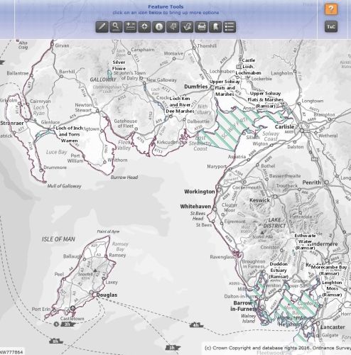
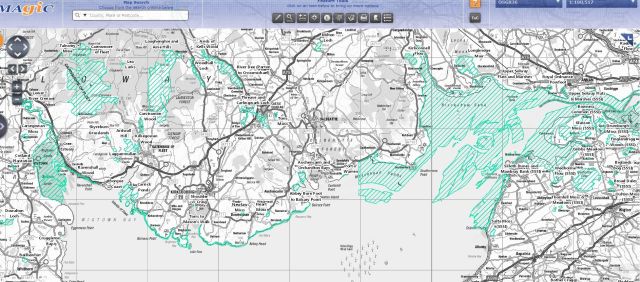
Grazing and Growth on Rockcliffe Marsh

At Rockcliffe [Marsh] it’s about the birds, it’s about the saltmarsh as a vegetation community; it’s about the geological interest in the development of saltmarshes. Many other saltmarshes have been enclosed and changed because of agricultural methods, but the Solway marshes haven’t suffered to the same extent.” Bart Donato

Giles Mounsey-Heysham, the owner of Castletown Estate and Rockcliffe Marsh, refers to Bart Donato as the Estate’s “guru from Natural England” (NE), which made Bart laugh when we met in a café near Kendal in August 2017, but it was immediately obvious that he was very enthusiastic about his involvement with Rockcliffe.

He explained, “The Marsh has been part of an agricultural system for a thousand years or so – it’s not wild, it’s not a natural marsh, but a by-product of the agricultural system set on a natual landform. Local farming systems were once dictated by local needs, but over time have become subsumed within agri-business on a global scale – we have to try to buffer the system.”

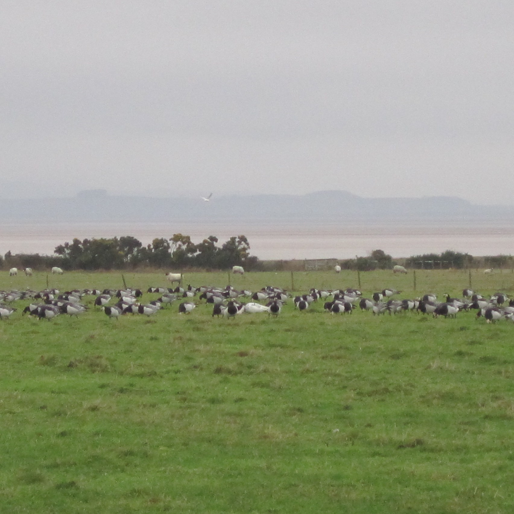
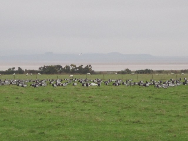
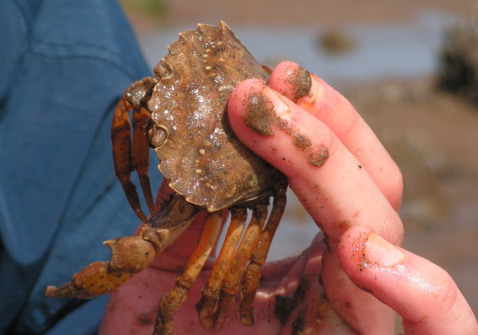
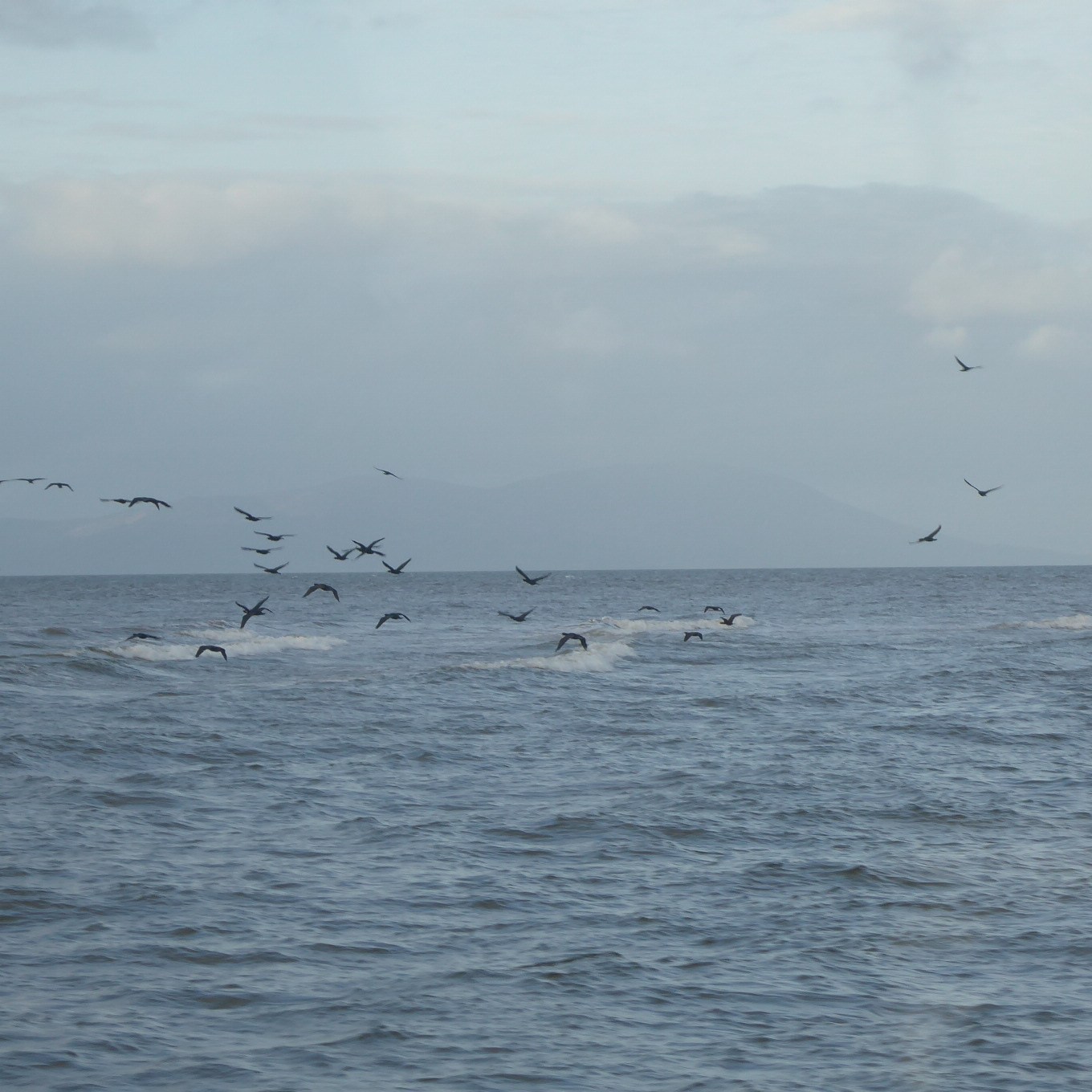
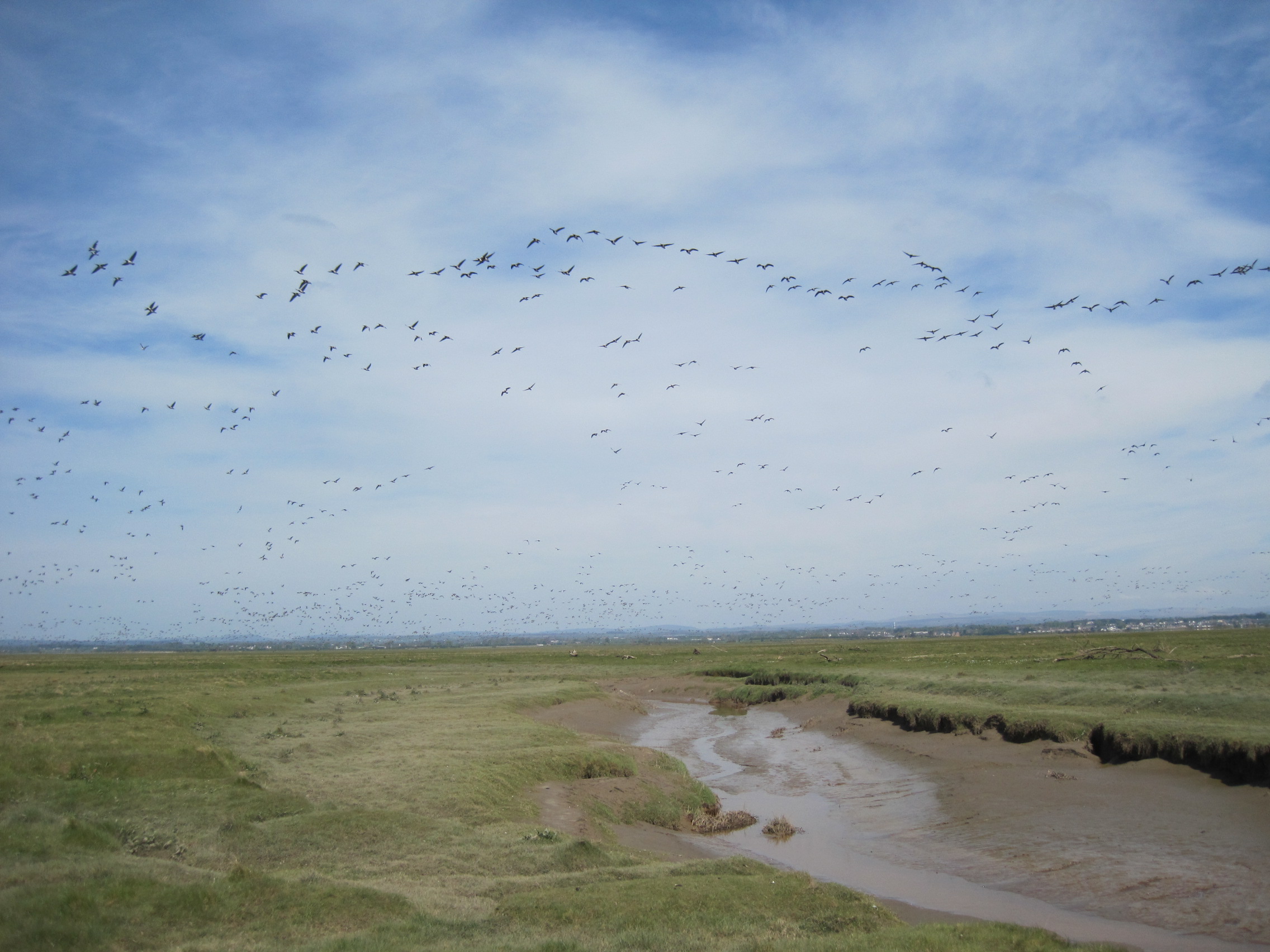
Giles had asked for his help back in 2004 because “the grazing régime wasn’t working.” The result was that the Marsh was put into the Higher Level Stewardship (HLS) scheme, with funding for managing the saltmarsh better for birds. The rôle of NE is look at and secure Rockcliffe’s SSSI designation. “We look at the natural heritage, and think what’s the right management to look after that asset,” Bart explained. “We have to look at the flora and fauna and work out what’s best to support them. As for birds, it’s not just the breeding waders but also the wintering populations, the really big flocks of barnacle geese.”

Managing the grazing

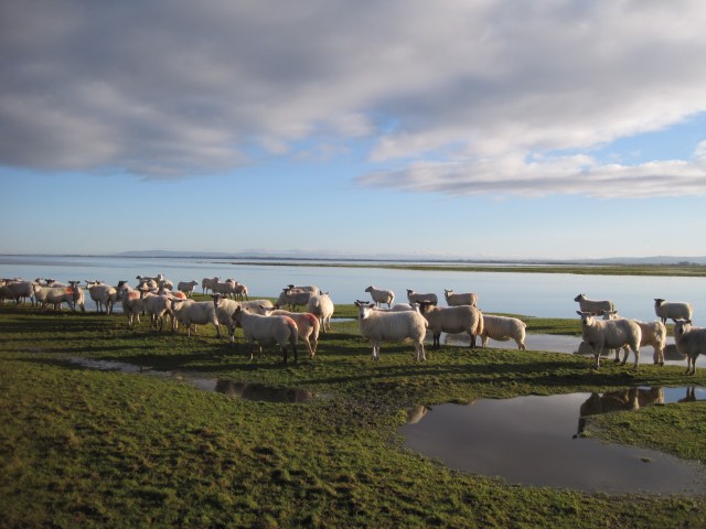
“We don’t have the magic grazing system [for the birds],” Bart acknowledged. “We probably never will because the market drives things like the time and the type of grazing stock.” Geese “like a bowling green” but breeding waders prefer rougher vegetation, so the challenge is to balance this, to manage the grass growth to provide a mosaic. “We’re bringing the Marsh back to something more goose-y and breeding-wader-y.”

I imagined the long, muscular tongues of cattle, ripping off the grass, and the crisp snipping by sheep. That year the Marsh was also a temporary home for a herd of gypsy horses, black- and brown-and-white, and Bart said he “was quite excited to see them – they take on the rougher vegetation like tufted hair-grass, they take it down, and they behave very differently from the other stock.”

In the winter, most of the sheep and cattle are taken off. “The Marsh needs to be grazed enough to stop it growing, yet to keep a bit on it until the geese come again,” Bart said. “The winter grazing is problematic because of the marsh’s great size, the creeks and the winter tides.” Ultimately, “The tides are in control – creeks become quagmires, the pens get churned up.”

Total inundation of the Marsh also, as might be expected, has dramatic effects. For many years Mike Carrier was Honorary Warden for Cumbria Wildlife Trust’s involvement with the Marsh, and in his report for the period 2006/2015 for NE and the Trust, he wrote: “Both tides and weather play an extremely important role in the everyday life of Rockcliffe Marsh. Complete tidal inundations of the whole marsh occur perhaps no more than two or three times per year … When they do occur, the effect is to leave parts of the marsh under water for days particularly in the winter when little or no evaporation or natural drying out takes place. Should complete inundations take place during the [bird] breeding season, the effects can be catastrophic.”

Anatomising the Marsh

Bart talked about the need to manage the grassland as a mosaic of ‘bowling green’ and tufts and longer vegetation, to encourage breeding and grazing birds. But the HLS scheme was also about managing Rockcliffe as a saltmarsh, a mosaic of wet ground and creeks and open water amongst the vegetation, “a Swiss-cheese effect of water-bodies and big sheets of water.”

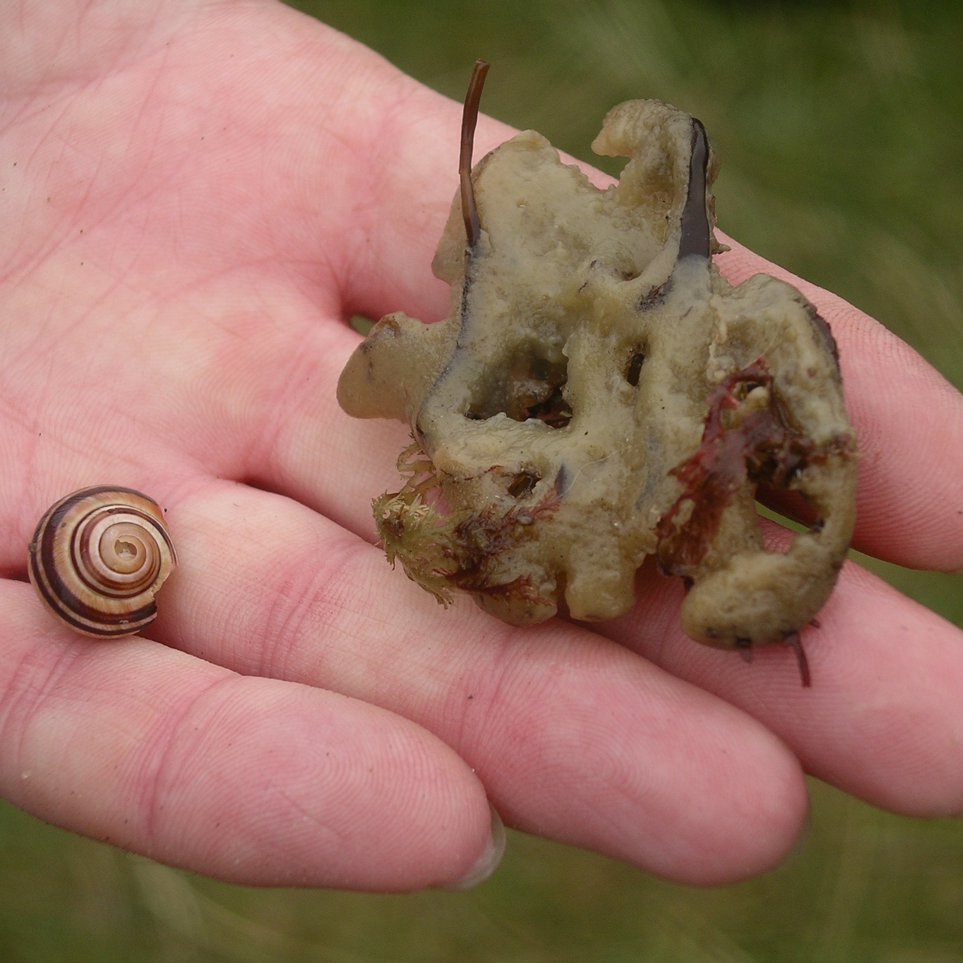
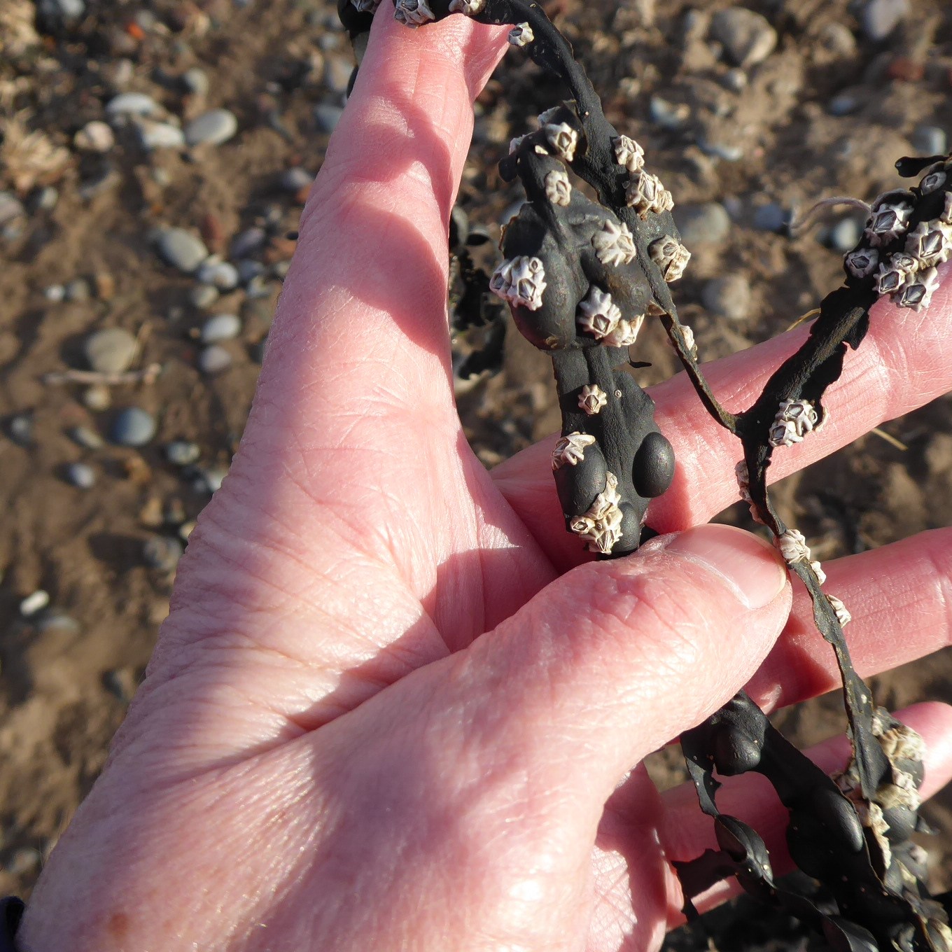
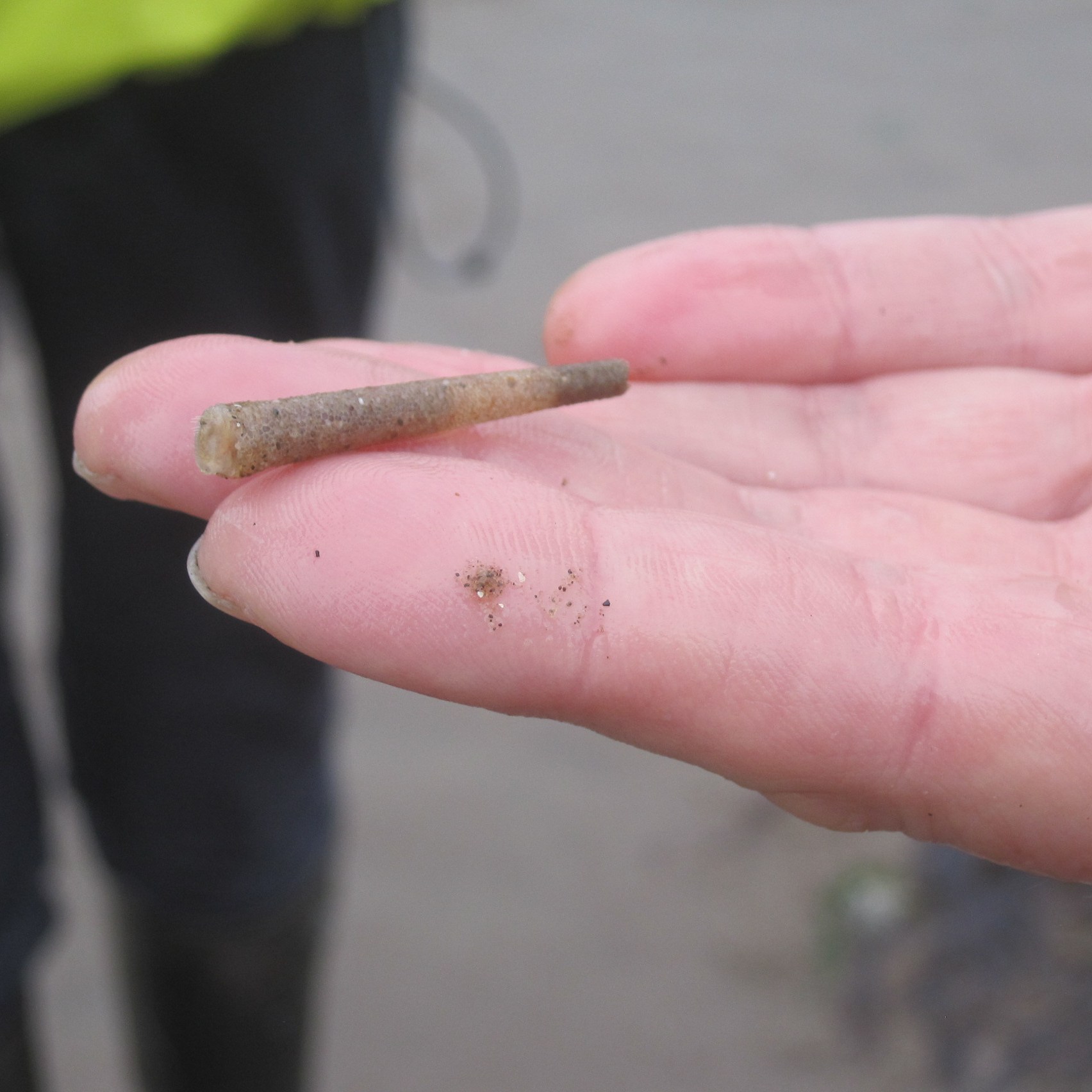
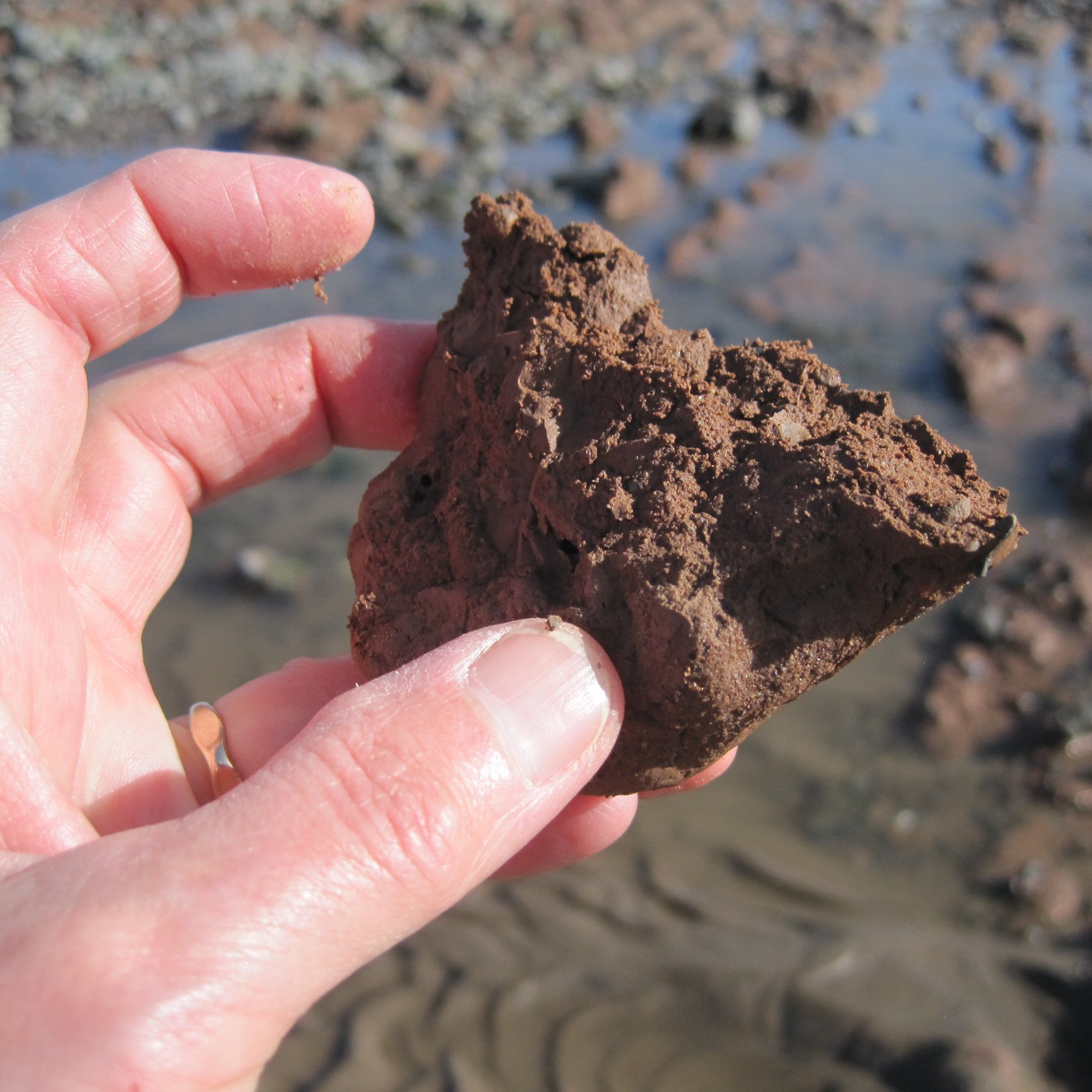
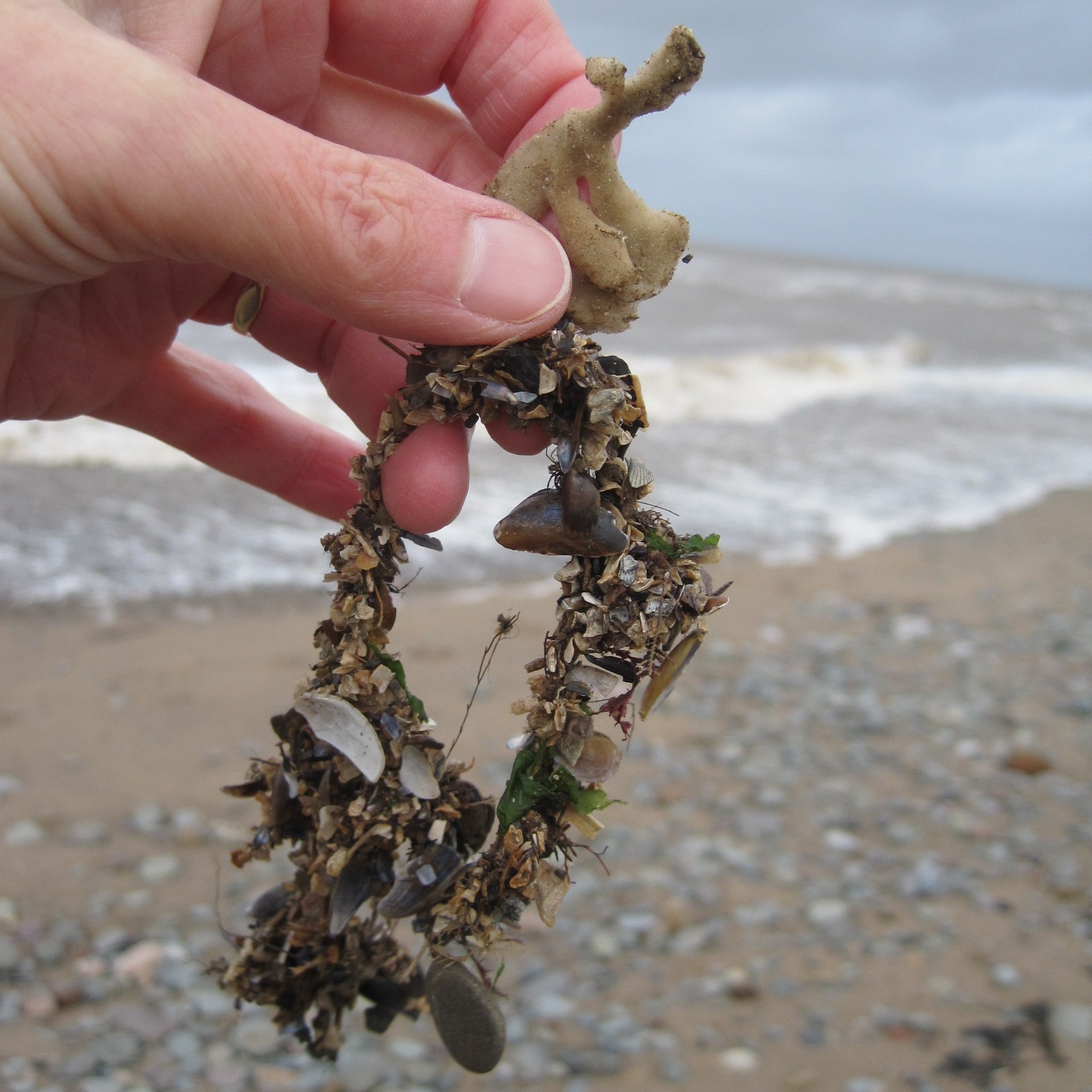
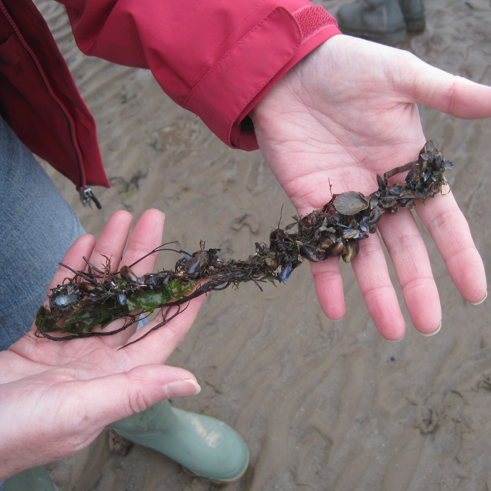
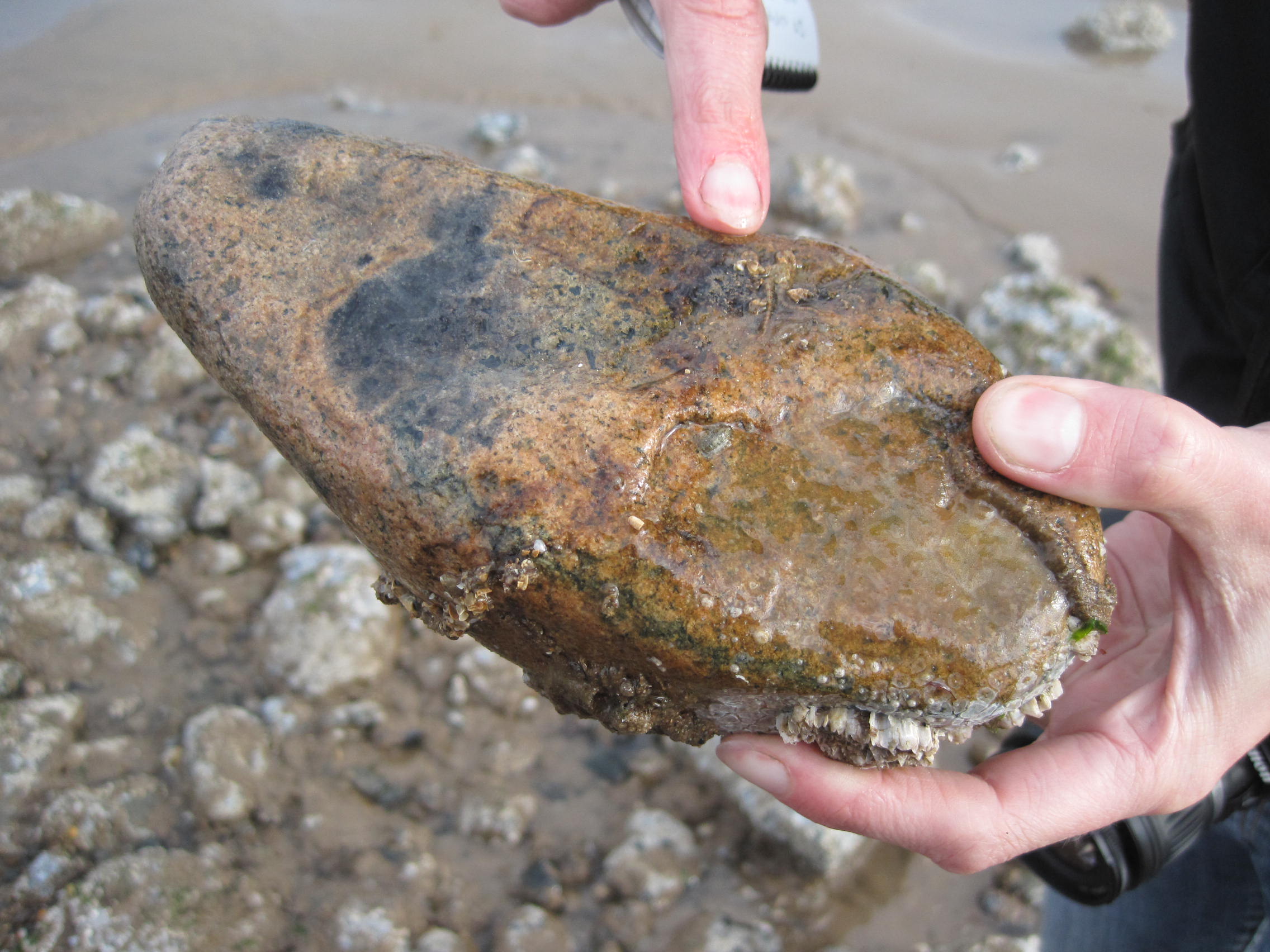
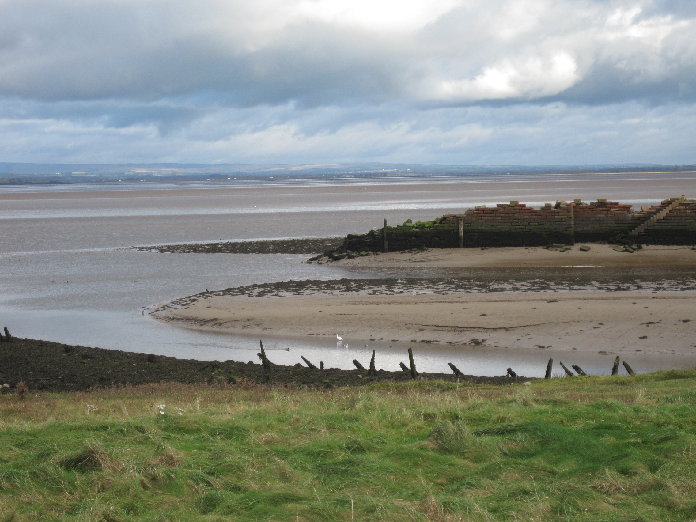
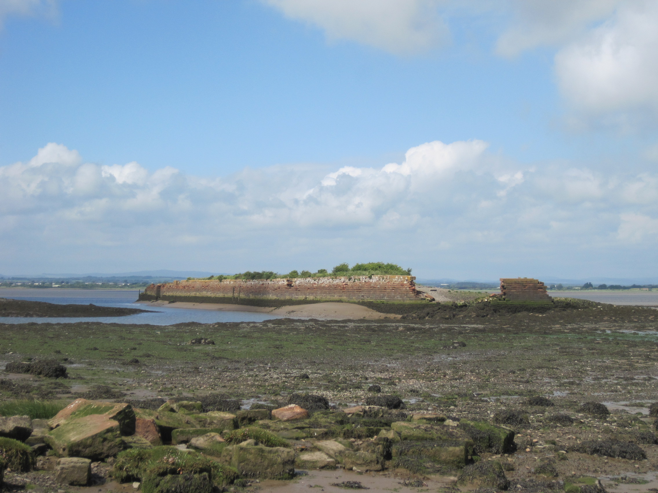
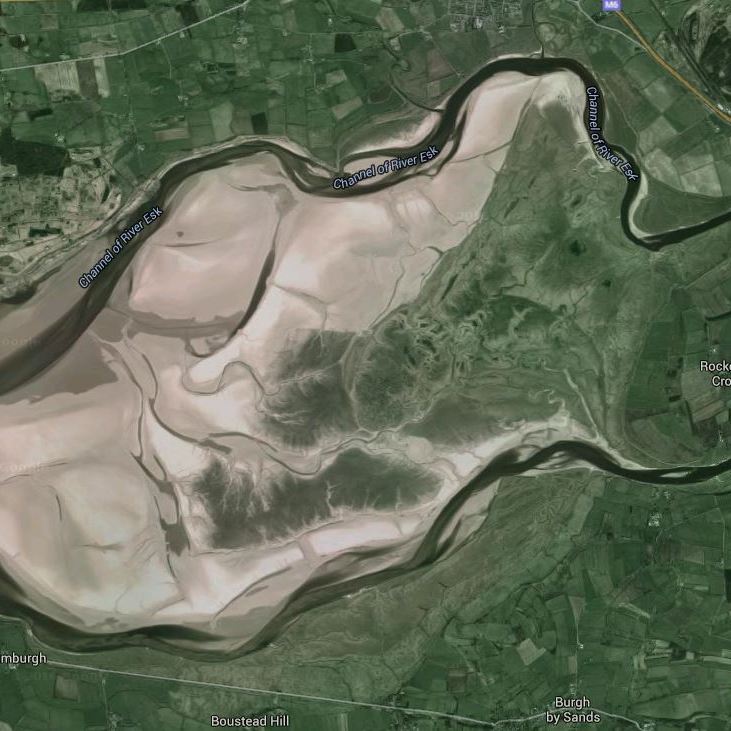
To do this, it was important to understand how the saltmarsh forms and develops. Rockcliffe isn’t only growing outwards, it’s growing upwards too. At the edges, ‘pioneer’ plants like Pulcinellia grass, Salicornia (samphire) and, as at RSPB Campfield further down the coast, the alien grass species Spartina, establish a root-hold. The meshwork of roots stabilises the trapped silt and forms a tiny island. Small changes in water-currents cause more sediment to be deposited and the islands fuse. Sediment accretion raises the level of the new-formed ‘land’, plants colonise, more sediment is trapped … and so a terrace is built up and the diversity of plants increases.

The Solway Firth has famously sediment-laden tides, the sea often the colour of milk-chocolate during strong winds. When the incoming tide reaches the head of the Firth at Rockcliffe and meets the outflowing freshwater of the rivers, it deposits its load of silt. Moreover, during storms, sediment also washes down the rivers “from everybody’s fields”, Bart said, and much of this gets trapped upstream of the ‘neck’ of the Firth at Bowness, so that above-average amounts of riverine sediment are deposited too.

‘The posts were previously this high’

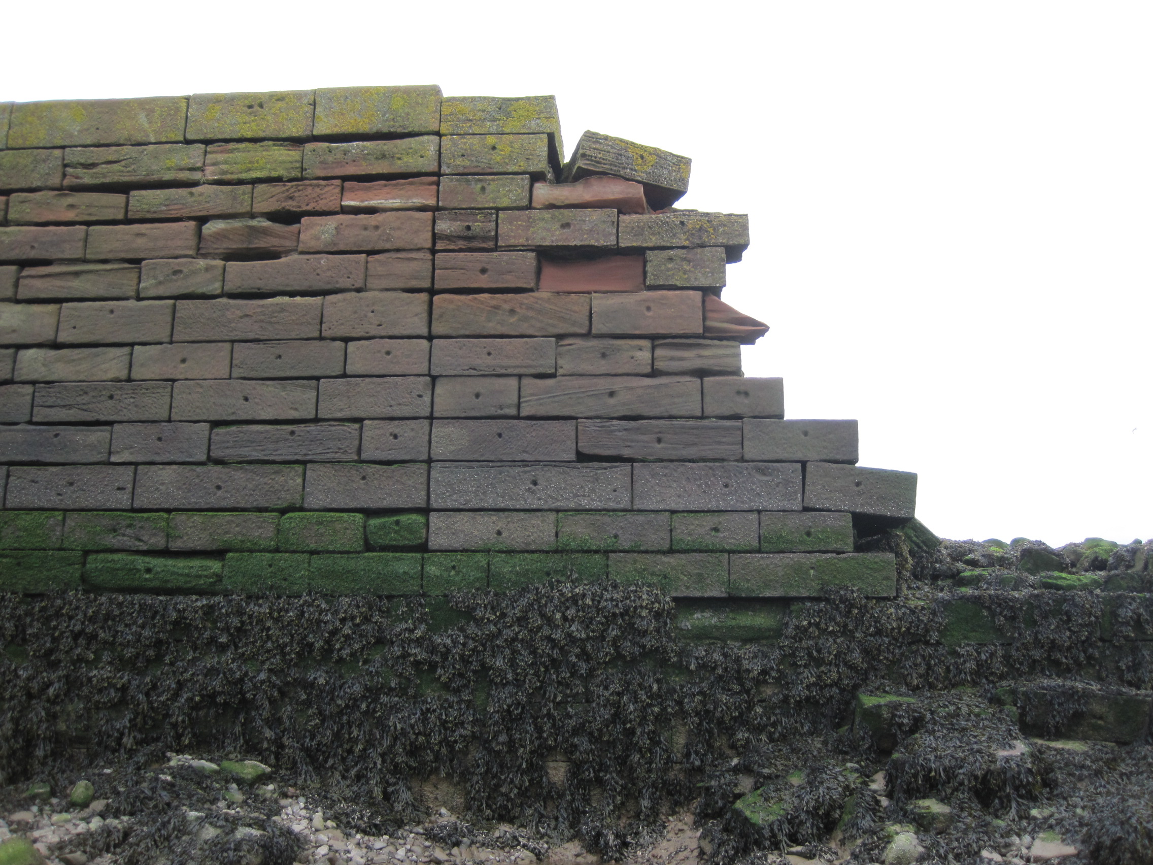
Upward growth, though, is caused by ‘topping tides’, the high Spring tides that happen when the Moon and Sun are in alignment and their gravitational pull is greatest. Then, the water, “brown with muck”, creeps in through the creeks and overspills onto the Marsh. The vegetation creates at its base a layer of still water from which the sediment precipitates out. On a big tide, there’s a relatively long period of slack water at the head of the Firth, which means a longer period for sedimentation to happen; as much as 1cm of silt might then be deposited within a few tidal cycles amongst the grass and herbiage. When Giles had given me a tour of the Marsh he had jumped off the quad near the elbow of the Esk, next to a line of fence posts. “They’re gradually getting buried,” he says, lifting his hand to indicate they were nearly one-third higher when knocked in.

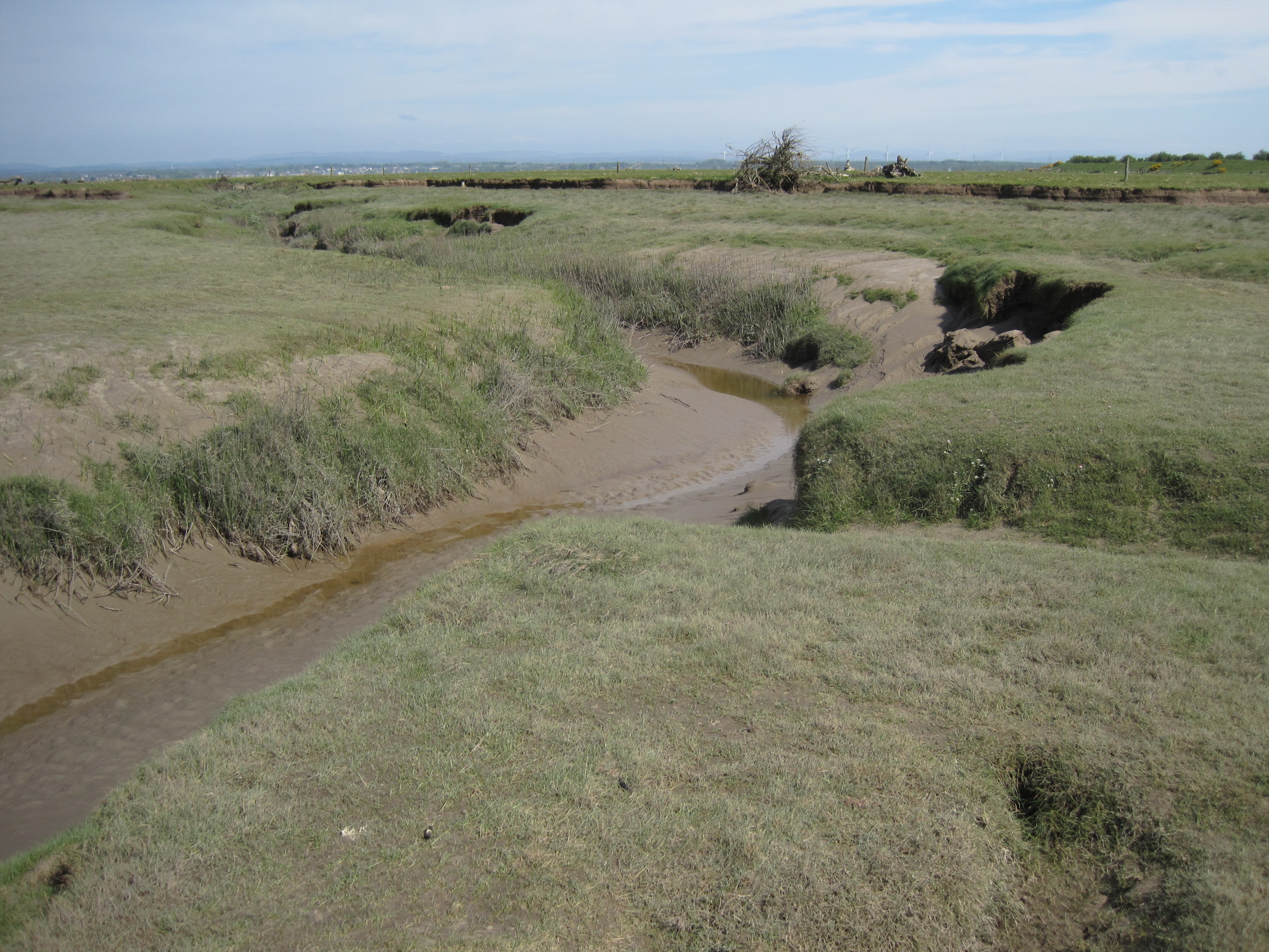
The sediment deposition affects the creeks and pool formation too. In the café, Bart got out the PlayDough, and fashioned a blue creek in a purple Marsh to illustrate what happens. When an incoming tide overtops the banks and spills onto the Marsh, the vegetation traps sediment close to the creek, so that levées gradually form along the banks. As the tide drops, the water on the Marsh cannot escape and forms ephemeral pools, stretches of open water, which slowly decrease by evaporation.

But at one stage in the marsh’s earlier management for sheep, drainage ditches were dug and the levées breached so that the standing water could drain back into the creeks. Now, under NE’s management, the drains have been blocked, the gaps in the banks filled and wet flashes have been dug for waders. The hydrology of the Marsh is being restored to its former state.

(Note: there is much more about other marshes and merses of the Solway, and specifically also about Rockcliffe Marsh in my book The Fresh and the Salt: the Story of the Solway; Birlinn, 2020; see https://thefreshandthesalt.co.uk/chapter-four/ )

Posted in conservation, saltmarshes, wetlands | Tagged , , , | Comments Off on Grazing and Growth on Rockcliffe Marsh

The acronyms’ stories: imagine.

‘Alphabet soup’: AONB, EMS, MPA, MCZ, NNR, SAC, SPA, SSSI – how many more of these acronyms for conservation designations can you recall? Do you know what they mean? (If you don’t – and not many people do – you can find out more on the previous post on this blog.) Do words like biodiverse, conservation, habitat and environment perhaps pass you by?

At the other end of the spectrum from alphabet soup, a war of words broke out between some of the ‘new nature writers’, some accusing others of the over-use of complicated metaphors, mysterious similes and literary allusions that make the reader work too hard to understand what has actually been seen and experienced. George Monbiot wrote that we needed a new language, that ‘language is crucial to how we perceive the natural world’: ‘habitat’ and ‘conservation’ were too dry and alienating. Richard Mabey’s flash of self-awareness in this respect was delightful. Observing and writing about barn owls, he found he was constructing ‘extravagant phrases. …  I was rather pleased with my poetic metaphors, and it was only when I first read this passage out in public that I realised its utter stupidity.’ The moment of understanding came when he realised that the owls were his neighbours. ‘For much of my working life I have been trying to find way of talking about other organisms that neither reduces them to mechanical objects nor turns them into sentimentalised versions of ourselves. Neighbours are fellow creatures, but independent souls. You share their territory (their parish) and often their fortunes, but you can care about them in full knowledge they may not even recognise you.’

This is a fine idea. The small mudshrimp, Corophium, is a near-neighbour of mine; we live in adjacent parishes – he/she within the mudflats that fringe both shores of the Solway Firth, while I live in rolling farmland within sight of the Firth. Corophium is a small pale-brown crustacean, less than a centimetre long and with one pair of very long antennae. Few people have heard of mudshrimps, let alone seen them; they spend many hours each day – hours when the falling tide has uncovered the mudflats – in a burrow or crawling across the thin surface-film of water on the mud. Mudshrimps aren’t ‘charismatic’ or ‘iconic’ like a curlew, watervole, or polar bear, yet their bodies and behaviour are exquisitely adapted to the difficult conditions in which they live. Another of the ways in which our ‘parishes’ differ (there are obviously several) is that Corophium also lives, quite unknowingly, in an alphabet soup. The Upper Solway is an EMS, and has SAC and SPA status; part of the Upper Firth, too, is a MCZ.

Yet these designations, these acronyms, describe living, changing neighbourhoods and parishes. Imagine, then, making a short trip around the north-west Cumbrian coast from Bowness-on-Solway to Anthorn, preferably when the tide is mid-way up and rising; leisurely cycling is a good way of getting about – it’s slow, and you can abandon the bike to explore on foot.

Here at Bowness the Firth, stretching between Scotland and England, shore to shore between Mean High Water Level, is the Ramsar site, and an SAC, SPA, MPA and SSSI. Mudflats and pebbly banks have been exposed. There are tiny holes in the mud, hinting at the burrows of crustacea like Corophium and of snails like Hydrobia; coils of muddy sand on the surface betray the U-tubes of lugworms. They, and several species of burrowing molluscs, use the mud as protection from predators like fish and crabs, but many species of the wading birds busy on the shore are specialist probers intent on finding them. Other snails, and worms like ragworms, lurk beneath small rocks and pebbles, but oyster-catchers and gulls know where to look. As the tide floods in, redshank scurry along the water’s edge; flocks of knot flash binary signals of black and white as they wheel and turn, and curlews pace and probe.

These acronym-ed mudflats are home to hundreds of species of invertebrate animals, millions of animals that are adapted to live and feed and breed in a place where the sea covers and exposes them twice a day, and where brackish conditions can change from one day to another, depending on the state of the rivers and the height of the tide. They are tough and adaptable  animals – within limits – and their numbers and life-styles make the Upper Solway mud a rich feeding-ground for resident and migrant wading birds to re-stock their energy levels.

To the South-West of Bowness, trees and scrub hide the landward end of a stub of red sandstone, all that remains of the former railway viaduct that crossed the Firth. Imagine the Upper Solway during the construction of that viaduct, throughout the five years between 1864-69: barges, pile-drivers, the movement of hundreds of tons of sandstone and iron (and sea-borne sediment), the day-after-day clatter and shouting and banging; the fishing and wild-fowling needed to supplement the meals of all those workers; the disruption and disturbance in the Firth and surrounding countryside. Did they worry about ‘the environment’? ‘Conservation’ and ‘biodiversity’ were not part of the everyday vocabulary. That is now an old story, history, and saltmarshes and mudflats line the shore each side of the embankment’s remains.

But here the story of the Upper Solway Flats conservation area interacts with the story of the Solway Mosses SAC: the railway viaduct, of course, required a railway – which was driven across the raised mire of Bowness Common (Moss) from Whitrigg to the Solway coast. Bowness Common is part of the South Solway Mosses SAC (and is also an SSSI and NNR); part of it is also owned and managed by the RSPB as its Campfield Reserve. The line for the railway was excavated through the peat, which was in places nearly 50 feet (15m) deep. This was (eventually – for a while there were some problems with subsidence) good for the railway, but very harmful for the complex hydrological structure of the mire. Then, peat-bogs were ‘wasteland’. Now, we recognise that peat-bogs and raised mires are very important carbon-stores, and we need to restore and re-wet them so that water-retaining sphagnum mosses can re-establish. Natural England and the RSPB have, over recent years, done considerable work in re-wetting the Moss of Bowness Common, including turning parts of the old railway track into ponds and wetland. You can read more of this extraordinary present-day story, of optimism and engineering, here.

So, bump over the cattle-grid at the entrance to Campfield Reserve, have a cup of coffee in the Solway Wetlands Centre, then walk up the track to the hides that variously overlook grazed pastures, wetlands and lakes. Birds of the hedgerows, of woodland, waterbirds and raptors, and waders from the Solway shore, all take advantage of the variety. Carry on past the wood and out onto Bowness Common, onto a glorious wide-open space dominated by heather, mosses, sundew, butterwort and all manner of other bogplants; here be dragonflies – and butterflies, water-beetles and pondskaters, frogs and newts and lizards …

In the autumn and winter, the stories of this RSPB Reserve – and of the Reserves and protected merses across the Firth at Caerlaverock too – turn a page to a new chapter, that tells of the influx of thousands of overwintering barnacle and pinkfooted geese, and whooper swans. They come here, visitors from far-off Iceland, Greenland and Svalbard, to graze on the Upper Solway wetlands and on the other ‘designated’ areas of the Firth – the salt-marshes.

On the Cumbrian side, saltmarshes stretch South along the coast to Anthorn near Whitrigg, their turf jigsaw-ed by muddy creeks. They too are part of the Ramsar, SSSI and AONB stories, and home to mud-loving and saline-tolerant plants and animals. Small samphire plants appear to be caught in freeze-frame as they stride out across the mud, and pink thrift carpets the close-cropped turf between the feet of grazing sheep and cattle. The story of the saltmarshes is never constant, for the marshes are always shape-changing, sequestering or releasing the sediment carried by the tide; they are the intermediary narrators between the land and sea.

Posted in conservation, Marine Conservation Zone, mud-shrimps, peat, bogs and moors, saltmarshes, wetlands | Tagged , | Comments Off on The acronyms’ stories: imagine.

SACs, SPAs, SSSIs on the Solway Firth: Learning to love the acronyms

Think of [the list] as not so much an inventory as a catalogue leading to compelling and interacting stories.” [1]

Conservation designations: their borders aren’t marked by posts or buoys, but they are marked by lines on maps, and by co-ordinates and words in documents.               

Native and migrant wading birds don’t know about the borders, but they know that this great seascape of changing tides and rich mudflats and saltmarshes is where they want and need to be. Burrowing crustacea, worms and bivalve molluscs, samphire, sea-kale and pink thrift, the millions of microscopic animals and plants and algae that make up the densely-interwoven life of the Solway Firth – their lives depend on the intricacy and uniqueness of their three-dimensional surroundings.

The sea and estuaries and the many types of coastal ‘edge-lands’ that form this large crooked finger of water that reaches deep into the borderlands between Scotland and England, form a ‘soup’ of acronyms. The Firth and its surrounds are protected from human exploitation and ‘re-arrangement’ by layers of statutory – that is, legally-enforceable – conservation designations. You can investigate their virtual boundaries yourself on the interactive maps on MagicMap [2]: I have included screen-shots here (having enquired of MagicMap whether I might do so).

‘Safe areas’ along the Solway 


Magic Map: Ramsar sites

The large, main, protected area that comprises the Upper Solway Flats and Marshes unites the two countries around the coasts and across the water. This is a Ramsar site – designated as important wetlands under The Ramsar Convention on Wetlands,  an inter-governmental, ie international, treaty which ‘provides the framework for national action and international co-operation for the conservation and wise use of wetlands and their resources.’

Exactly the same area is designated under EU legislation as a European Marine Site (EMS).  This is quite complicated and I quote from the Solway Firth Partnership’s website: “A Special Protection Area (SPA) is a site designated under the Birds Directive. These sites, together with Special Areas of Conservation (SACs), are called Natura sites and they are internationally important for threatened habitats and species. Natura sites form a unique network of protected areas which stretch across Europe [my italics]. The inner Solway Firth … is designated as an SAC and SPA and is collectively known as the Solway Firth European Marine Site. The [separate] Solway Firth SAC designation reflects the importance of the site’s marine and coastal habitats including merse (saltmarsh), mudflats and reefs. The Upper Solway Flats and Marshes SPA designation recognises the large bird populations that these habitats support, particularly in winter.” [3]

MagicMap: SACs (purple) and SPAs (blue)

It is also a Site of Special Scientific Interest (SSSI) under UK statutory protection, overseen by Natural England & Nature Scot, respectively. So this multi-layered protected space is not trivial.

And note that a proposal to extend the SPA is still under consideration (the decision has of course been delayed, due to the Covid19 outbreak and Brexit negotiations – we might finally hear this summer, 2020).

Potential SPA extension [4]

Although not strictly within the Firth, there are other international Ramsar sites along the adjacent coasts: the inner part of Luce Bay, and the Duddon and Morecambe Estuaries (again, on the basis of being internationally important wetland areas). They – and the coast at Drigg near Sellafield – are also Special Areas of Conservation, SACs, under EU statutes.

(The Solway’s  importance for birds – so many species, both residents and migrants, and in such numbers – is also recognised by the UK charities the Wildlife & Wetlands Trust with their big wetland and coastal reserve at Caerlaverock, and by the RSPB’s coastal and wetland reserves at Campfield and St Bees’ Head.)

MCZs (map from Living Seas NW)

Over the past few years, DEFRA has designated parts of the English and Irish seas and coast as Marine Conservation Zones (MCZs). The Cumbrian Coast MCZ stretches along the shore from St Bees’ Head to Ravenglass, and Allonby Bay MCZ pushes out into the Solway, recognised especially for its important honeycomb-worm (Sabellaria) reefs. The Solway Firth MCZ around Rockcliffe Marsh and the mouth of the R Eden is mainly for the protection of sparling (smelt, or cucumber fish) as they migrate upstream to spawn.

MCZs are designated under the UK’s Marine & Coastal Access Act, which in turn was set up in response to the European Marine Strategy Framework Directive.

Parcels of protection

The sea, estuaries, mudflats and saltmarshes of the Solway Firth have been parcelled, here and there, into places of protection for our ‘natural capital’ – which, in reality, means the vast numbers and species of other residents of our own land- and sea-scape.

But the Solway’s estuaries and coasts are not solely a product of the sea and the mouths of the many rivers that flow into the Firth because they are also influenced strongly, both in geological time and the short-term, by what happens inland.

If we move inshore, a little deeper into the edgelands, we find dunes, then peaty raised mires (the ‘Mosses’) and areas of carr and wetland where water is retained. Many of these places are special, too, for their appearance and ‘feel’, the colours, the smells, and the very different plants and animals and fungi that live there. And luckily for us – and them – many are under statutory protection.

Most of the UK’s remaining raised mires are around the Solway’s upper end, and the three South Solway Mosses – Wedholme Flow, Glasson Moss, Bowness Common – plus Drumburgh Moss, on the English side, are Special Areas of Conservation (SACs) protected by European legislation [4]. So too is Kirkconnell Flow near Dumfries.

Then there are the National Nature Reserves (NNR), protected by UK legislation: on the English side, the South Solway Mosses, Drumburgh Moss, Walton Moss and Thornhill Moss; on the Scottish side Caerlaverock  and Kirkconnell Flow.

We have the Solway Coast Area of Outstanding Natural Beauty, the AONB, 50 km of coastline stretching from Maryport along the dunes and saltmarshes to Rockcliffe, managed in statutory compliance [5] with the Countryside & Rights of Way Act 2000 (CroW) and overseen by the three local councils, and Natural England; the AONB incorporates SSSIs too. 

And there are many SSSIs, both sides of the Firth, along the coast and inshore; they too are under UK statutory protection through the Wildlife & Countryside Act 1981 and CRoW, and managed by Natural England and Nature Scot. Amongst them, I’ve already mentioned the Upper Solway Flats & Marches – but there are also, for example, the SSSIs of the South Solway Mosses, Finglandrigg Wood, Silloth Dunes and Mawbray Banks, Maryport Harbour, St Bees’ Head, Drigg Coast … and on the Scottish side, Kirkconnell Flow, Auchencairn and Orchardtown Bays, Abbeyhead Coast, Brighouse Bay, Wigtown Sands and the Whithorn Coast…

I haven’t yet mentioned the many GeoConservation Sites (formerly known as RIGS), such as exposures of the submerged forest near Beckfoot, and Birkham’s red sandstone quarry above St Bees’; although some of these are SSSIs and therefore under statutory protection, many are not. And I’m not going to consider the few Local Nature Reserves such as Siddick Pond.

Birkham’s Quarry, St Bees. A GeoConservation site

‘Too much information?’

I’ve gathered this information here

firstly to understand how, and to what degree, the Solway Firth and its edgelands are protected from human intervention, whether from carelessness or from major construction projects;

and secondly, to try to dispel my own despair over lists of acronyms by considering what these ‘designated areas’ mean in real-life terms.

Let’s turn again to Richard Fortey: “Think of [the list] as not so much an inventory as a catalogue leading to compelling and interacting stories.”  He persuades us to think beyond the check-list of  ‘species found’: to pause, and take time to examine the life-habits of those species.

But his suggestion could equally apply to the list of designated conservation areas along the Solway. SAC? Tick. SPA? Tick. SSSI? Tick, tick, tick … What is the reality of these places on the ground?

Some of these ‘acronyms’ stories’ are elsewhere on this blog.

Sheep on a flooded saltmarsh, Grune Point, Moricambe Bay (AONB, SSSI, SAC, SPA, Ramsar)

Designations, legislations

But what if their story-book gets torn, or if a group of people decide the books are merely clutter and should be thrown out?

If you carry out dredging operations on Ramsar mudflats, place gas-gun bird-scarers on an SAC, drag a trawl across the bottom of an MCZ, or set fire to the heather on a SSSI – who has the power to stop you? Will you get a ‘talking-to’ or be taken to court? And if you are to be prosecuted, under which laws, and in which court and where – a local magistrate’s court, a Crown court… The European Court of Justice will soon have no powers of legislation in the UK. At the time of writing this, we’re waiting on the progress of the new Environment Bill which makes provision for a UK Environmental Court.

The answers to any questions regarding legislation are, as you might expect, very complicated (and might lead you on to further questions such as ‘So, who does own the foreshore of the SAC?’ – and the answer to that depends on which foreshore …).

It also depends whether the damage is done by you, as an individual and therefore ‘third party’ (when you might be answerable to, for example, Natural England [6] and petty crimes might be prosecuted in local courts), or whether the damage occurs because one of the statutory organisations – such as the Marine Management Organisation (MMO), Natural England, Nature Scot – have failed to fully protect or manage a designated site. More serious infringements could well require lawyers expensively well-versed in international environmental law.

After looking into this, and asking questions of my friends and contacts in the relevant organisations, I realised this section could stretch to several pages. So, happily, I can point you to the Marine section of the excellent website , ‘Law & the environment, a plain guide to environmental law’

Also, there is a government website solely concerned with legislation. From the page on Marine Strategy regulations you can, if you wish, click on Section 2, Enactments, and can keep following and clicking (here, for example, is how the MMO has power to bring legal proceedings). And so on, and on, until you forget which question you wanted answered, and need to escape to watch videos of ‘dogs doing silly things’ on YouTube.

Instead, it’s often worthwhile to pause and try to imagine what those acronyms stand for in the real world of the Solway Firth and its edgelands – and feel positive about the future.

Footnotes:

1. Richard Fortey. (2016) The Wood for the Trees: the long view of nature from a small wood. Collins.

2. MagicMap http://magic.defra.gov.uk/MagicMap.aspx

3. The Joint Nature Conservation Committee’s (JNCC) directory of designations for protected areas http://jncc.defra.gov.uk/page-1527

Natural England’s National Character Assessment NCA no 6 The Solway Basin http://nepubprod.appspot.com/publication/5276440824119296 p22 for Landscape & Nature Conservation Designations (on the English side only)

Solway Firth Partnership’s website explains and illustrates some of the Scottish & English designations http://www.solwayfirthpartnership.co.uk/index.php?page=special-places

4. Joint Nature Conservation Committee’s (JNCC) detailed explanations about characteristics and statutory provisions for raised mires in general http://jncc.defra.gov.uk/protectedsites/sacselection/habitat.asp?FeatureIntCode=H7110

and for the South Solway Mosses http://jncc.defra.gov.uk/protectedsites/sacselection/sac.asp?EUcode=UK0030310

5. The legal framework for AONBs http://www.landscapesforlife.org.uk/aonb-legal-framework.html  

6. Enforcement by Natural England of SSSI policy http://www.sssi.naturalengland.org.uk/Special/sssi/images/EnforcementPolicyNotice.pdf

Posted in conservation, Marine Conservation Zone, mudflats, peat, bogs and moors, saltmarshes, wetlands | Tagged , , , | Comments Off on SACs, SPAs, SSSIs on the Solway Firth: Learning to love the acronyms

“Look!”

Look what I’ve found!”
“Look at that!”
“What’s this?

We do it automatically, hold out the treasure on our hand.

For about 10 years I’ve been taking pictures of what people have found when they joined me for low-tide guided walks on the Solway shore, and it became an interesting and often amusing record of our wanderings. The hands’ owners are unseen in the photos, but the hands themselves are often eloquent about the owner and his or her surroundings. Wedding rings, gloves, nail varnish, or sandy fingers; whether the objects are held lovingly, or with wonder, or with an air of squeamishness … (Quite a few of the hands belong to young people from Settlebeck School, Sedbergh; the Head of Science, Stephen Burrowes and I took them to the Allonby shore a couple of times back in 2005.)

On the tidelines

On the shore

In the pools

Posted in Found Objects, tidelines | Tagged | Comments Off on “Look!”

A Solway small-holding

Yesterday I stood leaning on the pitchfork by the glowing ash-pile, just looking around at the trees and the hedges and our sheep. Two weeks ago, on a blue, still morning, there had been a sound like a gun-shot from our wood and the rooks all leapt into the air, shrieking and shouting. My husband went out to remonstrate with (presumably) someone who was shooting into the rookery – and found an enormous branch had cracked off from one of the Scots pines. Luckily no human or other creature was hurt, although some of the smaller trees had been hit. Hence the bonfire out in the field, to burn the brash (the sap-sticky logs have already been sawn and split, and will dry out for at least a year before being used on the wood-burner.)

We run a small-holding of about 2 hectares, in NW Cumbria and looking across to the Solway Firth: woodland, hedges, vegetable and flower garden, pasture for the sheep, and a beck which rises from a spring and runs through the pond that we created. Our small wood is at least 160 years old, presumably having been planted at the time our Victorian house was built, and has a mixture of native and non-native trees, including a very tall and increasingly straggly redwood, its trunk pitted with woodpeckered holes (where, my birder brother-in-law assures me, wrens might huddle together in the winter).

The previous owner (and the original Victorian owners – they had carriages not cars) kept horses, and the pasture-land had become rank and full of docks; a narrow strip alongside the wood was damp and dull.

After we moved in eighteen years ago we, and two kind and energetic friends, planted many more native trees – including alders, hornbeam, willow, birch, oak, Scots pine, guelder rose, hazel – singly and as a copse, and thickets of hawthorn, blackthorn and wild rose, in an attempt to make the local woodland and garden birds feel more at home, and migrant warblers and other birds to stay.

Some years later chiffchaffs came, and a pair of blackcaps; there are 2 pairs of breeding nuthatches now, a tree-creeper, and Great-spotted woodpeckers, amongst others. We also planted a windbreak in the field, of suckers from the wild cherries, and a mix of other trees and shrubby bushes – all fenced to keep out the sheep, who always enjoy a bit of novelty in their diet.

United Utilities have started mutilating West Cumbria in the construction of a new water pipleine for West Cumbria (hundreds of tonnes of concrete are being poured into a new reservoir on the other side of the hill as I write) – and my despair at the effect that this would be having on the wildlife surrounding our village kept growing.

So, last year, we sold 4 of our 10 sheep – the Herdwick ewes, since they were in good condition for breeding – and  planted up a third of a hectare of pasture with native trees. But it was the year of the Beast from the East, which was followed not long after by – unheard of for this area! – six weeks of drought. I don’t like tubular tree-guards, and we’ll remove them when each tree is sufficiently tall and robust to look after itself, but the tubes ensured a warmer, damper micro-climate around each sapling. By scooping water from the dribbling slimy beck with a bowl and into buckets, we managed to keep the trees wet enough in the drought so that we only lost about 8 percent. The survivors are already looking good this Spring, and we recently – with the ‘help’ of our grand-children – planted hawthorn slips to make a hedge along one side.

We’ve learnt a lot about managing woodland during our time here: when to trim branches so that light can reach the smaller species or the wild violets and cowslips; when and what to plant. We pollarded a big old ash by the pond, partly because it had a crack between two branches, but also because it was throwing so much shade that there was no chance that dragonflies would stay.

I managed to persuade my husband that the grass in the wooded areas doesn’t need to be cut like a lawn! At the moment the floor of the old wood is a white froth of cow-parsley, mixed with the deep purple of self-seeded Honesty and a jumble of pink- and white- and blue-bells, all of which are now the ‘Spanish’ type (although I’m sure they were ‘English’ when we first moved in). This has been a good year for celandine and dandelions – and also for cuckoo-pint, whose pale sheaths and glossy leaves have proliferated in every shady patch. Earlier, there was a carpet of snowdrops, followed by daffs – both species seem to proliferate naturally as well as with some help from us (splitting and re-planting clumps when they’re ‘in the green’).

The newest woodland was planted on a pasture which has for decades been fertilised by horse- then sheep-droppings, and kept well-grazed. A range of grasses grew up last year amongst the saplings, plus chickweed, creeping and meadow buttercup, and some milkweed. We had to cut the grass at the end of the summer and remove the cuttings to reduce the fertility of the land – this was during the hot dry weather when the flies swarmed and I spent the time whining, raking and sweating – but already this year we’re seeing many more milkweed growing and I’m hoping the grey furry-leaved mulleins and foxgloves that I retrieved from inappropriate places elsewhere (the gravel path, the veg garden) will flourish in their new sites.

The pond has evolved with time. When you think of the Lake District you think of volcanic rocks and slate, but that massif is fringed with limestone – and our village sits at the base of a low plateau, where the rain gathers in sink-holes and flows into aquifers, eventually emerging as springs where the limestone meets the harder rock. Our beck is surprisingly ‘flashy’ during heavy rain in winter – very soon the percolating water explodes out of the ground and flushes silt from the field behind us into the pond; then still rising, spreads out onto the mini-floodplain of our field, before finding its way back into the water-course again.  The volume and speed of the water that comes down is spectacular.

But that hasn’t happened for several winters, and there has been very little heavy rain for weeks. Last week shingle banks were showing in the River Derwent in both Cockermouth and Keswick (seeing the water so low, it’s hard to believe how high the river rose during the floods of 2009 and 2017, over-topping the defences) and already our pond is so low that it is fringed with mudbanks, and much of the weed is no longer floating but resting, humped, upon the mud. I don’t know how the tadpoles and caddis-fly larvae, the whirligig beetles and various snails are faring – they are scarcely to be seen, presumably finding refuge amongst the water-forget-me-not and watercress and mint; even the base of the reed-bed looks dry and the reeds themselves are not growing as fast as usual for this time of year.

Perhaps there are no longer tadpoles anyway; for several mornings it was apparent that something had been rooting in the water-forget-me-not, patches of which were left floating, roots pointing to the sky. Our trail-camera picked up a male mallard arriving in the dark and leaving at dawn: mystery solved (but see note below, three weeks later). One year a female mallard made her nest on the small island in the pond but it wasn’t a wise move to nest within sight of a wood that is so aurally and visibly busy with corvids – there are about 40 rook and several jackdaw nests, and there is a crows’ nest at the top of the field – and of course the constantly vigilant magpies patrol the hedgerows. The duck eggs didn’t last long.

Last year the introduction of more light to the pond paid off, because it was finally visited by a large yellow-and-black hawker dragonfly and several red-bodied damselflies. But there’s not a chance that they’ll come to stay this year unless the water level rises – and now, in this period of lush growth, the vegetation upstream on the plateau will soak up any rain that falls.

As I stood beside the ashes of the bonfire, which occasional flurries of wind sparked into life, I was trying to remember all the birds and animals that have visited since we have been living here, and I hope that what we have been doing – in the wood, the pond, the fields and hedges and the garden itself – has helped to make them feel welcome and at home. Hedgehogs have bred; an otter visited when the frogs were mating (betrayed only by its pawmarks); bank voles burrow everywhere and a red squirrel visited (but we must have been found wanting because it left after three days). There are pipistrelles, on whom I eaves-drop with the bat-detector, and frogs and toads.

As for birds: 3 species of tit live here and long-tailed tits visit; chaffinches, greenfinches (fewer these days), goldfinches, and recently a pair of bullfinches; the usuals like robins, (lots of) blackbirds; dunnocks; goldcrested wrens and (never-ordinary) wrens; a pair of song-thrushes, and a pair of mistles; the tree-creeper(s), nuthatches, house- and tree-sparrows; the corvids; the Great-Spot… A sparrowhawk hunts frequently through the garden, sometimes sitting on the sandstone gatepost by the kitchen window, glaring around with glittering yellow eyes; a collared dove provides the occasional good meal, but the wood-pigeons are too heavy for him to take on. Last year a buzzard learnt to snatch rooklings from their nests and, dropping down through the trees, tore at their flesh and feathers on the floor of the wood. In the cold spells, siskins and bramblings cluster round the feeders.

And then there is the song of the chiffchaff and the blackcap, and the twittering of the swallows and house-martins, the night- and dawn-calling of the tawny owls …

Except there isn’t. This year, as last, a chiffchaff returned and made me briefly, almost deliriously happy; but he left despite my daily exhortations to stay – presumably no mate came to keep him company. The barn owl hasn’t been seen for at least two years; the work on the water-pipeline seems to have scared the hares away; the local tawnies haven’t been heard for at least 8 months; only 4 swallows have (finally – 3 weeks late) returned, of which only one pair is probably ‘ours’ and will nest in the hayloft; so far I have seen only one house-martin. The heron that used to visit hasn’t been seen since last summer. The hedgehogs began to shuffle around in day-time last year, and were later found dead – a sure sign they had succumbed to some infection. Spotted fly-catchers nested in the Clematis montana for a few years when we first arrived, but they didn’t return one summer and I have never seen one again.

It is so easy to become upset and depressed at what we have lost and are losing, and some days it is very hard to be positive, especially in the face of such global losses and anthropocene-induced extinctions. But then I make myself stop and watch and listen, and make a tally of what we do have; think what we – perhaps – have managed to accomplish, in looking after our ‘neighbours’ and making them feel that our land is, actually, theirs too. And I have to hold on to those thoughts, and rejoice in the sound of even that single pair of swallows, chattering to each other excitedly as they swoop around the barn and yard, as they come back home for the summer.

Update, May 29th 2019.

Success!

Yesterday a female mallard and nine ducklings swam and scuttled down what currently remains of the beck. That male mallard flying in after dark must have been coming ‘home’ to visit her – somewhere near the pond she had, after all, had a nest. What a brave little female – and what a triumph to have kept that nest and eggs so well hidden.

Posted in conservation, farming, smallholding | Tagged , , , , | Comments Off on A Solway small-holding

Tidal Power proposals on the Solway: an update

Out on the Firth

When I first blogged about this topic, back in October 2015, I explained why the Solway Firth is being considered as a suitable estuary for the construction of tidal power schemes, and the basic ideas and technology behind the schemes. Please do read that post first, if you have time, as the background of the companies – and the people involved – also provide good stories.

This post is a short, factual update – two of the original players have (probably) departed, and one (or two?) new players have entered the pool. The B-word has, of course, played havoc with decision-making, and as a result, with financial backing.

Barrages and weirs

  1. North-West Energy Squared.

A system of barrages (sorry – ‘gateways’) across estuaries in the NW of England, including across the Solway Firth from Workington to Kirkcudbright; read the earlier blogpost for details of the plan, and the CEO’s comments.

NWE2’s uninformative website no longer exists, though the company is still listed and took on 2 new directors in September 2018.

Note: ‘barrage’ is now a dirty word in the context of estuarine power generation – it’s considered an outdated and disruptive technology, very expensive to construct, with too many problems relating to environmental changes and remediation.

 2. Solway Energy Gateway

The idea of an ‘electric bridge’, proposed by Nigel Catterson, across the Firth between Bowness and Annan, along what has been called a ‘brownfield site’ (Arup) – the line of former Solway viaduct.

This would be a ‘weir’, fixed to the sea-bed and with 6m vanes which can be raised or lowered, creating a difference in head (see my earlier post for an explanation); the vanes could be dropped flat at slack tide. Power would be generated via Venturi turbines .

SEG also plans also to construct a foot- and/or cycle-bridge across the Firth – this idea has met with considerable enthusiasm in public consultations on the Scottish side. Nigel Catterson is working with Scottish councils. It has also been suggested that the scheme could contribute to flood defences of Carlisle.

Note: The bidirectional turbine technology is as yet untried in sediment-laden fast-flowing tides. At lowest Spring tides, there small amount of water in the channel is mainly from Rivers Esk & Eden – though the ‘weir’ would hold back water (salt and fresh) to create a head of pressure.

Lagoons

Russell lagoons are U-shaped, joined at each end to the coast

Ullman offshore lagoons are circular (‘doughnuts’), free-standing in the estuary

  1. Tidal Lagoon Power

TLP’s original proposal was for 6 Russell  lagoons – Wales (Swansea, Cardiff, Newport, Colwyn), Bridgewater Bay, and the Solway (Workington-Dubmill Point).

All emphasis has been on Swansea, the smallest:  Charles Hendry, in his January 2017 review of tidal power for the government, strongly recommended the Swansea project should be funded and built as a ‘pathfinder’ – ie allowed to run for 5 years, with its financial viability and its effect on the environment being monitored, before decisions were made about further schemes.

Despite the Environmental Impact Assessment having been carried out, and the supply-chain companies being on board, the Westminster government continually dithered about granting approval or approving the Contract for Difference price. In June 2018, Minister Greg Clarke stated the project would be too expensive, and would not give value for money, and so the government would not back the scheme.

The Welsh government is still keen to support the Swansea scheme and other players – financial and constructual – have come forward (December 2018). And TLP announced this month (February 2019) that it plans to go ahead without government backing, by signing Power Purchase Agreements (PPA) with other companies. TLP also has a new plan, to float solar panels in the lagoon, increasing power output by an estimated one-third.  As reported by the Guardian‘s energy correspondent Adam Vaughan, ‘The plan is to secure enough signed PPAs by the end of the year to enable a final investment decision in early 2020, with construction starting shortly afterwards. If that timetable were met, the project would be generating power in 2024 or 2025.’

But whether or not the Swansea lagoon will ever be built is still far from clear.

Tidal Electric (see below) submitted a response to the Hendry report, in favour of their own offshore lagoons

Note: Should Swansea ever go ahead, and be deemed successful as a ‘pathfinder’, Tidal Lagoon Power would then most probably focus attention on building another Welsh lagoon, eg Cardiff Bay.

TLP’s Solway project is now unlikely.

2. ARUP

A new suggestion since my 2015 blogpost: a Russell Lagoon.

These notes are from my conversations with Michael Osborne, Director, ARUP, Whitehaven. October 2018 and February 2019.

The wall of the proposed coastal tidal lagoon could be 18km (12 miles) long from just North of Maryport to Mawbray, effectively around the outside of the Allonby Bay Marine Conservation Zone.

The emphasis would be on local sourcing of rock materials. Ideas include: the bund core of waste slate from a quarry near Askam in Furness; outer rock armour – slate blocks or granite blocks from Askam in Furness or Kirkmabreck quarry near Creetown; inner rock armour might be red sandstone possibly from a quarry near Maryport – sandstone is more easily colonised by algae and marine animals. The water off Allonby Bay is fairly shallow so the wall would not need to be too large, but the deeper channel just NW of Maryport could be where the bi-directional turbines are sited.  The grid connection would be inshore of Maryport. .

Michael Osborne recognises the importance of the Allonby Bay Marine Conservation Zone. ‘It includes the sea-bed, and we must respect that – otherwise what would be the point of the designation?’

Note: this coastal lagoon option leaves Maryport harbour entrance and the mouth of the River Ellen open (unlike the Tidal Lagoon Power scheme); goes outside Allonby Bay MCZ; and the scheme could reduce the current rate of coastal erosion. This concept of a coastal tidal lagoon has been raised through the Maryport Delivery Plan.

This proposal currently has no financial backers. Michael Osborne thinks that the way forward for tidal power in general is for the government to support renewable energy schemes, including tidal, as a matter of policy. Regardless of policy tidal energy projects should be competitive with other energy sources.

The Labour Party have indicated an interest in renewables including wind, tidal and wave power.

3. Tidal Electric Consortium

A new suggestion since my 2015 blogpost: an Ullman lagoon (CEO of Tidal Electric is California-based Peter Ullman.)

Dr Amir Eilon (the sole Director of Ullman Offshore Lagoon; the rest of Tidal Electric’s Board are based in the US or Switzerland) has given two presentations to the Solway Firth Partnership in Dumfries, the most recent in association with syndicate members from Ecotricity and DEME (Dredging Environmental & Marine Engineering; Belgium)

Eilon has previously also discussed ideas for a Russell lagoon in the Solway (see ARUP, above).

This second presentation in December 2018 focussed only on the proposed Ullman lagoon – either off Hesten Island (D&G) or off Allonby Bay MCZ; the power generated would be onshore-d to Cumbria, where the existing grid has capacity.

The circular wall, 16km in perimeter, would be constructed of geotubes covered by locally-sourced external rock armour, with sluice gates and turbines in a block. The plan is for 55 turbines, producing 388 MW; the estimated cost of approximately £710m depends on rock source/price, turbine price etc – in other words, on several currently known unknowns.

Ovals indicate possible lagoon sites in the Firth (from Tidal Electric’s presentation slide)

As for siting, if the lagoon is constructed in 10m depth of water, fewer and bigger turbines are required; if in shallower water, for example 5m, 100-150 smaller turbines might be necessary. From the geological point of view, the English side is better, because of the sandstone bedrock, but it is also more exposed (and next to the Allonby Bay MCZ); on the Scottish side near Heston Island, the sea-bed is more pitted but is more sheltered.

Since the lagoon is not connected to the coast, there is no access other than by boat (‘We don’t do tourism’), so there would be no H&S constraints with regard to visiting tourists. The wall would therefore be cheaper to build, have a much lower profile and therefore much less visual impact than the wall of a Russell lagoon.

Note: The syndicate will not commit to further work on the project unless they receive assurances that the government is willing to support tidal power generation. Eilon was supposedly meeting with the UK government’s Energy Minister in January 2019, but that meeting has now been postponed until March. Interestingly, Tidal Electric’s website now refers to this as a ‘Scotland’ project, (rather than a Solway project, as previously): make of that what you will!

A general point about timescales

Even if a lagoon, of either sort, should be given approval tomorrow – the time to power generation is in the region of about 7-8 years.

Scoping, modelling, working out risk mitigation, gaining the necessary permissions, public consultations, planning applications, agreeing Contract for Difference price with the government and so on would take 3-4 years.

The actual construction phase – requiring movements of large amounts of material by land, rail and sea; dredging; cable-laying; building the walls and turbine housing; building onshore works and offices; environmental remediation etc – would take a further 3-4 years.

And my personal view

It is such a startlingly obvious idea, to capture the mighty energy of the seas that surround our islands – the waves, the predictable tidal flows – and to convert this into the electrical power that we will increasingly need (imagine all those electric cars). The technologies and designs are challenging – for unstartlingly obvious reasons – but are exciting and always advancing.

Until fairly recently I believed that nuclear power should also be part of the portfolio, partly because West Cumbria already has such a concentration of nuclear expertise, and the influx of jobs and the continuing necessary financial support would be vital for the area’s economy: but my opinion has changed (as has, it seems, the government’s, although for different reasons – the new nuclear build proposed for the Moorhouse site has been cancelled).

Wind, water and sunshine could together provide a smoothed-out supply of energy for our use. But we also need the technology to store the electricity and release at peak demand; we need large-scale technology to split water to release hydrogen, which can be burnt – cleanly – to generate power.

All this is possible, even though as a country we are coming to it much too tardily and with only a fragmentary long-term plan. We should be concentrating our research and resources on adding tidal and wave power to our portfolio. More than ever we need to stop using fossil fuels to provide energy. The current extremes in climate breakdown hint that we may already be too late.

So: power must be generated where there are ‘big tides’.

But in the Solway Firth?

I swither.

The Solway is so ‘unspoilt’ by humans, and most of the changes that occur are natural, the result of interactions between storms and tides and rivers.

So I hate the thought of the years’-long, major, disruptions to the Firth of constructing the lagoons: the noise, both air-borne and water-borne; the traffic on land and sea; the dumping of rocks; the hauling of cement; and around it all, the swirling sediment.

I swither again. I remember how the Solway’s margins – the mudflats and the saltmarshes – have changed over thousands of years, and I think that the Firth and its non-human inhabitants will, eventually, adapt.

And yet … This ‘intervention’ would be so dramatic, a mere eye-blink in geological and evolutionary terms, that it would require the Solway’s creatures – the salmonids that pass through to breed, the fish that browse on the sea-bed, the micro-organisms and invertebrate animals that live on or in the mud and sand and rocks, the algae and saltmarsh plants – to survive and feed and breed despite ‘the storm’.

Already the numbers of so many of the creatures and plants with whom we share this space have plummeted. For many more, in this precious and protected finger of the sea, this disruption could be the final straw.

NIMBY-ism? No: it’s not my backyard, is it? It’s their’s.

I cannot swither any more.

Posted in renewable energy, tide & wind | Tagged , , , | Comments Off on Tidal Power proposals on the Solway: an update

Where ships meet …

Goldilocks would have liked the tanker Zapadnyy’s cargo: molasses, at just the right temperature, not too hot and not too cold. Transporting molasses is tricky – it must be kept fairly fluid, so heating coils warm it to 24oC in the ship’s hold. If the molasses is too cold, it is impossible to discharge, but if it’s too warm it undergoes a Maillard reaction, an exothermic reaction which turns it into caramel. Eddie Atherton told me that “it’s like coke! I’ve seen people having to take a jack-hammer to it to release it.”

The Zapadnyy, molasses cargo discharged, at the port of Silloth

Eddie, now retired, was Production Manager at Caltech-Carrs Milling, based at the Port of Silloth on the Solway and it’s there – to Silloth – that Zapadnyy is bound.

She’s my favourite ship on the Solway, a ship whose erratic behaviour collects stories. I first heard about her in connection with some emergency welding that had to be carried out on the dock, and all the Silloth pilots have stories to tell about her.  “She’s unmanoeuvrable!” (Bill Amyes); “It’s anybody’s guess which way she’s going to go” (Ed Deeley, pilot and former Harbour Master); “She’s got such a broad beam. It’s like trying to steer a coracle” (Chris Puxley, pilot and former Harbour Master).

Ships longer than 50metres going up the Solway Firth to Silloth must take on a pilot from just off the Port of Workington. It’s a 90-minute voyage with known and occasionally unknown hazards: the Admiralty chart shows uncharted areas and ‘Changeable depths’, and the pilot and ship’s Master must negotiate the English Channel  – limited to the North by the Workington Bank – then pass through the Maryport Roads followed by a wiggle North/North-East through the shifting channel off Allonby Bay (see Piloting a ship to Silloth for more stories).

This afternoon, Sunday 13th January, Zapadnyy is due in to Silloth, and Workington’s Harbour Master, Russell Oldfield, has offered me a trip out to the ship on the pilot boat Derwent. At breakfast time, I watch Zapadnyy’s red icon on the live shipping website, making her way up the Irish Sea, turning East into the Solway, and slowing and anchoring off Workington just after 9am.

The Marine Traffic website gives all her details, her tonnage, her deadweight (weight including cargo), her length and breadth (77m x 14m) and more. She’s an old ship, built in 1988, and she’s registered in Belize – but I know that she has a crew of Russians and Ukrainians who, despite political differences, apparently co-exist amicably in this confined space.

The Solway’s English ports – Maryport, Workington, Whitehaven and Silloth – can only be entered at High Water and only, in Zapadnyy’s case, during daylight, so now she must wait off Workington for the late afternoon high tide.

But the wind has got up and the rolling brown waves on the Firth are streaked with white. The forecast is bad – a north-westerly wind, Force 5 or 6, increasing Gale Force 7 later in the afternoon. Tim Riley, pilot and Silloth’s current Harbour Master, phones me at midday – none of us will be going anywhere today.

I watch online as Zapadnyy’s icon swings round to the South-West and increases speed, direction 200o. She will sit out the gale elsewhere, heading out into the Irish Sea and then sheltering off the Isle of Man overnight: no shore time for her crew tonight.

Monday January 14th: the wind has moderated and I see that the tanker is back off Workington, speed 0.0knots – her crew waiting, again.  The next high water at Silloth is at 1702h; pilot Tim will need to board Zapadnyy at about 1500h, so the Derwent will be setting out to meet her at about 1430h. At Workington’s Harbour Office I’m directed towards the far end of the dock where the Derwent is moored.

Pilot boat and harbour tug Derwent by the dock gates at Workington

Since I last wrote about the port there have been many obvious changes: the green bund of plastic-wrapped bales of Solid Recycled Fuel destined for Latvia has disappeared, as has the pyramid of incoming gypsum. The main cargo entering the port these days is timber and wood-pulp for the paperboard mill Iggesund: stripped tree-trunks are piled like small mountains, new ‘Wainwrights’ in the making. Black plastic pipes for West Cumbria’s new water supply wait to be transported to the scarred countryside. The port still receives cement, but the hoped-for container traffic did not happen, and the two enormous Nelcon cranes, iconic reminders of the port’s glory days, have been sold and are due to be taken away. The quays look empty and tidy, waiting for new business.

The Derwent’s deck lies fifteen feet below me, for the dock gates are open and high tide is still two hours away. Russell Oldfield is washing the deck. Despite my willingness to do so, he insists that I should not climb down the quayside’s metal ladder, and directs me to the far side of the dock next to the RNLI station (from where I drove the previous lifeboat, Sir John Fisher, two years ago) and the fretted metal ‘safety steps’. Oily water sloshes to and fro beneath them, and green and grey shadows shift and shape-change in this underworld amongst the concrete piers.

Under the quay

The cabin of the pilot boat – which is also the harbour’s tug – is surprisingly roomy and warm, and coxswain Phil Scattergood lifts a hatch to show me that there is a larger cabin below, with bunks and a ‘head’ (toilet). Then Tim and coxswain Ian Cormack arrive onboard, and immediately we are off, heading out of the gates and out to sea.

Dozens of cormorants perch on the railings of the breakwater, black as crotchets on a stave; a syncopated tune that falls off the edge of the page, its notes flying, as we roar by.

Out past the breakwater the swell is noticeable, and the view from the windows is bleared and distorted by blasts of spray as the bow plunges and slams into the waves.

Zapadnyy is visible now, idling under motor, her bow pointing West, but she is of course expecting us, and as her captain and Phil talk on the radio, smoke puffs briefly from her funnel and she slowly turns around, wallowing gently, waiting. She has come up from Avonmouth, where she took on her cargo of molasses from a bigger tanker, but she is not fully-laden for her red-brown hull is partly visible.

Phil slowly brings the Derwent along the starboard side, in the lee of the north-westerly wind; two of the crew are waiting to welcome Tim and – it happens so quickly that I miss taking a photo at the crucial time – Tim has climbed the short rope ladder and is aboard. Russell is laughingly sympathetic that I’ve failed to see and record the ‘pilot transfer’, the main point of my trip, and he and Ian say that Tim must be ‘camera- shy’. But Zapadnyy’s crew, rolling up the ladder, make up for my disappointment with their broad smiles.

In seconds, we’re going astern and the tanker is under way: the meeting of ships and humans of different nationalities, briefly united by the sea, has been terminated.

We loop away, and now Russell sits at a computer and Phil, watching another screen, steers us along a pre-ordained course towards the West. Under the terms of its licence to dredge, the Port has to check the movements of the dredged material where it has been dumped in the designated ‘Soil Grounds’ in the Firth, so now the boat’s sonar measures and records the depth along the current course.

I watch, and feel, the rise and fall of the waves, and a guillemot takes off in a flurry of wings and running feet as the sun’s rays suddenly fan out from a hole in the cloud, gilding the surface of the sea.

Sunlight gilds the Solway

The dark prow of St Bees’ head stands out to the West, and the low coast around Workington is busy with turning wind-turbines and plumes of steam from the factories. A dark-grey catamaran, one of C-Winds’ service boats for the Robin Rigg windfarm, passes us in the distance, moving fast towards the port; its skipper is on the radio asking for permission to enter. Zapadnyy is disappearing up the English Channel, her green-and-brown hull merging with the coastline. The Derwent turns and heads back to port, leaving a spreading vee of frothing white water astern.

***

Zapadnyy heading up the Firth in the darkening day

Driving East along the coast road, I catch glimpses of Zapadnyy in the distance as Tim guides her through the channels up to Silloth. A smirr of rain hides her as she passes in front of Criffel, but soon she is slowly passing the harbour entrance, losing way, idling – waiting.

Someone comes down from the Harbour office to check the tide-gauge by the dock gate: he waves at me and shakes his head – not enough water yet for the tanker to make her entrance.

Fifteen minutes pass, and then her masthead riding-lights appear above the wall and she approaches gently, gently, delicately turning into the difficult entrance, sweetly gliding through the outer dock and setting the anchored shrimp boats swaying; gently through the narrow entrance of New Dock, and safely into port. It’s almost dark now, lights from the the warehouses glittering on the water and scattering as Zapadnyy manoeuvres to her own special place.

Her entrance was perfect.

But it has not always been so trouble-free. One of the photos on the Marine Traffic website shows her elsewhere with a spectacularly damaged bow. And here at Silloth, where wind and counter-currents at the harbour mouth make for a very difficult entry, she has on occasion rammed the dock wall – the incident when emergency welding was required – and, worse, on Ayr pilot John Munro’s watch, grounded outside the harbour on a sandbank.


The day the Zapadnyy got it wrong. September 13th 2016.
Photo thanks to Danny Ferris, Solway Shipping

On that occasion, she had to stay put (much to the delight and interest of ship-watchers close by on the shore) until she could be hauled off on the night’s high tide.

This evening, though, she arrives quietly and calmly. The harbour staff in hi-vis are waiting on the quay, ready to secure the ropes and hawsers. She is declared ‘all fast’.

The crew wave to me again, and then busy themselves with their well-practised tasks. They will spend tomorrow at Silloth – there should be time to go ashore – and then Tim Riley will guide them back down to Workington on the falling evening tide.

Meanwhile, the pipe will be connected and warm molasses will start to flow, to be stored then mixed in the harbour-side factory to make Crystalyx for sheep and cows. Zapadnyy may be difficult to steer but, as pilot Ed Deeley says, “She’s got a very competent bridge team as well as a very good echo-sounder! And she’s the only vessel that manages to keep molasses in a good state.”

Posted in coastal heritage, ports, ships | Tagged , , , , , | Comments Off on Where ships meet …

Port Carlisle: canals and ships and trains

(September 2020: you can now also view two videos about Port Carlisle, made for the launch of my book The Fresh and the Salt. The Story of the Solway: links are on the website.)

When the tide is out, Port Carlisle’s former life is laid bare in stark, dark shapes.

A line of rotten wooden stumps, marching out across the mud, scarcely hints that here was once the steamer pier.

wharf steps & egret

Posts of the steamer pier, the dock, and the coaling wharf

Out beyond the whale-back of mud and stone in the centre of the dock is a long, stone wharf, a jumble of straight lines and ragged edges: red sandstone blocks, their intertidal surfaces dark with fucoids, greened at the high tideline, and speckled with yellow and grey lichen – the coaling wharf, disconnected from the shore, disconnected from the sandstone quay, disconnected from the village.

wharf

The coaling wharf (and ‘garden’)

To reach the wharf I squelch across mud and shelly sand, noting the footprints and beak-probes of waders; I climb over fallen blocks of dressed sandstone, coated green with Ulva, up onto what was the working surface of the wharf – and find a wild garden of blazing yellow gorse, grass and pink thrift.

There is a wall of part-dressed red blocks, some shifted by the tides, and granite bollards, pale speckled grey, geologically incongruous  – fallen sideways, unmoored. Sandstone steps, green and slimy, lead down to the muddy seabed of the dock. I find strange shapes of flattened metalwork in the stone, bolts that are twisted and rusty, decayed wooden fenders, and dislodged sandstone, the edges of the wharf no longer neat and protective. And a strong sense of the past, a place of bollards and hawsers, where boats came up from Liverpool, picking the right tides to negotiate the Firth’s notorious sandbanks; and tied up to collect or deliver coal and goods and people, that were then transported up the canal to Carlisle.

The eastern, seaward side slopes gently towards the water, a shore of mud, red clay and shells, from which pebbles have been scooped and thrown up onto the wharf.

Standing on top of the wharf I look North across the Solway to Scotland and the sheds of Eastriggs munitions depot, that are low and an unnatural pale-green, failing to be inconspicuous. To my right is the vast Rockcliffe marsh at the head of the Firth, barely visible beyond a low headland that anchors the shiny mud of the low-tide bay in place; intersecting lines of mud and sand and water, silver, pewter, ochre, where  oyster-catchers and two curlews pipe and forage. And here on my left, across the dock, are the houses of a port that was once an insignificant place known as Fisher’s Cross.

That dark mound in the centre of the dock, that rarely gets covered by the tide, is not a merely a heap of pebbly sediment, swirled and dumped by the tides: originally built as a stone breakwater, it forced a splitting of the ebbing and flowing tides, to reduce the silting of the harbour. Beyond it, the red sandstone of the quay where ships once unloaded passengers and goods, is still visible.

The tide is coming in fast now, the wave-fronts creamed with brown froth, and I pick my way back across the mud, where the mouths of tiny burrows spurt water with each footfall. The mudflats are home to a rich community of animals. Winkles crawl amongst the pebbles and spiralling fucoid fronds, and the empty valves of pink tellins and chalky grey clams crunch underfoot. A Little Egret, shocking in its whiteness, flaps slowly along the shore. I find a few ragged-topped wooden stakes, blackened and soft, which hold memories of the narrow rail track along which horse-drawn wagons teetered to the wharf; the tree-rings are still clearly visible in the timber, and winkles colonise the stumps.

The quay by the village is disrupted by a gap, through which a sluggish stream of water trickles across the mud at low tide. Here is the ghost of the sea-lock that marked the end of the Carlisle canal.

Little remains except the sandstone walls, and it’s not easy now to imagine the two lock-gates with their associated wheels and handles. Between 1823 and 1853 the canal was the route to the Solway, and thence to Annan, Liverpool and Ireland, for ships carrying goods from the warehouse at Carlisle, and for goods and coal in the other direction, brought up along the coast. Laden barges and ships travelled in both direction along the canal, being swung round in the now-overgrown turning circle by the lock. High walls of dressed stone are almost hidden by shrubs and dangling ivy.

People travelled, too, mostly away from Cumberland – to Scotland, the Isle of Man or Ireland or further, emigrating from Liverpool to America. The jagged line of stumps, like broken teeth, to the West of the port are all that remains of the steamer pier, which was built out into the Firth so that arrivals and departures would not be limited by the tides. Outgoing passengers and sight-seers crammed onto passage-boats that left the Carlisle basin and travelled along the canal, the schedule timed to rendezvous with the steamer.

bath house

The bath-house today

The former Solway Hotel and the Steam-Packet Inn offered shelter and refreshment; a bath-house with heated sea-water pumped from the Firth provided ‘spa’ facilities, and the Wesleyan Methodist chapel on the outskirts looked after people’s souls.

All ports require a Customs House, preferably large and imposing, and new local housing was equally smart: a terrace of elegant Georgian houses – now Listed – each with individually designed fan-lights above the door; a house with a sandstone Roman altar embedded in the stone-work; a Wesleyan Methodist chapel.

Port Carlisle had style, it had stunning views, it was busy, a tourist destination and a stepping stone to the New World. By 1854 it even had a railway station.  The canal’s working life had been relatively short, and eventually uneconomic. It was filled in – and railway tracks laid. At first steam trains carried passengers and freight. When that too proved a financial embarrassment, passengers were pulled in the horsedrawn ‘Dandy’ along the rails between Burgh and the Port. But finally, after a range of transport methods had been tried and failed, the line closed and was dismantled.

station platform

Station platform

Back in the village I wander round a weedy, grassy rectangle, kicking weeds from the low brick-edged platform which is all that remains of the station terminal. The station house itself has been converted into a private dwelling.

The Port’s former life is imprinted in large detail on the landscape and the shore. It’s not too difficult to imagine the comings and goings, the excitement of a new vessel’s arrival up the Firth; the driving rain and fast-ebbing tides that kept ships stalled across at Annan; the passage boat’s arrival at the final lock, laden with sight-seers, emigrants, and their baggage; the wet, impatient, hungry, passengers drinking in the pubs; the racket of the crane and laden shaky wagons; or the soft light of a tender Solway day encouraging walkers to stroll along the road.

IMG_5088

But it is the small details that stay in my mind: letters ‘JW’ precisely engraved in a block by the canal; rusty bolts; flattened metal shapes found both on the wharf and on the quay; the zoned colours of sea-weeds, weathered and wave-washed sandstone and lichen; the glistening mud speckled with stones; the single dark pockmark on each dressed block where pincers lifted it into place.

As the tide flows into the vacated basin of the port, the place is again populated, with hundreds of gulls and ducks, sitting quietly on the silvery surface of the water, enjoying the ride.

port carlisle3 nov16.JPG

The incoming tide

And now …

This is not a sad place. There may no longer a busy-ness on the streets and quay, but the inner life of the village is full of pride and warm memories. The lady who lives in the former Bath-house once invited me inside to look at its original features; friends have been given impromptu conducted tours along the quay, and recently villagers and other local people took party in the ‘Remembering the Solway’ oral history project, meeting regularly in the Methodist Chapel: their reminiscences were recorded and transcribed, and in the accompanying film Daphne Hoggs remembers learning to swim in the harbour, and how she and her friends would swim from the central ‘island’ to the wharf steps.

In the related ‘Port Carlisle Heritage Project’ run by the North of England Civic Trust, the villagers explored the Port’s history, and illuminated it for visitors with helpful information boards.

It’s a place where people get on with their daily lives, yet are able to delight in their village’s very special place on the edge of the Solway Firth, a stepping-stone between land and sea and distant countries.

Where to find out more:

David Ramshaw’s history of The Carlisle Ship Canal, 2013, P3 Publications, ISBN 978-0-9572412, is packed with photos, newscuttings and maps. david ramshaw book cover

Remembering the Solway oral history project. In the film,  Daphne Hogg remembers her childhood, and swimming at Port Carlisle

The Port Carlisle Heritage Project: Ruth Lord gives an illustrated talk about the Port and the project

The ‘Dandy’ is now in the National Railway Museum

Posted in coastal heritage, industrial heritage, ports, ships | Tagged , , , , , | Comments Off on Port Carlisle: canals and ships and trains

Tracking Triops, the elusive Tadpole Shrimp

tadpole_shrimp_LRG

Triops cancriformis adult (photo thanks to Larry Griffin)

In August, after the long weeks of cloudless blue skies, and heat that shimmered over the cracked mud of the merse, the rain came. The jet stream had looped into another orientation, and the rain fell day after day for a week. Dr Larry Griffin emailed me: “the rain after the heat has brought the eggs out of stasis in at least two pools” and so he was ready to take a small group to have a look.

Larry is the Principal Species Research Officer at the Wildfowl and Wetlands Trust (WWT) Caerlaverock Reserve on the north coast of the Solway Firth, near Dumfries, and Caerlaverock is one of only two places in the UK where the rare and elusive tadpole shrimp, Triops cancriformis, is – occasionally – found. [1]

The modern story of Triops is a story of discovery and loss and re-discovery. But this is an animal that has scarcely changed since the Triassic period – its fossils date back two hundred million years. It is a freshwater Crustacean, belonging to the Order Notostraca, and looks very similar to (but is unrelated to) a small horseshoe crab as it trundles around on the bottom of a pond: its head and thorax are covered by a carapace, like a shield, so that from above its legs and mouthparts are scarcely visible.

Was it always the case that Triops lived, fed and bred in freshwater pools? This is a dangerous life-strategy yet despite, or because of, this danger the animals evolved a means of surviving when the pools dried out. Today, they are found only in ephemeral pools in the New Forest and on the saltmarshes (merse) and wet pastures around Caerlaverock. They can live for two to three months, or until the tide inundates the merse – and when the pools dry out under the hot summer sun, the adults die and disappear. But in the drying sediment their eggs live on, yet ‘switched off’ in a state of diapause.

When the rain comes and the pond re-wets, the eggs are stimulated to hatch – and the larvae feed and grow very quickly, so that adults are ready to lay eggs within as little as two to three weeks from hatching. As Larry says, “They can flash in and out of existence – it’s just luck whether you find them. It needs an inquisitive person … in the right place at the right time, who thinks ‘Oooh, what’s that?’ ”

This explains why the Triops’ story has been so exciting and challenging; for me even more so because this special animal survives just across the Solway from where I live, and I now have a chance to see the creatures alive, rather than – many years ago – pickled in formalin in an undergraduate Invertebrate Zoology class.

It was more than 100 years ago that Triops (then known as Apus) was found on the merse, by F. Balfour-Brown. Forty years later, in 1948, in a paper to Nature, he wrote (or narrated – the style of scientific writing was much more like story-telling than it is now):

“In September 1907 I discovered two shallow grassy pools on the Preston sea merse, near Southwick, Kirkcudbrightshire, in which Apus was present. In one of these it was so abundant that when I raised my eleven-inch ring net out of the water it was half full of specimens, mostly full-grown. I searched many other pools in the same area but without finding it and, returning to the same pools a few days later, I found the edges covered with the shells and very few specimens left in the water. The gulls had discovered this mass of food and had destroyed most of the Apus. I have visited the area many times during the last forty years but not until this month, working the merse near the mouth of the Southwick burn, have I again seen Apus. My son found three specimens in a pool which then yielded us about thirty or more, and several other pools near the first produced small numbers, mostly immature.”

These pools were subsequently lost through erosion of the merse, but Tadpole Shrimps were found again, nearly 20 kms away, in 2004.

Larry grinned as he told me about his own discovery. “I’d been out looking for natterjack tadpoles, it was quite a late season. I thought I might as well have a look in that pool – and there they [the Triops] were, tons of them!”

He wasn’t immediately sure what he had found, until he took some of the animals back to the lab. “It was a gradual dawning… I was looking in the back of a Collins book, I think it was – there was a drawing, a silhouette. And then I had a memory of someone from the RSPB, who had been talking about trying to introduce them somewhere – and then it was ‘hang on, this is that incredibly rare thing’!”

Collaboration with Dr Ruth Feber [2], from Oxford University’s WILDCru, and Professor Colin Adams of Glasgow University’s Scottish Centre for Ecology and the Natural Environment (SCENE), and their colleagues, led to discussions, then further investigations and research at WWT Caerlaverock.

Colin and colleagues collected sediment from the bottom of 86 ponds at Caerlaverock. It was known that the eggs or cysts needed to be desiccated to enter the quiescent, diapause, state, so samples were dried out and then incubated in fresh water at 20oC. Samples from just two ponds produced living larvae (nauplii). And then, “During the preparation of this [scientific] paper, on 29 July 2010, a population of c. 100+ adults of various sizes up to 3cm were discovered by chance in another ephemeral pond 80m west of the original 2004 site on the Caerlaverock upper salt marshes. This pool was largely created by tractor wheel ruts and cattle movements in an area of gorse (Ulex sp.) and rushes (Juncus effusus).” [3]

As a result of this serendipitous discovery, just three ponds at Caerlaverock were found to be home to Tadpole Shrimps!

It’s thought that eggs are spread in several ways – through the guts of animals, on the feet of cattle, deer, or geese, “Anything traipsing around, really,” Larry says. This includes the tyres of tractors and quad bikes, and because the Tadpole Shrimps are hermaphrodite, “It just needs one egg, and after it hatches and survives, you could then get hundreds.”

Sometimes the shrimps themselves have been found, other times it has been the presence of the eggs in washed and filtered sediment samples. Larry reckons there could be stores of eggs of different ages in some of the sites. “I feel a lot better knowing that it’s not just in the one pool!”

dried mud samples

Dried mud samples in the lab

He has collected mud from the ponds, as a safety precaution and also as part of his research. There’s a shelf in his office piled with polythene bags that contain mud-samples dating back to 2008. “I wet them every September – so far, they’re still hatching out. This year will be the tenth year [to test them].”

Larry uses tanks of de-chlorinated tap-water, bubbled with air for a day to oxygenate it, then throws in the mud-sample containing eggs. “It’s really low-tech! I feed them on fish food and a bit of sea-weed to provide some iodine. They show good behaviour! They learn that when I come into the office, I’ll feed them. They come up to the surface – and I sprinkle the food on the surface, and they turn over and swim on their backs so they can take it with their little legs.”

The adult shrimps lay their eggs in little scrapes in the mud. From an egg less than 0.5mm diameter, an adult can grow up to 7 cm long when reared in the lab. It reaches maturity by passing through several larval stages, each of which grows then moults its skin, or exuvium, before passing on to the next stage.

How often does Larry find the Triops out on the merse? “Most years. It depends on the weather, but if conditions are right, you can easily see them crawling around. One clue is the exuviae, you find them wind-blown at the end of a pond.”

When Larry emailed me after the rain, it was because he had seen these papery skins at the edges of a pond and found some nauplii. But finding a date for even our small group of privileged people to join him proved impossible – and the pools dried out again. This was not to be the year when I would see living Triops in the wild.

Are they living on the other Solway saltmarshes, at Rockcliffe, say, or at Campfield or Newton Arlosh? After all, these are no distance as the goose flies (and large flocks of geese do fly between these sites).

IMG_3756

Barnacle geese at Caerlaverock, February 2016

People have looked, and Bart Donato, of Natural England, who has a great interest in Rockcliffe, says the shrimps have never been found there. But it needs someone to be there at exactly the right time, someone who can recognise what they are seeing.

Now, though, there’s a new molecular diagnostic technique available, to test environmental samples for a range of ‘eDNA’ – fragments of genes that are species-characteristic and which may have been left ‘lying around’ in the environment. Graham Sellers from Hull University has recently developed this ‘DNA bar-coding’ technique for Triops and, working with Larry, has established the existence of the shrimp in six ponds at Caerlaverock. [4]

fig-4-full

Location & condition of Triops egg-banks: Fig 4 from the paper by Sellers et al 2017 (see below)

Perhaps this technique can now be used for pools on the other Solway saltmarshes?

It would be exciting, and a relief, to find that the story of the rare and elusive Triops can be expanded to a few more chapters: that this enigmatic survivor will remain an important addition to the other ‘shrimps’ – brown shrimps and mudshrimps – of the Solway.

Meanwhile, I’m hoping for a hot dry summer in 2019, followed by a spell of rain …

Notes:

1.Triops cancriformis is classified as Endangered, listed as a priority BAP species, and specially protected under Schedule 5 of the Wildlife and Countryside Act 1981.

2. Ruth Feber et al. June 2011. Ecology and conservation of the Tadpole Shrimp, Triops cancriformis, in Britain. In British Wildlife, p334

3. Colin Adams et al. 2014. Short range dispersal by a rare, obligate freshwater crustacean Triops cancriformis (Bosc). In Aquatic Conservation: Marine & Freshwater Ecosystems. 24: 48–55

4. Graham Sellers et al. 2017. A new molecular diagnostic tool for surveying and monitoring Triops cancriformis populations. PeerJ 5:e3228; DOI 10.7717/peerj.3228

Posted in conservation, saltmarshes, wetlands | Tagged , , , | Comments Off on Tracking Triops, the elusive Tadpole Shrimp

Recording the Solway’s amazing nature: a guest post by Deborah Muscat

Why we need to pay attention to the other living species with whom we share this area, and identify and record them. My thanks to Deborah Muscat, Manager of the Cumbria Biodiversity Data Centre based in Carlisle, for writing this guest post.

In mid-April Cumbria Biodiversity Data Centre (CBDC) and the Solway Coast AONB launched the Solway Nature Networks as a small project to encourage people to tell the CBDC what nature they had seen on their walks and travels around the area.  So why are we doing this – surely everyone knows what nature there is on the Solway?

First, a bit about me. I have some very early memories: one is looking at wiggly things in a hole filled with water in a tree, another is poking snails to make their eyes go in.  Cut to fifty years later and natural history still makes me excited – just as it did when I was four.

Having lived here for many years I have explored both the Solway coast and the plain.  I know that we live with wildlife that my friends in the South can only dream about; Hares, Natterjack toads, Curlew, Grey Partridge, Corn Marigold, Mudwort (more about these later) etc. But, because we have so much wildlife it becomes commonplace, and that is when it starts to become overlooked.

This was brought home to me when I started to work in Tullie House Museum for the CBDC, a small organisation that few people have ever heard of, but one that has a unique insight into 150 years’ of Cumbria’s natural history.

A wildlife (or biological) record consists of: what was seen, where it was seen, when it was seen and by whom.  Currently, CBDC has over 2.2 million individual records from the whole of Cumbria, and they include flowers, ferns, trees, seaweed, snails, worms, butterflies, beetles, flies, fish, to name but a few. But digging deeper into the data, it was clear that apart from information about birds and toads, CBDC receives only a few records from the Solway area each year.

Why does this matter?  All decisions about land use, management and development must consider biodiversity and this is where biological records are vital.  Increasingly makers look at dots on maps to discover the presence or absence of a species. However, an absence of a dot does not mean that something isn’t there!  But if decisions are made this way then we need to make sure that we record our wildlife so as to put the dots on the map.

This leads me on to another issue.  Observations of common species like the brown rat are not noted down; sightings of rare species like red squirrels are always recorded.  This skews our view of what is really out there.  Take the rat as an example.  According to the National Biodiversity Network Atlas, an online source of information used by Government about the distribution of species in the UK, there are two records of Brown Rat on the Solway Plain.  Experience tells me this is not true!  The Atlas also shows a similar number of House Mouse records.  Once a common sighting, few ecologists have seen a House Mouse recently and it could be becoming extinct without us even noticing.  Thus we need to start recording the common species as well as the rare and interesting ones.

It was this last fact that started to make me feel guilty – I hadn’t sent a record to CBDC for  years.  So, inspired by our new Solway Nature Network project I too have started to take a note-book and camera with me on my local walks.

I know a bit about wildlife but I am far from being an expert.  Like a lot of people I rely on photographs, books, other people and the internet to find out what I am looking at.  But even with my basic knowledge I am finding out what a remarkable place the Solway is.

Anyone travelling by Dub Mill at this time of the year will see a field yellow with flowers. These are corn marigolds (Chrysanthemum segetum), a species which was probably introduced to the UK in Neolithic times with grain from the Mediterranean.  Once an abundant sight in the cornfields of Britain is becoming rare.

debs' photo1

Corn marigolds (photo: Debs Muscat)

Similarly, the nationally scarce Mudwort (Limosella gallica) thrives in the Summer on the dry muddy edges of Edderside pond.  Found on only 6 sites in Cumbria this small unassuming plant is disappearing as UK ponds are not allowed to dry up, or are lost altogether.

Many people are aware that the traditional Bluebell (Hyacynthoides non-scripta) is also in decline as it hybridises with the larger Spanish Bluebell grown in many gardens.  Here on the Solway Plain most of the ones we see are the native variety.  This fact inspired one of the new Solway Nature Network volunteers to go out and map the Solway’s bluebells, especially those on the banks at Crosscanonby.

The more volunteers we have the more eyes there are to spot rare and unusual wildlife. One such plant is the endangered small-flowered catchfly (Silene galica). I spotted this in New Cowper several years ago.  It had previously been seen in Silloth in 1877.  The catchfly has now almost disappeared from Northern Europe, and I have not seen it since in New Cowper as the field was reseeded with more vigorous clover and rye grass.  However, the catchfly could still be lurking in sandy soil around the edge of a field close by.

Having rediscovered the four-year-old in me I am always looking under stones, logs and leaves for “bugs”.  It is surprising what has turned up. On a dog walk at very low tide near Mawbray I picked up some sandstone. Underneath I spied something that looked like a woodlouse.  It turned out to be a waterlouse (Sphaeroma serratum). As it was only 0.5cm long I am not surprised that it is not something anyone had recorded before.  Because I am not a waterlouse expert I needed help from someone who is.

Fortunately, CBDC is part of a network of wildlife recorders and museums and we can usually track down someone who will confirm what has been found.

Indeed, a little brown thing, about 1 cm tall that I discovered on a leaf in Flimby Woods took a year to identify.  I found out from a gentleman in Scotland that it was a chocolate tube slime mould.  A Google search followed and to my astonishment I learned that a slime mould consists of several different types of single-celled organisms that exist as slime on decaying plant matter.  When the food starts to run out or conditions are not right these single-celled organisms begin to move and join together to create the reproductive structures that I had found.  I then read that there are scientists currently studying the slime mould “decision making” algorithm which is described as “a tendency to exploit environments in proportion to their reward based on previous experience”.  Apparently this is similar to the algorithm used by Amazon when it finds items that you might like to buy based on previous searches!

debs' photo2

Stemonitis, the chocolate tube slime mould (photo: Debs Muscat)

More recently a shiny black beetle caught my eye.  Looking closely at the indentations on the wing cases and the shape of its “feet” I decided it could be the rare Chrysolina oricalcia, one of the leaf beetles.  This time I sent my pictures to John, a reknown beetle expert in Whitehaven.  He agreed with my identification and followed it up with “this beetle has not been seen in Cumbria since 1835.”

debs' photo3

The beetle Chrysolina oricalcia (photo: Debs Muscat)

The more I look the more I am inspired to look again, and the more I learn – just as when I was four.  We really do live in a place that is home to some amazing plants and animals.  Our area is special and we should be proud that we haven’t lost as much of our wildlife as other parts of the UK.  However, we still need to know more about what is here to keep it that way. 

So why don’t you rediscover your inquisitive inner child and join the Solway Nature Network volunteers to find out about the wildlife on our doorstep?

To join in or find out more contact CBDC on 01228 618717 or visit their website.


Posted in conservation, Guest Posts | Tagged , , | Comments Off on Recording the Solway’s amazing nature: a guest post by Deborah Muscat