

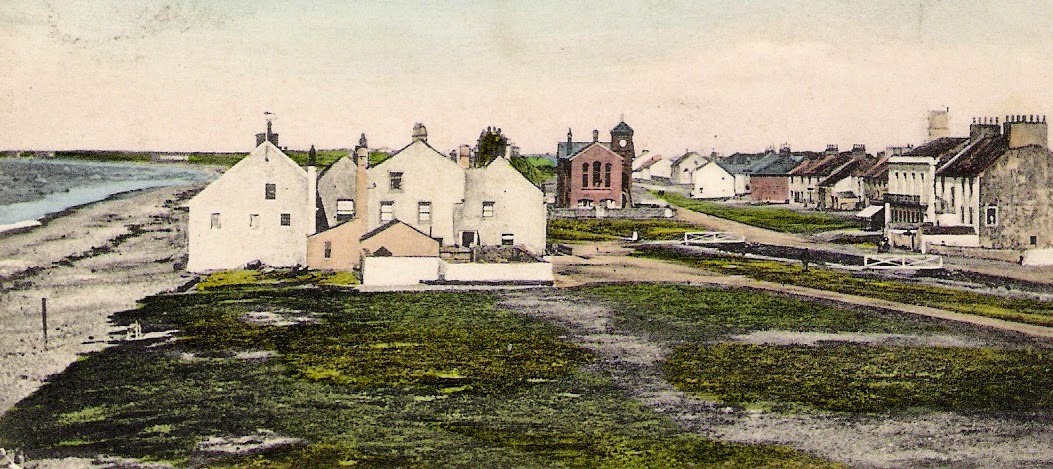
Allonby in the late 1800s (postcard image from ‘More Plain People’); Reading Room in the distance
“Of course there was a reading-room. Where? Where! why, over there. Where was over there? Why, there! Let Mr. Idle carry his eye to that bit of waste ground above high-water mark, where the rank grass and loose stones were most in a litter; and he would see a sort of long, ruinous brick loft, next door to a ruinous brick out-house, which loft had a ladder outside, to get up by. That was the reading-room, and if Mr. Idle didn’t like the idea of a weaver’s shuttle throbbing under a reading-room, that was his look out.” Thus ‘Francis Goodchild’ described Allonby’s reading room to his companion ‘Thomas Idle’.
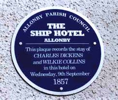
‘Goodchild’ and ‘Idle’ were Charles Dickens and Wilkie Collins, who had found accommodation at Allonby’s Ship Hotel. In September 1857, they were being guided up Carrock Fell, in the Caldbeck Fells to the north-east of Allonby, when Collins hurt his ankle: he “was within one step of the opposite bank, when his foot slipped on a wet stone, his weak ankle gave a twist outwards, a hot, rending, tearing pain ran through it at the same moment, and down [he] fell.”
We know the story and its sequel because they wrote about themselves, as Goodchild and Idle, and their adventures, in The Lazy Tour of the Two Idle Apprentices.
Allonby, postcard, from Peter Ostle’s blog (for details, see below); note foreshore coming right up to the houses
Collins was taken, via Wigton, to an unnamed village, where he was treated by a doctor. After a day or two of rest, and boredom, ‘Goodchild’ then “converted Thomas Idle to a scheme he formed, of conveying the said Thomas to the sea-coast, and putting his injured leg under a stream of salt-water. … he immediately referred to the county-map, and ardently discovered that the most delicious piece of sea-coast … was Allonby on the coast of Cumberland. … and at Allonby itself there was every idle luxury (no doubt) that a watering-place could offer to the heart of idle man.”
They set out with great expectations.
 At Allonby, Collins hauled himself up “a clean little bulk-headed staircase, into a clean little bulk-headed room”, at the Ship Hotel, and lay in enforced idleness for three days while the inflammation in his ankle decreased. Dickens, meanwhile, was required to explore and describe the village to his sessile companion: perhaps he wasn’t a shore-walker, for he doesn’t mention the shore.
He was very rude about Allonby.
“It was… what you might call a primitive place. Large? No, it was not large. Who ever expected it would be large? Shape? What a question to ask! No shape. What sort of a street? Why, no street. Shops? Yes, of course (quite indignant). How many? Who ever went into a place to count the shops? Ever so many. Six? Perhaps.”
“And was there a reading-room?” Idle/Collins asks …
It’s mentioned in a verse of the poem, Allonby, 60 years ago, recited by Allonby’s ‘cobbler poet’ J.J.Heskett, in 1901 (so relating to the 1840s):
Where now we have the Reading Room/ Th’ old weaving factory stood,/There busy men, with fourteen looms,/for many mouths earn’d food.
A reading room had indeed been established above the weaving shed, but this was soon to change. Thomas Richardson, a Quaker, banker, and local philanthropist, commissioned the construction of a new building, with considerable financial backing from his cousin Joseph Pease, who was the country’s first Quaker MP.
Pease appointed an architect, and a local builder and joiner, and the tall and substantial red sandstone building, held in trust for the public by five Trustees, was opened on July 28th 1862 – nearly 5 years after the Idle Apprentices’ visit. The building is described in the delightful book, full of precious memories, ‘More Plain People, and places on the Cumbrian Solway Plain’ *:
“The building was raised on vaults, to protect it from high tides, and, originally, these were open, providing an Italian style piazza in which visitors could shelter during inclement weather. Above this was a 16 foot reading room and at the end of this, separated by folding doors, was the library.”
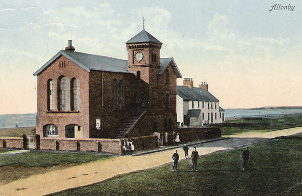
A postcard, reproduced in ‘More Plain People’ (for details of the book, see below)
Later, the colonnade was enclosed to provide a games room. According to Darren King, the builder involved with the 21st-century renovation and conversion, and quoted in the Times & Star in 2012, “Right up until the 1940s, silent movies were shown on the ground floor of the Reading Rooms. There was a billiard room, and reading room on the top floor with newspapers and books for local people to read.”
Gradually, though, usage declined. The Trustees sold the building in the 1970s, and for the next 30 years or more, the Reading Room decayed, its disintegration accelerating when the roof collapsed during a storm. It began to resemble Dickens’ “ruinous brick loft”.
Every time I walked or drove through Allonby I was saddened by its decrepitude, its boarded windows and surrounding drifts of wind-blown rubbish.
Then, in 2005, it acquired new owners and eventually, by January 2014, the Times & Star was able to report, in a feature illustrating the interior, that Allonby’s Reading Room had been converted from “a seaside eyesore into a stunning, desirable home”, through a “labour of love” by the owners (and, presumably also, by Darren King).
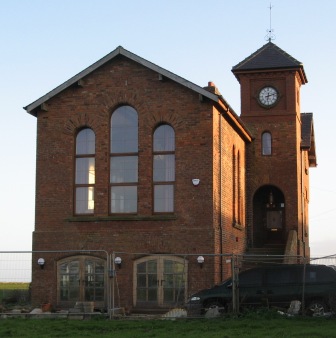
The Reading Room a couple of years ago, nearing completion of its conversion
As for the original architect, appointed by Joseph Pease, he was a Quaker from Manchester –Alfred Waterhouse, who went on to design the rather more magnificent Natural History Museum in South Kensington, London.
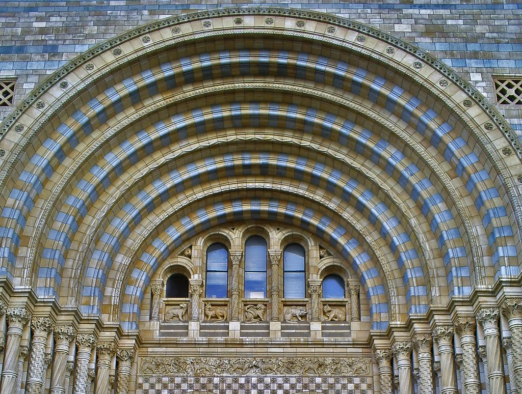
Natural History Museum, Cromwell Road entrance
More Plain People, and places on the Cumbrian Solway Plain, 2007; published by the Holme St Cuthbert History Group. ISBN 978-0-95488-232-7
Peter Ostle’s blog is Solway Past and Present


