Ship’s-keel scaur: but whose keel?

The ship's keel at low water Spring tide, May 2015
The ship’s keel at low water Spring tide, May 2015; the piled chain is top right (photo: Ann Lingard)

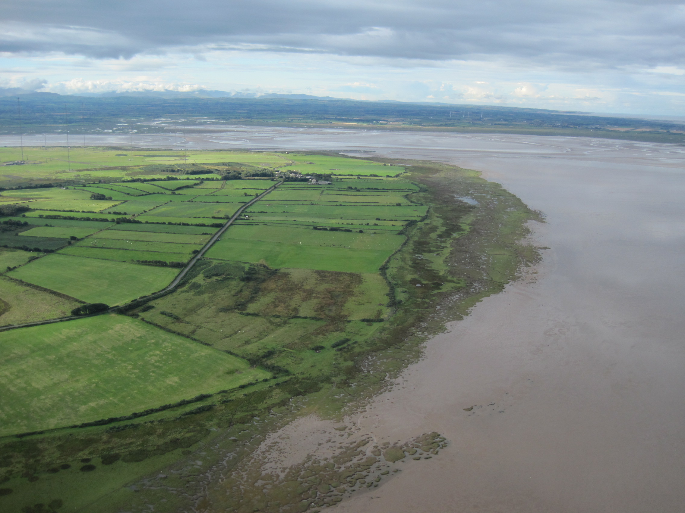
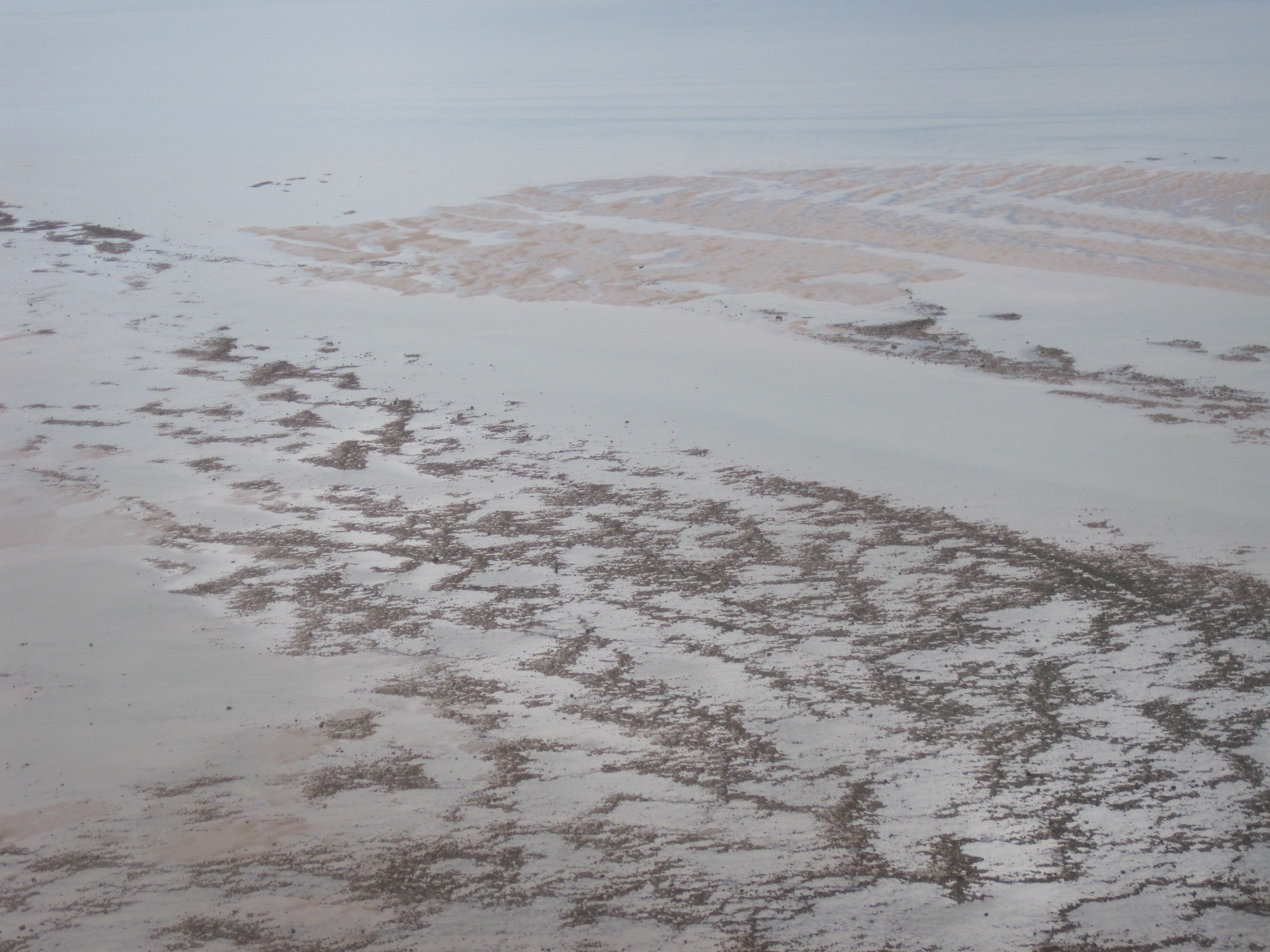
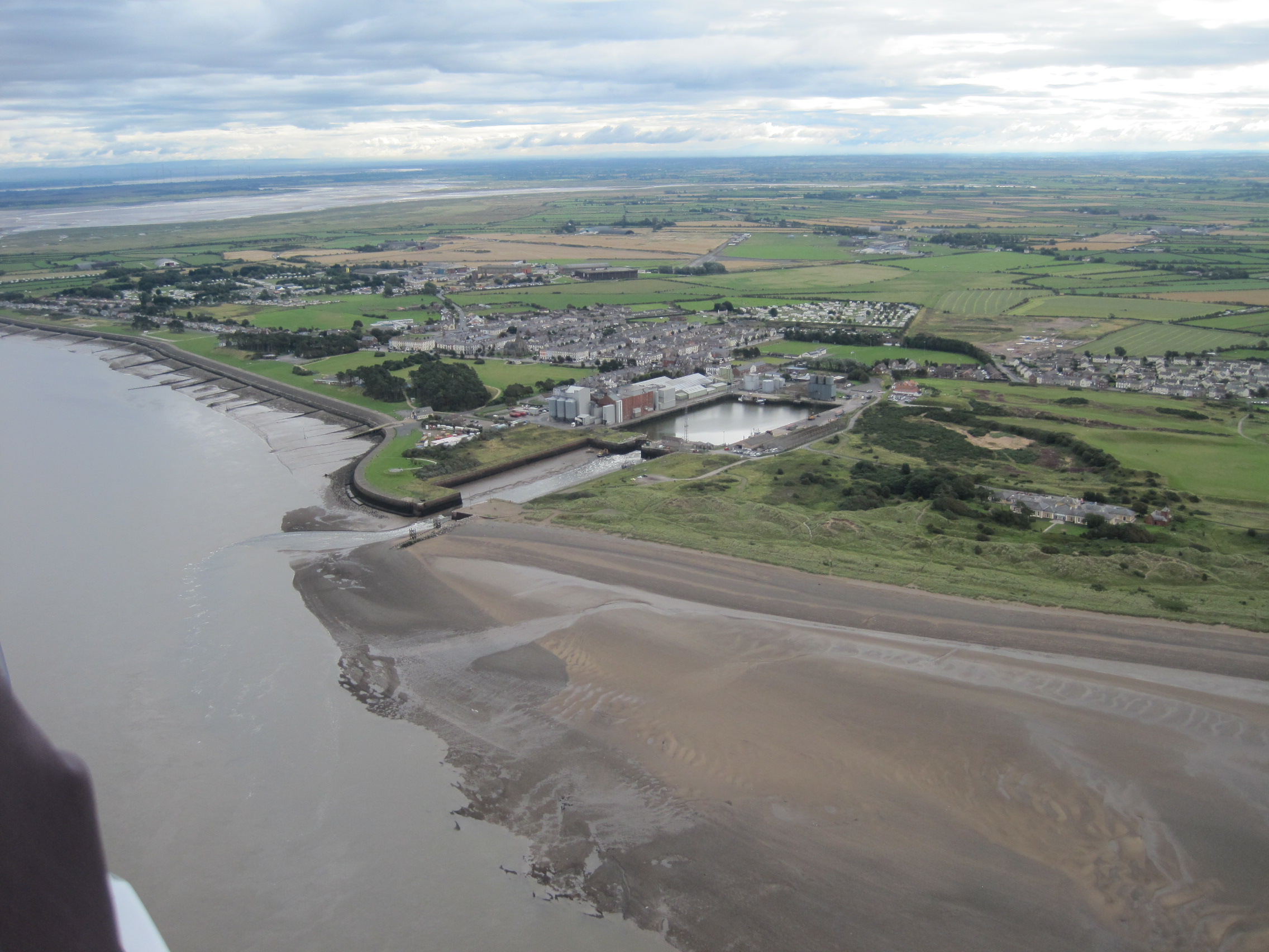
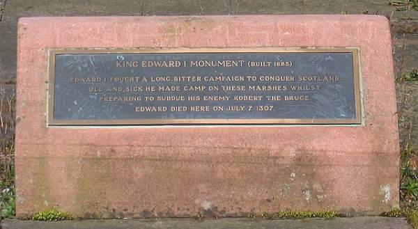
On a warm, calm evening in May, at a low Spring tide, Ronnie Porter led me along the shore at Allonby. As we walked, he showed me the various rocky scaurs and boulders, and he told me their names.

Ronnie Porter and the ship's keel (photo: Ann Lingard)
Ronnie Porter and the ship’s keel (photo: Ann Lingard)

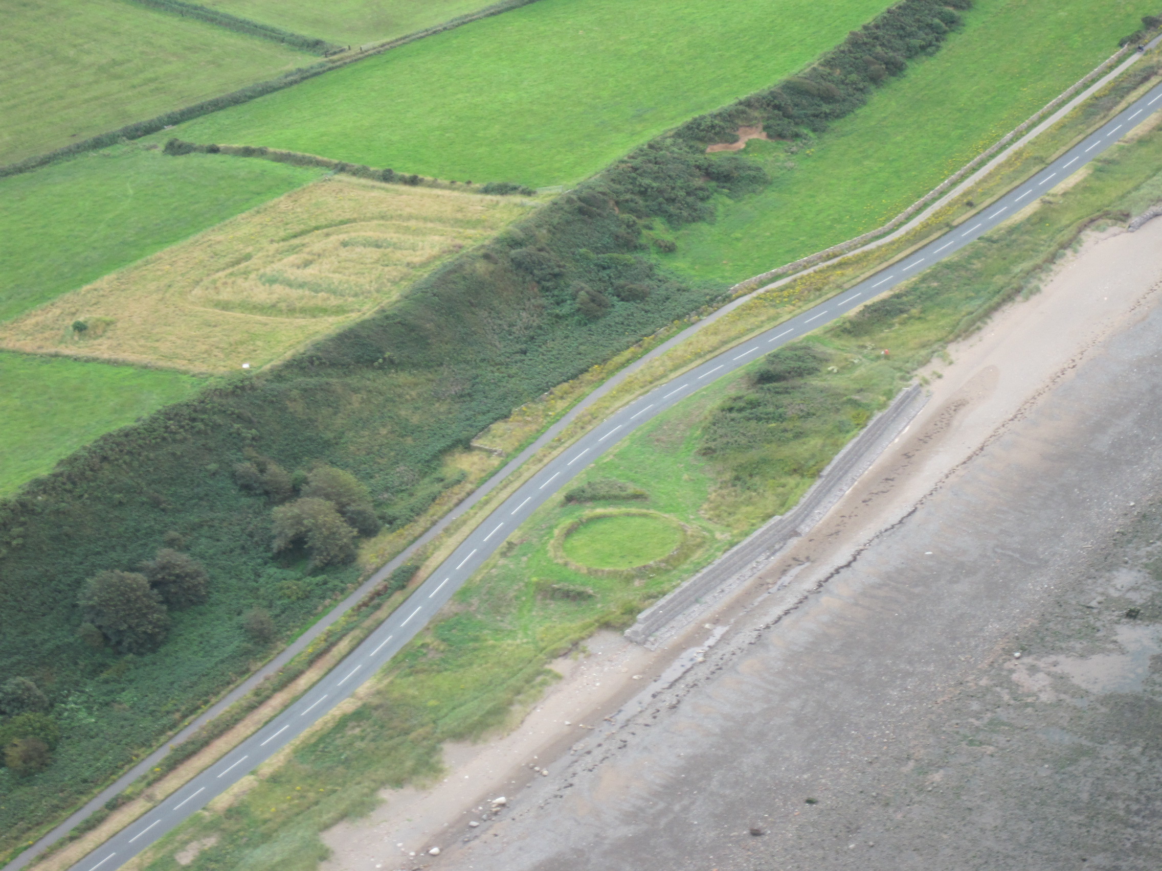
Near Dubmill Point, we made a small diversion towards the mid-shore, and he showed me something for which I’d searched unsuccessfully on several occasions: the wooden keel of an ancient vessel – on Ship’s-Keel Scaur.

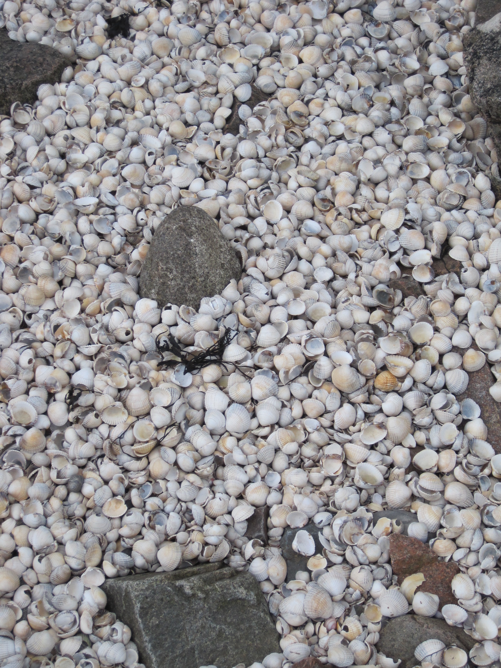
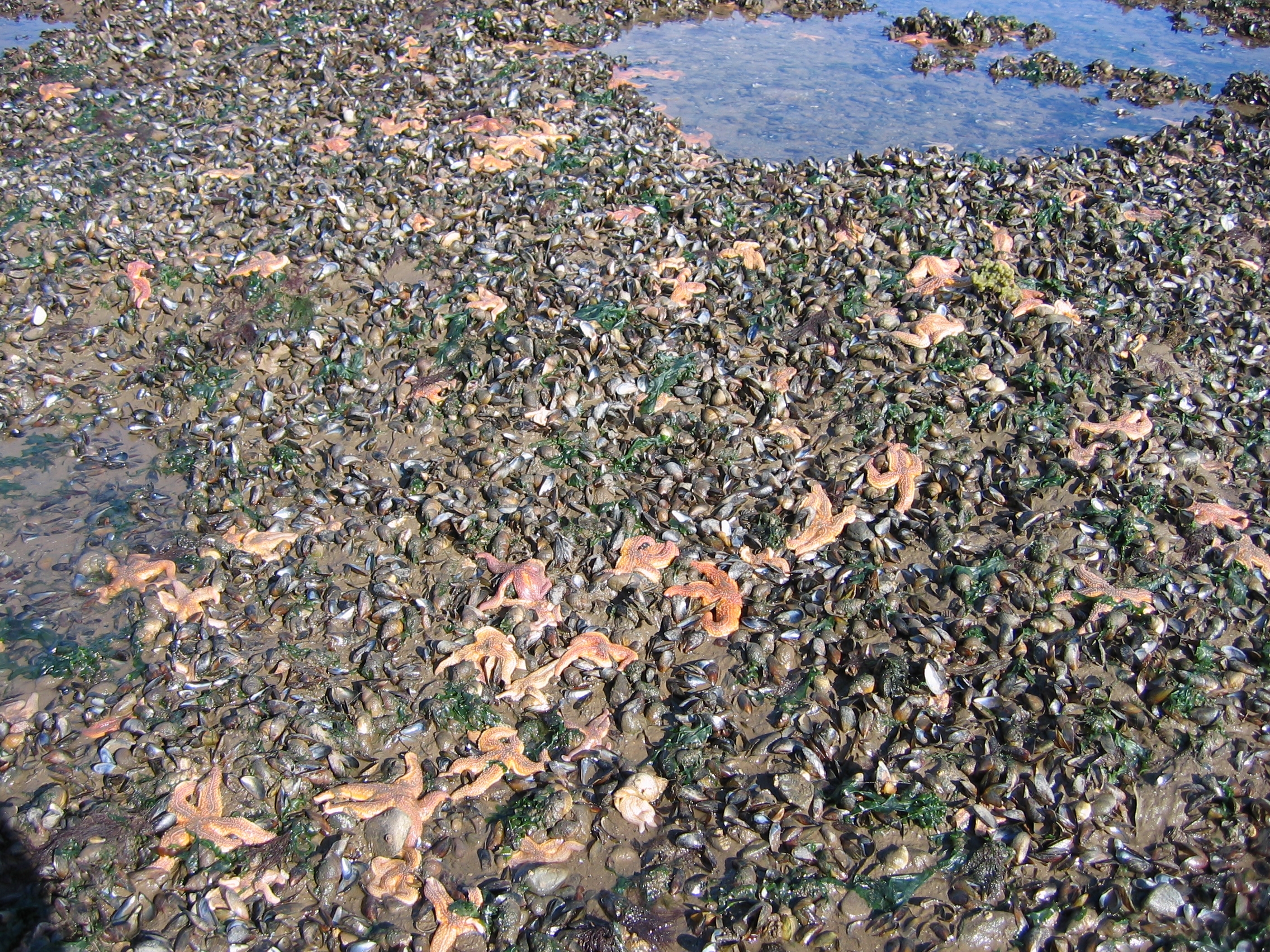
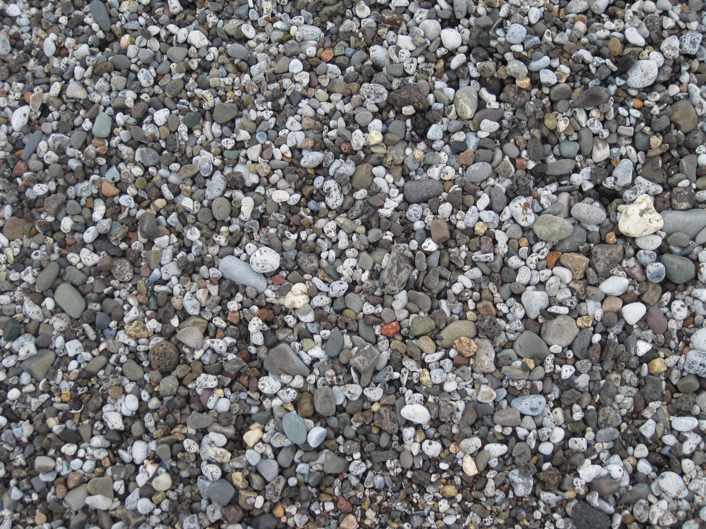
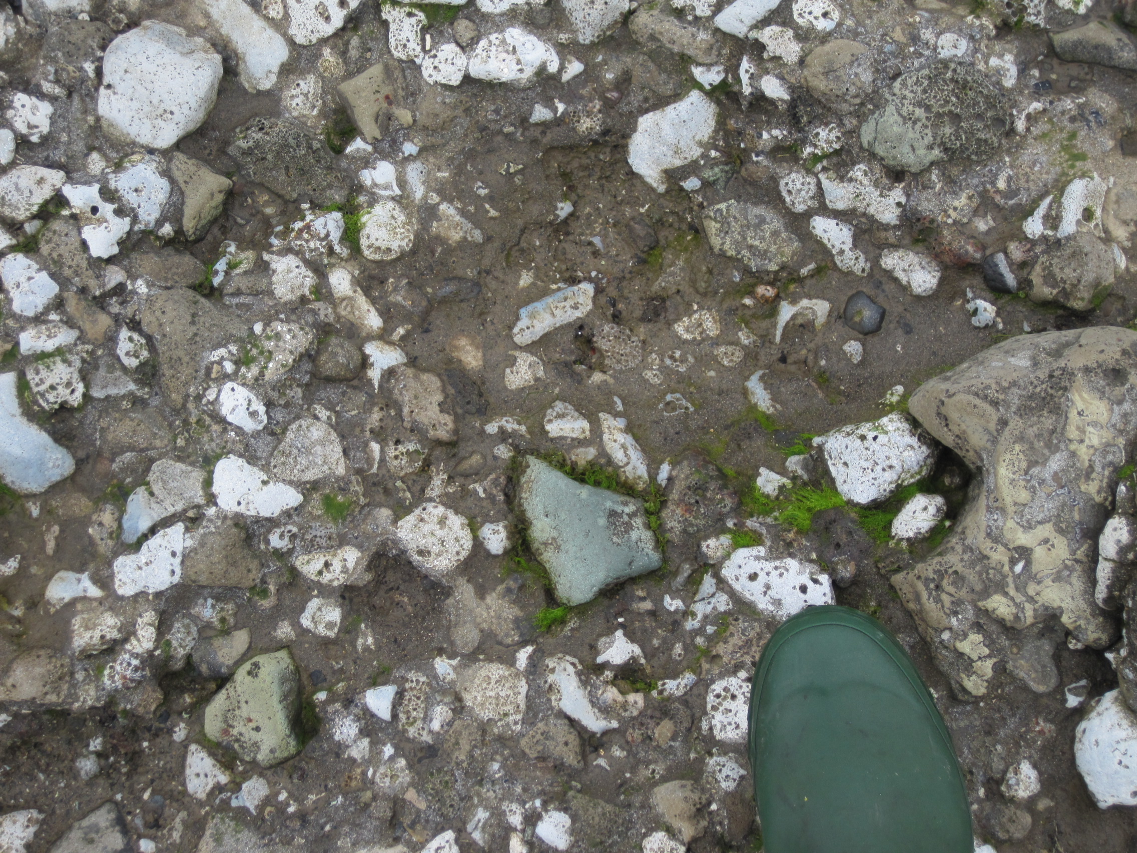
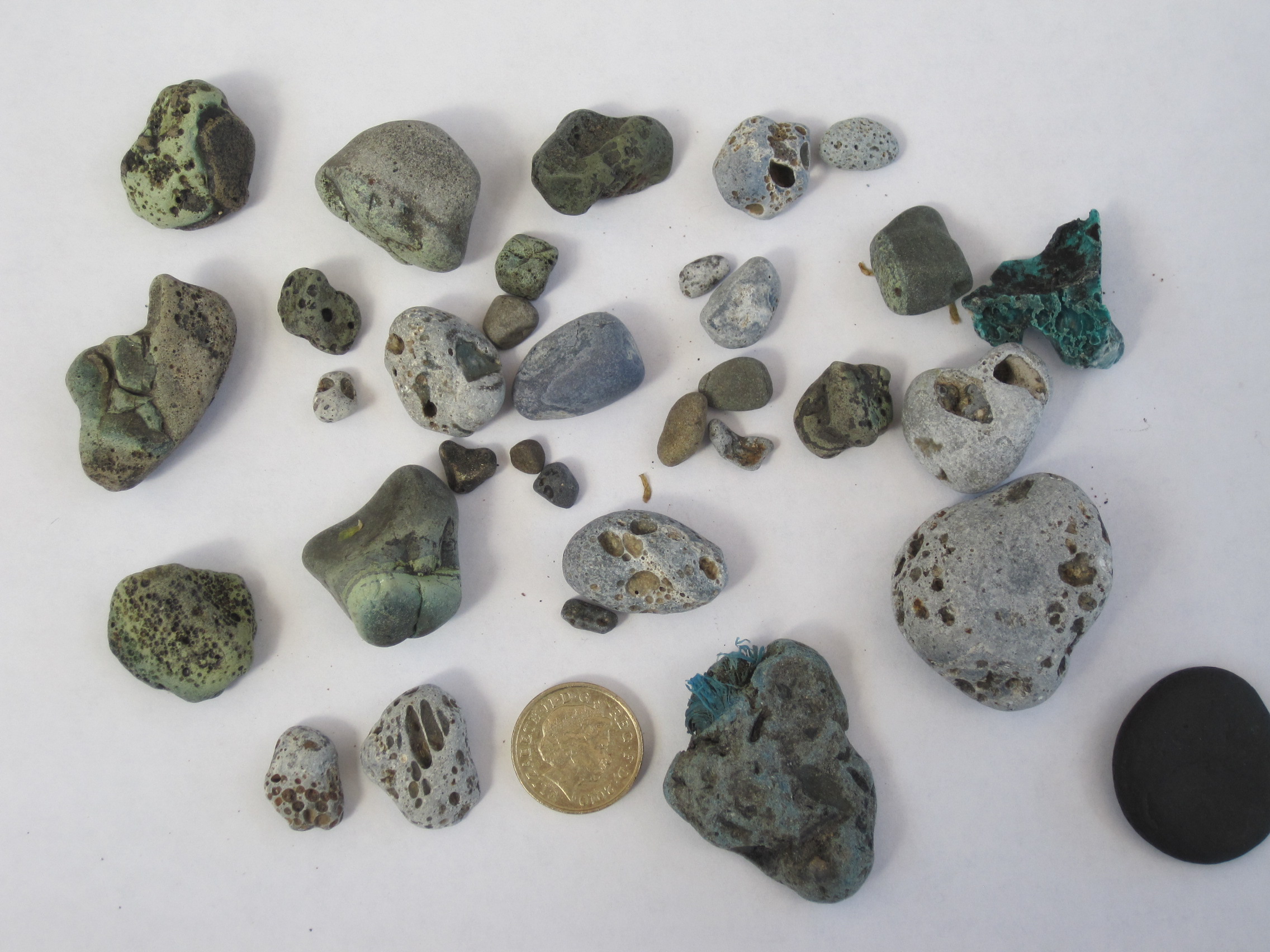
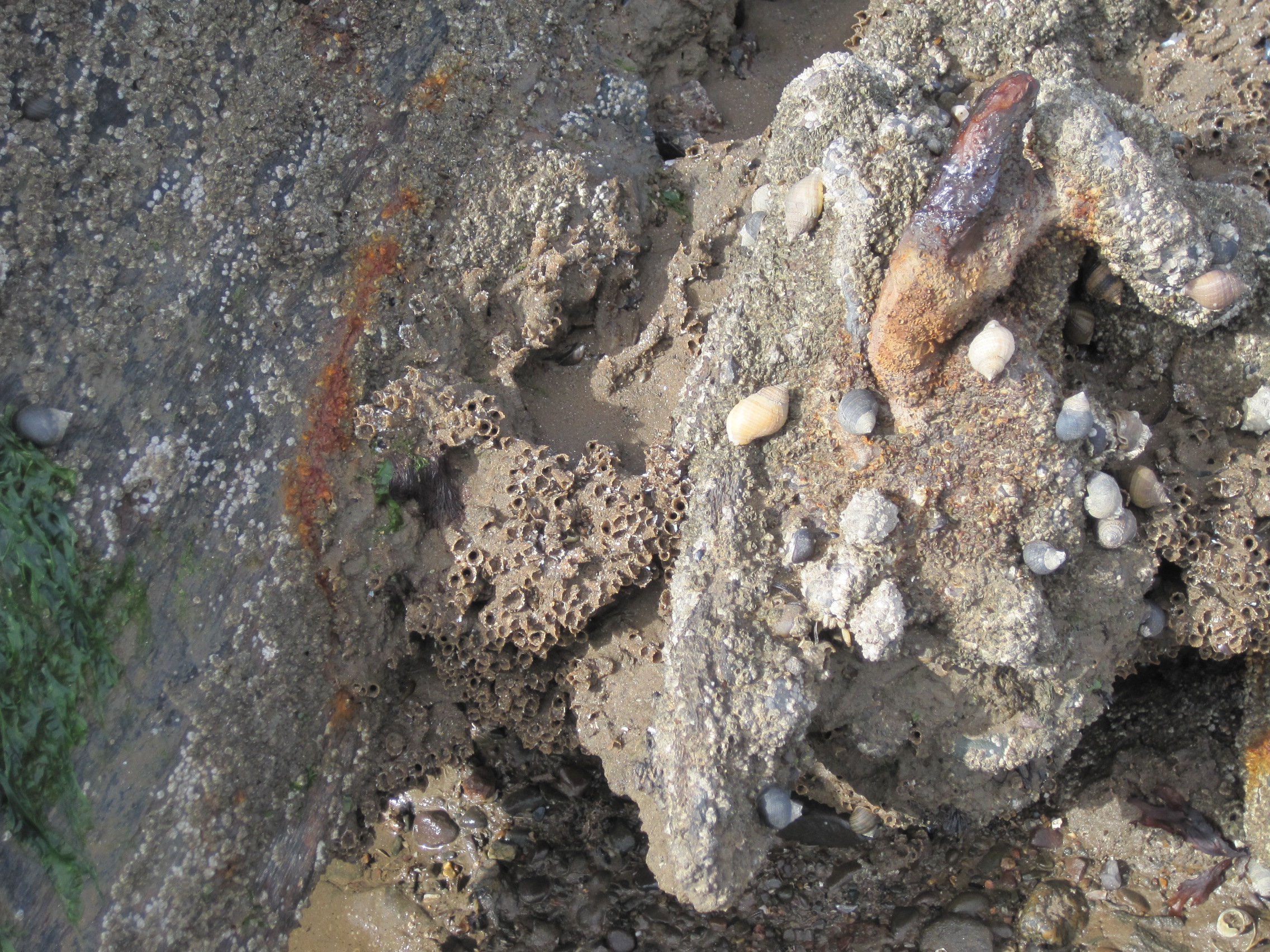
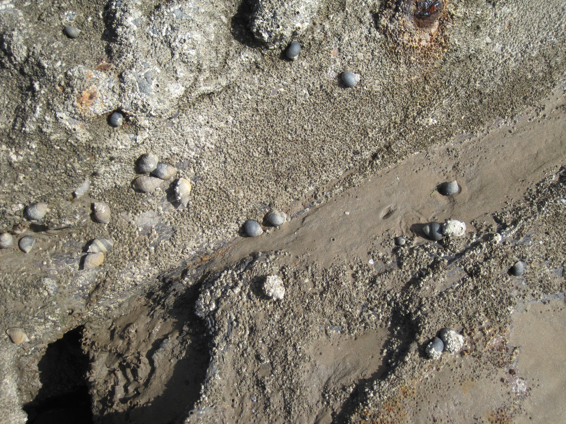
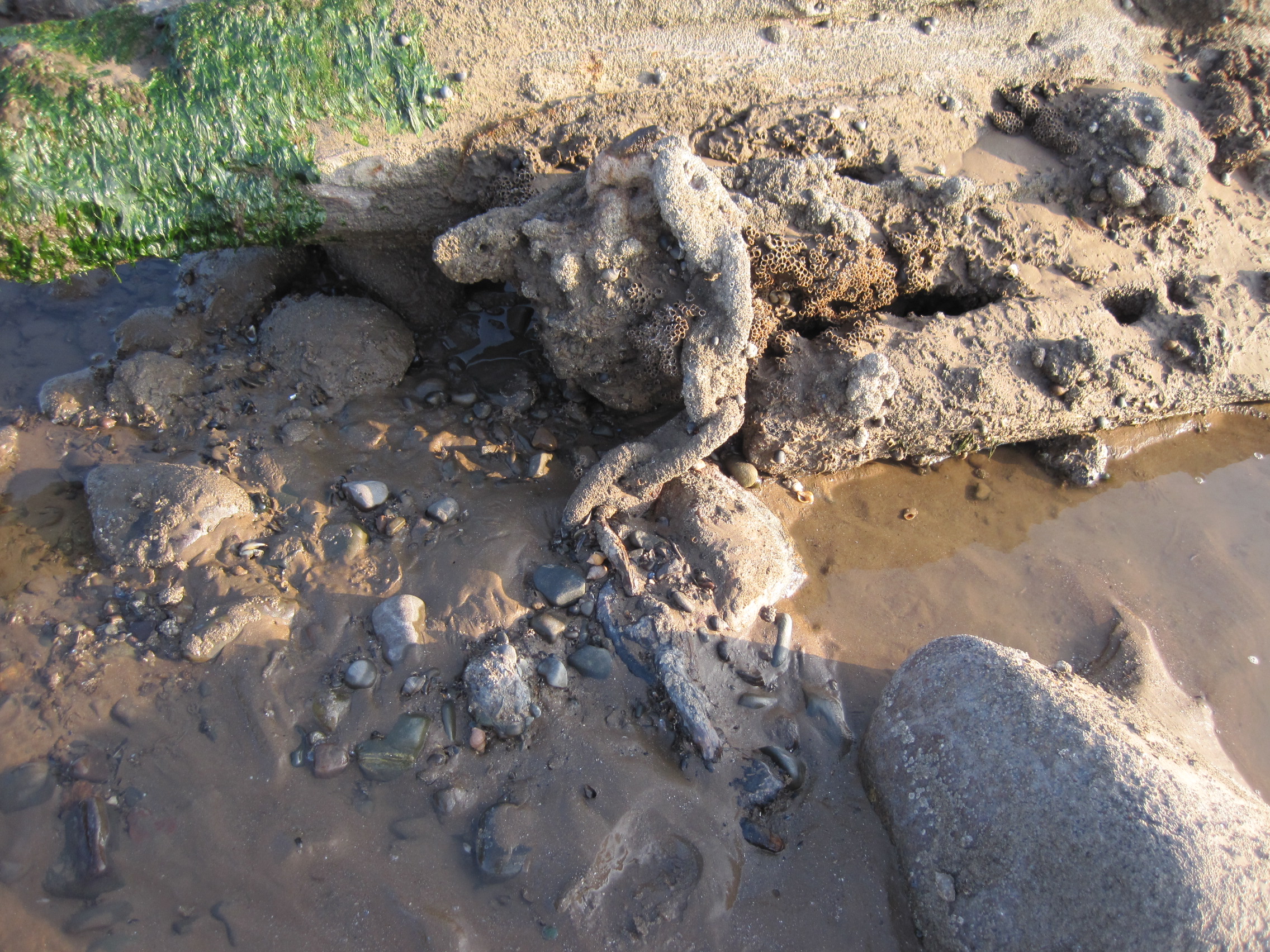
Now, its timbers as hard as iron, the keel (if that is what it is – its profile has been much transformed, holed and distorted and overgrown) is home to a variety of marine species, a microcosm of the animals and algae on the shore. Sandy tubes of the honeycomb worm, Sabellaria; mats of barnacles; a few limpets; grazing winkles; predatory dog-whelks, which have laid mats of their orange vase-shaped eggs under overhanging timber; beadlet anemones, Actinia; green Ulva algae. Footprints show that wading birds have been sheltering in its shadow.

Barnacles, winkles and dog-whelks coat the timber: rust bleeds through (photo: Ann Lingard)

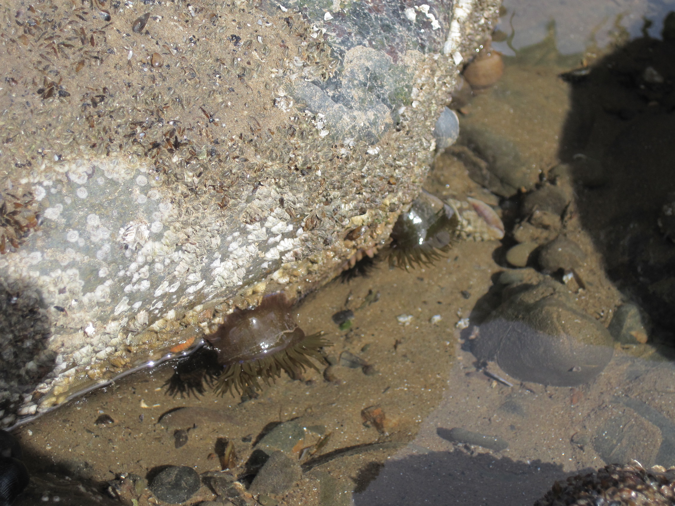
Although 6 or 7 metres long, the keel blends into its surroundings on the scaur, providing yet another stable surface against the shifting sands; its encrusted chain bleeds oxidised iron.

The chain (photo: Ann Lingard)

It is scarred by deep rectangular excisions, which I now realise have been caused by present-day hacksaws. Someone I know who has been responsible for one of these wounds told me that he and his friend had been extracting copper nails. He showed me the wedge-shaped nail, several inches long and tapering at one end. He says he will take it to Tullie House Museum in Carlisle to see if they can date it.

The marks of hack-saws (photo: Ann Lingard)

The nail, the keel, are old, that much is obvious – but how old? Which vessel did it support, and how did it come to be cast up in Allonby Bay?

The Hougoumont
The Hougoumont

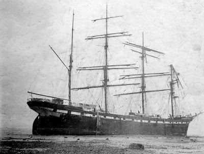
Allonby’s most famous shipwreck was of the barque Hougoumont. Bound for Liverpool, she was driven North to Maryport in a storm in March 1903; she dragged her anchor and ran ashore at Allonby and her cargo, boxes of tins of pears, peaches and salmon, was much appreciated by local people. Her story is well told and illustrated in Peter Ostle’s blog about Allonby’s history. But she is not the source of the ancient keel, because her battered hull was eventually towed to Maryport to be repaired.

The cargo of the Hougoumont piled up on the Allonby shore
The cargo of the Hougoumont piled up on the Allonby shore (photo from Peter Ostle’s blog)

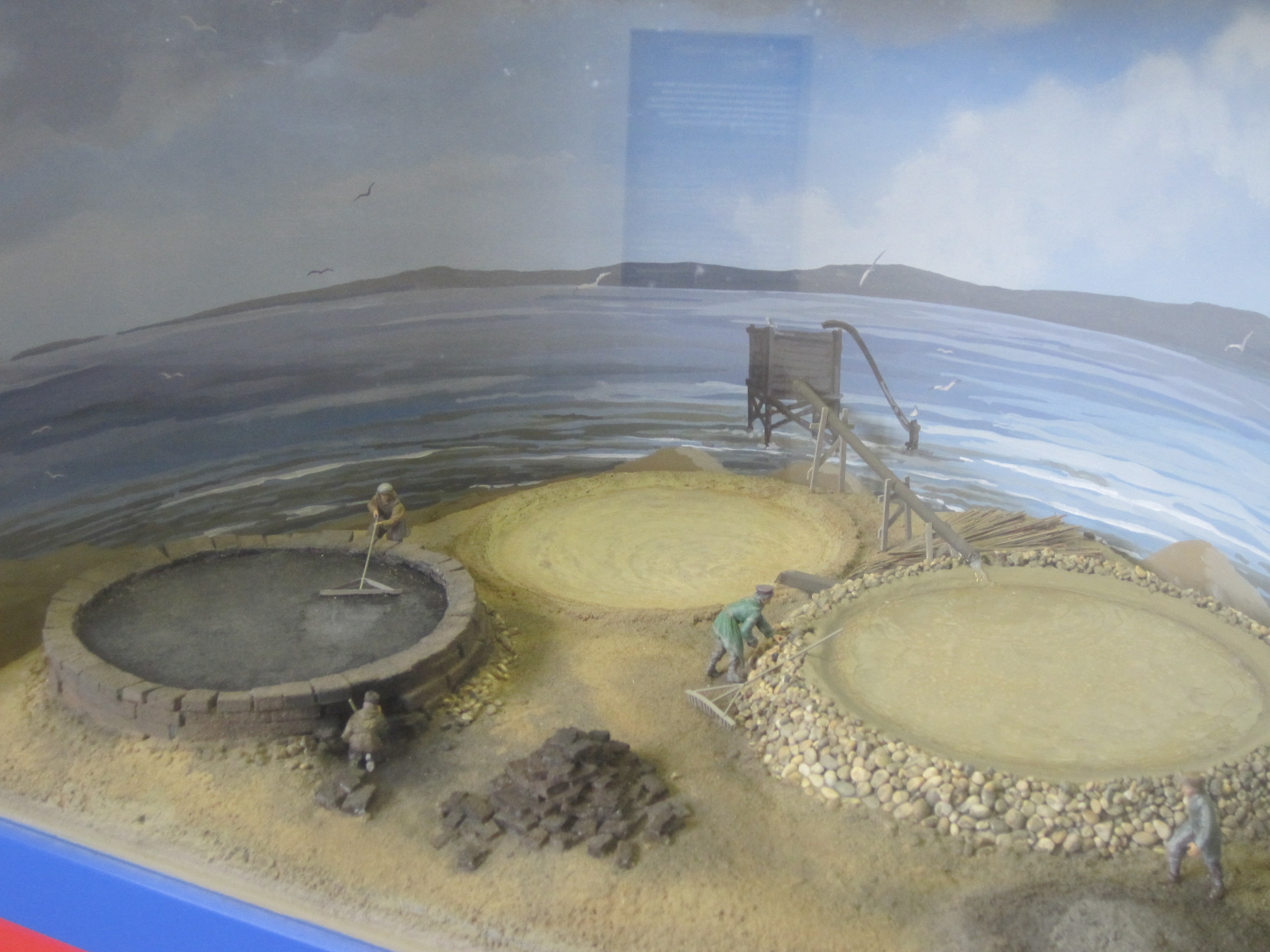
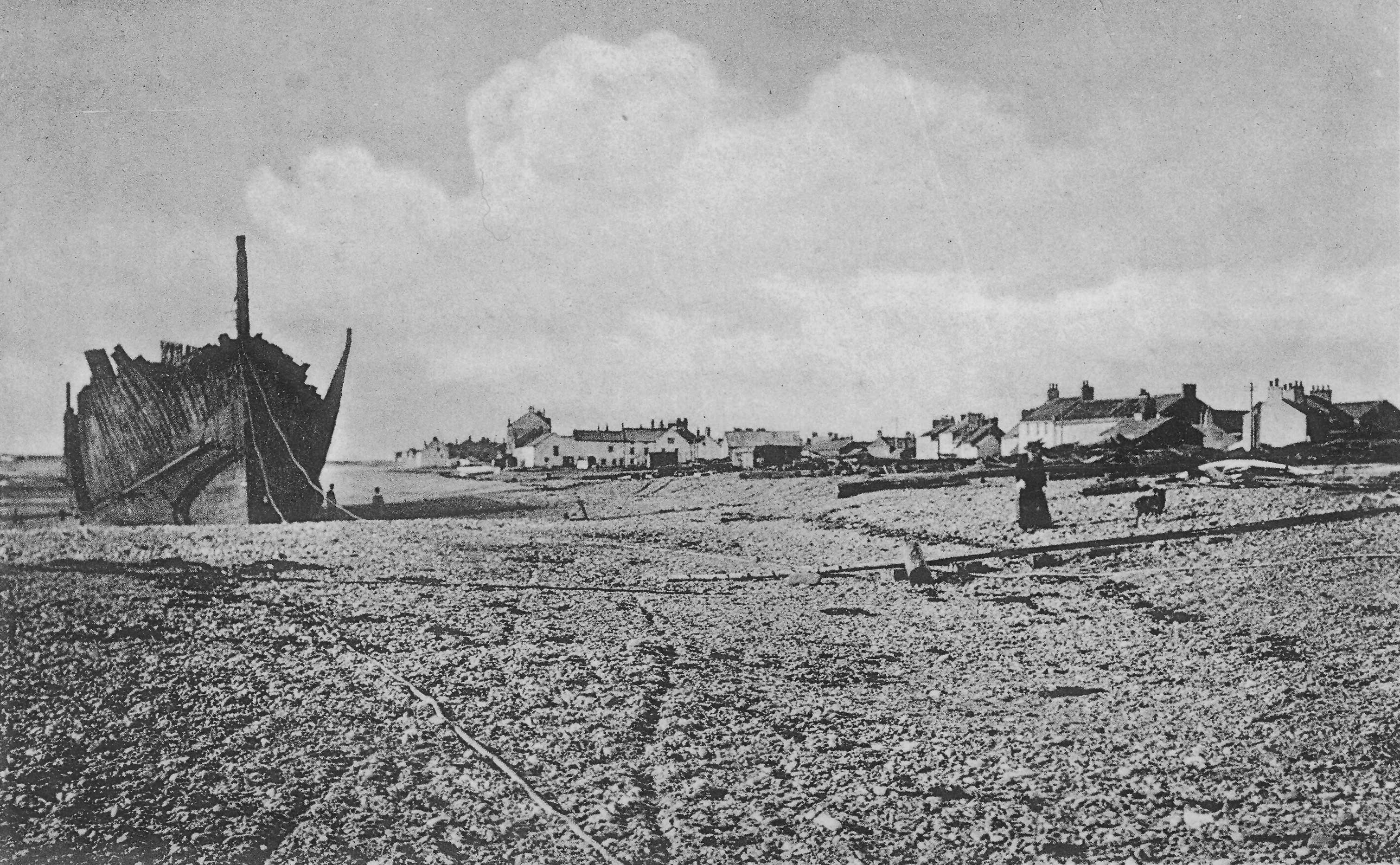
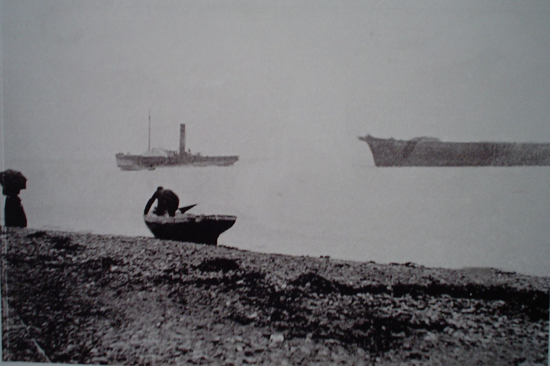
In the early 1900s Allonby was also, surprisingly, a site for ship-breaking, a business that was operated at the southern end of the bay by the Twentyman family. Ships were towed to the beach by tug then broken up over a period of many months, but their timbers and metals were salvaged and reclaimed. What happened to the reclaimed materal – was it taken to the various ship-building firms at Maryport for re-use?

Ship-breaking at Allonby(photo from the image gallery at www.allonbycumbria.co.uk)
Ship-breaking at Allonby (photo from the image gallery at http://www.allonbycumbria.co.uk)

Wanting to find out more about the ship’s-keel, I put a small notice in the Solway Buzz asking for information, and several weeks later John Whitwell, a volunteer at the Maryport Maritime Museum, phoned me, wondering if he might have found an answer.
John had been hunting through the archives for me, and he has given me copies of extraordinary photographs of ships being towed and in the process of being broken.

John Whitwell in the library of the Maryport Maritime Museum
Tug towing ship for breakage (photo courtesy of John Whitwell and Maryport Maritime Museum)

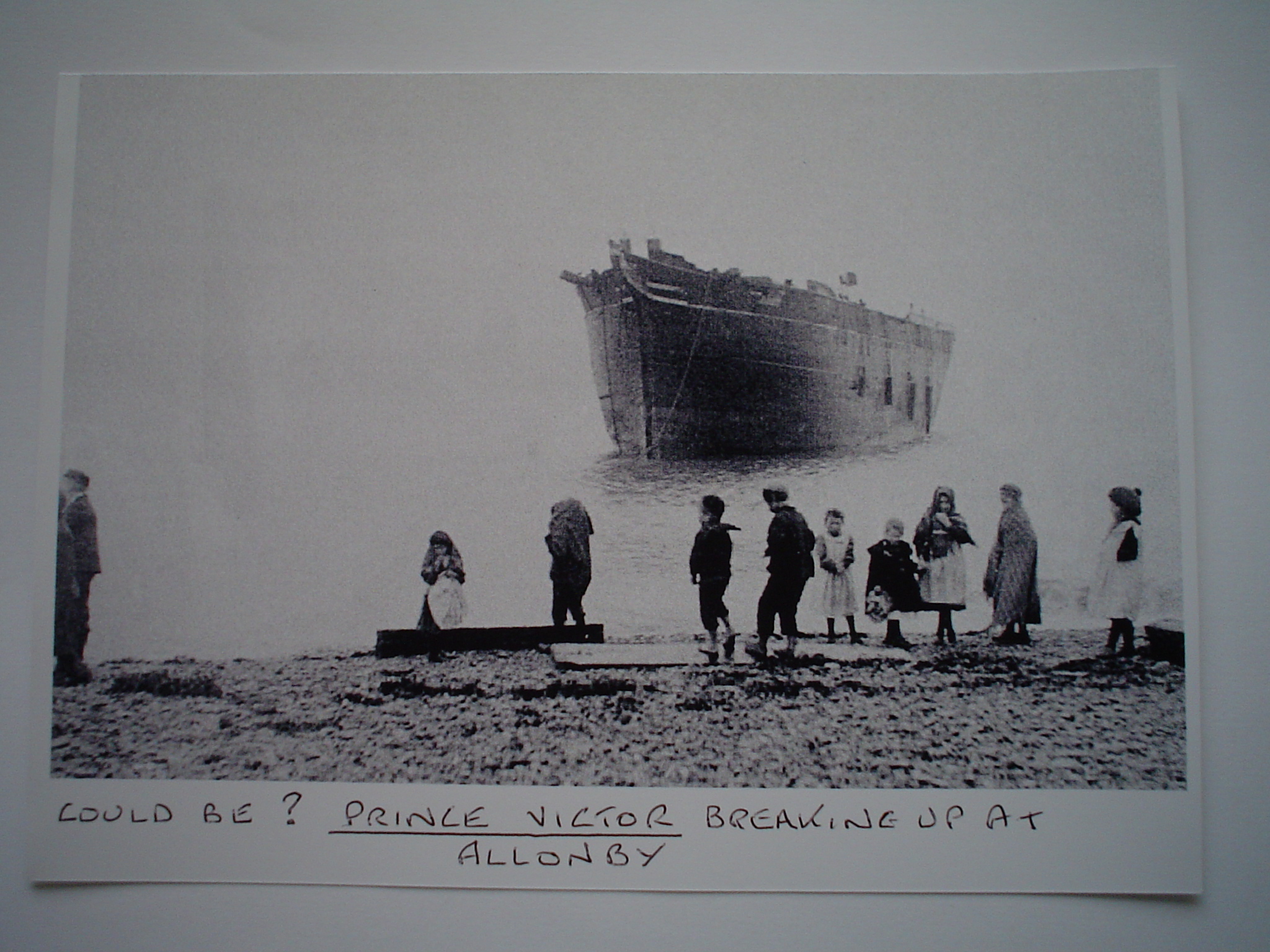
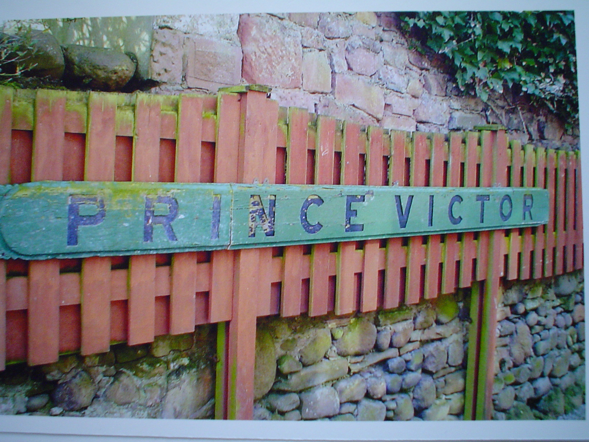
John wonders if one of these was the Prince Victor – a board with the ship’s name still hangs outside a house in Allonby.

The Prince Victor (?) at Allonby for breakage (photo courtesy of John Whitwell and Maryport Maritime Museum)
A sign at Allonby
A sign at Allonby

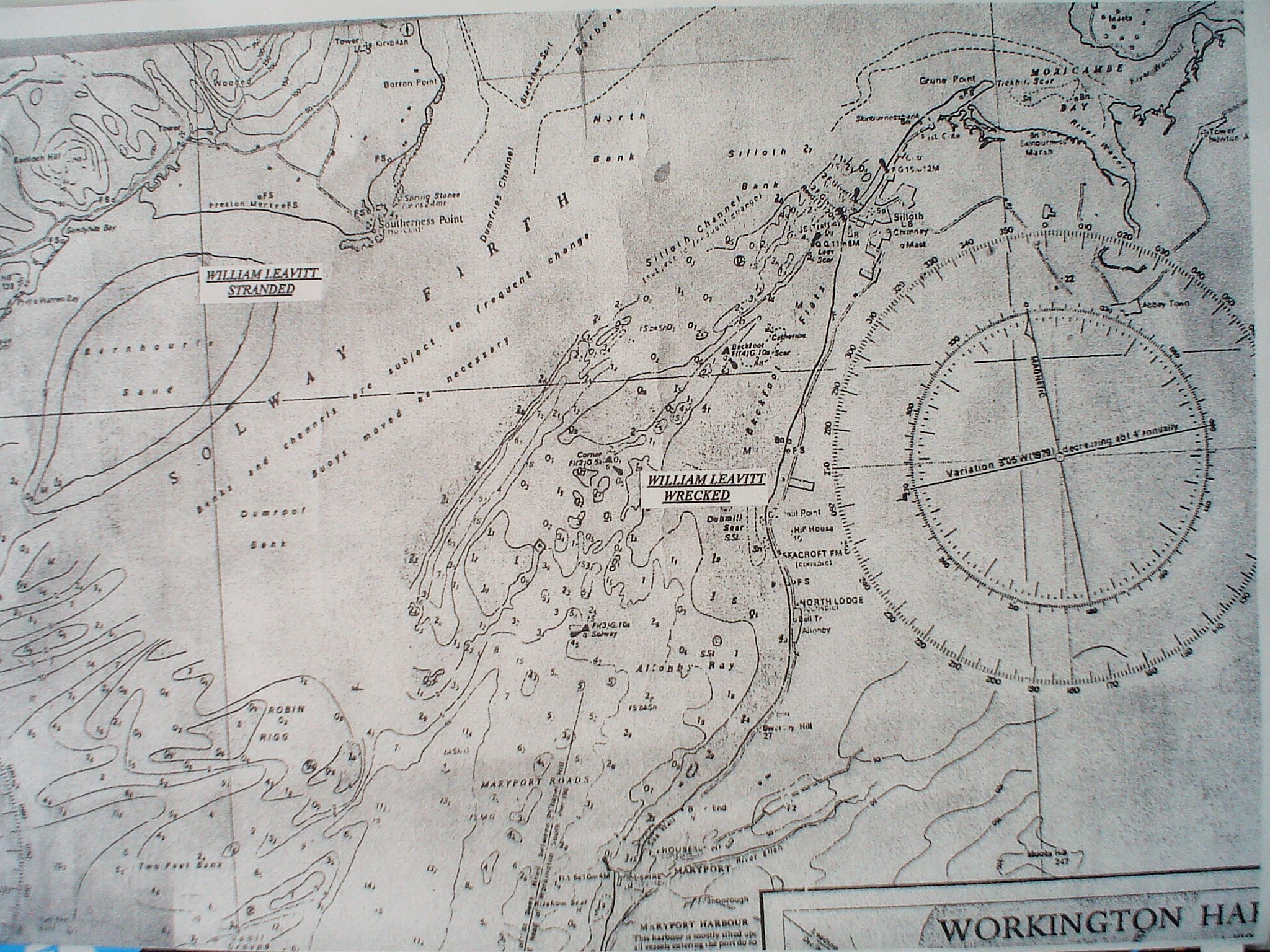
As for the ship’s keel, John has given me copies of a notice and a chart that suggest the intriguing possibility that the keel might be from the 1180-ton barque William Leavitt, which was wrecked just off Dubmill Point on April 20th 1889.

Thanks to John Whitwell and the Maryport Maritime Museum for this notice from the Maryport Gazeteer

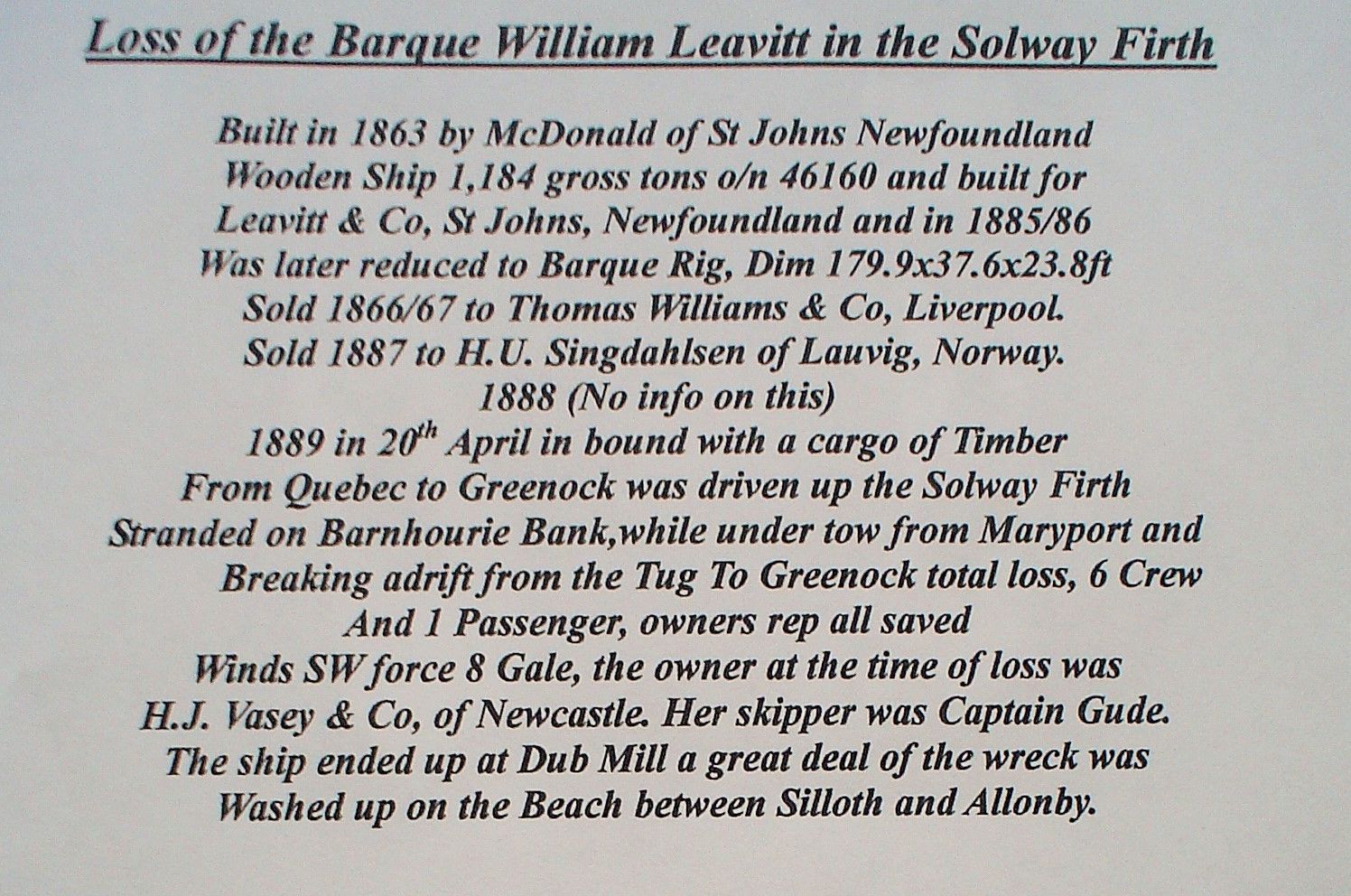
This notice, from the Maryport Advertiser on Friday November 30th 1889, shows the barque’s varied history: she was built in St Johns, Newfoundland, in 1863 for Leavitt and Co. and was sold three years later to the well-known shipowner Thomas Williams of Liverpool.

On his website, R. Cadwallader gives the interesting information that “Thomas Williams was Master then Marine Superintendant with the Famous “Black Ball Line” of Liverpool. When James Baines got into financial troubles in the 1860s, Capt Williams bought some of the old wooden ships from him. This was the start of his shipping business.”

The rest of the notice reads that in April 1889 she was

“In bound with a cargo of Timber
From Quebec to Greenock was driven up the Solway Firth
Stranded at Barnhousie Bank, while under tow from Maryport and
Breaking adrift from the tug to Greenock total loss, 6 Crew
And 1 passenger, owners rep all saved.
Winds SW force 8 Gale, the owner at the time of loss was
H J Vasey of Newcastle. Her skipper was Captain Gude.
The ship ended up at Dub Mill and a great deal of the wreck was
Washed up on the Beach between Silloth and Allonby”

According to the Maryport Advertiser the barque was sold to a Norwegian company in 1887 (Cadwallader’s chart states 1888), and the implication is that she was then sold on to Vasey of Newcastle; the newspaper article, however, says that the crew didn’t understand English, and were Norwegian. But whoever was the owner, their short-lived ownership of the 36-year-old vessel didn’t bring them much prosperity.

Admiralty chart showing where the William Leavitt was stranded, and where her wreckage ended up (Grateful thanks to John Whitwell for supplying this image)

The picture below, which hangs in the Maritime Museum and was painted by well-known local artist William Mitchell in 1884, is of ‘the steam tug Florence leading the 598 ton Italian barque Gimello into Maryport, 18th October 1883’ and gives us an idea of the stormy conditions on the Firth during which the bigger barque, the William Leavitt, ran aground.

Steam tug Florence towing barque Gimello into Maryport in a storm, 1883

There is a much longer article about the William Leavitt’s plight in the Maryport Advertiser (see below) which brings out the drama of the situation (note that there are minor discrepancies between this account and the notice; and the newpaper cutting has been dated, by hand, November 30th, much later than April).

The article suggests that ‘the barque is likely to become a total wreck, [but] it is probable that most, if not all, of her cargo of 1180 tons of timber, will be got ashore.’ (The weight of the cargo is probably a mistake, since the vessel itself weighed 1180 tons)

But what of the ‘great deal of the wreck [that] was washed up on the beach between Silloth and Allonby’? Perhaps there are even now ‘family heirlooms’, of cutlery or brass, sitting on mantelpieces or tucked away in drawers, whose stories have been passed down from great-grandparents.

As for the keel on Ship’s-Keel Scaur, whatever its origin, it now supports new life of a different kind – and has given its name to a part of Allonby’s shore.

For an update on the changes to the keel, see the blogpost on the vanishing keel


Article from the Maryport Advertiser

EXCITING SCENES ON SUNDAY

On Friday afternoon the Norwegian barque, William Leavitt, of Laurvig, 1181 tones register, Captain Gude, bound from Quebec to Greenock with a cargo of timber, was driven into the Solway Firth through stress of weather and anchored in the roads off Maryport and Workington. The captain afterwards went ashore at Workington for the purpose of telegraphing to Greenock for a steam tug, and as a very strong wind was blowing and a high sea running he was unable to return to his vessel. When night came on the gale, which had been blowing all day, increased in violence, and the barque began to drag her anchors. About 11 o’clock the steamer Plantaganet, from Liverpool for Maryport with a general cargo, came off St Helens, and seeing the “flare up” light, the captain altered his course and bore down upon the craft. On getting near he noticed that the vessel was drifitng ashore, while the crew were running about with lighted torches, being apparently panic-stricken. The steamer sailed round the barque and came quite near her on the lee side, but the captain could get no intelligent response to his frequent inquiries. This circumstance is now explained by the fact that the barque’s crew were all foreigners and unable to speak English. The Plantaganet, however, stood by until the ship drifted past Maryport and came off the Salt Pans, situate about 2½ miles higher up the Solway. Although it was fearful night and the steamer had enough to do to live in the surf, the captain is of an opinion that if he had got a rope from the barque before she passed Maryport, he could have held on until assistance arrived. The first indication that a vessel was in need of assistance appears to have been observed at Maryport at about twenty minutes past eleven, At that time the pilot boat Ally Sloper, owned by Mr. W. Walker, junr., and manned by John Robinson (master), James McAvoy, John Messenger, and John Byers, was on the lookout for a steamer expected by that tide, and seeing the light the men got into the boat and went out. After getting outside the harbour the frail craft was in danger of being engulphed at any moment by the angry waves, but the men held on until they came within speaking distance of the barque in distress. Just then the pilot boat’s foresail and mizzen were carried away and the crew placed in greater jeopardy than those they were attempting to rescue. When in this plight they fell in with the Plantaganet and all having after with great difficulty got safely on board with the boat secured behind, Robinson, the pilot, took charge of the steamer, and made for the harbour. When running up against the wind the steamer passed both the steam-tug Senhouse and the lifeboat going after the barque. About this time the Norwegians abandoned the vessel, and she ran ashore at Dub Mill, while they continued to drift about in an open boat until they were picked up by the tug …. The men, 16 in number, were landed at Maryport and taken to the Coffee Tavern at about three o’clock on Saturday morning. They were all much exhausted and two were suffering from slight injuries received while getting into the boat to leave the ship. The lifeboat did not arrive in time to render any assistance, but she remained close to the wreck for some time after the tug returned to make sure that none had been left either on board or near the barque. … The coxwain states that the lifeboat behaved remarkably well in the surf at Dub Mill. The barque is most likely to become a total wreck, but it is probable that most, if not all, of her cargo of 1,800 tons of timber, will be got ashore. On Saturday forenoon the master attended at the Custom House to make his deposition. The shipwrecked crew were taken charge of by Mr. J.B.Mason, Vice-Consul for Sweden and Norway.
On Monday evening the crew boarded the vessel and brought their clothes ashore, but as yet no attempt has been made to float the ship.
A good deal of the wreck was washed upon the beach between Silloth and Allonby.

Posted in Allonby, coastal heritage, industrial heritage, ports, ships | Tagged , , , , , , , | Comments Off on Ship’s-keel scaur: but whose keel?

Snippets 5: Angels, salt and shroud-pins

Pat Bull showing me the 'finds'. Photo copyright Fiona Smith Photography, & Solway Wetlands Partnership

Pat Bull showing me the ‘finds’. Photo copyright Fiona Smith Photography, & Solway Wetlands Partnership

Pat Bull unlocked a peeling black door and showed me into a small brick-walled room. On the plain wooden table which almost filled the space were small polythene bags and boxes, labelled in black feltpen with numbers and letters.

Some of the 'finds' from the Holme Cultram dig, Autumn 2015

Some of the ‘finds’ from the Holme Cultram dig, Autumn 2015

At one side were several patterned terracotta tiles, thick and tapering towards the base. What was the dull-grey metallic dome, from which projected a metal stub – half of an Amazon’s breast-plate? She must have been as strong as legend suggests, because the extremely heavy base was made of lead; Pat thought it might have been the base for a candle-holder or something similar. She slipped a tiny metal disc out of its polythene envelope and showed me the simple depiction of a ship on one side and the letters ‘S E L’ on the other. ‘We’ve found several of these,’ she said, ‘and one thought is that they’re salt tokens’.

Pat is a former President of the West Cumbria Archaeology Society, and WCAS and Grampus Heritage have been engaged on ‘digs’ at Holme Cultram Abbey at Abbeytown on the Solway Plain for three seasons. The Abbey, set up in 1150 by Cistercian monks, has had a complicated history and is now a mere fraction of its former size – you can read elsewhere about its past, and the arson attack in 2006 that nearly destroyed it.

A new section of the dig

A new section of the dig

The current archaeological digs to discover earlier parts of the building are funded by HLF with the involvement of the Solway Wetlands Landscape Partnership and have so far uncovered the remains of cloisters and the wall of a refectory. As I watched the diggers carefully scraping away soil with trowels and placing pieces of bone and pottery in black plastic seed-trays for examination, Pat told me how they had found several graves that had been broken into, their covering stones destroyed.

High tech archaeological equipment

High tech archaeological equipment

But they had seen the edge of one intact stone, and on excavation had found an engraved rectangular grave-slab.

Inscribed grave-slabs, September 2015

Inscribed grave-slabs, September 2015

Nearby another had also been found – just these two remained untouched. Looking at the still-sharp letters of the inscription I could easily imagine the thrill of finding these handsome objects. When the dig finishes in early October, the excavations will be covered and filled in, but for now, briefly, I was able to see stones that had been carved six hundred years ago, and later had been hidden when the cloisters were knocked down.

Saltpans model in the new exhibition space at Holme Cultram Abbey

Saltpans model in the new exhibition space at Holme Cultram Abbey


The remains of Crosscannonby saltpans (and Milefortlet21) South of Allonby

The remains of Crosscannonby saltpans (and Roman Milefortlet 21) Photo: Ann Lingard


The monks had a major influence on the appearance and productivity of the Solway Plain; woodland was felled, land was drained, sheep were reared; iron-smelting works have been discovered, and large salt-pans were constructed to evaporate sea-water for salt.(The Crosscannonby saltpans on Allonby Bay, pictured, date from about 1630, and were not built by the monks.)

Another object on the table was a fine pin with a rounded head, for fixing a shroud. Pat opened packet after packet, showing me metallic fragments – a piece of leading from around stained glass, a book clasp, a tiny spur, something that looked like a mustard spoon (or was it for removing ear-wax?); and fragments of coloured window glass and pottery. I felt privileged to be able to see these finds, to be able to hold them and feel their weight – it was so different from seeing them in a museum collection. It restored them to practicality, as objects that were useful and had been used, rather than objets to be catalogued and dated, made abstract.

‘I can show you what’s in this box if you like,’ Pat smiled – and she carefully unwrapped a thin gold-coloured disc and held it out. The detailing of the patterns was very fine, and on one side she showed me the pattern that was an angel. These tokens were called just that, ‘angels’.

Pat Bull holds an 'angel'

Pat Bull holds an ‘angel’

My thanks to Fiona Smith and Solway Wetlands Partnership for allowing me to use her photo of Pat Bull (back left) in the ‘room of artefacts’; there are more of Fiona’s photos from the event here.


Posted in archaeology, coastal heritage, industrial heritage, Snippets | Tagged , , , , | Comments Off on Snippets 5: Angels, salt and shroud-pins

‘Signor tuberculato’, PH Gosse and Charles Kingsley

Cockle drifts at Balcary bay, April 2015

Cockle drifts at Balcary Bay, April 2015

Cockle shells are piled like snow-drifts amongst the trees at the top of the bay; they form banks and ridges along the shore. Balcary Bay, its entrance partly plugged by Heston Island, looks to be a tranquil and sheltered haven, but it would seem that a mass ‘startle’ by predatory starfish or – far more plausibly – pounding waves, have forced the cockles out of their shallow burrows in the muddy sand and sent them rolling and tumbling, to be hurled onto the upper shore. The stench of dying shellfish must have been impressive.

Cerastodesma edule

Cerastodesma edule, Balcary Bay April 2015

These cockles are Cerastodesma (formerly Cardium) edule, the common cockle, which are gathered commercially and most (in)famously at Morecambe Bay. A large commercial cockle fishery also existed until about 10 years ago in Allonby Bay, on the opposite side of the Firth from Balcary, and we find their empty shells there too, along the tideline. Rarely, there might be a shell of the spiny cockle, its larger relative, which has obvious protrusions on its shell; hence its earlier name of Cardium (now Acanthocardia) tuberculatum.

Amongst the predators of cockles and mussels are starfish, which prise apart the bivalve’s two shells. Mussels, being fixed to the substratum, are unable to escape but a cockle, at the first scent of ‘starfish’ in the water, can attempt to leap away – as Philip Henry Gosse, the Victorian naturalist, writer and lecturer, who devised the marine aquarium and initiated ‘shore-classes’, so delightfully describes.

Starfish invading the mussel beds at Ellison's Scar, Allonby Bay (photo: Dr Jane Lancaster)

Starfish invading the mussel beds at Ellison’s Scar, Allonby Bay (photo: Dr Jane Lancaster)

For several years, Gosse was a close friend of the Rev Charles Kingsley, who shared his enthusiasm for marine life. Kingsley wrote to Gosse, “I am half a sailor, having been bred on the sea-shore, with our own trawl and dredge, with which as a boy I used to work day after day in North Devon for poor dear old opium-eating Dr. Turton, when he lived at Bideford.” Thus it was that Kingsley sent parcels of marine animals to Gosse in London, and the two of them kept up a rich correspondence (the letters are held at the Brotherton Library at Leeds University [1]).

Charles Kingsley to PH Gosse: Livermead, [Devon], January 29th 1854
I am going dredging for you on Thursday, and DV I shall send the jar off on Friday. These short days prevent my getting the haul sorted after I come home.
I must add my thanks to you for giving not me only, but Mrs. Kingsley and my children, this occupation – we are as busy as bees about the animals all day, and the little ones full of desire to find something worth sending you.

'Dredging off Weymouth', from PH Gosse's The Aquarium

‘Dredging off Whitenose’, from PH Gosse’s The Aquarium

PH Gosse to Charles Kingsley: 58 Huntingdon Street, [London], Feb. 2nd 1854:
Dear Sir, If you have the wind as we have, this moderate off-shore breeze will give you a good day’s dredging today. I hope by the time I finish this note you will be safe home with a rich harvest of spoils …
Please to express my thanks to your dear little boy for the specimen he has found for me, and for the zeal with which all the family have engaged in the search. I feel sure they will never have cause to regret having had an early bias towards out of door zoology. May I venture also to offer my respectful thanks to your lady for her kind co-operation also. It is a grand gala day for Mrs. Gosse as well as myself, when we get an opportunity of examining a consignment from the sea; such an array of pans and bowls, of vases and tubs comes out, and the whole house is on the tiptoe of expectation!

PH Gosse to Charles Kingsley: 58 Huntingdon Street, May 30th 1854
I have now 6 aquaria of various sizes and forms, most of which are in beautiful order, and well stocked, but in some there is yet room for many more inhabitants. .. My most charming tank is now 13 weeks old, and contains nearly a hundred species of animals, and perhaps twice that number of individuals, all in the highest health and beauty – many of them the treasures you kindly sent me ..

Charles Kingsley to P H Gosse
My dear Sir, I send off your hamper by this night’s Mail. I will put a list in it, with some notes and queries. …Note 6a. Cardium Tuberculatum and Aculeatum; their respiration should be (worked) out …

PH Gosse: from his book The Aquarium (1854)
“Among a number of animals of great interest kindly sent to me from the vicinity of Torquay, by the Rev. C. Kingsley, were a posse of cockles .. those giants, Cardium aculeatum and C. tuberculatum, the real aristocracy of the cockle kind. .. Many persons are aware that the Common Cockle can perform gymnastic feats of no mean celebrity, but the evolutions of Signor Tuberculato are worth seeing.
Some of the troupe I had put into a pan of sea-water …(and) by and by, as we (PHG, his wife Emily and their son Edmund [Willy]) were quietly reading, our attention was attracted to the table where the dish was placed, by a rattling uproar, as if flint stones were rolling one over the other about the dish.

Drawn by PH Gosse

from P H Gosse’s ‘Natural History: Mollusca” p271

We could look at nothing but the magnificent foot, and the curious manner in which it was used… (It) is suddenly thrust out sideways .. then, its point being curved backwards, the animal pushes strongly against any opposing object, by the resistance of which the whole animal, shell and all, makes a considerable step forwards. Cooped up with its fellows in a deep dish, all these herculean efforts availed only to knock the massive shells against the sides, or to roll them irregularly over each other.

A considerable number of those sent up we “killed to save their lives”; making gastronomical use of them …”


[1] My thanks to the then Librarian, Christopher Sheppard, for providing me with photocopies of their correspondence, when I was researching Gosse’s papers, diaries and letters for my novel Seaside Pleasures (2003). The story is told in 4 voices, 3 of them in the present day, and the fourth – that of Anne Church – is a student on one of Gosse’s shore-classes: see my Eliot & Entropy blog for details, ordering, reviews, photos and more.

SP cover


Posted in fishing, shells | Tagged , , , , , , , | Comments Off on ‘Signor tuberculato’, PH Gosse and Charles Kingsley

The design of the Solway: an aerial perspective, part 2

September 2nd, 0845h: Andrew Lysser, pilot, aerial photographer, instructor, and owner of Cumbria Gyroplanes, and I lifted off from the runway at Carlisle airport in a silver-coloured gyroplane. This time I wasn’t nervous, and there was no wall of rain advancing towards the Firth. It was a perfect morning for our second attempt to fly along the English coast of the Upper Solway Firth. Quiet, bright weather. Scattered clouds, and a slanting light painting water and sand in shades of satin-silver and grey. And moreover – the whole point of this flight – an Extreme Low Water Spring (ELWS) tide.

The retreating sea would reveal the rocky scaurs, the sandbanks and shoals, and the morning light would pick out the patterns of sand and rocks on the shores, would show the run-offs, the saltmarsh creeks, the channels of the rivers and of the Firth itself: a snapshot of a moment in time, of the design that influences the function of the Solway.

The Solway Firth from Rockcliffe to Maryport (satellite image from Google Earth)

The Solway Firth from Rockcliffe to Maryport (satellite image from Google Earth)

On our first attempt we had reached Bowness-on-Solway and the stubby remains of the Bowness-Annan viaduct before the weather forced us to turn back, so now our attention was focussed on ‘the island’ (actually, a bulging peninsula) with the masts of Anthorn, and beyond.

Eroded edge of the saltmarsh at Cardurnock, with Moricambe Bay beyond and the Lakeland fells; the masts of Anthorn to the right

Eroded edge of the saltmarsh at Cardurnock, with Moricambe Bay beyond and the Lakeland fells; the masts of Anthorn to the left

ELWS also means extreme high water at the other end of the tidal cycle, and the saltmarshes were still holding large pools of water, the creeks were full.

The creeks and pools on Newton Marsh; Moricambe Bay and the channel of the Wampool meandering through the sandbanks between Anthorn and Newton Arlosh

The creeks and pools on Newton Marsh; Moricambe Bay and the channel of the Wampool meandering through the sandbanks between Anthorn and Newton Arlosh

We circled over the mud and sand of shallow Moricambe Bay; a piece of the fuselage of a WW2 Hudson bomber – hence the Bay’s other, grim, name of Hudson Bay  – protruded sufficiently from its grave to provide a perch for a gull, and cormorants posed nearby on the posts of long-gone stakenets. Then we turned South again, over Grune Point, part of the AONB, where mudflats – teeming with burrowing crustacea and bivalves – attract wading birds.

Grune Point with the town of Silloth in the distance, Skinburness Marsh to the left and on the right the Galloway coast

Grune Point with the town of Silloth in the distance, Skinburness Marsh to the left and on the right the Galloway coast

Skinburness & Silloth: groynes attempt to reduce erosion of the coast

Skinburness & Silloth: groynes attempt to reduce erosion and transport of the sand and shingle

Rocky scars extend far into the channel; the outermost dark patch is outer Ellison’s scar

Rocky scars extend far into the channel; the outermost dark patch is Outer Ellison’s scar.

The 'Tommy-legs' light

The ‘Tommy-legs’ light

South of Silloth, rocky scars had been uncovered and the ‘Tommy-Legs’ lighthouse is stranded like a triffid on the sands.

Already a striking pattern is emerging, of broad, long-wavelength sand-ripples – sand-waves or megaripples; and along the exposed edge of the sloping shore, strips and patches of rock and stone. More surprisingly, the rocks are arranged in dark ribbons at a steep angle to the shore-line, and even more surprising, sometimes normal to the direction of the megaripples. But even at about 500 feet, we’re too high to discern the orientation of the small sand-ripples that the megaripples will carry on their backs, and which will affect the extent to which sediment is lifted and carried by the waves.

Lines of rocks at right-angles to the sand-waves

Lines of rocks at right-angles to the sand-waves

I know that on the ground the scaurs are made up of small- to medium-sized pebbles and rocks with no distinct orientation: yet, seen from above, it’s clear that the direction of tidal flow has a strong influence on their design. This in turn must surely have an effect on the biology of the shore, the places where animals and algae are deposited or can actively find shelter.

Off Mawbray Banks we circle to have a closer look at the lines, rectangles and triangles of stones on the lower shore. From the air, it seems even more likely that they are the remnants of fish-traps  (see this blog-post for the aerial photos). Were there also wooden stakes and nets, or are the stones merely the walls of retaining pools? Andrew suggests I take a spade and dig near the stones to see if fragments of wooden stumps remain.

It has been worth the wait for this exceptional low tide. From above Dubmill Point the view in all directions is breath-taking.

Looking N to Criffel; Dubmill Scar, the posts of the oyster lines; outer Ellison's scar and sandbanks in the distance (photo: Andrew Lysser)

Looking N to Criffel; Dubmill Scaur, the posts of the oyster lines; Outer Ellison’s Scar (far middle) and sandbanks (far left) in the distance (photo: (c) Andrew Lysser)

Looking North from above Dubmill: the concrete sea-defences on the right. The rocky scars of Archie and Dubmill are where the Sabellaria reef is concentrated

Looking North from above Dubmill: the concrete sea-defences on the right with Seafield Farm just visible. The rocky scaurs, Archie and Dubmill, are where the Sabellaria reef is concentrated (photo (C) Andrew Lysser)

The reefs and sculpted mounds of the honeycomb worm, Sabellaria, are special to Allonby Bay, and one of the reasons why it has been proposed as a Marine Conservation Zone. The reefs retain the outgoing tide and thus change the distribution of animals and algae on the shore – so it’s interesting to see that the Sabellaria areas appear in some areas as almost-square ‘cells’ of trapped water. This isn’t apparent when you are at reef-level on the shore.

The Sabellaria reefs trap the tide. (photo: Ann Lingard)

The Sabellaria reefs trap the tide. (photo: Ann Lingard)

On evening back in April I walked along the Allonby shore with Ronnie Porter so that he could tell me about ‘the naming of stones’ – the old names for scaurs and boulders, that identify where one might put out herring nets or gather shrimps or prawns. It was difficult to understand the overall topography from shore-level, so to ‘see the bigger picture’ was another purpose of this flight. This was much harder than expected, and it proved impossible to identify single marker stones other than Maston up on the mid-shore; but it was astonishing to see how far out the scaurs stretched, to see the often hard-to-reach Hill and Far Hill exposed. What a wealth of marine animals and algae would be out there!

Allonby Bay (village in top left corner). Dubmill, Archie,metalstones and Matta scars (photo (C) Andrew Lysser)

Allonby Bay (village in top left corner). Dubmill, Archie, Metalstones, Matta & Popple scaurs (photo (C) Andrew Lysser)

Sandbanks in the middle of the Firth (photo: Ann Lingard)

Sandbanks in the middle of the Firth (photo: Ann Lingard)

Quite often, on a rough and windy day when the tide is flowing back up the Firth, a shifting white line of breakers is visible way out in the channel to the West. Today, it was obvious why: large sandbanks were exposed in the middle of the Firth, upon which waves would shoal.

This was also a graphic explanation of why ships heading for the Port of Silloth are required to take on a pilot at Workington.

South end of Allonby village (photo: Ann Lingard)

South end of Allonby village (photo: Ann Lingard)

Looking South to Maryport and the wind-turbines at Siddick; the prow of St Bees' head beyond (photo: Ann Lingard)

Looking South to Maryport and the wind-turbines at Siddick; the prow of St Bees’ head beyond (photo: Ann Lingard)

Crosscannonby at the south end of Allonby Bay was to be our turning point, where we had a seagull’s eye view of the saltpans and Roman Milefortlet 21 (for more on the Solway saltpans see ‘Angels, salt and shroud-pins‘).

Crosscannonby saltpans and Milefortlet 21 (photo: (C) Andrew Lysser)

Crosscannonby saltpans and Milefortlet 21 (photo: (C) Andrew Lysser)

Above Silloth once again, we could see far into the distance, where there would once have been a large freshwater lake, formed from melting glaciers. Below us, about 10000 years ago, a forest, subsequently replaced by sphagnum bogs, would have spread across the low-lying land between ‘England’ and ‘Scotland’. Now we could see how the encroaching sea and the outflowing rivers had eroded and sculpted the former plain; they are doing it still. Beyond Silloth the broad shallow estuary of Moricambe Bay glittered; beyond Anthorn and Bowness, a narrow silvery line shone light on the contest between the tides and the rivers Esk and Eden. Closer, it was obvious, too, why pilots must enter Silloth’s New Dock at an angle.

The Port of Silloth and beyond (photo: Ann Lingard)

The Port of Silloth and beyond (photo: Ann Lingard)

And across the Firth the tide had drained away into the Irish Sea leaving behind, for a few hours, the story – in ripples and sand-waves and shoals – of last night’s waves and wind and currents.

Looking across to Scotland (photo (C) Andrew Lysser)

Looking across to Scotland (photo (C) Andrew Lysser)

***

Footnote: Since I wrote this, photographer James Smith has made a beautiful video, using his UAV (‘drone’) for aerial views of both sides of the Firth, called the Light of the Solway

Posted in aerial views, Allonby, ports, sand, sea-bed & undersea | Tagged , , , , , , , , , , , | Comments Off on The design of the Solway: an aerial perspective, part 2

Waths: fords and borders

On a very low Spring tide in August, my guide Mark Messenger and I crossed and re-crossed the Solway on foot, from England to Scotland and back. We waded across the Firth through the outgoing tide and the flow of the Rivers Eden and Esk, a little to the East of the ancient Wath which runs from Bowness to Seafield in Scotland.

The ancient Bowness or Annan Wath is one of the shortest foot-crossings of the Firth proper. It was used by William Wallace and Edward I during the Scottish Wars of Independence, and by cattle drovers, driving their beasts to English markets, until the new railway viaduct came into commission in 1869. More recently, Hugh Dias, co-author of the beautifully illustrated book ‘Exploring Solway History’, told me, “ We were warned about the tides but were sort of free range. It was my elder sister and two female cousins who one day crossed the Bowness wath to Scotland. They must have been in their mid teens when they did it and as far as I know their parents were clueless about what they were doing…” But as he notes in his book, “they lived to tell the tale”!

Probable routes of the fords crossing the Solway. (Jim Hawkins, 1998)

Probable routes of fords crossing the Solway (Jim Hawkins 1998 – from Annan website and Nixon & Dias’ book)

The waters of the Firth acted as an international frontier, across which the English and Scottish armies attempted to by-pass the land defences. Although it’s difficult these days to identify the various waths other than through historical accounts, partly because the topography of the shores and marshes have changed so dramatically, the three main waths were the Sulwath across the mouth of the River Esk, the Peatwath across the River Eden, and the Bowness wath across the Firth.

The meandering R Eden, with Rockcliffe marsh beyond. Peatwath was probably near the river mouth (photo: Ann Lingard)

The meandering R Eden, with Rockcliffe marsh beyond. Peatwath was probably near the middle of the upper (in the photo) loop (photo: Ann Lingard)

There was also the Dornock or Sandy Wath across a broad stretch of the Firth from Drumburgh to Dornock; Blawath a little further to the East; and shorter waths – Rockcliffe Wath and Stoney Wath – across the Eden, and Loanwath across the Sark.

The muddy ford

“The Solewath, Sulewad, or Sulwath, [is] a word which easily explains itself. Sol is a term, common to Anglo-Saxon and to the Norse languages, for mud. Anglo-Saxon woeth – Norse vad or vath… is a word for ford. Sulewad or Sulwath means therefore the muddy ford.” (Neilson 1896)

In November 1896, George Neilson read a long and well-researched paper on The Annals of the Solway Until A.D. 1307, at a Meeting of the Glasgow Archaeological Society. In this paper (reproduced on Steve Bulman’s website about Cumbria) he argues convincingly that the Firth’s name derives from its main wath:

“The evidence of the thirteenth century, therefore, sets forth a number of propositions which the course of subsequent history amply confirms. These are:
1. That Sulewad, Sulwath, or Solway, interpreted by the earliest allusions to it, did not denote an arm of the sea, did not indeed denote even a river, but was a distinctly limited locus, a point or place upon a river.
2. That it was a meeting-place for the administration of border law.
3. That it was a place where the English escort might meet a royal visitor passing into England.
4. That it was on the marches of the realms.
5. That it was on the river Esk.
6. That it was already recognized as a regular crossing place.
These facts lead to an induction as little open to question as themselves, namely, that the original Solway was a ford across the mouth of the Esk.”

Neilson’s researches into old documents and maps led him to conclude that during the 300 years up until the end of the 19th century the eastern boundary of the Firth had gradually extended nearly 3 miles to the West: Rockcliffe Marsh had grown, bulging out into the sea. “Many an acre now under the plough, or green with rich merse grass, then formed part of the sands of the Solway.”

The edge of Rockcliffe Marsh at low tide (photo: Ann Lingard)

The edge of Rockcliffe Marsh at low tide (photo: Ann Lingard)

And, pleasingly, he pays attention to the underlying geology: between the mouths of the Kirtle and the Sark on the Scottish side, there was “unmistakable hard ground … Of a firm and gravelly structure”, well-suited to forming the base of a ford. He suggests therefore that the start of the Sulwath was marked by the Lochmabenstane (a “weather beaten sentinel grown grey with centuries of duty as watchman of the ford”) near Gretna, and ended near Rockcliffe where a ferry crossed the Eden at Stoneywath.

Miscalculated crossings
There are many interesting, often horrifying stories, in Neilson’s paper about the to-ing and fro-ing of English and Scottish troops across the Firth in the 13th and 14th centuries. In February 1216 followers of Scottish King Alexander II, laden with spoils from pillaging Holme Cultram Abbey, were crossing the ford on the Eden when the incoming tidal bore overtook and drowned 1900 men.

In 1300, when English ships were provisioning the army, “Victuals, in course of being taken with two carts and seven horses to Lochmaben, were carried off by the Scots ‘in the passage at Sulwath.’ The incident is typical of the guerilla warfare pursued by the Scottish army.”

edward1-plaqueIn 1307 Edward I was again sending troops to wage war against the Scots; despite growing ever weaker from dysentery, he insisted on being carried across the Solway as an example to his troops. “Daybreak on 7th July, 1307, found him in camp on the shore north of Burgh by Sands. The road for Scotland lay in front across the fords – the Stonywath, hard by, over the Eden; and the Sulwath, two miles distant, over the Esk. As his attendants were in the act of raising him to give him food he collapsed in their hands, and the mighty spirit passed away.” (Neilson 1896).

A line in the sand.
Stand still in the middle of the Firth and the current swirls the sand from beneath your feet. Yet, there in the water, you are standing on a metaphorical line in the sand, part of a border which was contested for centuries. Now, although these waths are mostly forgotten, as cross-border routes they still have great political and social significance.

As Rory Stewart MP writes, of his own crossing at Bowness, “On one side [of the invisible line], the Scottish state possessed absolute power, but at the millimetre line of the border, its sovereignty ended. On this side of the line, the English were citizens in their own nation … Step one foot across the mid-point of the Solway, and they were aliens…” It is his hope that “the Solway will always remain, as it is now, the ambiguous, opaque, tantalising, meeting of nations; but never again a frontier to make us foreigners.”


Exploring Solway History, 2007. Philip Nixon & Hugh Dias. Breedon Books, ISBN 978-1-85983-586-9

A pdf of the Annan shore-walk, showing Jim Hawkins’ map of the probable fords.

Posted in aerial views, coastal heritage, crossings & waths | Tagged , , , , , , , , | Comments Off on Waths: fords and borders

The design of the Solway: Hems, reestings, holes and shoals

The Upper Solway at low tide (from Google Earth). The channels of the Eden and the Esk are top right. Moricambe Bay lies between Skinburness & Cardurnock

The Upper Solway at low tide (from Google Earth). The channels of the Eden and the Esk are top right. Moricambe Bay lies between Skinburness & Cardurnock.

The turning tide takes time to fill the Solway. Today (August 12th) the first low tide at Maryport was at 0544h, height 1.5m; after turning, the flood tide was at its highest at Maryport at 1102h, height 7.5m. Heading North to Silloth, High Water was at 1114h, and 8.10m; then the flood had to sweep North-east, round Grune Point, some of it washing into Moricambe (‘Hudson’) Bay; and then carry on North-East again, along the main channel and over Cardurnock Flatts, past the stub of the long-gone viaduct, and round the corner to Bowness-on-Solway, tucking in against the English side then flooding East to the edge of Rockcliffe Marsh to meet the mouths of the Rivers Eden and Esk. At the mouth of the River Annan, on the Scottish side and just West of Bowness, high tide was at 1136h.
Sometimes the sea returns stealthily, its edges scummy with silt; sometimes it hurtles in as a roaring, though not very high, bore. Carrying its own burden of sand and mud, it meets the fresh waters from the rivers which, after rain has fallen on the hills, are murky brown with silt.

The paths of the rivers are never constant; they carve deeper channels, or change their routes, finding new ways between the sandy shoals. Where sea and river meet, sediment is deposited and is swirled and patterned and heaved into new shapes. Sand, rocks, mud, are eroded from one place and deposited elsewhere; longshore drift brings material up from the Irish Sea. Saltmarshes are divided and their margins resculpted.
And so, if you and your animals – whether horses or stolen cattle – want to cross the Solway on foot, like Edward I’s army or the Border Reivers, you need to choose your time and tide and ‘wath’ (foot-crossing) carefully.

A year or so ago Mark Messenger, haaf-netter and owner of the Highland Laddie pub at Glasson, had told me that he had taken Rory Stewart MP across a wath near Rockcliffe Marsh – and said he’d be happy to guide me too. A few weeks ago, I happened to break a cycle ride to have lunch at his pub, and we got talking about the changes that had recently occurred in the upper reaches of the Firth. Two big rocks, the Anchor Stone and the Drawing Stone, had recently reappeared at low tide after being covered for years, and Mark told me that it was now possible to cross just West of the remains of the Bowness-Annan viaduct: ‘You can wade across, there’s that much sand. I’ve never seen it like that in 18 years.’

Who could resist such a challenge?

Tthe end of the viaduct at Bowness on Solway

Remains of the Bowness-Annan viaduct, and the Firth at low water Spring tide

As it turned out, I’d already booked a gyroplane flight with Andrew Lysser, to catch a very low Spring tide, and a few days later we flew over that stretch of the Firth before we had to turn back due to bad weather. The water certainly looked shallow, there were large sandbanks, and I felt rather more confident about a crossing. Mark Messenger and I agreed to make the attempt on the first low tide two days later.

The English and Scottish sides near Bowness-on-Solway. From Google Earth

The English and Scottish shores near Bowness-on-Solway. From Google Earth

However, when I met Mark at the pub he told me that the situation West of the viaduct had already changed: a deep channel had opened on the far side and we would no longer be able to cross there but would try elsewhere.
We drove down the coast road in Mark’s van and at Bowness we pulled in behind cars parked on the roadside. Several men were wandering around, chatting, and pulling on waders and yellow waterproofs. As he parked, Mark nodded towards a man who was taking waders out of his car. ‘He’s the one who went for a swim last week,’ he grinned . The fisherman (we’ll call him Jim) got knocked off his feet and swept a short way downstream into a ‘hole’. ‘I couldn’t get out,’ Jim told me. ‘I was trapped in it. Then the tide turned and washed me out. I was only in for 15 minutes but it was cold.’ Meanwhile, two of the Scottish haafnetters had seen that where there had been two men fishing, there was now only one, and they had alerted the rescue; the lifeboat came from Silloth. ‘A bit embarrassing,’ Mark told me later. ‘He was upstream of us, we’d have got him out. But he was blue with cold.’ Nevertheless, here was Jim, back again, kitting up, pulling the strap of his bag over his head, readying himself for another few hours fishing in the Firth.

At Silloth, the tide would be on the turn and would soon be flooding back up the Firth. Here, just upstream of Bowness-on-Solway the tide was still – just – on the ebb. Here there is a long period of slack water between the ebb and flow. As Mark said, ‘We don’t get 24-hour tides here’.
Sandbanks and mudflats stretched out from both the English and Scottish shores and in places sandy shoals were beginning to show beneath the surface. It looked as though it should be an easy crossing.
To reach the water we would have to cross slippery mud and stones, and then a long stretch of sand. ‘It’s hard to believe it’s changed so much in just a few days,’ Mark said. ‘This was all rocks last week, like that over there.’ Now, mud and tangled grass had been pushed right up to the bank along the margin of the road. He pointed out curving lines on the shore. ‘You can see where the current comes in close, the tide keeps to the English side when it comes round the point.’

Crossing from Bowness (From Google Earth)

Crossing from Bowness (From Google Earth). At the time of writing, the R Esk also has a channel close to the northern shore

He’d already been chatting to Billy, another haafnetter who was getting kitted up, about the state of the channels and the shoals. Billy had been out fishing this stretch of the Firth the previous day, and he pointed out a white house we should aim for, and where standing waves indicated a shoal. ‘Why’d you want to do this?’ He was laughing at me as I was flapping the over-large top of the waders Mark had lent me. ‘Something you’ve always wanted to do, is it?’ I agreed but admitted I was slightly nervous, now that I’d seen how far we had to walk and wade (in both directions – there would be no waiting taxi on the Scottish side to bring us home via Gretna!) ‘You’ll be okay. It’ll be easier coming back. And Mark’ll look after you, won’t you, Mark?’

I knew he would: I’d previously been out haafnetting with Mark, standing chest-deep in the incoming tide. He’s a man of few words, but he constantly scans the surface of the water, and he will always explain what he’s looking for and what it means. If you want to cross the Solway, on one of the ancient ‘waths’ or anywhere else, you couldn’t do better than ask a haaf-netter.

My guide: Mark Messenger with haafnet

My guide: Mark Messenger with haafnet

Mark’s own haafnet was on the marsh the other side of Bowness, so he borrowed one that was lying on the bank. He said we’d ‘have a look and see what we can find’ – but he also told me later that carrying the net was useful in case ‘anything goes wrong’, because the frame can be used as an anchor or support. The weather was good for a crossing, very little wind, the air was warm despite the grey sky; the waves were small.

We waded into the shallow water; soon it was knee-deep and then above the knee. Walking wasn’t difficult. But then we reached the current, where the Eden – busily carrying water that had recently fallen on the Fells – was making its presence felt. The water wasn’t deep but walking against the current became slower and harder. Whenever I stopped, the ground beneath my feet was sucked away. Occasionally, a sudden stronger swirl caused me to lurch. I began to feel hot and sweaty from the effort, and anxious about having to make the return journey. But I was determined not to fail, to keep going and not show how weak my legs felt (what had happened to those running muscles I’d been building up?). Mark waded slowly, keeping an eye on me while pretending not to do so, occasionally asking if I was alright, suggesting I could hold the bar of the net if I needed to (I was determined not to). He also stopped frequently to look at the water. ‘If there’re salmon, they’ll be coming down like bullets,’ he said. ‘Look out for flashes of white.’ And, ‘We’re heading for where the water’s smoother, over there. Another 50 yards and we’ll be over the worst bit.’ And so we were, eventually, though there was still a fair way to wade through the shallower, calmer water, towards a sandbank splattered white by resting gulls and oystercatchers.

Approaching Scotland

Approaching Scotland: the green huts are armaments stores

Over to our right, the River Esk swirled round the point but instead of immediately joining the flow of the Eden it had, in the past few days, carved itself a new channel close to the Scottish shore. Mark wanted to see if salmon were trapped there, so we ambled about on the sand and in the shallows, looking at the view, admiring Bowness as seen from the Scottish shore, watching the other haaf-netters downstream on both the English and Scottish sides. Mark has a Scottish licence as well as an English one, but we had set foot on the Duke of Buccleuch’s territory where haafnetting wasn’t permitted.

Setting foot on Scotland

Setting foot on Scotland

Down towards Annan Water, six Scottish fishermen were standing close to each other. ‘They’re fishing a hem. If you think of two currents meeting, one flows on top of the other and then it drops down—, ’ he showed me with his hands. ‘And where it drops the water’s flowing faster and harder. The fish can get trapped. But it’s hard to fish.’ The men clearly weren’t having any luck, they were moving round the hem, and eventually moved away to look for better water. Two English netters further down near the viaduct had given up, and were wandering up through the water towards us, chatting, nets balanced on their shoulders.

Our crossing had taken just over 20 minutes and now, having examined Scotland and rested, it was time to head back to England. In the 40 minutes or so since we walked onto the sand at Bowness, the water-level had dropped even more, and new sand was exposed. We were also walking with, rather than against, the rivers’ flow so the going was easier. I wondered if we were now wading through freshwater rather than brackish but it was so turbid and brown with silt that I didn’t feel inclined to taste it.

Reestings

Reestings

Ahead of us were reestings – standing waves, occasionally, chaotically, tipped with white – an indication that the water ran fast and shallow over shoals. It made interesting wading, to feel the sudden change in speed and force, to stand and watch how the patterns and heights of the waves changed subtly.

The flood tide should be starting to reach Bowness, the haafnetters would soon be feeling the stem, that change in pressure when the opposing waters meet. We had returned to the English shore. I was elated and still finding it hard to believe that I had, finally, walked across the Firth and back.

But I was also strangely disappointed: the ground underfoot, the air around us, were so predictable in comparison.

Bowness-on-Solway seen from the far side of the Firth

Bowness-on-Solway seen from the far side of the Firth. The masts of Anthorn are in the distance.

We drove through Bowness to look at the state of the Firth next to the viaduct. Despite the great expanse of sand and the apparently shallow water, there was a new channel on the English side where Mark said he hoped to find good fishing. ‘If that breaks through at the Cardurnock end, the fishing will be dynamite!’ And on the Annan side, a patch of stationary white water hinted at a deep hole which would have prevented our reaching Scotland.

This had been a very different experience from when I went haafnetting: then I had had to wade out into the flood-tide, standing with the net as the water rose to chest-level. I’d learnt about breists and reestings and holes, seen and heard the bore, seen the way the water crept so unnervingly quietly into the channels on the mudflats. It had been about the power and the vagaries of behaviour of the sea.

Today, I’d seen and felt the power of the rivers that modify the inner Firth, on their own and during their interactions with the sea. I’d learnt that every time you go out you have to see and understand the subtle clues that tell you where it is safe to walk and stand, where shoals have formed or holes appeared, and how the hems and holes and breists affect the fish and their behaviour.

You have to understand the water: and that is the clue to starting to understand the Solway Firth itself.


Read about my own experience of haafnetting in The Fresh and the Salt. The Story of the Solway (Birlinn Books 2020); for more information about the book (available from all bookshops), reviews and more photos, see the related website.
There are other posts about bathymetry, the sea-bed, and currents, on this blog.

Posted in crossings & waths, sea-bed & undersea | Tagged , , , , , | Comments Off on The design of the Solway: Hems, reestings, holes and shoals

The design of the Solway: an aerial perspective, part 1

The Upper Solway: edges and divisions

The Upper Solway: edges and divisions

To understand how something works, you need to understand not only its design, but its interconnections and interactions with its surroundings.
So it is with the Solway Firth.

My ongoing fascination with the Firth’s ‘design’ is why I have recently flown over it, and have walked across it at low tide. The new experiences and perspectives are adding to my glimpses of ‘understanding’ all four dimensions of this segment of sea and shores.

An aerial view
Last week I took a flight in a gyroplane to get an aerial perspective: but all did not go to plan (*).
The plan was to get to Carlisle Airport for 7.30am so as to fly South-West to the upper end of the Firth and then fly down the coast to reach Allonby Bay at low tide. Low water was due at about 0930h, and would be a good tide, as low as about 0.4 metres – perfect for over-flying and photographing the exposed rocky scars, the named boulders and the strange lines of stones along the shore. Andrew Lysser, who runs Cumbria Gyroplanes based at Carlisle, was completely unfazed by the fact that he’d have to get up at 5am to reach the airport and do pre-flight checks: as he said, “It’s good to have something make you get up in the morning.” Andrew not only takes people up on flights but is also a gyroplane instructor and experienced aerial photographer, and he very generously offered to take additional photographs for me.

IMG_3107
At the aircraft hangar I was fitted with flying suit, scarf and helmet; hung my camera’s lanyard round my neck; found my gloves; discarded my notebook. Andrew explained some of the mechanics of the ‘plane to me, gave me a few important tips about communication and emergency procedures; and then we went outside to look at the gyroplane. The open-sided flying-machine, with rotors that looked ridiculously flimsy, and a motor that sounded like a wasp, was rather shocking. Getting in required some flexibility.

Andrew checked with the control tower; told them our plans, was given clearance, and we motored across to the runway, then accelerated along it, waiting for the top rotor to reach 200 revs/min. As I watched our shadow to my right, I saw a gap open below the shadow of the wheels and the runway and I knew we had become airborne, smoothly. My mouth was so dry with nerves I could barely reply to Andrew’s questions, and I felt very exposed; there was nothing between me and ‘outside’, only the seatbelt holding me in.

The railway marshalling yard, Carlisle

The railway marshalling yard, Carlisle

He calmly pointed out the warehouses and alterations to the airport perimeter for the new Stobart expansion; a mansion belonging to someone well-known; the huge expanse of Carlisle’s railway marshalling yards. It became easy to enjoy the experience. We were seeing places which, screened at ground-level, I hadn’t even known existed. We spied.

Grey skies

Grey skies

IMG_3129

Rain

But, less than a half-hour into the flight, a grey curtain approached the coast from the South, obliterating the fells, the fields and woods, the Firth, the Scottish hills. The rain was driving North and East towards us. If we couldn’t find a ‘hole’ through it, or fly around it, we would have to turn round: too much rain damages the tips of the rotors – but in any case we would not be able to see anything, and without a lid over us, we would get wet.

The wall of rain looked solid and wide and low, and even though we flew North again to find an edge, there was no way round. Instead we flew back into the sunshine towards the Border, over Rockcliffe Marsh and village, Lanercost Priory and nearby Naworth Castle – and over an unusually secluded village near Longtown.

The saltmarshes and the channels in the Firth

But the unexpected consequence of this short flight was that the design and functioning of the margins and channels and shoals of the Firth had become much clearer.
We flew over the saltmarshes of the Upper Solway, beyond which the outgoing tide had left sandbanks and mudflats glistening in the sun. A great advantage of the gyroplane is that you can fly low and fairly slow, which gives you plenty of opportunities for a detailed look. The vibration precludes taking legible notes –  and, with my lack of skill, good clear photos – but here are some observations:

Burgh Marsh

Burgh Marsh

Burgh (‘Bruff’) Marsh: three cattle start running, tails up, but the rest continue grazing, unconcerned. Bright white dots on land and water are gulls; a cormorant takes off, its beating wings leaving a V of spray; Andrew tells me he has seen salmon when they are running upstream.

IMG_3112

Two channels of the Eden; one channel of the Esk on right

Two channels of the Eden; one channel of the Esk on right

The darker, flow-patterned beds of the rivers Eden and Esk show clearly beneath the surrounding shallow water.

The monument to Edward I

The monument to Edward I

The uninspired monument to Edward I stands in the middle of the marsh, well away from the track: the king died while leading his men back to England across the Solway,and for a while his body lay in state in the fortified church of St Michael at Burgh-by-Sands.

Cattle tracks converge on a bridge

Burgh Marsh. Cattle tracks converge on a bridge

Burgh Marsh is intercut with creeks and straight lines of drainage; water shines silver and blue amongst the green.

Port Carlisle; the canal's end is on the left, where a creek bisects the mud

Port Carlisle; the canal’s end is on the left, where a creek bisects the mud

At Port Carlisle, the port is silted with mud in shades of brown, grey and green, the dilapidated harbour wall a tumble of red sandstone; the end (or start) of the abandoned Carlisle canal remains just visible.

Bowness-on-Solway curves up and along a rise in the land; coastal mud now reaches up towards the road, and is etched with the patterns of currents where the incoming tide sweeps round the English side.

The end of the viaduct at Bowness on Solway. Low water: shallow channels but no sign yet of the flood tide

The end of the viaduct at Bowness on Solway. Low water: shallow channels but no sign yet of the flood tide

A rectangular stub of stonework is all that remains of the Bowness to Annan railway viaduct. Even the channel holding the ebbing tide is shallow, and sandy shoals cast off the water. A couple of weeks previously, Mark Messenger, haafnetter and owner of Glasson’s Highland Laddie pub, had told me it was now possible to walk across the Firth here on a good low tide, for the first time in his memory.

Saltmarsh at Campfield and Cardurnock

Saltmarsh at Campfield and Cardurnock

And so towards the Campfield RSPB Reserve, where – having previously walked on springy grass and leapt across narrow inlets – I suddenly understood the three-dimensional nature of the saltmarsh. The lower level is jigsawed by glistening creeks, but the green sward rises in ever-dryer steps towards the narrow road that follows the coast. The RSPB’s scrapes for wading birds have been inundated by the tide, and retain the water.

Bund, road and canal

Estuary, saltmarsh, bund, road, canal

Then we circled, rain spattering against the windshields, as we searched for the edge of the cloud. We briefly followed the traces of the Port Carlisle canal that lay parallel to the road, before re-entering bright light and colour.

The return

The return

Three days later, I crossed the Firth on foot near Bowness and, at low tide, felt the force of the Rivers Eden and Esk.


For other posts on, for example, saltmarshes and crossing the Solway on foot near a ‘wath’, browse the topics in this blog.

A post about my second gyroplane flight, much further along the coast, is in ‘The design of the Solway Part2’ in this blog.

Posted in aerial views, coastal heritage, industrial heritage, ports | Tagged , , , , , , | Comments Off on The design of the Solway: an aerial perspective, part 1

The volcanoes of Workington

A multicoloured cliff

A multicoloured cliff

The colours of pebbles on the shore range from grey and ochre through green to blue, and the eroded cliff is banded orange and purple and red, like a section through an old volcano.

Pumice? Or pebbles?

Pumice? Or pebbles?

Pebbles are bubbled with cavities, though not as airy as pumice. We could have been in Iceland, but we were on the shore at Workington – looking at slag.


At Moss Bay, to the south, the 20-metre-high white cliffs that edge the land are man-made. To the north of the town, low rusty-brown cliffs are held back by tumbled blocks of limestone, and reefs of slag spill towards the sea in solid waves, part-hidden by slippery brown fronds of Fucus vesiculatus and F. serratus. Sea-smoothed fragments, greys, greens, blues, all sizes, have drifted over hard pavements of pebbled slag.

Slag pavement

Slag pavement

It’s a landscape that intrigues and draws you on, further and further along the beach: a man-made landscape, and you can only wonder at the human effort it required, the sequential steps – quarrying, haulage, smelting, and yet more haulage.

Limestone blocks holding back the rusty slag

Limestone blocks holding back the rusty slag

West Cumberland has been ideally suited to the production of iron and steel. Haematite and limestone were there to be quarried; and so was coal, both beneath the land and beneath the sea. In 1856 the Workington Haematite Iron Company Ltd, set up to make pig iron from locally-mined haematite ore, had two blast furnaces at Oldside, just north of the town; Bessemer steelmaking commenced there in 1877. In that same year the Workington Moss Bay plant added three Bessemer converters to its own iron-works, and the production of pig-iron and its conversion to steel escalated within the county. Sadly, the story of the industry’s decline is well-known, Cumbria’s iron and steel works closing in the 20th century. The Moss Bay works remained, turning iron into steel for rails until 1974, after which steel ingots were brought in from Teeside. Corus’s rail-making factory closed in 2006.

Nevertheless, the Workington area was a centre of iron and steel production for 100 years, and during these decades, one major unwanted by-product was slag.

Iron ore, limestone, coke. To make iron, you need these three ingredients, plus heat.
‘Coking’, or metallurgical, coal – in contrast to ‘thermal’ coal which is used for generating power – is produced by heating suitable coal to very high temperatures in the absence of oxygen to drive off the impurities such as sulphur and phosphorus and create a hard porous material. Photographs of the now-vanished coke works, furnaces and Bessemer converters are part of the region’s lost industrial heritage. There are valuable photos of the Moss Bay coke works on R W Barnes’ website.

Phil Baggely reproduces a 1908 article on his own website  [1] where the writer notes that “Old coal miners used to say that there is good coking coal lying between Distington and Moss Bay…” Current explorations by West Cumbria Mining in the Haig Pit and Whitehaven area indicate that some of the coal still remaining underground is indeed high-quality coking coal.

Coke, haematite and limestone are introduced into the top of the blast furnace and hot air is blasted into the furnace near the base. As the hot air burns the coke, the resulting carbon monoxide reduces the iron ore to iron. Molten iron is tapped off into a channel with lateral chambers to form iron ‘pigs’ (the pigs can then be converted to steel in a Bessemer converter).

The limestone acts as a flux, combining chemically with coke ash and impurities such as aluminates and silicates from the ore to form slag. The molten slag floats – think of the bubble-cavities in the pebbles – on top of the molten iron. It has to be removed, so it’s tapped off into specially-designed trucks, or ladles, and taken away for disposal.

In Workington, during more than a century of iron-making, this still-molten slag was tipped along the coast, forming artificial hills and cliffs, pavements and reefs.
Phil Baggely has put together a fascinating collection of information and old photos about Workington’s iron and steel works and their locomotives and wagons. Copyrighted material shows a diagram of a slag-ladle, and rare photos of filled ladles being pulled by a locomotive, then tipped and emptied.

Elsewhere, R W Barnes describes the hazardous business of emptying each ladle: “(It) was held in place on the track by ramming a giant wooden wedge – called a ‘Scotch’ – under the wheels. The loco then ran backwards, tensioning a chain attached to the ladle. As the chain tightened, the ladle tipped its load, returning under gravity when empty.” His photograph shows white-hot slag cascading down the tip, and Barnes remembers “standing on the green metal steps of the old Rocket-Brigade station with my Granda – half frightened, half excited – watching this regular, awe-inspiring event. Several tons of white-hot slag racing downwards from above; Workington’s own Vesuvius.”

IMG_3052
And thus the beaches are strewn with gaseous pebbles, and rusty iron-bearing material like the smooth and oozing shapes of solidified lava. It is an alien but involving landscape, devoid of marine life except where algae colonise the reefs.

Slag: weed-covered reefs, pavements and cliffs

Slag: weed-covered reefs, pavements and cliffs

When we visited, it was also a place of alien sounds: the regular scything ‘swish’ of nearby wind-turbines, reminiscent of a samurai sword; a man shouting angrily above the baying and yapping of an intermingling pack of dogs along the shore; the growling of trail-bikes unseen behind the slag-banks.

Sea-kale

Sea-kale

But at the top of the shore hemispherical mounds of sea-kale, with fleshy leaves and small white cruciform flowers, defiantly spread across the banked-up pebbles.IMG_3064

A short way inland, heath-spotted orchids and wild roses dotted the once-derelict land.

The colours and shapes of slag-pebbles from the shore

The colours and shapes of slag-pebbles from the shore


[1] Phil Baggely has also co-authored, with Neil Sanderson, a very interesting and copiously-illustrated book, A Pictorial Archive of Steel-making at Workington.  ISBN 0 9538447 1 4, published 2002 by Richard Byers, Workington

Posted in coal, industrial heritage, slag-banks, The 'Energy Coast' | Tagged , , , , , , , | Comments Off on The volcanoes of Workington

Snippets 4: First notes – Hadrian’s Wall of Sound, Bowness-on-Solway

IMG_2928

At 5.45am the tide was still on the ebb, standing waves (‘reestings’) corrugated the surface of the channel, and the only sound amid the weighty silence of the still air was the trilling of oyster-catchers.

The end of the Wall at Bowness

The end of the Wall at Bowness

I walked, and waited, and fretted. Where was the saxophonist who was due to start playing at 6am, to play the first notes of the Hadrian’s Wall of Sound? Had she overslept? I was at the start of the Wall, where was she? Shafts of sunlight picked out Chapel Cross on the Scottish side. A radio droned from a house on the main street; a haaf-net was propped against a front wall; otherwise, no-one stirred in Bowness-on-Solway.

IMG_2913

A haaf-net, freshly-netted for the new season

Six o’clock came. An electrician set off to work in his van. I went back to my car – and the outdoor presenter on Radio Cumbria explained she was waiting for the BBC countdown to the Music Day; she was with the saxophonist at Bowness. But where? The village of Bowness is small. Then she mentioned cows…

IMG_2917I drove quickly to the saltmarsh just south of the village, and there they were: the radio van, the TV crews, fluffy microphones, hefty cameras hoisted on shoulders, cars parked along the verge, the vintage open-top bus. The cows.

Loud instructions were issuing from radio links in the vans, media people milled around – and Roz Sluman stood on the cropped, salty turf, against the silky grey backdrop of the Firth and sky, and played, ignoring the fuss and absorbed in her music. The plangent notes of the sax rose into the gentle air.

Roz Sluman. (Are those haaf-nets propped against the wall?)

Roz Sluman. (Are those haaf-nets propped against the wall?)

Before she had finished, the engine of the bus started with a clatter, and the ‘relay’ moved off with guitarist Tom Lapworth to the next venue on the Wall.

IMG_2922Roz moved away from her music stand and played on; photographers asked her pose here, and there. The cows chewed silently as they stared down at this unusual morning activity.

As I drove home, a different radio presenter explained that not much of Hadrian’s Wall survived in this area, but St Michael’s Church at Burgh-by-Sands, where the Dalston Male Voice Choir were warming up their vocal cords, was built of stone taken mainly from the Wall. At the moment, he and the singers were waiting for the relay to arrive.

A short time later on Radio4’s Today, Hadrian’s Wall of Sound got a brief mention, and so did Cumbria as the Dalston Male Voice Choir sang us into the Weather Forecast.

IMG_2926

Posted in Hadrian's Wall, Snippets | Tagged , | Comments Off on Snippets 4: First notes – Hadrian’s Wall of Sound, Bowness-on-Solway

Snippets 3: plastic rubbish and a bathyscope

My new piece of kit as a ‘low-tide guide’ (a delightful title conferred on me recently by BBC Radio4’s Open Country) is a bathyscope; with a bathyscope one can peer beneath the ruffled surface of pools and find out what’s going on. I could, of course, have bought a smart red bathyscope, but it sounded rather heavy to carry down to the low-tide mark, so it was time to ‘think laterally’: to investigate the rubbish.

The Marine Conservation Society recently highlighted the accumulation of rubbish on our shores, much of it plastic. It’s always been assumed that most of the rubbish on the shores comes from sea-farers on fishing boats and ships, but a recent survey shows that forty per cent – yes, that is 40% – comes from us land-dwellers. (In contrast about 17% derives from fishing and shipping.) We lazily, uncaringly, accidentally or intentionally, throw or flush away cartons, plastic bottles, baby wipes, disposable nappies and the like, at home or as we walk or drive around the towns and countryside.

Proportion of types of beach rubbish (taken from the MCS's report - details below)

Proportion of types of beach rubbish (taken from the MCS’s report – details below)

Our discards are blown by the wind or washed down in the rivers to the estuaries and the sea. The waves and wind knit the single objects together in tangled piles which accumulate on the shores open to the prevailing wind or longshore drift.

rascarrel rubbish3
The Galloway shore in the above photo is exposed to the Irish Sea and presents tidelines decorated with intriguing, colourful masses of objects, each with its own history, but the impact of their present and future stories is enormous. john & bathyscope barrel

However, one piece of rubbish from that shore has found a new and potentially beneficial use: looking like a bottomless bucket, but probably the former entrance tunnel to a lobster-creel, its inside was scribbled with the lime-white tubes of serpulid worms.

Brought home and fitted, by my husband, with a circle of perspex and two handles, it has been transformed into a bathyscope.

From Bucket to Bathyscope: looking at Lanice's tube-dwelling

From Bucket to Bathyscope: looking at Lanice’s tube-dwelling

Now, by pressing the bathyscope against the water’s surface and flattening the ripples, we’re able to see what lies beneath, in the undersea. Peering into this sub-surface world, we can see the living organisms that inhabit it, and learn their stories (in this photo, the  worm Lanice,whose sandy tube stands vertically at ’12 o’clock’) — and in doing so I hope that everyone who peers through the ‘peepscope’ (another good title) will begin to see why we must take more care, and take our rubbish home.

*****

Marine Conservation Society report 2014 on beach litter

World Ocean Review: 1 Living with the oceans.  A report on the state of the world’s oceans

Posted in conservation, Snippets, tidelines | Tagged , , | Comments Off on Snippets 3: plastic rubbish and a bathyscope